National Register of Historic Places listings in Boulder County, Colorado
This is a list of the National Register of Historic Places listings in Boulder County, Colorado.
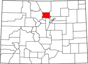
Location of Boulder County in Colorado
This is intended to be a complete list of the properties and districts on the National Register of Historic Places in Boulder County, Colorado, United States. The locations of National Register properties and districts for which the latitude and longitude coordinates are included below, may be seen in a map.[1]
There are 87 properties and districts listed on the National Register in the county, including 1 National Historic Landmark. Another property was once listed but has been removed.
- This National Park Service list is complete through NPS recent listings posted February 5, 2021.[2]
| Adams - Alamosa - Arapahoe - Archuleta - Baca - Bent - Boulder - Broomfield - Chaffee - Cheyenne - Clear Creek - Conejos - Costilla - Crowley - Custer - Delta - Denver - Dolores - Douglas - Eagle - El Paso - Elbert - Fremont - Garfield - Gilpin - Grand - Gunnison - Hinsdale - Huerfano - Jackson - Jefferson - Kiowa - Kit Carson - La Plata - Lake - Larimer - Las Animas - Lincoln - Logan - Mesa - Mineral - Moffat - Montezuma - Montrose - Morgan - Otero - Ouray - Park - Phillips - Pitkin - Prowers - Pueblo - Rio Blanco - Rio Grande - Routt - Saguache - San Juan - San Miguel - Sedgwick - Summit - Teller - Washington - Weld - Yuma |
Current listings
| [3] | Name on the Register[4] | Image | Date listed[5] | Location | City or town | Description |
|---|---|---|---|---|---|---|
| 1 | Arnett-Fullen House | 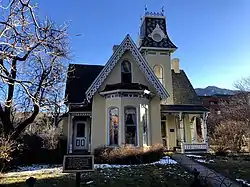 Arnett-Fullen House |
January 29, 2009 (#08001376) |
646 Pearl St. 40°00′58″N 105°17′12″W |
Boulder | Commonly referred to as the Gingerbread House. |
| 2 | Hannah Barker House | 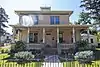 Hannah Barker House |
September 12, 2019 (#100004376) |
800 Arapahoe Ave. 40°00′46″N 105°17′05″W |
Boulder | |
| 3 | Boulder County Poor Farm | 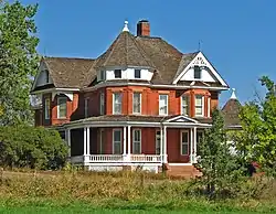 Boulder County Poor Farm |
September 13, 2001 (#01000969) |
63rd St. near its junction with Jay Rd.[6] 40°02′44″N 105°12′23″W |
Boulder | |
| 4 | Boulder Creek Bridge |  Boulder Creek Bridge |
March 11, 2003 (#03000103) |
State Highway 119 at milepost 39.13 40°00′52″N 105°19′12″W |
Boulder | |
| 5 | Boulder Valley Grange No. 131 | 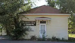 Boulder Valley Grange No. 131 |
December 7, 1987 (#87002009) |
3400 N. 95th St. 40°02′13″N 105°07′48″W |
Lafayette | |
| 6 | Buchan Cabin | September 3, 2020 (#100005521) |
2386 Cty. Rd. 111 39°58′02″N 105°36′09″W |
Eldora vicinity | ||
| 6 | Bunce School |  Bunce School |
May 22, 1986 (#86001109) |
State Highway 7 south of Allenspark 40°10′24″N 105°28′06″W |
Allenspark | |
| 7 | T.M. Callahan House | 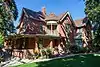 T.M. Callahan House |
May 16, 1985 (#85001064) |
312 Terry St. 40°09′51″N 105°06′15″W |
Longmont | |
| 8 | Cardinal Mill | .JPG.webp) Cardinal Mill |
December 22, 2011 (#11000945) |
Along Coon Track Creek at Cardinal[7] 39°58′08″N 105°33′00″W |
Nederland | |
| 9 | Carnegie Library | 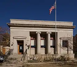 Carnegie Library |
February 16, 1979 (#79000573) |
1125 Pine St. 40°01′12″N 105°16′52″W |
Boulder | |
| 10 | Chautauqua Auditorium | 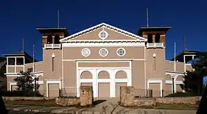 Chautauqua Auditorium |
January 21, 1974 (#74000562) |
Chautauqua Park 39°59′51″N 105°16′47″W |
Boulder | |
| 11 | Church of the Brethren | 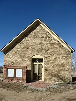 Church of the Brethren |
January 5, 1984 (#84000794) |
17th Ave. 40°11′19″N 105°10′06″W |
Hygiene | |
| 12 | Colorado Chautauqua | 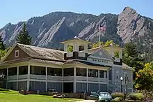 Colorado Chautauqua |
March 21, 1978 (#78000830) |
900 Baseline Rd., Chautauqua Park 39°59′52″N 105°16′50″W |
Boulder | |
| 13 | Columbia Cemetery | 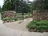 Columbia Cemetery |
August 1, 1997 (#97000792) |
Along 9th St., bounded by Pleasant and College Aves. 40°00′30″N 105°16′58″W |
Boulder | |
| 14 | Congregational Church | .JPG.webp) Congregational Church |
May 20, 1983 (#83001298) |
300 E. Simpson St. 39°59′53″N 105°05′15″W |
Lafayette | |
| 15 | Denver Elevator-Grain Elevator | 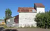 Denver Elevator-Grain Elevator |
February 14, 1986 (#86000212) |
Tract 712 near State Highway 42 39°58′36″N 105°07′45″W |
Louisville | Commonly referred to as Louisville Grain Elevator[8][9] |
| 16 | Denver, Boulder and Western Railway Historic District |  Denver, Boulder and Western Railway Historic District |
September 18, 1980 (#80000882) |
State Highway 72 40°00′27″N 105°29′58″W |
Ward | Also known as the Switzerland Trail. |
| 17 | Denver, Northwestern and Pacific Railway Historic District | 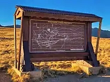 Denver, Northwestern and Pacific Railway Historic District |
September 30, 1980 (#80000881) |
Southwest of Eldora 39°54′52″N 105°41′10″W |
Eldora | Historic railroad route over Rollins Pass; extends into Gilpin and Grand counties. |
| 18 | Dickens Opera House | 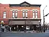 Dickens Opera House |
July 28, 1987 (#87000702) |
300 Main St. 40°09′52″N 105°06′06″W |
Longmont | |
| 19 | Downtown Boulder Historic District | 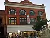 Downtown Boulder Historic District |
December 3, 1980 (#80000878) |
State Highway 119 40°01′07″N 105°16′43″W |
Boulder | |
| 20 | Downtown Longmont Historic District |  Downtown Longmont Historic District |
August 28, 2017 (#100001501) |
Roughly Main, Coffman & Kimbark Sts. between 3rd & 5th Aves. 40°09′57″N 105°06′09″W |
Longmont | |
| 21 | East Longs Peak Trail | 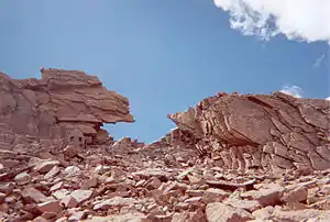 East Longs Peak Trail |
July 10, 2007 (#07000740) |
West of State Highway 7[10] 40°16′20″N 105°36′02″W |
Allenspark | Extends into Larimer County. |
| 22 | East Side Historic District | 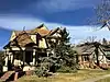 East Side Historic District |
October 2, 1986 (#86002812) |
Roughly bounded by Long's Peak Ave., Collyer St., Fourth Ave., and Emery St. 40°10′00″N 105°05′56″W |
Longmont | |
| 23 | Eldora Historic District | 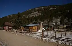 Eldora Historic District |
October 4, 1989 (#89000978) |
Roughly Eaton Pl., 6th, Pearl, and 4th Sts., Huron Ave., 6th St., Eldorado Ave., and 7th St., Klondyke Ave., and 10th St. 39°57′01″N 105°34′17″W |
Eldora | |
| 24 | Empson Cannery | 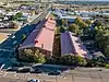 Empson Cannery |
January 5, 1984 (#84000796) |
15 3rd Ave. 40°09′49″N 105°05′37″W |
Longmont | |
| 25 | First Baptist Church of Boulder | 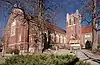 First Baptist Church of Boulder |
April 14, 2004 (#04000275) |
1237 Pine St. 40°01′13″N 105°16′45″W |
Boulder | |
| 26 | First Congregational Church of Lyons | 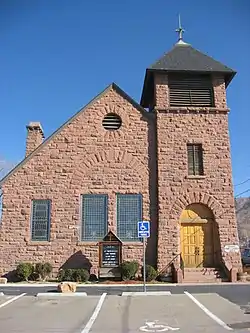 First Congregational Church of Lyons |
December 12, 1976 (#76000547) |
High and 4th Sts. 40°13′33″N 105°16′11″W |
Lyons | |
| 27 | Fox Mine Office |  Fox Mine Office |
February 23, 1996 (#96000168) |
1226 S. Cherryvale Rd. 39°58′06″N 105°12′51″W |
Boulder | |
| 28 | Fox Stone Barn | 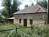 Fox Stone Barn |
February 16, 1996 (#96000070) |
S. Cherryvale Rd., 0.5 miles south of U.S. Highway 36 39°58′10″N 105°12′46″W |
Boulder | |
| 29 | Ginacci House |  Ginacci House |
February 14, 1986 (#86000213) |
1116 LaFarge St. 39°58′52″N 105°07′57″W |
Louisville | |
| 30 | Gold Hill Historic District | 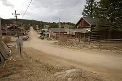 Gold Hill Historic District |
August 3, 1989 (#89000979) |
Roughly bounded by North St., Pine St., Boulder St., Gold Run St., and College St. 40°03′43″N 105°24′26″W |
Gold Hill | |
| 31 | Gold Miner Hotel | 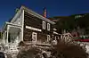 Gold Miner Hotel |
July 3, 1997 (#97000657) |
601 Klondyke Ave. 39°57′01″N 105°34′10″W |
Eldora | |
| 32 | Highland School | 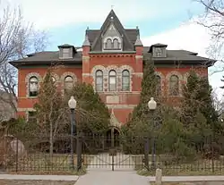 Highland School |
December 18, 1978 (#78000831) |
885 Arapahoe Ave. 40°00′48″N 105°17′01″W |
Boulder | |
| 33 | David Hull Holmes House |  David Hull Holmes House |
December 3, 2018 (#100003225) |
720 11th St. 40°00′01″N 105°16′43″W |
Boulder | |
| 34 | Hotel Boulderado | 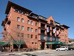 Hotel Boulderado |
November 3, 1994 (#94001226) |
2115 13th St. 40°01′09″N 105°16′43″W |
Boulder | |
| 35 | Hoverhome and Hover Farmstead | 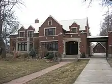 Hoverhome and Hover Farmstead |
January 15, 1999 (#98001555) |
1303-1309 Hover Rd. 40°10′55″N 105°07′53″W |
Longmont | |
| 36 | Jacoe Store |  Jacoe Store |
February 14, 1986 (#86000215) |
1001 Main St. 39°58′47″N 105°07′53″W |
Louisville | |
| 37 | Jamestown Mercantile Building | 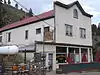 Jamestown Mercantile Building |
August 3, 1989 (#89000985) |
Main St. 40°06′57″N 105°23′18″W |
Jamestown | |
| 38 | Jamestown Town Hall | 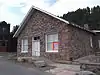 Jamestown Town Hall |
July 10, 2003 (#03000615) |
118 Main St. 40°06′58″N 105°23′15″W |
Jamestown | |
| 39 | Kullgren House | 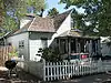 Kullgren House |
May 20, 1983 (#83001299) |
209 E. Cleveland St. 39°59′51″N 105°05′17″W |
Lafayette | |
| 40 | Lackner's Tavern | 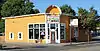 Lackner's Tavern |
February 14, 1986 (#86000220) |
1006 Pine 39°58′31″N 105°07′45″W |
Louisville | |
| 41 | Lafayette House | 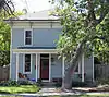 Lafayette House |
May 20, 1983 (#83001300) |
600 E. Simpson St. 39°59′53″N 105°05′01″W |
Lafayette | |
| 42 | LaSalla House | 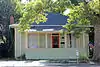 LaSalla House |
February 14, 1986 (#86000217) |
1124 Main St. 39°58′53″N 105°07′52″W |
Louisville | |
| 43 | Lewis House | 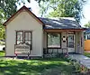 Lewis House |
May 20, 1983 (#83001301) |
108 E. Simpson St. 39°59′53″N 105°05′21″W |
Lafayette | |
| 44 | Little Church in the Pines |  Little Church in the Pines |
August 3, 1989 (#89000983) |
414 Gold Run Rd. 40°03′12″N 105°22′33″W |
Salina | |
| 45 | Longhurst Lodge | September 18, 2017 (#100001606) |
State Highway 7 and County Road 82, Arapaho-Roosevelt National Forest and Pawnee National Grassland 40°15′33″N 105°32′13″W |
Allenspark | ||
| 46 | Longmont Carnegie Library | 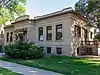 Longmont Carnegie Library |
November 3, 1992 (#92001406) |
457 4th Ave. 40°09′56″N 105°06′01″W |
Longmont | |
| 47 | Longmont College | .jpg.webp) Longmont College |
August 12, 1987 (#87001285) |
546 Atwood St. 40°10′08″N 105°05′45″W |
Longmont | |
| 48 | Longmont Fire Department | 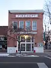 Longmont Fire Department |
May 16, 1985 (#85001063) |
667 4th Ave. 40°09′56″N 105°06′10″W |
Longmont | |
| 49 | Longmont Power Plant | 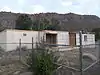 Longmont Power Plant |
September 10, 1987 (#87001553) |
Old Apple Valley Rd. 40°14′01″N 105°17′38″W |
Lyons | |
| 50 | Lyons Railroad Depot | 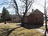 Lyons Railroad Depot |
December 2, 1974 (#74000563) |
400 block of Broadway 40°13′27″N 105°16′14″W |
Lyons | |
| 51 | Lyons Sandstone Buildings | 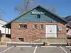 Lyons Sandstone Buildings |
April 29, 1980 (#80000880) |
U.S. Highway 36 and State Highway 7 40°13′05″N 105°15′16″W |
Lyons | |
| 52 | McKenzie Well |  McKenzie Well |
January 26, 2005 (#04001553) |
Near Independence Rd. and State Highway 119 40°02′36″N 105°14′27″W |
Boulder | |
| 53 | Miller House | .JPG.webp) Miller House |
May 20, 1983 (#83001291) |
409 E. Cleveland St. 39°59′51″N 105°05′08″W |
Lafayette | |
| 54 | Modoc Mill | December 27, 1978 (#78000833) |
North of Ward 40°04′50″N 105°30′39″W |
Ward | ||
| 55 | Mount St. Gertrude Academy | 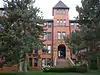 Mount St. Gertrude Academy |
November 3, 1994 (#94001227) |
970 Aurora St. 40°00′13″N 105°16′51″W |
Boulder | |
| 56 | National Fuel Company Store | 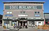 National Fuel Company Store |
February 14, 1986 (#86000222) |
801 Main St. 39°58′09″N 105°07′53″W |
Louisville | |
| 57 | Norlin Quadrangle Historic District | 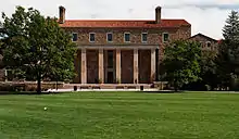 Norlin Quadrangle Historic District |
March 27, 1980 (#80000879) |
University of Colorado campus 40°00′32″N 105°16′20″W |
Boulder | |
| 58 | North St. Vrain Creek Bridge | 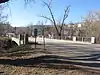 North St. Vrain Creek Bridge |
October 15, 2002 (#02001159) |
State Highway 7 at milepost 32.98, over the North St. Vrain Creek 40°13′22″N 105°16′17″W |
Lyons | |
| 59 | Northern Colorado Power Company Substation | 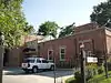 Northern Colorado Power Company Substation |
May 22, 1986 (#86001108) |
1590 Broadway 40°00′40″N 105°16′36″W |
Boulder | |
| 60 | Petrelli-DelPizzo House | 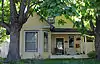 Petrelli-DelPizzo House |
February 14, 1986 (#86000224) |
1016 Main St. 39°58′48″N 105°07′52″W |
Louisville | |
| 61 | Rhoades House | 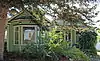 Rhoades House |
February 14, 1986 (#86000226) |
1024 Grant 39°58′49″N 105°08′06″W |
Louisville | |
| 62 | Robinson House | .JPG.webp) Robinson House |
February 14, 1986 (#86000228) |
301 Spruce 39°58′41″N 105°07′51″W |
Louisville | |
| 63 | Rocky Mountain Mammoth Mine | 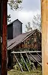 Rocky Mountain Mammoth Mine |
July 6, 2010 (#10000422) |
4879 Magnolia Dr. 39°59′08″N 105°24′01″W |
Nederland | |
| 64 | St. Stephen's Episcopal Church, 1881 | 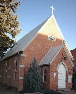 St. Stephen's Episcopal Church, 1881 |
February 24, 1975 (#75000501) |
470 Main St. 40°10′03″N 105°06′06″W |
Longmont | |
| 65 | Salina School | 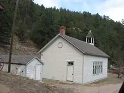 Salina School |
August 3, 1989 (#89000984) |
536 Gold Run Rd. 40°03′15″N 105°22′37″W |
Salina | |
| 66 | Sandbeach Lake Trail | January 29, 2008 (#07001471) |
South of Lookout Mountain 40°13′14″N 105°32′12″W |
Meeker Park | ||
| 67 | Shannon Farm |  Shannon Farm |
October 17, 2003 (#03001047) |
1341 N. 95th St. 40°00′39″N 105°07′51″W |
Lafayette | |
| 68 | Squires-Tourtellot House | 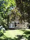 Squires-Tourtellot House |
August 10, 1978 (#78000832) |
1019 Spruce St. 40°01′07″N 105°16′55″W |
Boulder | |
| 69 | Stolmes House |  Stolmes House |
February 14, 1986 (#86000229) |
616 Front St. 39°58′35″N 105°07′47″W |
Louisville | |
| 70 | Sunshine School | 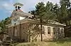 Sunshine School |
July 27, 1989 (#89000982) |
355 County Road 83 40°03′42″N 105°21′54″W |
Sunshine | |
| 71 | Swedish Evangelical Lutheran Church of Ryssby |  Swedish Evangelical Lutheran Church of Ryssby |
February 16, 1984 (#84000797) |
N. 63rd St. 40°08′23″N 105°12′20″W |
Boulder | |
| 72 | Tego Brothers Drugstore-State National Bank of Louisville |  Tego Brothers Drugstore-State National Bank of Louisville |
February 14, 1986 (#86000230) |
700 Main St. 39°58′37″N 105°07′51″W |
Louisville | |
| 73 | The Terrace | The Terrace |
November 3, 1987 (#87001287) |
207 E. Cleveland St. 39°59′54″N 105°05′17″W |
Lafayette | |
| 74 | Thomas House |  Thomas House |
February 14, 1986 (#86000231) |
700 Lincoln 39°58′40″N 105°08′09″W |
Louisville | |
| 75 | Thunder Lake Patrol Cabin |  Thunder Lake Patrol Cabin |
January 29, 1988 (#87001124) |
Thunder Lake 40°13′20″N 105°38′39″W |
Estes Park | In Rocky Mountain National Park |
| 76 | Thunder Lake Trail-Bluebird Lake Trail | January 29, 2008 (#07001472) |
Roughly along the North St. Vrain Creek, west of Wild Basin Ranger Station 40°11′34″N 105°39′07″W |
Allenspark | ||
| 77 | US Post Office-Boulder Main |  US Post Office-Boulder Main |
January 22, 1986 (#86000164) |
1905 15th St. 40°01′42″N 105°16′31″W |
Boulder | |
| 78 | Walker Ranch Historic District |  Walker Ranch Historic District |
June 14, 1984 (#84000798) |
West of Boulder; also 7.5 miles west of Boulder off Flagstaff Rd. 39°57′14″N 105°20′03″W |
Boulder | Second location represents a boundary increase |
| 79 | Wall Street Assay Office | 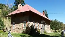 Wall Street Assay Office |
August 3, 1989 (#89000986) |
6352 Four Mile Canyon Dr. 40°02′24″N 105°23′21″W |
Wallstreet | Assay Office for the Storm King Mine located in Wall Street, CO |
| 80 | Ward Congregational Church | 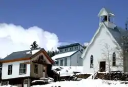 Ward Congregational Church |
August 3, 1989 (#89000981) |
41 Modoc 40°04′22″N 105°30′29″W |
Ward | |
| 81 | Ward School | 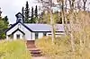 Ward School |
August 3, 1989 (#89000980) |
66 Columbia 40°04′18″N 105°30′28″W |
Ward | |
| 82 | Martha Weiser House | 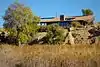 Martha Weiser House |
October 16, 2013 (#13000825) |
4020 N. 75th St. 40°03′11″N 105°10′42″W |
Boulder | |
| 83 | West Side Historic District | 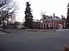 West Side Historic District |
January 7, 1987 (#86002846) |
Roughly bounded by 5th, Terry, 3rd, and Grant 40°09′57″N 105°06′32″W |
Longmont | |
| 84 | Wild Basin House | 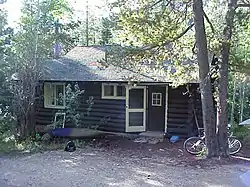 Wild Basin House |
January 29, 1988 (#87001125) |
Wild Basin 40°12′29″N 105°33′56″W |
Estes Park | |
| 85 | Wild Basin Ranger Station and House |  Wild Basin Ranger Station and House |
January 29, 1988 (#87001126) |
Wild Basin 40°12′32″N 105°33′55″W |
Estes Park | |
| 86 | Woodward-Baird House | 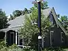 Woodward-Baird House |
February 15, 1979 (#79000574) |
1733 Canyon Boulevard 40°01′03″N 105°16′16″W |
Boulder |
Former listings
| [3] | Name on the Register | Image | Date listed | Date removed | Location | City or town | Summary |
|---|---|---|---|---|---|---|---|
| 1 | Snowbound Mine | 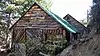 Snowbound Mine |
August 3, 1989 (#89000998) | July 11, 2016 | County Road 52 40°04′19″N 105°23′01″W |
Gold Hill | Burned down September 6, 2010[11] |
| 2 | Wilbur Williams House |  Wilbur Williams House |
June 3, 1982 (#82002286) | October 18, 1988 | 1434 Baseline Rd. |
Boulder | Removed from Register due to extensive alterations[12] |
See also
| Wikimedia Commons has media related to National Register of Historic Places in Boulder County, Colorado. |
References
- The latitude and longitude information provided in this table was derived originally from the National Register Information System, which has been found to be fairly accurate for about 99% of listings. Some locations in this table may have been corrected to current GPS standards.
- "National Register of Historic Places: Weekly List Actions". National Park Service, United States Department of the Interior. Retrieved on February 5, 2021.
- Numbers represent an alphabetical ordering by significant words. Various colorings, defined here, differentiate National Historic Landmarks and historic districts from other NRHP buildings, structures, sites or objects.
- "National Register Information System". National Register of Historic Places. National Park Service. July 9, 2010.
- The eight-digit number below each date is the number assigned to each location in the National Register Information System database, which can be viewed by clicking the number.
- Location derived from Danaher, Charlie. Danaher: Neighbors and Inspiration, Daily Camera, 2010-09-26. Accessed 2010-12-26.
- Location derived from the owner's website; the NRIS lists the property as "Address Restricted".
- "Louisville Grain Elevator | City of Louisville, CO". www.louisvilleco.gov. Retrieved 2019-03-03.
- "First look inside Louisville's historic grain elevator restoration". www.dailycamera.com. Retrieved 2019-03-03.
- Coordinates are those of the East Longs Peak Trail as provided by its GNIS record; the NRIS gives no coordinates
External links
| Topics | |
|---|---|
| Lists by state |
|
| Lists by insular areas | |
| Lists by associated state | |
| Other areas | |
| Related | |
| |
Municipalities and communities of Boulder County, Colorado, United States | ||
|---|---|---|
| Cities | Map of Colorado highlighting Boulder County | |
| Towns | ||
| CDPs | ||
| Unincorporated communities | ||
| Ghost towns |
| |
| Footnotes | ‡This populated place also has portions in an adjacent county or counties | |
| ||
This article is issued from Wikipedia. The text is licensed under Creative Commons - Attribution - Sharealike. Additional terms may apply for the media files.