Wavrans-sur-l'Aa
Wavrans-sur-l’Aa is a commune in the Pas-de-Calais department in the Hauts-de-France region of France.
Wavrans-sur-l’Aa | |
|---|---|
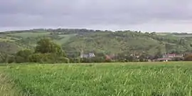 A general view of Wavrans-sur-l'Aa | |
 Coat of arms | |
Location of Wavrans-sur-l’Aa 
| |
 Wavrans-sur-l’Aa  Wavrans-sur-l’Aa | |
| Coordinates: 50°41′01″N 2°08′15″E | |
| Country | France |
| Region | Hauts-de-France |
| Department | Pas-de-Calais |
| Arrondissement | Saint-Omer |
| Canton | Lumbres |
| Intercommunality | Pays de Lumbres |
| Government | |
| • Mayor (2014-2020) | Julien Delannoy |
| Area 1 | 11.48 km2 (4.43 sq mi) |
| Population (2017-01-01)[1] | 1,270 |
| • Density | 110/km2 (290/sq mi) |
| Time zone | UTC+01:00 (CET) |
| • Summer (DST) | UTC+02:00 (CEST) |
| INSEE/Postal code | 62882 /62380 |
| Elevation | 43–141 m (141–463 ft) (avg. 73 m or 240 ft) |
| 1 French Land Register data, which excludes lakes, ponds, glaciers > 1 km2 (0.386 sq mi or 247 acres) and river estuaries. | |
Geography
Wavrans-sur-l'Aa is located 13 kilometres (8.1 mi) southwest of Saint-Omer, at the D192 and D225 road junction, on the banks of the river Aa. It is home to a site of great ecological interest, which justified the creation of a voluntary nature reserve, which become the Grotte et Pelouses a'Acquin-Westbecourt et Coteaux de Wavrans-sur-l'Aa National Nature Reserve in 2008[2]
Population
| Year | Pop. | ±% |
|---|---|---|
| 2006 | 1,297 | — |
| 2007 | 1,307 | +0.8% |
| 2008 | 1,318 | +0.8% |
| 2009 | 1,329 | +0.8% |
| 2010 | 1,328 | −0.1% |
| 2011 | 1,325 | −0.2% |
| 2012 | 1,314 | −0.8% |
| 2013 | 1,302 | −0.9% |
| 2014 | 1,290 | −0.9% |
| 2015 | 1,282 | −0.6% |
| 2016 | 1,286 | +0.3% |
References
- "Populations légales 2017". INSEE. Retrieved 6 January 2020.
- http://www.legifrance.gouv.fr/affichTexte.do?cidTexte=JORFTEXT000018217161&dateTexte Décret n° 2008-219 du 5 mars 2008 créant la réserve naturelle nationale de la grotte et des pelouses d'Acquin-Westbécourt et des coteaux de Wavrans-sur-l'Aa (Pas-de-Calais)
| Wikimedia Commons has media related to Wavrans-sur-l'Aa. |
| Authority control |
|---|
This article is issued from Wikipedia. The text is licensed under Creative Commons - Attribution - Sharealike. Additional terms may apply for the media files.