Ellijay, Georgia
Ellijay is a city in Gilmer County, Georgia, United States. The population was 1,619 at the 2010 census.[5] The city is the county seat of Gilmer County.[6]
Ellijay, Georgia | |
|---|---|
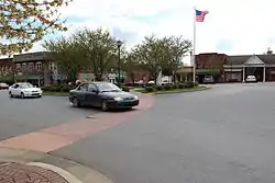 Ellijay town center | |
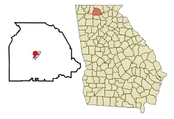 Location in Gilmer County and the state of Georgia | |
| Coordinates: 34°41′41″N 84°29′1″W | |
| Country | United States |
| State | Georgia |
| County | Gilmer |
| Area | |
| • Total | 3.54 sq mi (9.18 km2) |
| • Land | 3.54 sq mi (9.18 km2) |
| • Water | 0.00 sq mi (0.00 km2) |
| Elevation | 1,280 ft (390 m) |
| Population (2010) | |
| • Total | 1,619 |
| • Estimate (2019)[2] | 1,714 |
| • Density | 483.63/sq mi (186.71/km2) |
| Time zone | UTC-5 (Eastern (EST)) |
| • Summer (DST) | UTC-4 (EDT) |
| ZIP code | 30540 |
| Area code(s) | 706/762 |
| FIPS code | 13-27092[3] |
| GNIS feature ID | 0331651[4] |
| Website | www |
Agriculture is important in Gilmer County, known as the "Apple Capital of Georgia."[7] The city holds an annual Georgia Apple Festival in October.[8]
Former President Jimmy Carter and his wife Rosalynn own a pine cabin second home in Ellijay.[9] Other tourists are attracted to the mountains and whitewater kayaking.
History
This area was long settled by cultures of indigenous peoples. It was known as part of the homeland of the historic Cherokee people. They had a village here, at the confluence of the Ellijay and Cartecay rivers, which together form the Coosawattee River.
Ellijay (sometimes formerly spelled "Elejoy") is the anglicized form or transliteration of the Cherokee name Elatseyi, meaning "new ground".[10] Other sources say it means "green place".[11] Some locals would say that it means "land of three rivers" or "land of many waters", referring to the two rivers that converge in the town to create a third.
Gilmer County was organized by territory cut from Cherokee County in 1832, and Ellijay was designated as its county seat in 1834.[12] It was a fairly isolated and remote mountain community until the late nineteenth century. After the Marietta and Northern Georgia Railroad (later the Louisville and Nashville Railroad) was constructed through here in 1884, the railroad stimulated a boom in the timber industry by providing a profitable way to get lumber to markets. Many timber companies came into the area with their workers.
More than a century later, another major transportation improvement was construction of the Zell Miller Mountain Parkway (Georgia 515, named for Georgia governor and U.S. senator Zell Miller), which was completed in 1991.
Geography
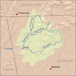
Ellijay is located at the center of Gilmer County, at 34°41'41" north, 84°29'1" west (34.694656, -84.483566).[13] According to the United States Census Bureau, the city has a total area of 3.6 square miles (9.2 km2), all land.[5] It is situated at the confluence of the Ellijay and Cartecay rivers, which together form the Coosawattee River. The Coosawattee flows west as part of the Oostanaula/Coosa/Alabama River watershed. The county seat is bordered to the east and south by the city of East Ellijay.
U.S. Route 76 bypasses the city center to the south and east. It leads west 24 miles (39 km) to Chatsworth and northeast 16 miles (26 km) to Blue Ridge. Georgia State Route 52 (Chatsworth Highway) also leads 24 miles (39 km) to Chatsworth, taking a more northerly route over Fort Mountain of the Cohutta Mountains. Georgia State Route 515, the Zell Miller Mountain Parkway, leads northeast with US 76 to Blue Ridge and south 20 miles (32 km) to Jasper. Downtown Atlanta is 78 miles (126 km) to the south via GA-5/515 to Interstate 575 and Interstate 75.
Demographics
| Historical population | |||
|---|---|---|---|
| Census | Pop. | %± | |
| 1880 | 200 | — | |
| 1890 | 437 | 118.5% | |
| 1900 | 581 | 33.0% | |
| 1910 | 659 | 13.4% | |
| 1920 | 632 | −4.1% | |
| 1930 | 657 | 4.0% | |
| 1940 | 1,497 | 127.9% | |
| 1950 | 1,527 | 2.0% | |
| 1960 | 1,320 | −13.6% | |
| 1970 | 1,326 | 0.5% | |
| 1980 | 1,507 | 13.7% | |
| 1990 | 1,178 | −21.8% | |
| 2000 | 1,584 | 34.5% | |
| 2010 | 1,619 | 2.2% | |
| 2019 (est.) | 1,714 | [2] | 5.9% |
| U.S. Decennial Census[14] | |||
As of the census[3] of 2000, there were 1,584 people, 593 households, and 342 families residing in the city. The population density was 591.7 people per square mile (228.2/km2). There were 662 housing units at an average density of 247.3 per square mile (95.4/km2). There were 662 housing units at an average density of 247.3 per square mile (95.4/km2). The racial makeup of the city was 81.25% White, 1.39% African American, 0.00% Native American, 1.70% Asian, 0.57% Pacific Islander, 12.50% from other races, and 2.46% from two or more races. Hispanic or Latino of any race were 25.19% of the population.
There were 593 households, out of which 26.8% had children under the age of 18 living with them, 36.1% were married couples living together, 16.5% had a female householder with no husband present, and 42.2% were non-families. 37.6% of all households were made up of individuals, and 20.4% had someone living alone who was 65 years of age or older. The average household size was 2.49 and the average family size was 3.14.
In the city, the population was spread out, with 22.9% under the age of 18, 10.5% from 18 to 24, 25.0% from 25 to 44, 19.7% from 45 to 64, and 21.9% who were 65 years of age or older. The median age was 38 years. For every 100 females, there were 93.2 males. For every 100 females age 18 and over, there were 88.9 males.
The median income for a household in the city was $22,120, and the median income for a family was $36,250. Males had a median income of $21,875 versus $20,469 for females. The per capita income for the city was $13,740. About 20.3% of families and 27.5% of the population were below the poverty line, including 27.3% of those under age 18 and 31.7% of those age 65 or over.
Notable facts
Although filmed further north in Rabun County, the fictional plot of the 1972 movie Deliverance is based on the Coosawattee River and events related to construction of a dam that created Carters Lake upriver, and destroyed the river's wild waters. These places are all located in Gilmer County.[15][16][17]
Government
Ellijay is governed by a five-member city council and a mayor. The current mayor is William Albert "Al" Hoyle.
Education
Higher education
Dalton State College - Gilmer County Center[18]
Gilmer County School District
The Gilmer County School District holds pre-school to grade twelve, and consists of four elementary schools, two middle schools, and a high school.[19] There is also Crossroads, which is the alternative school in Ellijay.
- Ellijay Elementary School
- Ellijay Primary School
- Mountain View Elementary School
- Oakland Elementary School (closed in 2011, due to county budget constraints)
- Clear Creek Middle School
- Gilmer Middle School
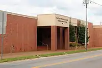
- Gilmer High School
- Pleasant Hills Montessori School
References
- "2019 U.S. Gazetteer Files". United States Census Bureau. Retrieved July 9, 2020.
- "Population and Housing Unit Estimates". United States Census Bureau. May 24, 2020. Retrieved May 27, 2020.
- "U.S. Census website". United States Census Bureau. Retrieved 2008-01-31.
- "US Board on Geographic Names". United States Geological Survey. 2007-10-25. Retrieved 2008-01-31.
- "Geographic Identifiers: 2010 Demographic Profile Data (G001): Ellijay city, Georgia". American Factfinder. U.S. Census Bureau. Retrieved November 22, 2016.
- "Find a County". National Association of Counties. Archived from the original on 2011-05-31. Retrieved 2011-06-07.
- "Official website". Gilmer County. Retrieved 2017-06-24.
- Benefield, Kevin (2015-11-28). "Road Trip: North Georgia Mountains". Atlanta. Retrieved 2017-06-24.
- Nemy, Enid (1983-07-14). "A Small Blue Ridge Pine Cabin is the Carters' Rustic Retreat". The New York Times. Retrieved 2015-06-02.
- Gannett, Henry (1905). The Origin of Certain Place Names in the United States. Govt. Print. Off. pp. 117.
- "The Names Stayed". Calhoun Times and Gordon County News. August 29, 1990. p. 64. Retrieved 29 April 2015.
- Hellmann, Paul T. (May 13, 2013). Historical Gazetteer of the United States. Routledge. p. 229. ISBN 978-1135948597. Retrieved 30 November 2013.
- "US Gazetteer files: 2010, 2000, and 1990". United States Census Bureau. 2011-02-12. Retrieved 2011-04-23.
- "Census of Population and Housing". Census.gov. Retrieved June 4, 2015.
- Gatling, William (2010-06-30). "Deliverance and the Coosawattee". Georgia Canoeing Association. Retrieved 2020-09-29.
- "Filming Locations for 'Deliverance' (1972), in Georgia". The Worldwide Guide to Movie Locations. Retrieved 2020-09-29.
- "Brown's Guide to Georgia". 2010-12-22. Archived from the original on 2010-12-22. Retrieved 2020-09-29.
- Dalton State - Extended Campus. Dalton State College. Retrieved 22 March 2012.
- Georgia Board of Education, Retrieved June 9, 2010.
External links
Municipalities and communities of Gilmer County, Georgia, United States | ||
|---|---|---|
| Cities | 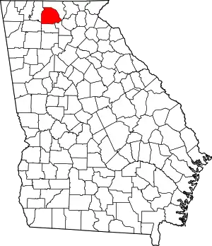 Map of Georgia highlighting Gilmer County | |
| CDP | ||
| Unincorporated communities | ||
| Ghost town | ||
| ||

| Authority control |
|---|
