White County, Georgia
White County is a county located in the northeastern part of the U.S. state of Georgia. As of the 2010 census, the population was 27,144.[1] The county seat is Cleveland.[2] The county was created on December 22, 1857 from part of Habersham County and most likely was named for Newton County Representative David T. White, who helped a Habersham representative successfully attain passage of an act creating the new county.[3]
White County | |
|---|---|
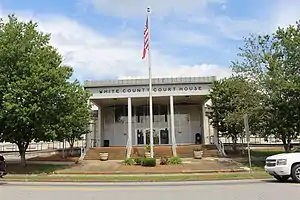 White County Courthouse in Cleveland | |
 Seal | |
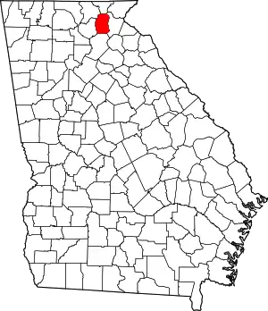 Location within the U.S. state of Georgia | |
 Georgia's location within the U.S. | |
| Coordinates: 34°41′N 83°45′W | |
| Country | |
| State | |
| Founded | 1857 |
| Named for | David T. White |
| Seat | Cleveland |
| Largest city | Cleveland |
| Area | |
| • Total | 242 sq mi (630 km2) |
| • Land | 241 sq mi (620 km2) |
| • Water | 1.5 sq mi (4 km2) 0.6%% |
| Population | |
| • Estimate (2018) | 29,970 |
| • Density | 113/sq mi (44/km2) |
| Time zone | UTC−5 (Eastern) |
| • Summer (DST) | UTC−4 (EDT) |
| Congressional district | 9th |
| Website | www |
Geography

According to the U.S. Census Bureau, the county has a total area of 242 square miles (630 km2), of which 241 square miles (620 km2) is land and 1.5 square miles (3.9 km2) (0.6%) is water.[4]
The county is mostly located in the foothills of the Blue Ridge Mountains. Northern parts of the county have the highest elevations, being in the mountains themselves. The highest point in White County is 4,430-foot (1,350 m) Tray Mountain, shared with Towns County to the north. Tray Mountain is the 6th-highest mountain in Georgia. Another very prominent White County peak is Yonah Mountain, also known as Mount Yonah. This 3,143-foot (958 m) peak, located between Helen and Cleveland, is rimmed by sheer cliffs and is the highest point on Georgia's Piedmont Plateau.
All of White County is located in the Upper Chattahoochee River sub-basin of the ACF River Basin (Apalachicola-Chattahoochee-Flint River Basin).[5]
Adjacent counties
- Towns County - north
- Habersham County - east
- Hall County - south
- Lumpkin County - west
- Union County - northwest
Protected areas
Transportation
Major highways
Pedestrians and cycling
- River Bridge Trail
- River Hiking Trail
- Unicoi State Park Trail
- Yonah Preserve Trail
Demographics
| Historical population | |||
|---|---|---|---|
| Census | Pop. | %± | |
| 1860 | 3,315 | — | |
| 1870 | 4,606 | 38.9% | |
| 1880 | 5,341 | 16.0% | |
| 1890 | 6,151 | 15.2% | |
| 1900 | 5,912 | −3.9% | |
| 1910 | 5,110 | −13.6% | |
| 1920 | 6,105 | 19.5% | |
| 1930 | 6,056 | −0.8% | |
| 1940 | 6,417 | 6.0% | |
| 1950 | 5,951 | −7.3% | |
| 1960 | 6,935 | 16.5% | |
| 1970 | 7,742 | 11.6% | |
| 1980 | 10,120 | 30.7% | |
| 1990 | 13,006 | 28.5% | |
| 2000 | 19,944 | 53.3% | |
| 2010 | 27,144 | 36.1% | |
| 2018 (est.) | 29,970 | [6] | 10.4% |
| U.S. Decennial Census[7] 1790-1960[8] 1900-1990[9] 1990-2000[10] 2010-2013[1] | |||
2000 census
As of the census[11] of 2000, there were 19,944 people, 7,731 households, and 5,782 families living in the county. The population density was 83 people per square mile (32/km2). There were 9,454 housing units at an average density of 39 per square mile (15/km2). The racial makeup of the county was 95.16% White, 2.17% Black or African American, 0.40% Native American, 0.51% Asian, 0.18% Pacific Islander, 0.51% from other races, and 1.07% from two or more races. 1.56% of the population were Hispanic or Latino of any race.
There were 7,731 households, out of which 31.20% had children under the age of 18 living with them, 62.70% were married couples living together, 8.70% had a female householder with no husband present, and 25.20% were non-families. 21.70% of all households were made up of individuals, and 8.60% had someone living alone who was 65 years of age or older. The average household size was 2.51 and the average family size was 2.91.
In the county, the population was spread out, with 23.20% under the age of 18, 9.20% from 18 to 24, 27.80% from 25 to 44, 25.20% from 45 to 64, and 14.60% who were 65 years of age or older. The median age was 38 years. For every 100 females there were 98.20 males. For every 100 females age 18 and over, there were 94.80 males.
The median income for a household in the county was $36,084, and the median income for a family was $40,704. Males had a median income of $29,907 versus $22,168 for females. The per capita income for the county was $17,193. About 8.40% of families and 10.50% of the population were below the poverty line, including 12.30% of those under age 18 and 15.40% of those age 65 or over.
2010 census
As of the 2010 United States Census, there were 27,144 people, 10,646 households, and 7,750 families living in the county.[12] The population density was 112.8 inhabitants per square mile (43.6/km2). There were 16,062 housing units at an average density of 66.7 per square mile (25.8/km2).[13] The racial makeup of the county was 95.1% white, 1.7% black or African American, 0.5% Asian, 0.5% American Indian, 0.8% from other races, and 1.4% from two or more races. Those of Hispanic or Latino origin made up 2.4% of the population.[12] In terms of ancestry, 16.0% were English, 14.9% were American, 14.5% were Irish, and 10.8% were German.[14]
Of the 10,646 households, 31.4% had children under the age of 18 living with them, 57.6% were married couples living together, 10.7% had a female householder with no husband present, 27.2% were non-families, and 22.8% of all households were made up of individuals. The average household size was 2.52 and the average family size was 2.93. The median age was 42.3 years.[12]
The median income for a household in the county was $41,756 and the median income for a family was $50,981. Males had a median income of $40,265 versus $31,061 for females. The per capita income for the county was $23,680. About 16.9% of families and 19.4% of the population were below the poverty line, including 24.4% of those under age 18 and 12.0% of those age 65 or over.[15]
Communities
Census-designated places
Other unincorporated communities
- Mossy Creek
- Robertstown
- Scorpion Hollow
- Benefit
- Leo
- Leaf
- Shoal Creek
Politics
| Year | Republican | Democratic | Third parties |
|---|---|---|---|
| 2020 | 82.5% 12,222 | 16.3% 2,411 | 1.2% 183 |
| 2016 | 81.9% 9,761 | 14.1% 1,674 | 4.0% 477 |
| 2012 | 82.2% 8,651 | 15.9% 1,671 | 1.9% 201 |
| 2008 | 78.4% 8,467 | 20.1% 2,174 | 1.5% 158 |
| 2004 | 77.9% 7,403 | 21.2% 2,016 | 0.9% 85 |
| 2000 | 69.0% 4,857 | 28.6% 2,014 | 2.4% 172 |
| 1996 | 54.6% 2,959 | 34.4% 1,864 | 11.0% 597 |
| 1992 | 47.4% 2,477 | 33.6% 1,756 | 19.1% 996 |
| 1988 | 71.7% 2,648 | 27.8% 1,028 | 0.5% 20 |
| 1984 | 68.5% 2,369 | 31.5% 1,090 | |
| 1980 | 35.8% 1,175 | 61.4% 2,017 | 2.9% 95 |
| 1976 | 22.7% 625 | 77.3% 2,125 | |
| 1972 | 81.8% 1,537 | 18.2% 343 | |
| 1968 | 32.4% 762 | 18.5% 436 | 49.1% 1,157 |
| 1964 | 35.6% 840 | 64.3% 1,520 | 0.1% 3 |
| 1960 | 27.1% 662 | 72.9% 1,784 | |
| 1956 | 29.9% 469 | 70.1% 1,099 | |
| 1952 | 19.9% 282 | 80.2% 1,139 | |
| 1948 | 9.4% 59 | 78.9% 497 | 11.7% 74 |
| 1944 | 18.5% 161 | 81.2% 706 | 0.2% 2 |
| 1940 | 12.8% 111 | 87.2% 754 | |
| 1936 | 21.2% 161 | 78.8% 599 | |
| 1932 | 5.4% 53 | 94.5% 936 | 0.2% 2 |
| 1928 | 67.5% 568 | 32.5% 274 | |
| 1924 | 24.3% 158 | 73.2% 476 | 2.5% 16 |
| 1920 | 55.8% 264 | 44.2% 209 | |
| 1916 | 23.7% 200 | 75.6% 639 | 0.7% 6 |
| 1912 | 40.3% 110 | 55.7% 152 | 4.0% 11 |
References
- "State & County QuickFacts". United States Census Bureau. Retrieved February 18, 2014.
- "Find a County". National Association of Counties. Retrieved June 7, 2011.
- Krakow, Kenneth K. (1975). Georgia Place-Names: Their History and Origins (PDF). Macon, GA: Winship Press. p. 251. ISBN 0-915430-00-2.
- "US Gazetteer files: 2010, 2000, and 1990". United States Census Bureau. February 12, 2011. Retrieved April 23, 2011.
- "Georgia Soil and Water Conservation Commission Interactive Mapping Experience". Georgia Soil and Water Conservation Commission. Retrieved November 17, 2015.
- "Population and Housing Unit Estimates". Retrieved July 31, 2019.
- "U.S. Decennial Census". United States Census Bureau. Retrieved June 27, 2014.
- "Historical Census Browser". University of Virginia Library. Retrieved June 27, 2014.
- "Population of Counties by Decennial Census: 1900 to 1990". United States Census Bureau. Retrieved June 27, 2014.
- "Census 2000 PHC-T-4. Ranking Tables for Counties: 1990 and 2000" (PDF). United States Census Bureau. Retrieved June 27, 2014.
- "U.S. Census website". United States Census Bureau. Retrieved January 31, 2008.
- "DP-1 Profile of General Population and Housing Characteristics: 2010 Demographic Profile Data". United States Census Bureau. Archived from the original on February 13, 2020. Retrieved December 30, 2015.
- "Population, Housing Units, Area, and Density: 2010 - County". United States Census Bureau. Archived from the original on February 13, 2020. Retrieved December 30, 2015.
- "DP02 SELECTED SOCIAL CHARACTERISTICS IN THE UNITED STATES – 2006-2010 American Community Survey 5-Year Estimates". United States Census Bureau. Archived from the original on February 13, 2020. Retrieved December 30, 2015.
- "DP03 SELECTED ECONOMIC CHARACTERISTICS – 2006-2010 American Community Survey 5-Year Estimates". United States Census Bureau. Archived from the original on February 13, 2020. Retrieved December 30, 2015.
- Leip, David. "Dave Leip's Atlas of U.S. Presidential Elections". uselectionatlas.org. Retrieved March 24, 2018.
External links
- White County Chamber of Commerce website
- White County Government Website
- White County Historical Society Website
- History of White County, Georgia
Places adjacent to White County, Georgia | ||||||||||
|---|---|---|---|---|---|---|---|---|---|---|
| ||||||||||
Municipalities and communities of White County, Georgia, United States | ||
|---|---|---|
| Cities | Map of Georgia highlighting White County | |
| CDPs | ||
| Unincorporated communities | ||
| ||

| Authority control |
|---|