Grade II* listed buildings in South Lakeland
There are over 20,000 Grade II* listed buildings in England. This page is a list of these buildings in the district of South Lakeland in Cumbria.
South Lakeland
| Name | Location | Type | Completed [note 1] | Date designated | Grid ref.[note 2] Geo-coordinates |
Entry number [note 3] | Image |
|---|---|---|---|---|---|---|---|
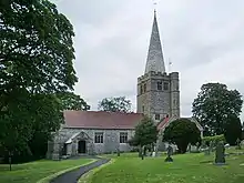
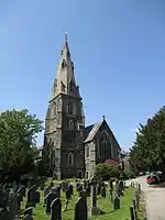
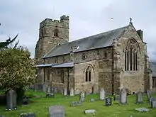
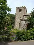
| Church of Cuthbert | Aldingham, South Lakeland | Church | c. 1190 | 25 March 1970 | SD2834571034 54°07′49″N 3°05′53″W |
1335944 | 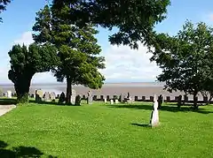 Church of Cuthbert |
| Arnside Tower | Arnside, South Lakeland | Tower House | Ruin | 12 February 1962 | SD4587876837 54°11′04″N 2°49′51″W |
1312275 | |
| Beckside House | Barbon, South Lakeland | House | 1767 | 12 February 1962 | SD6270082715 54°14′20″N 2°34′26″W |
1312337 |  |
| Church of St Bartholomew | Barbon, South Lakeland | Church | 1893 | 21 February 1989 | SD6305082462 54°14′11″N 2°34′06″W |
1086928 | |
| Ashton House | Beetham, South Lakeland | House | Mid 18th century | 21 November 1952 | SD4959579467 54°12′30″N 2°46′28″W |
1087330 | |
| Beetham Hall and attached Outbuildings | Beetham, South Lakeland | House | later alterations | 21 November 1952 | SD4992079055 54°12′17″N 2°46′09″W |
1312254 | .jpg.webp) Beetham Hall and attached Outbuildings |
| Curtain wall about 30m north of Beetham Hall | Beetham, South Lakeland | Curtain Wall | Medieval | 21 November 1952 | SD4993479114 54°12′19″N 2°46′09″W |
1137542 | Curtain wall about 30m north of Beetham Hall |
| Heron Corn Mill and attached Mill Race | Beetham, South Lakeland | Corn Mill | Late 18th century or earlier | 1 July 1974 | SD4962179969 54°12′47″N 2°46′26″W |
1087334 | 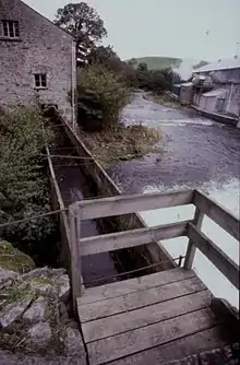 Heron Corn Mill and attached Mill Race |
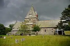
| Church of St Peter | Field Broughton, Broughton East, South Lakeland | Church | 1892-4 | 25 March 1970 | SD3870581776 54°13′41″N 2°56′30″W |
1349025 | |
| Broughton Tower special school | Broughton in Furness, Broughton West, South Lakeland | House | 14th century | 18 May 1953 | SD2139787917 54°16′51″N 3°12′32″W |
1335949 | 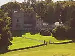 Broughton Tower special school |
| Obelisk and Stocks | Broughton-in-Furness, Broughton West, South Lakeland | Obelisk | 1810 | 25 March 1970 | SD2122387580 54°16′40″N 3°12′41″W |
1086822 | .jpg.webp) Obelisk and Stocks |
| Burton House, North Wing; Burton House, South Wing; Burton House and Rear Garden Wall attached to South Wing and Forming Rear Wa | Burton-in-Kendal, South Lakeland | House | Late 18th century | 12 February 1962 | SD5303276215 54°10′46″N 2°43′16″W |
1087316 | 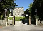 Burton House, North Wing; Burton House, South Wing; Burton House and Rear Garden Wall attached to South Wing and Forming Rear Wa |
| Entrance Lodge to south of Broadleys | Cartmel Fell, South Lakeland | Lodge | 1898-1900 | 13 May 1972 | SD3931393262 54°19′53″N 2°56′05″W |
1266564 | |
| Hodge Hill | Cartmel Fell, South Lakeland | House | 1560 | 18 May 1953 | SD4184888162 54°17′09″N 2°53′41″W |
1289621 | 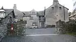 Hodge Hill |
| Casterton Hall, East Wing, the Mews (includes the Orangery) | Casterton, South Lakeland | House | Early 19th century | 21 November 1952 | SD6195379398 54°12′32″N 2°35′05″W |
1335933 | .jpg.webp) Casterton Hall, East Wing, the Mews (includes the Orangery) |
| Friends' Meeting House | Colthouse, Claife, South Lakeland | Schoolroom | 1688 | 25 March 1970 | SD3588798174 54°22′30″N 2°59′18″W |
1087266 | 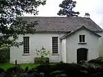 Friends' Meeting House |
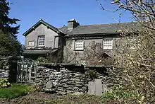
| Hill Top | Near Sawrey, Claife, South Lakeland | Farmhouse | 17th century or early 18th century | 25 March 1970 | SD3700995563 54°21′06″N 2°58′14″W |
1087304 | |
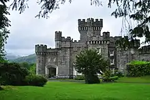
| Wray Castle | Wray, Claife, South Lakeland | House | 1840-47 | 25 March 1970 | NY3749701014 54°24′03″N 2°57′51″W |
1106324 | |
| The Cragg, Cragg Cottage and Barn | Colthouse, Claife, South Lakeland | House | 1695 | 25 March 1970 | SD3594198535 54°22′42″N 2°59′16″W |
1087263 | 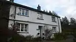 The Cragg, Cragg Cottage and Barn |
| Church of St Peter | Finsthwaite, Colton, South Lakeland | Church | 1973-9 | 23 July 1987 | SD3688387826 54°16′56″N 2°58′15″W |
1225177 | |
| Nibthwaite Mill | Nibthwaite, Colton, South Lakeland | House | 1987 | 23 July 1987 | SD2946488292 54°17′07″N 3°05′06″W |
1225382 | |
| Rook How Friends' Meeting House and Cottage | Rusland, Colton, South Lakeland | House | 1725 | 25 March 1970 | SD3322389542 54°17′50″N 3°01′39″W |
1225464 | 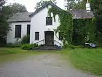 Rook How Friends' Meeting House and Cottage |
| Brantwood | Coniston, South Lakeland | House | c. 1797 | 25 March 1970 | SD3125895854 54°21′13″N 3°03′33″W |
1335727 | |
| Coniston Hall | Haws Bank, Coniston, South Lakeland | Farmhouse | 1953 | 18 May 1953 | SD3048396364 54°21′29″N 3°04′16″W |
1119652 | |
| Lodge and former Stable approx 70m to south of Brantwood | Coniston, South Lakeland | Stable | 18th century | 22 September 1987 | SD3123495798 54°21′11″N 3°03′34″W |
1087283 | |
| Cowmire Hall and Wall running Approx 20m to East, with Gate Piers | Crosthwaite and Lyth, South Lakeland | House | 17th century | 21 November 1952 | SD4275188713 54°17′27″N 2°52′52″W |
1087118 | 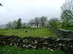 Cowmire Hall and Wall running Approx 20m to East, with Gate Piers |
| Biggerside Farmhouse | Dentdale, Dent, South Lakeland | Farmhouse | 1690 | 14 June 1984 | SD7001487733 54°17′04″N 2°27′44″W |
1383820 | |
| Burton Hill Farmhouse including adjoining Outbuilding | Dentdale, Dent, South Lakeland | Farmhouse | Probably mid to later 17th century | 14 June 1984 | SD6724989851 54°18′12″N 2°30′17″W |
1383829 | |
| High Hall Farmhouse including Cartshed | Dentdale, Dent, South Lakeland | Farmhouse | 1625 | 16 March 1954 | SD7037587610 54°17′00″N 2°27′24″W |
1383893 | 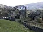 High Hall Farmhouse including Cartshed |
| High House | Gawthrop, Dent, South Lakeland | Farmhouse | 1687 | 16 March 1954 | SD6926186858 54°16′35″N 2°28′25″W |
1383968 | |
| Newland Blast Furnace and attached ancillary Buildings | Newland, Egton with Newland, South Lakeland | Blast furnace | Late 18th century or earlier | 14 April 1993 | SD2999879709 54°12′30″N 3°04′29″W |
1096782 | 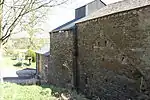 Newland Blast Furnace and attached ancillary Buildings |
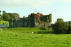
| Plumpton Hall | Egton with Newland, South Lakeland | House | Mid to late 16th century | 18 May 1953 | SD3128778718 54°11′59″N 3°03′17″W |
1158458 | 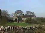 Plumpton Hall |
| Lune Viaduct (that Part in Firbank CP) | Marthwaite, Firbank, South Lakeland | Railway Viaduct | 1857-61 | 14 June 1984 | SD6306493054 54°19′54″N 2°34′10″W |
1086911 | .jpg.webp) Lune Viaduct (that Part in Firbank CP) |
| Badger Dub and Stable or Shippon attached to South West | Garsdale, South Lakeland | Farmhouse | Probably early 18th century | 14 June 1984 | SD7231290629 54°18′38″N 2°25′37″W |
1384006 | |
| Dandra Garth | Garsdale, South Lakeland | Farmhouse | Probably late 17th century | 16 March 1954 | SD7532989705 54°18′08″N 2°22′50″W |
1384014 | 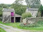 Dandra Garth |
| East Rackenthwaite and adjoining Barn | Garsdale, South Lakeland | Farmhouse | Probably 16th century or early 17th century | 11 August 1978 | SD7323190326 54°18′28″N 2°24′46″W |
1384019 | .jpg.webp) East Rackenthwaite and adjoining Barn |
| Netherwood Hotel | Grange-over-Sands, South Lakeland | Hotel | 1893 | 2 May 1975 | SD4142678401 54°11′53″N 2°53′58″W |
1269682 | .jpg.webp) Netherwood Hotel |
| Clock Tower Works | Low Wood, Haverthwaite, South Lakeland | Gunpowder Works | 1849 | 2 September 1985 | SD3466583679 54°14′41″N 3°00′15″W |
1266371 | 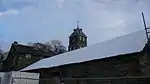 Clock Tower Works |
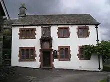
| Anne Tyson's Cottage | Hawkshead, South Lakeland | House | 17th century | 18 May 1953 | SD3516998175 54°22′30″N 2°59′58″W |
1338191 | 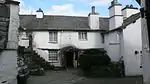 Anne Tyson's Cottage |
| Hawkshead Courthouse | Hawkshead, South Lakeland | Court House | 13th century | 25 March 1970 | SD3504298813 54°22′50″N 3°00′06″W |
1335777 | 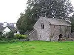 Hawkshead Courthouse |
| Hawkshead Grammar School | Hawkshead, South Lakeland | School | 1675 | 18 May 1953 | SD3523698038 54°22′25″N 2°59′54″W |
1087232 | |
| Hawkshead Old Hall | Hawkshead, South Lakeland | House | 17th century | 18 May 1953 | SD3492798781 54°22′49″N 3°00′12″W |
1087223 | |
| Stables and attached Barn to South West of Sizergh Castle | Helsington, South Lakeland | House | 1983 | 22 November 1983 | SD4979387838 54°17′01″N 2°46′22″W |
1136853 | 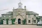 Stables and attached Barn to South West of Sizergh Castle |
| Barn to East of Park House Farmhouse with Attached Shippons to North and East | Heversham, South Lakeland | Horse Engine House | 19th century | 21 November 1952 | SD4951982640 54°14′13″N 2°46′34″W |
1086563 | |
| Church of St Peter | Heversham, South Lakeland | Cross | Celtic | 12 February 1962 | SD4960083390 54°14′37″N 2°46′30″W |
1086557 | |
| Heversham Hall | Heversham, South Lakeland | House | 14th century | 21 November 1952 | SD4938283241 54°14′32″N 2°46′42″W |
1137245 | |
| Hincaster Hall | Hincaster, South Lakeland | Farmhouse | Late 16th century | 21 November 1952 | SD5063684838 54°15′25″N 2°45′33″W |
1086572 | 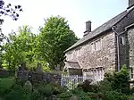 Hincaster Hall |
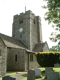
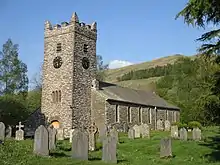
| Church of St Anne | Hugill, South Lakeland | Parish Church | 1743 | 12 February 1962 | SD4460898633 54°22′49″N 2°51′16″W |
1281325 | 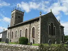 Church of St Anne |
| Reston Hall | Reston, Hugill, South Lakeland | House | 1743 | 12 February 1962 | SD4575898573 54°22′47″N 2°50′12″W |
1204237 | |
| Bridge carrying Drive to North East of Helsington Laithes Farmhouse | Kendal, South Lakeland | Road Bridge | 18th century | 30 January 1985 | SD5067190736 54°18′35″N 2°45′35″W |
1137459 | |
| Church of Holy Trinity and St George | Kendal, South Lakeland | Roman Catholic Church | 1835 | 30 January 1985 | SD5173592761 54°19′41″N 2°44′37″W |
1318999 | |
| Collinfield Farmhouse | Kendal, South Lakeland | Farmhouse | Mid/Late 16th century | 24 April 1951 | SD5108591401 54°18′57″N 2°45′12″W |
1312242 | |
| Entrance to Yard 41 | Kendal, South Lakeland | Gate | C20 | 14 April 1969 | SD5160392780 54°19′42″N 2°44′44″W |
1318997 | |
| Friends Meeting House | Kendal, South Lakeland | Classroom | 1934 | 24 April 1951 | SD5177892808 54°19′43″N 2°44′35″W |
1319001 | 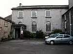 Friends Meeting House |
| Gilthwaiterigg | Kendal, South Lakeland | House | Later | 30 January 1985 | SD5208395323 54°21′04″N 2°44′19″W |
1145706 | |
| Helsington Laithes Farmhouse | Kendal, South Lakeland | Manor House | Late C15/Early 16th century | 24 April 1951 | SD5062290700 54°18′34″N 2°45′38″W |
1145728 | |
| Highgate Hotel | Kendal, South Lakeland | House | 1769 | 24 April 1951 | SD5147492327 54°19′27″N 2°44′51″W |
1319004 | 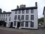 Highgate Hotel |
| No.7 (includes 9 and 11) | Kendal, South Lakeland | Town House | 16th century | 14 April 1969 | SD5166592756 54°19′41″N 2°44′41″W |
1145672 | |
| Nos 13, 15, 17 17a and 19 | Kendal, South Lakeland | House | 1688 | 24 April 1951 | SD5151292754 54°19′41″N 2°44′49″W |
1145674 | |
| Numbers 26 and 28 with Entrance to Yard 24 | Kendal, South Lakeland | Shop | c. 1828 | 14 April 1969 | SD5147092671 54°19′38″N 2°44′52″W |
1145715 | |
| Shop and adjoining Public Convenience | Kendal, South Lakeland | Town House | Late 17th century | 18 February 1992 | SD5158792765 54°19′41″N 2°44′45″W |
1254250 | |
| Wattsfield Farmhouse and Cottage | Kendal, South Lakeland | House | 17th century | 24 April 1951 | SD5168691291 54°18′54″N 2°44′39″W |
1145641 | |
| Kentmere Hall and attached Barn | Hodgson Brow, Kentmere, South Lakeland | Farmhouse | Late 14th century or early 15th century | 21 November 1952 | NY4510004236 54°25′50″N 2°50′52″W |
1086547 | 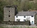 Kentmere Hall and attached Barn |
| Church of All Saints | Killington, South Lakeland | Church | 14th century | 12 February 1962 | SD6132288992 54°17′42″N 2°35′45″W |
1335928 | 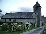 Church of All Saints |
| Hallbeck | Hallbeck, Killington, South Lakeland | House | 1684 | 12 February 1962 | SD6210288411 54°17′24″N 2°35′01″W |
1086885 | |
| Ashlack Hall and Outbuildings | Kirkby Ireleth, South Lakeland | House | 16th century | 18 May 1953 | SD2467785516 54°15′35″N 3°09′28″W |
1086791 | .jpg.webp) Ashlack Hall and Outbuildings |
| Church of St Cuthbert | Beck Side, Kirkby Ireleth, South Lakeland | Church | 12th century | 25 March 1970 | SD2336982234 54°13′48″N 3°10′37″W |
1086792 | 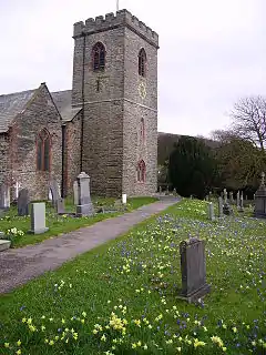 Church of St Cuthbert |
| Church Brow Cottage | Kirkby Lonsdale, South Lakeland | House | Early 19th century | 22 March 1983 | SD6115978892 54°12′15″N 2°35′49″W |
1311544 | |
| High Biggins Old Hall | Kirkby Lonsdale, South Lakeland | Manor House | 15th century | 12 February 1962 | SD6012078244 54°11′54″N 2°36′46″W |
1145801 | |
| Tearnside Hall and attached Stable and Barn | Kirkby Lonsdale, South Lakeland | Farmhouse | 1686 | 21 November 1952 | SD5882779397 54°12′31″N 2°37′58″W |
1145782 | |
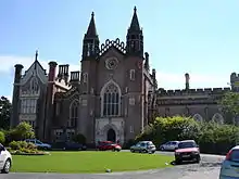
| Underley Hall School | Kirkby Lonsdale, South Lakeland | House | 1825-8 | 5 March 1982 | SD6150480135 54°12′56″N 2°35′31″W |
1311597 | 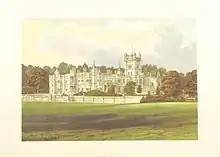 Underley Hall School |
| Barn adjacent to the Bield | Langdales, Lakes, South Lakeland | House | 17th century | 12 January 1967 | NY3115803655 54°25′25″N 3°03′45″W |
1271944 | |
| Barn at Town End | Troutbeck Village, Lakes, South Lakeland | Barn | 1666 | 12 January 1967 | NY4072802234 54°24′44″N 2°54′53″W |
1245541 | 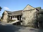 Barn at Town End |
| Barns, Stables etc to North and East of Rydal Hall | Rydal, Lakes, South Lakeland | Barn | 15 March 1974 | NY3662606377 54°26′56″N 2°58′44″W |
1245500 | 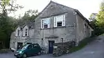 Barns, Stables etc to North and East of Rydal Hall | |
| Bridge over Rydal Beck in Grounds of Rydal Hall | Rydal, Lakes, South Lakeland | Arch Bridge | Late 17th century | 15 March 1974 | NY3665706319 54°26′54″N 2°58′42″W |
1245408 | 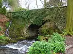 Bridge over Rydal Beck in Grounds of Rydal Hall |
| Buildings attached to Walthwaite | Langdales, Lakes, South Lakeland | House | 17th century | 12 January 1967 | NY3238205568 54°26′28″N 3°02′39″W |
1245269 | |
| Church of St Mary | Ambleside, Lakes, South Lakeland | Church | 1850-1854 | 12 January 1967 | NY3739604360 54°25′51″N 2°58′00″W |
1244784 | |
| Church of St Mary | Rydal, Lakes, South Lakeland | Church | 1842 | 12 January 1967 | NY3643606214 54°26′50″N 2°58′54″W |
1245403 | 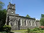 Church of St Mary |
| Fox How | Lakes, South Lakeland | House | 1834 | 15 March 1974 | NY3652104950 54°26′10″N 2°58′49″W |
1271870 | |
| Game Larder in Grounds of Rydal Hall | Rydal, Lakes, South Lakeland | Game Larder | 15 March 1974 | NY3658506422 54°26′57″N 2°58′46″W |
1245409 |  Game Larder in Grounds of Rydal Hall | |
| Gatehouse at Croft Hotel | Clappersgate, Lakes, South Lakeland | Garage | 16th century | 12 January 1967 | NY3671603581 54°25′25″N 2°58′37″W |
1245480 | 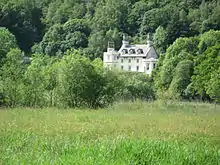 Gatehouse at Croft Hotel |
| Goodybridge House and attached Barn to North East | Lakes, South Lakeland | House | 17th century | 15 March 1974 | NY3329608167 54°27′52″N 3°01′50″W |
1272006 |  Goodybridge House and attached Barn to North East |
| Ice House in Grounds of Rydal Hall | Rydal, Lakes, South Lakeland | Icehouse | 15 March 1974 | NY3662806573 54°27′02″N 2°58′44″W |
1245501 | | |
| Jesus Church | Troutbeck, Lakes, South Lakeland | Bell Tower | 1736 | 12 January 1967 | NY4130802796 54°25′02″N 2°54′21″W |
1271827 | |
| Rydal Hall | Lakes, South Lakeland | House | 16th century | 12 January 1967 | NY3655306354 54°26′55″N 2°58′48″W |
1245499 | |
| Slater's Bridge (that Part in the Lakes Urban District) | Langdales, Lakes, South Lakeland | Packhorse Bridge | 17th century | 12 January 1967 | NY3120903010 54°25′04″N 3°03′42″W |
1245295 | 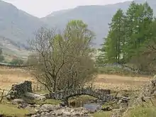 Slater's Bridge (that Part in the Lakes Urban District) |
| Slater's Bridge (that Part in the Parish of Coniston) | Little Langdale, Lakes, South Lakeland | Packhorse Bridge | 17th century | 22 September 1987 | NY3120903007 54°25′04″N 3°03′42″W |
1119623 | 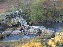 Slater's Bridge (that Part in the Parish of Coniston) |
| Summer House in Grounds of Rydal Hall | Rydal, Lakes, South Lakeland | Summerhouse | Late 17th century | 15 March 1974 | NY3664206334 54°26′54″N 2°58′43″W |
1271834 | .JPG.webp) Summer House in Grounds of Rydal Hall |
| Terraces to South of Rydal Hall | Rydal, Lakes, South Lakeland | Stepped Terrace | 15 March 1974 | NY3656106317 54°26′54″N 2°58′47″W |
1245407 | 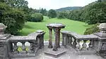 Terraces to South of Rydal Hall | |
| The Nab | Rydal, Lakes, South Lakeland | House | 1702 | 12 January 1967 | NY3549206399 54°26′56″N 2°59′47″W |
1271876 | 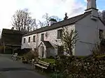 The Nab |
| Wood Farmhouse | Troutbeck, Lakes, South Lakeland | Farmhouse | 17th century | 15 March 1974 | NY3941601559 54°24′21″N 2°56′05″W |
1245538 | |
| Wordsworth Group of Graves in Churchyard of Church of St Oswald | Grasmere, Lakes, South Lakeland | Gravestone | 15 March 1974 | NY3377107398 54°27′27″N 3°01′23″W |
1272008 | 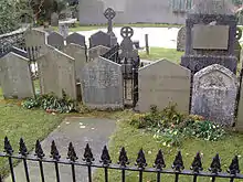 Wordsworth Group of Graves in Churchyard of Church of St Oswald | |
| Nether Levens Farmhouse and attached Store to North | Levens, South Lakeland | Farmhouse | Early 16th century | 21 November 1952 | SD4882785119 54°15′33″N 2°47′13″W |
1319030 | |
| Old Stables about 50m North East of Levens Hall, Cottages attached to North West and South; and Gate Piers Attache | Levens, South Lakeland | House | Mid C20 | 21 November 1952 | SD4958785150 54°15′34″N 2°46′31″W |
1318992 | |
| Priory Close House | Cartmel, Lower Allithwaite, South Lakeland | House | Possibly Medieval | 25 March 1970 | SD3792678796 54°12′04″N 2°57′11″W |
1348727 |  Priory Close House |
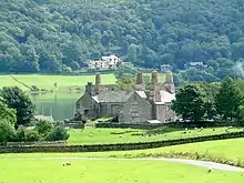
| Priory Gatehouse, Including East Bay of Gatehouse | Cartmel, Lower Allithwaite, South Lakeland | School | 1624 | 25 March 1970 | SD3782278787 54°12′04″N 2°57′17″W |
1348693 | 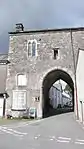 Priory Gatehouse, Including East Bay of Gatehouse |
| Wraysholme Tower | Flookburgh, Lower Allithwaite, South Lakeland | Farmhouse | 17th century | 25 March 1970 | SD3831875420 54°10′15″N 2°56′47″W |
1100320 | 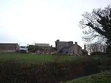 Wraysholme Tower |
| Canon Winder Hall | Flookburgh, Lower Holker, South Lakeland | Farmhouse | 16th century | 18 May 1953 | SD3514774718 54°09′51″N 2°59′41″W |
1335840 | |
| Cark Hall, North Cottage, South Cottage | Cark in Cartmel, Lower Holker, South Lakeland | House | 1580 | 18 May 1953 | SD3651676741 54°10′57″N 2°58′27″W |
1087146 | 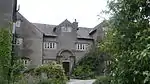 Cark Hall, North Cottage, South Cottage |
| Church of St John Baptist | Flookburgh, Lower Holker, South Lakeland | Church | 1777 | 25 March 1970 | SD3654976019 54°10′34″N 2°58′25″W |
1087115 | |
| Holker Hall and Terrace Wall Approximately 70 Metres to Garden to South East | Holker, Lower Holker, South Lakeland | Apartment | 1970 | 25 March 1970 | SD3590977383 54°11′17″N 2°59′01″W |
1335814 | 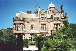 Holker Hall and Terrace Wall Approximately 70 Metres to Garden to South East |
| Manor House and Adjoining Outbuilding | Flookburgh, Lower Holker, South Lakeland | House | 1686 | 25 March 1970 | SD3679575837 54°10′28″N 2°58′11″W |
1335820 | |
| Lowick Hall | Lowick, South Lakeland | House | Mid 18th century | 25 March 1970 | SD2858685956 54°15′51″N 3°05′52″W |
1086795 | .jpg.webp) Lowick Hall |
| Curtain Wall to South-west of Middleton Hall | Middleton, South Lakeland | Privy House | Mid 15th century | 12 February 1962 | SD6268287426 54°16′52″N 2°34′29″W |
1146448 | |
| Curtain Wall to West and North West and Barn to North West of Middleton Hall | Middleton, South Lakeland | Curtain Wall | Mid 15th century | 12 February 1962 | SD6267687458 54°16′53″N 2°34′29″W |
1086862 | |
| Middleton Hall | Middleton, South Lakeland | Farmhouse | Late 14th century | 21 November 1952 | SD6269687441 54°16′52″N 2°34′28″W |
1086861 | |
| Outbuilding adjoining North East angle of Middleton Hall and adjoining Wall | Middleton, South Lakeland | Farmhouse | Early to Mid 15th century | 21 November 1952 | SD6269787455 54°16′53″N 2°34′28″W |
1146424 | |
| Roman Milestone approx. 74m to West of Road | Middleton, South Lakeland | Milestone | Roman | 12 February 1962 | SD6226385883 54°16′02″N 2°34′51″W |
1086866 | .jpg.webp) Roman Milestone approx. 74m to West of Road |
| Church of St Mark | Natland, Natland, South Lakeland | Parish Church | 1909-1910 | 19 July 1984 | SD5210789200 54°17′46″N 2°44′14″W |
1137760 | |
| Blease Hall | Old Hutton and Holmescales, South Lakeland | House | c. 1600 | 21 November 1952 | SD5492589167 54°17′46″N 2°41′39″W |
1312207 | .jpg.webp) Blease Hall |
| Tower of Chapel of St Margaret | Over Staveley, South Lakeland | Tower | 1388 | 12 February 1962 | SD4713698176 54°22′35″N 2°48′55″W |
1086550 | |
| Preston Patrick Hall | Preston Patrick, South Lakeland | House | 15th century or early 16th century | 21 November 1952 | SD5443083748 54°14′51″N 2°42′03″W |
1312117 | .jpg.webp) Preston Patrick Hall |
| Graythwaite Old Hall | Graythwaite, Satterthwaite, South Lakeland | House | 16th century or 17th century | 18 May 1953 | SD3720290891 54°18′35″N 2°58′00″W |
1087200 | .jpg.webp) Graythwaite Old Hall |
| Abbot Holme Bridge | Dentdale, Sedbergh, South Lakeland | Road Bridge | Probably 17th century | 14 June 1984 | SD6488890827 54°18′43″N 2°32′28″W |
1384064 | 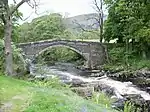 Abbot Holme Bridge |
| Archer's Hall | Millthrop, Sedbergh, South Lakeland | Farmhouse | 1681 | 16 March 1954 | SD6585791111 54°18′52″N 2°31′35″W |
1384200 | |
| Chapel at Sedbergh School | Sedbergh Town, Sedbergh, South Lakeland | School | 1897 | 14 June 1984 | SD6579691770 54°19′13″N 2°31′38″W |
1384171 | .jpg.webp) Chapel at Sedbergh School |
| The Old Grammar School (now the School Library) | Sedbergh, South Lakeland | School | 1954 | 16 March 1954 | SD6577592030 54°19′22″N 2°31′40″W |
1384071 | 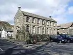 The Old Grammar School (now the School Library) |
| Crook of Lune Bridge (that part in Grayrigg CP) | Sedbergh, South Lakeland | Bridge | 17th century or 18th century | 16 February 1963 | SD6203396311 54°21′39″N 2°35′09″W |
1137785 | .jpg.webp) Crook of Lune Bridge (that part in Grayrigg CP) |
| Crook of Lune Bridge (that Part in Sedbergh CP) | Howgill, Sedbergh, South Lakeland | Bridge | 16th century or earlier | 16 March 1954 | SD6203396312 54°21′39″N 2°35′09″W |
1384145 | Crook of Lune Bridge (that Part in Sedbergh CP) |
| High Oaks | Marthwaite, Sedbergh, South Lakeland | Kitchen | 19th century | 16 March 1954 | SD6270791076 54°18′50″N 2°34′29″W |
1384164 | |
| Hollin Hill Farmhouse | Soolbank, Sedbergh, South Lakeland | Farmhouse | 1712 | 14 June 1984 | SD6745192880 54°19′50″N 2°30′07″W |
1384082 | |
| Lune Viaduct at Newbys Dub (that part in Sedbergh CP) | Marthwaite, Sedbergh, South Lakeland | Railway Viaduct | 1861 | 18 October 1999 | SD6306993048 54°19′54″N 2°34′10″W |
1383592 | Lune Viaduct at Newbys Dub (that part in Sedbergh CP) |
| Mire House | Sedbergh, South Lakeland | Farmhouse | 17th century | 14 June 1984 | SD6915194276 54°20′35″N 2°28′34″W |
1384111 | |
| Stone Hall | Soolbank, Sedbergh, South Lakeland | Farmhouse | 1695 | 16 March 1954 | SD6717292786 54°19′46″N 2°30′23″W |
1384219 | |
| The Hill | Marthwaite, Sedbergh, South Lakeland | House | Altered post 1712 | 16 March 1954 | SD6258690550 54°18′33″N 2°34′36″W |
1384166 | |
| Thorns Hall and attached Stable Wing to Rear | Soolbank, Sedbergh, South Lakeland | House | Probably early to mid 17th century | 16 March 1954 | SD6636892158 54°19′26″N 2°31′07″W |
1384176 | |
| War Memorial Cloister at Sedbergh School | Sedbergh, South Lakeland | War Memorial | 1924 | 14 June 1984 | SD6552891912 54°19′18″N 2°31′53″W |
1384218 | |
| Barn End, Bull Close, Bull Close Cottage | Skelwith Fold, Skelwith, South Lakeland | House | Late 17th century | 25 March 1970 | NY3473402469 54°24′48″N 3°00′26″W |
1121997 | |
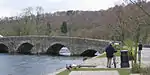
| Newby Bridge | Newby Bridge, Staveley-in-Cartmel, South Lakeland | Bridge | Before 17th century | 25 March 1970 | SD3690186359 54°16′08″N 2°58′13″W |
1225523 | |
| Burneside Hall | Strickland Roger, South Lakeland | House | Later than 14th century | 21 November 1952 | SD5099195934 54°21′24″N 2°45′20″W |
1289216 | |
| Hoathwaite Farmhouse and Outbuildings | Torver, South Lakeland | Farmhouse | Late 17th century | 22 September 1987 | SD2959694927 54°20′42″N 3°05′04″W |
1087210 | |
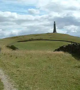
| Barrow Monument | Ulverston, South Lakeland | Commemorative Monument | 1850 | 2 March 1950 | SD2946079072 54°12′09″N 3°04′58″W |
1375003 | |
| Church of St Mary | Ulverston, South Lakeland | Parish Church | 16th century | 2 March 1950 | SD2889978685 54°11′56″N 3°05′29″W |
1374977 | |
| Conishead Priory | Ulverston, South Lakeland | House | Earlier | 2 March 1950 | SD3040375826 54°10′25″N 3°04′04″W |
1270176 | |
| Friends Meeting House | Ulverston, South Lakeland | Meeting Hall | 1996 | 2 March 1950 | SD2837876875 54°10′57″N 3°05′56″W |
1270207 | .jpg.webp) Friends Meeting House |
| Swarthmoor Hall | Ulverston, South Lakeland | House | Early 17th century | 2 March 1950 | SD2818677293 54°11′11″N 3°06′07″W |
1270174 | |
| Barrow Wife | Upper Allithwaite, South Lakeland | House | 1987 | 25 March 1970 | SD4068284824 54°15′20″N 2°54′43″W |
1225720 | 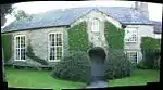 Barrow Wife |
| Monument to John Wilkinson approx. 17m north of Junction with Dixon Wood Close | Lindale, Upper Allithwaite, South Lakeland | Commemorative Monument | 1808 | 25 March 1970 | SD4184280331 54°12′55″N 2°53′36″W |
1266208 | 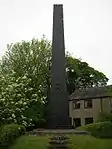 Monument to John Wilkinson approx. 17m north of Junction with Dixon Wood Close |
| Selside Hall and attached Outbuilding | Whitwell and Selside, South Lakeland | House | Late 14th century | 21 November 1952 | SD5345999043 54°23′05″N 2°43′05″W |
1311671 | |
| Causeway Farmhouse | Windermere, South Lakeland | Farmhouse | Mid 17th century | 8 May 1950 | NY4154600045 54°23′33″N 2°54′06″W |
1124676 | |
| Far Orest Old Farm Cottage | Troutbeck, Windermere, South Lakeland | House | 17th century | 20 February 1982 | NY4128900786 54°23′57″N 2°54′21″W |
1124758 | |
| Far Orrest Old Farm Cottage | Troutbeck, Windermere, South Lakeland | House | 17th century porch / open store | 20 February 1982 | NY4128000785 54°23′57″N 2°54′22″W |
1255499 | |
| Ferry Cottage, Low Miller Ground | Windermere, South Lakeland | House | 17th century | 8 May 1950 | SD4026098841 54°22′54″N 2°55′17″W |
1124747 | |
| Helm Farmhouse, and Helm Farm Cottage, with attached Barn | Bowness on Windermere, Windermere, South Lakeland | Farmhouse | 1692 | 8 May 1950 | SD4128796987 54°21′54″N 2°54′18″W |
1124691 | |
| High Miller Ground | Windermere, South Lakeland | House | 18th century | 8 May 1950 | SD4038998858 54°22′54″N 2°55′10″W |
1203436 | |
| Longmire | Troutbeck, Windermere, South Lakeland | House | 17th century | 8 May 1950 | NY4140401935 54°24′34″N 2°54′15″W |
1124753 | |
| Near Orrest Farmhouse | Windermere, South Lakeland | Farmhouse | 16th century | 8 May 1950 | NY4187500202 54°23′38″N 2°53′48″W |
1124677 | |
| Rayrigg Hall Farmhouse | Windermere, South Lakeland | Farmhouse | Early 18th century | 8 May 1950 | SD4027498095 54°22′29″N 2°55′15″W |
1332567 | |
| Rayrigg Hall | Windermere, South Lakeland | House | Early 18th century | 8 May 1950 | SD4028898088 54°22′29″N 2°55′15″W |
1124746 | |
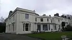
| Rectory (St Martin's) | Bowness-on-Windermere, Windermere, South Lakeland | Vicarage | 16th century | 8 May 1950 | SD3990896210 54°21′28″N 2°55′34″W |
1124688 | .jpg.webp) Rectory (St Martin's) |
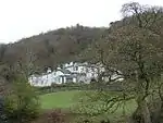
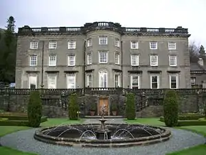
| Storrs Hall | Bowness on Windermere, Windermere, South Lakeland | Country House | 18th century | 8 May 1950 | SD3926294135 54°20′21″N 2°56′09″W |
1332564 | |
| Storrs Temple | Storrs Hall, Windermere, South Lakeland | Garden House | 1804 | 8 May 1950 | SD3904594103 54°20′20″N 2°56′20″W |
1124742 | 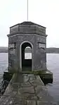 Storrs Temple |
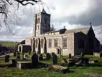
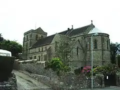
| Church of St Paul | Witherslack, South Lakeland | Church | 1664-1671 | 12 February 1962 | SD4317484191 54°15′01″N 2°52′25″W |
1087094 |
.jpg.webp)


.JPG.webp)

Notes
- The date given is the date used by Historic England as significant for the initial building or that of an important part in the structure's description.
- Sometimes known as OSGB36, the grid reference is based on the British national grid reference system used by the Ordnance Survey.
- The "List Entry Number" is a unique number assigned to each listed building and scheduled monument by Historic England.
External links
![]() Media related to Grade II* listed buildings in Cumbria at Wikimedia Commons
Media related to Grade II* listed buildings in Cumbria at Wikimedia Commons
This article is issued from Wikipedia. The text is licensed under Creative Commons - Attribution - Sharealike. Additional terms may apply for the media files.