Schnecksville, Pennsylvania
Schnecksville is an unincorporated community and census-designated place (CDP) in North Whitehall Township, Lehigh County, Pennsylvania, in the United States. It is a suburb of Allentown, in the Lehigh Valley region of the state.
Schnecksville, Pennsylvania | |
|---|---|
 | |
 Location in Lehigh County | |
 Schnecksville Location in Pennsylvania  Schnecksville Location in the United States | |
| Coordinates: 40°40′13″N 75°36′29″W | |
| Country | United States |
| State | Pennsylvania |
| County | Lehigh |
| Township | North Whitehall |
| Area | |
| • Total | 2.70 sq mi (6.99 km2) |
| • Land | 2.69 sq mi (6.97 km2) |
| • Water | 0.008 sq mi (0.02 km2) |
| Elevation | 668 ft (204 m) |
| Population (2010)[2] | |
| • Total | 2,935 |
| • Density | 1,091/sq mi (421.3/km2) |
| Time zone | UTC-5 (EST) |
| • Summer (DST) | UTC-4 (EDT) |
| ZIP code | 18078 |
| Area code(s) | 610 & 484 |
| FIPS code | 42-68192 |
| GNIS feature ID | 1200116 |
The population of Schnecksville was 2,935 at the 2010 census.[2] Its U.S. postal code (ZIP code) is 18078.
History
Schnecksville was first settled in 1756 by Adam Schneck. His log home is still standing but has been moved about a half mile from its original location. In 1840 Schnecksville was laid out by Daniel Schneck. Descendants of the Schnecks still live in the town today. He and his son Moses Schneck owned a hotel and other buildings. A George Rau opened a store. There was a post office here in 1846 with Peter Gross as postmaster. In 1880 the population was 160 persons. There were two hotels, a store, twenty two dwellings, a school and a church. There is reference made to two churches, an Evangelical church dated from 1871, and a frame church owned by the United Brethren, the date not given.
Geography
Schnecksville is located in northern Lehigh County at 40°40′33″N 75°36′59″W (40.675741, -75.616260),[3] in the western part of North Whitehall Township.
Pennsylvania Route 309 runs through the middle of the community, leading south through Orefield 7 miles (11 km) to Interstate 78 on the west side of Allentown. To the northwest PA 309 leads through Pleasant Corners 24 miles (39 km) to Tamaqua. Pennsylvania Route 873 begins at PA 309 in Schnecksville and leads north through Neffs 6 miles (10 km) to Slatington. The Trexler Nature Preserve, which is also home to the Trexler Environmental Center and the Lehigh Valley Zoo, is on the southwest side of Schnecksville.
According to the United States Census Bureau, the CDP has a total area of 2.7 square miles (7.0 km2), of which 0.01 square miles (0.02 km2), or 0.28%, are water.[2] Schnecksville sits on a ridge at an elevation of about 660 feet (200 m) above sea level. To the west, water flows to Jordan Creek, while to the east water flows to Coplay Creek. Both creeks are southeast-flowing tributaries of the Lehigh River and part of the Delaware River watershed.
Crystal Spring Farm
Schnecksville is home to one of the area's top dairy farms, the Crystal Spring dairy farm. The farm has been in operation for over 100 years. The farm has a store that sells homemade and homegrown products. A specialty of the store is homemade ice cream, which is made fresh daily.
Demographics
| Historical population | |||
|---|---|---|---|
| Census | Pop. | %± | |
| 2000 | 2,664 | — | |
| 2010 | 2,935 | 10.2% | |
As of the census[4] of 2010, there were 2,935 people, 1241 households, and 864 families residing in the CDP. The population density was 1,572.5 people per square mile (609.5/km2). There were 738 housing units at an average density of 583.5/sq mi (226.1/km2). The racial makeup of the CDP was 97.89% White, 0.35% African American, 0.10% Native American, 1.06% Asian, 0.50% from other races, and 0.10% from two or more races. Hispanic or Latino of any race were 1.21% of the population.
The ancestry of its residents is as follows: German (47.0%), Irish (10.0%), Italian (9.8%), English (9.2%), Welsh (7.1%), Slovak (6.1%).
There were 715 households, out of which 43.1% had children under the age of 18 living with them, 73.8% were married couples living together, 7.4% had a female householder with no husband present, and 17.2% were non-families. 14.7% of all households were made up of individuals, and 5.2% had someone living alone who was 65 years of age or older. The average household size was 2.78 and the average family size was 3.09.
In the CDP, the population was spread out, with 29.0% under the age of 18, 4.7% from 18 to 24, 28.9% from 25 to 44, 28.0% from 45 to 64, and 9.4% who were 65 years of age or older. The median age was 40 years. For every 100 females, there were 93.9 males. For every 100 females age 18 and over, there were 94.0 males.
The median income for a household in the CDP was $74,808, and the median income for a family was $78,519. Males had a median income of $51,716 versus $35,714 for females. The per capita income for the CDP was $27,533. About 1.2% of families and 1.3% of the population were below the poverty line, including 1.5% of those under age 18 and none of those age 65 or over.
Public education
The community is served by the Parkland School District and Northwestern Lehigh School District. Most students in grades nine through twelve attend Parkland High School in the district.
Schnecksville is home to one of three campuses of Lehigh Carbon Community College (also known LCCC, or "L-tri-C"), a public community college with 2,145 full-time students.
Schnecksville Community Fair
Every summer since 1981, a country fair is held in Schnecksville. In recent years, it has been held at the Schnecksville Fire Company on Pennsylvania Route 309, near the community's southern entrance. The Schnecksville Community Fair was not held in 2020 due to the Covid19 pandemic.
References
- "2019 U.S. Gazetteer Files: Places: Pennsylvania". United States Census Bureau. Retrieved October 27, 2020.
- "Total Population: 2010 Census DEC Summary File 1 (P1), Schnecksville CDP, Pennsylvania". data.census.gov. U.S. Census Bureau. Retrieved October 27, 2020.
- "US Gazetteer files: 2010, 2000, and 1990". United States Census Bureau. 2011-02-12. Retrieved 2011-04-23.
- "U.S. Census website". United States Census Bureau. Retrieved 2008-01-31.
| Wikimedia Commons has media related to Schnecksville, Pennsylvania. |
External links
- Lehigh Carbon Community College
- Schnecksville Community Fair
- Trexler Preserve (Lehigh County Parks & Recreation web page)
- Trexler Environmental Center (Lehigh County Parks & Recreation web page)
Places adjacent to Schnecksville, Pennsylvania | ||||||||||
|---|---|---|---|---|---|---|---|---|---|---|
| ||||||||||
Municipalities and communities of Lehigh County, Pennsylvania, United States | ||
|---|---|---|
| Cities | 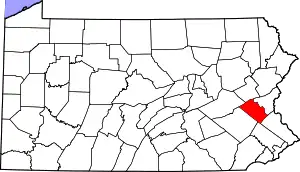 | |
| Boroughs | ||
| Townships | ||
| CDPs | ||
| Unincorporated communities |
| |
| Footnotes | ‡This populated place also has portions in an adjacent county or counties | |
| ||

| Authority control |
|---|
