Trexlertown, Pennsylvania
Trexlertown (also Trexlerstown[3]) is an unincorporated community and census-designated place (CDP) in Upper Macungie Township, Lehigh County, Pennsylvania, United States. Part of the Lehigh Valley region, it lies between Breinigsville and Wescosville. As of the 2010 census the population was 1,988.[2]
Trexlertown, Pennsylvania | |
|---|---|
 Location in Lehigh County | |
 Trexlertown Location in Pennsylvania  Trexlertown Location in the United States | |
| Coordinates: 40°32′53″N 75°36′21″W | |
| Country | United States |
| State | Pennsylvania |
| County | Lehigh |
| Township | Upper Macungie |
| Area | |
| • Total | 2.09 sq mi (5.42 km2) |
| • Land | 2.07 sq mi (5.37 km2) |
| • Water | 0.02 sq mi (0.04 km2) |
| Elevation | 397 ft (121 m) |
| Population | |
| • Total | 1,988 |
| • Density | 958/sq mi (369.9/km2) |
| Time zone | UTC-5 (Eastern (EST)) |
| • Summer (DST) | UTC-4 (EDT) |
| ZIP code | 18087 |
| Area code(s) | 610 and 484 |
| FIPS code | 42-77488 |
| GNIS feature ID | 1189757[3] |
Air Products & Chemicals is located on the east side of Trexlertown. The town also is next to the Lehigh Valley Velodrome, which is home to various cycling competitions.
History
Jeremiah Trexler obtained land adjoining that of his father in Upper Macungie Township, Bucks County, Pennsylvania, where he kept a tavern as early as in 1732. In 1734 a road was laid out from his tavern through North Wales in now Montgomery County to Philadelphia. As was the custom of the time, a village grew around the tavern, which came to be known as Trexlertown.[4]
| Historical population | |||
|---|---|---|---|
| Census | Pop. | %± | |
| 2000 | 957 | — | |
| 2010 | 1,988 | 107.7% | |
Geography
Trexlertown is located southwest of the center of Lehigh County, along the southeast edge of Upper Macungie Township, at an altitude of 397 feet (121 m).[3] It is bordered to the southwest by Breinigsville and to the southeast by Lower Macungie Township. U.S. Route 222 forms the northern edge of the community; US 222 leads northeast 3 miles (5 km) to its terminus at Interstate 78 outside of Allentown and southwest 30 miles (48 km) to Reading. Pennsylvania Route 100 forms the western edge of Trexlertown, leading north 11 miles (18 km) to its terminus at PA 309 near Pleasant Corners and south 27 miles (43 km) to Pottstown.
According to the U.S. Census Bureau, the Trexlertown CDP has a total area of 2.1 square miles (5.4 km2), of which 0.02 square miles (0.04 km2), or 0.80%, are water.[1] Schaefer Run and Iron Run join in the southwest part of the community to form Spring Creek, a southwest-flowing tributary of Little Lehigh Creek and part of the Lehigh River watershed.
Public education
Trexlertown is part of the Parkland School District. Students in grades nine through 12 attend Parkland High School.
References
- "2019 U.S. Gazetteer Files: Places: Pennsylvania". United States Census Bureau. Retrieved October 28, 2020.
- "Total Population: 2010 Census DEC Summary File 1 (P1), Trexlertown CDP, Pennsylvania". data.census.gov. U.S. Census Bureau. Retrieved October 28, 2020.
- "Trexlertown". Geographic Names Information System. United States Geological Survey.
- Roberts, Stoudt, Krick and Dietrich, History of Lehigh County, Pennsylvania, 3:1321; "History of Upper Macungie Township, Lehigh County, Pennsylvania", online <"Archived copy". Archived from the original on 2005-04-18. Retrieved 2005-05-26.CS1 maint: archived copy as title (link)>; Thomas Lynch Montgomery, Pennsylvania Archives, Sixth Series, 14: 269-271.
Places adjacent to Trexlertown, Pennsylvania | |
|---|---|
Municipalities and communities of Lehigh County, Pennsylvania, United States | ||
|---|---|---|
| Cities | 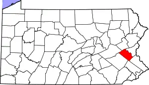 | |
| Boroughs | ||
| Townships | ||
| CDPs | ||
| Unincorporated communities |
| |
| Footnotes | ‡This populated place also has portions in an adjacent county or counties | |
| ||
