Grade II* listed buildings in High Peak
There are over 20,000 Grade II* listed buildings in England. This page is a list of these buildings in the district of High Peak in Derbyshire.
List of buildings
| Name | Location | Type | Completed [note 1] | Date designated | Grid ref.[note 2] Geo-coordinates |
Entry number [note 3] | Image |
|---|---|---|---|---|---|---|---|
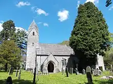
| Church of St John the Baptist | Bamford | Church | 1856–60 | 21 April 1967 | SK2076083376 53°20′49″N 1°41′23″W |
1087859 | 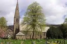 Church of St John the Baptist |
| Church of St Edmund | Castleton | Church | Early 12th century | 21 April 1967 | SK1502882901 53°20′34″N 1°46′33″W |
1087866 | |
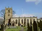
| Church of St Thomas of Canterbury | Chapel-en-le-Frith | Church | Early 14th century | 21 April 1967 | SK0577080827 53°19′28″N 1°54′53″W |
1088062 | 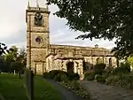 Church of St Thomas of Canterbury |
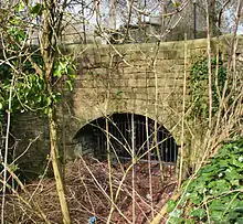
| Stodhart Tunnel | Chapel-en-le-Frith | Tunnel | 1796 | 3 September 1985 | SK0588081490 53°19′49″N 1°54′47″W |
1334843 | |
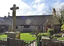
| Chinley Independent Chapel | Chinley | Congregational chapel | 1711 | 21 April 1967 | SK0552582001 53°20′06″N 1°55′07″W |
1088033 | 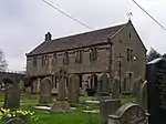 Chinley Independent Chapel |
| Stable block at Park Hall | Little Hayfield | House | Early 19th century | 21 April 1967 | SK0380888332 53°23′31″N 1°56′39″W |
1298715 |  Stable block at Park Hall |
| Torr Vale Mill, attached weir sluice gates, watercourse walls, headrace arches, retaining walls and steps | New Mills | Mill | circa 1790 | 23 February 1998 | SJ9990385332 53°21′53″N 2°00′11″W |
1119721 | 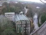 Torr Vale Mill, attached weir sluice gates, watercourse walls, headrace arches, retaining walls and steps |
| Canal Warehouse at end of Peak Forest Canal | Whaley Bridge | Canal warehouse | 1832 | 18 December 1972 | SK0118681620 53°19′53″N 1°59′01″W |
1088081 | Canal Warehouse at end of Peak Forest Canal |
| St James' Church | Taxal, Whaley Bridge | Church | 16th or 17th century | 19 September 1977 | SK0065379810 53°18′55″N 1°59′30″W |
1088087 | 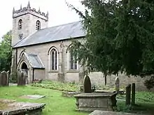 St James' Church |
| Church of St Margaret | Wormhill | Church | 1864 | 21 April 1967 | SK1245574182 53°15′52″N 1°48′53″W |
1087930 | |
| Wormhill Hall | Wormhill | Country house | 1697 | 25 October 1951 | SK1246074068 53°15′48″N 1°48′53″W |
1146377 | 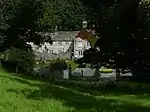 Wormhill Hall |
| 12 stone urns and linking walls and steps | Buxton | Urns | 1818 | 4 December 1990 | SK0584773537 53°15′32″N 1°54′50″W |
1257871 | |
| Church of St Anne | Buxton | Church | Earlier than 1625 | 25 January 1951 | SK0572272975 53°15′14″N 1°54′57″W |
1259392 | |
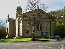
| Church of St John the Baptist | Buxton | Church | 1802–11 | 25 January 1951 | SK0561773550 53°15′32″N 1°55′02″W |
1258025 | |
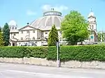
| Devonshire Royal Hospital | Buxton | Stable | 1785–90 | 21 December 1970 | SK0565173672 53°15′36″N 1°55′00″W |
1259351 | |
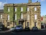
| Old Hall Hotel | Buxton | Town house | 1572 | 25 January 1951 | SK0575473477 53°15′30″N 1°54′55″W |
1257847 | |
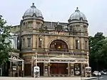
| Buxton Opera House | Buxton | Opera house | 1901–03 | 21 December 1970 | SK0562573485 53°15′30″N 1°55′02″W |
1257789 | |
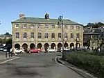
| 1–6 The Square | Buxton | Apartments | 1803–06 | 25 January 1951 | SK0571973512 53°15′31″N 1°54′57″W |
1257843 |
.jpg.webp)
See also
- Grade I listed buildings in Derbyshire
- Grade II* listed buildings in Amber Valley
- Grade II* listed buildings in Bolsover (district)
- Grade II* listed buildings in Chesterfield
- Grade II* listed buildings in Derby
- Grade II* listed buildings in Derbyshire Dales
- Grade II* listed buildings in Erewash
- Grade II* listed buildings in North East Derbyshire
- Grade II* listed buildings in South Derbyshire
- Listed buildings in New Mills
Notes
- The date given is the date used by Historic England as significant for the initial building or that of an important part in the structure's description.
- Sometimes known as OSGB36, the grid reference is based on the British national grid reference system used by the Ordnance Survey.
- The "List Entry Number" is a unique number assigned to each listed building and scheduled monument by Historic England.
External links
![]() Media related to Grade II* listed buildings in Derbyshire at Wikimedia Commons
Media related to Grade II* listed buildings in Derbyshire at Wikimedia Commons
This article is issued from Wikipedia. The text is licensed under Creative Commons - Attribution - Sharealike. Additional terms may apply for the media files.
