National Register of Historic Places listings in Alfalfa County, Oklahoma
This is a list of the National Register of Historic Places listings in Alfalfa County, Oklahoma.
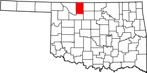
Location of Alfalfa County in Oklahoma
This is intended to be a complete list of the properties on the National Register of Historic Places in Alfalfa County, Oklahoma, United States. The locations of National Register properties for which the latitude and longitude coordinates are included below, may be seen in a map.[1]
There are 12 properties listed on the National Register in the county.
- This National Park Service list is complete through NPS recent listings posted January 29, 2021.[2]
Current listings
| [3] | Name on the Register[4] | Image | Date listed[5] | Location | City or town | Description |
|---|---|---|---|---|---|---|
| 1 | Alfalfa County Courthouse | 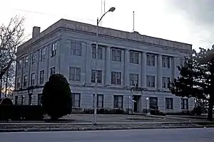 Alfalfa County Courthouse |
August 23, 1984 (#84002937) |
Grand Ave. 36°45′18″N 98°21′22″W |
Cherokee | |
| 2 | Aline IOOF Lodge No. 263 | March 8, 1984 (#84002941) |
Off Main and Broadway 36°30′36″N 98°27′00″W |
Aline | ||
| 3 | Carmen IOOF Home | March 8, 1984 (#84002944) |
North of Carmen 36°35′43″N 98°27′43″W |
Carmen | ||
| 4 | Carmen IOOF Lodge No. 84 | March 8, 1984 (#84002948) |
Main and 4th St. 36°34′45″N 98°27′30″W |
Carmen | ||
| 5 | Cherokee Armory | September 8, 1988 (#88001371) |
E 2nd St and S Kansas Ave 36°45′23″N 98°21′21″W |
Cherokee | ||
| 6 | Cherokee Friends Church |  Cherokee Friends Church |
December 6, 2004 (#04001337) |
120 S. Pennsylvania 36°45′25″N 98°21′14″W |
Cherokee | |
| 7 | Cherokee IOOF Lodge No. 219 | March 8, 1984 (#84002953) |
S Grand Ave and E 2nd St 36°45′23″N 98°21′25″W |
Cherokee | ||
| 8 | Farmers' Exchange Elevator | October 7, 1983 (#83004152) |
State Highway 45 36°31′57″N 98°09′15″W |
Goltry | ||
| 9 | Farmers' Federation Elevator | October 7, 1983 (#83004153) |
Ohio Ave and W 2nd St 36°45′23″N 98°21′34″W |
Cherokee | ||
| 10 | Hotel Cherokee | March 5, 1998 (#98000200) |
117 W. Main 36°45′29″N 98°21′28″W |
Cherokee | ||
| 11 | Ingersoll Tile Elevator | 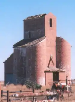 Ingersoll Tile Elevator |
October 7, 1983 (#83004156) |
Off U.S. Route 64 36°47′49″N 98°23′20″W |
Ingersoll | |
| 12 | Sod House | September 29, 1970 (#70000526) |
About 4 miles north of Cleo Springs 36°28′17″N 98°25′23″W |
Cleo Springs |
See also
| Wikimedia Commons has media related to National Register of Historic Places in Alfalfa County, Oklahoma. |
References
- The latitude and longitude information provided in this table was derived originally from the National Register Information System, which has been found to be fairly accurate for about 99% of listings. Some locations in this table may have been corrected to current GPS standards.
- "National Register of Historic Places: Weekly List Actions". National Park Service, United States Department of the Interior. Retrieved on January 29, 2021.
- Numbers represent an alphabetical ordering by significant words. Various colorings, defined here, differentiate National Historic Landmarks and historic districts from other NRHP buildings, structures, sites or objects.
- "National Register Information System". National Register of Historic Places. National Park Service. March 13, 2009.
- The eight-digit number below each date is the number assigned to each location in the National Register Information System database, which can be viewed by clicking the number.
| Topics | |
|---|---|
| Lists by state |
|
| Lists by insular areas | |
| Lists by associated state | |
| Other areas | |
| Related | |
| |
| Aline | ||
|---|---|---|
| Carmen | ||
| Cherokee |
| |
| Cleo Springs | ||
| Goltry |
| |
| Ingersoll | ||
This article is issued from Wikipedia. The text is licensed under Creative Commons - Attribution - Sharealike. Additional terms may apply for the media files.