National Register of Historic Places listings in Tulsa County, Oklahoma
This is a list of the National Register of Historic Places listings in Tulsa County, Oklahoma.
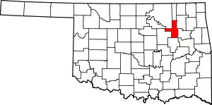
Location of Tulsa County in Oklahoma
This is intended to be a complete list of the properties and districts on the National Register of Historic Places in Tulsa County, Oklahoma, United States. The locations of National Register properties and districts for which the latitude and longitude coordinates are included below, may be seen in a map.[1]
There are 99 properties and districts listed on the National Register in the county, including 1 National Historic Landmark.
- This National Park Service list is complete through NPS recent listings posted January 29, 2021.[2]
Current listings
| [3] | Name on the Register[4] | Image | Date listed[5] | Location | City or town | Description |
|---|---|---|---|---|---|---|
| 1 | 66 Motel | December 13, 1996 (#96001487) |
3660 Southwest Boulevard 36°06′37″N 96°00′46″W |
Tulsa | Demolished in 2001.[6] | |
| 2 | Ambassador Hotel | 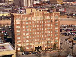 Ambassador Hotel |
November 17, 1999 (#99001085) |
1314 S. Main 36°08′34″N 95°59′14″W |
Tulsa | |
| 3 | Atlas Life Building | 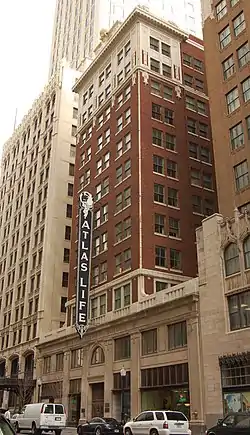 Atlas Life Building |
May 19, 2009 (#09000358) |
415 S. Boston Ave. 36°09′08″N 95°59′20″W |
Tulsa | |
| 4 | Belmont Apartments | December 8, 2015 (#15000876) |
1314 S. Denver Ave., W. 36°08′35″N 95°59′32″W |
Tulsa | ||
| 5 | Blue Cross Blue Shield of Oklahoma Building | 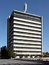 Blue Cross Blue Shield of Oklahoma Building |
September 12, 2016 (#16000624) |
1215 S. Boulder Ave. 36°08′39″N 95°59′19″W |
Tulsa | |
| 6 | Blue Dome Historic District | 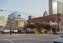 Blue Dome Historic District |
January 4, 2012 (#11000895) |
Roughly between S. Kenosha & S. Detroit Aves., Frisco Railroad tracks, & E. 8th St. 36°09′17″N 95°59′03″W |
Tulsa | part of the Route 66 and Associated Resources in Oklahoma AD MPS |
| 7 | Boston Avenue Methodist Episcopal Church | 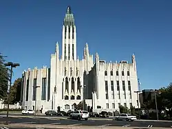 Boston Avenue Methodist Episcopal Church |
August 31, 1978 (#78002270) |
1301 South Boston Ave. 36°08′38″N 95°59′04″W |
Tulsa | |
| 8 | Boulder-on-the-Park | September 2, 2003 (#03000872) |
1850 S. Boulder Ave. 36°08′02″N 95°59′20″W |
Tulsa | ||
| 9 | Brady Heights Historic District | 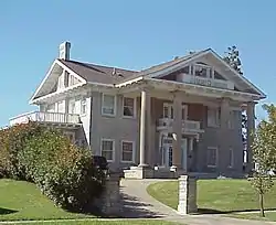 Brady Heights Historic District |
June 27, 1980 (#80003302) |
Roughly bounded by Marshall and Easton Sts. and Denver and Cheyenne Aves. 36°09′58″N 95°59′54″W |
Tulsa | |
| 10 | Brady Historic District | Brady Historic District |
September 3, 2010 (#10000618) |
Roughly along E/W Cameron and E/W Archer, from N. Boulder to N. Detroit 36°09′31″N 95°59′33″W |
Tulsa | |
| 11 | Broken Arrow Elementary-Junior High School | 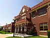 Broken Arrow Elementary-Junior High School |
March 7, 2003 (#03000095) |
210 N. Main 36°03′18″N 95°47′28″W |
Broken Arrow | |
| 12 | Buena Vista Park Historic District | 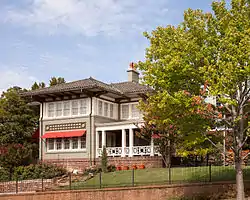 Buena Vista Park Historic District |
September 6, 2007 (#07000919) |
Roughly bounded by W. 18th St., S., rear lot lines of the eastern side of S. Cheyenne Ave., W., W. 21st St., S., and Riverside Dr./S. Carson 36°08′05″N 95°59′24″W |
Tulsa | |
| 13 | Cain’s Dancing Academy | 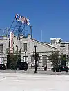 Cain’s Dancing Academy |
September 4, 2003 (#03000874) |
423 N. Main 36°09′38″N 95°59′35″W |
Tulsa | |
| 14 | Carlton Place Historic District | 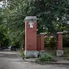 Carlton Place Historic District |
September 6, 2007 (#07000907) |
Bounded by W. 14th St., S., S. Carson Ave., W., W. 15th St., S., and S. Cathage Ave., W. 36°08′29″N 95°59′28″W |
Tulsa | |
| 15 | Casa Loma Hotel |  Casa Loma Hotel |
September 3, 2010 (#10000805) |
2626-2648 E. Eleventh St. 36°08′52″N 95°57′10″W |
Tulsa | Route 66 and Associated Resources in Oklahoma AD MPS |
| 16 | Cheairs Furniture Company Building | June 11, 2018 (#100002546) |
537 S Kenosha Ave. 36°09′12″N 95°58′56″W |
Tulsa | ||
| 17 | The Church Studio |  The Church Studio |
September 8, 2017 (#100001595) |
304 S. Trenton Ave. 36°09′24″N 95°58′10″W |
Tulsa | |
| 18 | Circle Theater | 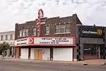 Circle Theater |
March 7, 2003 (#03000098) |
10 S. Lewis Ave. 36°09′33″N 95°57′29″W |
Tulsa | |
| 19 | Cities Service Station #8 | Cities Service Station #8 |
March 14, 2011 (#11000080) |
1648 Southwest Boulevard 36°08′17″N 96°00′26″W |
Tulsa | Route 66 and Associated Resources in Oklahoma AD MPS |
| 20 | City Veterinary Hospital | 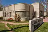 City Veterinary Hospital |
August 26, 2008 (#08000848) |
3550 S. Peoria Ave. 36°06′44″N 95°58′33″W |
Tulsa | |
| 21 | Clinton-Hardy House | 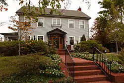 Clinton-Hardy House |
January 23, 1979 (#79002027) |
1322 S. Guthrie 36°08′34″N 95°59′45″W |
Tulsa | |
| 22 | Convention Hall | 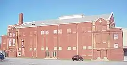 Convention Hall |
August 29, 1979 (#79002028) |
105 W. Brady St. 36°09′29″N 95°59′43″W |
Tulsa | |
| 23 | Cosden Building | 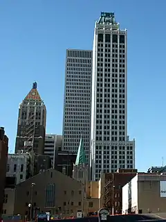 Cosden Building |
February 1, 1979 (#79002029) |
409 S. Boston 36°09′09″N 95°59′20″W |
Tulsa | |
| 24 | Creek Council Tree Site | 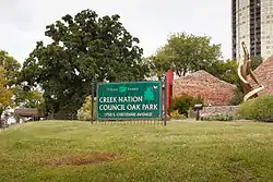 Creek Council Tree Site |
September 29, 1976 (#76001576) |
18th and Cheyenne Sts. 36°08′13″N 95°59′24″W |
Tulsa | |
| 25 | Dawson School | 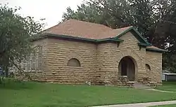 Dawson School |
December 7, 2001 (#01001357) |
Junction of East Ute Place and N. Kingston Pl. 36°11′02″N 95°54′32″W |
Tulsa | |
| 26 | Downtown Tulsa YMCA | September 7, 2016 (#16000625) |
515 S. Denver Ave. 36°08′58″N 95°59′36″W |
Tulsa | ||
| 27 | Carl K. Dresser House | June 2, 2000 (#00000625) |
235 W. 18th St. 36°08′11″N 95°59′29″W |
Tulsa | ||
| 28 | Eleventh Street Arkansas River Bridge | 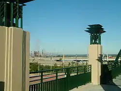 Eleventh Street Arkansas River Bridge |
December 13, 1996 (#96001488) |
Former U.S. Route 66 over the Arkansas River from Tulsa to West Tulsa 36°08′38″N 96°00′10″W |
Tulsa | |
| 29 | Elizabeth Manor | June 8, 2015 (#15000329) |
1820 S. Boulder Ave., W. 36°08′07″N 95°59′21″W |
Tulsa | ||
| 30 | Fire Station No. 13 | March 13, 2020 (#100005084) |
3924 Charles Page Blvd. 36°08′52″N 96°02′14″W |
Tulsa | ||
| 31 | First National Bank | March 4, 2015 (#15000066) |
123 E. W.C. Rogers Blvd. 36°22′07″N 96°00′01″W |
Skiatook | ||
| 32 | Fort Arbuckle Site | December 22, 1978 (#78002269) |
West of Sand Springs 36°09′15″N 96°13′29″W |
Sand Springs | ||
| 33 | Fox Hotel | December 10, 2014 (#14001033) |
201 East W.C. Rogers Blvd. 36°22′07″N 96°00′00″W |
Skiatook | ||
| 34 | Gillette Historic District | September 20, 1982 (#82003702) |
Bounded by S. Yorktown and S. Lewis Aves, E. 15th and E. 17th Sts. 36°08′21″N 95°57′35″W |
Tulsa | ||
| 35 | Gillette-Tyrrell Building | 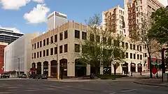 Gillette-Tyrrell Building |
January 21, 1982 (#82003703) |
423 S. Boulder Ave. 36°09′04″N 95°59′27″W |
Tulsa | |
| 36 | Harwelden | 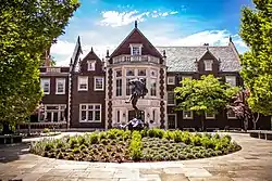 Harwelden |
February 8, 1978 (#78002271) |
2210 S. Main St. 36°07′54″N 95°59′15″W |
Tulsa | |
| 37 | Haskell State School of Agriculture | 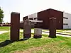 Haskell State School of Agriculture |
December 19, 1978 (#78002268) |
808 E. College St. 36°03′12″N 95°46′49″W |
Broken Arrow | |
| 38 | Holy Family Cathedral, Rectory, and School | 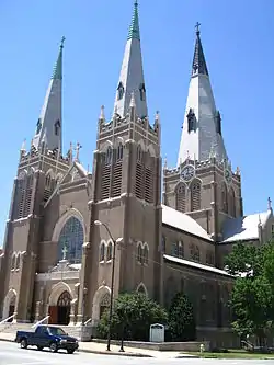 Holy Family Cathedral, Rectory, and School |
February 11, 1982 (#82003704) |
W. 8th St. and S. Boulder Ave. 36°08′51″N 95°59′23″W |
Tulsa | |
| 39 | Hooper Brothers Coffee Company Building | 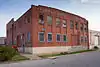 Hooper Brothers Coffee Company Building |
December 19, 1978 (#78002272) |
731-733 E. Admiral Boulevard 36°09′33″N 95°58′55″W |
Tulsa | |
| 40 | Robert Lawton Jones House | December 13, 2001 (#01001355) |
1916 E. 47th St. 36°05′40″N 95°57′47″W |
Tulsa | ||
| 41 | KATY Railroad Historic District | 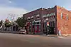 KATY Railroad Historic District |
December 13, 2010 (#10001012) |
Roughly along W. Easton and the old KATY Railroad Right-of-Way between N. Cheyenne and N. Boston Aves. 36°09′37″N 95°59′51″W |
Tulsa | |
| 42 | Maple Ridge Historic Residential District | Maple Ridge Historic Residential District |
April 6, 1983 (#83002138) |
Roughly bounded by Hazel Boulevard, S. Peoria Ave., 14th St., and Railroad 36°07′58″N 95°58′48″W |
Tulsa | |
| 43 | Mayo Building | 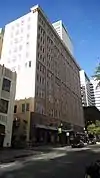 Mayo Building |
December 4, 2008 (#08001152) |
420 S. Main St. 36°09′08″N 95°59′26″W |
Tulsa | |
| 44 | Mayo Hotel | 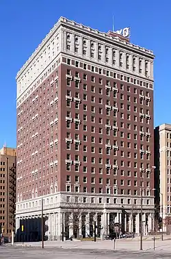 Mayo Hotel |
June 27, 1980 (#80003303) |
115 W. 5th St. 36°09′03″N 95°59′31″W |
Tulsa | |
| 45 | Mayo Motor Inn | 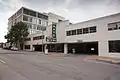 Mayo Motor Inn |
August 26, 2008 (#08000850) |
416 S. Cheyenne Ave. 36°09′05″N 95°59′34″W |
Tulsa | |
| 46 | James H. McBirney House | 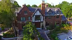 James H. McBirney House |
November 13, 1976 (#76001577) |
1414 S. Galveston 36°08′30″N 95°59′52″W |
Tulsa | |
| 47 | McFarlin Building | 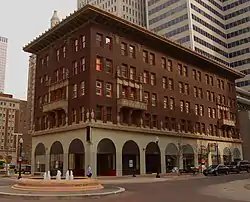 McFarlin Building |
December 6, 1979 (#79002030) |
11 E. 5th St. 36°09′06″N 95°59′22″W |
Tulsa | |
| 48 | Robert M. McFarlin House | 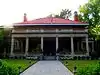 Robert M. McFarlin House |
January 25, 1979 (#79002031) |
1610 Carson 36°08′20″N 95°59′26″W |
Tulsa | |
| 49 | McGregor House | .jpg.webp) McGregor House |
June 9, 2014 (#14000299) |
1401 S. Quaker Ave. 36°08′32″N 95°58′27″W |
Tulsa | |
| 50 | B.W. McLean House and Office | 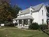 B.W. McLean House and Office |
March 22, 1991 (#91000309) |
123 E. A St. 36°01′25″N 95°58′05″W |
Jenks | |
| 51 | Mincks-Adams Hotel | 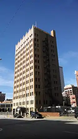 Mincks-Adams Hotel |
November 7, 1978 (#78002273) |
403 S. Cheyenne Ave. 36°09′05″N 95°59′34″W |
Tulsa | |
| 52 | Moore Manor |  Moore Manor |
February 19, 1982 (#82003705) |
228 W. 17th Pl. 36°08′12″N 95°59′26″W |
Tulsa | |
| 53 | Morrow Home Place | September 3, 2010 (#10000627) |
13200 E. 126th St. N. 36°20′12″N 95°49′36″W |
Collinsville | ||
| 54 | Mount Zion Baptist Church |  Mount Zion Baptist Church |
September 5, 2008 (#08000847) |
419 N. Elgin E. Ave. 36°09′45″N 95°59′25″W |
Tulsa | |
| 55 | North Cheyenne Avenue Historic District | 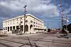 North Cheyenne Avenue Historic District |
December 13, 2010 (#10001011) |
Roughly along East/West Frisco Tracks and alley between W. Archer and W. Brady Sts., N. Denver and alley between N. Boulder 36°09′27″N 95°59′46″W |
Tulsa | |
| 56 | Oil Capital Historic District | 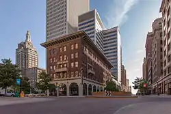 Oil Capital Historic District |
December 13, 2010 (#10001013) |
Roughly between 3rd and 7th Sts. and Cincinnati and Cheyenne Aves. 36°09′05″N 95°59′24″W |
Tulsa | |
| 57 | Oklahoma Iron Works-Bethlehem Supply Company Building | March 9, 2015 (#15000067) |
118 N. Lansing Ave. 36°09′45″N 95°58′56″W |
Tulsa | ||
| 58 | Oklahoma Natural Gas Company Building | 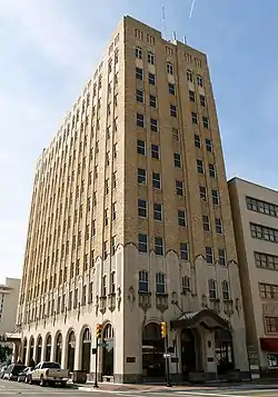 Oklahoma Natural Gas Company Building |
April 10, 1984 (#84003458) |
624 S. Boston Ave. 36°09′00″N 95°59′18″W |
Tulsa | |
| 59 | Owen Park Historic District | September 9, 1999 (#99001137) |
Roughly bounded by U.S. 412, Zenith Ave., Edison Ave., and Interstate 244 36°09′32″N 96°00′41″W |
Tulsa | ||
| 60 | Page Memorial Library | March 18, 1999 (#99000352) |
6 E. Broadway 36°08′23″N 96°06′35″W |
Sand Springs | ||
| 61 | Foster B. Parriott House | 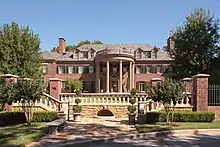 Foster B. Parriott House |
September 14, 2002 (#02000971) |
2216 E. 30th St. 36°07′13″N 95°57′35″W |
Tulsa | |
| 62 | Petroleum Building | 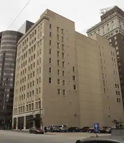 Petroleum Building |
April 15, 1982 (#82003706) |
420 S. Boulder St. 36°09′04″N 95°59′29″W |
Tulsa | |
| 63 | Philcade Building | 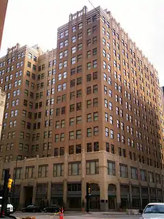 Philcade Building |
September 18, 1986 (#86002196) |
511 S. Boston Ave. 36°09′03″N 95°59′26″W |
Tulsa | |
| 64 | Phillips 66 Station No. 473 | 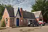 Phillips 66 Station No. 473 |
December 6, 2004 (#04001332) |
2224 E. Admiral Boulevard 36°09′34″N 95°57′34″W |
Tulsa | |
| 65 | Waite Phillips Mansion | 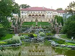 Waite Phillips Mansion |
December 1, 1978 (#78002274) |
2727 S. Rockford Rd. 36°07′22″N 95°58′10″W |
Tulsa | |
| 66 | Philtower | 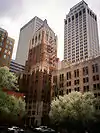 Philtower |
August 29, 1979 (#79002032) |
427 S. Boston Ave. 36°09′07″N 95°59′19″W |
Tulsa | |
| 67 | Pierce Block | 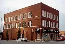 Pierce Block |
December 11, 1979 (#79002033) |
301 E. 3rd St. 36°09′18″N 95°59′13″W |
Tulsa | |
| 68 | Public Service of Oklahoma Building | 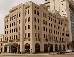 Public Service of Oklahoma Building |
April 10, 1984 (#84003443) |
600 S. Main St. 36°09′00″N 95°59′22″W |
Tulsa | |
| 69 | Ranch Acres Historic District | 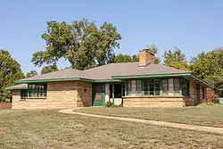 Ranch Acres Historic District |
December 12, 2007 (#07001268) |
Roughly bounded by E. 31 St., S. Harvard Ave, E. 41st St., and S. Delaware and S. Florence Aves. 36°06′41″N 95°56′32″W |
Tulsa | |
| 70 | Riverside Historic Residential District | March 31, 2005 (#04000937) |
Roughly bounded by the Midland Railway Bike Trail, Riverside Dr., S. Boston Ave., E. 24th St., and E. 21st St. 36°07′37″N 95°59′05″W |
Tulsa | ||
| 71 | Riverside Studio | 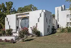 Riverside Studio |
June 14, 2001 (#01000656) |
1381 Riverside Dr. 36°06′44″N 95°59′47″W |
Tulsa | |
| 72 | Riverview Historic District | 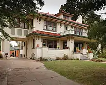 Riverview Historic District |
September 6, 2007 (#07000906) |
Roughly bounded by W. 12th and 13th Sts., S., east of S. Elwood Ave., W., W. 14th Place, S., S. Riverside Dr., and S. Jackson Ave. 36°08′30″N 95°59′43″W |
Tulsa | |
| 73 | St. John Vianney Training School for Girls | June 7, 1983 (#83002139) |
4001 E. 101st St. 36°01′04″N 95°56′13″W |
Tulsa | ||
| 74 | Sally Ann Apartments | September 8, 2015 (#15000581) |
1309, 1311, 1313, 1310, 1312, 1314 S. Jackson Ave. 36°08′37″N 96°00′02″W |
Tulsa | ||
| 75 | Sand Springs Power Plant | September 3, 1998 (#98001148) |
221 S. Main St. 36°08′02″N 96°06′32″W |
Sand Springs | ||
| 76 | Sinclair Service Station |  Sinclair Service Station |
December 13, 1996 (#96001486) |
3501 E. 11th St. 36°08′53″N 95°56′15″W |
Tulsa | |
| 77 | Sixth Street Commercial/Residential Historic District | September 3, 2009 (#09000687) |
Roughly along E. 6th St. from S. Peoria Ave. to the north/south alley between Quaker and Quincy Aves. 36°09′07″N 95°58′31″W |
Tulsa | ||
| 78 | William G. Skelly House | 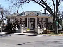 William G. Skelly House |
November 28, 1978 (#78002275) |
2101 S. Madison 36°07′59″N 95°58′48″W |
Tulsa | |
| 79 | Sophian Plaza | 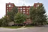 Sophian Plaza |
December 13, 2011 (#11000896) |
1500 S. Frisco Ave., W. 36°08′25″N 95°59′44″W |
Tulsa | |
| 80 | Southwestern Bell Main Dial Building | 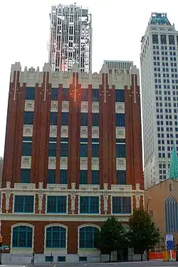 Southwestern Bell Main Dial Building |
June 22, 1984 (#84003445) |
424 Detroit Ave. 36°09′10″N 95°59′14″W |
Tulsa | |
| 81 | Stonebraker Heights Historic District | 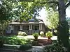 Stonebraker Heights Historic District |
September 6, 2007 (#07000917) |
Roughly bounded by W. 15th St., S., an alley east of South Cheyenne Ave., W., W. 17th St., S., and S. Elwood Ave., W. 36°08′21″N 95°59′28″W |
Tulsa | |
| 82 | Swan Lake Historic District | 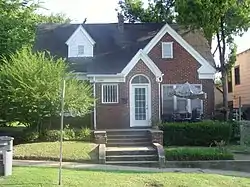 Swan Lake Historic District |
February 20, 1998 (#98000140) |
Roughly bounded by E. 15th St., S. Utica Ave., E. 21st St., and S. Peoria Ave. 36°08′17″N 95°58′11″W |
Tulsa | |
| 83 | Tracy Park Historic District |  Tracy Park Historic District |
September 20, 1982 (#82003707) |
Roughly bounded by Norfolk, Peoria, 11th, and 13th Sts. 36°08′45″N 95°58′37″W |
Tulsa | |
| 84 | Tribune Building | 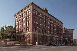 Tribune Building |
July 16, 1979 (#79003644) |
20 E. Archer St. 36°09′26″N 95°59′30″W |
Tulsa | |
| 85 | Tulsa Boys' Home Historic District | December 1, 2020 (#100005864) |
Bounded by East 8th St., South Quincy Ave., East 7th St., and South Rockford Ave. 36°09′05″N 95°58′21″W |
Tulsa | ||
| 86 | Tulsa Civic Center Historic District | 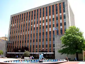 Tulsa Civic Center Historic District |
January 4, 2012 (#11000641) |
Between W. 3rd & 6th Sts. & S. Houston & Denver Aves. 36°08′42″N 95°59′46″W |
Tulsa | |
| 87 | Tulsa Fire Alarm Building | 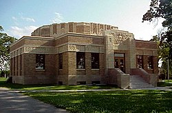 Tulsa Fire Alarm Building |
September 2, 2003 (#03000879) |
1010 E. 8th St. 36°09′00″N 95°58′43″W |
Tulsa | |
| 88 | Tulsa Monument Company | 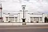 Tulsa Monument Company |
September 4, 2008 (#08000849) |
1735 E. 11th St., S. 36°08′53″N 95°57′57″W |
Tulsa | |
| 89 | Tulsa Municipal Building | 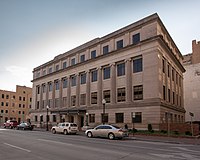 Tulsa Municipal Building |
July 18, 1975 (#75001574) |
124 E. 4th St. 36°09′10″N 95°59′18″W |
Tulsa | |
| 90 | United States Post Office and Courthouse | 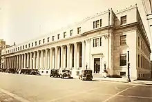 United States Post Office and Courthouse |
March 24, 2000 (#00000244) |
224 S. Boulder Ave. 36°09′12″N 95°59′33″W |
Tulsa | |
| 91 | James Alexander Veasey House | 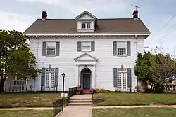 James Alexander Veasey House |
July 27, 1989 (#89001006) |
1802 S. Cheyenne Ave. 36°08′12″N 95°59′23″W |
Tulsa | |
| 92 | Vernon A.M.E. Church | August 17, 2018 (#100002547) |
311 N Greenwood Ave. 36°09′42″N 95°59′12″W |
Tulsa | ||
| 93 | Vickery Phillips 66 Station | 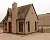 Vickery Phillips 66 Station |
March 3, 2004 (#04000135) |
602 S. Elgin 36°09′06″N 95°59′04″W |
Tulsa | |
| 94 | Westhope | 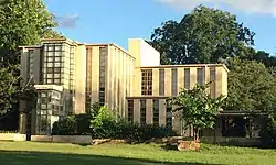 Westhope |
April 10, 1975 (#75001575) |
3704 S. Birmingham St. 36°06′35″N 95°57′14″W |
Tulsa | |
| 95 | White City Historic District | June 14, 2001 (#01000663) |
Roughly bounded by E. 2nd St., S. Fulton Ave., the former St. Louis – San Francisco railroad tracks, E. 11th St., and S. Yale Ave. 36°09′04″N 95°55′03″W |
Tulsa | ||
| 96 | Whittier Square Historic District |  Whittier Square Historic District |
June 15, 2012 (#12000348) |
Roughly between Lewis, & Zunis Aves., E. 1st St., & I-244 36°09′33″N 95°57′34″W |
Tulsa | part of the Route 66 and Associated Resources in Oklahoma AD Multiple Property Submission |
| 97 | Will Rogers High School | 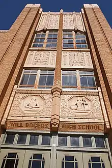 Will Rogers High School |
September 6, 2007 (#07000918) |
3909 E. 5th Place 36°09′13″N 95°55′58″W |
Tulsa | |
| 98 | Woodward Park and Gardens Historic District |  Woodward Park and Gardens Historic District |
March 11, 2014 (#14000054) |
2101 & 2435 S. Peoria Ave. 36°07′53″N 95°58′25″W |
Tulsa | |
| 99 | Yorktown Historic District |  Yorktown Historic District |
June 20, 2002 (#02000657) |
Roughly bounded by 16th and 17th Sts., Victor and Wheeling Aves., 20th St., and Lewis Ave. 36°08′12″N 95°57′44″W |
Tulsa |
See also
| Wikimedia Commons has media related to National Register of Historic Places in Tulsa County, Oklahoma. |
References
- The latitude and longitude information provided in this table was derived originally from the National Register Information System, which has been found to be fairly accurate for about 99% of listings. Some locations in this table may have been corrected to current GPS standards.
- "National Register of Historic Places: Weekly List Actions". National Park Service, United States Department of the Interior. Retrieved on January 29, 2021.
- Numbers represent an alphabetical ordering by significant words. Various colorings, defined here, differentiate National Historic Landmarks and historic districts from other NRHP buildings, structures, sites or objects.
- "National Register Information System". National Register of Historic Places. National Park Service. March 13, 2009.
- The eight-digit number below each date is the number assigned to each location in the National Register Information System database, which can be viewed by clicking the number.
- http://www.tulsapreservationcommission.org/nationalregister/buildings/index.pl?id=41
| Topics | |
|---|---|
| Lists by state |
|
| Lists by insular areas | |
| Lists by associated state | |
| Other areas | |
| Related | |
| |
This article is issued from Wikipedia. The text is licensed under Creative Commons - Attribution - Sharealike. Additional terms may apply for the media files.