National Register of Historic Places listings in Muskogee County, Oklahoma
This is a list of the National Register of Historic Places listings in Muskogee County, Oklahoma.
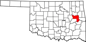
Location of Muskogee County in Oklahoma
This is intended to be a complete list of the properties and districts on the National Register of Historic Places in Muskogee County, Oklahoma, United States. The locations of National Register properties and districts for which the latitude and longitude coordinates are included below, may be seen in a map.[1]
There are 51 properties and districts listed on the National Register in the county, including 2 National Historic Landmarks.
- This National Park Service list is complete through NPS recent listings posted January 29, 2021.[2]
Current listings
| [3] | Name on the Register[4] | Image | Date listed[5] | Location | City or town | Description |
|---|---|---|---|---|---|---|
| 1 | Administration Building-Post Hospital | 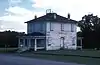 Administration Building-Post Hospital |
November 14, 1985 (#85002828) |
803 Garrison Ave. 35°48′24″N 95°15′11″W |
Fort Gibson | |
| 2 | Bacone College Historic District | 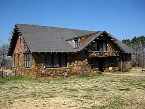 Bacone College Historic District |
December 10, 2014 (#14001027) |
Old Bacone Rd. 35°46′37″N 95°20′05″W |
Muskogee | |
| 3 | Central Baptist Church | 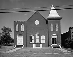 Central Baptist Church |
September 25, 1984 (#84003157) |
515 N. 4th St. 35°45′12″N 95°22′12″W |
Muskogee | Demolished in Summer 1985 for Arrowhead Mall |
| 4 | Cherokee National Cemetery | 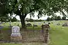 Cherokee National Cemetery |
March 19, 1979 (#79002002) |
1.5 miles (2.4 km) east of Fort Gibson 35°47′49″N 95°13′45″W |
Fort Gibson | |
| 5 | Commandant's Quarters | 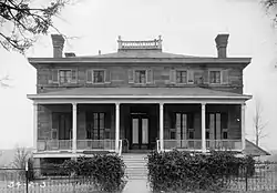 Commandant's Quarters |
November 14, 1985 (#85002830) |
905 Coppinger Ave. 35°48′32″N 95°15′08″W |
Fort Gibson | |
| 6 | V. R. Coss House | 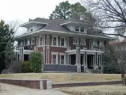 V. R. Coss House |
May 2, 1984 (#84003159) |
1315 W. Okmulgee St. 35°45′11″N 95°23′04″W |
Muskogee | |
| 7 | Dragoon Commandant's Quarters |  Dragoon Commandant's Quarters |
March 13, 1980 (#80003276) |
409 Creek St. 35°47′53″N 95°15′26″W |
Fort Gibson | |
| 8 | W.E.B. DuBois School | September 28, 1984 (#84003161) |
Off U.S. Route 69 35°40′05″N 95°25′24″W |
Summit | ||
| 9 | Escoe Building | July 14, 1983 (#83002094) |
228-230 N. 2nd St. 35°44′58″N 95°22′08″W |
Muskogee | ||
| 10 | First Baptist Church | 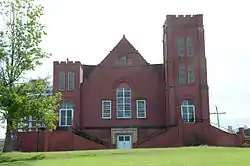 First Baptist Church |
September 25, 1984 (#84003164) |
6th and Denison Sts. 35°45′10″N 95°22′26″W |
Muskogee | |
| 11 | First Church of Christ, Scientist | %252C_Muskogee%252C_OK.jpg.webp) First Church of Christ, Scientist |
July 15, 2019 (#100004176) |
302 N. 7th St. 35°45′11″N 95°22′35″W |
Muskogee | |
| 12 | First Methodist Episcopal Church | 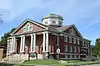 First Methodist Episcopal Church |
March 11, 2014 (#14000052) |
518 E. Houston St. 35°45′10″N 95°21′31″W |
Muskogee | |
| 13 | F.B. Fite House and Servant's Quarters | 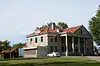 F.B. Fite House and Servant's Quarters |
October 6, 1983 (#83004198) |
443 N. 16th St. 35°45′29″N 95°23′09″W |
Muskogee | |
| 14 | Grant Foreman House | 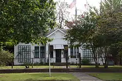 Grant Foreman House |
September 19, 1973 (#73001565) |
1419 W. Okmulgee St. 35°45′12″N 95°23′12″W |
Muskogee | |
| 15 | Fort Davis | November 23, 1971 (#71000670) |
2.5 miles northeast of Muskogee 35°47′00″N 95°19′35″W |
Muskogee | ||
| 16 | Fort Gibson | .jpg.webp) Fort Gibson |
October 15, 1966 (#66000631) |
Lee and Ash Sts. 35°48′24″N 95°15′33″W |
Fort Gibson | |
| 17 | Founders' Place Historic District |  Founders' Place Historic District |
March 13, 2020 (#100005081) |
Bounded by West Martin Luther King Jr. Blvd., east side of North 12th St., Court St. and east side of North 17th St. 35°45′30″N 95°22′58″W |
Muskogee | |
| 18 | Honey Springs Battlefield |  Honey Springs Battlefield |
September 29, 1970 (#70000848) |
North of Rentiesville 35°32′41″N 95°28′41″W |
Rentiesville | Extends into McIntosh County |
| 19 | Hotel Muskogee | Hotel Muskogee |
July 12, 2019 (#100004177) |
26 W. Broadway St. 35°44′55″N 95°22′06″W |
Muskogee | |
| 20 | Kendall Place Historic District |  Kendall Place Historic District |
December 16, 2005 (#05001418) |
Roughly bounded by W. Okmulgee St., S. 11th St., Elgin St., an alley north of Columbus St., and S. 14th and S. 16th Sts. 35°45′17″N 95°23′05″W |
Muskogee | |
| 21 | Manhattan Building |  Manhattan Building |
August 11, 1983 (#83002095) |
325 W. Broadway 35°44′57″N 95°22′18″W |
Muskogee | |
| 22 | Manual Training High School for Negroes | June 22, 1984 (#84003168) |
704 Altamont St. 35°45′24″N 95°22′08″W |
Muskogee | ||
| 23 | Masonic Temple |  Masonic Temple |
March 11, 2014 (#14000053) |
121 S. 6th St. 35°44′59″N 95°22′35″W |
Muskogee | |
| 24 | George A. Murphy House | 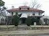 George A. Murphy House |
May 2, 1984 (#84003170) |
1321 W. Okmulgee St. 35°45′11″N 95°23′05″W |
Muskogee | |
| 25 | Muskogee County Courthouse | 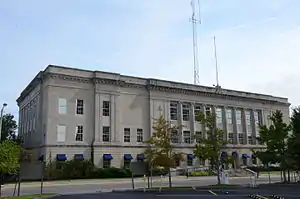 Muskogee County Courthouse |
August 23, 1984 (#84003173) |
216 State St. 35°45′01″N 95°22′59″W |
Muskogee | |
| 26 | Muskogee Depot and Freight District | 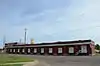 Muskogee Depot and Freight District |
December 6, 2006 (#06001114) |
Roughly bounded by Columbus Ave., S. Main St., Elgin Ave., and S. 5th St. 35°44′52″N 95°22′26″W |
Muskogee | |
| 27 | Muskogee Municipal Building | 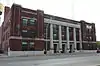 Muskogee Municipal Building |
December 18, 2013 (#13000942) |
229-231 W. Okmulgee Ave. 35°44′54″N 95°22′18″W |
Muskogee | |
| 28 | Nancy Taylor No. 1 Oil Well Site | November 15, 1989 (#89001962) |
Haskell Lake Rd., west of U.S. Route 64 35°50′33″N 95°43′54″W |
Haskell | ||
| 29 | Nash-Swindler House | 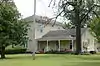 Nash-Swindler House |
July 13, 1979 (#79003640) |
Maple and Jackson Sts. 35°47′48″N 95°14′54″W |
Fort Gibson | |
| 30 | Officer's Quarters | 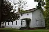 Officer's Quarters |
November 14, 1985 (#85002826) |
907 Coppinger Ave. 35°48′33″N 95°15′06″W |
Fort Gibson | |
| 31 | Oktaha School | August 24, 1978 (#78002242) |
Off U.S. Route 69 35°34′35″N 95°28′17″W |
Oktaha | ||
| 32 | A.W. Patterson House | 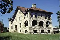 A.W. Patterson House |
May 2, 1984 (#84003322) |
1320 W. Okmulgee St. 35°45′12″N 95°23′04″W |
Muskogee | |
| 33 | Post Adjutant's Office | 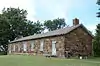 Post Adjutant's Office |
November 14, 1985 (#85002827) |
905 Garrison Ave. 35°48′31″N 95°15′15″W |
Fort Gibson | |
| 34 | Post Blacksmith Shop | 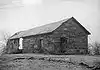 Post Blacksmith Shop |
November 14, 1985 (#85002829) |
905 Garrison Ave. 35°48′32″N 95°15′14″W |
Fort Gibson | |
| 35 | Pre-Statehood Commercial District | 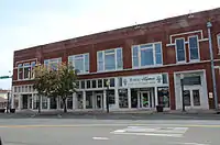 Pre-Statehood Commercial District |
October 6, 1983 (#83004210) |
Main, Broadway, Okmulgee, and 2nd Sts. 35°45′01″N 95°22′10″W |
Muskogee | |
| 36 | Railroad Exchange Building | 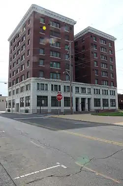 Railroad Exchange Building |
August 11, 1983 (#83002096) |
2nd and Court Sts. 35°44′59″N 95°22′10″W |
Muskogee | |
| 37 | Andrew W. Robb House | 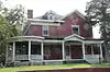 Andrew W. Robb House |
May 11, 1982 (#82003690) |
1321 Boston 35°44′43″N 95°23′07″W |
Muskogee | |
| 38 | St. Philip's Episcopal Church | 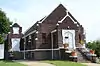 St. Philip's Episcopal Church |
December 18, 2013 (#13000943) |
502 N. 9th St. 35°45′20″N 95°22′37″W |
Muskogee | |
| 39 | St. Thomas Primitive Baptist Church |  St. Thomas Primitive Baptist Church |
March 3, 2004 (#04000123) |
5th St., north of its junction with Chimney Mountain Rd. 35°40′09″N 95°25′28″W |
Summit | |
| 40 | Seawell-Ross-Isom House | January 30, 1978 (#78002241) |
Beauregard and Elm Sts. 35°48′14″N 95°15′24″W |
Fort Gibson | ||
| 41 | Severs Hotel | 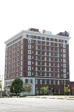 Severs Hotel |
September 12, 1982 (#82003691) |
200 N. State St. 35°44′55″N 95°22′13″W |
Muskogee | |
| 42 | Sheltered Shelter District | December 15, 1978 (#78002243) |
Address Restricted |
Warner | ||
| 43 | "Spirit of the American Doughboy" Statue | 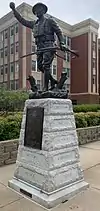 "Spirit of the American Doughboy" Statue |
January 25, 2018 (#100002057) |
Jack C. Montgomery VA Medical Center, 1011 Honor Heights Dr. 35°45′52″N 95°24′48″W |
Muskogee | |
| 44 | Surety Building | 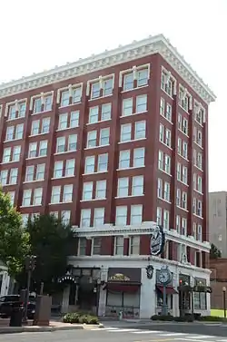 Surety Building |
September 4, 1986 (#86002156) |
117 N. 3rd 35°44′57″N 95°22′17″W |
Muskogee | |
| 45 | Taft City Hall | 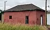 Taft City Hall |
September 28, 1984 (#84003330) |
Elm and Seminole Sts. 35°45′40″N 95°32′42″W |
Taft | |
| 46 | Reverend L.W. Thomas Homestead | June 7, 2018 (#100002544) |
5805 Oktaha Rd. 35°40′24″N 95°25′04″W |
Summit | ||
| 47 | A. C. Trumbo House |  A. C. Trumbo House |
May 2, 1984 (#84003334) |
1321 W. Broadway St. 35°45′13″N 95°23′01″W |
Muskogee | |
| 48 | Union Agency | 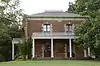 Union Agency |
October 6, 1970 (#70000535) |
Agency Hill in Honor Heights Park 35°46′00″N 95°25′00″W |
Muskogee | |
| 49 | United States Post Office and Courthouse | 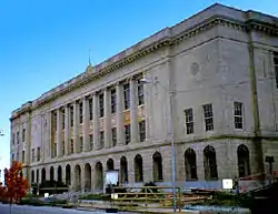 United States Post Office and Courthouse |
March 24, 2000 (#00000246) |
101 N. 5th St. 35°44′58″N 95°22′31″W |
Muskogee | |
| 50 | Ward Chapel AME Church | 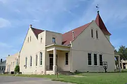 Ward Chapel AME Church |
September 25, 1984 (#84003338) |
319 N. 9th St. 35°45′16″N 95°22′41″W |
Muskogee | |
| 51 | J.C. Welch House |  J.C. Welch House |
May 2, 1984 (#84003343) |
1403 W. Okmulgee St. 35°45′13″N 95°23′10″W |
Muskogee |
See also
| Wikimedia Commons has media related to National Register of Historic Places in Muskogee County, Oklahoma. |
References
- The latitude and longitude information provided in this table was derived originally from the National Register Information System, which has been found to be fairly accurate for about 99% of listings. Some locations in this table may have been corrected to current GPS standards.
- "National Register of Historic Places: Weekly List Actions". National Park Service, United States Department of the Interior. Retrieved on January 29, 2021.
- Numbers represent an alphabetical ordering by significant words. Various colorings, defined here, differentiate National Historic Landmarks and historic districts from other NRHP buildings, structures, sites or objects.
- "National Register Information System". National Register of Historic Places. National Park Service. March 13, 2009.
- The eight-digit number below each date is the number assigned to each location in the National Register Information System database, which can be viewed by clicking the number.
| Fort Gibson |
| |
|---|---|---|
| Haskell |
| |
| Muskogee |
| |
| Oktaha |
| |
| Rentiesville | ||
| Summit |
| |
| Taft |
| |
| Warner |
| |
| Topics | |
|---|---|
| Lists by state |
|
| Lists by insular areas | |
| Lists by associated state | |
| Other areas | |
| Related | |
| |
Municipalities and communities of Muskogee County, Oklahoma, United States | ||
|---|---|---|
| City | Muskogee County map | |
| Towns | ||
| CDPs | ||
| Unincorporated communities |
| |
| Indian reservations | ||
| Footnotes | ‡This populated place also has portions in an adjacent county or counties | |
| ||
This article is issued from Wikipedia. The text is licensed under Creative Commons - Attribution - Sharealike. Additional terms may apply for the media files.