National Register of Historic Places listings in Beckham County, Oklahoma
This is a list of the National Register of Historic Places listings in Beckham County, Oklahoma.
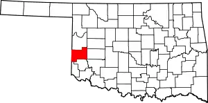
Location of Beckham County in Oklahoma
This is intended to be a complete list of the properties and districts on the National Register of Historic Places in Beckham County, Oklahoma, United States. The locations of National Register properties and districts for which the latitude and longitude coordinates are included below, may be seen in a map.[1]
There are 15 properties and districts listed on the National Register in the county.
- This National Park Service list is complete through NPS recent listings posted January 29, 2021.[2]
Current listings
| [3] | Name on the Register[4] | Image | Date listed[5] | Location | City or town | Description |
|---|---|---|---|---|---|---|
| 1 | Beckham County Courthouse | 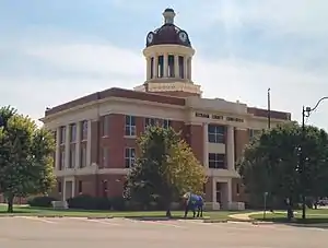 Beckham County Courthouse |
August 23, 1984 (#84002968) |
Courthouse Sq. 35°17′29″N 99°38′12″W |
Sayre | |
| 2 | Casa Grande Hotel | 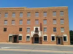 Casa Grande Hotel |
February 23, 1995 (#95000043) |
103 E. 3rd St. 35°24′43″N 99°24′15″W |
Elk City | |
| 3 | J. W. Danner House | 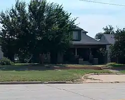 J. W. Danner House |
March 13, 2002 (#02000169) |
408 N. 4th St. 35°17′42″N 99°38′22″W |
Sayre | |
| 4 | Edwards Archeological Site | September 19, 1973 (#73001554) |
Address Restricted |
Carter | ||
| 5 | First National Bank |  First National Bank |
December 11, 1979 (#79001987) |
101 S. Main St. 35°12′53″N 99°52′01″W |
Erick | |
| 6 | Hedlund Motor Company Building | 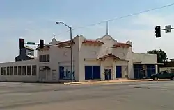 Hedlund Motor Company Building |
September 22, 1983 (#83002072) |
206 S. Main 35°24′35″N 99°24′15″W |
Elk City | |
| 7 | Magnolia Service Station | 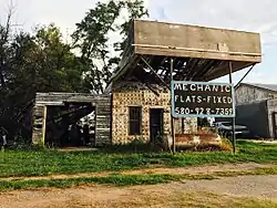 Magnolia Service Station |
February 23, 1995 (#95000028) |
Southwestern corner of the junction of Elm St. and former U.S. Route 66 35°13′08″N 99°59′29″W |
Texola | |
| 8 | Sayre Champlin Service Station | 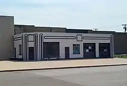 Sayre Champlin Service Station |
March 3, 2004 (#04000130) |
126 West Main 35°17′27″N 99°38′27″W |
Sayre | |
| 9 | Sayre City Park | 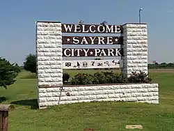 Sayre City Park |
March 3, 2004 (#04000127) |
200 yards south of the junction of E1200 Rd. and N1870 Rd. 35°16′28″N 99°38′43″W |
Sayre | |
| 10 | Sayre Downtown Historic District | 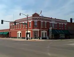 Sayre Downtown Historic District |
December 9, 2002 (#02000972) |
Main and 4th Sts. 35°17′29″N 99°38′22″W |
Sayre | |
| 11 | Sayre Rock Island Depot | 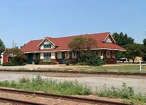 Sayre Rock Island Depot |
June 9, 2000 (#00000654) |
106 E. Poplar 35°17′35″N 99°38′19″W |
Sayre | |
| 12 | Storm House | 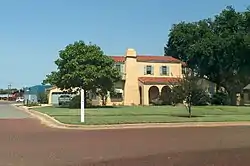 Storm House |
October 6, 1983 (#83004162) |
721 W. Broadway 35°24′40″N 99°24′45″W |
Elk City | |
| 13 | Vannerson Homestead | December 8, 2015 (#15000865) |
Address Restricted |
Erick vicinity | ||
| 14 | West Winds Motel | 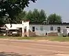 West Winds Motel |
May 27, 2004 (#04000520) |
623 Roger Miller 35°12′55″N 99°52′23″W |
Erick | |
| 15 | Whited Grist Mill | 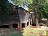 Whited Grist Mill |
January 1, 1976 (#76001554) |
Old Town Museum, W. 3rd St. and N. Pioneer Rd. 35°24′45″N 99°26′05″W |
Elk City |
See also
| Wikimedia Commons has media related to National Register of Historic Places in Beckham County, Oklahoma. |
References
- The latitude and longitude information provided in this table was derived originally from the National Register Information System, which has been found to be fairly accurate for about 99% of listings. Some locations in this table may have been corrected to current GPS standards.
- "National Register of Historic Places: Weekly List Actions". National Park Service, United States Department of the Interior. Retrieved on January 29, 2021.
- Numbers represent an alphabetical ordering by significant words. Various colorings, defined here, differentiate National Historic Landmarks and historic districts from other NRHP buildings, structures, sites or objects.
- "National Register Information System". National Register of Historic Places. National Park Service. March 13, 2009.
- The eight-digit number below each date is the number assigned to each location in the National Register Information System database, which can be viewed by clicking the number.
| Topics | |
|---|---|
| Lists by state |
|
| Lists by insular areas | |
| Lists by associated state | |
| Other areas | |
| Related | |
| |
| Carter | ||
|---|---|---|
| Elk City | ||
| Erick |
| |
| Sayre | ||
| Texola | ||
This article is issued from Wikipedia. The text is licensed under Creative Commons - Attribution - Sharealike. Additional terms may apply for the media files.