National Register of Historic Places listings in Cherokee County, Oklahoma
This is a list of the National Register of Historic Places listings in Cherokee County, Oklahoma.
Location of Cherokee County in Oklahoma
This is intended to be a complete list of the properties and districts on the National Register of Historic Places in Cherokee County, Oklahoma, United States. The locations of National Register properties and districts for which the latitude and longitude coordinates are included below, may be seen in a map.[1]
There are 21 properties and districts listed on the National Register in the county, including 2 National Historic Landmarks.
- This National Park Service list is complete through NPS recent listings posted January 29, 2021.[2]
Current listings
| [3] | Name on the Register[4] | Image | Date listed[5] | Location | City or town | Description |
|---|---|---|---|---|---|---|
| 1 | Alston-Bedwell House | 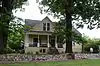 Alston-Bedwell House |
September 8, 2005 (#05001002) |
315 N. State 35°55′00″N 94°58′28″W |
Tahlequah | |
| 2 | American Baptist Home Mission House | September 3, 2010 (#10000621) |
530 Summit St. 35°55′10″N 94°58′26″W |
Tahlequah | ||
| 3 | American Legion Hut | 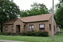 American Legion Hut |
August 24, 2006 (#06000798) |
Tehlequah City Park, junction of E. Shawnee St. and N. Brookside Ave. 35°54′47″N 94°58′03″W |
Tahlequah | |
| 4 | Cherokee Female Seminary | 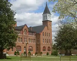 Cherokee Female Seminary |
April 5, 1973 (#73001558) |
Northeastern State University campus 35°55′13″N 94°58′12″W |
Tahlequah | |
| 5 | Cherokee National Capitol | 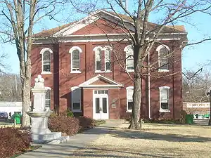 Cherokee National Capitol |
October 15, 1966 (#66000627) |
Eastern side of Muskogee Ave. between Keetoowah and Delaware Sts.[6] 35°54′45″N 94°58′14″W |
Tahlequah | |
| 6 | Cherokee National Jail | 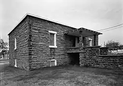 Cherokee National Jail |
June 28, 1974 (#74001656) |
Choctaw St. and Water Ave. 35°54′43″N 94°58′02″W |
Tahlequah | |
| 7 | Cherokee Supreme Court Building | 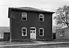 Cherokee Supreme Court Building |
June 28, 1974 (#74001657) |
Keetoowah St. and Water Ave. 35°54′47″N 94°58′00″W |
Tahlequah | |
| 8 | First Cherokee Female Seminary Site | First Cherokee Female Seminary Site |
April 30, 1974 (#74001658) |
21191 S. Keeler Dr. 35°51′59″N 94°57′11″W |
Park Hill | |
| 9 | M.E. Franklin House | 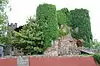 M.E. Franklin House |
September 5, 2006 (#06000791) |
415 N. College Ave. 35°55′03″N 94°58′13″W |
Tahlequah | |
| 10 | French-Parks House |  French-Parks House |
March 18, 1985 (#85000618) |
209 W. Keetoowah St. 35°54′45″N 94°58′23″W |
Tahlequah | |
| 11 | Illinois Campground | 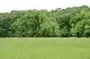 Illinois Campground |
December 6, 2004 (#04001330) |
County Road DO775 35°53′42″N 94°57′38″W |
Tahlequah | |
| 12 | Indian University of Tahlequah | 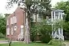 Indian University of Tahlequah |
July 6, 1976 (#76001557) |
320 Academy 35°55′05″N 94°58′20″W |
Tahlequah | |
| 13 | Dr. Irwin D. Loeser Log Cabin | 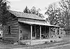 Dr. Irwin D. Loeser Log Cabin |
November 17, 1978 (#78002221) |
121 E. Smith St. 35°55′05″N 94°58′02″W |
Tahlequah | |
| 14 | Leonard M. Logan House | October 12, 2005 (#05001165) |
531 Summit 35°55′08″N 94°58′26″W |
Tahlequah | ||
| 15 | Murrell Home | .jpg.webp) Murrell Home |
June 22, 1970 (#70000530) |
19479 East Murrel Road 35°50′57″N 94°57′51″W |
Park Hill | |
| 16 | Park Hill Mission Cemetery | 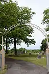 Park Hill Mission Cemetery |
December 6, 2006 (#06001113) |
South Park Hill Rd., 0.5 miles south of East Murrell Rd. 35°50′58″N 94°57′57″W |
Park Hill | |
| 17 | Rosamund | 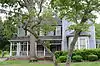 Rosamund |
September 6, 2006 (#06000793) |
527 Seminary Ave. 35°55′05″N 94°58′14″W |
Tahlequah | |
| 18 | Ross Cemetery | 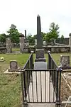 Ross Cemetery |
March 7, 2002 (#02000170) |
0.5 miles south of the junction of Murrell Rd. and N4530 Rd. 35°51′03″N 94°56′53″W |
Park Hill | |
| 19 | Tahlequah Armory |  Tahlequah Armory |
May 20, 1994 (#94000488) |
100 Water Ave. 35°54′47″N 94°58′08″W |
Tahlequah | |
| 20 | Tahlequah Carnegie Library | 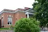 Tahlequah Carnegie Library |
June 5, 2003 (#03000516) |
120 S. College 35°54′48″N 94°58′22″W |
Tahlequah | |
| 21 | Joseph M. Thompson House | 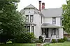 Joseph M. Thompson House |
March 11, 1993 (#93000155) |
300 S. College Ave. 35°54′48″N 94°58′33″W |
Tahlequah |
See also
| Wikimedia Commons has media related to National Register of Historic Places in Cherokee County, Oklahoma. |
References
- The latitude and longitude information provided in this table was derived originally from the National Register Information System, which has been found to be fairly accurate for about 99% of listings. Some locations in this table may have been corrected to current GPS standards.
- "National Register of Historic Places: Weekly List Actions". National Park Service, United States Department of the Interior. Retrieved on January 29, 2021.
- Numbers represent an alphabetical ordering by significant words. Various colorings, defined here, differentiate National Historic Landmarks and historic districts from other NRHP buildings, structures, sites or objects.
- "National Register Information System". National Register of Historic Places. National Park Service. March 13, 2009.
- The eight-digit number below each date is the number assigned to each location in the National Register Information System database, which can be viewed by clicking the number.
- Address derived from the coordinates provided by the NRIS; the NRIS lists the building as "Address Restricted"
| Topics | |
|---|---|
| Lists by state |
|
| Lists by insular areas | |
| Lists by associated state | |
| Other areas | |
| Related | |
| |
| Park Hill |
| |
|---|---|---|
| Tahlequah |
| |
This article is issued from Wikipedia. The text is licensed under Creative Commons - Attribution - Sharealike. Additional terms may apply for the media files.