National Register of Historic Places listings in Roger Mills County, Oklahoma
This is a list of the National Register of Historic Places listings in Roger Mills County, Oklahoma.
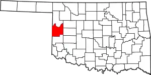
Location of Roger Mills County in Oklahoma
This is intended to be a complete list of the properties and districts on the National Register of Historic Places in Roger Mills County, Oklahoma, United States. The locations of National Register properties and districts for which the latitude and longitude coordinates are included below, may be seen in a map.[1]
There are 7 properties and districts listed on the National Register in the county, including 1 National Historic Landmark.
- This National Park Service list is complete through NPS recent listings posted January 29, 2021.[2]
Current listings
| [3] | Name on the Register[4] | Image | Date listed[5] | Location | City or town | Description |
|---|---|---|---|---|---|---|
| 1 | Allee Site | November 8, 1978 (#78002260) |
Address Restricted |
Hammon | ||
| 2 | Antelope Hills | 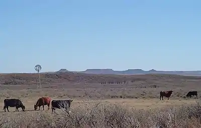 Antelope Hills |
December 14, 1978 (#78002259) |
North of Durham 35°54′14″N 99°53′00″W |
Durham | |
| 3 | Break O'Day Farm | June 16, 2005 (#05000616) |
0.5 miles southeast of the junction of E0680 Rd. and N1750 Rd. 35°45′38″N 99°53′05″W |
Durham | ||
| 4 | Dorroh-Trent House | October 3, 1979 (#79002026) |
11th and Conley Sts. 35°38′07″N 99°22′37″W |
Hammon | ||
| 5 | Goodwin-Baker Archeological Site | July 7, 1978 (#78002258) |
Southern side of Sandstone Creek, northeast of Berlin[6] 35°28′44″N 99°36′18″W |
Berlin | ||
| 6 | Lamb-Miller Site | October 2, 1978 (#78002261) |
Address Restricted |
Hammon | ||
| 7 | Washita Battlefield National Historic Site | 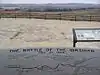 Washita Battlefield National Historic Site |
October 15, 1966 (#66000633) |
Northwest of Cheyenne on U.S. Route 283 35°38′39″N 99°42′00″W |
Cheyenne |
See also
| Wikimedia Commons has media related to National Register of Historic Places in Roger Mills County, Oklahoma. |
References
- The latitude and longitude information provided in this table was derived originally from the National Register Information System, which has been found to be fairly accurate for about 99% of listings. Some locations in this table may have been corrected to current GPS standards.
- "National Register of Historic Places: Weekly List Actions". National Park Service, United States Department of the Interior. Retrieved on January 29, 2021.
- Numbers represent an alphabetical ordering by significant words. Various colorings, defined here, differentiate National Historic Landmarks and historic districts from other NRHP buildings, structures, sites or objects.
- "National Register Information System". National Register of Historic Places. National Park Service. March 13, 2009.
- The eight-digit number below each date is the number assigned to each location in the National Register Information System database, which can be viewed by clicking the number.
- Thurmond, J. Peter. "Memoir 25: Late Paleoindian Utilization of the Dempsey Divide on the Southern Plains". Plains Anthropologist 35.131 Whole Number (1990): 3.
| Topics | |
|---|---|
| Lists by state |
|
| Lists by insular areas | |
| Lists by associated state | |
| Other areas | |
| Related | |
| |
Municipalities and communities of Roger Mills County, Oklahoma, United States | ||
|---|---|---|
| Towns | Roger Mills County map | |
| Unincorporated communities | ||
| Footnotes | ‡This populated place also has portions in an adjacent county or counties | |
| ||
This article is issued from Wikipedia. The text is licensed under Creative Commons - Attribution - Sharealike. Additional terms may apply for the media files.