National Register of Historic Places listings in Bradley County, Arkansas
This is a list of the National Register of Historic Places listings in Bradley County, Arkansas.
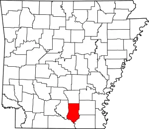
Location of Bradley County in Arkansas
This is intended to be a complete list of the properties on the National Register of Historic Places in Bradley County, Arkansas, United States. The locations of National Register properties for which the latitude and longitude coordinates are included below, may be seen in a map.[1]
There are 17 properties listed on the National Register in the county.
- This National Park Service list is complete through NPS recent listings posted February 5, 2021.[2]
Current listings
| [3] | Name on the Register[4] | Image | Date listed[5] | Location | City or town | Description |
|---|---|---|---|---|---|---|
| 1 | Adams-Leslie House | 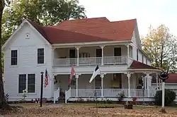 Adams-Leslie House |
August 9, 1979 (#79000433) |
South of Warren 33°31′14″N 92°05′41″W |
Warren | 1903 folk-Victorian house |
| 2 | Bailey House | 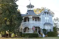 Bailey House |
August 28, 1975 (#75000375) |
302 Chestnut St. 33°36′57″N 92°03′43″W |
Warren | 1900 home of drugstore owner and CSA veteran |
| 3 | Blankinship Motor Company Building | 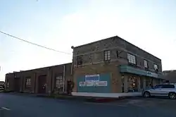 Blankinship Motor Company Building |
November 2, 2001 (#01001190) |
120 E. Cypress St. 33°36′51″N 92°03′52″W |
Warren | 1940 Art Moderne automobile dealership designed by H. Ray Burks |
| 4 | Bradley County Courthouse and Clerk's Office | 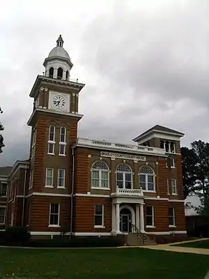 Bradley County Courthouse and Clerk's Office |
December 12, 1976 (#76000389) |
Courthouse Sq. 33°36′53″N 92°03′48″W |
Warren | 1903 courthouse with neoclassical details |
| 5 | Davis-Adams House |  Davis-Adams House |
February 18, 1999 (#99000224) |
509 N. Myrtle St. 33°37′08″N 92°03′49″W |
Warren | 1860 I-frame house with folk-Victorian details added later |
| 6 | Ederington House | 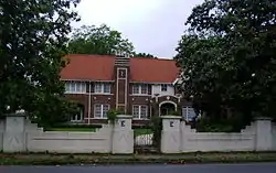 Ederington House |
June 21, 1984 (#84000660) |
326 S. Main St. 33°36′37″N 92°03′52″W |
Warren | 1926 craftsman style house designed by H. Ray Burks |
| 7 | Hermitage City Hall and Jail | 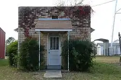 Hermitage City Hall and Jail |
September 19, 2007 (#07000956) |
112 S. Oak St. 33°27′03″N 92°10′24″W |
Hermitage | 1945 brick city hall and jail |
| 8 | Dr. John Wilson Martin House | 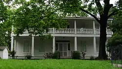 Dr. John Wilson Martin House |
December 27, 1990 (#90001948) |
200 Ash St. 33°37′00″N 92°04′04″W |
Warren | 1860-1868 vernacular Greek revival house |
| 9 | MORO BAY FERRY (towboat and barge) | September 19, 2018 (#100002944) |
670 Highway 600 (Moro Bay State Park) 33°18′04″N 92°21′00″W |
Moro Bay | ||
| 10 | Mt. Olive Rosenwald School | 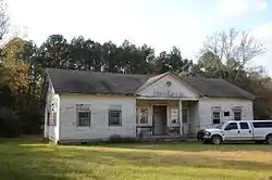 Mt. Olive Rosenwald School |
January 21, 2004 (#03001454) |
Bradley Rd. 45 33°25′41″N 92°03′33″W |
Mount Olive | 1927 Colonial revival house built with funds from the Julius Rosenwald Fund |
| 11 | New Zion AME Zion Church | 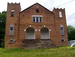 New Zion AME Zion Church |
June 9, 2000 (#00000628) |
Junction of Myrtle and Neely Sts. 33°37′33″N 92°04′05″W |
Warren | 1927 church with a historically black congregation |
| 12 | St. Luke's Catholic Church | 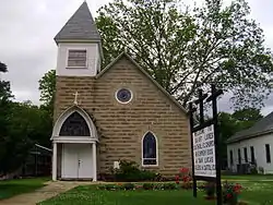 St. Luke's Catholic Church |
May 29, 1998 (#98000581) |
508 W. Pine 33°37′04″N 92°04′54″W |
Warren | 1907 Gothic revival style church |
| 13 | Warren and Ouachita Valley Railway Station | 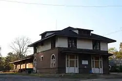 Warren and Ouachita Valley Railway Station |
August 3, 1977 (#77000244) |
325 W. Cedar St. 33°36′54″N 92°04′05″W |
Warren | 1909 wooden frame structure rebuilt following a fire in 1911 |
| 14 | Warren Brick Streets |  Warren Brick Streets |
January 24, 2007 (#06001277) |
Portions of Cedar, Myrtle, Chestnut, 1st, Walnut, Elm, and Cypress Sts. 33°36′52″N 92°03′45″W |
Warren | 1927 brick-surfaced streets |
| 15 | Warren Commercial Historic District |  Warren Commercial Historic District |
July 11, 2016 (#16000433) |
Roughly bounded by Alabama, Elm, Chestnut, 2nd, Church, Main & Howard Sts. 33°36′46″N 92°03′52″W |
Warren | |
| 16 | Warren Post Office | 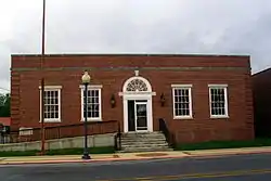 Warren Post Office |
January 21, 2004 (#03001460) |
236 S. Main St. (U.S. Route 63 Business) 33°36′45″N 92°03′53″W |
Warren | 1935 Colonial revival post office |
| 17 | Wilson-Martin House | 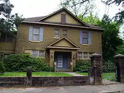 Wilson-Martin House |
September 20, 2006 (#06000827) |
511 Bond St. 33°37′13″N 92°03′57″W |
Warren | 1916 house with Georgian details |
See also
| Wikimedia Commons has media related to National Register of Historic Places in Bradley County, Arkansas. |
References
- The latitude and longitude information provided in this table was derived originally from the National Register Information System, which has been found to be fairly accurate for about 99% of listings. Some locations in this table may have been corrected to current GPS standards.
- "National Register of Historic Places: Weekly List Actions". National Park Service, United States Department of the Interior. Retrieved on February 5, 2021.
- Numbers represent an alphabetical ordering by significant words. Various colorings, defined here, differentiate National Historic Landmarks and historic districts from other NRHP buildings, structures, sites or objects.
- "National Register Information System". National Register of Historic Places. National Park Service. March 13, 2009.
- The eight-digit number below each date is the number assigned to each location in the National Register Information System database, which can be viewed by clicking the number.
This article is issued from Wikipedia. The text is licensed under Creative Commons - Attribution - Sharealike. Additional terms may apply for the media files.