National Register of Historic Places listings in Washington County, Arkansas
This is a list of the National Register of Historic Places listings in Washington County, Arkansas.
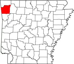
Location of Washington County in Arkansas
This is intended to be a complete list of the properties and districts on the National Register of Historic Places in Washington County, Arkansas, United States.
There are 146 properties and districts listed on the National Register in the county. Another 7 properties were once listed but have been removed.
- This National Park Service list is complete through NPS recent listings posted February 5, 2021.[1]
Current listings
| [2] | Name on the Register[3] | Image | Date listed[4] | Location | City or town | Description |
|---|---|---|---|---|---|---|
| 1 | Agriculture Building-University of Arkansas, Fayetteville | 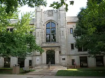 Agriculture Building-University of Arkansas, Fayetteville |
September 4, 1992 (#92001098) |
Campus Dr. 36°04′09″N 94°10′22″W |
Fayetteville | |
| 2 | Bean Cemetery | 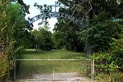 Bean Cemetery |
March 7, 1994 (#94000152) |
Northern side of U.S. Highway 62, about 2.2 miles (3.5 km) west of its junction with Highway 45 35°56′56″N 94°25′01″W |
Lincoln | |
| 3 | Beely-Johnson American Legion Post 139 | 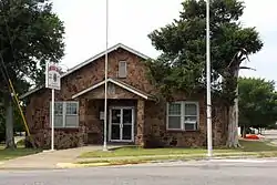 Beely-Johnson American Legion Post 139 |
May 30, 2007 (#07000474) |
200 N. Spring St. 36°11′11″N 94°07′47″W |
Springdale | |
| 4 | Bethlehem Cemetery | 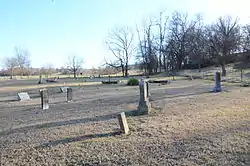 Bethlehem Cemetery |
November 15, 2000 (#00001365) |
Approximately 4 miles (6.4 km) southwest of Cane Hill on Highway 45, near its junction with County Road 442 35°52′21″N 94°27′31″W |
Canehill | |
| 5 | Black Oak Cemetery | 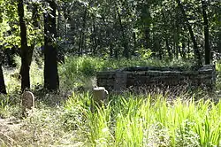 Black Oak Cemetery |
June 3, 1998 (#98000619) |
Off AR 265, 4 miles (6.4 km) southwest of Greenland[5] 35°58′48″N 94°13′44″W |
Greenland | A part of the ghost town of Black Oak[6] |
| 6 | Blackburn House | 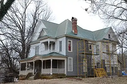 Blackburn House |
November 17, 1982 (#82000940) |
Main at College Sts. 35°54′37″N 94°23′46″W |
Canehill | |
| 7 | Borden House | 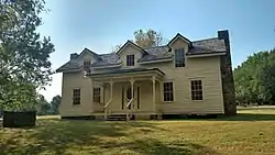 Borden House |
March 17, 1977 (#77000278) |
Northeast of Prairie Grove on U.S. Highway 62 35°58′33″N 94°18′10″W |
Prairie Grove | |
| 8 | Brown Bluff (3WA10) | June 24, 1987 (#86002946) |
Address Restricted |
Woolsey | ||
| 9 | Business Administration Building-University of Arkansas, Fayetteville | 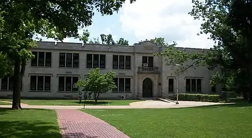 Business Administration Building-University of Arkansas, Fayetteville |
September 4, 1992 (#92001099) |
Campus Dr. 36°04′03″N 94°10′15″W |
Fayetteville | |
| 10 | Butterfield Overland Mail Route Fayetteville Segments Historic District | 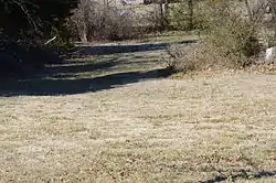 Butterfield Overland Mail Route Fayetteville Segments Historic District |
June 18, 2009 (#09000456) |
West of Highway 265 in Lake Fayetteville Park 36°08′22″N 94°07′37″W |
Fayetteville | Segment of the Butterfield Overland Mail route |
| 11 | Butterfield Overland Mail Route Segment | 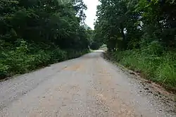 Butterfield Overland Mail Route Segment |
June 9, 2010 (#10000347) |
Bugscuffle Rd. south of Strickler and Old Cove City Rd. north of Chester 35°47′22″N 94°20′21″W |
Strickler | Segment of the Butterfield Overland Mail route; extends into Crawford County |
| 12 | Cane Hill Battlefield | 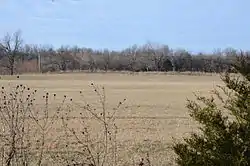 Cane Hill Battlefield |
March 7, 1994 (#94000132) |
Area surrounding Highway 45 and County Roads 291, 8, 284, and 285 35°51′16″N 94°22′25″W |
Canehill | |
| 13 | Cane Hill Road Bridge | 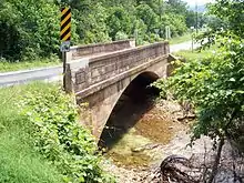 Cane Hill Road Bridge |
January 21, 2010 (#09001261) |
Highway 170 over the Little Red River 36°00′01″N 94°16′30″W |
Prairie Grove | Replaced in 2014 |
| 14 | Canehill Cemetery | 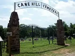 Canehill Cemetery |
November 17, 1982 (#82000941) |
Highway 13 35°54′50″N 94°23′55″W |
Canehill | |
| 15 | Cane Hill College Building | 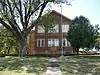 Cane Hill College Building |
November 17, 1982 (#82000942) |
McClellan and College St. 35°54′39″N 94°23′51″W |
Canehill | |
| 16 | Ella Carnall Hall | 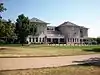 Ella Carnall Hall |
December 22, 1982 (#82000943) |
Arkansas Ave. and Maple St. 36°04′10″N 94°10′08″W |
Fayetteville | |
| 17 | A.R. Carroll Building | 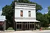 A.R. Carroll Building |
November 17, 1982 (#82000944) |
Main St. 35°54′32″N 94°23′48″W |
Canehill | |
| 18 | Chemistry Building-University of Arkansas, Fayetteville | 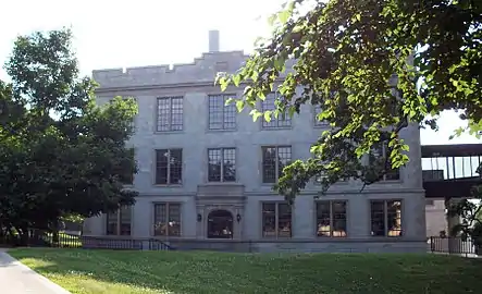 Chemistry Building-University of Arkansas, Fayetteville |
September 4, 1992 (#92001100) |
Campus Dr. 36°04′04″N 94°10′22″W |
Fayetteville | |
| 19 | Chi Omega Chapter House | 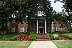 Chi Omega Chapter House |
April 20, 1995 (#95000456) |
940 Maple St. 36°04′13″N 94°10′24″W |
Fayetteville | |
| 20 | Chi Omega Greek Theatre-University of Arkansas, Fayetteville | 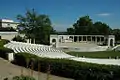 Chi Omega Greek Theatre-University of Arkansas, Fayetteville |
September 4, 1992 (#92001101) |
Dickson St. 36°04′01″N 94°10′25″W |
Fayetteville | |
| 21 | Clack House |  Clack House |
March 2, 2006 (#06000077) |
725 E. Dogwood Ln. 36°04′09″N 94°08′54″W |
Fayetteville | |
| 22 | Joe Marsh and Maxine Clark House | February 3, 2020 (#100004945) |
1724 Rockwood Trail 36°04′23″N 94°08′11″W |
Fayetteville | ||
| 23 | Clinton House |  Clinton House |
January 21, 2010 (#09000800) |
930 West Clinton Drive (formerly California Blvd.) 36°03′49″N 94°10′25″W |
Fayetteville | |
| 24 | Nathan Combs House | December 12, 1976 (#76000472) |
Address Restricted |
Fayetteville | ||
| 25 | County Road 6 Bridge | 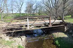 County Road 6 Bridge |
September 24, 2004 (#04001043) |
On County Road 6, approximately 0.5 miles (0.80 km) south of its junction with County Road 820 36°04′15″N 94°28′30″W |
Cincinnati | |
| 26 | Deepwood House | May 21, 2018 (#100002459) |
4697 W Finger Rd. 36°02′10″N 94°12′43″W |
Fayetteville | ||
| 27 | Devil's Den State Park Historic District | 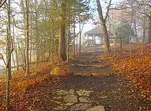 Devil's Den State Park Historic District |
July 24, 1994 (#92000071) |
Highway 74 west of Winslow 35°46′44″N 94°15′12″W |
Winslow | |
| 28 | David and Mary Margaret Durst House | 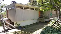 David and Mary Margaret Durst House |
May 28, 2015 (#15000288) |
857 Fairview Dr. 36°03′51″N 94°10′22″W |
Fayetteville | |
| 29 | Earle House | 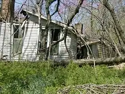 Earle House |
November 17, 1982 (#82000945) |
Highway 45 35°54′18″N 94°23′45″W |
Canehill | |
| 30 | D.N. Edmiston House | 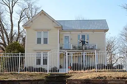 D.N. Edmiston House |
November 17, 1982 (#82000946) |
Main St. 35°54′39″N 94°23′45″W |
Canehill | |
| 31 | John Edmiston House | 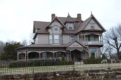 John Edmiston House |
November 17, 1982 (#82000947) |
Off Highway 45 35°54′49″N 94°23′46″W |
Canehill | |
| 32 | Zeb Edmiston House | 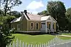 Zeb Edmiston House |
November 17, 1982 (#82000948) |
Main St. 35°54′30″N 94°23′45″W |
Canehill | |
| 33 | Ellis Building | May 28, 2019 (#100003982) |
208 N. Block Ave. 36°03′54″N 94°09′38″W |
Fayetteville | ||
| 34 | Elm Springs Cemetery, Historic Section | November 5, 2020 (#100005759) |
Northeast of the east end of School St. on Lawn View Ln. 36°12′20″N 94°13′50″W |
Elm Springs | ||
| 35 | Evansville-Dutch Mills Road Bridge | 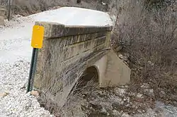 Evansville-Dutch Mills Road Bridge |
January 24, 2008 (#07001436) |
County Road 464 35°51′55″N 94°29′59″W |
Dutch Mills | |
| 36 | Evergreen Cemetery |  Evergreen Cemetery |
October 30, 1997 (#97001279) |
Junction of University and William Sts. 36°03′51″N 94°10′09″W |
Fayetteville | |
| 37 | Fayetteville Confederate Cemetery | 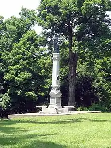 Fayetteville Confederate Cemetery |
June 3, 1993 (#93000481) |
Rock St., approximately 800 feet north of its junction with Willow St. 36°03′40″N 94°09′08″W |
Fayetteville | |
| 38 | Fayetteville Fire Department Fire Station 1 | 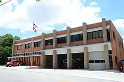 Fayetteville Fire Department Fire Station 1 |
June 2, 2015 (#15000289) |
303 W. Center 36°03′45″N 94°09′48″W |
Fayetteville | |
| 39 | Fayetteville Fire Department Fire Station 3 | 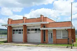 Fayetteville Fire Department Fire Station 3 |
June 2, 2015 (#15000290) |
4140 S. School St. 36°00′35″N 94°10′23″W |
Fayetteville | |
| 40 | Fayetteville National Cemetery | 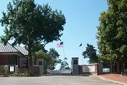 Fayetteville National Cemetery |
July 28, 1999 (#99000892) |
700 Government Ave. 36°03′09″N 94°10′04″W |
Fayetteville | |
| 41 | Fayetteville Veterans Administration Hospital | 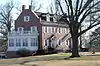 Fayetteville Veterans Administration Hospital |
February 15, 2012 (#12000024) |
1100 N. College Ave. 36°04′50″N 94°09′35″W |
Fayetteville | |
| 42 | Fishback School | 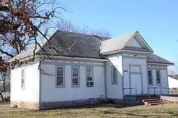 Fishback School |
September 4, 1992 (#92001120) |
Butterfield Coach Road 36°10′12″N 94°05′41″W |
Springdale | |
| 43 | Fitzgerald Station and Farmstead | 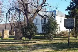 Fitzgerald Station and Farmstead |
May 29, 2003 (#03000465) |
2327 Old Wire Rd. and 1567 Dodd Ave. 36°12′19″N 94°06′49″W |
Springdale | c. 1870 Greek Revival house and outbuildings associated with Butterfield Overland Mail Company |
| 44 | Vernon Fitzhugh House | June 5, 2017 (#100001015) |
1551 E. Hope St. 36°04′43″N 94°08′18″W |
Fayetteville | ||
| 45 | Adrian Fletcher Residence | 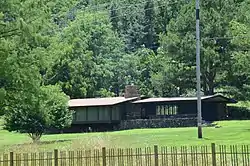 Adrian Fletcher Residence |
May 28, 2013 (#13000317) |
6725 Washington Road 36°02′37″N 94°03′39″W |
Fayetteville | |
| 46 | Frisco Depot | 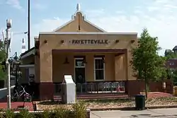 Frisco Depot |
December 8, 1988 (#88002819) |
550 W. Dickson St. 36°04′00″N 94°09′17″W |
Fayetteville | |
| 47 | Goff Farm Stone Bridge | 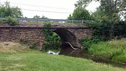 Goff Farm Stone Bridge |
January 21, 2010 (#09001262) |
Goff Farm Rd. approximately 0.5 miles (0.80 km) east of Dead Horse Mountain Rd. 36°02′38″N 94°06′35″W |
Fayetteville | |
| 48 | Troy Gordon House |  Troy Gordon House |
December 1, 1978 (#78000635) |
9 E. Township Rd. 36°05′40″N 94°10′11″W |
Fayetteville | |
| 49 | Gregg House | .jpg.webp) Gregg House |
September 17, 1974 (#74000502) |
339 N. Gregg St. 36°04′04″N 94°10′01″W |
Fayetteville | |
| 50 | Guisinger Building | 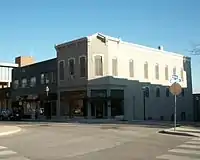 Guisinger Building |
September 20, 1984 (#84000910) |
E. Mountain St. 36°03′41″N 94°09′34″W |
Fayetteville | |
| 51 | Hantz House | .png.webp) Hantz House |
November 19, 2001 (#01001233) |
855 Fairview Dr. 36°03′51″N 94°10′21″W |
Fayetteville | |
| 52 | Happy Hollow Farm | 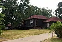 Happy Hollow Farm |
August 6, 1986 (#86002241) |
2099 Aqua Crossing 36°03′47″N 94°07′51″W |
Fayetteville | |
| 53 | Headquarters House | 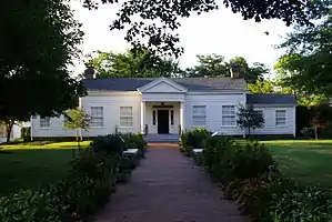 Headquarters House |
June 24, 1971 (#71000129) |
118 E. Dickson St. 36°03′58″N 94°09′04″W |
Fayetteville | |
| 54 | Hemingway House and Barn |  Hemingway House and Barn |
August 12, 1982 (#82002148) |
3310 Old Missouri Rd. 36°06′42″N 94°07′54″W |
Fayetteville | |
| 55 | Highway B-29 Bridge | 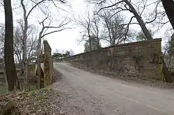 Highway B-29 Bridge |
September 24, 2008 (#08000945) |
County Road 623 over the Illinois River 35°59′42″N 94°17′54″W |
Prairie Grove | |
| 56 | Hindman Hall Museum |  Hindman Hall Museum |
September 15, 2020 (#100005593) |
14262 West US 62 35°58′06″N 94°20′26″W |
Prairie Grove | |
| 57 | Home Economics Building-University of Arkansas, Fayetteville | 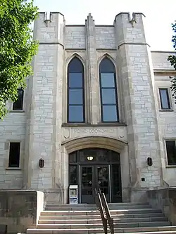 Home Economics Building-University of Arkansas, Fayetteville |
September 4, 1992 (#92001102) |
West of Campus Dr. 36°04′09″N 94°10′25″W |
Fayetteville | |
| 58 | House at 712 N. Mill Street |  House at 712 N. Mill Street |
September 4, 1992 (#92001157) |
712 N. Mill St. 36°11′32″N 94°07′48″W |
Springdale | |
| 59 | Illinois River Bridge at Phillips Ford | 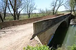 Illinois River Bridge at Phillips Ford |
January 22, 2009 (#08001344) |
County Road 848 over the Illinois River 36°08′06″N 94°21′29″W |
Savoy | |
| 60 | Jackson House | 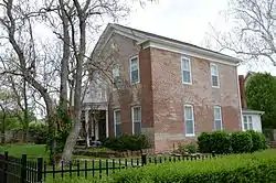 Jackson House |
August 17, 1982 (#82002149) |
1617 North Jordan Lane 36°04′57″N 94°08′34″W |
Fayetteville | |
| 61 | Johnson Barn | 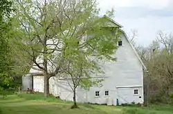 Johnson Barn |
June 21, 1990 (#90000896) |
Cato Springs Rd. north of Round Top Mtn. 36°00′55″N 94°12′21″W |
Fayetteville | |
| 62 | Johnson House and Mill | 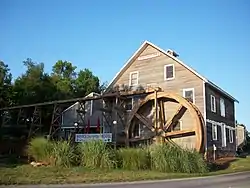 Johnson House and Mill |
December 12, 1976 (#76000473) |
West of Johnson on Johnson Rd. 36°08′14″N 94°10′41″W |
Johnson | |
| 63 | Johnson Switch Building |  Johnson Switch Building |
February 26, 1999 (#99000251) |
3201 Main St. 36°08′01″N 94°10′00″W |
Johnson | |
| 64 | Benjamin Franklin Johnson II Homestead District | May 29, 2019 (#100003989) |
3150 W. Pear Ln. 36°00′47″N 94°12′27″W |
Fayetteville | ||
| 65 | E. Fay and Gus Jones House | 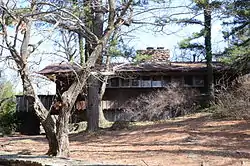 E. Fay and Gus Jones House |
April 28, 2000 (#97000453) |
1330 N. Hillcrest 36°04′51″N 94°09′10″W |
Fayetteville | |
| 66 | Lafayette Street Overpass | 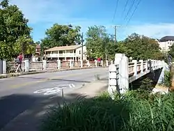 Lafayette Street Overpass |
May 26, 1995 (#95000653) |
Lafayette St. over the St. Louis – San Francisco railroad tracks 36°04′06″N 94°09′57″W |
Fayetteville | |
| 67 | Lake Wedington Historic District | 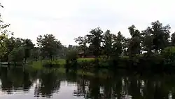 Lake Wedington Historic District |
September 11, 1995 (#94001612) |
Junction of Highway 16 and Forest Service Rd. 1750 in the Ozark-St. Francis National Forest 36°05′23″N 94°22′15″W |
Savoy | |
| 68 | Lake-Bell House | 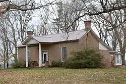 Lake-Bell House |
November 8, 1974 (#74000504) |
North of Prairie Grove 36°00′03″N 94°18′12″W |
Prairie Grove | |
| 69 | R.L. Leach Grocery Store | 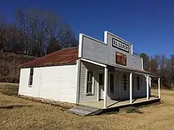 R.L. Leach Grocery Store |
January 26, 2018 (#100002013) |
W side of Dutch Mills Rd., 175 ft. from Cty. Rd. 418 35°52′34″N 94°29′29″W |
Dutch Mills | |
| 70 | Lewis Brothers Building | 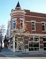 Lewis Brothers Building |
August 17, 1987 (#86003334) |
1 S. Block 36°03′44″N 94°09′34″W |
Fayetteville | |
| 71 | Magnolia Company Filling Station | 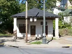 Magnolia Company Filling Station |
November 15, 1978 (#78000636) |
492 W. Lafayette St. 36°04′07″N 94°09′54″W |
Fayetteville | |
| 72 | Maguire-Williams House | 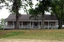 Maguire-Williams House |
September 7, 1995 (#95001093) |
19105 Highway 74 36°01′31″N 94°00′35″W |
Elkins | |
| 73 | Maple Street Overpass | .JPG.webp) Maple Street Overpass |
May 26, 1995 (#95000654) |
Maple St. over the St. Louis – San Francisco railroad tracks 36°04′12″N 94°10′00″W |
Fayetteville | |
| 74 | E.W. McClellan House | 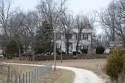 E.W. McClellan House |
November 17, 1982 (#82000949) |
Southwest of Canehill off Highway 45 35°54′39″N 94°23′51″W |
Canehill | |
| 75 | Wiley P. McNair House | September 20, 2016 (#16000654) |
301 Mountain St. 36°03′43″N 94°09′48″W |
Fayetteville | ||
| 76 | Meadow Spring Historic District | March 25, 2019 (#100003016) |
Roughly bounded by NW, School, Locust & Church Aves. between W Dickson St. & W Mountain 36°03′49″N 94°09′47″W |
Fayetteville | ||
| 77 | Men's Gymnasium-University of Arkansas, Fayetteville | 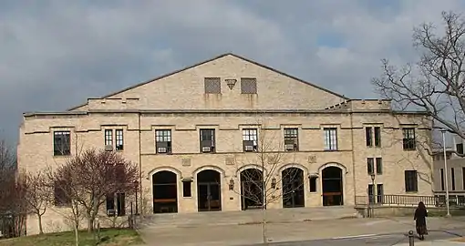 Men's Gymnasium-University of Arkansas, Fayetteville |
September 4, 1992 (#92001103) |
Garland Ave. 36°04′10″N 94°10′33″W |
Fayetteville | |
| 78 | Methodist Manse | 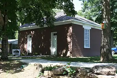 Methodist Manse |
November 17, 1982 (#82000950) |
Main and Spring Sts. 35°54′29″N 94°23′48″W |
Canehill | |
| 79 | Mineral Springs Community Building |  Mineral Springs Community Building |
May 29, 1998 (#98000580) |
County Road 34, east of West Fork 35°55′37″N 94°08′06″W |
West Fork | |
| 80 | Morrow Farmstead | January 13, 2021 (#100006044) |
16995 Hale Mountain Rd. 35°51′41″N 94°26′08″W |
Morrow | ||
| 81 | Moore House | 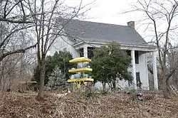 Moore House |
November 17, 1982 (#82000951) |
Northwest of Canehill on CR 13 35°54′55″N 94°24′19″W |
Canehill | |
| 82 | Mack Morton Barn | 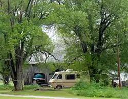 Mack Morton Barn |
February 15, 2005 (#05000047) |
11516 Appleby Rd. 36°01′15″N 94°14′42″W |
Appleby | |
| 83 | Mount Nord Historic District | 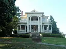 Mount Nord Historic District |
September 16, 1982 (#82002150) |
Mount Nord Ave. 36°04′10″N 94°09′38″W |
Fayetteville | |
| 84 | Mount Sequoyah Cottages | .JPG.webp) Mount Sequoyah Cottages |
August 6, 2012 (#12000278) |
808 & 810 E. Skyline Dr. 36°03′53″N 94°08′37″W |
Fayetteville | |
| 85 | Willis Noll House | 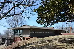 Willis Noll House |
January 20, 2005 (#04001498) |
531 N. Sequoyah Dr. 36°04′07″N 94°26′40″W |
Fayetteville | |
| 86 | North Mock Street Historic District | June 22, 2018 (#100002566) |
114 & 116 N Mock St. 35°58′34″N 94°19′02″W |
Prairie Grove | ||
| 87 | Old Bank of Fayetteville Building | 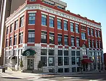 Old Bank of Fayetteville Building |
March 7, 1994 (#94000144) |
100 W. Center St. 36°03′46″N 94°09′38″W |
Fayetteville | |
| 88 | Old Main, University of Arkansas | 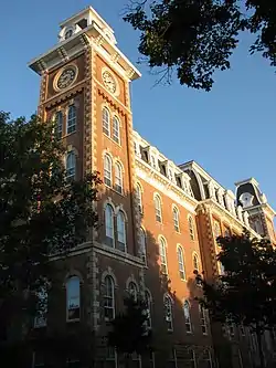 Old Main, University of Arkansas |
June 15, 1970 (#70000131) |
Arkansas Ave. 36°04′07″N 94°10′17″W |
Fayetteville | |
| 89 | Old Post Office | 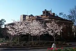 Old Post Office |
August 27, 1974 (#74000503) |
City Sq. 36°03′44″N 94°09′35″W |
Fayetteville | |
| 90 | Old Springdale High School | 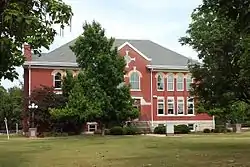 Old Springdale High School |
May 19, 1994 (#94000469) |
814 W. Johnson Ave 36°11′14″N 94°08′14″W |
Springdale | |
| 91 | Old US 71, Greenland Segment | 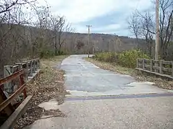 Old US 71, Greenland Segment |
September 24, 2004 (#04001041) |
County Road 1194 (S. Main Ave.) 35°58′54″N 94°10′28″W |
Greenland | |
| 92 | Dr. James Patrick House | January 31, 2017 (#100000592) |
370 N. Williams Dr. 36°04′04″N 94°08′35″W |
Fayetteville | ||
| 93 | Prairie Grove Airlight Outdoor Telephone Booth | 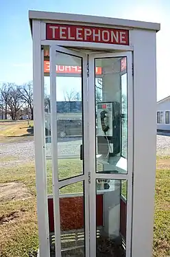 Prairie Grove Airlight Outdoor Telephone Booth |
November 9, 2015 (#15000291) |
SW. corner of E. Douglas and Parker Sts. 35°58′57″N 94°18′36″W |
Prairie Grove | The first telephone booth listed on the National Register. |
| 94 | Prairie Grove Battlefield Park | 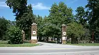 Prairie Grove Battlefield Park |
September 4, 1970 (#70000133) |
Within a triangle formed by North Rd. on the northwest and U.S. Highway 62 on the south; also the northern side of US 62, east of Prairie Grove; also north of US 62, east of Prairie Grove 35°59′09″N 94°18′51″W |
Prairie Grove | Second and third sets of boundaries represent boundary increases of November 9, 1992 and October 27, 2005 |
| 95 | Prairie Grove Cemetery Historic Section | 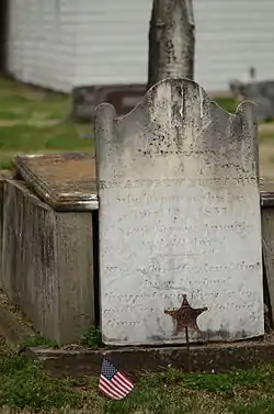 Prairie Grove Cemetery Historic Section |
January 8, 2016 (#15000292) |
Bounded by Kate Smith, W. Buchanan, & Parks Sts. 35°58′34″N 94°19′08″W |
Prairie Grove | |
| 96 | Prairie Grove Commercial Historic District | June 25, 2018 (#100002567) |
Odd numbers 107-305 E Buchanan & 123 S Neal Sts. 35°58′33″N 94°18′56″W |
Prairie Grove | ||
| 97 | Price Produce and Service Station |  Price Produce and Service Station |
September 23, 2011 (#11000694) |
413, 415 & 417 E. Emma Ave. 36°11′05″N 94°07′35″W |
Springdale | |
| 98 | Pyeatte Mill Site | 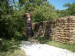 Pyeatte Mill Site |
November 17, 1982 (#82000954) |
South of Canehill on Highway 45 35°53′54″N 94°24′07″W |
Canehill | |
| 99 | Henry Pyeatte House | November 17, 1982 (#82000952) |
North of Canehill on Highway 45 35°55′05″N 94°23′39″W |
Canehill | ||
| 100 | Rabbits Foot Lodge | 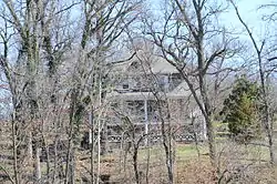 Rabbits Foot Lodge |
September 11, 1986 (#86002421) |
3600 Silent Grove Rd. 36°12′35″N 94°09′29″W |
Springdale | |
| 101 | Ridge House |  Ridge House |
November 2, 1972 (#72000211) |
230 W. Center St. 36°03′46″N 94°09′23″W |
Fayetteville | |
| 102 | Routh-Bailey House | September 28, 1989 (#89001592) |
Old Wire Rd. 3 miles (4.8 km) east of Fayetteville 36°06′37″N 94°07′06″W |
Fayetteville | ||
| 103 | St. Joseph Catholic Church | 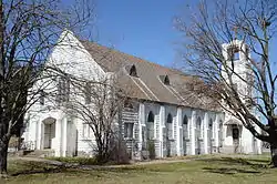 St. Joseph Catholic Church |
March 2, 2006 (#06000080) |
110 E. Henri de Tonti Boulevard 36°10′43″N 94°14′06″W |
Tontitown | |
| 104 | Warren Segraves House | June 5, 2017 (#100001016) |
217 N. Oklahoma Way 36°03′54″N 94°08′55″W |
Fayetteville | ||
| 105 | Lynn Shelton American Legion Post No. 27 | 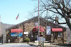 Lynn Shelton American Legion Post No. 27 |
January 4, 1996 (#95001480) |
28 S. College Ave. 36°03′43″N 94°09′26″W |
Fayetteville | |
| 106 | Shiloh Church | 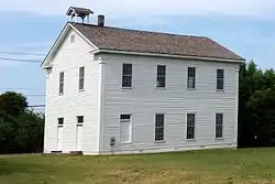 Shiloh Church |
June 5, 1975 (#75000418) |
Huntsville and Main Sts. 36°11′17″N 94°07′52″W |
Springdale | |
| 107 | Shiloh Historic District | 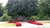 Shiloh Historic District |
August 31, 1978 (#78000640) |
Roughly bounded by Spring Creek, Shiloh, Johnson, Mill, and Spring Sts. 36°11′19″N 94°07′53″W |
Springdale | |
| 108 | Skillern House | 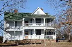 Skillern House |
January 27, 2015 (#14001203) |
3470 E. Skillern Rd. 36°06′05″N 94°06′22″W |
Fayetteville | |
| 109 | Tom Smith House | 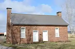 Tom Smith House |
October 8, 1992 (#92001344) |
Highway 74 west of its junction with Highway 295, northeast of Elkins 36°02′17″N 93°57′41″W |
Elkins | |
| 110 | Peter Smyth House | 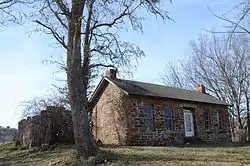 Peter Smyth House |
October 4, 2002 (#02001080) |
1629 Crossover St. 36°04′56″N 94°07′17″W |
Fayetteville | |
| 111 | Son's Chapel |  Son's Chapel |
September 25, 2003 (#03000949) |
5480 E. Mission 36°06′06″N 94°04′56″W |
Fayetteville | |
| 112 | Southern Mercantile Building | 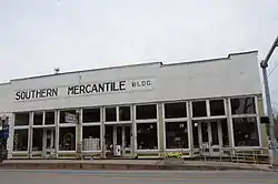 Southern Mercantile Building |
June 14, 1990 (#90000898) |
107 E. Buchanan 35°58′31″N 94°19′00″W |
Prairie Grove | |
| 113 | Spring Valley School District 120 Building | 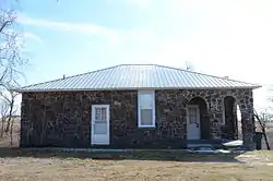 Spring Valley School District 120 Building |
September 4, 1992 (#92001119) |
County Road 379 36°10′39″N 93°55′56″W |
Spring Valley | |
| 114 | Springdale Poultry Industry Historic District | 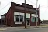 Springdale Poultry Industry Historic District |
September 23, 2011 (#11000695) |
317 & 319 E. Emma & 316 E. Meadow Aves. 36°11′04″N 94°07′40″W |
Springdale | |
| 115 | Stokenbury Cemetery | 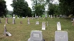 Stokenbury Cemetery |
February 4, 2010 (#09000799) |
Highway 16 36°00′52″N 94°00′31″W |
Elkins | |
| 116 | Stone House |  Stone House |
September 4, 1970 (#70000132) |
207 Center St. 36°03′17″N 94°09′56″W |
Fayetteville | |
| 117 | Strengthen the Arm of Liberty Monument |  Strengthen the Arm of Liberty Monument |
July 31, 2012 (#12000279) |
3215 North Northhills Boulevard 36°06′37″N 94°09′35″W |
Fayetteville | Originally listed on the National Register November 1, 2000 (refnum 00001264), but removed January 27, 2012 due to improper relocation.[7] Relisted August 16, 2012. |
| 118 | Student Union Building-University of Arkansas, Fayetteville | 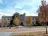 Student Union Building-University of Arkansas, Fayetteville |
September 4, 1992 (#92001104) |
Southeastern corner of the junction of Campus Dr. and Maple St. 36°04′11″N 94°10′15″W |
Fayetteville | |
| 119 | Tharp House | 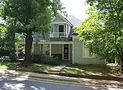 Tharp House |
January 21, 2004 (#03001461) |
15 N. West Ave. 36°03′48″N 94°09′56″W |
Fayetteville | |
| 120 | John Tilley House | 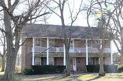 John Tilley House |
November 2, 1978 (#78000639) |
West of Prairie Grove on Stonewall Rd. 35°59′34″N 94°23′08″W |
Prairie Grove | |
| 121 | Tontitown School Building | 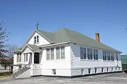 Tontitown School Building |
September 4, 1992 (#92001117) |
U.S. Highway 412 36°10′36″N 94°14′00″W |
Tontitown | |
| 122 | Tweedy-Puntch House | September 27, 2019 (#100004435) |
1411 W. Emma Ave. 36°11′07″N 94°08′42″W |
Springdale | ||
| 123 | Twin Bridges Historic District | 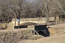 Twin Bridges Historic District |
March 7, 1994 (#94000162) |
County Road 3412 across an unnamed creek and Old County Road 11 across Baron Fork 35°52′35″N 94°27′12″W |
Morrow | |
| 124 | United Presbyterian Church of Canehill | 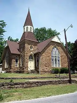 United Presbyterian Church of Canehill |
November 17, 1982 (#82000955) |
Main St. 35°54′36″N 94°23′46″W |
Canehill | |
| 125 | University of Arkansas Campus Historic District | 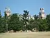 University of Arkansas Campus Historic District |
September 23, 2009 (#09000745) |
Roughly bounded by Garland Ave., Maple St., Arkansas Ave., and Dickson St. 36°04′06″N 94°10′19″W |
Fayetteville | |
| 126 | Vernon & Moore-McIlroy Produce Warehouse | September 10, 2020 (#100005594) |
200 North West Ave. 36°03′54″N 94°09′55″W |
Fayetteville | ||
| 127 | John S. Vest House | 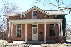 John S. Vest House |
November 27, 1979 (#79003103) |
21 N. West St. 36°03′48″N 94°09′56″W |
Fayetteville | |
| 128 | Villa Rosa | .jpg.webp) Villa Rosa |
December 27, 1990 (#90001946) |
617 W. Lafayette 36°04′05″N 94°10′03″W |
Fayetteville | |
| 129 | Wade-Heerwagen House | 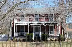 Wade-Heerwagen House |
June 15, 1978 (#78000637) |
338 Washington Ave., N. 36°04′03″N 94°09′20″W |
Fayetteville | |
| 130 | Walker Family Plot | 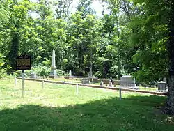 Walker Family Plot |
September 24, 2012 (#12000807) |
514 E. Rock St. 36°03′39″N 94°09′11″W |
Fayetteville | |
| 131 | Walker House | June 10, 1975 (#75000417) |
Knerr Rd. 36°03′29″N 94°08′59″W |
Fayetteville | ||
| 132 | Vol Walker Library-University of Arkansas, Fayetteville | 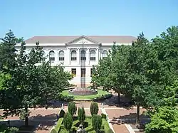 Vol Walker Library-University of Arkansas, Fayetteville |
September 4, 1992 (#92001105) |
Campus Dr. 36°04′07″N 94°10′21″W |
Fayetteville | |
| 133 | Walnut Grove Presbyterian Church | 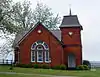 Walnut Grove Presbyterian Church |
December 7, 1995 (#95001411) |
Highway 170 36°00′08″N 94°16′03″W |
Farmington | |
| 134 | Washington County Courthouse | 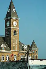 Washington County Courthouse |
February 23, 1972 (#72000212) |
4 S. College Ave. 36°03′45″N 94°09′27″W |
Fayetteville | |
| 135 | Washington County Jail | 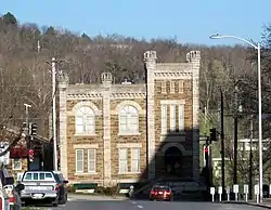 Washington County Jail |
December 1, 1978 (#78000638) |
College and County Aves. 36°03′42″N 94°09′27″W |
Fayetteville | |
| 136 | Washington County Road 35 Bridge |  Washington County Road 35 Bridge |
June 9, 2000 (#00000637) |
County Road 35 35°53′01″N 94°09′53″W |
Woolsey | |
| 137 | Washington-Willow Historic District | 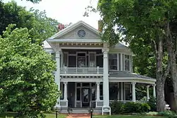 Washington-Willow Historic District |
May 23, 1980 (#80000789) |
Roughly bounded by College and Walnut Aves. and Rebecca and Spring Sts.; also roughly Spring, Dickson, Sutton, and Lafayette Sts. from Olive Ave. to Willow Ave., and the junction of Rebecca St. and Willow 36°04′08″N 94°09′19″W |
Fayetteville | Second set of boundaries represents a boundary increase of March 28, 1995 |
| 138 | Waterman-Archer House |  Waterman-Archer House |
June 25, 1999 (#99000730) |
2148 Markham 36°04′10″N 94°11′21″W |
Fayetteville | |
| 139 | William Welch House | November 17, 1982 (#82000956) |
Main St. 35°54′29″N 94°23′45″W |
Canehill | ||
| 140 | West Dickson Street Commercial Historic District | .jpg.webp) West Dickson Street Commercial Historic District |
October 1, 2007 (#07001028) |
Dickson St. between Arkansas and St. Charles Aves., and West Ave. between Dickson and Lafayette Sts. 36°03′59″N 94°09′52″W |
Fayetteville | |
| 141 | White River Bridge at Elkins | 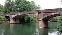 White River Bridge at Elkins |
January 24, 2008 (#07001437) |
County Road 44. 36°00′03″N 94°00′14″W |
Elkins | |
| 142 | John G. Williams House #2 | February 13, 2020 (#100004942) |
140 North Sang Ave. 36°03′57″N 94°11′19″W |
Fayetteville | ||
| 143 | Wilson Park Historic District |  Wilson Park Historic District |
March 31, 1995 (#95000365) |
Roughly bounded by College Ave., Maple St., Wilson Ave., and Louise St. 36°04′15″N 94°09′44″W |
Fayetteville | |
| 144 | Wilson-Pittman-Campbell-Gregory House | 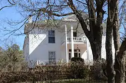 Wilson-Pittman-Campbell-Gregory House |
May 6, 1980 (#80000790) |
405 E. Dickson St. 36°03′55″N 94°09′07″W |
Fayetteville | |
| 145 | Woolsey Farmstead Cemetery | September 21, 2020 (#100005595) |
535 South Broyles Rd. 36°03′32″N 94°14′07″W |
Fayetteville | ||
| 146 | Mrs. Young Building | .JPG.webp) Mrs. Young Building |
June 25, 1999 (#99000731) |
5 S. Block Ave. 36°03′51″N 94°10′13″W |
Fayetteville |
Former listings
| [2] | Name on the Register | Image | Date listed | Date removed | Location | City or town | Summary |
|---|---|---|---|---|---|---|---|
| 1 | Bariola Farm | March 5, 1992 (#92000096) | January 26, 2015 | 329 Ardemagni Rd. 36°10′50″N 94°14′45″W |
Tontitown | ||
| 2 | Dodson Memorial Building | September 4, 1992 (#92001118) | October 7, 2009 | Northeastern corner of the junction of Pleasant St. and Emma Ave. 36°11′07″N 94°08′33″W |
Springdale | ||
| 3 | Durham School | 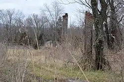 Durham School |
September 4, 1992 (#92001121) | January 26, 2018 | County Road 183 35°57′04″N 93°58′48″W |
Durham | |
| 4 | Kantz House | 1980 (#80000788) | September 17, 1999 | East of Fayetteville at 2650 Mission St. |
Fayetteville | ||
| 5 | Washington County Road 80F Bridge | May 5, 1995 (#95000565) | May 25, 2004 | County Road 80F over the Muddy Fork of the Illinois River |
Viney Grove | ||
| 6 | Waters-Pierce Oil Company Building | December 8, 1988 (#88002821) | September 24, 2004 | West St. |
Fayetteville | ||
| 7 | Wyman Bridge |  Wyman Bridge |
April 9, 1990 (#90000526) | September 24, 2004 | County Road 38 over the West Fork of the White River |
Fayetteville |
See also
| Wikimedia Commons has media related to National Register of Historic Places in Washington County, Arkansas. |
References
- "National Register of Historic Places: Weekly List Actions". National Park Service, United States Department of the Interior. Retrieved on February 5, 2021.
- Numbers represent an alphabetical ordering by significant words. Various colorings, defined here, differentiate National Historic Landmarks and historic districts from other NRHP buildings, structures, sites or objects.
- "National Register Information System". National Register of Historic Places. National Park Service. March 13, 2009.
- The eight-digit number below each date is the number assigned to each location in the National Register Information System database, which can be viewed by clicking the number.
- Location derived from the UTM coordinates written on the map in the National Register nomination; the NRIS provides greatly erroneous coordinates that were incorrectly transcribed elsewhere in the nomination.
- BLACK OAK CEMETERY, GREENLAND, WASHINGTON COUNTY, Arkansas Historic Preservation Program].
- Payne, Steve (February 19, 2012). "Statue of Liberty replica in Fayetteville removed from National Register of Historic Places". Little Rock, Arkansas: KTHV Television. Retrieved 2012. Check date values in:
|access-date=(help)
| Topics | |
|---|---|
| Lists by state |
|
| Lists by insular areas | |
| Lists by associated state | |
| Other areas | |
| Related | |
| |
This article is issued from Wikipedia. The text is licensed under Creative Commons - Attribution - Sharealike. Additional terms may apply for the media files.