National Register of Historic Places listings in Lawrence County, Arkansas
This is a list of the National Register of Historic Places listings in Lawrence County, Arkansas.
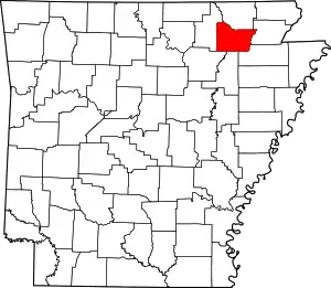
Location of Lawrence County in Arkansas
This is intended to be a complete list of the properties and districts on the National Register of Historic Places in Lawrence County, Arkansas, United States. The locations of National Register properties and districts for which the latitude and longitude coordinates are included below, may be seen in a map.[1]
There are 26 properties and districts listed on the National Register in the county. Another 2 properties were once listed but have been removed.
- This National Park Service list is complete through NPS recent listings posted February 5, 2021.[2]
Current listings
| [3] | Name on the Register[4] | Image | Date listed[5] | Location | City or town | Description |
|---|---|---|---|---|---|---|
| 1 | Bethel Cemetery | 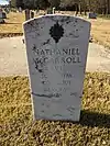 Bethel Cemetery |
June 15, 2011 (#11000354) |
1.1 miles (1.8 km) north of AR 117 on County Rd. 225 36°06′06″N 91°14′05″W |
Denton | |
| 2 | Dr. F.W. Buercklin House | 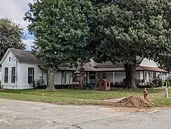 Dr. F.W. Buercklin House |
July 24, 1998 (#98000882) |
104 Main St. 36°05′15″N 91°04′02″W |
Portia | |
| 3 | Building Number 29 |  Building Number 29 |
October 17, 2012 (#12000856) |
162 N. Beacon Rd. 36°07′41″N 90°55′42″W |
Walnut Ridge | Part of the World War II Home Front Efforts in Arkansas, MPS |
| 4 | Cache River Bridge | 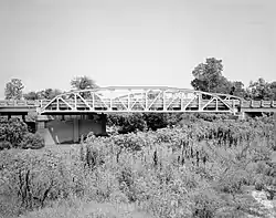 Cache River Bridge |
April 9, 1990 (#90000523) |
Highway 25, over the Cache River 36°04′09″N 90°49′28″W |
Walnut Ridge | |
| 5 | Clover Bend High School |  Clover Bend High School |
August 17, 1983 (#83001159) |
Highway 228 35°59′07″N 91°05′15″W |
Clover Bend | |
| 6 | Clover Bend Historic District | 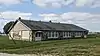 Clover Bend Historic District |
September 17, 1990 (#90001368) |
Junction of Highway 228 and County Road 1220 35°58′57″N 91°05′38″W |
Clover Bend | |
| 7 | Commandant's House |  Commandant's House |
January 21, 2010 (#09001251) |
264 McClellan Dr. 36°07′47″N 90°56′21″W |
Walnut Ridge | |
| 8 | Ficklin-Imboden House |  Ficklin-Imboden House |
October 16, 1989 (#88003206) |
3rd and Main Sts. 36°04′55″N 91°07′00″W |
Powhatan | |
| 9 | Dr. John Octavius Hatcher House | 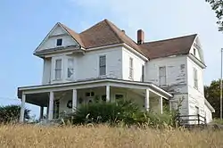 Dr. John Octavius Hatcher House |
October 23, 1992 (#92001358) |
210 3rd St. 36°12′11″N 91°10′28″W |
Imboden | |
| 10 | Home Economics-F.F.A. Building | 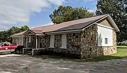 Home Economics-F.F.A. Building |
June 14, 1990 (#90000901) |
City Park Dr. 36°05′06″N 91°04′11″W |
Portia | |
| 11 | Imboden Methodist Episcopal Church, South |  Imboden Methodist Episcopal Church, South |
June 30, 2004 (#04000505) |
113 Main St. 36°12′17″N 91°10′25″W |
Imboden | |
| 12 | Lawrence County Courthouse | 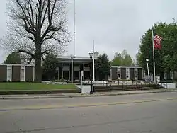 Lawrence County Courthouse |
September 28, 2015 (#15000627) |
315 W. Main St. 36°04′12″N 90°57′28″W |
Walnut Ridge | |
| 13 | Missouri Pacific Depot-Walnut Ridge | 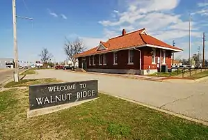 Missouri Pacific Depot-Walnut Ridge |
June 11, 1992 (#92000622) |
SW. 1st St. 36°04′03″N 90°57′24″W |
Walnut Ridge | |
| 14 | Old US 67, Alicia to Hoxie | 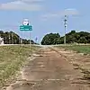 Old US 67, Alicia to Hoxie |
May 18, 2003 (#03000397) |
1st St., County Roads 747 and 549, and immediately east of the current U.S. Route 67 35°55′43″N 91°03′39″W |
Alicia | |
| 15 | Old Walnut Ridge Post Office |  Old Walnut Ridge Post Office |
May 20, 1994 (#94000496) |
225 W. Main St. 36°04′10″N 90°57′27″W |
Walnut Ridge | |
| 16 | Portia School | 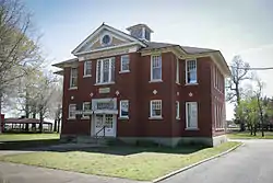 Portia School |
December 13, 1978 (#78000604) |
City Park 36°05′05″N 91°04′15″W |
Portia | |
| 17 | Powhatan Courthouse | 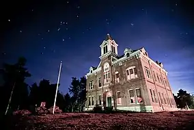 Powhatan Courthouse |
February 16, 1970 (#70000122) |
Off Highway 25[6] 36°04′54″N 91°07′12″W |
Powhatan | |
| 18 | Powhatan Jail | 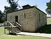 Powhatan Jail |
October 16, 1989 (#88003205) |
Highway 25 36°04′56″N 91°07′06″W |
Powhatan | |
| 19 | Powhatan Methodist Church | 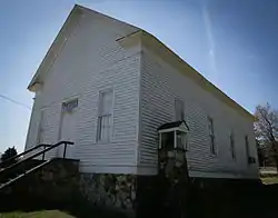 Powhatan Methodist Church |
November 23, 1977 (#77000260) |
Highway 25 36°04′55″N 91°07′12″W |
Powhatan | |
| 20 | Powhatan Schoolhouse | 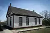 Powhatan Schoolhouse |
July 31, 1978 (#78000605) |
Highway 25 36°04′55″N 91°07′15″W |
Powhatan | |
| 21 | St. Louis-San Francisco Overpass | .jpg.webp) St. Louis-San Francisco Overpass |
April 9, 1990 (#90000513) |
U.S. Route 62 over the Spring River 36°12′24″N 91°10′17″W |
Imboden | |
| 22 | Scott Cemetery | 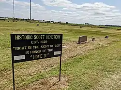 Scott Cemetery |
June 5, 2017 (#100001009) |
0.5 miles (0.80 km) S. of the jct. of US 412 & AR 91 36°03′33″N 90°56′41″W |
Walnut Ridge | |
| 23 | Smithville Public School Building | Smithville Public School Building |
January 14, 1993 (#92001219) |
Highway 117 36°04′48″N 91°18′20″W |
Smithville | |
| 24 | Telephone Exchange Building | 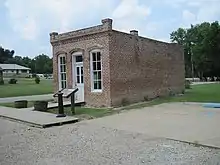 Telephone Exchange Building |
October 16, 1989 (#88003207) |
1st and Main Sts. 36°04′54″N 91°06′58″W |
Powhatan | |
| 25 | Walnut Ridge Army Airfield Access Road |  Walnut Ridge Army Airfield Access Road |
June 7, 2016 (#16000318) |
Roughly bounded by US 67 & jct. of Fulbright Ave. & Stafford Ln. 36°07′32″N 90°56′59″W |
Walnut Ridge | |
| 26 | Walnut Ridge Commercial Historic District | 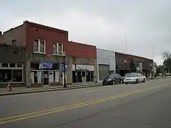 Walnut Ridge Commercial Historic District |
May 28, 2010 (#10000286) |
Roughly bounded by East and West Main, North and South Front Sts, West Vine, and Southwest Third Sts 36°04′06″N 90°57′21″W |
Walnut Ridge |
Former listings
| [3] | Name on the Register | Image | Date listed | Date removed | Location | City or town | Summary |
|---|---|---|---|---|---|---|---|
| 1 | Alice French House | January 11, 1976 (#76000425) | September 14, 2002 | AR 28 |
Clover Bend | ||
| 2 | US 63 Black River Bridge | June 9, 2000 (#00000631) | January 24, 2017 | U.S. Route 63 36°05′52″N 91°05′32″W |
Black Rock |
See also
| Wikimedia Commons has media related to National Register of Historic Places in Lawrence County, Arkansas. |
References
- The latitude and longitude information provided in this table was derived originally from the National Register Information System, which has been found to be fairly accurate for about 99% of listings. Some locations in this table may have been corrected to current GPS standards.
- "National Register of Historic Places: Weekly List Actions". National Park Service, United States Department of the Interior. Retrieved on February 5, 2021.
- Numbers represent an alphabetical ordering by significant words. Various colorings, defined here, differentiate National Historic Landmarks and historic districts from other NRHP buildings, structures, sites or objects.
- "National Register Information System". National Register of Historic Places. National Park Service. March 13, 2009.
- The eight-digit number below each date is the number assigned to each location in the National Register Information System database, which can be viewed by clicking the number.
- Location derived from this Arkansas state parks document; the NRIS provides coordinates but lists the site as "Address unknown at this time"
| Topics | |
|---|---|
| Lists by state |
|
| Lists by insular areas | |
| Lists by associated state | |
| Other areas | |
| Related | |
| |
Municipalities and communities of Lawrence County, Arkansas, United States | ||
|---|---|---|
| Cities | Map of Arkansas highlighting Lawrence County | |
| Towns | ||
| Other communities | ||
| ||
This article is issued from Wikipedia. The text is licensed under Creative Commons - Attribution - Sharealike. Additional terms may apply for the media files.