National Register of Historic Places listings in Dallas County, Arkansas
This is a list of the National Register of Historic Places listings in Dallas County, Arkansas.
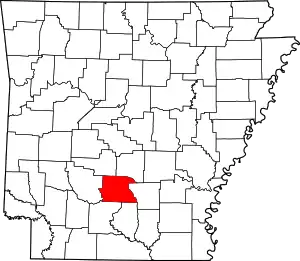
Location of Dallas County in Arkansas
This is intended to be a complete list of the properties and districts on the National Register of Historic Places in Dallas County, Arkansas, United States. The locations of National Register properties and districts for which the latitude and longitude coordinates are included below, may be seen in a map.[1]
There are 39 properties and districts listed on the National Register in the county.
- This National Park Service list is complete through NPS recent listings posted February 5, 2021.[2]
Current listings
| [3] | Name on the Register[4] | Image | Date listed[5] | Location | City or town | Description |
|---|---|---|---|---|---|---|
| 1 | Amis House | 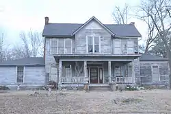 Amis House |
October 28, 1983 (#83003460) |
2nd St. 33°48′40″N 92°24′56″W |
Fordyce | |
| 2 | Henry Atchley House |  Henry Atchley House |
October 28, 1983 (#83003461) |
Off Highway 8 34°02′09″N 92°53′09″W |
Dalark | |
| 3 | Bank of Carthage | 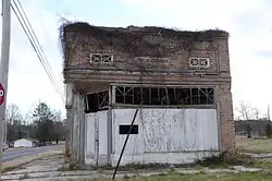 Bank of Carthage |
December 22, 1982 (#82000806) |
Highway 229 34°04′27″N 92°33′16″W |
Carthage | |
| 4 | Bird Kiln | May 29, 1975 (#75000381) |
6 miles southwest of Leola off Highway 9 34°07′38″N 92°40′36″W |
Leola | ||
| 5 | Brazeale Homestead | 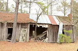 Brazeale Homestead |
October 28, 1983 (#83003463) |
Southeast of Highway 128 33°51′19″N 92°45′56″W |
Pine Grove | |
| 6 | Butler-Matthews Homestead | 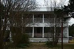 Butler-Matthews Homestead |
October 28, 1983 (#83003465) |
Southwest of Tulip off Highway 9 34°04′28″N 92°39′22″W |
Tulip | |
| 7 | Charlotte Street Historic District | 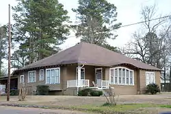 Charlotte Street Historic District |
September 14, 1987 (#87001348) |
Roughly bounded by Holmes, Charlotte, Broadway, and E. College Sts. 33°49′00″N 92°24′27″W |
Fordyce | |
| 8 | Cotton Belt Railroad Depot-Fordyce | 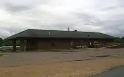 Cotton Belt Railroad Depot-Fordyce |
June 11, 1992 (#92000608) |
Southwestern corner of the junction of Main and 1st Sts. 33°48′39″N 92°24′43″W |
Fordyce | 1925 railroad depot with Mediterranean influences |
| 9 | Culbertson Kiln | May 29, 1975 (#75000382) |
East of Princeton on Stark Bland Rd. 34°00′41″N 92°35′10″W |
Princeton | ||
| 10 | Dallas County Courthouse | 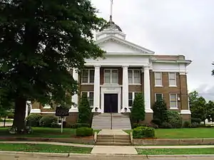 Dallas County Courthouse |
March 27, 1984 (#84000677) |
3rd and Oak Sts. 33°48′45″N 92°24′49″W |
Fordyce | |
| 11 | Dallas County Training School High School Building |  Dallas County Training School High School Building |
January 21, 2004 (#03001455) |
934 Center St. 33°49′01″N 92°24′07″W |
Fordyce | |
| 12 | Elliott House | 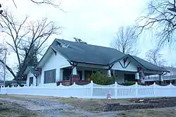 Elliott House |
March 27, 1984 (#84000681) |
309 Pine St. 33°48′41″N 92°25′02″W |
Fordyce | |
| 13 | Fielder House | October 28, 1983 (#83003467) |
U.S. Route 79 Business 33°48′45″N 92°25′47″W |
Fordyce | ||
| 14 | First Presbyterian Church | 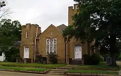 First Presbyterian Church |
October 28, 1983 (#83003468) |
U.S. Route 79 Business 33°48′47″N 92°24′53″W |
Fordyce | |
| 15 | First United Methodist Church | 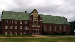 First United Methodist Church |
October 28, 1983 (#83003469) |
E. 4th and Spring Sts. 33°48′51″N 92°24′44″W |
Fordyce | |
| 16 | Fordyce Commercial Historic District | 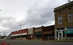 Fordyce Commercial Historic District |
May 20, 2008 (#08000436) |
Roughly bounded by Oak, 5th, and Spring Sts., and Highway 274 33°48′47″N 92°24′45″W |
Fordyce | c.1884-1958 commercial core of Fordyce |
| 17 | Fordyce Home Accident Ins. Co. | 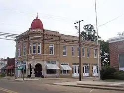 Fordyce Home Accident Ins. Co. |
December 22, 1982 (#82000807) |
300 Main 33°48′47″N 92°24′43″W |
Fordyce | |
| 18 | Garrison Place | October 28, 1983 (#83003470) |
South of Highway 48 34°05′13″N 92°27′54″W |
Carthage | Demolished | |
| 19 | Capt. Goodgame House | 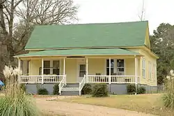 Capt. Goodgame House |
October 28, 1983 (#83003471) |
45 Highway 128 33°49′11″N 92°42′52″W |
Holly Springs | |
| 20 | Hampton Springs Cemetery (Black Section) | October 28, 1983 (#83003473) |
Off Highway 48 34°05′21″N 92°29′24″W |
Carthage | ||
| 21 | Ed Knight House | 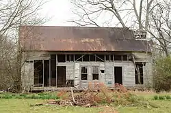 Ed Knight House |
October 28, 1983 (#83003524) |
Off Highway 128 33°51′55″N 92°47′23″W |
Pine Grove | |
| 22 | George W. Mallett House | October 28, 1983 (#83003526) |
Off Highway 8 33°58′41″N 92°37′34″W |
Princeton | ||
| 23 | Marathon Oil Service Station | 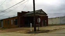 Marathon Oil Service Station |
May 10, 2001 (#01000484) |
E. 2nd and Spring St. 33°48′43″N 92°24′43″W |
Fordyce | |
| 24 | Mt. Carmel Methodist Church | 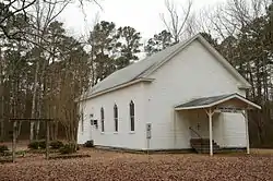 Mt. Carmel Methodist Church |
October 28, 1983 (#83003528) |
Highway 9 33°54′13″N 92°38′15″W |
Jacinto | |
| 25 | Mt. Zion Methodist Church | 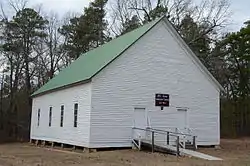 Mt. Zion Methodist Church |
October 28, 1983 (#83003529) |
Northeast of Carthage 34°06′32″N 92°31′15″W |
Carthage | |
| 26 | Nutt-Trussell Building | 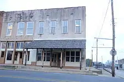 Nutt-Trussell Building |
March 4, 2001 (#01000110) |
202 N. Main St. 33°48′44″N 92°24′41″W |
Fordyce | |
| 27 | Princeton Cemetery | 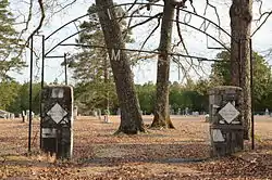 Princeton Cemetery |
March 27, 1984 (#84000872) |
Off Highway 9 33°58′34″N 92°37′01″W |
Princeton | |
| 28 | Prosperity Baptist Church | 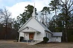 Prosperity Baptist Church |
May 22, 2003 (#03000421) |
Highway 8, W. 33°52′29″N 92°33′09″W |
Ramsey | |
| 29 | Rock Island Railway Depot | 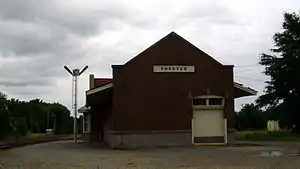 Rock Island Railway Depot |
October 28, 1983 (#83003534) |
3rd St. 33°48′49″N 92°24′36″W |
Fordyce | |
| 30 | John Russell House | 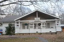 John Russell House |
October 28, 1983 (#83003535) |
904 Charlotte St. 33°49′08″N 92°24′29″W |
Fordyce | |
| 31 | Sardis Methodist Church | 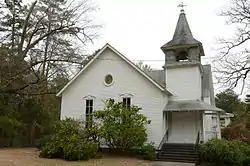 Sardis Methodist Church |
October 28, 1983 (#83003540) |
Northeast of Pine Grove off Highway 128 33°53′42″N 92°46′09″W |
Sparkman | |
| 32 | Jessie B. Smith House | 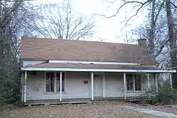 Jessie B. Smith House |
October 28, 1983 (#83003541) |
Off U.S. Route 79 33°48′52″N 92°24′27″W |
Fordyce | |
| 33 | Tennessee, Alabama & Georgia Railway Steam Locomotive #101 | 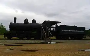 Tennessee, Alabama & Georgia Railway Steam Locomotive #101 |
January 24, 2008 (#07001425) |
Northwest of the junction of N. Main St. and the Union Pacific railroad line 33°48′46″N 92°24′42″W |
Fordyce | 1922 locomotive |
| 34 | Thomas Homestead | 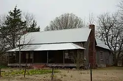 Thomas Homestead |
March 27, 1984 (#84000895) |
Off Highway 7 33°59′05″N 92°51′17″W |
Fairview | |
| 35 | Tulip Cemetery | Tulip Cemetery |
October 28, 1983 (#83003543) |
Off Highway 9 34°04′40″N 92°39′28″W |
Tulip | |
| 36 | Waters House | 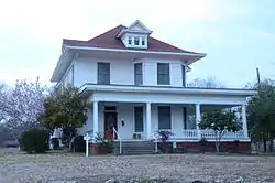 Waters House |
December 22, 1982 (#82000808) |
515 Oak St. 33°48′51″N 92°24′54″W |
Fordyce | |
| 37 | Welch Pottery Works | May 12, 1975 (#75000383) |
Address Restricted |
Tulip | ||
| 38 | Wommack Kiln | June 10, 1975 (#75000384) |
Southeast of Wave on Wave Rd. 34°01′10″N 92°40′56″W |
Wave | ||
| 39 | Wynne House | 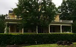 Wynne House |
October 28, 1983 (#83003544) |
4th St. 33°48′45″N 92°25′00″W |
Fordyce |
Former listings
| [3] | Name on the Register | Image | Date listed | Date removed | Location | City or town | Summary |
|---|---|---|---|---|---|---|---|
| 1 | Brewster House | 1983 (#83003464) | January 14, 2002 | U.S. Route 79 |
Fordyce | ||
| 2 | Koonce Building | 1983 (#83003525) | January 14, 2002 | 3rd Street |
Fordyce | ||
| 3 | Old Fordyce Post Office | 1983 (#83003530) | January 14, 2002 | E. 2nd Street |
Fordyce | ||
| 4 | Princeton Methodist Church | 1983 (#83003533) | January 14, 2002 | Arkansas Highway 9 |
Princeton |
See also
| Wikimedia Commons has media related to National Register of Historic Places in Dallas County, Arkansas. |
References
- The latitude and longitude information provided in this table was derived originally from the National Register Information System, which has been found to be fairly accurate for about 99% of listings. Some locations in this table may have been corrected to current GPS standards.
- "National Register of Historic Places: Weekly List Actions". National Park Service, United States Department of the Interior. Retrieved on February 5, 2021.
- Numbers represent an alphabetical ordering by significant words. Various colorings, defined here, differentiate National Historic Landmarks and historic districts from other NRHP buildings, structures, sites or objects.
- "National Register Information System". National Register of Historic Places. National Park Service. March 13, 2009.
- The eight-digit number below each date is the number assigned to each location in the National Register Information System database, which can be viewed by clicking the number.
| Topics | |
|---|---|
| Lists by state |
|
| Lists by insular areas | |
| Lists by associated state | |
| Other areas | |
| Related | |
| |
Municipalities and communities of Dallas County, Arkansas, United States | ||
|---|---|---|
| Cities | Map of Arkansas highlighting Dallas County | |
| Unincorporated communities | ||
| ||
This article is issued from Wikipedia. The text is licensed under Creative Commons - Attribution - Sharealike. Additional terms may apply for the media files.