National Register of Historic Places listings in Poinsett County, Arkansas
This is a list of the National Register of Historic Places listings in Poinsett County, Arkansas.

Location of Poinsett County in Arkansas
This is intended to be a complete list of the properties and districts on the National Register of Historic Places in Poinsett County, Arkansas, United States.
There are 19 properties and districts listed on the National Register in the county, and one former listing.
- This National Park Service list is complete through NPS recent listings posted February 5, 2021.[1]
Current listings
| [2] | Name on the Register[3] | Image | Date listed[4] | Location | City or town | Description |
|---|---|---|---|---|---|---|
| 1 | Bacon Hotel |  Bacon Hotel |
December 13, 1995 (#95001437) |
Southeastern corner of the junction of Homestead Rd. and a railroad line 35°28′48″N 90°44′05″W |
Whitehall | |
| 2 | Harrisburg Commercial Historic District |  Harrisburg Commercial Historic District |
September 18, 2009 (#09000736) |
Roughly bounded by Jackson, Water, South, and Gould Sts. 35°33′48″N 90°43′02″W |
Harrisburg | |
| 3 | Highway A-7, Bridges Historic District | 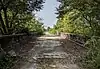 Highway A-7, Bridges Historic District |
May 12, 2009 (#09000318) |
Old U.S. Route 63 over Ditch No. 1 and its reliefs 35°30′58″N 90°23′50″W |
Marked Tree | Historic Bridges of Arkansas MPS |
| 4 | Highway A-7, Ditch No. 6 Bridge | 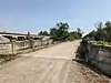 Highway A-7, Ditch No. 6 Bridge |
May 20, 2009 (#09000319) |
E. Davis St. over Ditch No. 6, southeast of Steel Bridge Rd. 35°28′55″N 90°20′37″W |
Tyronza | |
| 5 | Highway A-7, Tyronza Segment | 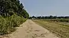 Highway A-7, Tyronza Segment |
May 20, 2009 (#09000320) |
Old U.S. Route 63 between Memphis Ave. and the Tyronza River 35°29′59″N 90°22′15″W |
Tyronza | |
| 6 | Hubbard Rice Dryer | 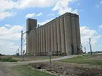 Hubbard Rice Dryer |
October 1, 2004 (#04001070) |
15015 Senteney Rd. 35°40′04″N 90°45′54″W |
Weiner | |
| 7 | Judd Hill Cotton Gin | 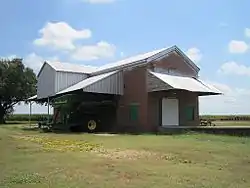 Judd Hill Cotton Gin |
September 28, 2005 (#05001080) |
Highway 214 east of Bridgewood Rd. 35°36′12″N 90°31′06″W |
Judd Hill | |
| 8 | Willie Lamb Post No. 26 American Legion Hut | 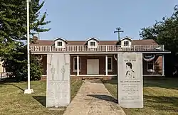 Willie Lamb Post No. 26 American Legion Hut |
January 8, 2003 (#02001674) |
205 Alexander St. 35°36′44″N 90°19′52″W |
Lepanto | |
| 9 | Lepanto Commercial Historic District |  Lepanto Commercial Historic District |
September 21, 2009 (#09000743) |
Roughly bounded by Holmes St., the Little River, Dewey St., and Alexander Ave. 35°36′41″N 90°19′49″W |
Lepanto | |
| 10 | Marked Tree Commercial Historic District | Marked Tree Commercial Historic District |
September 18, 2009 (#09000735) |
Elm St. between Liberty and Frisco Sts.; Frisco St. between Elm and Nathan Sts. 35°31′57″N 90°25′18″W |
Marked Tree | |
| 11 | Marked Tree Lock and Siphons | 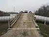 Marked Tree Lock and Siphons |
May 2, 1988 (#88000431) |
On the St. Francis River 35°35′10″N 90°25′47″W |
Marked Tree | |
| 12 | Modern News Building |  Modern News Building |
June 18, 1976 (#76000447) |
216 N. Main St. 35°33′50″N 90°43′30″W |
Harrisburg | |
| 13 | Poinsett Community Club | Poinsett Community Club |
October 9, 1986 (#86002847) |
Main and Poinsett Sts. 35°40′18″N 90°30′45″W |
Trumann | |
| 14 | Poinsett County Courthouse |  Poinsett County Courthouse |
November 3, 1989 (#89001876) |
Bounded by Market, East, Court, and Main Sts. 35°33′47″N 90°43′02″W |
Harrisburg | |
| 15 | Poinsett Lumber and Manufacturing Company Manager's House | 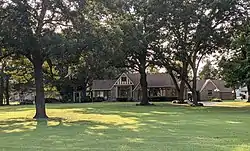 Poinsett Lumber and Manufacturing Company Manager's House |
January 21, 2010 (#09001257) |
512 Poinsett Ave. 35°40′29″N 90°31′01″W |
Trumann | |
| 16 | Rivervale Inverted Siphons |  Rivervale Inverted Siphons |
March 22, 1991 (#91000339) |
Just southwest of Highway 135 across the Little River 35°40′19″N 90°20′21″W |
Rivervale | |
| 17 | Tyronza Commercial Historic District | 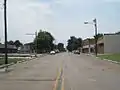 Tyronza Commercial Historic District |
July 29, 2010 (#09000896) |
S. Main St. bounded on the north by Old U.S. Highway 63 and on the south by Mullins St. 35°29′27″N 90°21′31″W |
Tyronza | |
| 18 | Tyronza Methodist Episcopal Church, South | 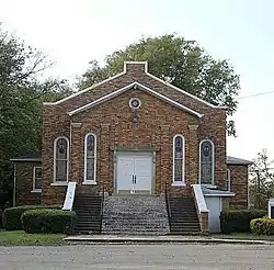 Tyronza Methodist Episcopal Church, South |
May 26, 2015 (#15000260) |
161 Church St. 35°29′24″N 90°21′35″W |
Tyronza | |
| 19 | Tyronza Water Tower | 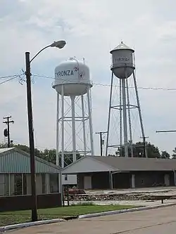 Tyronza Water Tower |
September 20, 2007 (#07000963) |
Northwest of the junction of Main St. and Oliver St. 35°29′24″N 90°21′30″W |
Tyronza |
Former listings
| [2] | Name on the Register | Image | Date listed | Date removed | Location | City or town | Summary |
|---|---|---|---|---|---|---|---|
| 1 | Maxie Theatre | 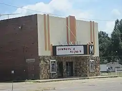 Maxie Theatre |
April 7, 2011 (#10000933) | September 8, 2020 | 136 Arkansas Highway 463 S. 35°40′14″N 90°30′59″W |
Trumann |
See also
| Wikimedia Commons has media related to National Register of Historic Places in Poinsett County, Arkansas. |
References
- "National Register of Historic Places: Weekly List Actions". National Park Service, United States Department of the Interior. Retrieved on February 5, 2021.
- Numbers represent an alphabetical ordering by significant words. Various colorings, defined here, differentiate National Historic Landmarks and historic districts from other NRHP buildings, structures, sites or objects.
- "National Register Information System". National Register of Historic Places. National Park Service. March 13, 2009.
- The eight-digit number below each date is the number assigned to each location in the National Register Information System database, which can be viewed by clicking the number.
| Topics | |
|---|---|
| Lists by state |
|
| Lists by insular areas | |
| Lists by associated state | |
| Other areas | |
| Related | |
| |
Municipalities and communities of Poinsett County, Arkansas, United States | ||
|---|---|---|
| Cities | Map of Arkansas highlighting Poinsett County | |
| Town | ||
| Unincorporated communities | ||
| ||
This article is issued from Wikipedia. The text is licensed under Creative Commons - Attribution - Sharealike. Additional terms may apply for the media files.