National Register of Historic Places listings in Monroe County, Arkansas
This is a list of the National Register of Historic Places listings in Monroe County, Arkansas.
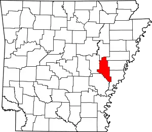
Location of Monroe County in Arkansas
This is intended to be a complete list of the properties and districts on the National Register of Historic Places in Monroe County, Arkansas, United States. The locations of National Register properties and districts for which the latitude and longitude coordinates are included below, may be seen in a map.[1]
There are 40 properties and districts listed on the National Register in the county, including 1 National Historic Landmark. Another three properties were once listed but have been removed.
- This National Park Service list is complete through NPS recent listings posted February 5, 2021.[2]
Current listings
| [3] | Name on the Register[4] | Image | Date listed[5] | Location | City or town | Description |
|---|---|---|---|---|---|---|
| 1 | Abramson House | 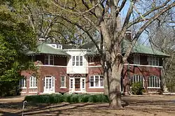 Abramson House |
September 7, 1995 (#95001092) |
127 Crescent Heights 34°35′29″N 91°11′52″W |
Holly Grove | |
| 2 | Anderson Boarding House | November 1, 1984 (#84000180) |
201 Main St. 34°41′44″N 91°19′00″W |
Clarendon | Demolished | |
| 3 | Bank of Clarendon | 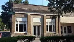 Bank of Clarendon |
November 1, 1984 (#84000183) |
125 Court St. 34°41′47″N 91°19′07″W |
Clarendon | |
| 4 | Bateman-Griffith House | 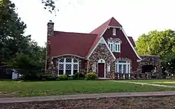 Bateman-Griffith House |
November 1, 1984 (#84000184) |
316 Jefferson St. 34°41′56″N 91°18′59″W |
Clarendon | |
| 5 | Baytown Site | 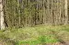 Baytown Site |
May 13, 1976 (#76000440) |
Southeastern quarter of the southwestern quarter of Section 2345, Section 2 South, Range 1 West[6] 34°22′57″N 91°03′54″W |
Indian Bay | |
| 6 | William Black Family House | 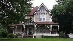 William Black Family House |
December 12, 1976 (#76000437) |
311 W. Ash St. 34°53′07″N 91°11′44″W |
Brinkley | |
| 7 | Bondi Brothers Store | 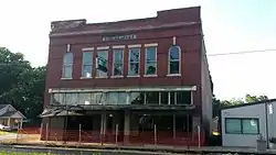 Bondi Brothers Store |
November 1, 1984 (#84000185) |
104 Madison St. 34°41′45″N 91°19′03″W |
Clarendon | |
| 8 | Bounds Building | November 1, 1984 (#84000186) |
105 2nd St. 34°41′47″N 91°19′02″W |
Clarendon | No longer standing. | |
| 9 | Brinkley Concrete Streets | 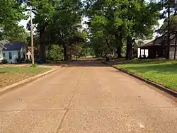 Brinkley Concrete Streets |
January 24, 2017 (#100000555) |
Ash St, between Main St. & New York Ave. & New York Ave. between Ash & Lynn Sts. 34°52′59″N 91°11′47″W |
Brinkley | |
| 10 | Capps House | 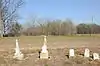 Capps House |
June 21, 1990 (#90000877) |
County Road 48 east of its junction with Highway 17 34°30′04″N 91°07′59″W |
Lawrenceville | House has been demolished. |
| 11 | Clarendon Methodist-Episcopal Church South |  Clarendon Methodist-Episcopal Church South |
November 1, 1984 (#84000187) |
121 3rd St. 34°41′53″N 91°19′01″W |
Clarendon | |
| 12 | Cumberland Presbyterian Church | _001.jpg.webp) Cumberland Presbyterian Church |
July 30, 1976 (#76000438) |
120 Washington St. 34°41′42″N 91°18′44″W |
Clarendon | |
| 13 | Ellas-McKay House | December 8, 1978 (#78000613) |
404 N. Wells St. 34°41′45″N 91°18′48″W |
Clarendon | Demolished prior to 1997 | |
| 14 | Ewan Building | November 1, 1984 (#84000188) |
124-128 2nd St. 34°41′48″N 91°19′06″W |
Clarendon | Demolished | |
| 15 | Fargo Training School Historic District | May 27, 2010 (#10000287) |
Floyd Brown Dr., east of M and A Rd. 34°57′04″N 91°10′28″W |
Fargo | ||
| 16 | Orth C. Galloway House | 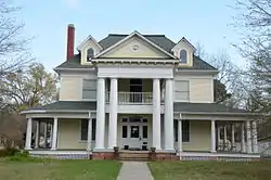 Orth C. Galloway House |
May 23, 1980 (#80000779) |
504 Park St. 34°42′02″N 91°18′46″W |
Clarendon | |
| 17 | Gazzola and Vaccaro Building | 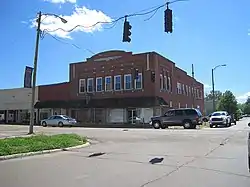 Gazzola and Vaccaro Building |
December 22, 1982 (#82000865) |
131-133 W. Cypress 34°53′14″N 91°11′34″W |
Brinkley | |
| 18 | Goldman and Son Store | November 1, 1984 (#84000189) |
101 Main St. 34°41′44″N 91°19′05″W |
Clarendon | Demolished | |
| 19 | Holly Grove Historic District | 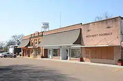 Holly Grove Historic District |
February 2, 1979 (#79000446) |
Main and Pine Sts. 34°35′44″N 91°12′03″W |
Holly Grove | |
| 20 | Holly Grove Presbyterian Church | 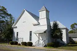 Holly Grove Presbyterian Church |
May 13, 1991 (#91000581) |
310 2nd St. 34°35′46″N 91°11′53″W |
Holly Grove | |
| 21 | Jefferies Building | November 1, 1984 (#84000191) |
122 Madison St. 34°41′43″N 91°19′03″W |
Clarendon | Demolished | |
| 22 | Jefferies-Crabtree House | 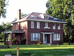 Jefferies-Crabtree House |
November 1, 1984 (#84000192) |
300 Jefferson St. 34°41′55″N 91°18′59″W |
Clarendon | Mistakenly listed as "Jefferies-Craptree House" in the NRIS[7] |
| 23 | Lair House | 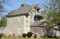 Lair House |
April 23, 1998 (#98000371) |
Junction of Stone and Elm Sts. 34°35′43″N 91°11′46″W |
Holly Grove | |
| 24 | Lick Skillet Railroad Work Station Historic District | 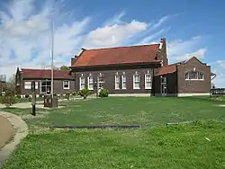 Lick Skillet Railroad Work Station Historic District |
June 1, 1992 (#92000558) |
Junction of E. Cypress St. and New Orleans Ave. 34°53′16″N 91°11′30″W |
Brinkley | |
| 25 | Lo Beele House | 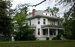 Lo Beele House |
December 22, 1982 (#82000866) |
312 New York Ave. 34°53′23″N 91°11′47″W |
Brinkley | |
| 26 | Louisiana Purchase Survey Marker |  Louisiana Purchase Survey Marker |
February 23, 1972 (#72000206) |
Southeast of Blackton at the corner of Monroe and Phillips counties 34°38′48″N 91°03′05″W |
Blackton | Extends into Lee and Phillips counties |
| 27 | Manning, Lee and Moore Law Office | 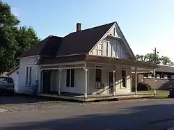 Manning, Lee and Moore Law Office |
November 1, 1984 (#84000193) |
109 Court St. 34°41′46″N 91°19′07″W |
Clarendon | |
| 28 | Marston House | 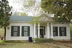 Marston House |
November 1, 1984 (#84000194) |
429 Main St. 34°41′44″N 91°18′44″W |
Clarendon | |
| 29 | Memphis to Little Rock Road-Henard Cemetery Road Segment | May 30, 2003 (#03000470) |
Henard Cemetery Rd. 34°59′22″N 91°09′13″W |
Zent | Segment of the Trail of Tears | |
| 30 | Merchants and Planters Bank | 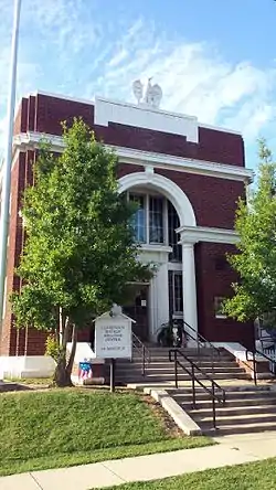 Merchants and Planters Bank |
December 22, 1982 (#82000867) |
214 Madison 34°41′35″N 91°18′49″W |
Clarendon | |
| 31 | Midland Depot | 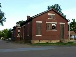 Midland Depot |
November 1, 1984 (#84000195) |
205 Midland St. 34°41′16″N 91°18′36″W |
Clarendon | |
| 32 | Monroe County Bank Building | 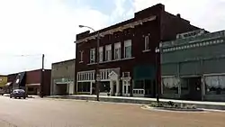 Monroe County Bank Building |
January 26, 2016 (#15000995) |
225-227 W. Cypress Sts. 34°41′33″N 91°18′51″W |
Brinkley | |
| 33 | Monroe County Courthouse | 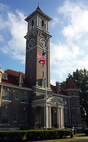 Monroe County Courthouse |
October 14, 1976 (#76000439) |
Courthouse Sq. 34°41′33″N 91°18′51″W |
Clarendon | |
| 34 | Moore-Jacobs House | 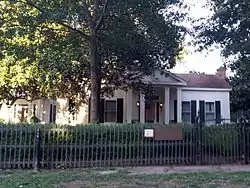 Moore-Jacobs House |
September 29, 1983 (#83001160) |
500 N. Main St. 34°41′52″N 91°18′49″W |
Clarendon | |
| 35 | Mount Zion Missionary Baptist Church | 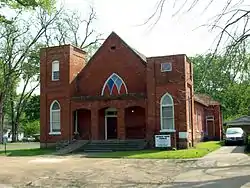 Mount Zion Missionary Baptist Church |
November 4, 1986 (#86002951) |
409 S. Main St. 34°52′56″N 91°11′39″W |
Brinkley | |
| 36 | New South Inn | November 1, 1984 (#84000196) |
132-164 2nd St. 34°41′15″N 91°18′29″W |
Clarendon | No longer standing | |
| 37 | Rusher Hotel | 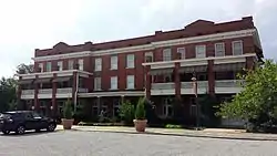 Rusher Hotel |
July 18, 1986 (#86001664) |
127 W. Cedar 34°53′15″N 91°11′32″W |
Brinkley | |
| 38 | St. John the Baptist Catholic Church |  St. John the Baptist Catholic Church |
October 2, 1992 (#92001283) |
Southwestern corner of the junction of New Orleans and W. Ash St. 34°53′07″N 91°11′35″W |
Brinkley | |
| 39 | James A. Walls House | 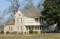 James A. Walls House |
June 9, 1980 (#80000780) |
Off Highway 17 34°35′45″N 91°11′38″W |
Holly Grove | |
| 40 | Ellis and Charlotte Williamson House | February 3, 2020 (#100004944) |
126 West Cloverdale Dr. 34°53′55″N 91°12′03″W |
Brinkley |
Former listings
| [3] | Name on the Register | Image | Date listed | Date removed | Location | City or town | Summary |
|---|---|---|---|---|---|---|---|
| 1 | Highway 79 Bridge |  Highway 79 Bridge |
November 1, 1984 (#84000190, 15000629) | September 8, 2020 | U.S. Route 79 over the White River 34°41′22″N 91°19′01″W |
Clarendon | Boundary increase September 28, 2015. |
| 2 | Monroe County Jail | April 11, 1977 (#77000262) | August 11, 1999 | 2nd and Kendall |
Clarendon | ||
| 3 | Palmer House |  Palmer House |
May 4, 1976 (#76000436) | January 22, 2014 | Southeast of Blackton off U.S. Route 49 34°38′12″N 91°04′22″W |
Blackton |
See also
| Wikimedia Commons has media related to National Register of Historic Places in Monroe County, Arkansas. |
References
- The latitude and longitude information provided in this table was derived originally from the National Register Information System, which has been found to be fairly accurate for about 99% of listings. Some locations in this table may have been corrected to current GPS standards.
- "National Register of Historic Places: Weekly List Actions". National Park Service, United States Department of the Interior. Retrieved on February 5, 2021.
- Numbers represent an alphabetical ordering by significant words. Various colorings, defined here, differentiate National Historic Landmarks and historic districts from other NRHP buildings, structures, sites or objects.
- "National Register Information System". National Register of Historic Places. National Park Service. March 13, 2009.
- The eight-digit number below each date is the number assigned to each location in the National Register Information System database, which can be viewed by clicking the number.
- Phillips, Philip, et al. Archaeological Survey in the Lower Mississippi Alluvial Valley 1940-1947. Reprint ed. Tuscaloosa: U of Alabama P, 2003, 51.
- "Jefferies-Crabtree House, Clarendon, Monroe County". Arkansas Historic Preservation Program. Archived from the original on September 13, 2013. Retrieved September 13, 2013.
| Topics | |
|---|---|
| Lists by state |
|
| Lists by insular areas | |
| Lists by associated state | |
| Other areas | |
| Related | |
| |
Municipalities and communities of Monroe County, Arkansas, United States | ||
|---|---|---|
| Cities | Map of Arkansas highlighting Monroe County | |
| Towns | ||
| Unincorporated communities | ||
| Footnotes | ‡This populated place also has portions in an adjacent county or counties | |
| ||
This article is issued from Wikipedia. The text is licensed under Creative Commons - Attribution - Sharealike. Additional terms may apply for the media files.