National Register of Historic Places listings in Searcy County, Arkansas
This is a list of the National Register of Historic Places listings in Searcy County, Arkansas.
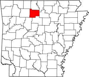
Location of Searcy County in Arkansas
This is intended to be a complete list of the properties and districts on the National Register of Historic Places in Searcy County, Arkansas, United States. The locations of National Register properties and districts for which the latitude and longitude coordinates are included below, may be seen in a map.[1]
There are 51 properties and districts listed on the National Register in the county.
- This National Park Service list is complete through NPS recent listings posted February 5, 2021.[2]
Current listings
| [3] | Name on the Register[4] | Image | Date listed[5] | Location | City or town | Description |
|---|---|---|---|---|---|---|
| 1 | 3SE33 | June 29, 1976 (#76000468) |
Address Restricted |
Silver Hill | AKA the Calf Creek site, a major archaeological site on the Buffalo River. | |
| 2 | Aday-Stephenson House | December 2, 1993 (#93001365) |
Pine St. 35°54′22″N 92°37′29″W |
Marshall | No longer standing. | |
| 3 | American Legion Post No. 131 | 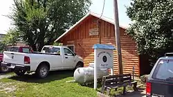 American Legion Post No. 131 |
December 2, 1993 (#93001369) |
Center St. west of its junction with Walnut St. 35°49′46″N 92°33′36″W |
Leslie | |
| 4 | Bank of Marshall Building | 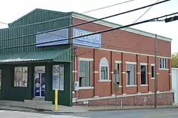 Bank of Marshall Building |
October 4, 1993 (#93000974) |
Southeastern corner of the junction of Main and Center Sts. 35°54′33″N 92°37′53″W |
Marshall | |
| 5 | Guy Bartley House |  Guy Bartley House |
December 2, 1993 (#93001372) |
Northeastern corner of the junction of Elm and 5th Sts. 35°50′02″N 92°33′25″W |
Leslie | |
| 6 | Bates Tourist Court | 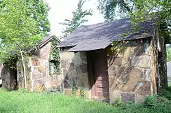 Bates Tourist Court |
October 4, 1993 (#93000979) |
Fair St. 35°54′39″N 92°37′56″W |
Marshall | |
| 7 | Bromley-Mills-Treece House | 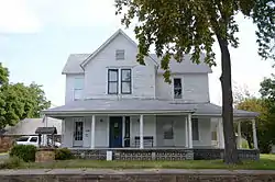 Bromley-Mills-Treece House |
October 4, 1993 (#93000966) |
Main St. 35°54′32″N 92°37′43″W |
Marshall | |
| 8 | Noah Bryan Store | 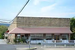 Noah Bryan Store |
August 18, 1993 (#93000760) |
Southwestern corner of the junction of Glade and Main Sts. 35°54′33″N 92°37′56″W |
Marshall | |
| 9 | Campbell Post Office-Kuykendall General Store | 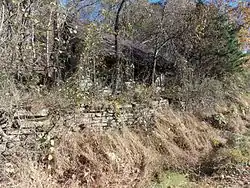 Campbell Post Office-Kuykendall General Store |
December 2, 1993 (#93001364) |
County Road 73 northwest of Oxley 35°52′19″N 92°28′35″W |
Oxley | No longer standing. |
| 10 | Dr. Clay House | 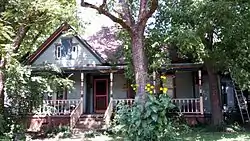 Dr. Clay House |
December 2, 1993 (#93001368) |
Junction of Walnut and Center Sts. 35°49′46″N 92°33′33″W |
Leslie | |
| 11 | Cooper's Bluff | May 4, 1982 (#82002132) |
Address Restricted |
Snowball | part of the Rock Art Sites in Arkansas Thematic Resource (TR) | |
| 12 | Dr. J.O. Cotton House | 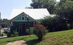 Dr. J.O. Cotton House |
December 2, 1993 (#93001366) |
Southeastern corner of the junction of Highway 66 and High St. 35°49′49″N 92°33′28″W |
Leslie | |
| 13 | Dr. Sam G. Daniel House | 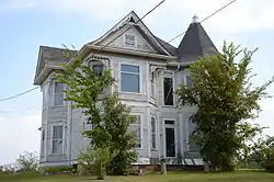 Dr. Sam G. Daniel House |
August 18, 1993 (#93000759) |
Northern side of Nome St., one block west of Courthouse Square 35°54′36″N 92°37′57″W |
Marshall | |
| 14 | Farmers Bank Building | 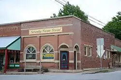 Farmers Bank Building |
August 18, 1993 (#93000753) |
Junction of Main and Walnut Sts. 35°49′44″N 92°33′35″W |
Leslie | |
| 15 | Bud Fendley House | 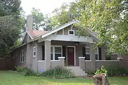 Bud Fendley House |
August 18, 1993 (#93000816) |
201 Spring St. 35°54′28″N 92°37′45″W |
Marshall | |
| 16 | Ferguson Gas Station | October 4, 1993 (#93000967) |
Southeastern corner of the junction of Center and U.S. Highway 65 35°54′37″N 92°37′52″W |
Marshall | ||
| 17 | T.M. Ferguson House | October 4, 1993 (#93000972) |
Canaan St. 35°54′29″N 92°38′05″W |
Marshall | No longer standing. | |
| 18 | Zeb Ferguson House | October 4, 1993 (#93000968) |
U.S. Highway 65 35°54′39″N 92°37′51″W |
Marshall | No longer standing. | |
| 19 | Gates-Helm Farm |  Gates-Helm Farm |
August 18, 1993 (#93000817) |
County Road 13, approximately 1 mile (1.6 km) north of its junction with County Road 250 35°55′16″N 92°50′04″W |
Snowball | |
| 20 | Mary Greenhaw Memorial Methodist Episcopal Church South | 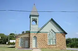 Mary Greenhaw Memorial Methodist Episcopal Church South |
September 24, 2012 (#12000805) |
115 E. Nome St. 35°54′36″N 92°37′49″W |
Marshall | |
| 21 | Columbus Hatchett House | 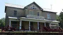 Columbus Hatchett House |
August 18, 1993 (#93000756) |
Northern side of the junction of Main and Hazel Sts. 35°49′40″N 92°33′26″W |
Leslie | |
| 22 | Henley Hotel | 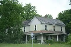 Henley Hotel |
January 24, 2011 (#10001152) |
112 U.S. Highway 65 North 36°01′47″N 92°48′09″W |
St. Joe | |
| 23 | Benjamin Franklin Henley House | 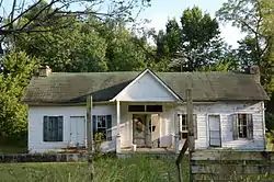 Benjamin Franklin Henley House |
December 5, 1985 (#85003070) |
Off U.S. Highway 65 36°02′15″N 92°47′09″W |
St. Joe | |
| 24 | Dr. Cleveland Hollabaugh House |  Dr. Cleveland Hollabaugh House |
December 2, 1993 (#93001371) |
Oak St. 35°49′56″N 92°33′34″W |
Leslie | |
| 25 | S.A. Lay House |  S.A. Lay House |
October 4, 1993 (#93000971) |
Junction of Glade St. and U.S. Highway 65 35°54′38″N 92°37′55″W |
Marshall | |
| 26 | Leslie Commercial Historic District | 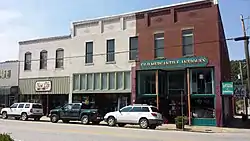 Leslie Commercial Historic District |
July 3, 2017 (#100001257) |
319-424 Main and 205 Oak Sts. 35°49′46″N 92°33′36″W |
Leslie | |
| 27 | Leslie-Rolen House |  Leslie-Rolen House |
August 18, 1993 (#93000815) |
Junction of Cherry and High Sts. 35°49′48″N 92°33′25″W |
Leslie | |
| 28 | Anthony Luna House | 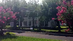 Anthony Luna House |
October 4, 1993 (#93000975) |
Southwestern corner of the junction of Main and Spring Sts. 35°54′33″N 92°37′50″W |
Marshall | |
| 29 | Thomas Lynch House | August 18, 1993 (#93000757) |
County Road 52, approximately 2.5 miles (4.0 km) north of Morning Star 36°00′18″N 92°35′52″W |
Morning Star | ||
| 30 | Sam Marshall House | October 4, 1993 (#93000980) |
County Road 163 35°58′14″N 92°35′05″W |
Morning Star | ||
| 31 | William P. and Rosa Lee Martin Farm | June 15, 2011 (#11000356) |
7429 Campbell Rd. 35°56′04″N 92°28′26″W |
Marshall | ||
| 32 | Mays General Store | 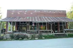 Mays General Store |
September 1, 1983 (#83001166) |
Front St. 35°59′20″N 92°42′57″W |
Gilbert | |
| 33 | J.M. McCall House | 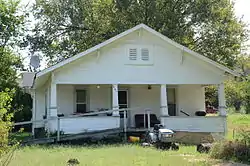 J.M. McCall House |
October 4, 1993 (#93000970) |
Spring St. 35°54′18″N 92°37′46″W |
Marshall | |
| 34 | Vinie McCall House | October 4, 1993 (#93000969) |
Spring St. 35°54′20″N 92°37′45″W |
Marshall | No longer standing. | |
| 35 | Meek Building | 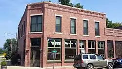 Meek Building |
November 15, 2000 (#00001367) |
Junction of Main and Oak Sts. 35°49′47″N 92°33′36″W |
Leslie | |
| 36 | J.C. Miller House | 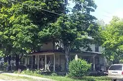 J.C. Miller House |
December 2, 1993 (#93001370) |
Northwestern corner of the junction of Oak and High Sts. 35°49′56″N 92°33′34″W |
Leslie | |
| 37 | Missouri and North Arkansas Depot-Leslie | 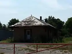 Missouri and North Arkansas Depot-Leslie |
June 11, 1992 (#92000613) |
Southwestern end of Walnut St. 35°49′38″N 92°33′32″W |
Leslie | |
| 38 | Oak Hill School House | January 24, 2019 (#100003339) |
151 Little Oak Hill Rd. 35°49′21″N 92°43′49″W |
Marshall | ||
| 39 | Old Searcy County Jail | 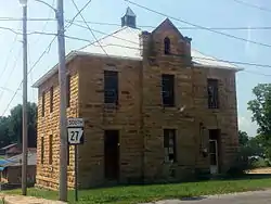 Old Searcy County Jail |
May 28, 2010 (#10000290) |
Highway 27 (Center St.) 35°54′35″N 92°37′54″W |
Marshall | |
| 40 | Charley Passmore House |  Charley Passmore House |
October 4, 1993 (#93000978) |
Campus St. 35°54′19″N 92°37′56″W |
Marshall | |
| 41 | Oscar Redman Building | 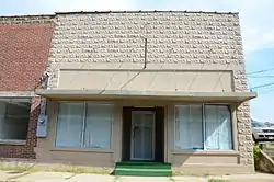 Oscar Redman Building |
August 18, 1993 (#93000758) |
119 E. Main St. 35°54′34″N 92°37′52″W |
Marshall | |
| 42 | W.F. Reeves House | October 4, 1993 (#93000977) |
Short St. 35°54′48″N 92°38′02″W |
Marshall | No longer standing. | |
| 43 | Dr. Robinson House | December 2, 1993 (#93001367) |
Walnut St. east of its junction with Center St. 35°49′46″N 92°33′31″W |
Leslie | No longer standing. | |
| 44 | St. Joe Missouri and North Arkansas Railroad Depot | 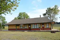 St. Joe Missouri and North Arkansas Railroad Depot |
September 16, 1993 (#93000988) |
Southern side of U.S. Highway 65 36°01′47″N 92°48′09″W |
St. Joe | |
| 45 | Sanders-Hollabaugh House |  Sanders-Hollabaugh House |
October 4, 1993 (#93000976) |
Church St. 35°54′39″N 92°37′47″W |
Marshall | |
| 46 | Searcy County Courthouse | 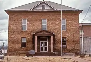 Searcy County Courthouse |
October 21, 1976 (#76000467) |
Courthouse Sq. 35°54′34″N 92°37′55″W |
Marshall | |
| 47 | Snowball Gymnasium | September 16, 2020 (#100005592) |
Cty. Rd. 12, .1 mile west of Harvest Ln. 35°54′24″N 92°49′29″W |
Snowball | ||
| 48 | Greene Thomas House | 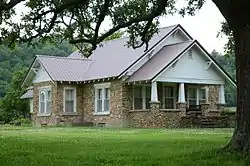 Greene Thomas House |
August 18, 1993 (#93000755) |
West of County Road 55, 0.25 miles (0.40 km) south of its junction with County Road 74 35°51′32″N 92°33′58″W |
Leslie | |
| 49 | Treat Commercial Building | 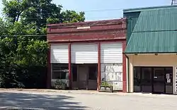 Treat Commercial Building |
August 18, 1993 (#93000752) |
Northwestern side of Oak St. between High and 4th Sts. 35°49′49″N 92°33′36″W |
Leslie | |
| 50 | Jasper E. Treece Building | 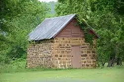 Jasper E. Treece Building |
August 18, 1993 (#93000754) |
West of County Road 55, approximately 0.5 miles (0.80 km) south of its junction with Highway 74 35°54′16″N 92°35′44″W |
Baker | |
| 51 | Willmering Tourist Cabins Historic District | 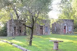 Willmering Tourist Cabins Historic District |
November 15, 2000 (#00001361) |
U.S. Highway 65 35°58′09″N 92°44′52″W |
Silver Hill |
Former listings
| [3] | Name on the Register | Image | Date listed | Date removed | Location | City or town | Summary |
|---|---|---|---|---|---|---|---|
| 1 | Dugger and Schultz Millinery Store Building | October 4, 1993 (#93000973) | January 26, 2018 | Southwestern corner of the junction of Glade and Nome Sts. 35°54′35″N 92°37′57″W |
Marshall | Demolished. Now site of the Marshall Post Office. |
See also
| Wikimedia Commons has media related to National Register of Historic Places in Searcy County, Arkansas. |
References
- The latitude and longitude information provided in this table was derived originally from the National Register Information System, which has been found to be fairly accurate for about 99% of listings. Some locations in this table may have been corrected to current GPS standards.
- "National Register of Historic Places: Weekly List Actions". National Park Service, United States Department of the Interior. Retrieved on February 5, 2021.
- Numbers represent an alphabetical ordering by significant words. Various colorings, defined here, differentiate National Historic Landmarks and historic districts from other NRHP buildings, structures, sites or objects.
- "National Register Information System". National Register of Historic Places. National Park Service. March 13, 2009.
- The eight-digit number below each date is the number assigned to each location in the National Register Information System database, which can be viewed by clicking the number.
| Topics | |
|---|---|
| Lists by state |
|
| Lists by insular areas | |
| Lists by associated state | |
| Other areas | |
| Related | |
| |
Municipalities and communities of Searcy County, Arkansas, United States | ||
|---|---|---|
| Cities | Map of Arkansas highlighting Searcy County | |
| Towns | ||
| Townships | ||
| Unincorporated communities |
| |
| Footnotes | ‡This populated place also has portions in an adjacent county or counties | |
| ||
This article is issued from Wikipedia. The text is licensed under Creative Commons - Attribution - Sharealike. Additional terms may apply for the media files.