National Register of Historic Places listings in Yell County, Arkansas
This is a list of the National Register of Historic Places listings in Yell County, Arkansas.
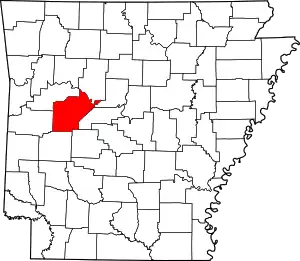
Location of Yell County in Arkansas
This is intended to be a complete list of the properties and districts on the National Register of Historic Places in Yell County, Arkansas, United States.
There are 30 properties and districts listed on the National Register in the county, and three former listings.
- This National Park Service list is complete through NPS recent listings posted February 5, 2021.[1]
Current listings
| [2] | Name on the Register[3] | Image | Date listed[4] | Location | City or town | Description |
|---|---|---|---|---|---|---|
| 1 | Archeological Site 3YE958 | November 8, 2006 (#06000838) |
Address Restricted |
Dardanelle | ||
| 2 | Brearley Cemetery Historic Section | 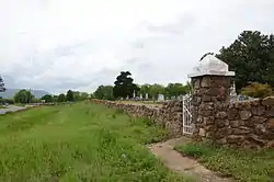 Brearley Cemetery Historic Section |
September 20, 2007 (#07000975) |
Highway 27 approximately ½ mile west of Highway 22 35°13′13″N 93°10′23″W |
Dardanelle | |
| 3 | CCC Company 749 Powder Magazine | March 30, 2007 (#07000199) |
North of Forest Service Road 4128 and south of Briggsville 34°51′19″N 93°29′57″W |
Briggsville | ||
| 4 | Thomas James Cotton House | 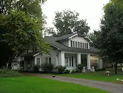 Thomas James Cotton House |
May 10, 2001 (#01000483) |
405 S. 3rd St. 35°13′12″N 93°09′21″W |
Dardanelle | |
| 5 | Dardanelle Agriculture and Post Office | 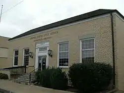 Dardanelle Agriculture and Post Office |
August 14, 1998 (#98000919) |
103 N. Front St. 35°13′14″N 93°08′50″W |
Dardanelle | |
| 6 | Dardanelle Commercial Historic District | Dardanelle Commercial Historic District |
January 28, 2009 (#08001039) |
Roughly bounded by Front, Oak, 2nd, and Pine Sts. 35°13′11″N 93°09′13″W |
Dardanelle | |
| 7 | Dardanelle Confederate Monument | 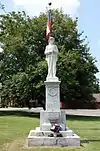 Dardanelle Confederate Monument |
April 26, 1996 (#96000456) |
Southeastern corner of the courthouse lawn, near the junction of Union and Front Sts. 35°13′26″N 93°09′23″W |
Dardanelle | |
| 8 | Evans-Neuhart House | 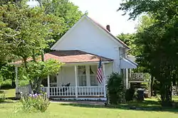 Evans-Neuhart House |
January 22, 2014 (#13001106) |
320 E. 5th St. 34°59′27″N 93°17′31″W |
Plainview | |
| 9 | First Presbyterian Church | 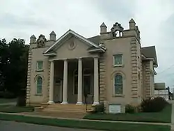 First Presbyterian Church |
July 9, 1987 (#87001156) |
2nd and Quay Sts. 35°13′15″N 93°09′17″W |
Dardanelle | |
| 10 | First Presbyterian Church-Berry House | 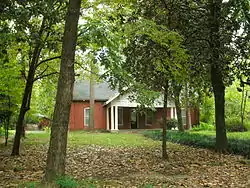 First Presbyterian Church-Berry House |
June 3, 1998 (#98000582) |
203 Pecan St. 35°13′03″N 93°09′15″W |
Dardanelle | |
| 11 | Dr. John Grace House and Hospital | 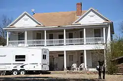 Dr. John Grace House and Hospital |
May 29, 2015 (#15000293) |
100 North Rd. 35°06′23″N 93°28′11″W |
Belleville | |
| 12 | Kimball House | 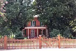 Kimball House |
June 23, 1982 (#82002151) |
713 N. Front St. 35°08′11″N 93°09′25″W |
Dardanelle | |
| 13 | Methodist Episcopal Church, South | 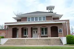 Methodist Episcopal Church, South |
November 7, 1996 (#96001275) |
Northeastern corner of the junction of Locust Dr. and 2nd St. 35°13′13″N 93°09′15″W |
Dardanelle | |
| 14 | Mitchell House | 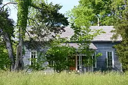 Mitchell House |
June 7, 1990 (#90000876) |
Highway 80 west of Watson Branch 34°59′04″N 93°36′58″W |
Waltreak | |
| 15 | Mountain View Farm | 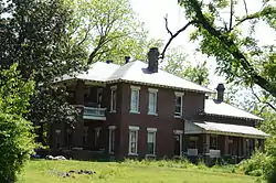 Mountain View Farm |
November 7, 1996 (#96001270) |
County Road 218, approximately 0.75 miles south of Plainview 34°58′38″N 93°17′45″W |
Plainview | |
| 16 | Mt. Nebo State Park Cabins Historic District |  Mt. Nebo State Park Cabins Historic District |
September 21, 2016 (#16000655) |
10006, 10105, 10115, and 10129 County Road 92, Mount Nebo State Park 35°13′32″N 93°15′21″W |
Dardanelle | |
| 17 | Mt. Nebo State Park Cabin No. 60 | 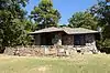 Mt. Nebo State Park Cabin No. 60 |
September 21, 2016 (#16000656) |
10707 County Road 102, Mount Nebo State Park 35°12′51″N 93°15′18″W |
Dardanelle | |
| 18 | Mt. Nebo State Park Cabin No. 61 | 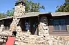 Mt. Nebo State Park Cabin No. 61 |
September 23, 2016 (#16000657) |
10775 County Road 102, Mount Nebo State Park 35°12′56″N 93°15′29″W |
Dardanelle | |
| 19 | Mt. Nebo State Park Cabin No. 62 | 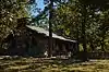 Mt. Nebo State Park Cabin No. 62 |
September 22, 2016 (#16000658) |
10913 County Road 102, Mount Nebo State Park 35°13′03″N 93°15′29″W |
Dardanelle | |
| 20 | Mt. Nebo State Park Cabin No. 63 | 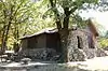 Mt. Nebo State Park Cabin No. 63 |
September 22, 2016 (#16000659) |
10919 County Road 102, Mount Nebo State Park 35°13′05″N 93°15′28″W |
Dardanelle | |
| 21 | Mt. Nebo State Park Cabin No. 64 | 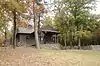 Mt. Nebo State Park Cabin No. 64 |
September 26, 2016 (#16000660) |
10070 County Road 93, Mount Nebo State Park 35°13′15″N 93°15′27″W |
Dardanelle | |
| 22 | Mt. Nebo State Park Cabin No. 65 | 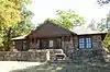 Mt. Nebo State Park Cabin No. 65 |
September 19, 2016 (#16000661) |
10034 County Road 92, Mount Nebo State Park 35°13′17″N 93°15′25″W |
Dardanelle | |
| 23 | Mt. Nebo State Park-Pavilion | 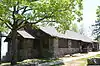 Mt. Nebo State Park-Pavilion |
May 28, 1992 (#92000542) |
North of Highway 155 in Mount Nebo State Park 35°13′13″N 93°15′01″W |
Dardanelle | |
| 24 | Old Arkansas 22-Dardanelle Segment | 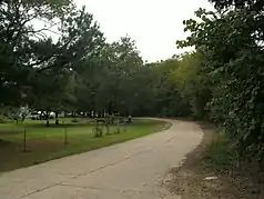 Old Arkansas 22-Dardanelle Segment |
January 24, 2008 (#07001438) |
County Road 906, ½ mile west of the junction of Highway 22 and County Road 51 35°14′49″N 93°11′48″W |
Dardanelle | |
| 25 | Spring Lake Bridge |  Spring Lake Bridge |
June 21, 1990 (#90000510) |
Highway 307 over Bob Barnes Branch 35°09′04″N 93°25′54″W |
Belleville | |
| 26 | Spring Lake Recreation Area Historic District | 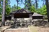 Spring Lake Recreation Area Historic District |
September 11, 1995 (#94001613) |
Forest Service Rd. 1602 in the Ozark-St. Francis National Forest 35°09′12″N 93°25′30″W |
Stafford | |
| 27 | Steamboat House | 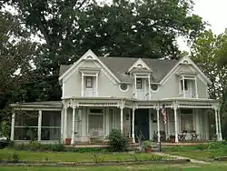 Steamboat House |
June 5, 1975 (#75000420) |
601 N. Front St. 35°13′34″N 93°09′25″W |
Dardanelle | |
| 28 | Sulphur Springs Cemetery | 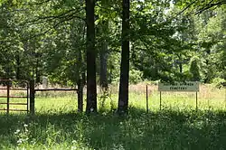 Sulphur Springs Cemetery |
February 21, 2012 (#12000038) |
Slo Fork Rd. 35°11′32″N 93°19′31″W |
Sulphur Springs | |
| 29 | Ward's Crossing Bridge | 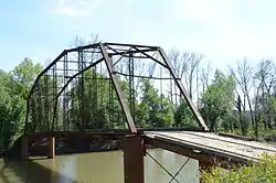 Ward's Crossing Bridge |
June 4, 2008 (#08000491) |
County Road 8 34°56′40″N 93°19′41″W |
Plainview | Camelback through truss |
| 30 | Yell County Courthouse |  Yell County Courthouse |
September 8, 1992 (#92001176) |
209 Union St. 35°13′26″N 93°09′23″W |
Dardanelle |
Former listings
| [2] | Name on the Register | Image | Date listed | Date removed | Location | City or town | Summary |
|---|---|---|---|---|---|---|---|
| 1 | Achmun Creek Bridge | April 9, 1990 (#90000539) | August 11, 1999 | Co. Rd. 222, over Achmun Creek |
Ola | Replaced in 1989. | |
| 2 | Mickles Bridge | August 16, 2007 (#07000437) | May 27, 2014 | Spanning the Petit Jean River 0.25 miles north of Highway 10 and approximately 1 mile west of County Road 49 35°04′27″N 93°17′51″W |
Mickles | ||
| 3 | Petit Jean River Bridge | 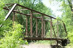 Petit Jean River Bridge |
January 21, 2010 (#09001263) | September 30, 2019 | County Road 49 over the Petit Jean River 35°04′37″N 93°14′29″W |
Ola |
See also
| Wikimedia Commons has media related to National Register of Historic Places in Yell County, Arkansas. |
References
- "National Register of Historic Places: Weekly List Actions". National Park Service, United States Department of the Interior. Retrieved on February 5, 2021.
- Numbers represent an alphabetical ordering by significant words. Various colorings, defined here, differentiate National Historic Landmarks and historic districts from other NRHP buildings, structures, sites or objects.
- "National Register Information System". National Register of Historic Places. National Park Service. March 13, 2009.
- The eight-digit number below each date is the number assigned to each location in the National Register Information System database, which can be viewed by clicking the number.
| Topics | |
|---|---|
| Lists by state |
|
| Lists by insular areas | |
| Lists by associated state | |
| Other areas | |
| Related | |
| |
Municipalities and communities of Yell County, Arkansas, United States | ||
|---|---|---|
| Cities | Map of Arkansas highlighting Yell County | |
| Town | ||
| Unincorporated communities | ||
| Footnotes | ‡This populated place also has portions in an adjacent county or counties | |
| ||
This article is issued from Wikipedia. The text is licensed under Creative Commons - Attribution - Sharealike. Additional terms may apply for the media files.