National Register of Historic Places listings in Little River County, Arkansas
This is a list of the National Register of Historic Places listings in Little River County, Arkansas.
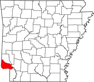
Location of Little River County in Arkansas
This is intended to be a complete list of the properties and districts on the National Register of Historic Places in Little River County, Arkansas, United States. The locations of National Register properties and districts for which the latitude and longitude coordinates are included below, may be seen in a map.[1]
There are 16 properties and districts listed on the National Register in the county, and one former listing.
- This National Park Service list is complete through NPS recent listings posted January 29, 2021.[2]
Current listings
| [3] | Name on the Register[4] | Image | Date listed[5] | Location | City or town | Description |
|---|---|---|---|---|---|---|
| 1 | Anderson-Hobson Mercantile Store | 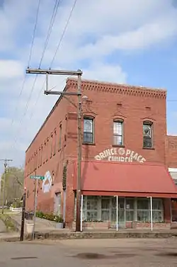 Anderson-Hobson Mercantile Store |
June 20, 1996 (#96000642) |
201 Schuman St. 33°43′19″N 94°23′49″W |
Foreman | |
| 2 | Ashdown Commercial Historic District | 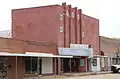 Ashdown Commercial Historic District |
May 20, 2008 (#08000439) |
Roughly bounded by Keller, E. Main Commerce, and N. Constitution Sts. 33°40′27″N 94°07′52″W |
Ashdown | |
| 3 | Judge Jefferson Thomas Cowling House |  Judge Jefferson Thomas Cowling House |
December 8, 1988 (#88002823) |
611 Willow St. 33°40′44″N 94°07′44″W |
Ashdown | |
| 4 | Hawkins House | 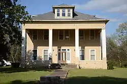 Hawkins House |
June 20, 1996 (#96000641) |
Northwestern corner of the junction of 3rd Ave. and 3rd St. 33°43′24″N 94°24′03″W |
Foreman | |
| 5 | Hunter-Coulter House | 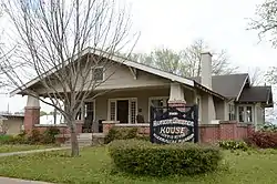 Hunter-Coulter House |
June 20, 1996 (#96000633) |
Northwestern corner of the junction of 2nd and Commerce Sts. 33°40′21″N 94°07′56″W |
Ashdown | |
| 6 | Little River County Courthouse | .jpg.webp) Little River County Courthouse |
September 29, 1976 (#76000427) |
Main and 2nd Sts. 33°40′20″N 94°07′58″W |
Ashdown | 1907 neoclassical-style courthouse |
| 7 | Little River County Training School Historic District | 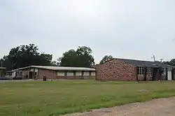 Little River County Training School Historic District |
January 26, 2016 (#15000994) |
100 W. Hamilton St. 33°40′07″N 94°07′59″W |
Ashdown | |
| 8 | Memphis, Paris and Gulf Railroad Depot | .jpg.webp) Memphis, Paris and Gulf Railroad Depot |
March 17, 1994 (#94000192) |
Northern corner of the junction of Whitaker Ave. and Frisco St. 33°40′26″N 94°07′42″W |
Ashdown | |
| 9 | Mills Cemetery | 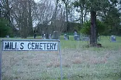 Mills Cemetery |
September 27, 2007 (#07000992) |
County Road 40, approximately 1⁄8-mile west of U.S. Route 71, N. 33°46′22″N 94°09′05″W |
Wilton | |
| 10 | New Rocky Comfort Jail |  New Rocky Comfort Jail |
December 9, 1994 (#94001465) |
Southeastern corner of the junction of 3rd and Schuman Sts. 33°43′22″N 94°23′46″W |
Foreman | |
| 11 | Old US 71-Ashdown Segment | 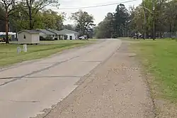 Old US 71-Ashdown Segment |
January 29, 2013 (#12001232) |
N. Park Ave. between E. Main St. & US 71 33°40′46″N 94°07′56″W |
Ashdown | |
| 12 | Old US 71-Ogden Segment | 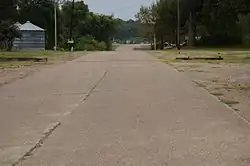 Old US 71-Ogden Segment |
January 29, 2013 (#12001230) |
Ogden & Grand Sts., west of US 71 & east of Kansas City Southern Railroad 33°34′58″N 94°02′33″W |
Ogden | |
| 13 | Old US 71-Wilton Segment |  Old US 71-Wilton Segment |
May 26, 2004 (#04000492) |
East of U.S. Route 71 from Old U.S. Route 71 and the U.S. Route 71 junction north to the southern bank of the Little River 33°46′04″N 94°08′49″W |
Wilton | |
| 14 | Will Reed Farm House |  Will Reed Farm House |
July 14, 1978 (#78000606) |
Main St. 33°46′20″N 94°15′36″W |
Alleene | |
| 15 | St. Barnabas Episcopal Church | 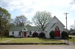 St. Barnabas Episcopal Church |
July 23, 1998 (#98000910) |
Junction of Tracy Lawrence Ave. and Bell St. 33°43′51″N 94°23′43″W |
Foreman | |
| 16 | Texarkana and Fort Smith Railway Depot |  Texarkana and Fort Smith Railway Depot |
January 24, 2008 (#07001428) |
Texarkana Ave. 33°44′32″N 94°08′56″W |
Wilton |
Former listing
| [3] | Name on the Register | Image | Date listed | Date removed | Location | City or town | Summary |
|---|---|---|---|---|---|---|---|
| 1 | S.S.P. Mills and Son Building | 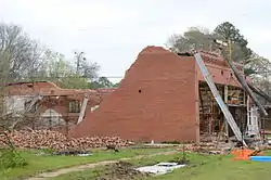 S.S.P. Mills and Son Building |
June 20, 1996 (#96000631) | January 27, 2014 | Northwestern corner of the junction of Texarkana Ave. and Main St. 33°44′25″N 94°08′54″W |
Wilton |
See also
| Wikimedia Commons has media related to National Register of Historic Places in Little River County, Arkansas. |
References
- The latitude and longitude information provided in this table was derived originally from the National Register Information System, which has been found to be fairly accurate for about 99% of listings. Some locations in this table may have been corrected to current GPS standards.
- "National Register of Historic Places: Weekly List Actions". National Park Service, United States Department of the Interior. Retrieved on January 29, 2021.
- Numbers represent an alphabetical ordering by significant words. Various colorings, defined here, differentiate National Historic Landmarks and historic districts from other NRHP buildings, structures, sites or objects.
- "National Register Information System". National Register of Historic Places. National Park Service. March 13, 2009.
- The eight-digit number below each date is the number assigned to each location in the National Register Information System database, which can be viewed by clicking the number.
| Topics | |
|---|---|
| Lists by state |
|
| Lists by insular areas | |
| Lists by associated state | |
| Other areas | |
| Related | |
| |
Municipalities and communities of Little River County, Arkansas, United States | ||
|---|---|---|
| Cities | Map of Arkansas highlighting Little River County | |
| CDP | ||
| Unincorporated communities | ||
| ||
This article is issued from Wikipedia. The text is licensed under Creative Commons - Attribution - Sharealike. Additional terms may apply for the media files.