National Register of Historic Places listings in Independence County, Arkansas
This is a list of the National Register of Historic Places listings in Independence County, Arkansas.

Location of Independence County in Arkansas
This is intended to be a complete list of the properties and districts on the National Register of Historic Places in Independence County, Arkansas, United States. The locations of National Register properties and districts for which the latitude and longitude coordinates are included below, may be seen in a map.[1]
There are 42 properties and districts listed on the National Register in the county. Another 2 properties were once listed but were removed.
- This National Park Service list is complete through NPS recent listings posted February 5, 2021.[2]
Current listings
| [3] | Name on the Register[4] | Image | Date listed[5] | Location | City or town | Description |
|---|---|---|---|---|---|---|
| 1 | Adler House | 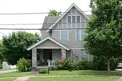 Adler House |
December 22, 1982 (#82000833) |
292 Boswell St. 35°46′09″N 91°39′02″W |
Batesville | |
| 2 | Akron Cemetery | 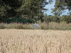 Akron Cemetery |
October 4, 2002 (#02001072) |
Approximately 2 miles south of Newark on Highway 122 35°39′53″N 91°26′58″W |
Newark | |
| 3 | Bartlett-Kirk House | 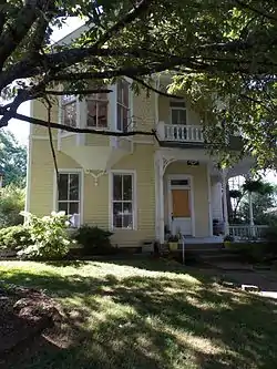 Bartlett-Kirk House |
August 16, 1994 (#94000856) |
910 College St. 35°46′25″N 91°38′41″W |
Batesville | |
| 4 | Batesville Commercial Historic District | 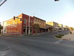 Batesville Commercial Historic District |
October 7, 1982 (#82000834) |
Main and Central Sts.; also Main St. from north of Central to one block north of Church; also roughly Main between State & 5th Sts., Broad between Main & Boswell Sts., Central Ave. between College Ave. & RR. 35°46′19″N 91°39′14″W |
Batesville | Second and third sets of address represent boundary increases approved October 5, 1990 and January 24, 2019. |
| 5 | Batesville Confederate Monument | 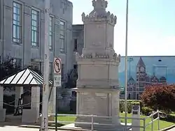 Batesville Confederate Monument |
May 3, 1996 (#96000504) |
Northeastern corner of the courthouse lawn, at the junction of S. Broad St. and W. Main St. 35°46′13″N 91°39′10″W |
Batesville | |
| 6 | Batesville East Main Historic District | 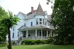 Batesville East Main Historic District |
December 22, 1983 (#83003546) |
Main St. between 7th and 11th Sts.; also 1011, 1041, 1063, and 1087 College Ave. 35°46′28″N 91°38′45″W |
Batesville | College Avenue addresses represent a boundary increase of December 27, 1996 |
| 7 | Bethel African Methodist Episcopal Church | 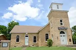 Bethel African Methodist Episcopal Church |
October 16, 1986 (#86002875) |
895 Oak St. 35°46′20″N 91°38′14″W |
Batesville | |
| 8 | Big Botton Slough Bridge | .JPG.webp) Big Botton Slough Bridge |
September 24, 2004 (#04001042) |
County Road 58 (Padgett Island Rd.), approximately 2.5 miles south of Highway 69 35°40′19″N 91°28′38″W |
Magness | |
| 9 | Cedar Creek Bridge | 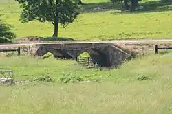 Cedar Creek Bridge |
May 18, 1995 (#95000613) |
County Road 235 over Cedar Creek, approximately 1.5 miles south of its junction with Highway 14 35°38′34″N 91°32′26″W |
Rosie | |
| 10 | Central Avenue Bridge | 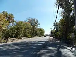 Central Avenue Bridge |
January 21, 2010 (#09001248) |
Central Avenue over Polk Bayou 35°46′16″N 91°39′19″W |
Batesville | |
| 11 | Cook-Morrow House | 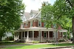 Cook-Morrow House |
July 29, 1977 (#77000256) |
875 Main St. 35°46′27″N 91°38′50″W |
Batesville | |
| 12 | Dearing House | 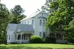 Dearing House |
May 3, 1976 (#76000419) |
Highway 122 35°42′09″N 91°26′23″W |
Newark | |
| 13 | Franklin Desha House | October 9, 1986 (#86002844) |
Address Restricted |
Desha | ||
| 14 | Edward Dickinson House | 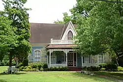 Edward Dickinson House |
November 26, 1986 (#86002907) |
672 E. Boswell St. 35°46′17″N 91°38′48″W |
Batesville | |
| 15 | Dondy Building | 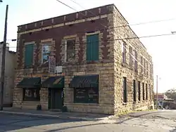 Dondy Building |
December 22, 1982 (#82000824) |
154 S. 3rd 35°46′14″N 91°39′06″W |
Batesville | |
| 16 | Garrott House | 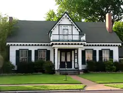 Garrott House |
June 24, 1971 (#71000125) |
561 E. Main St. 35°46′21″N 91°38′59″W |
Batesville | |
| 17 | Glenn House | 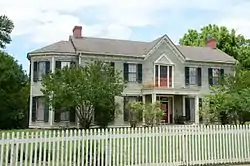 Glenn House |
May 2, 1975 (#75000389) |
653 Water St. 35°46′26″N 91°38′58″W |
Batesville | |
| 18 | Goff Petroglyph Site | May 4, 1982 (#82002117) |
Address Restricted |
Salado | ||
| 19 | Charles R. Handford House | 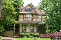 Charles R. Handford House |
May 2, 1975 (#75000390) |
658 E. Boswell St. 35°46′16″N 91°38′49″W |
Batesville | |
| 20 | James S. Handford House | 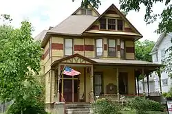 James S. Handford House |
May 2, 1975 (#75000391) |
659 E. Boswell St. 35°46′18″N 91°38′50″W |
Batesville | |
| 21 | Hankins' Store | 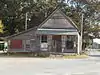 Hankins' Store |
May 23, 2014 (#14000248) |
NE. corner of Ferry Rd. & Main St. 35°37′56″N 91°27′47″W |
Oil Trough | |
| 22 | Hulsey Bend School | 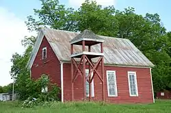 Hulsey Bend School |
February 12, 1999 (#99000153) |
Freeze Bend Rd., 0.7 miles east of the junction of Highways 14 and 122 35°38′07″N 91°25′05″W |
Oil Trough | |
| 23 | Jamestown School | 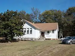 Jamestown School |
September 4, 1992 (#92001106) |
North of Highway 230 35°41′50″N 91°42′13″W |
Jamestown | |
| 24 | Lee's Chapel Church and Masonic Hall | 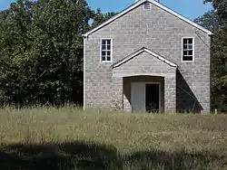 Lee's Chapel Church and Masonic Hall |
May 10, 2001 (#01000482) |
8 miles east on Sandtown Rd. 35°54′09″N 91°38′32″W |
Cushman | |
| 25 | Luster Urban Farmstead | 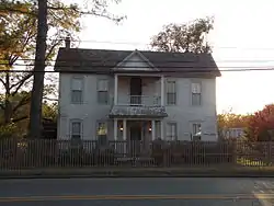 Luster Urban Farmstead |
September 16, 1983 (#83001158) |
487 N. Central Ave. 35°46′20″N 91°39′24″W |
Batesville | |
| 26 | Miller Creek Bridge | %252C_Batesville_vicinity_(Independence_County%252C_Arkansas).jpg.webp) Miller Creek Bridge |
January 21, 2010 (#09001249) |
County Road 86 over Miller Creek 35°47′00″N 91°37′10″W |
Batesville | |
| 27 | Mitchell House | 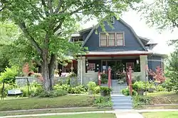 Mitchell House |
December 22, 1982 (#82000835) |
1138 Main St. 35°46′33″N 91°38′36″W |
Batesville | |
| 28 | Moorefield School | 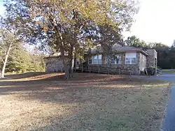 Moorefield School |
September 4, 1992 (#92001109) |
65 Ham St. 35°45′57″N 91°34′12″W |
Moorefield | |
| 29 | Morrow Hall | 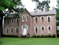 Morrow Hall |
October 18, 1972 (#72000205) |
7th and Boswell Sts. 35°46′21″N 91°38′35″W |
Batesville | |
| 30 | National Guard Armory | 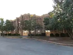 National Guard Armory |
May 29, 1998 (#98000579) |
380 S. 9th St. 35°46′21″N 91°38′37″W |
Batesville | |
| 31 | Pfeiffer House | May 1, 1989 (#89000172) |
U.S. Route 167 35°49′48″N 91°35′31″W |
Pfeiffer | ||
| 32 | Ruddell Mill Site | 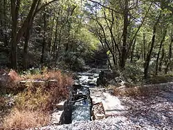 Ruddell Mill Site |
August 28, 2007 (#07000434) |
Address Restricted |
Batesville | |
| 33 | St. Paul's Parish Church | 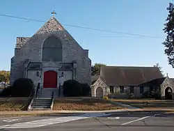 St. Paul's Parish Church |
December 22, 1982 (#82000836) |
5th and Main 35°46′19″N 91°39′00″W |
Batesville | |
| 34 | School Addition Historic District |  School Addition Historic District |
February 1, 2007 (#06001315) |
560–770 Water, 210–293 N. 7th, 709–897 Rock, and 215–280 N. 8th 35°46′28″N 91°38′56″W |
Batesville | |
| 35 | Spring Mill | 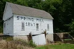 Spring Mill |
March 1, 1974 (#74000477) |
Northwest of Batesville on Highway 69 35°49′42″N 91°43′24″W |
Batesville | |
| 36 | Thida Grove School | 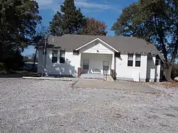 Thida Grove School |
September 4, 1992 (#92001108) |
County Road 20 35°34′16″N 91°27′58″W |
Thida | |
| 37 | Walnut Grove Cemetery | 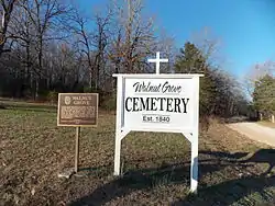 Walnut Grove Cemetery |
September 30, 2013 (#13000786) |
Walden Rd. 35°50′16″N 91°23′14″W |
Cord | |
| 38 | Capt. John T. Warner House | September 2, 1982 (#82002115) |
822 E. College St. 35°46′23″N 91°38′44″W |
Batesville | ||
| 39 | The Wheel Store | 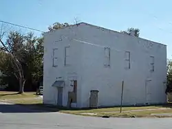 The Wheel Store |
December 8, 1988 (#88002822) |
River and Broad Sts. 35°46′03″N 91°39′00″W |
Batesville | |
| 40 | Wyatt House | 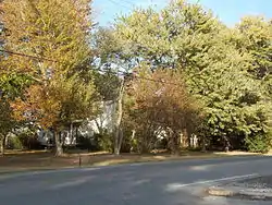 Wyatt House |
March 5, 1999 (#99000263) |
Junction of Highway 25 and Gainer Ferry Rd. 35°44′13″N 91°40′31″W |
Desha | |
| 41 | Wyatt Petroglyphs | May 4, 1982 (#82002116) |
Address Restricted |
Desha | ||
| 42 | Wycough–Jones House | 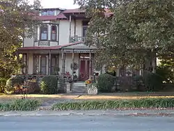 Wycough–Jones House |
May 2, 1975 (#75000393) |
683 Water St. 35°46′27″N 91°38′57″W |
Batesville |
Former listing
| [3] | Name on the Register | Image | Date listed | Date removed | Location | City or town | Summary |
|---|---|---|---|---|---|---|---|
| 1 | Locust Grove School |  Locust Grove School |
September 4, 1992 (#92001107) | January 23, 2008 | Highway 230 south of its junction with Highway 25 35°46′27″N 91°38′57″W |
Locust Grove | |
| 2 | Uriah Maxfield House | May 2, 1975 (#75000392) | June 3, 1986 | 410 E. Harrison St. |
Batesville |
See also
| Wikimedia Commons has media related to National Register of Historic Places in Independence County, Arkansas. |
References
- The latitude and longitude information provided in this table was derived originally from the National Register Information System, which has been found to be fairly accurate for about 99% of listings. Some locations in this table may have been corrected to current GPS standards.
- "National Register of Historic Places: Weekly List Actions". National Park Service, United States Department of the Interior. Retrieved on February 5, 2021.
- Numbers represent an alphabetical ordering by significant words. Various colorings, defined here, differentiate National Historic Landmarks and historic districts from other NRHP buildings, structures, sites or objects.
- "National Register Information System". National Register of Historic Places. National Park Service. March 13, 2009.
- The eight-digit number below each date is the number assigned to each location in the National Register Information System database, which can be viewed by clicking the number.
| Topics | |
|---|---|
| Lists by state |
|
| Lists by insular areas | |
| Lists by associated state | |
| Other areas | |
| Related | |
| |
Municipalities and communities of Independence County, Arkansas, United States | ||
|---|---|---|
| Cities | Map of Arkansas highlighting Independence County | |
| Towns | ||
| Unincorporated communities | ||
| Footnotes | ‡This populated place also has portions in an adjacent county or counties | |
| ||
This article is issued from Wikipedia. The text is licensed under Creative Commons - Attribution - Sharealike. Additional terms may apply for the media files.