National Register of Historic Places listings in Lonoke County, Arkansas
This is a list of the National Register of Historic Places listings in Lonoke County, Arkansas.
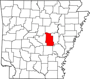
Location of Lonoke County in Arkansas
This is intended to be a complete list of the properties and districts on the National Register of Historic Places in Lonoke County, Arkansas, United States. The locations of National Register properties and districts for which the latitude and longitude coordinates are included below, may be seen in a map.[1]
There are 33 properties and districts listed on the National Register in the county, including 1 National Historic Landmark. Another property was once listed but has been removed.
- This National Park Service list is complete through NPS recent listings posted January 29, 2021.[2]
Current listings
| [3] | Name on the Register[4] | Image | Date listed[5] | Location | City or town | Description |
|---|---|---|---|---|---|---|
| 1 | Ashley-Alexander House | 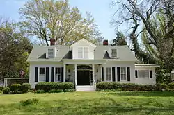 Ashley-Alexander House |
June 18, 1976 (#76000431) |
North of Scott 34°42′21″N 92°05′33″W |
Scott | |
| 2 | Thomas Sloan Boyd House | 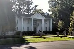 Thomas Sloan Boyd House |
January 1, 1976 (#76000430) |
220 Park Ave. 34°46′55″N 91°54′07″W |
Lonoke | |
| 3 | J. M. Bransford House | September 27, 2019 (#100004440) |
506 S. Center St. 34°46′47″N 91°54′01″W |
Lonoke | ||
| 4 | Camp Nelson Confederate Cemetery | 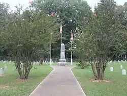 Camp Nelson Confederate Cemetery |
May 3, 1996 (#96000503) |
Rye St., approximately 1 mile northwest of the junction of Highways 319 and 321 34°56′46″N 91°58′49″W |
Cabot | |
| 5 | Carlisle Rock Island Depot | 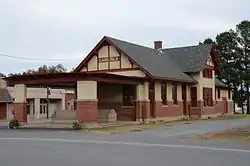 Carlisle Rock Island Depot |
June 14, 1990 (#90000905) |
Junction of Main St. and Court Ave. 34°46′58″N 91°44′46″W |
Carlisle | |
| 6 | Carver Gymnasium | September 23, 2009 (#09000741) |
400 Ferguson St. 34°46′51″N 91°53′47″W |
Lonoke | ||
| 7 | Coy Mound Site | 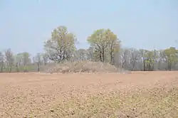 Coy Mound Site |
September 22, 1995 (#95001120) |
Next to Indian-Bakers Bayou 34°32′56″N 91°53′24″W |
Coy | |
| 8 | Dairyman's Bank Building | October 29, 2019 (#100004439) |
124 W. Main St. 34°46′58″N 91°44′52″W |
Carlisle | ||
| 9 | Dortch Plantation | 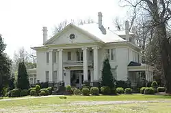 Dortch Plantation |
December 6, 1975 (#75000397) |
Northeast of Scott off Highway 130 at Bearskin Lake 34°42′55″N 92°03′13″W |
Scott | |
| 10 | Eagle House | 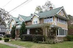 Eagle House |
December 22, 1982 (#82000858) |
217 Ash St. 34°46′57″N 91°54′06″W |
Lonoke | |
| 11 | Joe P. Eagle and D. R. Boone Building | 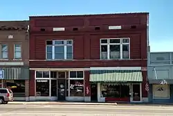 Joe P. Eagle and D. R. Boone Building |
December 9, 1994 (#94001462) |
105-107 W. Front St. 34°47′01″N 91°54′01″W |
Lonoke | |
| 12 | First Christian Church | 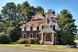 First Christian Church |
July 9, 1997 (#97000748) |
Junction of 2nd and Depot Sts. 34°47′07″N 91°54′04″W |
Lonoke | |
| 13 | First Presbyterian Church | 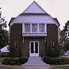 First Presbyterian Church |
September 23, 2004 (#04001037) |
304 S. Center St. 34°46′53″N 91°54′01″W |
Lonoke | |
| 14 | W.P. Fletcher House | 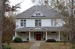 W.P. Fletcher House |
September 5, 1990 (#90001373) |
604 W. 4th St. 34°47′14″N 91°54′19″W |
Lonoke | |
| 15 | Keo Commercial Historic District | 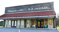 Keo Commercial Historic District |
June 15, 2011 (#11000355) |
Main & Fleming Sts., Arkansas Highway 232 34°36′02″N 92°00′33″W |
Keo | Cotton and Rice Farm History and Architecture in the Arkansas Delta MPS |
| 16 | Lonoke Confederate Monument | 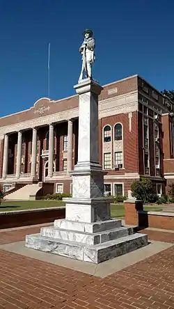 Lonoke Confederate Monument |
May 3, 1996 (#96000508) |
On the courthouse lawn, near the junction of 3rd and Center Sts. 34°47′09″N 91°53′58″W |
Lonoke | |
| 17 | Lonoke County Courthouse | 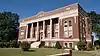 Lonoke County Courthouse |
June 8, 1982 (#82002121) |
N. Center St. 34°47′09″N 91°53′57″W |
Lonoke | |
| 18 | Lonoke Downtown Historic District | 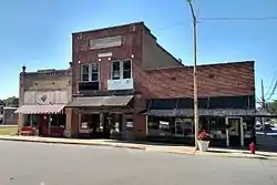 Lonoke Downtown Historic District |
May 10, 1996 (#96000528) |
Junction of Front and Center Sts. 34°47′05″N 91°53′58″W |
Lonoke | |
| 19 | Memphis to Little Rock Road-Bayou Two Prairie Segment | September 20, 2006 (#06000836) |
Address Restricted |
Brownsville | A segment of the Trail of Tears[6] | |
| 20 | Memphis to Little Rock Road-Brownsville Segment | September 27, 2003 (#03000954) |
Address Restricted |
Brownsville | A segment of the Trail of Tears[6] | |
| 21 | Morris House | May 30, 2019 (#100004000) |
16284 AR 89 34°48′24″N 91°56′42″W |
Lonoke | ||
| 22 | Rock Island Depot | 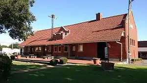 Rock Island Depot |
October 4, 1984 (#84000006) |
U.S. Route 70 and Center St. 34°47′02″N 91°54′02″W |
Lonoke | |
| 23 | Sears House | 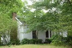 Sears House |
August 5, 1992 (#92000952) |
Southeast of the junction of Highways 38 and 319 34°59′05″N 91°57′43″W |
Austin | |
| 24 | Shull House | 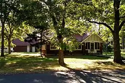 Shull House |
December 22, 1982 (#82000859) |
418 Park 34°46′48″N 91°54′05″W |
Lonoke | |
| 25 | Toltec Mounds | 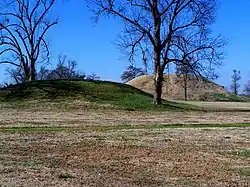 Toltec Mounds |
January 12, 1973 (#73000382) |
Off United States Route 165 34°38′49″N 92°03′55″W |
Scott | State park |
| 26 | Trimble House | 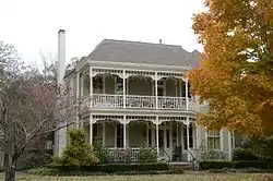 Trimble House |
December 22, 1982 (#82000860) |
518 Center St. 34°46′46″N 91°53′59″W |
Lonoke | |
| 27 | Trimble-McCrary House | 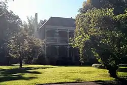 Trimble-McCrary House |
September 24, 2004 (#04001038) |
516 Jefferson 34°46′45″N 91°54′10″W |
Lonoke | |
| 28 | US 70, Union Valley Segment | 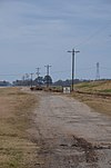 US 70, Union Valley Segment |
September 23, 2004 (#04001040) |
North and south of U.S. Route 70 from the S28/S29 boundary line R9W west to the S26/S27 boundary line R10W 34°45′56″N 92°01′25″W |
Union Valley | |
| 29 | Dr. E.F. Utley House | 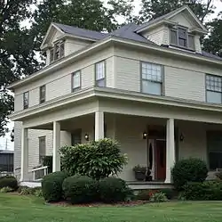 Dr. E.F. Utley House |
June 3, 1998 (#98000623) |
401 W. Pine St. 35°00′43″N 92°01′04″W |
Cabot | |
| 30 | Walls Farm Barn and Corn Crib | November 29, 1995 (#95001379) |
Highway 31 north of Tomberlin 34°31′26″N 91°52′26″W |
Tomberlin | Destroyed | |
| 31 | Walls House | 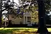 Walls House |
December 22, 1982 (#82000861) |
406 Jefferson St. 34°46′49″N 91°54′12″W |
Lonoke | |
| 32 | Wheat House | 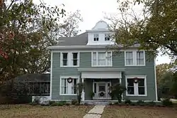 Wheat House |
December 22, 1982 (#82000862) |
600 Center St. 34°46′43″N 91°53′59″W |
Lonoke | |
| 33 | Woodlawn School Building | 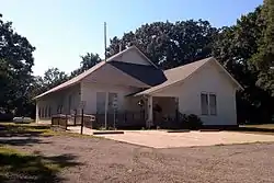 Woodlawn School Building |
February 25, 1993 (#93000086) |
Northwest of the junction of Highway 31 and Bizzell Rd. 34°55′22″N 91°52′30″W |
Woodlawn |
Former listing
| [3] | Name on the Register | Image | Date listed | Date removed | Location | City or town | Summary |
|---|---|---|---|---|---|---|---|
| 1 | St. Louis Southwest Railway (Cotton Belt Route) Depot | January 22, 2004 (#03001459) | January 23, 2008 | Main St. (Highway 31) |
Coy |
See also
| Wikimedia Commons has media related to National Register of Historic Places in Lonoke County, Arkansas. |
References
- The latitude and longitude information provided in this table was derived originally from the National Register Information System, which has been found to be fairly accurate for about 99% of listings. Some locations in this table may have been corrected to current GPS standards.
- "National Register of Historic Places: Weekly List Actions". National Park Service, United States Department of the Interior. Retrieved on January 29, 2021.
- Numbers represent an alphabetical ordering by significant words. Various colorings, defined here, differentiate National Historic Landmarks and historic districts from other NRHP buildings, structures, sites or objects.
- "National Register Information System". National Register of Historic Places. National Park Service. March 13, 2009.
- The eight-digit number below each date is the number assigned to each location in the National Register Information System database, which can be viewed by clicking the number.
- "Trail Of Tears National Historic Trail: National Register Research". National Park Service. Retrieved January 22, 2013.
| Topics | |
|---|---|
| Lists by state |
|
| Lists by insular areas | |
| Lists by associated state | |
| Other areas | |
| Related | |
| |
Municipalities and communities of Lonoke County, Arkansas, United States | ||
|---|---|---|
| Cities | Map of Arkansas highlighting Lonoke County | |
| Towns | ||
| CDP | ||
| Townships |
| |
| Unincorporated communities | ||
| Footnotes | ‡This populated place also has portions in an adjacent county or counties | |
| ||
This article is issued from Wikipedia. The text is licensed under Creative Commons - Attribution - Sharealike. Additional terms may apply for the media files.