National Register of Historic Places listings in Nevada County, Arkansas
This is a list of the National Register of Historic Places listings in Nevada County, Arkansas.
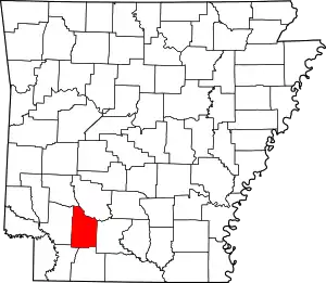
Location of Nevada County in Arkansas
This is intended to be a complete list of the properties and districts on the National Register of Historic Places in Nevada County, Arkansas, United States. The locations of National Register properties and districts for which the latitude and longitude coordinates are included below, may be seen in a map.[1]
There are 17 properties and districts listed on the National Register in the county, including 2 National Historic Landmarks. Another three properties were once listed, but have since been removed.
- This National Park Service list is complete through NPS recent listings posted February 5, 2021.[2]
Current listings
| [3] | Name on the Register[4] | Image | Date listed[5] | Location | City or town | Description |
|---|---|---|---|---|---|---|
| 1 | Camden to Washington Road-Rosston Segment |  Camden to Washington Road-Rosston Segment |
January 29, 2009 (#08001374) |
County Road 10 33°35′30″N 93°10′08″W |
Rosston | |
| 2 | Carolina Methodist Church | 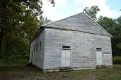 Carolina Methodist Church |
January 3, 1991 (#90001947) |
County Road 10 east of its junction with Kirk Rd. in the Poison Springs State Forest 33°35′31″N 93°10′07″W |
Rosston | |
| 3 | De Ann Cemetery Historic Section |  De Ann Cemetery Historic Section |
June 1, 2005 (#05000498) |
½ mile west of the junction of U.S. Route 371 and Highway 19 33°48′38″N 93°23′32″W |
Prescott | |
| 4 | Elkins' Ferry | 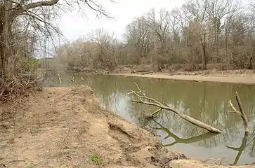 Elkins' Ferry |
April 19, 1994 (#94001182) |
Both banks of the Little Missouri River, about 10 miles north of Prescott 33°56′09″N 93°21′12″W |
Prescott | Site of the Civil War Battle of Elkin's Ferry; one of the Camden Expedition Sites, a National Historic Landmark District consisting of sites in several counties; Elkin's Ferry extends into Clark County |
| 5 | Emmet Methodist Church |  Emmet Methodist Church |
September 23, 2009 (#09000742) |
209 S. Walnut 33°43′40″N 93°28′20″W |
Emmet | |
| 6 | Ephesus Cemetery | 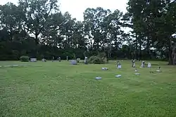 Ephesus Cemetery |
January 22, 2009 (#08001340) |
¼ mile north of Emmet on U.S. Route 67 33°44′26″N 93°28′02″W |
Emmet | |
| 7 | Henry McKenzie House | 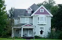 Henry McKenzie House |
September 3, 1998 (#98001128) |
324 E. Main 33°47′59″N 93°22′41″W |
Prescott | |
| 8 | D.L. McRae House | 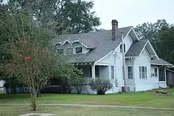 D.L. McRae House |
December 22, 1982 (#82000869) |
424 E. Main St. 33°47′57″N 93°22′38″W |
Prescott | |
| 9 | T.C. McRae House | December 22, 1982 (#82000870) |
506 E. Elm St. 33°47′52″N 93°22′40″W |
Prescott | Demolished | |
| 10 | Missouri Pacific Depot | 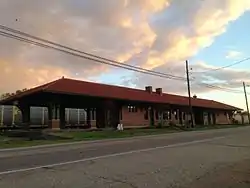 Missouri Pacific Depot |
November 17, 1978 (#78000614) |
300 W. 1st St., N. 33°47′45″N 93°23′22″W |
Prescott | |
| 11 | Moscow Methodist Church and Cemetery |  Moscow Methodist Church and Cemetery |
September 20, 2006 (#06000826) |
Junction of Highways Highway 23 and Highway 260 33°46′42″N 93°22′00″W |
Prescott | |
| 12 | Nevada County Courthouse |  Nevada County Courthouse |
May 24, 2018 (#100002454) |
215 E 2nd St. 33°48′01″N 93°22′52″W |
Prescott | |
| 13 | Prairie De Ann Battlefield | 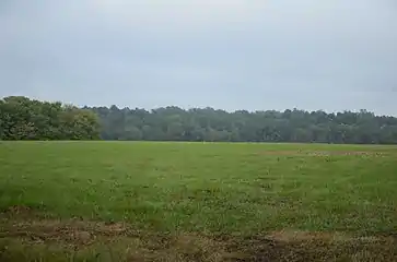 Prairie De Ann Battlefield |
March 22, 1974 (#74000481) |
North and south of Highway 24 and southwest of Prescott 33°49′31″N 93°25′54″W |
Prescott | One of the Camden Expedition Sites, a National Historic Landmark consisting of sites in several counties |
| 14 | Prescott & Northwestern Railroad Caboose No. 3 | September 14, 2020 (#100005585) |
403 West 1st St. South 33°48′02″N 93°23′00″W |
Prescott | ||
| 14 | Prescott City Jail |  Prescott City Jail |
September 28, 2005 (#05001077) |
Alley behind City Hall at 118 W. Elm St. 33°48′15″N 93°22′56″W |
Prescott | |
| 15 | Prescott Commercial Historic District | 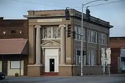 Prescott Commercial Historic District |
December 24, 2008 (#08000818) |
Roughly bounded by E. 3rd St., Walnut St., W. 3rd St., and Pine St. 33°48′06″N 93°22′54″W |
Prescott | |
| 16 | US 67 Bridge over Little Missouri River |  US 67 Bridge over Little Missouri River |
January 24, 2007 (#06001271) |
U.S. Route 67 33°52′48″N 93°18′16″W |
Prescott | Extends into Clark County |
Former listings
| [3] | Name on the Register | Image | Date listed | Date removed | Location | City or town | Summary |
|---|---|---|---|---|---|---|---|
| 1 | Allen Tire Company and Gas Station |  Allen Tire Company and Gas Station |
May 25, 2001 (#01000523) | September 30, 2019 | 228 1st St., SW. 33°48′05″N 93°22′56″W |
Prescott | |
| 2 | Bemis Florist Shop | December 22, 1982 (#82000868) | September 17, 1999 | 117 E. Second |
Prescott | ||
| 3 | Wortham Gymnasium | April 19, 1990 (#90000667) | September 29, 2015 | Highway 200 33°35′55″N 93°14′19″W |
Oak Grove |
See also
| Wikimedia Commons has media related to National Register of Historic Places in Nevada County, Arkansas. |
References
- The latitude and longitude information provided in this table was derived originally from the National Register Information System, which has been found to be fairly accurate for about 99% of listings. Some locations in this table may have been corrected to current GPS standards.
- "National Register of Historic Places: Weekly List Actions". National Park Service, United States Department of the Interior. Retrieved on February 5, 2021.
- Numbers represent an alphabetical ordering by significant words. Various colorings, defined here, differentiate National Historic Landmarks and historic districts from other NRHP buildings, structures, sites or objects.
- "National Register Information System". National Register of Historic Places. National Park Service. March 13, 2009.
- The eight-digit number below each date is the number assigned to each location in the National Register Information System database, which can be viewed by clicking the number.
| Topics | |
|---|---|
| Lists by state |
|
| Lists by insular areas | |
| Lists by associated state | |
| Other areas | |
| Related | |
| |
Municipalities and communities of Nevada County, Arkansas, United States | ||
|---|---|---|
| Cities | Map of Arkansas highlighting Nevada County | |
| Towns | ||
| CDP | ||
| Unincorporated communities | ||
| Footnotes | ‡This populated place also has portions in an adjacent county or counties | |
| ||
This article is issued from Wikipedia. The text is licensed under Creative Commons - Attribution - Sharealike. Additional terms may apply for the media files.