National Register of Historic Places listings in Desha County, Arkansas
This is a list of the National Register of Historic Places listings in Desha County, Arkansas.
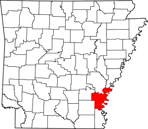
Location of Desha County in Arkansas
This is intended to be a complete list of the properties and districts on the National Register of Historic Places in Desha County, Arkansas, United States. The locations of National Register properties and districts for which the latitude and longitude coordinates are included below, may be seen in a map.[1]
There are 26 properties and districts listed on the National Register in the county, including 1 National Historic Landmark.
- This National Park Service list is complete through NPS recent listings posted February 5, 2021.[2]
Current listings
| [3] | Name on the Register[4] | Image | Date listed[5] | Location | City or town | Description |
|---|---|---|---|---|---|---|
| 1 | Arkansas City Commercial District | 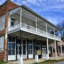 Arkansas City Commercial District |
February 18, 1999 (#99000227) |
Roughly along the junction of Desoto Ave. and Sprague St. 33°36′19″N 91°12′13″W |
Arkansas City | |
| 2 | Arkansas City High School | 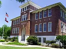 Arkansas City High School |
October 4, 1984 (#84000005) |
Robert S. Moore and President Sts. 33°36′36″N 91°12′05″W |
Arkansas City | |
| 3 | Dante House | January 23, 2020 (#100004905) |
501 Court St. 33°52′56″N 91°29′18″W |
Dumas | ||
| 4 | Desha County Courthouse | 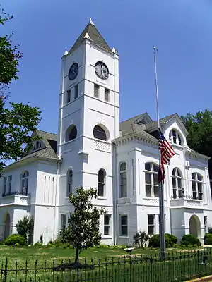 Desha County Courthouse |
July 12, 1976 (#76000403) |
Robert S. Moore Ave. 33°36′33″N 91°12′08″W |
Arkansas City | |
| 5 | Dickinson-Moore House | 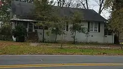 Dickinson-Moore House |
February 1, 2011 (#10001192) |
707 Robert S. Moore Ave. 33°36′31″N 91°12′10″W |
Arkansas City | |
| 6 | Dumas Commercial Historic District | 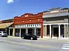 Dumas Commercial Historic District |
May 22, 2007 (#07000446) |
S. Main St. between Choctaw and Waterman Sts. 33°53′22″N 91°29′32″W |
Dumas | |
| 7 | Hubert & Ionia Furr House | 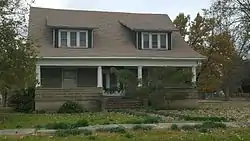 Hubert & Ionia Furr House |
February 4, 2011 (#10001197) |
702 Desoto Ave. 33°36′24″N 91°12′04″W |
Arkansas City | |
| 8 | Kemp Cotton Gin Historic District | 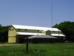 Kemp Cotton Gin Historic District |
June 1, 2005 (#05000491) |
County Road 227 west of Highway 1 33°45′48″N 91°16′36″W |
Rohwer | |
| 9 | Jay Lewis House | 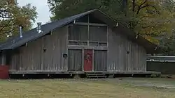 Jay Lewis House |
January 20, 2005 (#04001501) |
12 Fairview Dr. 33°38′13″N 91°24′33″W |
McGehee | |
| 10 | McGehee City Jail | 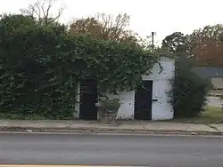 McGehee City Jail |
January 21, 2011 (#10001149) |
Southwest corner of S. First St. and Pine St. 33°37′37″N 91°23′45″W |
McGehee | |
| 11 | McGehee National Guard Armory | 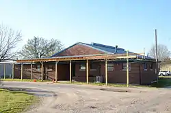 McGehee National Guard Armory |
May 31, 2006 (#06000441) |
1610 S. 1st St. 33°36′48″N 91°23′04″W |
McGehee | |
| 12 | McGehee Post Office | 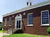 McGehee Post Office |
January 19, 2010 (#09001245) |
201 N. Second St. 33°37′44″N 91°23′50″W |
McGehee | |
| 13 | McKennon-Shea House | 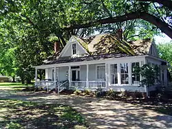 McKennon-Shea House |
June 8, 1993 (#93000485) |
206 Waterman St. 33°53′13″N 91°29′39″W |
Dumas | |
| 14 | Merchants & Farmers Bank | 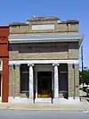 Merchants & Farmers Bank |
December 22, 1982 (#82000809) |
Waterman and Main Sts. 33°53′15″N 91°29′29″W |
Dumas | |
| 15 | Missouri Pacific Railroad Depot-McGehee | 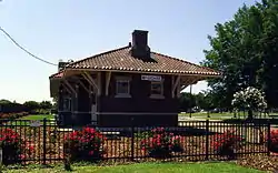 Missouri Pacific Railroad Depot-McGehee |
June 11, 1992 (#92000616) |
Railroad St. 33°37′42″N 91°23′42″W |
McGehee | |
| 16 | Missouri Pacific Railway Van Noy Eating House | 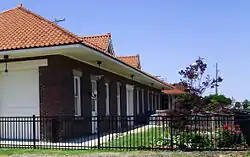 Missouri Pacific Railway Van Noy Eating House |
January 24, 2011 (#10001154) |
Southeast of the Seamans Dr. and Railroad St. intersection 33°37′41″N 91°23′42″W |
McGehee | |
| 17 | Mound Cemetery | 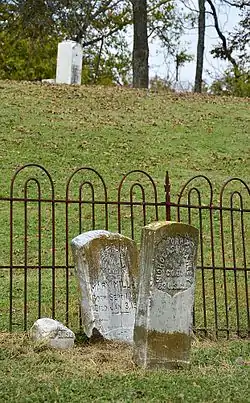 Mound Cemetery |
January 24, 2008 (#07001426) |
0.5 miles north of Arkansas City on County Road 351 33°37′13″N 91°12′03″W |
Arkansas City | |
| 18 | Parnell-Sharpe House | 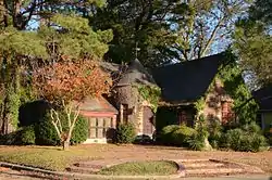 Parnell-Sharpe House |
September 28, 1989 (#89001594) |
302 N. 2nd St. 33°37′51″N 91°23′52″W |
McGehee | |
| 19 | R.A. Pickens II House | May 29, 2019 (#100003992) |
1 Pickens Pl. 33°50′38″N 91°28′53″W |
Pickens | ||
| 20 | Xenophon Overton Pindall Law Office | 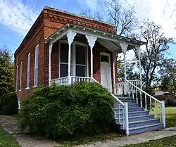 Xenophon Overton Pindall Law Office |
May 10, 1999 (#98000832) |
Junction of Capitol and Kate Adams Sts. 33°36′22″N 91°12′11″W |
Arkansas City | |
| 21 | Rohwer Relocation Center Memorial Cemetery |  Rohwer Relocation Center Memorial Cemetery |
July 6, 1992 (#92001882) |
Highway 1 33°45′59″N 91°16′49″W |
Rohwer | |
| 22 | Rohwer Relocation Center Site |  Rohwer Relocation Center Site |
July 30, 1974 (#74000474) |
Highway 1 33°45′58″N 91°16′34″W |
Rohwer | |
| 23 | Temple Meir Chayim | 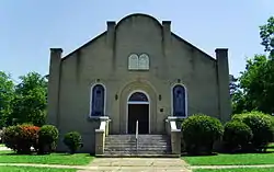 Temple Meir Chayim |
April 22, 1999 (#99000470) |
Junction of 4th and Holly Sts. 33°37′43″N 91°23′59″W |
McGehee | |
| 24 | Thane House | 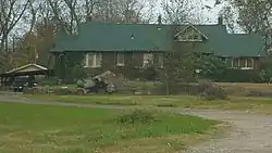 Thane House |
December 22, 1982 (#82000810) |
Levy and 1st Sts. 33°36′26″N 91°11′59″W |
Arkansas City | |
| 25 | Trippe Holly Grove Cemetery | 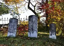 Trippe Holly Grove Cemetery |
June 25, 1999 (#99000729) |
Highway 4 or Crooked Bayou Rd., approximately 2 miles south of McGehee 33°36′07″N 91°20′53″W |
McGehee | |
| 26 | Dr. J.D. Watts House | 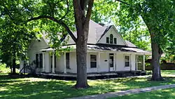 Dr. J.D. Watts House |
December 9, 1994 (#94001460) |
205 W. Choctaw 33°53′17″N 91°29′39″W |
Dumas |
See also
| Wikimedia Commons has media related to National Register of Historic Places in Desha County, Arkansas. |
References
- The latitude and longitude information provided in this table was derived originally from the National Register Information System, which has been found to be fairly accurate for about 99% of listings. Some locations in this table may have been corrected to current GPS standards.
- "National Register of Historic Places: Weekly List Actions". National Park Service, United States Department of the Interior. Retrieved on February 5, 2021.
- Numbers represent an alphabetical ordering by significant words. Various colorings, defined here, differentiate National Historic Landmarks and historic districts from other NRHP buildings, structures, sites or objects.
- "National Register Information System". National Register of Historic Places. National Park Service. March 13, 2009.
- The eight-digit number below each date is the number assigned to each location in the National Register Information System database, which can be viewed by clicking the number.
| Topics | |
|---|---|
| Lists by state |
|
| Lists by insular areas | |
| Lists by associated state | |
| Other areas | |
| Related | |
| |
Municipalities and communities of Desha County, Arkansas, United States | ||
|---|---|---|
| Cities | Map of Arkansas highlighting Desha County | |
| Towns | ||
| Unincorporated communities | ||
| Ghost town | ||
| Footnotes | ‡This populated place also has portions in an adjacent county or counties | |
| ||
This article is issued from Wikipedia. The text is licensed under Creative Commons - Attribution - Sharealike. Additional terms may apply for the media files.