National Register of Historic Places listings in White County, Arkansas
This is a list of the National Register of Historic Places listings in White County, Arkansas.
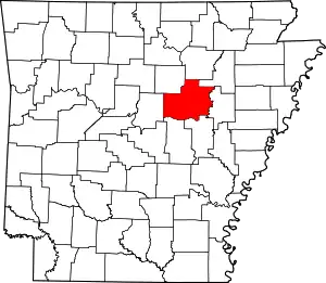
Location of White County in Arkansas
This is intended to be a complete list of the properties and districts on the National Register of Historic Places in White County, Arkansas, United States. The locations of National Register properties and districts for which the latitude and longitude coordinates are included below, may be seen in a map.[1]
There are 186 properties and districts listed on the National Register in the county. Another 24 properties were once listed but have been removed.
- This National Park Service list is complete through NPS recent listings posted February 5, 2021.[2]
Current listings
| [3] | Name on the Register[4] | Image | Date listed[5] | Location | City or town | Description |
|---|---|---|---|---|---|---|
| 1 | William Thomas Abington House |  William Thomas Abington House |
July 11, 1992 (#91001350) |
Center St., southwest of its junction with Highway 367 35°04′28″N 91°52′30″W |
Beebe | |
| 2 | Ackins House | July 11, 1992 (#91001322) |
Junction of Highways 31 and 305 35°11′31″N 91°58′01″W |
Floyd | No longer standing. | |
| 3 | American Legion Hall | 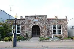 American Legion Hall |
September 13, 1991 (#91001186) |
Junction of Race and Spruce Sts. 35°15′04″N 91°44′17″W |
Searcy | |
| 4 | Col. Ralph Andrews House | 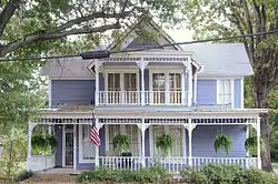 Col. Ralph Andrews House |
September 5, 1991 (#91001253) |
517 W. Center St. 35°04′05″N 91°53′09″W |
Beebe | |
| 5 | Baldock House |  Baldock House |
September 5, 1991 (#91001239) |
Junction of S. Elm St. and W. Woodruff Ave. 35°14′45″N 91°44′25″W |
Searcy | |
| 6 | Bank of Searcy | 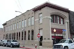 Bank of Searcy |
September 5, 1991 (#91001228) |
301 N. Spruce St. 35°15′01″N 91°44′19″W |
Searcy | |
| 7 | Beebe Jail |  Beebe Jail |
September 13, 1991 (#91001251) |
East of the junction of N. Main and Illinois Sts. 35°04′17″N 91°52′48″W |
Beebe | |
| 8 | Beebe Railroad Station |  Beebe Railroad Station |
December 11, 1979 (#79000465) |
Center St. 35°04′11″N 91°52′49″W |
Beebe | |
| 9 | Beebe Theater | September 5, 1991 (#91001265) |
Center St. 35°04′15″N 91°52′46″W |
Beebe | Demolished. | |
| 10 | Bell House | 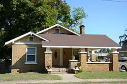 Bell House |
September 5, 1991 (#91001201) |
302 W. Woodruff Ave. 35°14′47″N 91°44′24″W |
Searcy | |
| 11 | Berry House | 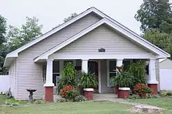 Berry House |
September 5, 1991 (#91001262) |
208 Hickory 35°04′22″N 91°53′14″W |
Beebe | |
| 12 | Big Four School | .JPG.webp) Big Four School |
July 10, 1992 (#91001192) |
County Road 383 south of its junction with Highway 258 35°20′44″N 91°38′34″W |
Providence | Demolished. |
| 13 | Benjamin Clayton Black House |  Benjamin Clayton Black House |
November 20, 1974 (#74000505) |
300 E. Race St. 35°15′36″N 91°44′01″W |
Searcy | |
| 14 | Bloom House | 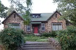 Bloom House |
September 5, 1991 (#91001176) |
Junction of N. Maple and Academy Sts. 35°15′10″N 91°44′41″W |
Searcy | |
| 15 | Blunt House Livestock Barn | July 10, 1992 (#91001363) |
County Road 357, east of its junction with Highway 157 35°31′00″N 91°38′13″W |
Midway | ||
| 16 | James William Boggs House | 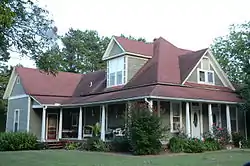 James William Boggs House |
September 5, 1991 (#91001298) |
Austin St. between South and Torrence Sts. 35°25′29″N 91°50′11″W |
Pangburn | |
| 17 | Luke Bone Grocery-Boarding House | 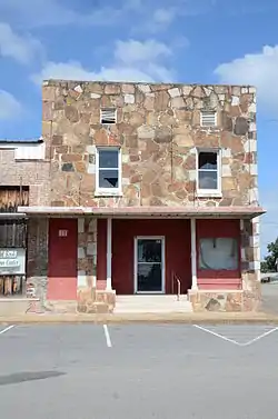 Luke Bone Grocery-Boarding House |
September 13, 1991 (#91001275) |
Junction of Main and Market Sts. 35°18′35″N 91°34′00″W |
Bald Knob | |
| 18 | Green Booth House |  Green Booth House |
September 5, 1991 (#91001202) |
Junction of S. Pecan St. and W. Center Ave. 35°14′56″N 91°44′39″W |
Searcy | |
| 19 | Booth-Weir House | 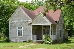 Booth-Weir House |
September 5, 1991 (#91001345) |
W. 1st St. 35°07′11″N 91°48′54″W |
McRae | |
| 20 | Bradford City Hall-Byers Masonic Lodge | 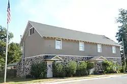 Bradford City Hall-Byers Masonic Lodge |
October 21, 1999 (#99001260) |
302 W. Walnut St. 35°25′27″N 91°27′19″W |
Bradford | |
| 21 | Brooks House | 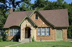 Brooks House |
July 10, 1992 (#91001217) |
704 E. Market St. 35°14′59″N 91°43′48″W |
Searcy | |
| 22 | Brown House |  Brown House |
September 13, 1991 (#91001268) |
Elm St. 35°18′39″N 91°34′07″W |
Bald Knob | |
| 23 | Joe Brown House and Farmstead | September 13, 1991 (#91001338) |
County Road 529 northwest of Little Red 35°28′34″N 91°43′20″W |
Little Red | ||
| 24 | Burnett House | July 11, 1992 (#91001337) |
County Road 766 northwest of Searcy 35°15′55″N 91°47′04″W |
Searcy | Demolished. | |
| 25 | Caldwell House | 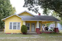 Caldwell House |
September 5, 1991 (#91001347) |
Junction of E. 2nd and Smith Sts. 35°06′43″N 91°49′19″W |
McRae | |
| 26 | Campbell-Chrisp House | 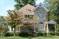 Campbell-Chrisp House |
September 5, 1991 (#91001280) |
102 Elm St. 35°18′38″N 91°34′09″W |
Bald Knob | |
| 27 | Cary House |  Cary House |
July 10, 1992 (#91001293) |
Junction of Searcy and Short Sts. 35°25′41″N 91°50′14″W |
Pangburn | |
| 28 | Chandler House | July 10, 1992 (#91001310) |
Junction of County Roads 327 and 379 35°22′41″N 91°37′19″W |
Stevens Creek | ||
| 29 | Childers Farmstead | 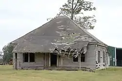 Childers Farmstead |
July 11, 1992 (#91001349) |
East of Highway 367 and south of McRae 35°05′38″N 91°49′39″W |
McRae | |
| 30 | Churchill-Hilger House | 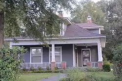 Churchill-Hilger House |
September 5, 1991 (#91001301) |
Junction of Main and Searcy Sts. 35°25′35″N 91°50′10″W |
Pangburn | |
| 31 | Pattie Cobb Hall | 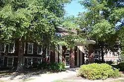 Pattie Cobb Hall |
September 5, 1991 (#91001209) |
900 E. Center at Harding University 35°14′50″N 91°43′40″W |
Searcy | |
| 32 | Collison House | 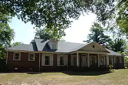 Collison House |
May 29, 2008 (#08000489) |
206 N. Main St. 35°18′43″N 91°34′03″W |
Bald Knob | |
| 33 | Sam Cooley Barn | July 11, 1992 (#91001282) |
County Road 96 southeast of Bald Knob 35°17′41″N 91°32′53″W |
Bald Knob | ||
| 34 | Cremane House | 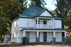 Cremane House |
July 10, 1992 (#91001320) |
County Road 95 west of Bradford Lake 35°25′01″N 91°26′19″W |
Bradford | |
| 35 | Col. John Critz Farm, Springhouse | July 10, 1992 (#91001333) |
County Road 818 west of its junction with County Road 41 35°17′14″N 91°52′10″W |
Center Hill | Demolished. | |
| 36 | Cumberland Presbyterian Church |  Cumberland Presbyterian Church |
July 10, 1992 (#91001225) |
Junction of Race and Spring Sts. 35°15′03″N 91°44′14″W |
Searcy | |
| 37 | Jesse N. Cypert Law Office | 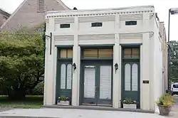 Jesse N. Cypert Law Office |
July 12, 1992 (#91001179) |
104 E. Race St. 35°15′04″N 91°44′13″W |
Searcy | |
| 38 | Darden-Gifford House | 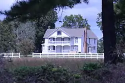 Darden-Gifford House |
January 1, 1976 (#76000474) |
North of Rose Bud off Highway 5 35°20′15″N 92°04′44″W |
Rose Bud | |
| 39 | Deener House | 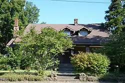 Deener House |
December 22, 1982 (#82000957) |
310 E. Center Ave. 35°14′54″N 91°43′57″W |
Searcy | |
| 40 | Doniphan Lumber Mill Historic District | September 13, 1991 (#91001196) |
Around Doniphan Lake off Highway 367 35°15′02″N 91°40′31″W |
Doniphan | ||
| 41 | David Doyle House No. 2 | September 5, 1991 (#91001302) |
Junction of Highway 5 and County Road 953 35°07′27″N 92°05′40″W |
El Paso | Demolished 11/2003. | |
| 42 | James W. Edie House |  James W. Edie House |
September 5, 1991 (#91001189) |
Junction of Jackson and Washington Sts. 35°16′07″N 91°38′18″W |
Judsonia | |
| 43 | El Paso Bank | 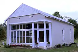 El Paso Bank |
September 5, 1991 (#91001303) |
County Road 3 east of its junction with Highway 5 35°07′34″N 92°05′45″W |
El Paso | |
| 44 | Elm Street House | 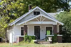 Elm Street House |
September 13, 1991 (#91001269) |
Elm St. 35°18′37″N 91°34′07″W |
Bald Knob | |
| 45 | Joe Emmer House | July 12, 1992 (#91001327) |
County Road 47 35°21′36″N 91°45′29″W |
Holly Springs | Demolished. | |
| 46 | First United Methodist Church | 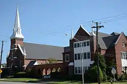 First United Methodist Church |
July 12, 1992 (#91001206) |
Junction of Main and Market Sts. 35°15′00″N 91°44′09″W |
Searcy | |
| 47 | Floyd Cotton Gin |  Floyd Cotton Gin |
July 12, 1992 (#91001324) |
Junction of Highways 31 and 305 35°11′29″N 91°58′04″W |
Floyd | |
| 48 | Fox Motel House | July 12, 1992 (#91001267) |
Highway 367 35°18′51″N 91°33′55″W |
Bald Knob | No longer standing. | |
| 49 | Fredonia Cemetery Historic Section | 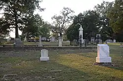 Fredonia Cemetery Historic Section |
January 29, 2007 (#06001312) |
Roughly 0.5 miles (0.80 km) down Fredonia Rd., past its junction with Honeysuckle Rd. 35°23′12″N 91°37′34″W |
Stevens Creek | |
| 50 | Wood Freeman House No. 1 |  Wood Freeman House No. 1 |
September 5, 1991 (#91001185) |
702 Arch St. 35°15′01″N 91°44′40″W |
Searcy | |
| 51 | Wood Freeman House No. 2 | September 5, 1991 (#91001181) |
703 W. Race St. 35°15′02″N 91°44′40″W |
Searcy | No longer standing. | |
| 52 | Dr. Frizell House |  Dr. Frizell House |
July 12, 1992 (#91001318) |
Junction of U.S. Highway 67 and Elm St. 35°25′20″N 91°27′23″W |
Bradford | |
| 53 | Lizzie Garrard House | 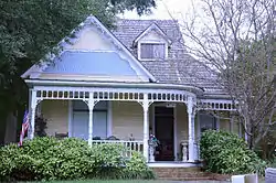 Lizzie Garrard House |
September 5, 1991 (#91001263) |
N. Cypress St. 35°04′17″N 91°52′59″W |
Beebe | |
| 54 | Milt Gooden House | July 13, 1992 (#91001281) |
County Road 83 southeast of Bald Knob 35°15′15″N 91°32′10″W |
Bald Knob | No longer standing. | |
| 55 | Grand Army of the Republic Memorial | 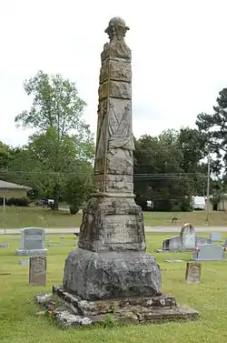 Grand Army of the Republic Memorial |
May 3, 1996 (#96000502) |
Evergreen Cemetery, approximately 0.25 miles (0.40 km) south of the junction of Highways 367 and 13 35°16′41″N 91°38′25″W |
Judsonia | |
| 56 | Gravel Hill Baptist Church | .JPG.webp) Gravel Hill Baptist Church |
July 21, 1992 (#91001323) |
Gravel Hill Rd. 35°14′56″N 91°58′40″W |
Gravel Hill | Demolished. |
| 57 | Gray House | .JPG.webp) Gray House |
July 21, 1992 (#91001334) |
Junction of County Roads 46 and 758 35°18′27″N 91°48′48″W |
Crosby | Demolished. |
| 58 | Louis Gray Homestead, Barn | 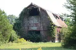 Louis Gray Homestead, Barn |
July 21, 1992 (#91001194) |
Highway 157 east of Plainview 35°18′48″N 91°39′18″W |
Plainview | Demolished. |
| 59 | Rufus Gray House |  Rufus Gray House |
September 5, 1991 (#91001294) |
Junction of Austin and South Sts. 35°25′27″N 91°50′10″W |
Pangburn | |
| 60 | Gray-Kincaid House |  Gray-Kincaid House |
July 21, 1992 (#91001335) |
Junction of County Roads 46 and 759 35°19′01″N 91°49′17″W |
Crosby | |
| 61 | Griffithville School | July 13, 1992 (#91001357) |
Highway 11 west of its junction with Highway 385 35°07′14″N 91°38′54″W |
Griffithville | Building listed on the NRHP has been demolished, but the gym and another building dating to the same period still stand. | |
| 62 | Thomas Jefferson Hale General Merchandise Store | 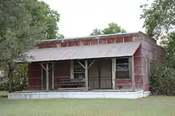 Thomas Jefferson Hale General Merchandise Store |
July 21, 1992 (#91001358) |
Junction of County Roads 62 and 433 35°04′46″N 91°44′37″W |
Vinity Corner | |
| 63 | Fred Hall House | 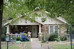 Fred Hall House |
September 5, 1991 (#91001222) |
Junction of 2nd and W. Searcy Sts. 35°13′58″N 91°40′07″W |
Kensett | |
| 64 | Mary Alice Hammond House |  Mary Alice Hammond House |
July 21, 1992 (#91001204) |
County Road 839 west of its junction with Highway 367 35°11′41″N 91°44′04″W |
Searcy | |
| 65 | Roy Harper House | July 21, 1992 (#91001304) |
County Road 16 east of its junction with Highway 5 35°11′26″N 92°02′53″W |
Romance | ||
| 66 | Morris Hartsell Farmstead | September 13, 1991 (#91001340) |
Highway 157 35°25′48″N 91°41′09″W |
Steprock | ||
| 67 | Hassell House | 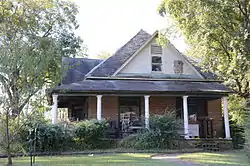 Hassell House |
September 5, 1991 (#91001205) |
Junction of S. Elm St. and W. Woodruff Ave. 35°14′45″N 91°44′27″W |
Searcy | |
| 68 | Brady Hays Homestead | September 13, 1991 (#91001312) |
U.S. Highway 167 south of Denmark 35°28′12″N 91°35′17″W |
Denmark | Burned 7/15/2007. | |
| 69 | Alfred W. Henson House | October 23, 1986 (#86002938) |
111 Main St. 35°16′14″N 91°38′27″W |
Judsonia | Burned and demolished. | |
| 70 | Marshall Hickmon Homestead | 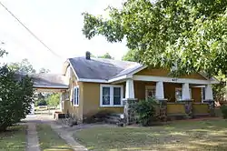 Marshall Hickmon Homestead |
July 21, 1992 (#91001317) |
Highway 87 35°25′28″N 91°27′55″W |
Bradford | |
| 71 | U.L. Hickmon Hardware Store | 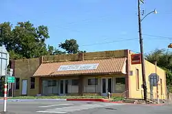 U.L. Hickmon Hardware Store |
September 5, 1991 (#91001316) |
Junction of Main and 2nd Sts. 35°25′25″N 91°27′20″W |
Bradford | |
| 72 | Hicks-Dugan-Deener House | 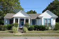 Hicks-Dugan-Deener House |
April 18, 1985 (#85000835) |
306 E. Center St. 35°14′54″N 91°43′51″W |
Searcy | |
| 73 | Louis N. Hilger Homestead, Livestock Barn | 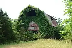 Louis N. Hilger Homestead, Livestock Barn |
July 21, 1992 (#91001191) |
County Road 374 west of its junction with Highway 157 35°22′10″N 91°41′31″W |
Providence | |
| 74 | Hill Farm | 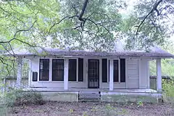 Hill Farm |
July 21, 1992 (#91001258) |
North of U.S. Highway 67 southwest of Beebe 35°03′37″N 91°56′42″W |
Beebe | |
| 75 | Hoag House | July 21, 1992 (#91001236) |
Junction of Highways 157 and 367 35°17′07″N 91°37′49″W |
Judsonia | Demolished. | |
| 76 | Holly Grove School | July 13, 1992 (#91001309) |
County Road 379 north of its junction with County Road 327 35°22′41″N 91°37′20″W |
Stevens Creek | Burned in early 2014. | |
| 77 | Hoofman Farmstead Barn |  Hoofman Farmstead Barn |
July 22, 1992 (#91001188) |
Between Plainview and the Little Red River 35°18′30″N 91°41′52″W |
Searcy | |
| 78 | Arthur W. Hoofman House | 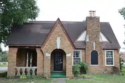 Arthur W. Hoofman House |
July 22, 1992 (#91001184) |
Junction of E. Race and N. Cross Sts. 35°15′01″N 91°43′24″W |
Searcy | |
| 79 | Tobe Hoofman Farmstead | 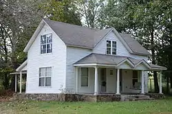 Tobe Hoofman Farmstead |
July 22, 1992 (#91001238) |
Highway 13 north of its junction with Highway 157 35°19′18″N 91°39′43″W |
Providence | |
| 80 | Hopewell District No. 45 School | July 13, 1992 (#91001283) |
Highway 258 west of Lake Bald Knob 35°20′12″N 91°36′05″W |
Hopewell | Demolished. | |
| 81 | Hunt House |  Hunt House |
September 13, 1991 (#91001207) |
707 W. Center St. 35°14′54″N 91°44′41″W |
Searcy | |
| 82 | Thomas Hunt House | July 22, 1992 (#91001193) |
Highway 157 north of Plainview 35°20′01″N 91°40′35″W |
Plainview | Burned to the ground 9-24-2015. | |
| 83 | L.D. Hutchinson House | 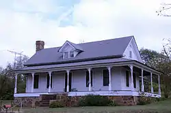 L.D. Hutchinson House |
July 22, 1992 (#91001325) |
Highway 31 north of its junction with Highway 305 35°11′47″N 91°58′02″W |
Floyd | |
| 84 | Dr. James House | September 13, 1991 (#91001241) |
Junction of W. Center and S. Gum Sts. 35°14′55″N 91°44′22″W |
Searcy | ; probably demolished | |
| 85 | Jameson-Richards Cafe | 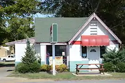 Jameson-Richards Cafe |
September 5, 1991 (#91001266) |
Highway 367 east of its junction with Vine St. 35°18′35″N 91°34′07″W |
Bald Knob | |
| 86 | Jameson-Richards Gas Station | 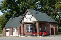 Jameson-Richards Gas Station |
September 5, 1991 (#91001279) |
Junction of Highway 367 and Vine St. 35°18′34″N 91°34′08″W |
Bald Knob | |
| 87 | Joiner House | 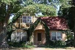 Joiner House |
July 22, 1992 (#91001214) |
708 Market St. 35°14′59″N 91°43′45″W |
Searcy | |
| 88 | Mark P. Jones House | 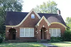 Mark P. Jones House |
September 5, 1991 (#91001197) |
Junction of Center and Fir Sts. 35°14′55″N 91°44′33″W |
Searcy | |
| 89 | Judsonia Bridge | 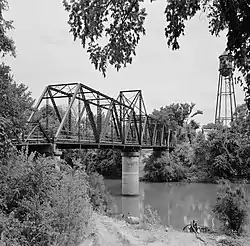 Judsonia Bridge |
April 9, 1990 (#90000535) |
County Road 66 over the Little Red River 35°16′03″N 91°38′23″W |
Judsonia | |
| 90 | Judsonia Community Building Historic District | 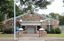 Judsonia Community Building Historic District |
September 5, 1991 (#91001234) |
Junction of Judson Ave. and 6th St. 35°16′22″N 91°38′20″W |
Judsonia | |
| 91 | C.D. Kelly House | 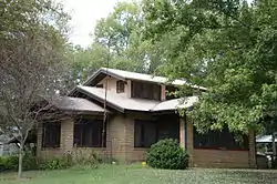 C.D. Kelly House |
September 5, 1991 (#91001190) |
Junction of Main and Adams Sts. 35°16′12″N 91°38′27″W |
Judsonia | |
| 92 | Kerr-Booth House | 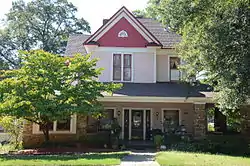 Kerr-Booth House |
March 2, 2006 (#06000076) |
611 W. Center Ave. 35°15′01″N 91°44′34″W |
Searcy | |
| 93 | S.A. Kimbrough House | 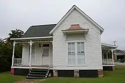 S.A. Kimbrough House |
September 5, 1991 (#91001252) |
302 E. Illinois St. 35°04′21″N 91°52′43″W |
Beebe | |
| 94 | Henry W. Klotz, Sr., Service Station | 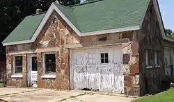 Henry W. Klotz, Sr., Service Station |
September 13, 1991 (#91001273) |
W. 1st St. 35°21′51″N 91°30′27″W |
Russell | |
| 95 | Henry Klotz, Sr., House | 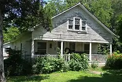 Henry Klotz, Sr., House |
July 22, 1992 (#91001285) |
1st St. 35°21′52″N 91°30′26″W |
Russell | |
| 96 | Capt. Larned House |  Capt. Larned House |
July 22, 1992 (#91001235) |
Highway 157 north of U.S. Highway 64 35°18′14″N 91°38′37″W |
Judsonia | |
| 97 | Lattimer House |  Lattimer House |
September 5, 1991 (#91001215) |
Junction of Oak and Market Sts. 35°14′59″N 91°44′03″W |
Searcy | |
| 98 | Laws-Jarvis House |  Laws-Jarvis House |
July 22, 1992 (#91001256) |
409 N. Main St. 35°04′22″N 91°52′55″W |
Beebe | |
| 99 | Harvey Lea House | July 13, 1992 (#91001270) |
County Road 70 35°21′53″N 91°30′40″W |
Russell | Burned down. | |
| 100 | Leggett House | July 13, 1992 (#91001339) |
Highway 124 east of Little Red 35°26′56″N 91°43′50″W |
Little Red | ||
| 101 | Letona Hotel | 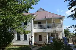 Letona Hotel |
September 13, 1991 (#91001329) |
Off Highway 310 35°21′44″N 91°49′45″W |
Letona | |
| 102 | Lightle House | 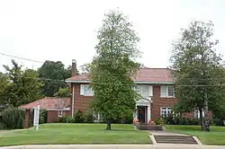 Lightle House |
December 22, 1982 (#82000958) |
605 Race Ave. 35°15′01″N 91°43′50″W |
Searcy | |
| 103 | Lightle House | July 20, 1992 (#91001224) |
County Road 76 35°15′20″N 91°42′40″W |
Searcy | ||
| 104 | Ben Lightle House |  Ben Lightle House |
September 5, 1991 (#91001216) |
Junction of N. Locust and E. Market Sts. 35°14′58″N 91°44′06″W |
Searcy | |
| 105 | William H. Lightle House | 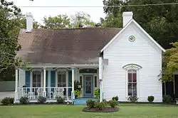 William H. Lightle House |
September 5, 1991 (#91001226) |
601 E. Race St. 35°15′02″N 91°43′55″W |
Searcy | |
| 106 | Jim Little House | September 5, 1991 (#91001315) |
Walnut St. east of its junction with Front St. 35°25′24″N 91°27′11″W |
Bradford | No longer standing. | |
| 107 | Livestock and Equipment Barn, Glenn Homestead | 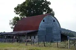 Livestock and Equipment Barn, Glenn Homestead |
July 20, 1992 (#91001287) |
Highway 124 northeast of Pangburn 35°25′51″N 91°48′00″W |
Pangburn | |
| 108 | Lone Star School | July 20, 1992 (#91001355) |
East of Big Mingo Creek 35°13′20″N 91°30′05″W |
Lone Star | Demolished. | |
| 109 | Dr. Lovell House |  Dr. Lovell House |
July 20, 1992 (#91001314) |
Walnut St. east of its junction with Main St. 35°25′28″N 91°27′25″W |
Bradford | |
| 110 | E.D. Maddox Farm Chicken House | July 20, 1992 (#91001359) |
County Road 36 east of its junction with Highway 5 35°19′57″N 92°04′25″W |
Rose Bud | ; possibly moved or demolished. | |
| 111 | Walter Marsh House |  Walter Marsh House |
September 5, 1991 (#91001288) |
Junction of Maple and Torrence Sts. 35°25′24″N 91°50′30″W |
Pangburn | |
| 112 | Wesley Marsh House |  Wesley Marsh House |
July 20, 1992 (#91001328) |
Junction of Highways 16 and 305 35°22′19″N 91°48′33″W |
Letona | |
| 113 | Martindale Corn Crib |  Martindale Corn Crib |
July 20, 1992 (#91001330) |
Highway 310 35°21′43″N 91°50′28″W |
Letona | |
| 114 | Mason House | July 20, 1992 (#91001319) |
W. Main St. west of its junction with Walnut St. 35°25′30″N 91°27′37″W |
Bradford | No longer standing. | |
| 115 | Mayfair Hotel |  Mayfair Hotel |
September 5, 1991 (#91001242) |
Junction of Spring and Center Sts. 35°14′56″N 91°44′16″W |
Searcy | |
| 116 | McAdams House | 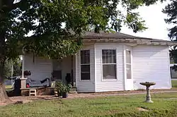 McAdams House |
September 5, 1991 (#91001289) |
Junction of Maple and South Sts. 35°25′21″N 91°50′25″W |
Pangburn | |
| 117 | Dr. McAdams House | September 13, 1991 (#91001300) |
Junction of Maple and Searcy Sts. 35°25′29″N 91°50′08″W |
Pangburn | Demolished prior to 2010. | |
| 118 | Emmett McDonald House | 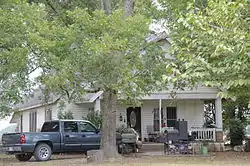 Emmett McDonald House |
July 20, 1992 (#91001368) |
County Road 443 southeast of McRae 35°05′40″N 91°48′27″W |
McRae | |
| 119 | McRae Jail |  McRae Jail |
July 20, 1992 (#91001344) |
E. 1st St. 35°06′48″N 91°49′16″W |
McRae | |
| 120 | Methodist Episcopal Church, South |  Methodist Episcopal Church, South |
July 20, 1992 (#91001278) |
Junction of Main and Center Sts. 35°18′40″N 91°34′04″W |
Bald Knob | |
| 121 | Emmett Miller House | July 20, 1992 (#91001237) |
Highway 13 east of Plainview 35°18′38″N 91°39′38″W |
Plainview | Demolished. | |
| 122 | Mills House | 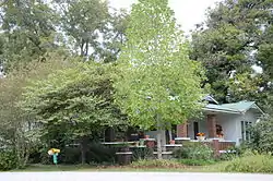 Mills House |
September 5, 1991 (#91001220) |
200 W. Searcy St. 35°13′59″N 91°40′09″W |
Kensett | |
| 123 | Missouri Pacific Depot | 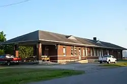 Missouri Pacific Depot |
July 20, 1992 (#91001276) |
Junction of Market and Ramey Sts. 35°18′28″N 91°34′09″W |
Bald Knob | |
| 124 | Missouri Pacific Railway Caboose No. 928 | 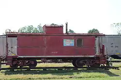 Missouri Pacific Railway Caboose No. 928 |
May 16, 2011 (#11000303) |
Next to UPRR on Market St., southwest of Vine St. 35°18′28″N 91°34′09″W |
Bald Knob | |
| 125 | Moody House |  Moody House |
July 20, 1992 (#91001277) |
104 Market St. 35°18′24″N 91°34′16″W |
Bald Knob | |
| 126 | Moore House |  Moore House |
September 13, 1991 (#91001210) |
405 Center St. 35°14′54″N 91°44′27″W |
Searcy | |
| 127 | Morris House | 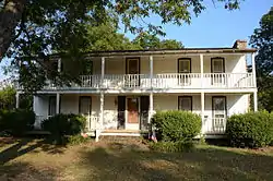 Morris House |
December 4, 1978 (#78000641) |
Route 1 35°29′03″N 91°37′31″W |
Bradford | |
| 128 | Morris Institute Dairy Barn | July 20, 1992 (#91001332) |
County Road 41 south of its junction with County Road 818 35°16′31″N 91°52′01″W |
Crosby | Demolished. | |
| 129 | Mount Olive-Bedford Chapel Cemetery | May 30, 2019 (#100003997) |
SW of the intersection of Nix & Manning Rds. 35°15′07″N 92°06′03″W |
Mount Vernon vicinity | ||
| 130 | J.A. Neaville House | 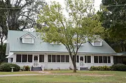 J.A. Neaville House |
July 22, 1992 (#91001356) |
Highway 385 north of its junction with Highway 11 35°07′26″N 91°38′40″W |
Griffithville | |
| 131 | New Mt. Pisgah School | 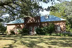 New Mt. Pisgah School |
July 20, 1992 (#91001331) |
Between Mt. Pisgah and Little Creek 35°19′45″N 91°49′48″W |
New Mt. Pisgah | |
| 132 | Nimmo Clubhouse |  Nimmo Clubhouse |
July 22, 1992 (#91001360) |
County Road 65 at the Little Red River 35°11′03″N 91°28′34″W |
Nimmo | |
| 133 | Howard O'Neal Barn | July 20, 1992 (#91001286) |
County Road 73 south of Russell 35°21′19″N 91°30′21″W |
Russell | Demolished. | |
| 134 | Austin Pangburn House | 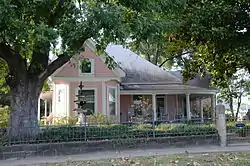 Austin Pangburn House |
September 5, 1991 (#91001290) |
Junction of Main and Austin Sts. 35°25′34″N 91°50′16″W |
Pangburn | |
| 135 | Paschall House | 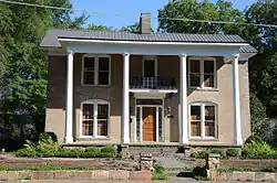 Paschall House |
September 5, 1991 (#91001203) |
Junction of N. Oak and E. Center Sts. 35°14′56″N 91°44′02″W |
Searcy | |
| 136 | Patman House | September 5, 1991 (#91001292) |
Junction of Mountain and Jackson Sts. 35°25′17″N 91°50′30″W |
Pangburn | Demolished prior to 2010. | |
| 137 | Pence-Carmichael Farm, Barn and Root Cellar | 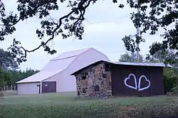 Pence-Carmichael Farm, Barn and Root Cellar |
July 20, 1992 (#91001305) |
Off Highway 31 east of Romance 35°14′29″N 92°02′25″W |
Romance | |
| 138 | Plummer House | 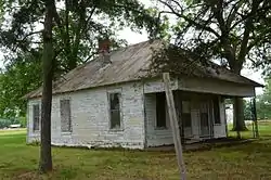 Plummer House |
July 22, 1992 (#91001247) |
314 Alabama St. 35°03′39″N 91°52′37″W |
Beebe | |
| 139 | Powell Clothing Store | 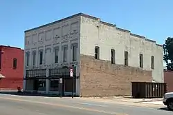 Powell Clothing Store |
September 5, 1991 (#91001249) |
201 N. Main St. 35°04′16″N 91°52′51″W |
Beebe | |
| 140 | Prince House | July 22, 1992 (#91001307) |
County Road 68 northwest of Velvet Ridge 35°26′19″N 91°35′50″W |
Velvet Ridge | ||
| 141 | Edward Ransom Farmstead, Livestock and Equipment Barn | July 22, 1992 (#91001361) |
County Road 359 west of its junction with U.S. Highway 167 35°30′11″N 91°36′46″W |
Midway | Demolished. | |
| 142 | Sam Ray House | 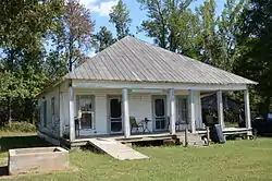 Sam Ray House |
July 23, 1992 (#91001296) |
Highway 305 northeast of its junction with County Road 47 35°24′02″N 91°46′58″W |
Clay | |
| 143 | J.C. Rhew Co. Packing Shed | July 23, 1992 (#91001343) |
County Road 376 northeast of Providence 35°23′57″N 91°38′53″W |
Providence | No longer standing. | |
| 144 | Rialto Theater | 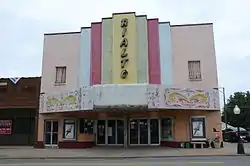 Rialto Theater |
September 13, 1991 (#91001231) |
Junction of Race and Spring Sts. 35°15′03″N 91°44′16″W |
Searcy | |
| 145 | Robertson Drugstore | 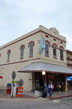 Robertson Drugstore |
September 13, 1991 (#91001245) |
Junction of Spring and Arch Sts. 35°15′00″N 91°44′16″W |
Searcy | |
| 146 | Robertson House | 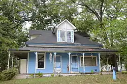 Robertson House |
September 5, 1991 (#91001221) |
Junction of 2nd and Dandridge Sts. 35°13′55″N 91°40′13″W |
Kensett | |
| 147 | Rock Building |  Rock Building |
July 23, 1992 (#91001195) |
County Road 370 south of its junction with Highway 157 35°18′00″N 91°40′09″W |
Plainview | |
| 148 | Russell Jail | 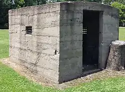 Russell Jail |
July 23, 1992 (#91001271) |
Off Elm St. 35°21′46″N 91°30′33″W |
Russell | |
| 149 | St. Richard's Catholic Church | 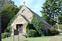 St. Richard's Catholic Church |
July 20, 1992 (#91001274) |
Junction of Hickory and Cleveland Sts. 35°18′42″N 91°34′14″W |
Bald Knob | |
| 150 | Scott-Davis House | July 20, 1992 (#91001306) |
County Road 15 southwest of Romance 35°13′41″N 92°03′29″W |
Romance | ||
| 151 | Searcy Confederate Monument | 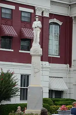 Searcy Confederate Monument |
April 26, 1996 (#96000458) |
Courthouse lawn near the junction of W. Arch Ave. and Spring St. 35°15′03″N 91°44′18″W |
Searcy | |
| 152 | Searcy Post Office | 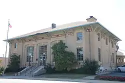 Searcy Post Office |
July 20, 1992 (#91001200) |
Southwestern corner of the junction of Gum and Arch Sts. 35°14′59″N 91°44′24″W |
Searcy | ; now the municipal courthouse |
| 153 | Sellers House | 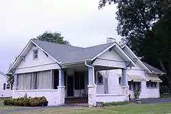 Sellers House |
September 5, 1991 (#91001261) |
702 W. Center St. 35°04′06″N 91°53′16″W |
Beebe | |
| 154 | Shue House | 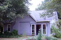 Shue House |
September 5, 1991 (#91001257) |
108 Holly St. 35°04′08″N 91°53′18″W |
Beebe | |
| 155 | John Shutter House | 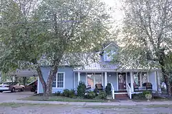 John Shutter House |
September 5, 1991 (#91001299) |
Junction of Austin and Main Sts. 35°25′32″N 91°50′15″W |
Pangburn | |
| 156 | Stanley Simpson Farmstead Picking Shed | September 13, 1991 (#91001342) |
County Road 390 west of its junction with Highway 157 35°22′44″N 91°41′25″W |
Providence | ||
| 157 | Smith House |  Smith House |
September 5, 1991 (#91001218) |
607 W. Arch Ave. 35°15′00″N 91°44′36″W |
Searcy | |
| 158 | A.J. Smith House | September 5, 1991 (#91001223) |
Highway 385 35°07′35″N 91°38′41″W |
Griffithville | No longer standing. | |
| 159 | Smyrna Methodist Church | 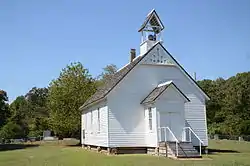 Smyrna Methodist Church |
July 20, 1992 (#91001336) |
Highway 36 east of Center Hill 35°15′08″N 91°51′11″W |
Center Hill | |
| 160 | Dr. Emmett Snipes House | September 5, 1991 (#91001243) |
Junction of E. Market and N. Locust Sts. 35°14′59″N 91°44′05″W |
Searcy | No longer standing. | |
| 161 | Staggs-Huffaker Building |  Staggs-Huffaker Building |
September 5, 1991 (#91001250) |
Junction of N. Main and W. Illinois Sts. 35°04′15″N 91°52′50″W |
Beebe | |
| 162 | Stipe Cotton Gin | 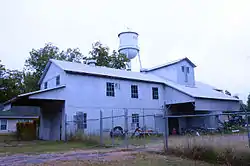 Stipe Cotton Gin |
July 20, 1992 (#91001248) |
Junction of Florida and Cypress Sts. 35°04′04″N 91°52′42″W |
Beebe | |
| 163 | William Howell House, Storm Cellar |  William Howell House, Storm Cellar |
July 20, 1992 (#91001295) |
County Road 47 east of its junction with Highway 305 35°23′47″N 91°47′06″W |
Clay | |
| 164 | Thomas House | July 23, 1992 (#91001326) |
County Road 751 northwest of Fourmile Hill 35°18′23″N 91°47′17″W |
Fourmile Hill | ||
| 165 | Thompson House | July 23, 1992 (#91001341) |
County Road 328 behind Holly Grove Cemetery 35°23′08″N 91°37′52″W |
Stevens Creek | ||
| 166 | John Thrasher Homestead | July 23, 1992 (#91001362) |
Off County Road 359 west of its junction with U.S. Highway 167 35°30′05″N 91°36′50″W |
Midway | Demolished. | |
| 167 | Titan II ICBM Launch Complex 373-5 Site |  Titan II ICBM Launch Complex 373-5 Site |
March 6, 2000 (#00000100) |
Approximately 0.5 miles (0.80 km) northeast of Highway 36 35°15′34″N 91°51′26″W |
Center Hill | |
| 168 | Titus House |  Titus House |
September 5, 1991 (#91001240) |
406 E. Center St. 35°14′56″N 91°44′00″W |
Searcy | |
| 169 | Trinity Episcopal Church | 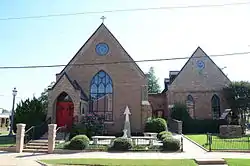 Trinity Episcopal Church |
July 23, 1992 (#91001199) |
Junction of N. Elm and Market Sts. 35°14′59″N 91°44′25″W |
Searcy | |
| 170 | Walker Homestead Historic District | 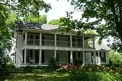 Walker Homestead Historic District |
July 20, 1992 (#91001351) |
County Road 56 east of its junction with Highway 267 35°11′16″N 91°46′35″W |
Garner | |
| 171 | Otha Walker Homestead |  Otha Walker Homestead |
July 23, 1992 (#91001354) |
Highway 36 35°12′12″N 91°36′27″W |
West Point | |
| 172 | Ward-Stout House | 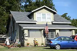 Ward-Stout House |
September 5, 1991 (#91001313) |
Junction of Front and Walnut Sts. 35°25′23″N 91°27′15″W |
Bradford | |
| 173 | Watkins House |  Watkins House |
September 5, 1991 (#91001182) |
1208 E. Race St. 35°15′03″N 91°43′25″W |
Searcy | |
| 174 | Tom Watkins House | 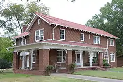 Tom Watkins House |
September 5, 1991 (#91001183) |
Junction of Oak and Race Sts. 35°15′03″N 91°44′01″W |
Searcy | |
| 175 | William Henry Watson Homestead | .JPG.webp) William Henry Watson Homestead |
July 20, 1992 (#91001308) |
County Road 68 south of Denmark 35°26′32″N 91°35′23″W |
Denmark | Demolished. |
| 176 | Weber House | September 5, 1991 (#91001272) |
Elm St. 35°21′46″N 91°30′36″W |
Russell | Burned down. | |
| 177 | Albert Whisinant House | July 23, 1992 (#91001297) |
Highway 16 north of Mountain Home 35°24′02″N 91°49′08″W |
Mountain Home | ||
| 178 | White County Courthouse | 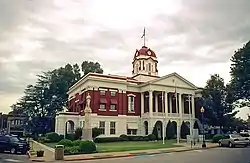 White County Courthouse |
August 3, 1977 (#77000279) |
Court Sq. 35°15′17″N 91°44′16″W |
Searcy | |
| 179 | Wilburn House |  Wilburn House |
September 5, 1991 (#91001177) |
707 E. Race St. 35°15′02″N 91°43′48″W |
Searcy | |
| 180 | Williams House | July 23, 1992 (#91001353) |
Junction of Highway 267 and County Road 54 35°13′44″N 91°45′00″W |
Searcy | No longer standing. | |
| 181 | Arthur Williams Homestead, Feed Storage Shed | July 23, 1992 (#91001321) |
Falwell Rd. 35°25′15″N 91°27′50″W |
Bradford | ||
| 182 | Jack Wood House |  Jack Wood House |
November 2, 1989 (#89001939) |
Judson Ave. 35°16′49″N 91°38′14″W |
Judsonia | |
| 183 | Arthur W. Woodson House | 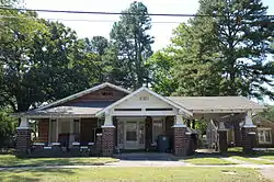 Arthur W. Woodson House |
September 5, 1991 (#91001211) |
1005 W. Arch Ave. 35°15′00″N 91°44′51″W |
Searcy | |
| 184 | Dalton Woodson House |  Dalton Woodson House |
September 5, 1991 (#91001212) |
1007 W. Arch Ave. 35°15′00″N 91°44′54″W |
Searcy | |
| 185 | Avanell Wright House | 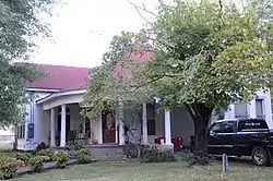 Avanell Wright House |
September 5, 1991 (#91001291) |
Junction of Main and Pine Sts. 35°25′38″N 91°50′07″W |
Pangburn | |
| 186 | Jim Wright Farmstead Historic District | 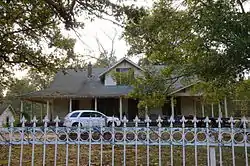 Jim Wright Farmstead Historic District |
September 5, 1991 (#91001284) |
Highway 258 east of its junction with Highway 323 35°21′14″N 91°37′10″W |
Bald Knob |
Former listings
| [3] | Name on the Register | Image | Date listed | Date removed | Location | City or town | Summary |
|---|---|---|---|---|---|---|---|
| 1 | Arnold Farmstead | September 13, 1991 (#91001187) | January 26, 2018 | Off Maple St., south of Deener Creek 35°15′20″N 91°44′32″W |
Searcy | Demolished. | |
| 2 | Coward House | July 10, 1992 (#91001229) | January 26, 2018 | 1105 N. Maple St. 35°15′34″N 91°44′42″W |
Searcy | Demolished. | |
| 3 | Cross House | July 10, 1992 (#91001259) | January 26, 2018 | 410 S. Main St. 35°03′58″N 91°52′31″W |
Beebe | No longer standing. | |
| 4 | Doss House | September 5, 1991 (#91001264) | October 18, 2002 | 408 N. Main Street |
Beebe | ||
| 5 | First Christian Church | September 5, 1991 (#91001198) | September 25, 2003 | Junction of Race and N. Locust Sts. |
Searcy | ||
| 6 | Leonard Gordon Homestead, Hexagonal Grain Crib | July 21, 1992 (#91001311) | January 24, 2017 | County Road 69 35°22′34″N 91°36′01″W |
Twentythree | ||
| 7 | Herring Building | September 5, 1991 (#91001348) | March 31, 2000 | Junction of E. First and Smith Streets |
McRae | ||
| 8 | Herring Building | September 28, 2005 (#05001083) | September 25, 2012 | 601-603 E. 1st. St. |
McRae | ||
| 9 | Ida Hicks House | September 5, 1991 (#91001180) | January 26, 2018 | 410 W. Arch St. 35°15′01″N 91°44′29″W |
Searcy | Demolished prior to 2004. | |
| 10 | Honey Hill Christian Union Church | September 5, 1991 (#91001352) | May 15, 2003 | South of AR 36, southwest of Searcy |
Searcy | ||
| 11 | Judsonia High School Gymnasium | September 13, 1991 (#91001232) | September 29, 2015 | Roadman Ave. 35°16′37″N 91°38′19″W |
Judsonia | No longer standing. | |
| 12 | Lemay House | July 20, 1992 (#91001254) | January 26, 2018 | 305 S. Cypress St. 35°03′39″N 91°52′37″W |
Beebe | No longer standing. | |
| 13 | Lightle House | September 5, 1991 (#91001244) | January 26, 2018 | 107 N. Elm St. 35°14′57″N 91°44′27″W |
Searcy | Demolished. | |
| 14 | National Guard Armory Building | September 13, 1991 (#91001178) | September 20, 2006 | Junction of Race and N. Locust Sts. |
Searcy | ||
| 15 | Pemberton House | September 5, 1991 (#91001255) | March 31, 2000 | 601 N. Cypress Street |
Beebe | ||
| 16 | Rascoe House | July 23, 1992 (#91001213) | January 26, 2018 | 702 Main St. 35°14′33″N 91°44′10″W |
Searcy | No longer standing. | |
| 17 | Porter Rodgers, Sr., House | September 5, 1991 (#91001230) | January 26, 2018 | Junction of N. Oak and E. Race Sts. 35°14′54″N 91°44′41″W |
Searcy | Demolished. | |
| 18 | Bob Rogers House | September 13, 1991 (#91001219) | January 26, 2018 | Junction of S. Spring St. and W. Woodruff Ave. 35°14′45″N 91°44′14″W |
Searcy | Demolished. | |
| 19 | Roper House | September 5, 1991 (#91001227) | January 14, 2002 | Hill Street |
McRae | ||
| 20 | Searcy City Hall | September 5, 1991 (#91001227) | October 11, 2005 | Junction of Wade and 14th Sts. |
Searcy | ||
| 21 | Dean L.C. Sears House | July 20, 1992 (#91001208) | January 26, 2018 | 805 E. Center St. 35°14′54″N 91°43′41″W |
Searcy | Demolished prior to 2004. | |
| 22 | Smith-Moore House | July 20, 1992 (#91001246) | January 26, 2018 | 901 N. Main St. 35°04′41″N 91°52′55″W |
Beebe | ||
| 23 | R. L. Van Meter House | September 5, 1991 (#91001233) | October 4, 1999 | Junction of Wade and 14th Sts. |
Judsonia | ||
| 24 | Lipsy Westbrooke House | September 5, 1991 (#91001260) | March 31, 2000 | 809 W. Center Street |
Beebe |
See also
| Wikimedia Commons has media related to National Register of Historic Places in White County, Arkansas. |
References
- The latitude and longitude information provided in this table was derived originally from the National Register Information System, which has been found to be fairly accurate for about 99% of listings. Some locations in this table may have been corrected to current GPS standards.
- "National Register of Historic Places: Weekly List Actions". National Park Service, United States Department of the Interior. Retrieved on February 5, 2021.
- Numbers represent an alphabetical ordering by significant words. Various colorings, defined here, differentiate National Historic Landmarks and historic districts from other NRHP buildings, structures, sites or objects.
- "National Register Information System". National Register of Historic Places. National Park Service. March 13, 2009.
- The eight-digit number below each date is the number assigned to each location in the National Register Information System database, which can be viewed by clicking the number.
| Topics | |
|---|---|
| Lists by state |
|
| Lists by insular areas | |
| Lists by associated state | |
| Other areas | |
| Related | |
| |
Municipalities and communities of White County, Arkansas, United States | ||
|---|---|---|
| Cities | Map of Arkansas highlighting White County | |
| Towns | ||
| Unincorporated communities |
| |
| ||
This article is issued from Wikipedia. The text is licensed under Creative Commons - Attribution - Sharealike. Additional terms may apply for the media files.