National Register of Historic Places listings in Randolph County, Arkansas
This is a list of the National Register of Historic Places listings in Randolph County, Arkansas.
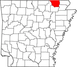
Location of Randolph County in Arkansas
This is intended to be a complete list of the properties and districts on the National Register of Historic Places in Randolph County, Arkansas, United States. The locations of National Register properties and districts for which the latitude and longitude coordinates are included below, may be seen in a map.[1]
There are 17 properties and districts listed on the National Register in the county. Another two properties were once listed but have been removed.
- This National Park Service list is complete through NPS recent listings posted February 5, 2021.[2]
Current listings
| [3] | Name on the Register[4] | Image | Date listed[5] | Location | City or town | Description |
|---|---|---|---|---|---|---|
| 1 | Campbell Cemetery | 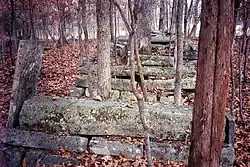 Campbell Cemetery |
May 25, 2005 (#05000463) |
Off Muddy Ln., southeast of Imboden[6] 36°10′59″N 91°08′28″W |
Imboden | |
| 2 | Cedar Grove School #81 | 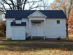 Cedar Grove School #81 |
January 21, 2004 (#03001452) |
Approximately 5 miles north of Pocahontas along Highway 115 in the community of Brockett 36°19′57″N 90°57′06″W |
Pocahontas | |
| 3 | Hillyard Cabin | 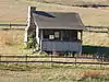 Hillyard Cabin |
August 16, 1994 (#94000851) |
Western side of Old Burr Rd., northeast of Warm Springs 36°29′02″N 91°02′04″W |
Warm Springs | |
| 4 | Looney-French House |  Looney-French House |
September 23, 2004 (#04001035) |
1325 Deer Run Trail 36°23′50″N 91°07′22″W |
Dalton | |
| 5 | Marr's Creek Bridge | January 24, 2008 (#07001433) |
S. Bettis St. 36°15′29″N 90°58′19″W |
Pocahontas | ||
| 6 | Old Davidsonville Historic Site | 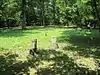 Old Davidsonville Historic Site |
January 18, 1974 (#74000499) |
Northeast of Black Rock on the Black River 36°09′23″N 91°03′23″W |
Black Rock | |
| 7 | Old Randolph County Courthouse | 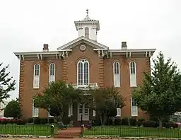 Old Randolph County Courthouse |
April 24, 1973 (#73000390) |
Broadway and Vance St. 36°15′38″N 90°58′10″W |
Pocahontas | |
| 8 | Old Union School |  Old Union School |
November 12, 1993 (#93001203) |
504 Old Union Rd. 36°15′41″N 91°06′07″W |
Birdell | |
| 9 | Old US 67, Biggers to Datto | 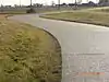 Old US 67, Biggers to Datto |
September 24, 2004 (#04001046) |
Biggers-Reyno Rd., 1st St., and County Road 111 36°21′35″N 90°46′37″W |
Biggers | Extends into Clay County |
| 10 | Pocahontas Commercial Historic District | Pocahontas Commercial Historic District |
June 12, 2009 (#09000315) |
Roughly bounded by Rice, Thomasville, Jordan, and McDonald Sts. 36°15′41″N 90°58′14″W |
Pocahontas | |
| 11 | Pocahontas Federal Savings and Loan | Pocahontas Federal Savings and Loan |
January 24, 2019 (#100003338) |
201 W. Broadway St. 36°15′42″N 90°58′17″W |
Pocahontas | |
| 12 | Pocahontas Post Office | 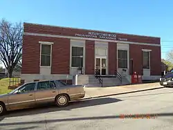 Pocahontas Post Office |
May 16, 2002 (#02000488) |
109 Van Bibber St. 36°15′43″N 90°58′16″W |
Pocahontas | |
| 13 | Randolph County Courthouse | 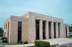 Randolph County Courthouse |
August 22, 1996 (#96000910) |
Southwestern corner of the junction of Broadway and N. Marr Sts. 36°15′39″N 90°58′16″W |
Pocahontas | |
| 14 | Ravenden Springs School | 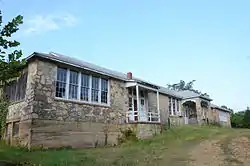 Ravenden Springs School |
January 14, 2004 (#03001379) |
Highway 90 36°18′52″N 91°13′26″W |
Ravenden Springs | |
| 15 | Rice-Upshaw House | 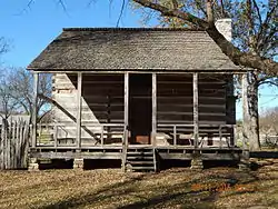 Rice-Upshaw House |
October 6, 2004 (#04001107) |
Highway 93, 2 miles south of Dalton 36°25′02″N 91°07′11″W |
Dalton | |
| 16 | St. Mary's AME Church-Pocahontas Colored School | 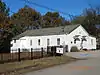 St. Mary's AME Church-Pocahontas Colored School |
August 5, 2002 (#02000830) |
1708 Archer St. 36°15′44″N 90°58′53″W |
Pocahontas | |
| 17 | Yadkin Church | 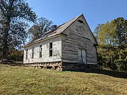 Yadkin Church |
May 30, 2019 (#100004003) |
Western side of Upper James Creek Rd. approximately 1 mile north of the junction with Lower James Creek Rd. 36°22′45″N 91°14′46″W |
Ravenden Springs |
Former listings
| [3] | Name on the Register | Image | Date listed | Date removed | Location | City or town | Summary |
|---|---|---|---|---|---|---|---|
| 1 | Daniel V. Bates House | (#79000457) | September 14, 2002 | U.S. Route 67 |
Pocahontas | ||
| 2 | Black River Bridge | .jpg.webp) Black River Bridge |
April 9, 1990 (#90000522) | January 26, 2018 | U.S. Route 67 over the Black River 36°15′16″N 90°58′15″W |
Pocahontas | Swing truss bridge; demolished |
See also
| Wikimedia Commons has media related to National Register of Historic Places in Randolph County, Arkansas. |
References
- The latitude and longitude information provided in this table was derived originally from the National Register Information System, which has been found to be fairly accurate for about 99% of listings. Some locations in this table may have been corrected to current GPS standards.
- "National Register of Historic Places: Weekly List Actions". National Park Service, United States Department of the Interior. Retrieved on February 5, 2021.
- Numbers represent an alphabetical ordering by significant words. Various colorings, defined here, differentiate National Historic Landmarks and historic districts from other NRHP buildings, structures, sites or objects.
- "National Register Information System". National Register of Historic Places. National Park Service. March 13, 2009.
- The eight-digit number below each date is the number assigned to each location in the National Register Information System database, which can be viewed by clicking the number.
- Location derived from its GNIS feature record; the NRIS lists the site as "Address Restricted"
| Topics | |
|---|---|
| Lists by state |
|
| Lists by insular areas | |
| Lists by associated state | |
| Other areas | |
| Related | |
| |
Municipalities and communities of Randolph County, Arkansas, United States | ||
|---|---|---|
| Cities | Map of Arkansas highlighting Randolph County | |
| Towns | ||
| Unincorporated communities |
| |
| Townships | ||
| Ghost towns |
| |
| ||
This article is issued from Wikipedia. The text is licensed under Creative Commons - Attribution - Sharealike. Additional terms may apply for the media files.