National Register of Historic Places listings in Mississippi County, Arkansas
This is a list of the National Register of Historic Places listings in Mississippi County, Arkansas.
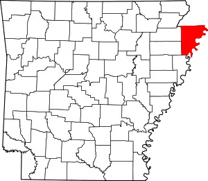
Location of Mississippi County in Arkansas
This is intended to be a complete list of the properties and districts on the National Register of Historic Places in Mississippi County, Arkansas, United States.
There are 42 properties and districts listed on the National Register in the county, including 2 National Historic Landmarks. Another two properties were once listed but have been removed.
- This National Park Service list is complete through NPS recent listings posted February 5, 2021.[1]
Current listings
| [2] | Name on the Register[3] | Image | Date listed[4] | Location | City or town | Description |
|---|---|---|---|---|---|---|
| 1 | Bank of Osceola |  Bank of Osceola |
August 6, 1987 (#87001352) |
207 E. Hale St. 35°42′10″N 89°58′00″W |
Osceola | |
| 2 | Blytheville Air Force Base Capehart Housing Historic District | .jpg.webp) Blytheville Air Force Base Capehart Housing Historic District |
September 28, 2015 (#15000628) |
Roughly bounded by Village Ave., Northside, Cypress Dr., Hemlock, Westminster, Apricot, Azalea & Pigeon Sts. 35°57′58″N 89°57′43″W |
Blytheville | |
| 3 | Blytheville Air Force Base Strategic Air Command (SAC) Alert and Weapons Storage Areas Historic District |  Blytheville Air Force Base Strategic Air Command (SAC) Alert and Weapons Storage Areas Historic District |
January 26, 2018 (#100001999) |
4701 Memorial Drive 35°57′33″N 89°57′47″W |
Blytheville | |
| 4 | Blytheville Commercial Historic District |  Blytheville Commercial Historic District |
May 24, 2006 (#06000421) |
Main St. between 5th and Franklin Sts. and Ash St. between 5th and 2nd Sts. 35°55′44″N 89°54′20″W |
Blytheville | |
| 5 | Blytheville Greyhound Bus Station | 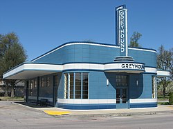 Blytheville Greyhound Bus Station |
August 17, 1987 (#87000447) |
109 N. 5th St. 35°55′41″N 89°54′30″W |
Blytheville | |
| 6 | Blytheville, Leachville and Arkansas Southern Railroad Depot-Leachville |  Blytheville, Leachville and Arkansas Southern Railroad Depot-Leachville |
June 11, 1992 (#92000612) |
Northeastern corner of the junction of 2nd and McNamee Sts. 35°56′15″N 90°15′33″W |
Leachville | |
| 7 | Burdette School Complex Historic District | October 28, 2001 (#01001174) |
153 E. Park Ln. 35°48′47″N 89°56′13″W |
Burdette | burned, 9-20-2015 | |
| 8 | Chickasawba Mound (3M55) | 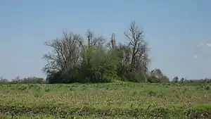 Chickasawba Mound (3M55) |
November 16, 1984 (#84000217) |
North of the junction of Highway 151 and Chickasawba Ave.[5] 35°55′54″N 89°55′50″W |
Blytheville | |
| 9 | City Hall |  City Hall |
August 6, 1987 (#87001350) |
316 W. Hale St. 35°42′10″N 89°58′15″W |
Osceola | |
| 10 | Delta Valley & Southern Railway Locomotive #50 | January 24, 2007 (#06001263) |
U.S. Route 61 at the Delta Valley and Southern Railway crossing 35°33′15″N 90°05′03″W |
Delpro | Last known location Oklahoma City, Oklahoma, May 2009 | |
| 11 | Dyess Colony Center | Dyess Colony Center |
January 1, 1976 (#76000435) |
Highway 297 35°35′29″N 90°12′46″W |
Dyess | |
| 12 | Eaker Site |  Eaker Site |
November 25, 1992 (#91001048) |
Northwest of the former landfill at Eaker Air Force Base[6] 35°57′48″N 89°56′04″W |
Blytheville | |
| 13 | Farm No. 266—Johnny Cash Boyhood Home | 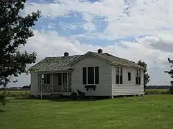 Farm No. 266—Johnny Cash Boyhood Home |
May 2, 2018 (#100002000) |
4791 W. County Road 924 35°35′51″N 90°14′42″W |
Dyess | Home from age 3 through high school of Johnny Cash, part of a New Deal program. |
| 14 | Florida Brothers Building | 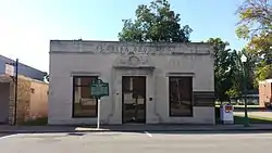 Florida Brothers Building |
August 6, 1987 (#87001355) |
319 W. Hale St. 35°42′09″N 89°58′15″W |
Osceola | |
| 15 | Garden Point Cemetery | 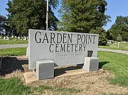 Garden Point Cemetery |
May 24, 2006 (#06000415) |
4682 W. Highway 140 35°42′08″N 90°14′17″W |
Etowah | |
| 16 | Hale Avenue Historic District | 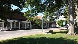 Hale Avenue Historic District |
September 14, 1987 (#87001349) |
Roughly bounded by Hale Ave., Poplar St., Ford Ave., and Walnut St.; also roughly 107-111 W. Hale Ave. and 101-109 N. Walnut St.; also the 100 and 200 blocks of W. Hale Ave., the 100 and 200 blocks of E. Hale Ave., and the 100 block of N. Poplar St. 35°42′09″N 89°58′10″W |
Osceola | Second and third sets of addresses represent boundary increases of September 2, 2003 and August 1, 2008 |
| 17 | Herman Davis Memorial | 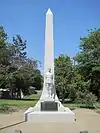 Herman Davis Memorial |
April 7, 1995 (#95000379) |
Northeastern corner of the junction of Baltimore Avenue (Highway 18B) and Highway 18 35°52′23″N 90°09′57″W |
Manila | |
| 18 | Jonesboro, Lake City & Eastern Railroad Depot |  Jonesboro, Lake City & Eastern Railroad Depot |
March 8, 1997 (#97000206) |
Northwestern corner of the junction of S. Dewey and Baltimore Avenue (Highway 18B) 35°52′43″N 90°10′00″W |
Manila | |
| 19 | Keiser School | 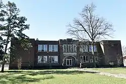 Keiser School |
October 8, 1992 (#92001342) |
Southeastern corner of the junction of Main and School Sts. 35°40′26″N 90°05′42″W |
Keiser | |
| 20 | Keiser Water Tower |  Keiser Water Tower |
January 24, 2007 (#06001283) |
Junction of Water and E. Main Sts. 35°40′39″N 90°05′50″W |
Keiser | |
| 21 | Kress Building | 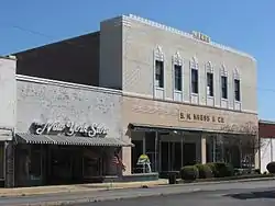 Kress Building |
June 13, 1997 (#97000555) |
210 W. Main St. 35°55′40″N 89°53′37″W |
Blytheville | |
| 22 | Minaret Manor | 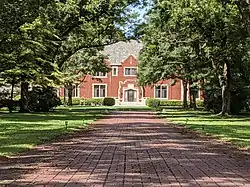 Minaret Manor |
January 24, 2017 (#100000554) |
844 W. Semmes 35°42′23″N 89°58′51″W |
Osceola | Also referred to as: Cox-Florida Mansion |
| 23 | Mississippi County Courthouse | 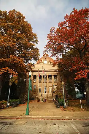 Mississippi County Courthouse |
December 13, 1978 (#78000612) |
Hale and Poplar Aves. 35°42′11″N 89°58′09″W |
Osceola | |
| 24 | Mississippi County Courthouse, Chickasawba District | 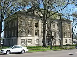 Mississippi County Courthouse, Chickasawba District |
December 6, 1996 (#96001411) |
200 W. Walnut St. 35°55′44″N 89°54′17″W |
Blytheville | |
| 25 | Nodena Site | 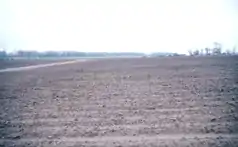 Nodena Site |
October 15, 1966 (#66000201) |
Address Restricted |
Wilson | An archeological site which is the type site for the Nodena culture. Possibly visited by Spanish explorer Hernando de Soto in 1542 |
| 26 | Old Bell Telephone Building |  Old Bell Telephone Building |
August 6, 1987 (#87001353) |
100 block of Ash St. 35°42′12″N 89°57′59″W |
Osceola | |
| 27 | Osceola Times Building |  Osceola Times Building |
August 6, 1987 (#87001351) |
112 N. Poplar St. 35°42′11″N 89°58′07″W |
Osceola | |
| 28 | Planters Bank Building |  Planters Bank Building |
August 6, 1987 (#87001354) |
200 E. Hale St. 35°42′09″N 89°58′01″W |
Osceola | |
| 29 | Sherman Mound and Village | February 1, 2018 (#100002062) |
Address Restricted |
Osceola | ||
| 30 | Three States Lumber Company Mill Powerhouse |  Three States Lumber Company Mill Powerhouse |
October 28, 2001 (#01001175) |
Old Mill Rd. 35°49′00″N 89°56′24″W |
Burdette | |
| 31 | Chris Tompkins House | 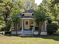 Chris Tompkins House |
October 28, 2001 (#01001176) |
144 South Oak Dr. 35°48′57″N 89°56′19″W |
Burdette | |
| 32 | United States Highway 61 Arch | 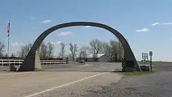 United States Highway 61 Arch |
October 28, 2001 (#01001177) |
U.S. Route 61 35°59′58″N 89°53′54″W |
Blytheville | Extends into Pemiscot County, Missouri |
| 33 | Violet Cemetery | 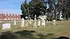 Violet Cemetery |
October 6, 2004 (#04001108) |
Area bounded by W. Johnson Ave., Semmes Ave., and Pecan St. 35°42′22″N 89°58′01″W |
Osceola | |
| 34 | West Main Street Residential Historic District | 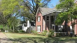 West Main Street Residential Historic District |
August 5, 2010 (#10000521) |
W. Main St. between B and 6th St. and Division 35°55′39″N 89°55′08″W |
Blytheville | |
| 35 | Widner-Magers Farm Historic District |  Widner-Magers Farm Historic District |
January 29, 2007 (#06001325) |
3398 Highway 181 35°52′41″N 90°02′38″W |
Dell | |
| 36 | Edward Samuel Wildy Barn |  Edward Samuel Wildy Barn |
January 15, 2004 (#03001382) |
1198 S. Highway 136 35°43′07″N 90°14′33″W |
Etowah | Barn felled by high winds in 2015. Silo and windmill remain. |
| 37 | Wilson Commercial Historic District | 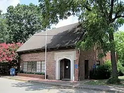 Wilson Commercial Historic District |
September 23, 2016 (#16000651) |
Roughly bounded by Union Ave., S. Jefferson, Madison, Adams & 2nd Sts. 35°34′07″N 90°02′35″W |
Wilson | |
| 38 | Wilson Community House |  Wilson Community House |
June 2, 2015 (#15000285) |
10 Lake Dr. 35°34′14″N 90°02′28″W |
Wilson | |
| 39 | Wilson High School Gymnasium |  Wilson High School Gymnasium |
May 27, 2015 (#15000286) |
Main & Lee Sts. 35°33′53″N 90°03′03″W |
Wilson | |
| 40 | Wilson Motor Company | January 24, 2019 (#100003332) |
42 Cortez Kennedy Ave. 35°33′57″N 90°02′50″W |
Wilson | Structure no longer exists, 9/2010. | |
| 41 | Wilson Residential Historic District |  Wilson Residential Historic District |
September 21, 2016 (#16000652) |
4737, 4785, 4877 & 5101 US 61 35°35′02″N 90°02′00″W |
Wilson | |
| 42 | Zebree Homestead | May 2, 1975 (#75000398) |
Section 28, T16N, R9E, in the Big Lake National Wildlife Refuge[7]:19 35°59′05″N 90°07′48″W |
Buckeye | Mississippian village site.[7]:22 Located along the ditch at the refuge's western boundary; extends as far east as the old bed of the Little River[7]:25 |
Former listings
| [2] | Name on the Register | Image | Date listed | Date removed | Location | City or town | Summary |
|---|---|---|---|---|---|---|---|
| 1 | First Baptist Church | September 7, 1995 (#95001083) | September 14, 2005 | 513 S. Pecan St. |
Osceola | ||
| 2 | Mississippi County Jail | 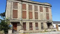 Mississippi County Jail |
August 6, 1987 (#87001356) | January 24, 2017 | 300 S. Poplar St. 35°42′06″N 89°58′09″W |
Osceola | demolished 2-25-2016 |
See also
| Wikimedia Commons has media related to National Register of Historic Places in Mississippi County, Arkansas. |
References
- "National Register of Historic Places: Weekly List Actions". National Park Service, United States Department of the Interior. Retrieved on February 5, 2021.
- Numbers represent an alphabetical ordering by significant words. Various colorings, defined here, differentiate National Historic Landmarks and historic districts from other NRHP buildings, structures, sites or objects.
- "National Register Information System". National Register of Historic Places. National Park Service. March 13, 2009.
- The eight-digit number below each date is the number assigned to each location in the National Register Information System database, which can be viewed by clicking the number.
- U.S. Geological Survey Geographic Names Information System: Chickasawba Mound
- Carmichael, David, and Mark R. Barnes. National Historic Landmark Nomination: Eaker Site. National Park Service, 1994-01-14, 7.
- Anderson, David G. An Evaluation of Excavation Strategies Employed at the Zebree Site (3MS20): 1968-1976 Field Seasons. Thesis U of Arkansas, 1979.
| Topics | |
|---|---|
| Lists by state |
|
| Lists by insular areas | |
| Lists by associated state | |
| Other areas | |
| Related | |
| |
Municipalities and communities of Mississippi County, Arkansas, United States | ||
|---|---|---|
| Cities | Map of Arkansas highlighting Mississippi County | |
| Towns | ||
| Unincorporated communities |
| |
| Footnotes | ‡This populated place also has portions in an adjacent county or counties | |
| ||
This article is issued from Wikipedia. The text is licensed under Creative Commons - Attribution - Sharealike. Additional terms may apply for the media files.