National Register of Historic Places listings in Clermont County, Ohio
This is a list of the National Register of Historic Places listings in Clermont County, Ohio.
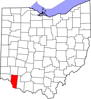
Location of Clermont County in Ohio
This is intended to be a complete list of the properties and districts on the National Register of Historic Places in Clermont County, Ohio, United States. The locations of National Register properties and districts for which the latitude and longitude coordinates are included below, may be seen in a Google map.[1]
There are 28 properties and districts listed on the National Register in the county. Another property was once listed but has been removed.
- This National Park Service list is complete through NPS recent listings posted January 29, 2021.[2]
Current listings
| [3] | Name on the Register[4] | Image | Date listed[5] | Location | City or town | Description |
|---|---|---|---|---|---|---|
| 1 | Bethel Methodist Church | 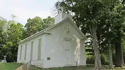 Bethel Methodist Church |
August 11, 1978 (#78002020) |
1 mi (1.6 km) north of Bantam on Elk Lick Rd. 39°00′26″N 84°08′18″W |
Tate Township | |
| 2 | Bullskin Creek Site | 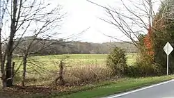 Bullskin Creek Site |
March 30, 1978 (#78002022) |
On a terrace above Bullskin Creek, near its mouth at the Ohio River[6] 38°46′57″N 84°05′32″W |
Franklin Township | |
| 3 | Clarke Farm Site | November 19, 1974 (#74001420) |
Address Restricted |
Monroe Township | Near Point Pleasant | |
| 4 | Devanney Site | March 30, 1978 (#78002023) |
West of Goshen[7] |
Goshen Township | ||
| 5 | East Fork Site | March 30, 1978 (#78002021) |
South of Batavia[7] |
Batavia Township | ||
| 6 | Edgington Mound |  Edgington Mound |
July 15, 1974 (#74001415) |
Southern side of U.S. Route 52, east of Neville[8] 38°48′16″N 84°11′24″W |
Washington Township | |
| 7 | Elk Lick Road Mound |  Elk Lick Road Mound |
February 20, 1975 (#75001344) |
Off Elk Lick Road, northwest of Bantam[8] 39°00′42″N 84°08′02″W |
Batavia Township | |
| 8 | Aaron Fagin House |  Aaron Fagin House |
February 9, 2006 (#06000034) |
2088 Lindale-Nicholsville Rd. 38°58′30″N 84°10′49″W |
Monroe Township | |
| 9 | Ferris Site | 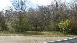 Ferris Site |
October 29, 1974 (#74001416) |
On the banks of the Ohio River, 5 miles downstream from the William H. Zimmer Power Station[9] 38°56′26″N 84°16′16″W |
Ohio Township | Near New Richmond |
| 10 | Gaskins-Malany House | 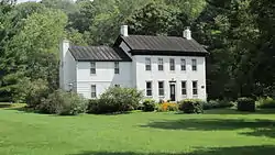 Gaskins-Malany House |
October 29, 1975 (#75001345) |
726 Bradbury Rd., southwest of Withamsville 39°02′N 84°17′W |
Pierce Township | |
| 11 | Gatch Site |  Gatch Site |
October 15, 1974 (#74001414) |
On the Gatch farm, off Gatch Avenue above the Little Miami River[10] 39°10′12″N 84°17′21″W |
Milford | |
| 12 | U.S. Grant Birthplace and Grant Commemorative Sites Historic District | 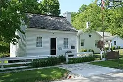 U.S. Grant Birthplace and Grant Commemorative Sites Historic District |
August 6, 1998 (#98001013) |
State Route 232 and U.S. Route 52, at Point Pleasant 38°53′39″N 84°13′58″W |
Monroe Township | |
| 13 | Grace Groesbeck House | February 23, 2015 (#15000037) |
4949 Tealtown Rd. 39°07′50″N 84°15′10″W |
Union Township | On the grounds of the Cincinnati Nature Center. | |
| 14 | Harmony Hill Dairy House |  Harmony Hill Dairy House |
May 30, 2001 (#01000592) |
299 S. 3rd St. 39°02′58″N 84°03′31″W |
Williamsburg | |
| 15 | Krippendorf Estate |  Krippendorf Estate |
June 15, 2011 (#11000364) |
4949 Tealtown Rd., southwest of Perintown 39°07′31″N 84°14′51″W |
Union Township | On the grounds of the Cincinnati Nature Center at Rowe Woods; main house is a circa 1899 Shingle-style building; other contributing structures include an ice house, a laundry/maid's quarters, a garage and a water tower[11] |
| 16 | Lewis McKever Farmhouse | 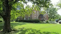 Lewis McKever Farmhouse |
April 1, 1982 (#82003555) |
4475 McKeever Rd., north of Williamsburg 39°04′45″N 84°02′09″W |
Williamsburg Township | |
| 17 | New Richmond Water Works and Electric Station |  New Richmond Water Works and Electric Station |
December 23, 1993 (#93001389) |
701 Washington St. 38°56′43″N 84°16′37″W |
New Richmond | Razed in 2012[12] |
| 18 | Pfarr Log House | 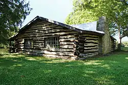 Pfarr Log House |
September 16, 1977 (#77001048) |
West of Owensville on Olive Branch-Stonelick Rd. 39°06′55″N 84°12′38″W |
Union Township | |
| 19 | Pleasant Hill |  Pleasant Hill |
February 28, 2008 (#08000112) |
909 State Route 131 39°10′37″N 84°15′37″W |
Milford | |
| 20 | Promont |  Promont |
November 21, 1980 (#80002959) |
906 Goshen Pike 39°10′39″N 84°16′45″W |
Milford | |
| 21 | Roas-Ilhardt Farm and Winery |  Roas-Ilhardt Farm and Winery |
September 16, 1982 (#82003553) |
North of New Richmond at 3233 Cole Rd. 39°00′39″N 84°15′21″W |
Pierce Township | |
| 22 | Ross-Gowdy House |  Ross-Gowdy House |
June 1, 1982 (#82003554) |
125 George St. 38°56′58″N 84°16′54″W |
New Richmond | |
| 23 | Salt House |  Salt House |
June 22, 1976 (#76001382) |
Southwest of Bethel on State Route 222 38°55′10″N 84°08′23″W |
Tate Township | |
| 24 | Schafer House | .jpg.webp) Schafer House |
May 13, 1974 (#74001417) |
East of Neville off U.S. Route 52 38°47′56″N 84°10′30″W |
Washington Township | |
| 25 | Snead Mound | July 30, 1974 (#74001418) |
Off U.S. Route 52[7] |
Neville | ||
| 26 | Stonelick Covered Bridge | 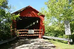 Stonelick Covered Bridge |
September 10, 1974 (#74001419) |
East of Perintown 39°07′52″N 84°11′14″W |
Stonelick Township | |
| 27 | Williams House |  Williams House |
June 26, 2002 (#02000704) |
112 Gay St. 39°03′16″N 84°02′58″W |
Williamsburg | |
| 28 | William Winter Stone House | 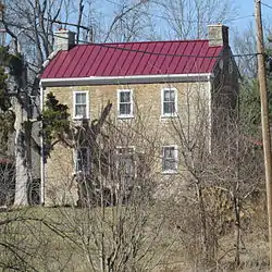 William Winter Stone House |
March 25, 1977 (#77001049) |
North of Mt. Olive on State Route 133 38°53′26″N 84°05′33″W |
Tate Township |
Former listing
| [3] | Name on the Register | Image | Date listed | Date removed | Location | City or town | Summary |
|---|---|---|---|---|---|---|---|
| 1 | Pinkham Farm |  Pinkham Farm |
July 23, 1973 (#73001397) | September 22, 1983 | Northwest of Bantam off State Route 125 |
Bantam |
See also
| Wikimedia Commons has media related to National Register of Historic Places in Clermont County, Ohio. |
References
- The latitude and longitude information provided in this table was derived originally from the National Register Information System, which has been found to be fairly accurate for about 99% of listings. Some locations in this table may have been corrected to current GPS standards.
- "National Register of Historic Places: Weekly List Actions". National Park Service, United States Department of the Interior. Retrieved on January 29, 2021.
- Numbers represent an alphabetical ordering by significant words. Various colorings, defined here, differentiate National Historic Landmarks and historic districts from other NRHP buildings, structures, sites or objects.
- "National Register Information System". National Register of Historic Places. National Park Service. April 24, 2008.
- The eight-digit number below each date is the number assigned to each location in the National Register Information System database, which can be viewed by clicking the number.
- Location derived from Otto, Martha P., and Brian G. Redmond. Transitions: Archaic and Early Woodland Research in the Ohio Country. Athens: Ohio UP, 2009, 9. The NRIS lists the site as "Address Restricted".
- Location derived from its Federal Register notice; the NRIS lists the site as "Address Restricted"
- Location derived from Mills, William C. Archeological Atlas of Ohio. Columbus: Ohio State Archeological and Historical Society, 1914, page 13 and plate 13. The NRIS lists the site as "Address Restricted".
- Location derived from Oregon State University Department of Anthropology. "The Search". Mammoth Trumpet 8.3 (June 1993): 6. The NRIS lists the site as "Address Restricted".
- Owen, Lorrie K., ed. Dictionary of Ohio Historic Places. Vol. 1. St. Clair Shores: Somerset, 1999, 142-143.; and Final Project Plan, Valley View Foundation, May 2005, figure 3. Accessed 2010-04-08. The NRIS lists the site as "Address Restricted".
- "National Register of Historic Places Registration Form - Krippendorf Estate" (PDF). January 28, 2010. Archived from the original (PDF) on March 15, 2012. Retrieved July 7, 2011.
- "President's Corner" (PDF). Past Times. New Richmond, Ohio: Friends of Historic New Richmond, Inc. 1 (4): 7. Retrieved December 6, 2012.

Municipalities and communities of Clermont County, Ohio, United States | ||
|---|---|---|
| Cities | Map of Ohio highlighting Clermont County | |
| Villages | ||
| Townships | ||
| CDPs | ||
| Unincorporated settings |
| |
| Footnotes | ‡This populated place also has portions in an adjacent county or counties | |
| ||
This article is issued from Wikipedia. The text is licensed under Creative Commons - Attribution - Sharealike. Additional terms may apply for the media files.