National Register of Historic Places listings in Cuyahoga County, Ohio
This is a list of the National Register of Historic Places listings in Cuyahoga County, Ohio.
This is intended to be a complete list of the properties and districts on the National Register of Historic Places in Cuyahoga County, Ohio, United States. Latitude and longitude coordinates are provided for many National Register properties and districts; these locations may be seen together in an online map.[1]
There are 410 properties and districts listed on the National Register in the county, including 4 National Historic Landmarks. 156 of these properties and districts, including 1 National Historic Landmark, are located outside of Cleveland, and are listed here, while the properties and districts in Cleveland are listed separately. Three properties and districts are split between Cleveland and other parts of the county, and are thus included on both lists.
- This National Park Service list is complete through NPS recent listings posted January 29, 2021.[2]
Current listings
Exclusive of Cleveland
| [3] | Name on the Register[4] | Image | Date listed[5] | Location | City or town | Description |
|---|---|---|---|---|---|---|
| 1 | Adams Bag Company Paper Mill and Sack Factory |  Adams Bag Company Paper Mill and Sack Factory |
July 3, 2012 (#12000391) |
218 Cleveland St. 41°26′08″N 81°23′09″W |
Chagrin Falls | |
| 2 | John and Maria Adams House |  John and Maria Adams House |
October 10, 1975 (#75001368) |
7315 Columbia Rd., north of Olmsted Falls 41°23′04″N 81°54′09″W |
Olmsted Township | |
| 3 | Alcazar Hotel |  Alcazar Hotel |
April 17, 1979 (#79001805) |
Surrey and Derbyshire Rds. 41°30′07″N 81°35′34″W |
Cleveland Heights | |
| 4 | Aaron Aldrich House |  Aaron Aldrich House |
December 4, 1978 (#78002033) |
30663 Lake Rd. 41°29′49″N 81°57′32″W |
Bay Village | |
| 5 | Ambler Heights Historic District |  Ambler Heights Historic District |
August 22, 2002 (#02000883) |
Roughly bounded by Martin Luther King, Jr. Boulevard, Cedar Glen, N. Park Boulevard, and along Harcourt Dr. 41°29′50″N 81°36′04″W |
Cleveland Heights | |
| 6 | John M. Annis House |  John M. Annis House |
March 19, 1992 (#92000174) |
9271 State Rd. 41°20′31″N 81°43′27″W |
North Royalton | |
| 7 | Baldwin-Wallace College North Campus Historic District | 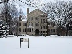 Baldwin-Wallace College North Campus Historic District |
January 23, 2013 (#12001210) |
Bounded by Bagley & E. 5th Aves., Front & Beech Sts. 41°22′28″N 81°51′05″W |
Berea | |
| 8 | Baldwin-Wallace College South Campus Historic District | 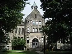 Baldwin-Wallace College South Campus Historic District |
June 7, 2010 (#10000315) |
Seminary St. between School St. and Church St., Front St. to Beach St., variable west/east boundary 41°22′05″N 81°51′06″W |
Berea | |
| 9 | Bay View Hospital | 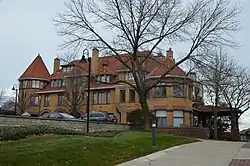 Bay View Hospital |
August 27, 1974 (#74001428) |
23200 Lake Rd. 41°28′56″N 81°52′36″W |
Bay Village | |
| 10 | Bedford Baptist Church |  Bedford Baptist Church |
December 27, 2002 (#02001618) |
750 Broadway Ave. 41°23′24″N 81°32′03″W |
Bedford | |
| 11 | Bedford Historic District | 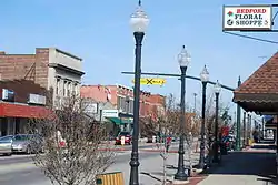 Bedford Historic District |
July 14, 2004 (#04000712) |
Roughly bounded by Willis St., Franklin St., Broadway Ave., and Columbus Rd. 41°23′27″N 81°32′06″W |
Bedford | |
| 12 | Bedford Township Hall |  Bedford Township Hall |
May 27, 1975 (#02001455) |
30 South Park St. 41°23′24″N 81°32′05″W |
Bedford | |
| 13 | Berea District 7 School |  Berea District 7 School |
April 3, 1975 (#75001355) |
323 E. Bagley Rd. 41°22′22″N 81°50′29″W |
Berea | |
| 14 | Berea Union Depot | 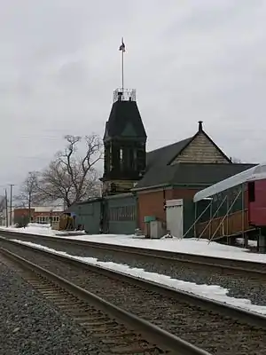 Berea Union Depot |
November 21, 1980 (#80002976) |
30 Depot St. 41°22′52″N 81°51′16″W |
Berea | |
| 15 | Birdtown Historic District |  Birdtown Historic District |
June 27, 2007 (#07000634) |
Roughly bounded by Magee Rd., Plover Rd., Halstead Rd., and Madison Ave. 41°28′30″N 81°46′35″W |
Lakewood | |
| 16 | Elizabeth B. Blossom Subdivision Historic District |  Elizabeth B. Blossom Subdivision Historic District |
September 22, 1987 (#87001543) |
Junction of Richmond and Cedar Rds. 41°29′57″N 81°30′19″W |
Beachwood | |
| 17 | Elizabeth B. and Dudley S. Blossom Estate Service Compound |  Elizabeth B. and Dudley S. Blossom Estate Service Compound |
February 20, 2004 (#04000059) |
24449 Cedar Rd. 41°30′06″N 81°30′22″W |
Lyndhurst | |
| 18 | Chester and Frances Bolton House |  Chester and Frances Bolton House |
March 29, 1984 (#84002911) |
1950 Richmond Rd.[6] 41°30′28″N 81°30′13″W |
Lyndhurst | |
| 19 | Brecksville-Northfield High Level Bridge |  Brecksville-Northfield High Level Bridge |
January 17, 1986 (#86000078) |
State Route 82 and the Cuyahoga River 41°19′17″N 81°35′16″W |
Brecksville | Extends into Sagamore Hills Township in Summit County |
| 20 | Brecksville Town Hall |  Brecksville Town Hall |
July 2, 1973 (#73001404) |
Public Sq. 41°19′15″N 81°37′41″W |
Brecksville | |
| 21 | Brecksville Trailside Museum |  Brecksville Trailside Museum |
August 14, 1992 (#92000988) |
Chippewa Creek Dr. southeast of its junction with State Route 82 41°19′04″N 81°36′57″W |
Brecksville | |
| 22 | John Hartness Brown House |  John Hartness Brown House |
November 7, 1976 (#76001389) |
2380 Overlook Rd. 41°30′24″N 81°35′42″W |
Cleveland Heights | |
| 23 | Buehl House | 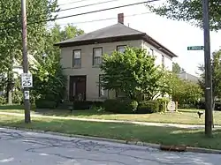 Buehl House |
April 30, 1976 (#76001388) |
118 E. Bridge St. 41°21′58″N 81°50′59″W |
Berea | |
| 24 | Harold B. Burdick House |  Harold B. Burdick House |
September 17, 1974 (#74001434) |
2424 Stratford Rd. 41°29′36″N 81°34′17″W |
Cleveland Heights | |
| 25 | William Burt House |  William Burt House |
March 22, 1979 (#79000286) |
9525 Brecksville Rd. 41°18′10″N 81°37′35″W |
Brecksville | |
| 26 | John Carroll University North Quad Historic District | 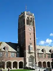 John Carroll University North Quad Historic District |
January 23, 2013 (#12001211) |
1 John Carroll Blvd. 41°29′20″N 81°31′59″W |
University Heights | |
| 27 | Chagrin Falls East Side Historic District |  Chagrin Falls East Side Historic District |
June 14, 2013 (#13000387) |
E. Washington and Philomethian Sts. 41°25′48″N 81°23′15″W |
Chagrin Falls | |
| 28 | Chagrin Falls Township Hall |  Chagrin Falls Township Hall |
October 1, 1974 (#74001432) |
83 N. Main St. 41°25′55″N 81°23′34″W |
Chagrin Falls | |
| 29 | Chagrin Falls Triangle Park Commercial District |  Chagrin Falls Triangle Park Commercial District |
December 29, 1978 (#78002036) |
Main, Franklin, and Washington Sts.; also at the junction of N. Main and E. Orange Sts., extending east and south 41°25′49″N 81°23′30″W |
Chagrin Falls | Second set of boundaries represents a boundary increase |
| 30 | Chagrin Falls West Side District |  Chagrin Falls West Side District |
October 9, 1974 (#74001433) |
Bounded by W. Washington, Church, Maple, and Franklin Sts. 41°25′46″N 81°23′33″W |
Chagrin Falls | |
| 31 | Clague House |  Clague House |
January 11, 1976 (#76001408) |
1371 Clague Rd. 41°28′00″N 81°52′55″W |
Westlake | |
| 32 | Jared Clark House |  Jared Clark House |
August 1, 1975 (#75001357) |
6241 Wallings Rd. 41°20′42″N 81°38′34″W |
Broadview Heights | |
| 33 | Cleveland and Pittsburgh Railroad Bridge |  Cleveland and Pittsburgh Railroad Bridge |
July 24, 1975 (#75001351) |
Tinker's Creek 41°23′05″N 81°32′03″W |
Bedford | |
| 34 | Clifton Park Lakefront District | 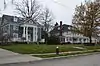 Clifton Park Lakefront District |
November 20, 1974 (#74001459) |
Roughly bounded by Clifton Boulevard, the Rocky River, Lake Erie, and Webb Rd. 41°29′25″N 81°49′38″W |
Lakewood | |
| 35 | Commodore Apartment Building |  Commodore Apartment Building |
April 21, 1983 (#83001951) |
15610 Van Aken Boulevard 41°27′59″N 81°34′08″W |
Shaker Heights | |
| 36 | Cooley Farms |  Cooley Farms |
August 8, 1979 (#79001823) |
North of Warrensville Heights off State Route 175 41°27′02″N 81°29′56″W |
Beachwood | |
| 37 | Jonas Coonrad House | 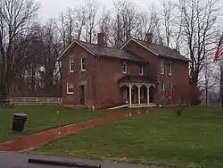 Jonas Coonrad House |
July 24, 1979 (#79000287) |
Southeast of Brecksville at 10340 Riverview Rd. 41°16′50″N 81°34′21″W |
Brecksville | |
| 38 | Samuel Danalds House |  Samuel Danalds House |
August 11, 1979 (#09000095) |
6511 Ruple Rd. 41°23′35″N 81°52′33″W |
Brook Park | |
| 39 | Erastus Day House |  Erastus Day House |
May 8, 1979 (#79001812) |
16807 Hilliard Rd. 41°28′29″N 81°48′50″W |
Lakewood | |
| 40 | Grant Deming's Forest Hill Allotment Historic District |  Grant Deming's Forest Hill Allotment Historic District |
April 13, 2010 (#10000189) |
Woodward Ave., Lincoln Boulevard, Edgehill Rd., Parkway Dr., and Redwood Rd. 41°30′25″N 81°34′12″W |
Cleveland Heights | |
| 41 | Detroit Avenue Bridge | 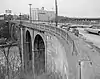 Detroit Avenue Bridge |
February 23, 1973 (#73001428) |
Detroit Ave. at the Rocky River 41°28′57″N 81°49′53″W |
Lakewood and Rocky River | |
| 42 | Detroit-Warren Building |  Detroit-Warren Building |
May 15, 1986 (#86001055) |
14801-14813 Detroit Ave. 41°29′06″N 81°47′59″W |
Lakewood | |
| 43 | Alonzo Drake House |  Alonzo Drake House |
November 28, 1978 (#78002047) |
24262 Broadway 41°21′50″N 81°30′26″W |
Oakwood | |
| 44 | Hezekiah Dunham House |  Hezekiah Dunham House |
June 18, 1975 (#75001352) |
729 Broadway 41°23′27″N 81°32′04″W |
Bedford | |
| 45 | East Cleveland District 9 School |  East Cleveland District 9 School |
July 26, 1979 (#79001806) |
14391 Superior Rd. 41°30′34″N 81°34′07″W |
Cleveland Heights | |
| 46 | Euclid Golf Allotment |  Euclid Golf Allotment |
August 23, 2002 (#02000887) |
Roughly bounded by Cedar Rd., Coventry Rd., Scarborough Rd., W. St. James Parkway, and Ardleigh Dr. 41°29′51″N 81°35′11″W |
Cleveland Heights | |
| 47 | Euclid Heights Historic District |  Euclid Heights Historic District |
October 31, 2012 (#12000897) |
Mayfield Rd., Coventry Rd., Cedar Rd., and Overlook Lane 41°30′23″N 81°34′57″W |
Cleveland Heights | |
| 48 | Fairhill Road Village Historic District | 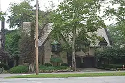 Fairhill Road Village Historic District |
May 10, 1990 (#90000758) |
12309-12511 Fairhill Rd. 41°29′36″N 81°35′47″W |
Cleveland Heights | Extends into Cleveland[7] |
| 49 | Fairmount Boulevard District |  Fairmount Boulevard District |
December 12, 1976 (#76001391) |
2485-3121 Fairmount Boulevard 41°29′37″N 81°34′50″W |
Cleveland Heights | |
| 50 | Fairview Community Park Historic District | 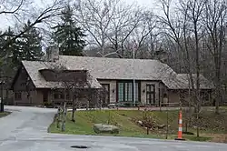 Fairview Community Park Historic District |
June 14, 2013 (#13000388) |
21077 N. Park Dr. 41°26′24″N 81°51′14″W |
Fairview Park | |
| 51 | Falls River Road |  Falls River Road |
April 28, 2000 (#00000421) |
Falls Rd. 41°26′30″N 81°23′24″W |
Chagrin Falls, Chagrin Falls Township, Hunting Valley, and Moreland Hills | |
| 52 | First Church of Christ in Euclid |  First Church of Christ in Euclid |
November 28, 1978 (#78002044) |
16200 Euclid Ave. 41°32′40″N 81°34′01″W |
East Cleveland | |
| 53 | First Universalist Church of Olmsted |  First Universalist Church of Olmsted |
November 25, 1980 (#80002983) |
5050 Porter Rd. 41°24′58″N 81°55′45″W |
North Olmsted | |
| 54 | Forest Hill Historic District |  Forest Hill Historic District |
August 14, 1986 (#86001662) |
Roughly bounded by Glynn Rd., Northdale Boulevard and Cleviden Rd., Mt. Vernon Boulevard and Wyatt Rd., and Lee Boulevard 41°31′41″N 81°34′07″W |
Cleveland Heights and East Cleveland | |
| 55 | Forest Hill Park |  Forest Hill Park |
February 27, 1998 (#98000072) |
Roughly along Lee Boulevard and Superior, Terrace, and Mayfield Rds. 41°31′20″N 81°34′37″W |
Cleveland Heights and East Cleveland | |
| 56 | Forest Hill Realty Sales Office |  Forest Hill Realty Sales Office |
June 21, 2007 (#07000580) |
2419 Lee Boulevard 41°31′05″N 81°34′12″W |
Cleveland Heights | |
| 57 | Fort Hill |  Fort Hill |
July 25, 1974 (#74001460) |
East of North Olmsted off State Route 252 41°24′33″N 81°53′14″W |
North Olmsted | |
| 58 | Stephen Frazee House |  Stephen Frazee House |
May 4, 1976 (#76000211) |
7733 Canal Rd. 41°21′10″N 81°35′34″W |
Valley View | |
| 59 | John Froelich House |  John Froelich House |
July 30, 1974 (#74001461) |
7095 Broadview Rd. 41°22′23″N 81°41′04″W |
Seven Hills | |
| 60 | Fuller-Bramley House |  Fuller-Bramley House |
October 7, 1999 (#99001242) |
7489 Brecksville Rd. 41°21′31″N 81°38′05″W |
Independence | |
| 61 | Daniel Gabel House |  Daniel Gabel House |
May 23, 1978 (#78002049) |
1102 E. Ridgewood Dr. 41°23′31″N 81°40′36″W |
Seven Hills | |
| 62 | Garfield Memorial | 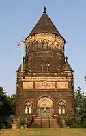 Garfield Memorial |
April 11, 1973 (#73001411) |
12316 Euclid Ave. in Lake View Cemetery 41°30′36″N 81°35′29″W |
Cleveland Heights | Extends into Cleveland[8] |
| 63 | Gates Mills Historic District |  Gates Mills Historic District |
October 9, 1991 (#91001491) |
Roughly along Berkshire, Chagrin River, Epping, Old Mill, and Sherman Rds. 41°31′38″N 81°24′32″W |
Gates Mills | |
| 64 | Gates Mills Methodist Episcopal Church | 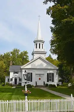 Gates Mills Methodist Episcopal Church |
July 18, 1975 (#75001367) |
Old Mill Rd. off U.S. Route 322 41°31′04″N 81°24′17″W |
Gates Mills | |
| 65 | Holsey Gates House |  Holsey Gates House |
June 30, 1975 (#75001354) |
762 Broadway 41°23′23″N 81°32′02″W |
Bedford | |
| 66 | Edmund Gleason House | 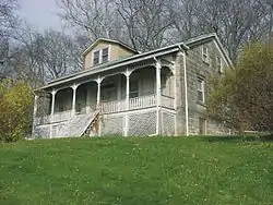 Edmund Gleason House |
December 18, 1978 (#78000377) |
7243 Canal Rd. 41°22′02″N 81°36′38″W |
Valley View | |
| 67 | Grand Pacific Hotel | 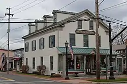 Grand Pacific Hotel |
October 10, 1975 (#75001369) |
8112 Columbia Rd. 41°22′27″N 81°54′08″W |
Olmsted Falls | |
| 68 | Greenwood Farm |  Greenwood Farm |
February 23, 2016 (#16000041) |
264 Richmond Rd. 41°34′23″N 81°29′41″W |
Richmond Heights | |
| 69 | Gwinn Estate |  Gwinn Estate |
October 1, 1974 (#74001430) |
12407 Lakeshore Boulevard 41°33′36″N 81°35′58″W |
Bratenahl | |
| 70 | Harvey Hackenberg House |  Harvey Hackenberg House |
July 7, 1983 (#83001952) |
1568 Grace Ave. 41°28′48″N 81°46′50″W |
Lakewood | |
| 71 | The Hangar |  The Hangar |
January 9, 1986 (#86000032) |
24400 Cedar Rd. 41°29′57″N 81°30′19″W |
Beachwood | |
| 72 | Howard M. Hanna, Jr., House |  Howard M. Hanna, Jr., House |
July 24, 1974 (#74001431) |
11505 Lakeshore Boulevard 41°33′21″N 81°36′34″W |
Bratenahl | |
| 73 | Heights Rockefeller Building |  Heights Rockefeller Building |
May 15, 1986 (#86001058) |
3091 Mayfield Rd. 41°30′58″N 81°34′08″W |
Cleveland Heights | |
| 74 | Albert W. Henn Mansion |  Albert W. Henn Mansion |
April 28, 2000 (#00000422) |
23131 Lake Shore Boulevard 41°36′56″N 81°31′18″W |
Euclid | |
| 75 | Phillip Henninger House |  Phillip Henninger House |
August 28, 2003 (#03000859) |
5757 Broadview Rd. 41°24′23″N 81°41′27″W |
Parma | |
| 76 | Robert W. Henry House |  Robert W. Henry House |
December 8, 1978 (#78002048) |
6607 Pearl Rd. 41°22′58″N 81°46′43″W |
Parma Heights | |
| 77 | John Honam House |  John Honam House |
April 13, 1977 (#77001054) |
14710 Lake Ave. 41°29′36″N 81°47′55″W |
Lakewood | |
| 78 | John Huntington Pumping Tower |  John Huntington Pumping Tower |
February 28, 1979 (#79001798) |
28600 Lake Rd. 41°29′26″N 81°56′02″W |
Bay Village | |
| 79 | Independence Presbyterian Church | 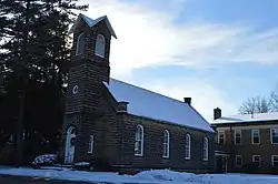 Independence Presbyterian Church |
April 13, 1977 (#77001053) |
State Route 21 41°22′55″N 81°38′30″W |
Independence | |
| 80 | Inglewood Historic District |  Inglewood Historic District |
April 15, 2009 (#09000210) |
Inglewood Dr., Oakridge Dr., Cleveland Heights Boulevard, Yellowstone and Glenwood Rds., and Quilliams 41°31′24″N 81°32′50″W |
Cleveland Heights | |
| 81 | Jaite Mill Historic District |  Jaite Mill Historic District |
May 21, 1979 (#79000288) |
Southeast of Brecksville at Riverview and Vaughan Rds. 41°17′18″N 81°34′24″W |
Brecksville | Extends into Sagamore Hills Township in Summit County |
| 82 | Gideon Keyt House |  Gideon Keyt House |
June 1, 1982 (#82003560) |
Chagrin River and Deerfield Rds. 41°30′50″N 81°24′01″W |
Gates Mills | |
| 83 | William Knapp House |  William Knapp House |
March 19, 1979 (#79000289) |
7101 Canal Rd. 41°22′20″N 81°36′42″W |
Valley View | |
| 84 | Dr. William A. Knowlton House |  Dr. William A. Knowlton House |
December 4, 1978 (#78002035) |
8937 Highland Dr. 41°19′11″N 81°37′49″W |
Brecksville | |
| 85 | Joseph Kuenzer, II, House |  Joseph Kuenzer, II, House |
August 13, 1974 (#74001458) |
2345 Rockside Rd. 41°24′13″N 81°40′19″W |
Seven Hills | |
| 86 | E.J. Kulas Estate Historic District |  E.J. Kulas Estate Historic District |
March 23, 1988 (#88000206) |
W. Hill Dr. 41°32′00″N 81°25′04″W |
Gates Mills | |
| 87 | Lakewood Downtown Historic District |  Lakewood Downtown Historic District |
September 23, 2020 (#100005539) |
Detroit Ave., roughly bounded by Bunts Rd. and Hall Ave., plus Warren Rd., roughly bounded by Detroit Ave. and Franklin Blvd. 41°29′06″N 81°48′00″W |
Lakewood | |
| 88 | Samuel Lay House |  Samuel Lay House |
June 20, 1979 (#79001814) |
7622 Columbia Rd. 41°22′48″N 81°54′13″W |
Olmsted Falls | |
| 89 | Lilly House |  Lilly House |
April 12, 2006 (#06000270) |
27946 Center Ridge Rd. 41°26′42″N 81°55′55″W |
Westlake | |
| 90 | Lock No. 37 and Spillway |  Lock No. 37 and Spillway |
December 11, 1979 (#79000290) |
Fitzwater Rd. 41°21′24″N 81°35′50″W |
Valley View | |
| 91 | Lock No. 38 and Spillway | 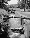 Lock No. 38 and Spillway |
December 11, 1979 (#79000291) |
Hillside Rd. 41°22′21″N 81°36′46″W |
Valley View | |
| 92 | Lock No. 39 and Spillway |  Lock No. 39 and Spillway |
December 11, 1979 (#79000292) |
Canal Rd. 41°23′25″N 81°37′30″W |
Valley View | |
| 93 | Lock Tender's House and Inn |  Lock Tender's House and Inn |
December 11, 1979 (#79000293) |
7104 Canal Rd. 41°22′21″N 81°36′47″W |
Valley View | |
| 94 | Look About Lodge |  Look About Lodge |
April 12, 2006 (#06000271) |
37374 Miles Rd. 41°25′25″N 81°25′18″W |
Bentleyville | |
| 95 | Lyceum Village Square And German Wallace College | 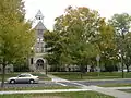 Lyceum Village Square And German Wallace College |
October 29, 1975 (#75001356) |
Seminary St. 41°22′06″N 81°51′06″W |
Berea | |
| 96 | George March House |  George March House |
April 20, 1978 (#78002037) |
126 E. Washington St. 41°25′47″N 81°23′14″W |
Chagrin Falls | |
| 97 | Mayfield Heights Historic District |  Mayfield Heights Historic District |
September 17, 2015 (#15000611) |
Caldwell and Preyer Aves., Rock Ct., Euclid Heights Boulevard, and Hampshire, Mayfield, Middlehurst, Radnor, and Somerton Rds. 41°30′36″N 81°34′34″W |
Cleveland Heights | |
| 98 | Duncan McFarland House |  Duncan McFarland House |
November 21, 2001 (#01001258) |
35069 Cannon Rd. 41°24′34″N 81°25′23″W |
Bentleyville | |
| 99 | NASA Lewis Research Center-Development Engineering Building & Annex | NASA Lewis Research Center-Development Engineering Building & Annex |
August 15, 2016 (#16000599) |
21000 Brookpark Rd. 41°25′11″N 81°51′10″W |
Fairview Park | |
| 100 | Nela Park | Nela Park |
May 29, 1975 (#75001365) |
Entrance at 1901 Noble Rd. 41°32′28″N 81°33′32″W |
East Cleveland | |
| 101 | James Nicholson House |  James Nicholson House |
August 24, 1979 (#79001813) |
13335 Detroit Ave. 41°29′04″N 81°46′59″W |
Lakewood | |
| 102 | North Olmsted Town Hall |  North Olmsted Town Hall |
November 25, 1980 (#80002984) |
5186 Dover Center Rd. 41°24′51″N 81°55′27″W |
North Olmsted | |
| 103 | North Union Shaker Site |  North Union Shaker Site |
August 13, 1974 (#74001446) |
Along Shaker Run below Upper Shaker Lake[9] 41°29′00″N 81°33′50″W |
Shaker Heights | |
| 104 | Julia Carter Northrop House |  Julia Carter Northrop House |
October 14, 1975 (#75001370) |
7872 Columbia Rd. 41°22′36″N 81°54′12″W |
Olmsted Falls | |
| 105 | Notre Dame College of Ohio | 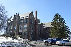 Notre Dame College of Ohio |
December 8, 1983 (#83004267) |
4545 College Rd. 41°30′27″N 81°30′56″W |
South Euclid | |
| 106 | Ohio and Erie Canal | 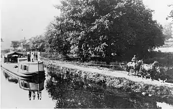 Ohio and Erie Canal |
November 13, 1966 (#66000607) |
State Route 631 (Canal Rd./Valley View Rd.) 41°22′14″N 81°36′59″W |
Valley View | Extends into Summit County |
| 107 | Old Center School | 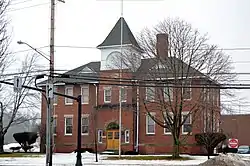 Old Center School |
April 3, 1973 (#73001426) |
784 S.O.M. Center Rd. 41°32′24″N 81°26′21″W |
Mayfield | |
| 108 | Old District 10 Schoolhouse |  Old District 10 Schoolhouse |
October 15, 1973 (#73001427) |
Corner of Sheldon and Fry Rds. 41°23′18″N 81°48′54″W |
Middleburg Heights | |
| 109 | Old Euclid District 4 Schoolhouse | 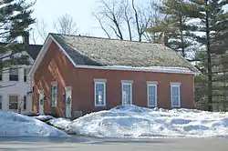 Old Euclid District 4 Schoolhouse |
April 16, 1980 (#80002982) |
Richmond Rd. 41°31′06″N 81°29′53″W |
Lyndhurst | |
| 110 | Olmsted Falls Depot |  Olmsted Falls Depot |
August 10, 2000 (#00000963) |
25802 Garfield Rd. 41°22′29″N 81°54′21″W |
Olmsted Falls | |
| 111 | Olmsted Falls Historic District |  Olmsted Falls Historic District |
July 14, 2000 (#00000798) |
Roughly bounded by Bagley Rd., Brookside Dr., the Rocky River, and Nobottom Rd. 41°22′37″N 81°54′00″W |
Olmsted Falls and Olmsted Township | |
| 112 | Overlook Road Carriage House District | 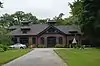 Overlook Road Carriage House District |
May 6, 1974 (#74001449) |
1-5 Herrick Mews 41°30′12″N 81°35′50″W |
Cleveland Heights | |
| 113 | Packard-Doubler House |  Packard-Doubler House |
March 9, 1979 (#79000294) |
7634 Riverview Rd. 41°21′18″N 81°36′12″W |
Independence | |
| 114 | Jay M. Pickands House |  Jay M. Pickands House |
August 24, 1979 (#79001799) |
9619 Lakeshore Boulevard 41°32′45″N 81°37′22″W |
Bratenahl | |
| 115 | Alanson Pomeroy House |  Alanson Pomeroy House |
June 20, 1975 (#75001371) |
Pearl Rd. at Westwood Dr. 41°18′54″N 81°50′09″W |
Strongsville | |
| 116 | Reidy Bros. & Flanigan Building |  Reidy Bros. & Flanigan Building |
October 2, 2018 (#100002999) |
11730 Detroit Ave. 41°29′02″N 81°46′12″W |
Lakewood | |
| 117 | Charles B. Rich House |  Charles B. Rich House |
February 22, 1979 (#79000295) |
9367 Brecksville Rd. 41°18′26″N 81°37′36″W |
Brecksville | |
| 118 | Rose Hill and Community House |  Rose Hill and Community House |
May 13, 1994 (#94000413) |
Junction of Cahoon and Lake Rds. 41°29′16″N 81°55′36″W |
Bay Village | |
| 119 | Roundwood Manor at Daisy Hill Farm | March 22, 2019 (#100003526) |
3450 Roundwood Rd. 41°27′53″N 81°25′45″W |
Hunting Valley | ||
| 120 | St. Joseph Convent and Academy Complex |  St. Joseph Convent and Academy Complex |
April 12, 2006 (#06000272) |
12215 Granger Rd. 41°25′05″N 81°35′54″W |
Garfield Heights | |
| 121 | St. Paul's Episcopal Church of East Cleveland | 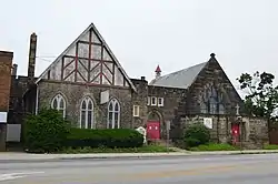 St. Paul's Episcopal Church of East Cleveland |
October 18, 1984 (#84000130) |
15837 Euclid Ave. 41°32′31″N 81°34′13″W |
East Cleveland | |
| 122 | Shaker Farm Historic District |  Shaker Farm Historic District |
February 15, 2012 (#12000032) |
Roughly bounded by Scarborough, Colchester, St. James, Roxboro, N. Park, Fairmount, Idlewood, E. Monmouth, and Lee Sts. 41°29′28″N 81°34′23″W |
Cleveland Heights | |
| 123 | Shaker Village Historic District | 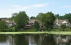 Shaker Village Historic District |
May 31, 1984 (#84003650) |
Roughly bounded by Fairmount and Lomond Boulevards and Green, Warrensville Center, Becket, and Coventry Rds.; also roughly bounded by Lomond Boulevard, Lytel Rd., Scottsdale Boulevard, and Lindholm Rd. 41°28′33″N 81°33′11″W |
Cleveland Heights and Shaker Heights | Extends into Cleveland |
| 124 | Shore High School |  Shore High School |
February 10, 2000 (#00000097) |
291 E. 222nd St. 41°36′25″N 81°31′35″W |
Euclid | |
| 125 | Russ and Holland Snow Houses |  Russ and Holland Snow Houses |
September 28, 1982 (#82001873) |
12911 and 13114 Snowville Rd. 41°16′59″N 81°35′39″W |
Brecksville | |
| 126 | South Park Site |  South Park Site |
June 22, 1976 (#76000212) |
On a promontory above the western bank of the Cuyahoga River, 7 miles (11 km) from Lake Erie[10] 41°22′43″N 81°37′20″W |
Independence | |
| 127 | Stadium Square Historic District | April 27, 2020 (#100005214) |
South Taylor Rd., Superior Park Dr. 41°30′26″N 81°33′27″W |
Cleveland Heights | ||
| 128 | Station Road Bridge | .jpg.webp) Station Road Bridge |
March 7, 1979 (#79000312) |
East of Brecksville at the Cuyahoga River 41°19′10″N 81°35′16″W |
Brecksville | Extends into Summit County |
| 129 | Lyman Stearns Farm | 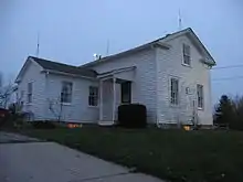 Lyman Stearns Farm |
October 1, 1981 (#81000431) |
6975 Ridge Rd. 41°22′30″N 81°43′43″W |
Parma | |
| 130 | Stebbens Farm |  Stebbens Farm |
April 17, 1996 (#96000381) |
8255 Riverview Rd. 41°20′12″N 81°35′56″W |
Brecksville | |
| 131 | Valerius C. Stone House |  Valerius C. Stone House |
December 22, 1978 (#78002050) |
21706 Lunn Rd. 41°17′52″N 81°51′56″W |
Strongsville | |
| 132 | Joseph Stoneman House |  Joseph Stoneman House |
May 29, 1975 (#75001358) |
18 E. Orange St. 41°25′57″N 81°23′30″W |
Chagrin Falls | |
| 133 | John Stoughton Strong House | 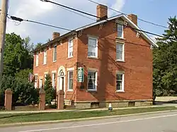 John Stoughton Strong House |
November 24, 1980 (#80002985) |
18910 Westwood St. 41°18′56″N 81°50′04″W |
Strongsville | |
| 134 | Strongsville Town Hall |  Strongsville Town Hall |
March 6, 2008 (#08000147) |
18825 Royalton Rd. 41°18′51″N 81°50′02″W |
Strongsville | |
| 135 | Taylor Mansion-Lakehurst |  Taylor Mansion-Lakehurst |
July 10, 1986 (#86001573) |
193 Bratenahl Rd. 41°33′03″N 81°36′51″W |
Bratenahl | |
| 136 | William E. Telling House | 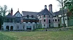 William E. Telling House |
October 16, 1974 (#74001463) |
4645 Mayfield Rd. 41°31′12″N 81°30′46″W |
South Euclid | |
| 137 | Temple on the Heights |  Temple on the Heights |
March 29, 1984 (#84003653) |
3130 Mayfield Rd. 41°30′57″N 81°34′20″W |
Cleveland Heights | |
| 138 | Terra Vista Archeological District |  Terra Vista Archeological District |
May 23, 1978 (#78000378) |
On the edge of a bluff above the Cuyahoga River, north of its confluence with Tinkers Creek[11] 41°22′06″N 81°36′37″W |
Valley View | |
| 139 | W.A. Thorp House |  W.A. Thorp House |
December 4, 1978 (#78002046) |
6183-6185 Mayfield Rd. 41°31′14″N 81°27′24″W |
Mayfield Heights | |
| 140 | Tinkers Creek Aqueduct |  Tinkers Creek Aqueduct |
December 11, 1979 (#79000296) |
Tinkers Creek 41°21′53″N 81°36′33″W |
Valley View | |
| 141 | Tower East |  Tower East |
February 22, 2014 (#14000029) |
20600 Chagrin Boulevard 41°27′50″N 81°32′04″W |
Shaker Heights | |
| 142 | Tremaine-Gallagher Residence | .jpg.webp) Tremaine-Gallagher Residence |
October 30, 1973 (#73001419) |
3001 Fairmount Boulevard 41°29′18″N 81°34′18″W |
Cleveland Heights | |
| 143 | Abraham Ulyatt House |  Abraham Ulyatt House |
February 27, 1979 (#79000297) |
6579 Canal Rd. 41°23′10″N 81°37′11″W |
Valley View | |
| 144 | Valley Railway Historic District |  Valley Railway Historic District |
May 17, 1985 (#85001123) |
Cuyahoga Valley between Rockside Rd. at the Cuyahoga Valley National Park and Howard St. at Little Cuyahoga Valley 41°13′38″N 81°34′13″W |
Brecksville and Independence | Extends into Summit County |
| 145 | Vaughn Site (33CU65) |  Vaughn Site (33CU65) |
November 12, 1987 (#87001902) |
Near Cuyahoga Valley National Park headquarters[12] 41°17′20″N 81°34′19″W |
Brecksville | |
| 146 | Richard Vaughn Farm |  Richard Vaughn Farm |
March 12, 1993 (#93000081) |
9570 Riverview Rd. 41°18′03″N 81°34′58″W |
Brecksville | |
| 147 | Villa San Bernardo Historic District |  Villa San Bernardo Historic District |
September 1, 2015 (#15000559) |
1160 Broadway Ave. 41°22′50″N 81°31′19″W |
Bedford | |
| 148 | Moses Warren House |  Moses Warren House |
October 22, 1974 (#74001462) |
3535 Ingleside Rd. 41°27′48″N 81°33′19″W |
Shaker Heights | |
| 149 | Westerly Apartments |  Westerly Apartments |
September 27, 2013 (#13000841) |
14300 Detroit Ave. 41°29′09″N 81°47′38″W |
Lakewood | |
| 150 | Westlake Hotel |  Westlake Hotel |
October 20, 1983 (#83004278) |
19000 Lake Rd. 41°29′02″N 81°49′54″W |
Rocky River | |
| 151 | John Wheeler House |  John Wheeler House |
December 1, 1978 (#78002034) |
445 S. Rocky River Dr. 41°21′28″N 81°50′51″W |
Berea | |
| 152 | George W. Whitney House | 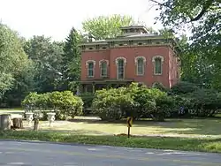 George W. Whitney House |
October 22, 1974 (#74001429) |
330 S. Rocky River Dr. 41°21′29″N 81°51′07″W |
Berea | |
| 153 | William Tricker Inc. Historic District |  William Tricker Inc. Historic District |
March 2, 2001 (#01000200) |
7125 Tanglewood Dr. 41°23′20″N 81°38′24″W |
Independence | |
| 154 | Wilson Feed Mill |  Wilson Feed Mill |
December 17, 1979 (#79000298) |
7604 Canal Rd. 41°21′22″N 81°35′48″W |
Valley View | |
| 155 | Wilson's Mills Settlement District |  Wilson's Mills Settlement District |
May 29, 1980 (#80002981) |
Chagrin River Rd. 41°32′56″N 81°24′55″W |
Gates Mills | |
| 156 | Woodland-Larchmere Commercial Historic District |  Woodland-Larchmere Commercial Historic District |
September 1, 2015 (#15000560) |
12019-13165 Larchmere and 2618 N. Moreland 41°29′15″N 81°35′35″W |
Shaker Heights | Extends into Cleveland |
Former listing
| [3] | Name on the Register | Image | Date listed | Date removed | Location | City or town | Summary |
|---|---|---|---|---|---|---|---|
| 1 | Calvin Gilbert House | Unavailable (#74002343) | 1975 | 6344 SOM Center Rd. |
Solon |
See also
References
| Wikimedia Commons has media related to National Register of Historic Places in Cuyahoga County, Ohio. |
- The latitude and longitude information provided in this table was derived originally from the National Register Information System, which has been found to be fairly accurate for about 99% of listings. Some locations in this table may have been corrected to current GPS standards.
- "National Register of Historic Places: Weekly List Actions". National Park Service, United States Department of the Interior. Retrieved on January 29, 2021.
- Numbers represent an alphabetical ordering by significant words. Various colorings, defined here, differentiate National Historic Landmarks and historic districts from other NRHP buildings, structures, sites or objects.
- "National Register Information System". National Register of Historic Places. National Park Service. April 24, 2008.
- The eight-digit number below each date is the number assigned to each location in the National Register Information System database, which can be viewed by clicking the number.
- Location derived from this Archived 2011-10-08 at the Wayback Machine Cleveland Clinic webpage; the NRIS lists the building as "Address Restricted"
- Zoning Map, Cleveland Heights Department of Planning and Development, November 2005. Accessed 2009-09-05.
- Plan of Lake View Cemetery Archived 2011-07-13 at the Wayback Machine, Lake View Cemetery. Accessed 2009-09-08.
- Location derived from MacLean, J. P., Shakers of Ohio: Fugitive Papers Concerning the Shakers of Ohio, With Unpublished Manuscripts. Columbus: F.J. Heer, 1907, 120. The NRIS lists the site as "Address Restricted"
- Location derived from Brose, David S. The South Park Village Site and the Late Prehistoric Whittlesey Tradition of Northeastern Ohio. "Monographs in World Archaeology" 20. Madison: Prehistory, 1994, 18-19. The NRIS lists the site as "Address Restricted"
- Location derived from this Archived 2012-06-01 at the Wayback Machine National Park Service webpage; the NRIS lists the site as "Address Restricted"
- Location derived from this National Park Service webpage; the NRIS lists the site as "Address Restricted"

Municipalities and communities of Cuyahoga County, Ohio, United States | ||
|---|---|---|
| Cities |
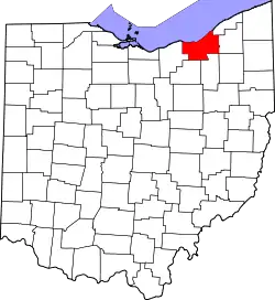
| Map of Ohio highlighting Cuyahoga County |
| Villages | ||
| Townships | ||
| Footnotes | ‡This populated place also has portions in an adjacent county or counties | |
| ||