National Register of Historic Places listings in Stark County, Ohio
This is a list of the National Register of Historic Places listings in Stark County, Ohio.
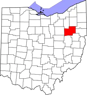
Location of Stark County in Ohio
This is intended to be a complete list of the properties and districts on the National Register of Historic Places in Stark County, Ohio, United States. Latitude and longitude coordinates are provided for many National Register properties and districts; these locations may be seen together in an online map.[1]
There are 90 properties and districts listed on the National Register in the county, including 1 National Historic Landmark. Another 3 properties were once listed but have been removed.
- This National Park Service list is complete through NPS recent listings posted January 29, 2021.[2]
Current listings
| [3] | Name on the Register[4] | Image | Date listed[5] | Location | City or town | Description |
|---|---|---|---|---|---|---|
| 1 | Alliance Bank Building | .JPG.webp) Alliance Bank Building |
July 28, 1995 (#95000940) |
502 E. Main St. 40°55′19″N 81°05′54″W |
Alliance | |
| 2 | Jacob H. Bair House | .JPG.webp) Jacob H. Bair House |
December 29, 1978 (#78002194) |
North of Canton at 7225 N. Market Ave. 40°53′13″N 81°21′52″W |
Plain Township | |
| 3 | Barber-Whitticar House | 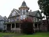 Barber-Whitticar House |
July 15, 1982 (#82003642) |
519 Cleveland Ave, SW. 40°47′45″N 81°22′41″W |
Canton | |
| 4 | Bender's Restaurant-Belmont Buffet | 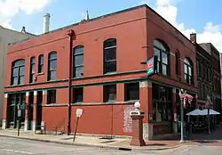 Bender's Restaurant-Belmont Buffet |
July 21, 1987 (#87001193) |
137 Court Ave., SW. 40°47′53″N 81°22′35″W |
Canton | |
| 5 | Bordner House | .JPG.webp) Bordner House |
February 17, 1978 (#78002191) |
4522 7th St., SW., west of Canton 40°47′40″N 81°25′43″W |
Perry Township | |
| 6 | Brewster Railroad YMCA/Wandle House | .JPG.webp) Brewster Railroad YMCA/Wandle House |
March 7, 1985 (#85000486) |
45 S. Wabash Ave. 40°42′46″N 81°35′54″W |
Brewster | Railroad dormitory constructed in 1916 by the Wheeling and Lake Erie Railway (W&LE). The building now houses the Brewster-Sugarcreek Township Historical Society Museum and The Station Restaurant.[6] |
| 7 | Canal Fulton Historic District | 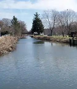 Canal Fulton Historic District |
December 2, 1982 (#82001488) |
Ohio-Erie Canal, Market, Canal, Cherry and High Sts. 40°53′13″N 81°35′42″W |
Canal Fulton and Lawrence Township | |
| 8 | Canton Public Library | 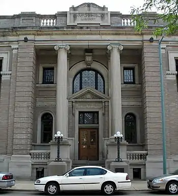 Canton Public Library |
July 15, 1982 (#82003643) |
236 3rd St., SW. 40°47′50″N 81°22′37″W |
Canton | |
| 9 | City National Bank Building | .JPG.webp) City National Bank Building |
July 15, 1982 (#82003644) |
205 Market Ave., S. 40°47′51″N 81°22′31″W |
Canton | With Saxton House, part of the First Ladies National Historic Site; also listed separately on the National Register. |
| 10 | City Savings Bank & Trust Company |  City Savings Bank & Trust Company |
September 2, 2016 (#16000602) |
449 E. Main St. 40°55′18″N 81°05′56″W |
Alliance | |
| 11 | Clearview Golf Club | Clearview Golf Club |
February 16, 2001 (#01000056) |
8410 Lincoln St., SE., southeast of East Canton 40°46′19″N 81°14′51″W |
Osnaburg Township | The only golf club in the United States designed, built, owned and operated by an African American (William J. Powell). Opened for business in 1948, it is still owned and operated by the Powell family.[7] |
| 12 | George E. Cook House | .JPG.webp) George E. Cook House |
May 2, 1995 (#95000498) |
1435 Market Ave. N. 40°48′48″N 81°22′16″W |
Canton | |
| 13 | Dewalt Building |  Dewalt Building |
July 15, 1982 (#82003645) |
122 Market Ave., N. 40°47′57″N 81°22′30″W |
Canton | |
| 14 | John and Syd Dobkins House | 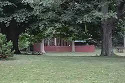 John and Syd Dobkins House |
January 8, 2009 (#08001298) |
5120 Plain Center, NE. 40°51′16″N 81°21′15″W |
Canton | |
| 15 | Eagles Building-Strand Theater |  Eagles Building-Strand Theater |
January 25, 1997 (#96001624) |
243 E. Main St. 40°55′18″N 81°06′10″W |
Alliance | |
| 16 | Eagles' Temple |  Eagles' Temple |
July 15, 1982 (#82003646) |
601 S. Market St. 40°47′41″N 81°22′32″W |
Canton | |
| 17 | Earley-Hartzell House | .JPG.webp) Earley-Hartzell House |
December 21, 1987 (#87002147) |
840 N. Park Ave. 40°55′49″N 81°06′17″W |
Alliance | Mabel Hartzell Historical Home at the Alliance Historical Society website. |
| 18 | East Main Street Historic District | East Main Street Historic District |
September 8, 2017 (#100001588) |
49-629 E. Main St., 40 N. Park, 77 S. Park, 532-570, 157 Prospect, 40 N.-136 S. Arch, 40 S. Linden Aves. 40°55′18″N 81°06′05″W |
Alliance | |
| 19 | Elson-Magnolia Flour Mill | .JPG.webp) Elson-Magnolia Flour Mill |
July 14, 2000 (#00000800) |
261 N. Main St. 40°39′12″N 81°17′59″W |
Magnolia | |
| 20 | Harry E. Fife House |  Harry E. Fife House |
July 21, 1987 (#87001196) |
606 McKinley Ave. SW. 40°47′44″N 81°22′46″W |
Canton | |
| 21 | Charles E. Firestone House | June 21, 2011 (#11000369) |
2814 Westdale Rd., NW 40°49′52″N 81°26′57″W |
Jackson Township | ||
| 22 | First Ladies National Historic Site | .JPG.webp) First Ladies National Historic Site |
January 31, 2001 (#01000286) |
205 and 331 Market Avenue, S. 40°47′48″N 81°22′31″W |
Canton | |
| 23 | First Methodist Episcopal Church |  First Methodist Episcopal Church |
April 16, 1979 (#79001948) |
120 Cleveland Ave., SW. 40°47′54″N 81°22′35″W |
Canton | Home church of President William McKinley; now known as Church of the Savior |
| 24 | First Methodist Episcopal Church | .JPG.webp) First Methodist Episcopal Church |
August 22, 1985 (#85001803) |
301 Lincoln Way E. 40°47′50″N 81°31′08″W |
Massillon | |
| 25 | First Methodist Episcopal Church of Alliance, Ohio | .JPG.webp) First Methodist Episcopal Church of Alliance, Ohio |
May 2, 1985 (#85000945) |
470 E. Broadway St. 40°55′10″N 81°05′58″W |
Alliance | |
| 26 | First National Bank Building | .JPG.webp) First National Bank Building |
May 8, 1987 (#87000689) |
11 Lincoln Way, W. 40°47′46″N 81°31′23″W |
Massillon | |
| 27 | First Reformed and First Lutheran Churches | 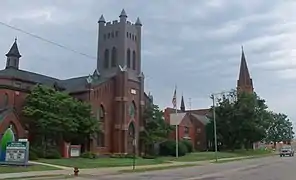 First Reformed and First Lutheran Churches |
September 28, 1982 (#82003647) |
901 and 909 E. Tuscarawas St. 40°47′51″N 81°22′03″W |
Canton | First Reformed is now called First Church of the Resurrection |
| 28 | Five Oaks | .JPG.webp) Five Oaks |
April 11, 1973 (#73001535) |
210 4th St., NE. 40°47′58″N 81°31′07″W |
Massillon | |
| 29 | Fourth Street Historic District | .JPG.webp) Fourth Street Historic District |
March 25, 1982 (#82003654) |
Roughly bounded by 3rd, 5th and Cherry St. and Federal Ave. 40°48′04″N 81°31′11″W |
Massillon | |
| 30 | Frances Apartment Building | 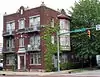 Frances Apartment Building |
June 6, 1988 (#88000668) |
534 Cleveland Ave., SW. 40°47′40″N 81°22′35″W |
Canton | |
| 31 | Garnet B. French House | .JPG.webp) Garnet B. French House |
October 31, 2002 (#02001275) |
2410 Cleveland Ave. 40°49′26″N 81°23′01″W |
Canton | |
| 32 | Glamorgan | .JPG.webp) Glamorgan |
October 5, 1972 (#72001043) |
1025 S. Union Ave. 40°54′42″N 81°06′33″W |
Alliance | |
| 33 | Haines House | .JPG.webp) Haines House |
July 30, 1974 (#74001623) |
186 W. Market St. 40°55′15″N 81°06′42″W |
Alliance | Haines House website |
| 34 | Hartville Hotel | .JPG.webp) Hartville Hotel |
January 3, 1980 (#80003235) |
101 N. Prospect St. 40°57′51″N 81°19′51″W |
Hartville | Renovated in 2019 as The Pantry restaurant. Previously named the Hartville Pie Factory and Restaurant. |
| 35 | Harvard Company-Weber Dental Manufacturing Company | 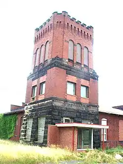 Harvard Company-Weber Dental Manufacturing Company |
July 21, 1987 (#87001194) |
2206 13th St. NE. 40°48′34″N 81°20′52″W |
Canton | |
| 36 | Hercules Motors Corporation Industrial Complex |  Hercules Motors Corporation Industrial Complex |
June 10, 2005 (#05000575) |
101 11th St. SE. 40°47′27″N 81°22′35″W |
Canton | |
| 37 | Hoover Company Historic District | 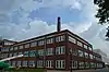 Hoover Company Historic District |
July 24, 2013 (#13000538) |
101 E. Maple St. 40°52′35″N 81°24′05″W |
North Canton | |
| 38 | Hoover Farm | .JPG.webp) Hoover Farm |
August 3, 1979 (#79001955) |
East of central North Canton on Easton St. 40°52′32″N 81°22′12″W |
North Canton | Also known as the Hoover Historical Center[4] |
| 39 | Ideal Department Store Building | .JPG.webp) Ideal Department Store Building |
September 10, 1992 (#92001245) |
55-59 Lincoln Way E. 40°47′47″N 81°31′20″W |
Massillon | |
| 40 | Lake Township School | .JPG.webp) Lake Township School |
June 22, 1976 (#76001528) |
East of Uniontown at 1101 Lake Center St. 40°57′32″N 81°21′42″W |
Lake Township | One room schoolhouse established circa 1850[8] |
| 41 | Landmark Tavern |  Landmark Tavern |
March 12, 1982 (#82003648) |
501 E. Tuscarawas St. 40°47′52″N 81°22′15″W |
Canton | |
| 42 | Carl and Audrey Lavin House | August 31, 2018 (#100002880) |
5240 Plain Center Ave., NE. 40°51′24″N 81°21′18″W |
Canton | ||
| 43 | John H. Lehman High School | 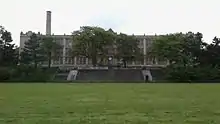 John H. Lehman High School |
August 24, 2017 (#100001508) |
1120 15th St. NW. 40°48′51″N 81°22′59″W |
Canton | |
| 44 | Loew-Define Grocery Store and Home | .JPG.webp) Loew-Define Grocery Store and Home |
November 29, 1979 (#79001954) |
202 S. Market St. 40°43′20″N 81°31′05″W |
Navarre | Home of Justice of the Peace John Loew; site of President William McKinley's first law trial in 1867. |
| 45 | Louisville Historic District | 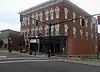 Louisville Historic District |
November 22, 2011 (#11000856) |
Roughly bounded by Chapel, Lincoln, St. Louis Ct., Nickel Plate, E. Gorgas, and Center Ct. 40°50′15″N 81°15′34″W |
Louisville | |
| 46 | Brooke and Anna E. Martin House | .JPG.webp) Brooke and Anna E. Martin House |
January 21, 1999 (#98001642) |
1627 Market Ave. N. 40°48′57″N 81°22′11″W |
Canton | |
| 47 | Massillon Cemetery Building | .JPG.webp) Massillon Cemetery Building |
March 12, 1982 (#82003655) |
1827 Erie St. S. 40°46′35″N 81°30′55″W |
Massillon | |
| 48 | Massillon Downtown Historic District | 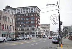 Massillon Downtown Historic District |
June 8, 2018 (#100002553) |
Roughly bounded by 1st and 3rd Sts. and Tremont and Federal Aves. 40°47′51″N 81°31′13″W |
Massillon | |
| 49 | Maudru House |  Maudru House |
November 25, 1980 (#80003234) |
11786 Easton St. in Maximo[9] 40°52′28″N 81°10′36″W |
Washington Township | Maximo's only brick house[10] |
| 50 | William McKinley Tomb | .JPG.webp) William McKinley Tomb |
November 10, 1970 (#70000516) |
7th St., NW. 40°48′24″N 81°23′33″W |
Canton | |
| 51 | McKinley Park Apartments | January 21, 2021 (#100006041) |
510 High Ave. SW 40°48′09″N 81°22′45″W |
Canton | ||
| 52 | Mellett-Canton Daily News Building |  Mellett-Canton Daily News Building |
April 21, 1983 (#83002058) |
401 W. Tuscarawas St. 40°47′57″N 81°22′35″W |
Canton | |
| 53 | John Miller House | .JPG.webp) John Miller House |
July 22, 1994 (#94000775) |
9677 Cleveland Ave., NW., in Greentown 40°55′37″N 81°24′11″W |
Lake Township | |
| 54 | Mount Union College District | .JPG.webp) Mount Union College District |
October 5, 1972 (#72001044) |
Hartshorn St., Miller and Aultman Aves. 40°54′12″N 81°06′34″W |
Alliance | |
| 55 | New Baltimore Inn | .JPG.webp) New Baltimore Inn |
December 18, 1975 (#75001535) |
14722 Ravenna Ave. in New Baltimore 40°59′04″N 81°14′57″W |
Marlboro Township | |
| 56 | Old McKinley High School |  Old McKinley High School |
June 30, 1982 (#82003649) |
800 N. Market St. 40°48′13″N 81°22′20″W |
Canton | |
| 57 | Onesto Hotel | 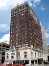 Onesto Hotel |
July 15, 1982 (#82003650) |
2nd and Cleveland, NW. 40°47′56″N 81°22′30″W |
Canton | |
| 58 | Palace Theater | 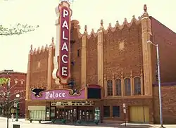 Palace Theater |
April 26, 1979 (#79001949) |
605 Market Ave., N. 40°48′07″N 81°22′27″W |
Canton | |
| 59 | Robert A. and Elizabeth H. Purcell House |  Robert A. and Elizabeth H. Purcell House |
October 13, 2004 (#04001146) |
2700 Fairway Ln. 40°53′42″N 81°05′33″W |
Alliance | |
| 60 | Walter S. Putman House | .JPG.webp) Walter S. Putman House |
September 10, 1992 (#92001247) |
303 Lawnford Ave. 40°39′18″N 81°38′17″W |
Wilmot | |
| 61 | Harry S. Renkert House | .JPG.webp) Harry S. Renkert House |
June 18, 1981 (#81000451) |
1414 Market Ave., N. 40°48′46″N 81°22′14″W |
Canton | Now houses the Greater Canton Amateur Sports Hall of Fame[11] |
| 62 | Ridgewood Historic District |  Ridgewood Historic District |
December 19, 1982 (#82001489) |
Bounded by Gibbs Ave., Frazer Ave., 25th St., and 19th St. 40°49′18″N 81°22′14″W |
Canton | |
| 63 | Rochester Square Historic District | .JPG.webp) Rochester Square Historic District |
October 26, 2005 (#05001187) |
6 & 10 Lintner Ct. NW; 14, 207, 212, 222, 228, and 232 Center St. W. 40°43′15″N 81°31′37″W |
Navarre | |
| 64 | St. Edward Hotel | 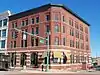 St. Edward Hotel |
May 2, 2005 (#05000024) |
400 Market Ave. N. 40°48′02″N 81°22′26″W |
Canton | |
| 65 | St. John's Catholic Church | 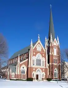 St. John's Catholic Church |
May 27, 1975 (#75001533) |
6th St. and McKinley Ave., NW. 40°48′11″N 81°22′39″W |
Canton | named a Minor basilica by Holy See in 2012 |
| 66 | St. Joseph Roman Catholic Church Complex | November 19, 2020 (#100005806) |
2427 Tuscarawas St. West 40°47′57″N 81°24′08″W |
Canton | ||
| 67 | Saint Joseph's Roman Catholic Church | 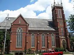 Saint Joseph's Roman Catholic Church |
May 21, 2010 (#10000279) |
322 3rd St. SE 40°47′40″N 81°31′03″W |
Massillon | |
| 68 | St. Louis Church | 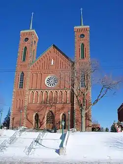 St. Louis Church |
February 22, 1979 (#79001951) |
300 N. Chapel St. 40°50′20″N 81°15′33″W |
Louisville | |
| 69 | St. Mary's Catholic Church | .JPG.webp) St. Mary's Catholic Church |
April 16, 1979 (#79001952) |
206 Cherry Rd., NE. 40°48′08″N 81°31′22″W |
Massillon | |
| 70 | St. Paul's Reformed Church | .JPG.webp) St. Paul's Reformed Church |
April 26, 2006 (#06000318) |
9669 Erie Ave., SW., south of Navarre 40°40′22″N 81°32′20″W |
Bethlehem Township | In 2008, was known as St. Paul's Community Church and had only one remaining active member.[12] |
| 71 | St. Peter Church | 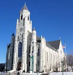 St. Peter Church |
March 22, 1990 (#90000472) |
720 Cleveland Ave., NW. 40°48′14″N 81°22′29″W |
Canton | |
| 72 | St. Timothy's Protestant Episcopal Church | .JPG.webp) St. Timothy's Protestant Episcopal Church |
February 22, 1979 (#79001953) |
226 SE. 3rd St. 40°47′44″N 81°31′04″W |
Massillon | |
| 73 | Saxton House | _2.JPG.webp) Saxton House |
April 26, 1979 (#79001950) |
331 S. Market St. 40°47′47″N 81°22′33″W |
Canton | |
| 74 | August Schuffenecker Building |  August Schuffenecker Building |
September 2, 1982 (#82003651) |
134 6th St. SW. 40°47′41″N 81°22′34″W |
Canton | |
| 75 | Science Hill School | .JPG.webp) Science Hill School |
July 22, 1994 (#94000776) |
11810 Beeson St., west of Alliance 40°55′24″N 81°10′26″W |
Lexington Township | One-room schoolhouse built circa 1870 operated continuously from 1884 to 1956; the last one-room school in Stark County.[13] |
| 76 | Emanuel and Frederick Serquet Farm | .JPG.webp) Emanuel and Frederick Serquet Farm |
December 2, 1982 (#82001490) |
North of Wilmot at 14091 Stoneford 40°40′52″N 81°37′42″W |
Sugar Creek Township | |
| 77 | Seven Ranges Terminus |  Seven Ranges Terminus |
December 12, 1976 (#76001527) |
West of Magnolia at the junction of Stark, Tuscarawas, and Carroll counties 40°39′07″N 81°19′05″W |
Pike and Sandy Townships | Extends into Carroll and Tuscarawas counties |
| 78 | Spring Hill | .JPG.webp) Spring Hill |
April 14, 1972 (#72001045) |
Wales Rd., NE. 40°48′45″N 81°30′23″W |
Massillon | |
| 79 | Stahl-Hoagland House | .JPG.webp) Stahl-Hoagland House |
February 6, 1997 (#96001621) |
330 W. Wooster St. 40°43′29″N 81°31′43″W |
Navarre | Built in 1834 by Ohio and Erie Canal boat captain William Stahl. Purchased in 1881 by Marquis L. Hoagland, another canal worker. Now owned by the son of Hoagland's youngest daughter.[14] |
| 80 | Stark County Courthouse and Annex | _edit.JPG.webp) Stark County Courthouse and Annex |
April 3, 1975 (#75001534) |
Market and Tuscarawas Sts. 40°47′56″N 81°22′31″W |
Canton | |
| 81 | Harry Bartlett Stewart Property | 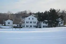 Harry Bartlett Stewart Property |
April 29, 1982 (#82003653) |
13480 Congress Lake Rd., northeast of Hartville 40°58′46″N 81°18′17″W |
Lake Township | |
| 82 | Third Street Bridge |  Third Street Bridge |
May 5, 1978 (#78002192) |
3rd St., SE. 40°47′37″N 81°21′30″W |
Canton | Demolished |
| 83 | Timken Vocational High School |  Timken Vocational High School |
December 7, 2018 (#100003211) |
521 Tuscarawas St., W. 40°47′57″N 81°22′44″W |
Canton | |
| 84 | Henry H. Timken Estate Barn | .JPG.webp) Henry H. Timken Estate Barn |
December 29, 1978 (#78002193) |
13th St., NW. and Interstate 77 40°48′42″N 81°23′57″W |
Canton | |
| 85 | The Town Pump of East Sparta |  The Town Pump of East Sparta |
April 1, 2009 (#09000172) |
Junction of Walnut Street and Main Avenue 40°40′00″N 81°21′12″W |
East Sparta | |
| 86 | Trinity Lutheran Church | 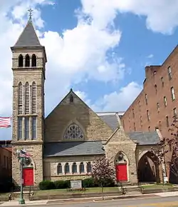 Trinity Lutheran Church |
August 23, 1985 (#85001802) |
415 W. Tuscarawas St. 40°47′58″N 81°22′40″W |
Canton | |
| 87 | Upper Downtown Canton Historic District | 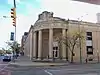 Upper Downtown Canton Historic District |
June 7, 2006 (#06000202) |
Market Ave., between Sixth St. N. and 2nd St. S., east to west variable boundary 40°48′06″N 81°22′32″W |
Canton | |
| 88 | Vicary House | .JPG.webp) Vicary House |
March 15, 1982 (#82003652) |
3730 Market Ave. N. 40°50′21″N 81°21′52″W |
Canton | |
| 89 | Werner Inn | .JPG.webp) Werner Inn |
September 17, 1987 (#87001635) |
131 E. Nassau St. 40°47′15″N 81°17′00″W |
East Canton | |
| 90 | Wilmot United Brethren Church | .JPG.webp) Wilmot United Brethren Church |
June 22, 1976 (#76001529) |
Massillon St. (U.S. Route 62) 40°39′24″N 81°37′55″W |
Wilmot |
Former listings
| [3] | Name on the Register | Image | Date listed | Date removed | Location | City or town | Summary |
|---|---|---|---|---|---|---|---|
| 1 | Case Mansion | July 21, 1987 (#87001191) | July 26, 1990 | 1717 Market Ave. N. 40°49′01″N 81°18′26″W |
Canton | ||
| 2 | Hotel Courtland | .jpg.webp) Hotel Courtland |
July 21, 1987 (#87001195) | January 31, 1995 | 209 W. Tuscarawas St. 40°47′55″N 81°22′33″W |
Canton | Razed in 1992; also known as the Hotel St. Francis |
| 3 | William Kettering Homestead | .jpg.webp) William Kettering Homestead |
January 11, 1983 (#83002057) | April 18, 1990 | North of Massillon at 5509 Wales Ave. 40°51′48″N 81°29′07″W |
Jackson Township | Relocated to 7753 Fulton Dr., NW, in Jackson Township |
See also
| Wikimedia Commons has media related to National Register of Historic Places in Stark County, Ohio. |
References
- The latitude and longitude information provided in this table was derived originally from the National Register Information System, which has been found to be fairly accurate for about 99% of listings. Some locations in this table may have been corrected to current GPS standards.
- "National Register of Historic Places: Weekly List Actions". National Park Service, United States Department of the Interior. Retrieved on January 29, 2021.
- Numbers represent an alphabetical ordering by significant words. Various colorings, defined here, differentiate National Historic Landmarks and historic districts from other NRHP buildings, structures, sites or objects.
- "National Register Information System". National Register of Historic Places. National Park Service. April 24, 2008.
- The eight-digit number below each date is the number assigned to each location in the National Register Information System database, which can be viewed by clicking the number.
- "Village of Brewster, Ohio: The WANDLE House". Village of Brewster, Ohio. Retrieved 2008-09-24.
- Winerip, Michael (1996-06-28). "His Most Powerful Drive Was to Play, With Pride". The New York Times. Retrieved 2008-08-25.
- "Lake Township Historical Society: One-Room Schoolhouse No. 12". Lake Township Historical Society. Retrieved 2008-09-25.
- Property Record Card: Parcel 7503274, Stark County Auditor, n.d. Accessed 2014-10-28.
- Owen, Lorrie K., ed. Dictionary of Ohio Historic Places. Vol. 2. St. Clair Shores: Somerset, 1999, 1290.
- Seaburn, John (2008-03-31). "Amateur sports hall of fame looks to branch out". Canton, Ohio: The Repository. Retrieved 2008-09-25.
- Duer, Benjamin (2008-08-10). "See the one-man church". The State Journal-Register. Retrieved 2008-08-26.
- "Science Hill School". Rodman Public Library. 2000-10-23. Archived from the original on 2008-07-27. Retrieved 2008-08-25.
- "Ohio and Erie Canal National Heritage Corridor: Stahl-Hoagland House". National Park Service. Retrieved 2008-08-26.

Municipalities and communities of Stark County, Ohio, United States | ||
|---|---|---|
| Cities | Map of Ohio highlighting Stark County | |
| Villages | ||
| Townships | ||
| CDPs | ||
| Unincorporated communities | ||
| Footnotes | ‡This populated place also has portions in an adjacent county or counties | |
| ||
This article is issued from Wikipedia. The text is licensed under Creative Commons - Attribution - Sharealike. Additional terms may apply for the media files.