National Register of Historic Places listings in Seneca County, Ohio
This is a list of the National Register of Historic Places listings in Seneca County, Ohio.
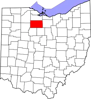
Location of Seneca County in Ohio
This is intended to be a complete list of the properties and districts on the National Register of Historic Places in Seneca County, Ohio, United States. The locations of National Register properties and districts for which the latitude and longitude coordinates are included below, may be seen in a Google map.[1]
There are 44 properties and districts listed on the National Register in the county. Another property was once listed but has been removed.
- This National Park Service list is complete through NPS recent listings posted January 29, 2021.[2]
Current listings
| [3] | Name on the Register[4] | Image | Date listed[5] | Location | City or town | Description |
|---|---|---|---|---|---|---|
| 1 | Aigler Alumni Building | 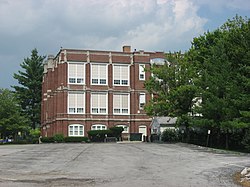 Aigler Alumni Building |
February 12, 1979 (#79002779) |
315 E. Market St. 41°06′58″N 83°10′10″W |
Tiffin | |
| 2 | Bagby-Hossler House |  Bagby-Hossler House |
July 10, 1986 (#86001562) |
530 Sycamore St. 41°05′51″N 83°11′15″W |
Tiffin | |
| 3 | Beatty Glass Company |  Beatty Glass Company |
January 7, 1980 (#80003217) |
4th Ave. and Vine St. 41°07′51″N 83°10′59″W |
Tiffin | |
| 4 | Black Student Union Center | 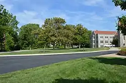 Black Student Union Center |
February 12, 1979 (#79002780) |
120 Hedges St. 41°06′50″N 83°10′02″W |
Tiffin | |
| 5 | Bowman's Distillery | 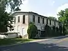 Bowman's Distillery |
January 7, 1980 (#80003218) |
215 Riverside Dr. 41°07′20″N 83°10′18″W |
Tiffin | |
| 6 | College Hall | 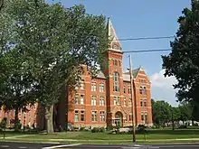 College Hall |
February 12, 1979 (#79002778) |
310 E. Market St. 41°06′59″N 83°10′04″W |
Tiffin | |
| 7 | Ambrose Cory House | 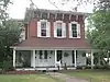 Ambrose Cory House |
June 20, 1979 (#79001942) |
957 N. Union St. 41°10′08″N 83°25′09″W |
Fostoria | |
| 8 | Daughters of America National Home | 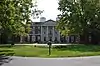 Daughters of America National Home |
January 23, 2003 (#02001730) |
652 N. Sandusky St. 41°08′04″N 83°10′06″W |
Tiffin | |
| 9 | Downtown Tiffin Historic District |  Downtown Tiffin Historic District |
May 2, 1978 (#78002186) |
Roughly bounded by Riverside Dr., Jefferson, S. Washington St., E. Market, Madison, and Court Sts. 41°06′46″N 83°10′33″W |
Tiffin | |
| 10 | Fort Ball-Railroad Historic District |  Fort Ball-Railroad Historic District |
June 20, 1979 (#79001944) |
Roughly bounded by the Sandusky River and Perry, Sandusky and Washington Sts. 41°07′02″N 83°11′02″W |
Tiffin | |
| 11 | Fostoria Downtown Historic District | 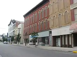 Fostoria Downtown Historic District |
September 28, 2001 (#01001065) |
Roughly bounded by North St., South St., and the alleys east and west of Main St. 41°09′23″N 83°24′52″W |
Fostoria | |
| 12 | Founders Hall, Heidelberg College | 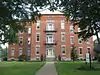 Founders Hall, Heidelberg College |
March 20, 1973 (#73001534) |
Perry St. (State Route 18) 41°06′59″N 83°10′02″W |
Tiffin | |
| 13 | France Hall | 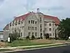 France Hall |
February 12, 1979 (#79002776) |
119 Greenfield St. 41°06′55″N 83°09′52″W |
Tiffin | |
| 14 | Gerhart-Rust Residence |  Gerhart-Rust Residence |
February 12, 1979 (#79002766) |
285 E. Perry St. 41°07′00″N 83°10′06″W |
Tiffin | |
| 15 | Great Hall |  Great Hall |
February 12, 1979 (#79002777) |
44 Greenfield St. 41°06′53″N 83°10′06″W |
Tiffin | |
| 16 | Hanson Machinery Company |  Hanson Machinery Company |
January 7, 1980 (#80003219) |
235 Miami St. 41°07′11″N 83°11′16″W |
Tiffin | |
| 17 | Hedges-Hunter-Keller-Bacon Gristmill |  Hedges-Hunter-Keller-Bacon Gristmill |
January 7, 1980 (#80003220) |
255 Riverside Dr. 41°07′25″N 83°10′14″W |
Tiffin | |
| 18 | Henny Barn |  Henny Barn |
November 6, 1979 (#79003646) |
Western half of the southwestern corner of section 1, on the northern side of County Road 34 east of the northwestern railroad tracks and east of Flat Rock 41°14′29″N 82°50′50″W |
Thompson Township | |
| 19 | Heter Farm |  Heter Farm |
March 29, 1979 (#79001941) |
8531 N. County Road 29, southwest of Bellevue[6] 41°14′45″N 82°51′33″W |
Thompson Township | |
| 20 | William Hunter House |  William Hunter House |
January 7, 1980 (#80003221) |
260 Riverside Dr. 41°07′23″N 83°10′12″W |
Tiffin | |
| 21 | Junior Order United American Mechanics National Orphans' Home | 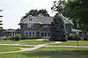 Junior Order United American Mechanics National Orphans' Home |
October 1, 1990 (#90001499) |
600 N. River Rd. 41°07′55″N 83°09′33″W |
Tiffin | |
| 22 | Laird Hall |  Laird Hall |
February 12, 1979 (#79002775) |
70 Greenfield St. 41°06′54″N 83°09′59″W |
Tiffin | |
| 23 | Miami Street Grade School | 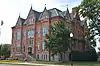 Miami Street Grade School |
March 21, 1979 (#79001945) |
155 Miami St. 41°07′06″N 83°11′04″W |
Tiffin | |
| 24 | Michaels Farm | 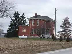 Michaels Farm |
November 29, 1979 (#79001943) |
South of Kansas on State Route 635 41°13′43″N 83°16′46″W |
Liberty Township | |
| 25 | Mueller Brewery | 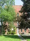 Mueller Brewery |
January 7, 1980 (#80003222) |
146-164 Riverside Dr. 41°07′11″N 83°10′21″W |
Tiffin | |
| 26 | Christ Mueller House | 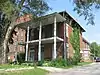 Christ Mueller House |
January 7, 1980 (#80003223) |
140-142 Riverside Dr. 41°07′11″N 83°10′22″W |
Tiffin | |
| 27 | North Sandusky Street Historic District | 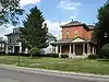 North Sandusky Street Historic District |
May 27, 1980 (#80003224) |
N. Sandusky St. 41°07′23″N 83°10′49″W |
Tiffin | |
| 28 | Northeast Tiffin Historic District |  Northeast Tiffin Historic District |
May 28, 1980 (#80003225) |
Clinton, Ohio, and Hunter Sts. 41°07′12″N 83°10′09″W |
Tiffin | |
| 29 | The Octagon | 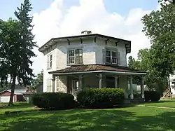 The Octagon |
February 12, 1979 (#79002764) |
297 E. Perry St. 41°07′00″N 83°10′05″W |
Tiffin | |
| 30 | Ohio Lantern Company | 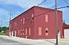 Ohio Lantern Company |
January 7, 1980 (#80003226) |
60-72 Hudson St. 41°07′13″N 83°10′47″W |
Tiffin | |
| 31 | Omar Chapel | 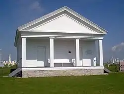 Omar Chapel |
November 5, 1987 (#87001982) |
408 State Route 4, north of Attica 41°07′06″N 82°51′46″W |
Reed Township | |
| 32 | Pfleiderer Center for Religion and the Humanities | 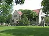 Pfleiderer Center for Religion and the Humanities |
February 12, 1979 (#79002773) |
28 Greenfield St. 41°06′55″N 83°10′05″W |
Tiffin | |
| 33 | Pleasant Ridge United Methodist Church and Cemetery | 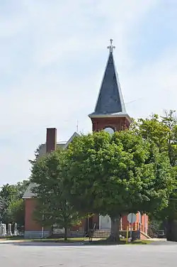 Pleasant Ridge United Methodist Church and Cemetery |
September 10, 1993 (#93000880) |
Junction of State Route 101 and County Road 38, northeast of Tiffin 41°10′05″N 83°05′58″W |
Pleasant Township | |
| 34 | President's House | 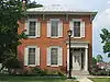 President's House |
February 12, 1979 (#79002768) |
67 Greenfield St. 41°06′56″N 83°09′59″W |
Tiffin | |
| 35 | St. Boniface Roman Catholic Church, School, Rectory, and Convent of the Sisters of the Precious Blood |  St. Boniface Roman Catholic Church, School, Rectory, and Convent of the Sisters of the Precious Blood |
November 17, 1982 (#82001487) |
N. Perry St. 41°03′16″N 83°19′17″W |
New Riegel | |
| 36 | Social Science House | 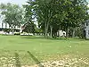 Social Science House |
February 12, 1979 (#79002782) |
266 E. Market St. 41°06′55″N 83°10′12″W |
Tiffin | |
| 37 | Springdale | 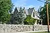 Springdale |
August 26, 1993 (#93000878) |
318 Sycamore St. 41°06′09″N 83°10′56″W |
Tiffin | |
| 38 | Tiffin Agricultural Works | 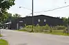 Tiffin Agricultural Works |
January 7, 1980 (#80003227) |
40 Harrison St. 41°07′13″N 83°10′32″W |
Tiffin | |
| 39 | Tiffin Art Metal Company | 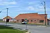 Tiffin Art Metal Company |
January 7, 1980 (#80003228) |
450 Wall St. 41°07′39″N 83°11′14″W |
Tiffin | |
| 40 | Tiffin Waterworks |  Tiffin Waterworks |
January 7, 1980 (#80003229) |
170 Ella St. 41°06′16″N 83°11′14″W |
Tiffin | |
| 41 | Umsted Farm |  Umsted Farm |
April 27, 1979 (#79001946) |
North of Tiffin on County Road 38 41°10′05″N 83°09′37″W |
Pleasant Township | |
| 42 | Wagner Brothers Bottling Works |  Wagner Brothers Bottling Works |
January 7, 1980 (#80003230) |
250-258 Benner St. 41°06′52″N 83°11′04″W |
Tiffin | |
| 43 | Webster Manufacturing |  Webster Manufacturing |
January 7, 1980 (#80003231) |
325 Hall St. 41°07′26″N 83°11′24″W |
Tiffin | |
| 44 | Williard Hall | 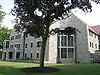 Williard Hall |
February 12, 1979 (#79002771) |
116 Greenfield St. 41°06′52″N 83°09′52″W |
Tiffin |
Former listing
| [3] | Name on the Register | Image | Date listed | Date removed | Location | City or town | Summary |
|---|---|---|---|---|---|---|---|
| 1 | Fine Arts Building | February 12, 1979 (#79002770) | January 31, 1995 | 338 E. Perry St. 41°07′00″N 83°09′58″W |
Tiffin |
See also
| Wikimedia Commons has media related to National Register of Historic Places in Seneca County, Ohio. |
References
- The latitude and longitude information provided in this table was derived originally from the National Register Information System, which has been found to be fairly accurate for about 99% of listings. Some locations in this table may have been corrected to current GPS standards.
- "National Register of Historic Places: Weekly List Actions". National Park Service, United States Department of the Interior. Retrieved on January 29, 2021.
- Numbers represent an alphabetical ordering by significant words. Various colorings, defined here, differentiate National Historic Landmarks and historic districts from other NRHP buildings, structures, sites or objects.
- "National Register Information System". National Register of Historic Places. National Park Service. April 24, 2008.
- The eight-digit number below each date is the number assigned to each location in the National Register Information System database, which can be viewed by clicking the number.
- Location derived from caption on photo at its Ohio Historical Society photograph; the NRIS erroneously lists the property as being northwest of Bellevue

Municipalities and communities of Seneca County, Ohio, United States | ||
|---|---|---|
| Cities | Map of Ohio highlighting Seneca County | |
| Villages | ||
| Townships | ||
| CDPs | ||
| Unincorporated communities | ||
| Ghost towns | ||
| Footnotes | ‡This populated place also has portions in an adjacent county or counties | |
| ||
This article is issued from Wikipedia. The text is licensed under Creative Commons - Attribution - Sharealike. Additional terms may apply for the media files.