National Register of Historic Places listings in Lawrence County, Ohio
This is a list of the National Register of Historic Places listings in Lawrence County, Ohio.
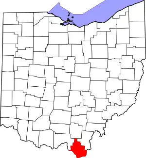
Location of Lawrence County in Ohio
This is intended to be a complete list of the properties and districts on the National Register of Historic Places in Lawrence County, Ohio, United States. The locations of National Register properties and districts for which the latitude and longitude coordinates are included below, may be seen in an online map.[1]
There are 20 properties and districts listed on the National Register in the county.
- This National Park Service list is complete through NPS recent listings posted January 29, 2021.[2]
Current listings
| [3] | Name on the Register[4] | Image | Date listed[5] | Location | City or town | Description |
|---|---|---|---|---|---|---|
| 1 | Brumberg Building | 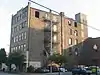 Brumberg Building |
March 6, 2008 (#08000148) |
222 S. 3rd St. 38°32′02″N 82°41′05″W |
Ironton | |
| 2 | Burlington 37 Cemetery |  Burlington 37 Cemetery |
September 28, 2001 (#01001064) |
Center St. in Burlington 38°24′41″N 82°31′12″W |
Fayette Township | |
| 3 | Chesapeake High School | 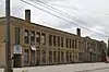 Chesapeake High School |
February 16, 2018 (#100002122) |
3748 State Route 7 38°26′00″N 82°25′45″W |
Union Township | Now the Chesapeake Community Center |
| 4 | Downtown Ironton Historic District | 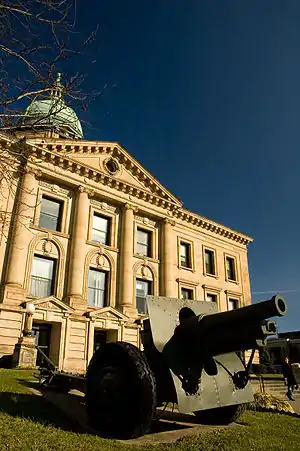 Downtown Ironton Historic District |
January 8, 2009 (#08001296) |
Portions of 2nd, 3rd, 4th, 5th, Center Sts., Park Ave., Vernon St., and Bobby Bare Boulevard 38°32′06″N 82°41′05″W |
Ironton | |
| 5 | F.W. Erlich House | 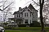 F.W. Erlich House |
October 3, 1980 (#80003134) |
1908 S. 6th St. 38°31′18″N 82°40′13″W |
Ironton | |
| 6 | Fifth and Lawrence Streets Residential District | 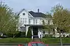 Fifth and Lawrence Streets Residential District |
August 2, 1978 (#78002098) |
5th and Lawrence Sts. 38°32′18″N 82°41′06″W |
Ironton | |
| 7 | Grand Army of the Republic Memorial Hall | 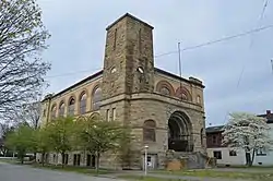 Grand Army of the Republic Memorial Hall |
September 19, 2012 (#12000801) |
401 Railroad St. 38°32′15″N 82°41′08″W |
Ironton | |
| 8 | William C. Johnston House and General Store | 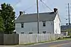 William C. Johnston House and General Store |
September 7, 1976 (#76001463) |
Washington and Davidson Sts. in Burlington 38°24′22″N 82°31′51″W |
Fayette Township | |
| 9 | Macedonia Church | 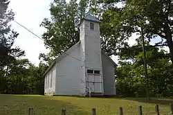 Macedonia Church |
February 7, 1978 (#78002096) |
North of Burlington 38°26′22″N 82°31′46″W |
Fayette Township | |
| 10 | Maplewood |  Maplewood |
April 13, 1977 (#77001070) |
West of Chesapeake on Maplewood Lane 38°25′22″N 82°28′23″W |
Fayette Township | |
| 11 | Marlow Theatre | 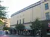 Marlow Theatre |
March 6, 2008 (#08000149) |
S. 3rd St. and Park Ave. 38°32′03″N 82°41′06″W |
Ironton | |
| 12 | Marting Hotel | 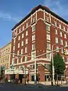 Marting Hotel |
March 12, 1999 (#99000331) |
202 Park Ave. 38°32′03″N 82°41′07″W |
Ironton | |
| 13 | Miller-Knight House |  Miller-Knight House |
August 4, 2003 (#03000720) |
2 Township Road 1046 38°32′27″N 82°17′53″W |
Rome Township | |
| 14 | Norfolk And Western Railroad Depot | 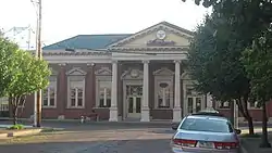 Norfolk And Western Railroad Depot |
September 13, 1978 (#78002099) |
1st St. and Park Ave. 38°32′03″N 82°41′11″W |
Ironton | |
| 15 | Old Lawrence County Jail |  Old Lawrence County Jail |
December 22, 1978 (#78002097) |
Court St. in Burlington 38°24′26″N 82°31′43″W |
Fayette Township | |
| 16 | Olive Furnace | 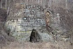 Olive Furnace |
April 12, 2007 (#07000299) |
State Route 93 at Township Road 239 (Olive Branch Rd.), north of Pedro 38°45′45″N 82°37′50″W |
Washington Township | |
| 17 | Rankin Historic District |  Rankin Historic District |
July 26, 1979 (#79001876) |
Roughly bounded by Vernon, 7th, Monroe and 4th Sts. 38°32′04″N 82°40′48″W |
Ironton | |
| 18 | Scottown Covered Bridge | 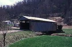 Scottown Covered Bridge |
November 12, 1975 (#75001456) |
East of Scottown on State Route 67 38°32′52″N 82°22′49″W |
Windsor Township | |
| 19 | Selby Shoe Company Building | 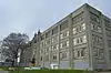 Selby Shoe Company Building |
June 18, 2009 (#09000444) |
1603 S. 3rd St. 38°31′22″N 82°40′30″W |
Ironton | |
| 20 | Vesuvius Furnace | 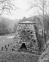 Vesuvius Furnace |
June 14, 1990 (#89001714) |
Vesuvius Recreation Area off State Route 93, near Ironton 38°36′19″N 82°37′49″W |
Elizabeth Township | Originally located on County Highway 29 at Storms Creek in the Vesuvius Recreation Area of the Wayne National Forest; current boundaries reflect a boundary decrease of 2011-09-15[6] |
See also
| Wikimedia Commons has media related to National Register of Historic Places in Lawrence County, Ohio. |
References
- The latitude and longitude information provided in this table was derived originally from the National Register Information System, which has been found to be fairly accurate for about 99% of listings. Some locations in this table may have been corrected to current GPS standards.
- "National Register of Historic Places: Weekly List Actions". National Park Service, United States Department of the Interior. Retrieved on January 29, 2021.
- Numbers represent an alphabetical ordering by significant words. Various colorings, defined here, differentiate National Historic Landmarks and historic districts from other NRHP buildings, structures, sites or objects.
- "National Register Information System". National Register of Historic Places. National Park Service. April 24, 2008.
- The eight-digit number below each date is the number assigned to each location in the National Register Information System database, which can be viewed by clicking the number.
- 76 FR 54250

Municipalities and communities of Lawrence County, Ohio, United States | ||
|---|---|---|
| City | Map of Ohio highlighting Lawrence County | |
| Villages | ||
| Townships | ||
| CDP | ||
| Unincorporated communities | ||
| Footnotes | ‡This populated place also has portions in an adjacent county or counties | |
| ||
This article is issued from Wikipedia. The text is licensed under Creative Commons - Attribution - Sharealike. Additional terms may apply for the media files.