National Register of Historic Places listings in Lake County, Ohio
This is a list of the National Register of Historic Places listings in Lake County, Ohio.
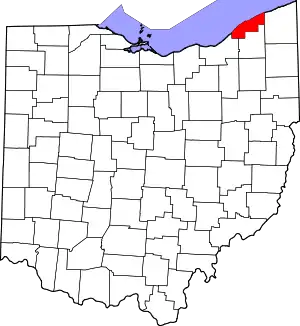
Location of Lake County in Ohio
This is intended to be a complete list of the properties and districts on the National Register of Historic Places in Lake County, Ohio, United States. The locations of National Register properties and districts for which the latitude and longitude coordinates are included below, may be seen in an online map.[1]
There are 80 properties and districts listed on the National Register in the county, including 2 National Historic Landmarks.
- This National Park Service list is complete through NPS recent listings posted January 29, 2021.[2]
Current listings
| [3] | Name on the Register[4] | Image | Date listed[5] | Location | City or town | Description |
|---|---|---|---|---|---|---|
| 1 | Administration Building, Lake Erie College | 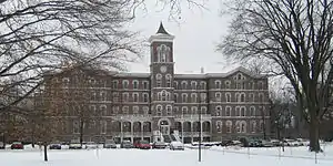 Administration Building, Lake Erie College |
March 20, 1973 (#73001486) |
391 W. Washington St. 41°43′03″N 81°15′06″W |
Painesville | |
| 2 | Brick Vernacular House No. 1 | 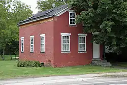 Brick Vernacular House No. 1 |
October 20, 1980 (#80003108) |
98 Lake St. 41°46′24″N 81°02′50″W |
Madison | |
| 3 | Brick Vernacular House No. 2 |  Brick Vernacular House No. 2 |
October 20, 1980 (#80003109) |
120 N. Lake St. 41°46′26″N 81°02′50″W |
Madison | |
| 4 | Casement House | 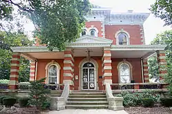 Casement House |
July 30, 1975 (#75001454) |
436 Casement Ave. 41°44′11″N 81°13′39″W |
Painesville Township | |
| 5 | Cheese-vat Factory |  Cheese-vat Factory |
October 20, 1980 (#80003110) |
16 Eagle St. 41°46′18″N 81°03′05″W |
Madison | |
| 6 | Alpha Charles Childs House |  Alpha Charles Childs House |
October 20, 1980 (#80003111) |
319 W. Main St. 41°46′14″N 81°03′17″W |
Madison | |
| 7 | Robertus W. Childs House |  Robertus W. Childs House |
October 20, 1980 (#80003112) |
307 W. Main St. 41°46′14″N 81°03′16″W |
Madison | |
| 8 | Connecticut Land Company Office |  Connecticut Land Company Office |
August 14, 1973 (#73001491) |
7877 E. Main St. in Unionville 41°46′48″N 81°00′18″W |
Madison Township | |
| 9 | Corning-White House |  Corning-White House |
November 7, 1972 (#72001027) |
8353 Mentor Ave. 41°39′58″N 81°20′31″W |
Mentor | |
| 10 | Harry Coulby Mansion |  Harry Coulby Mansion |
August 24, 1979 (#79001875) |
28730 Ridge Rd. 41°35′43″N 81°28′41″W |
Wickliffe | Named for Harry Coulby |
| 11 | George Damon House |  George Damon House |
October 20, 1980 (#80003113) |
841 W. Main St. 41°46′08″N 81°03′54″W |
Madison | |
| 12 | James Dayton House |  James Dayton House |
October 20, 1980 (#80003114) |
939 W. Main St. 41°46′08″N 81°03′15″W |
Madison | |
| 13 | James Dayton House II |  James Dayton House II |
October 20, 1980 (#80003115) |
417 W. Main St. 41°46′12″N 81°03′24″W |
Madison | |
| 14 | Albert DeHeck House |  Albert DeHeck House |
October 20, 1980 (#80003116) |
431 W. Main St. 41°46′12″N 81°03′26″W |
Madison | |
| 15 | Downtown Painesville Historic District |  Downtown Painesville Historic District |
June 29, 2020 (#100005323) |
Veterans Park, 22 Liberty St., 7 Richmond St., 7-71 North Park Pl., 30-100 South Park Pl., 15-34 South Saint Clair St., 105-270 Main St., excluding 177 Main St., 8-124 North State St., 1-83 South State St., excluding 54 South State St., 41°43′30″N 81°14′37″W |
Painesville | |
| 16 | Downtown Willoughby Historic District | 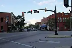 Downtown Willoughby Historic District |
November 29, 1995 (#95001362) |
Approximately nine blocks centered around the junction of Erie and River Sts. and Euclid Ave. 41°38′21″N 81°24′25″W |
Willoughby | |
| 17 | Fairport Harbor West Breakwater Light |  Fairport Harbor West Breakwater Light |
April 10, 1992 (#92000242) |
Western breakwater pierhead at harbor entrance, northeast of Fairport Harbor 41°46′02″N 81°16′53″W |
Painesville Township | |
| 18 | Fairport Marine Museum |  Fairport Marine Museum |
November 5, 1971 (#71000642) |
129 2nd St. 41°45′25″N 81°16′39″W |
Fairport Harbor | |
| 19 | Claud Foster House |  Claud Foster House |
June 16, 2004 (#04000611) |
30333 Lakeshore Boulevard 41°38′21″N 81°28′37″W |
Willowick | |
| 20 | Frances Ensign Fuller House |  Frances Ensign Fuller House |
October 20, 1980 (#80003117) |
790 W. Main St. 41°46′11″N 81°03′57″W |
Madison | |
| 21 | Garfield Library |  Garfield Library |
February 23, 1979 (#79001872) |
7300 Center St. 41°40′19″N 81°20′25″W |
Mentor | |
| 22 | Jane Gilbert House |  Jane Gilbert House |
October 20, 1980 (#80003118) |
189-195 W. Main St. 41°46′15″N 81°03′06″W |
Madison | |
| 23 | H. Gill House |  H. Gill House |
October 20, 1980 (#80003119) |
232 River St. 41°46′01″N 81°02′58″W |
Madison | |
| 24 | Norma Grantham Site (33-La-139) |  Norma Grantham Site (33-La-139) |
May 31, 1984 (#84003757) |
600 metres (2,000 ft) south of the Fairport Harbor Village Site,[6] along East Street about 0.75 miles (1.21 km) south of Lake Erie[7] 41°44′27″N 81°16′08″W |
Fairport Harbor | |
| 25 | Gray-Coulton House |  Gray-Coulton House |
December 3, 1975 (#75001452) |
8607-8617 Mentor Ave. 41°40′11″N 81°19′56″W |
Mentor | |
| 26 | Lucius Green House | 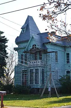 Lucius Green House |
July 12, 1976 (#76001462) |
4160 Main St. 41°45′31″N 81°08′21″W |
Perry | |
| 27 | Leonard C. Hanna, Jr., Estate | 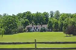 Leonard C. Hanna, Jr., Estate |
March 12, 1979 (#79001870) |
Little Mountain Rd. 41°38′25″N 81°19′02″W |
Kirtland Hills | |
| 28 | Francis Hendry House |  Francis Hendry House |
October 20, 1980 (#80003120) |
239-243 W. Main St. 41°46′15″N 81°03′10″W |
Madison | |
| 29 | Indian Point Fort |  Indian Point Fort |
July 30, 1974 (#74001543) |
East of Painesville 41°43′13″N 81°10′17″W |
LeRoy Township | |
| 30 | Cyrus J. Ingersoll House |  Cyrus J. Ingersoll House |
October 20, 1980 (#80003121) |
249 W. Main St. 41°46′14″N 81°03′11″W |
Madison | |
| 31 | John J. Jones House |  John J. Jones House |
October 20, 1980 (#80003122) |
298 Lake St. 41°46′37″N 81°02′50″W |
Madison | |
| 32 | John Kellogg House and Barn |  John Kellogg House and Barn |
October 20, 1980 (#80003123) |
30 E. Main St. 41°46′14″N 81°02′46″W |
Madison | |
| 33 | Addison Kimball House |  Addison Kimball House |
March 27, 1975 (#75001449) |
390 W. Main St. 41°46′15″N 81°03′23″W |
Madison | |
| 34 | Lemuel Kimball, II, House |  Lemuel Kimball, II, House |
October 15, 1974 (#74001540) |
467 W. Main St. 41°46′12″N 81°03′29″W |
Madison | |
| 35 | Solomon Kimball House |  Solomon Kimball House |
October 20, 1980 (#80003124) |
391 W. Main St. 41°46′13″N 81°03′23″W |
Madison | |
| 36 | Kirtland Temple | 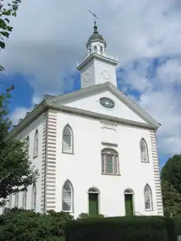 Kirtland Temple |
June 4, 1969 (#69000145) |
9020 Chillicothe Rd. 41°37′31″N 81°21′44″W |
Kirtland | |
| 37 | Ladd's Tavern |  Ladd's Tavern |
May 22, 1978 (#78002091) |
5466 S. Ridge Rd. 41°45′46″N 81°05′36″W |
Madison Township | |
| 38 | Lake Shore and Michigan Southern RR Depot and Freight House | 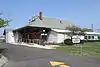 Lake Shore and Michigan Southern RR Depot and Freight House |
January 31, 1978 (#78002092) |
8445 Station St. 41°40′44″N 81°20′18″W |
Mentor | |
| 39 | Lawnfield-James A. Garfield Estate |  Lawnfield-James A. Garfield Estate |
October 15, 1966 (#66000613) |
8095 Mentor Ave. 41°39′44″N 81°20′50″W |
Mentor | Also designated a National Historic Landmark |
| 40 | Lutz's Tavern |  Lutz's Tavern |
April 23, 1973 (#73001487) |
792 Mentor Ave. 41°42′47″N 81°15′37″W |
Painesville | |
| 41 | William Lyman House |  William Lyman House |
October 20, 1980 (#80003125) |
734 W. Main St. 41°46′11″N 81°03′50″W |
Madison | |
| 42 | Madison Fort |  Madison Fort |
July 30, 1974 (#74001541) |
On a ridge between the Grand River and Mill Creek, southeast of Madison[8] 41°44′42″N 81°01′20″W |
Madison Township | |
| 43 | Madison Seminary and Home | 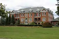 Madison Seminary and Home |
February 22, 1979 (#79001871) |
North of central Madison at 6769 Middle Ridge Rd. 41°47′25″N 81°02′45″W |
Madison | |
| 44 | James Mason House |  James Mason House |
September 18, 1975 (#75001453) |
8125 Mentor Ave. 41°39′52″N 81°20′57″W |
Mentor | |
| 45 | Mathews House |  Mathews House |
April 23, 1973 (#73001488) |
309 W. Washington St. 41°43′09″N 81°14′59″W |
Painesville | |
| 46 | Mentor Avenue District |  Mentor Avenue District |
August 3, 1978 (#78002093) |
Wood St. and Mentor Ave. from Liberty to Washington St. 41°43′17″N 81°14′56″W |
Painesville | |
| 47 | Mentor Village Hall |  Mentor Village Hall |
September 10, 2014 (#14000591) |
8383 Mentor Ave. 41°40′00″N 81°20′26″W |
Mentor | Renovated 2015–2017[9] |
| 48 | Mentor Village School |  Mentor Village School |
February 9, 2005 (#05000026) |
7482 Center St. 41°40′01″N 81°20′26″W |
Mentor | |
| 49 | Rev. Harlan Metcalf House |  Rev. Harlan Metcalf House |
October 20, 1980 (#80003126) |
275 W. Main St. 41°46′14″N 81°03′14″W |
Madison | |
| 50 | Methodist Episcopal Church of Painesville |  Methodist Episcopal Church of Painesville |
January 30, 1998 (#98000043) |
71 N. Park Place 41°43′31″N 81°14′40″W |
Painesville | |
| 51 | Edward W. and Louise C. Moore Estate | 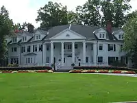 Edward W. and Louise C. Moore Estate |
March 10, 1988 (#88000209) |
7960 Garfield Rd. 41°38′19″N 81°21′24″W |
Kirtland | |
| 52 | Lewis Morley House |  Lewis Morley House |
March 30, 1978 (#78002094) |
231 N. State St. 41°43′47″N 81°14′40″W |
Painesville | |
| 53 | Norfolk and Western Freight Station |  Norfolk and Western Freight Station |
October 20, 1980 (#80003127) |
Lake St. 41°46′29″N 81°02′48″W |
Madison | |
| 54 | Old South Church |  Old South Church |
September 20, 1973 (#73001485) |
9802 Chillicothe Rd. 41°36′16″N 81°21′01″W |
Kirtland | |
| 55 | John G. Oliver House | 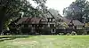 John G. Oliver House |
October 1, 1981 (#81000444) |
7645 Little Mountain Rd. 41°39′40″N 81°19′30″W |
Mentor | |
| 56 | David R. Paige House |  David R. Paige House |
December 23, 1975 (#75001450) |
21-29 W. Main St. 41°46′16″N 81°02′53″W |
Madison | |
| 57 | Painesville City Hall |  Painesville City Hall |
July 24, 1972 (#72001028) |
7 Richmond St. 41°43′27″N 81°14′45″W |
Painesville | |
| 58 | George Pease House |  George Pease House |
October 20, 1980 (#80003128) |
553 W. Main St. 41°46′11″N 81°03′34″W |
Madison | |
| 59 | Louis A. Penfield House |  Louis A. Penfield House |
February 7, 1997 (#96001622) |
2203 River Rd. 41°37′09″N 81°24′31″W |
Willoughby Hills | |
| 60 | St. James Episcopal Church |  St. James Episcopal Church |
July 7, 1975 (#75001455) |
141 N. State St. 41°43′41″N 81°14′36″W |
Painesville | |
| 61 | Sawyer-Wayside House |  Sawyer-Wayside House |
October 29, 1974 (#74001542) |
9470 Mentor Ave. 41°40′50″N 81°18′01″W |
Mentor | |
| 62 | Uri Seeley House |  Uri Seeley House |
August 14, 1973 (#73001489) |
969 Riverside Dr. 41°42′54″N 81°12′30″W |
Painesville Township | |
| 63 | Orland Selby House |  Orland Selby House |
October 20, 1980 (#80003129) |
564 E. Main St. 41°46′27″N 81°02′05″W |
Madison | |
| 64 | Sessions House | 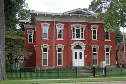 Sessions House |
August 14, 1973 (#73001490) |
157 Mentor Ave. 41°42′45″N 81°14′55″W |
Painesville | |
| 65 | Smart Building |  Smart Building |
September 29, 1983 (#83001989) |
4143-4145 Erie St. 41°38′22″N 81°24′24″W |
Willoughby | |
| 66 | Smead House |  Smead House |
November 21, 1974 (#74001544) |
187 Mentor Ave. 41°43′15″N 81°15′01″W |
Painesville | |
| 67 | David Smead House |  David Smead House |
October 20, 1980 (#80003130) |
269 E. Main St. 41°46′24″N 81°02′28″W |
Madison | |
| 68 | South Leroy Meetinghouse |  South Leroy Meetinghouse |
May 8, 1979 (#79001873) |
Southeast of Painesville at State Route 86 and Brakeman Rd. 41°39′51″N 81°08′48″W |
LeRoy Township | |
| 69 | Mr. and Mrs. Karl A. Staley House | 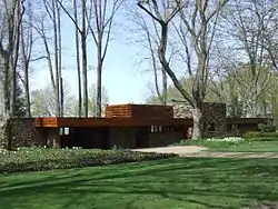 Mr. and Mrs. Karl A. Staley House |
March 4, 2014 (#14000042) |
6363 Lake Rd., W., north of Madison 41°49′53″N 81°03′40″W |
Madison Township | |
| 70 | Joseph Talcott House |  Joseph Talcott House |
October 20, 1980 (#80003131) |
354 River St. 41°45′55″N 81°02′55″W |
Madison | |
| 71 | Judge Abraham Tappan House |  Judge Abraham Tappan House |
May 8, 1979 (#79001874) |
7855 S. Ridge Rd. in Unionville 41°46′48″N 81°00′15″W |
Madison Township | |
| 72 | Town Center District |  Town Center District |
October 20, 1980 (#80004247) |
Main St. between River and Lake Sts. 41°46′16″N 81°02′56″W |
Madison | |
| 73 | Unionville District School |  Unionville District School |
December 29, 1978 (#78002095) |
3480 West St. in Unionville 41°46′45″N 81°00′24″W |
Madison Township | |
| 74 | Unionville Tavern |  Unionville Tavern |
July 26, 1973 (#73001492) |
On State Route 84 in Unionville 41°46′49″N 81°00′11″W |
Madison Township | |
| 75 | Edwin L. Ware House |  Edwin L. Ware House |
October 20, 1980 (#80003132) |
293 W. Main St. 41°46′14″N 81°03′15″W |
Madison | |
| 76 | Newel K. Whitney Store | 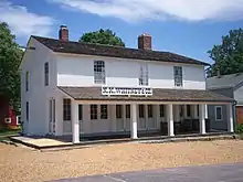 Newel K. Whitney Store |
August 30, 1984 (#84003759) |
8881 Chillicothe Rd. 41°37′46″N 81°21′42″W |
Kirtland | |
| 77 | George D. Wilson House |  George D. Wilson House |
October 20, 1980 (#80003133) |
367 River St. 41°45′54″N 81°02′53″W |
Madison | |
| 78 | Dr. J. C. Winans House | 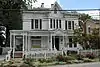 Dr. J. C. Winans House |
April 26, 1976 (#76001461) |
143 River St. 41°46′07″N 81°02′58″W |
Madison | |
| 79 | John and Carrie Yager House |  John and Carrie Yager House |
March 17, 1994 (#94000240) |
7612 S. Center St. 41°39′51″N 81°20′25″W |
Mentor | |
| 80 | Benjamin and Mary Young House |  Benjamin and Mary Young House |
August 8, 1996 (#96000867) |
7597 S. Center St. 41°39′52″N 81°20′24″W |
Mentor |
See also
| Wikimedia Commons has media related to National Register of Historic Places in Lake County, Ohio. |
References
- The latitude and longitude information provided in this table was derived originally from the National Register Information System, which has been found to be fairly accurate for about 99% of listings. Some locations in this table may have been corrected to current GPS standards.
- "National Register of Historic Places: Weekly List Actions". National Park Service, United States Department of the Interior. Retrieved on January 29, 2021.
- Numbers represent an alphabetical ordering by significant words. Various colorings, defined here, differentiate National Historic Landmarks and historic districts from other NRHP buildings, structures, sites or objects.
- "National Register Information System". National Register of Historic Places. National Park Service. April 24, 2008.
- The eight-digit number below each date is the number assigned to each location in the National Register Information System database, which can be viewed by clicking the number.
- Watson, Anna Louise. "Normality and the Aging Process in the Thoracic Spine: Two Late Prehistoric Ohio Populations". Thesis Ohio State U, 2009, 11.
- Morgan, Richard G., and H. Holmes Ellis. "The Fairport Harbor Village Site Archived 2004-01-08 at the Wayback Machine, Ohio History 52 (1963): 3-4. The NRIS lists the site as "Address Restricted".
- Location derived from this page of Ohio History; the NRIS lists the site as "Address Restricted"
- Scott, Betsy (March 21, 2017). "Mentor landmark building renovations complete; open house this week". The News-Herald. Retrieved March 21, 2017.

Municipalities and communities of Lake County, Ohio, United States | ||
|---|---|---|
| Cities | Map of Ohio highlighting Lake County | |
| Villages | ||
| Townships | ||
| CDP | ||
| Unincorporated communities | ||
| ||
This article is issued from Wikipedia. The text is licensed under Creative Commons - Attribution - Sharealike. Additional terms may apply for the media files.