National Register of Historic Places listings in Hamilton County, Ohio
This is a list of the National Register of Historic Places listings in Hamilton County, Ohio.
This is intended to be a complete list of the properties and districts on the National Register of Historic Places in Hamilton County, Ohio, United States. Latitude and longitude coordinates are provided for many National Register properties and districts; these locations may be seen together in a map.[1]
There are 370 properties and districts listed on the National Register in the county, including 14 National Historic Landmarks. The city of Cincinnati is the location of 274 of these properties and districts, including 12 National Historic Landmarks; they are listed separately, while the remaining 96 properties and districts, including 3 National Historic Landmarks, are listed here.
- This National Park Service list is complete through NPS recent listings posted January 29, 2021.[2]
Current listings
Outside Cincinnati
| [3] | Name on the Register[4] | Image | Date listed[5] | Location | City or town | Description |
|---|---|---|---|---|---|---|
| 1 | Joseph W. Baldwin House | 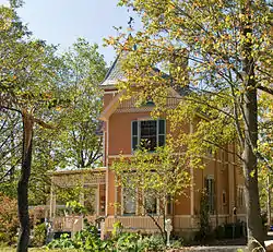 Joseph W. Baldwin House |
August 25, 1986 (#86001628) |
217 Springfield Pike 39°13′18″N 84°28′25″W |
Wyoming | |
| 2 | Joseph and Cecilia Bappert House | 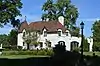 Joseph and Cecilia Bappert House |
August 29, 2016 (#16000596) |
1550 Neeb Rd. 39°07′23″N 84°38′02″W |
Green Township | |
| 3 | James Baxter House | 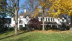 James Baxter House |
July 22, 1994 (#94000774) |
2930 Fair Acres Dr. 39°11′33″N 84°25′57″W |
Amberley | |
| 4 | Becker House |  Becker House |
July 18, 1974 (#74001522) |
179 W. Crescentville Rd. 39°18′06″N 84°28′28″W |
Springdale | |
| 5 | Benham Mound |  Benham Mound |
July 30, 1974 (#74001508) |
Section 30 of the original Columbia Township, off Montgomery Rd.[6] 39°11′38″N 84°25′31″W |
Amberley | |
| 6 | George Bennett House |  George Bennett House |
May 29, 1975 (#75001426) |
10281 Harrison Pike 39°14′45″N 84°46′58″W |
Harrison | |
| 7 | Blair House |  Blair House |
November 30, 1982 (#82001466) |
7844 Remington Rd (at West St.) 39°13′42″N 84°21′34″W |
Montgomery | |
| 8 | Cyrus Broadwell House | 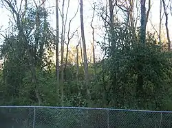 Cyrus Broadwell House |
May 29, 1975 (#75001433) |
Northeast of Newtown at 3882 Mount Carmel Rd. 39°07′58″N 84°18′35″W |
Anderson Township | |
| 9 | Jacob Bromwell House | 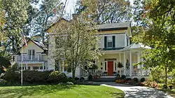 Jacob Bromwell House |
August 25, 1986 (#86001629) |
69 Mt. Pleasant Ave. 39°13′24″N 84°28′47″W |
Wyoming | |
| 10 | Brown-Gorman Farm | 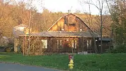 Brown-Gorman Farm |
August 1, 2012 (#12000463) |
10052 Reading Rd. 39°14′42″N 84°25′28″W |
Evendale | |
| 11 | Burchenal Mound | 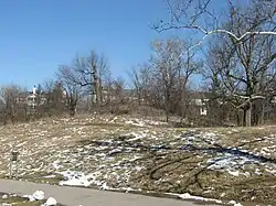 Burchenal Mound |
May 29, 1975 (#75001437) |
West of benchmark 659 above Mill Creek[7]:84 39°15′38″N 84°28′23″W |
Woodlawn | |
| 12 | Wesley Butler Archeological District | 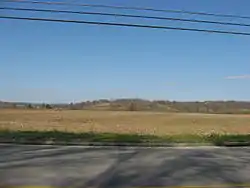 Wesley Butler Archeological District |
July 24, 1976 (#76001446) |
Off U.S. Route 50 southwest of Elizabethtown[7]:121 39°09′16″N 84°48′48″W |
Whitewater Township | |
| 13 | Hugh Campbell House | 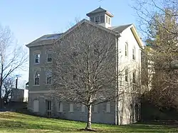 Hugh Campbell House |
November 7, 1976 (#76001448) |
332 Weathervane Rd. 39°15′03″N 84°48′43″W |
Harrison | |
| 14 | Cheviot Fieldhouse | 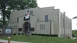 Cheviot Fieldhouse |
April 1, 2009 (#09000170) |
3729 Robb Ave. 39°09′22″N 84°37′12″W |
Cheviot | |
| 15 | Cincinnati and Whitewater Canal Tunnel |  Cincinnati and Whitewater Canal Tunnel |
May 25, 2001 (#01000562) |
Parallel to Miami Ave., junction of Wamsley and Miami Ave. 39°09′18″N 84°44′58″W |
Cleves and North Bend | |
| 16 | Clough Creek and Sand Ridge Archeological District | 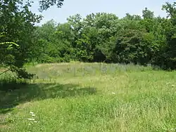 Clough Creek and Sand Ridge Archeological District |
October 1, 1974 (#74001509) |
Along the ridge to the west of the Union Bridge[8] 39°06′46″N 84°23′48″W |
Anderson Township | |
| 17 | Clovernook | 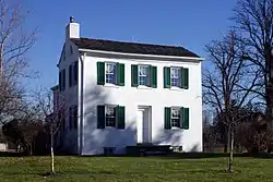 Clovernook |
June 18, 1973 (#73001454) |
7000 Hamilton Ave. 39°13′12″N 84°32′56″W |
North College Hill | |
| 18 | Colerain Works Archeological District | 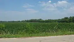 Colerain Works Archeological District |
June 18, 1976 (#76001445) |
Eastern bank of the Great Miami River, north of the site of Fort Dunlap[9] 39°17′53″N 84°39′36″W |
Colerain Township | |
| 19 | Conrad Mound Archeological Site | 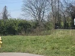 Conrad Mound Archeological Site |
June 20, 1975 (#75001420) |
Off Rittenhouse Rd., southwest of Cleves[10] 39°08′49″N 84°46′20″W |
Miami Township | |
| 20 | Dravo Gravel Site | 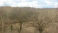 Dravo Gravel Site |
December 22, 1978 (#78002083) |
On a bluff above the Great Miami River, north of Cleves[11] 39°11′28″N 84°45′00″W |
Miami Township | |
| 21 | Dunlap Archeological District | 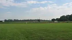 Dunlap Archeological District |
October 21, 1975 (#75001421) |
Eastern bank of the Great Miami River, near the junction of Dunlap and Great Miami River Rds.[12] 39°17′36″N 84°39′12″W |
Colerain Township | Also known as Fort Dunlap[4] |
| 22 | William Edwards Farmhouse | 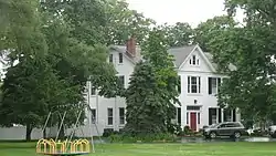 William Edwards Farmhouse |
October 4, 1989 (#89001455) |
3851 Edwards Rd. 39°07′41″N 84°20′30″W |
Newtown | |
| 23 | Eighteen Mile House | 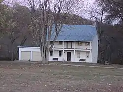 Eighteen Mile House |
October 10, 1975 (#75001427) |
2 mi (3.2 km) southeast of Harrison at Harrison Pike and Patriot Dr. 39°14′18″N 84°46′06″W |
Harrison Township | |
| 24 | Elliott House | 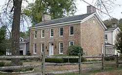 Elliott House |
October 29, 1976 (#76001451) |
9352 Given Rd., south of Remington 39°13′23″N 84°19′16″W |
Indian Hill | |
| 25 | Charles Fay House |  Charles Fay House |
August 25, 1986 (#86001630) |
325 Reily Rd. 39°13′41″N 84°28′46″W |
Wyoming | |
| 26 | Eliphalet Ferris House |  Eliphalet Ferris House |
May 29, 1975 (#75001431) |
3915 Plainville Rd. 39°08′50″N 84°22′42″W |
Mariemont | |
| 27 | Joseph Ferris House |  Joseph Ferris House |
June 30, 1975 (#75001417) |
5729 Dragon Way 39°08′28″N 84°23′31″W |
Fairfax | |
| 28 | Glendale Historic District |  Glendale Historic District |
July 20, 1976 (#76001447) |
State Route 747; Roughly bounded by OH 4/Springfield Pike, Oak Rd., RR right of way, Coral, Sharon and Morse Aves. 39°16′17″N 84°27′49″W |
Glendale | Second set of addresses represent a boundary alteration approved December 18, 2018 |
| 29 | Glendale Police Station | 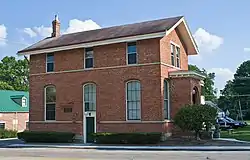 Glendale Police Station |
March 27, 1975 (#75001425) |
305 E. Sharon Ave. 39°16′18″N 84°27′30″W |
Glendale | |
| 30 | Greenhills Historic District | 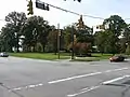 Greenhills Historic District |
January 12, 1989 (#88003066) |
Roughly Damon Rd., Enfield St., Farragut Rd., Flanders Ln., Winton Rd., Andover Rd., Burley Cir., and Cromwell Rd. 39°15′50″N 84°31′28″W |
Greenhills | |
| 31 | Hahn Field Archeological District |  Hahn Field Archeological District |
October 29, 1974 (#74001519) |
Above the Little Miami River in Clear Creek Park, 0.4 miles (0.64 km) north of State Route 32[13] 39°07′38″N 84°22′47″W |
Anderson Township | |
| 32 | William Henry Harrison Tomb State Memorial | 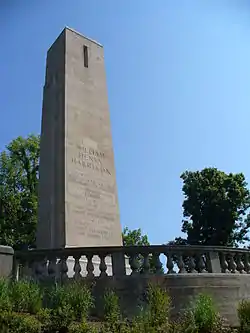 William Henry Harrison Tomb State Memorial |
November 10, 1970 (#70000499) |
Mount Nebo on State Route 128 39°09′06″N 84°45′08″W |
North Bend | |
| 33 | Harrison-Landers House |  Harrison-Landers House |
May 29, 1975 (#75001434) |
3881 Newtown Rd., north of Newtown 39°08′03″N 84°21′18″W |
Anderson Township | |
| 34 | Elmer Hess House |  Elmer Hess House |
August 25, 1986 (#86001633) |
333 Springfield Pike 39°13′27″N 84°28′24″W |
Wyoming | |
| 35 | Jediah Hill Covered Bridge | 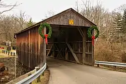 Jediah Hill Covered Bridge |
March 28, 1973 (#73001460) |
7 mi (11 km) north of Cincinnati off U.S. Route 127 on Covered Bridge Rd. 39°15′08″N 84°32′44″W |
Springfield Township | |
| 36 | Jefferson Schoolhouse |  Jefferson Schoolhouse |
March 17, 1976 (#76001450) |
Indian Hill and Drake Rds. 39°09′40″N 84°20′49″W |
Indian Hill | |
| 37 | Jehu John House |  Jehu John House |
October 31, 1975 (#75001428) |
East of Harrison on Stone Dr. 39°15′28″N 84°47′48″W |
Harrison | |
| 38 | Josiah Kirby House |  Josiah Kirby House |
August 25, 1986 (#86001634) |
65 Oliver Rd. 39°13′54″N 84°28′27″W |
Wyoming | |
| 39 | Gretchen Kroger Barnes Graf House |  Gretchen Kroger Barnes Graf House |
February 4, 2011 (#10001213) |
9575 Cunningham Rd. 39°11′56″N 84°18′18″W |
Indian Hill | |
| 40 | Othniel Looker House |  Othniel Looker House |
June 5, 1975 (#75001429) |
10580 Marvin Rd., north of Harrison 39°16′26″N 84°48′11″W |
Harrison Township | |
| 41 | Luethstrom-Hurin House | 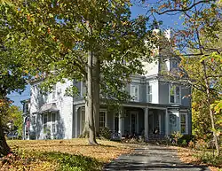 Luethstrom-Hurin House |
August 25, 1986 (#86001635) |
30 Reily Rd. 39°13′42″N 84°28′25″W |
Wyoming | |
| 42 | Main Theatre | 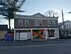 Main Theatre |
December 27, 2017 (#100001934) |
7428 Hamilton Ave. 39°13′52″N 84°32′54″W |
Mt. Healthy | |
| 43 | Mariemont Embankment and Village Site | 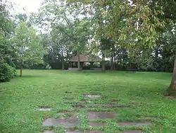 Mariemont Embankment and Village Site |
October 16, 1974 (#74001517) |
Southern side of Mariemont, above the Little Miami River[14] 39°08′27″N 84°22′45″W |
Mariemont | |
| 44 | Mariemont Historic District | 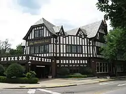 Mariemont Historic District |
July 24, 1979 (#79001862) |
U.S. Route 50; also bordering both sides of U.S. Route 50, bounded by Westover industrial section, Beech St., Murray and Grove Aves., and the Little Miami River 39°08′35″N 84°22′51″W |
Mariemont | Declared a National Historic Landmark District on March 29, 2007 under the name of "Village of Mariemont". Second set of boundaries represents the increased boundaries of the National Historic Landmark District. |
| 45 | Mathew Mound | 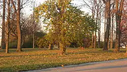 Mathew Mound |
May 29, 1975 (#75001424) |
Atop the hill on the northern side of Oak Rd.[7]:83 39°15′44″N 84°26′34″W |
Glendale | |
| 46 | Thomas Miller House | 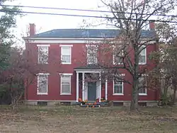 Thomas Miller House |
November 2, 2000 (#00001294) |
11294 U.S. Route 50 39°09′36″N 84°48′55″W |
Whitewater Township | |
| 47 | Miller-Leuser Log House | 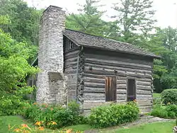 Miller-Leuser Log House |
August 30, 1974 (#74001511) |
Clough Pike and Newton Rd. in Turpin Hills 39°06′06″N 84°22′07″W |
Anderson Township | |
| 48 | Montgomery Saltbox Houses | 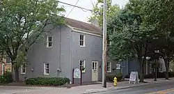 Montgomery Saltbox Houses |
July 28, 1987 (#87001254) |
7789 and 7795 Cooper Rd. 39°13′35″N 84°21′24″W |
Montgomery | |
| 49 | Charles H. Moore House | 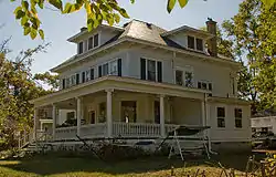 Charles H. Moore House |
August 25, 1986 (#86001636) |
749 Stout Ave. 39°13′55″N 84°28′11″W |
Wyoming | |
| 50 | Mt. Healthy Public School | 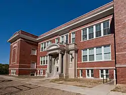 Mt. Healthy Public School |
May 2, 1985 (#85000946) |
Compton and Harrison Aves. 39°13′58″N 84°33′00″W |
Mt. Healthy | |
| 51 | Mt. Nebo Archeological District | 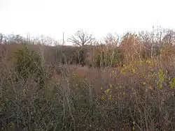 Mt. Nebo Archeological District |
March 3, 1975 (#75001435) |
Along the Great Miami River, west of North Bend[14] 39°08′42″N 84°47′31″W |
Miami Township | |
| 52 | Norwood Mound | 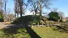 Norwood Mound |
May 2, 1974 (#74001520) |
Off Indian Mound Ave.[14] 39°10′04″N 84°26′45″W |
Norwood | |
| 53 | Norwood Municipal Building |  Norwood Municipal Building |
March 11, 1980 (#80003093) |
4645 Montgomery Rd. 39°09′42″N 84°27′22″W |
Norwood | |
| 54 | Nurre-Royston House | 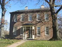 Nurre-Royston House |
January 8, 2009 (#08001295) |
4330 Errun Ln. 39°09′49″N 84°29′39″W |
St. Bernard | |
| 55 | Odd Fellows' Cemetery Mound | 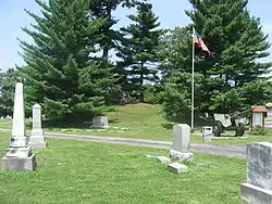 Odd Fellows' Cemetery Mound |
June 18, 1973 (#73001474) |
Along Round Bottom Rd.[15] 39°07′49″N 84°21′36″W |
Newtown | |
| 56 | Old Gothic Barns |  Old Gothic Barns |
July 20, 1976 (#76001438) |
6058 Colerain Ave. in White Oak East 39°12′13″N 84°34′49″W |
Green Township | |
| 57 | Professor William Pabodie House | 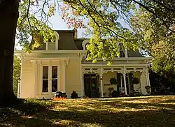 Professor William Pabodie House |
August 25, 1986 (#86001638) |
731 Brooks Ave. 39°13′52″N 84°28′35″W |
Wyoming | |
| 58 | Perin Village Site | 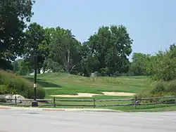 Perin Village Site |
March 25, 1977 (#77001067) |
0.3 miles (0.48 km) northwest of the Odd Fellows' Cemetery Mound[16] 39°07′49″N 84°21′36″W |
Newtown | |
| 59 | Pine Meer |  Pine Meer |
November 30, 1982 (#82001468) |
5336 Cleves-Warsaw Pike, west of Cincinnati 39°07′13″N 84°37′04″W |
Green Township | |
| 60 | John C. Pollock House |  John C. Pollock House |
August 25, 1986 (#86001639) |
88 Reily Rd. 39°13′43″N 84°28′35″W |
Wyoming | |
| 61 | Frederick and Harriet Rauh House | September 6, 2016 (#16000597) |
10068 Leacrest Rd. 39°14′58″N 84°29′18″W |
Woodlawn | ||
| 62 | Rennert Mound Archeological District |  Rennert Mound Archeological District |
March 4, 1975 (#75001422) |
Western side of Elizabethtown[14] 39°09′34″N 84°48′30″W |
Whitewater Township | |
| 63 | W.C. Retszch House |  W.C. Retszch House |
August 25, 1986 (#86001642) |
129 Springfield Pike 39°13′14″N 84°28′26″W |
Wyoming | |
| 64 | Riddle-Friend House | 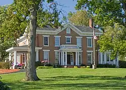 Riddle-Friend House |
August 25, 1986 (#86001643) |
507 Springfield Pike 39°13′37″N 84°28′23″W |
Wyoming | |
| 65 | Roudebush Farm | 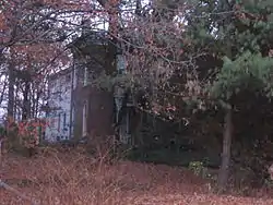 Roudebush Farm |
June 17, 1976 (#76001449) |
8643 Kilby Rd., southeast of Harrison 39°14′10″N 84°47′01″W |
Harrison Township | |
| 66 | St. Francis Seminary | 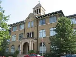 St. Francis Seminary |
March 5, 1999 (#99000275) |
10290 Mill Rd. 39°15′28″N 84°32′32″W |
Springfield Township | |
| 67 | Salem Methodist Church Complex | 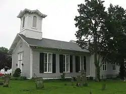 Salem Methodist Church Complex |
April 29, 1982 (#82003586) |
6137 Salem Rd. 39°04′31″N 84°23′29″W |
Anderson Township | |
| 68 | Louis Sawyer House | 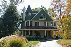 Louis Sawyer House |
August 25, 1986 (#86001645) |
315 Reily Rd. 39°13′41″N 84°28′40″W |
Wyoming | |
| 69 | Shawnee Lookout Archeological District | 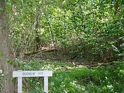 Shawnee Lookout Archeological District |
December 2, 1974 (#74001516) |
In Shawnee Lookout, southwest of Cleves[14] 39°07′30″N 84°47′56″W |
Miami Township | |
| 70 | Edwin M. Shield's House | 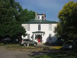 Edwin M. Shield's House |
April 1, 1982 (#82003592) |
220 Riverside Ave. 39°16′01″N 84°15′44″W |
Loveland | |
| 71 | Smith-Jessup House | 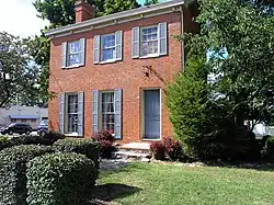 Smith-Jessup House |
August 23, 1984 (#84003717) |
1038 W. North Bend Rd. in Finneytown 39°12′07″N 84°31′47″W |
Springfield Township | |
| 72 | State Line Archeological District |  State Line Archeological District |
July 24, 1975 (#75001423) |
Straddling the Ohio/Indiana border, 2 miles (3.2 km) north of the Ohio River[17] 39°08′15″N 84°49′12″W |
Whitewater Township | Extends into Dearborn County, Indiana |
| 73 | Edward R. Stearns House |  Edward R. Stearns House |
August 25, 1986 (#86001648) |
333 Oliver Rd. 39°13′54″N 84°28′45″W |
Wyoming | |
| 74 | William Stearns House |  William Stearns House |
August 25, 1986 (#86001649) |
320 Reily Rd. 39°13′46″N 84°28′44″W |
Wyoming | |
| 75 | Sunny Knolls-Gordon E. Pape House |  Sunny Knolls-Gordon E. Pape House |
June 9, 2006 (#06000484) |
8725 Blome Rd. 39°12′55″N 84°20′42″W |
Indian Hill | |
| 76 | John Tangeman House |  John Tangeman House |
August 25, 1986 (#86001650) |
550 Larchmont 39°13′39″N 84°28′31″W |
Wyoming | |
| 77 | Gerald B. and Beverley Tonkens House |  Gerald B. and Beverley Tonkens House |
October 3, 1991 (#91001414) |
6980 Knoll Rd. 39°11′43″N 84°24′54″W |
Amberley | |
| 78 | Turpin Site |  Turpin Site |
December 27, 1974 (#74001514) |
On the old Turpin farmstead at 3295 Turpin Ln.[6][18] 39°07′23″N 84°22′19″W |
Anderson Township | |
| 79 | Twelve Mile House |  Twelve Mile House |
September 1, 1976 (#76001452) |
11006 Reading Rd. 39°16′07″N 84°24′46″W |
Sharonville | |
| 80 | Twin Oaks |  Twin Oaks |
May 29, 1975 (#86001640) |
629 Liddle Lane 39°13′46″N 84°28′53″W |
Wyoming | Also known as the Robert Reily House[4] |
| 81 | United Brethren in Christ |  United Brethren in Christ |
June 13, 1978 (#78002082) |
South of Cincinnati off Interstate 275 39°03′12″N 84°22′29″W |
Anderson Township | |
| 82 | United Methodist Church |  United Methodist Church |
December 4, 1975 (#75001432) |
5125 Drake Rd., northeast of Mariemont 39°09′37″N 84°20′49″W |
Indian Hill | |
| 83 | United States Playing Card Company Complex |  United States Playing Card Company Complex |
June 30, 2015 (#15000044) |
4590 Beech St. 39°09′32″N 84°26′33″W |
Norwood | |
| 84 | Universalist Church Historic District | 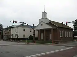 Universalist Church Historic District |
December 2, 1970 (#70000498) |
Montgomery Rd. from 9433 north to Remington Ave. 39°13′41″N 84°21′15″W |
Montgomery | |
| 85 | Village Historic District | 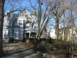 Village Historic District |
August 25, 1986 (#86001626) |
Roughly bounded by Wentworth Ave., the former B&O railroad tracks, E. Mills Ave., and Springfield Pike 39°13′27″N 84°28′11″W |
Wyoming | |
| 86 | Village of Addyston Historic District | 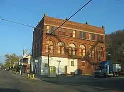 Village of Addyston Historic District |
September 13, 1991 (#91001388) |
Roughly along Main, Sekitan, Church, 1st, and 2nd Sts., and the Three Rivers Parkway 39°08′14″N 84°42′47″W |
Addyston | |
| 87 | Waldschmidt-Camp Dennison District | 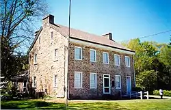 Waldschmidt-Camp Dennison District |
March 7, 1973 (#73001471) |
7509 and 7567 Glendale-Milford Rd. in Camp Dennison 39°11′28″N 84°17′26″W |
Symmes Township | |
| 88 | John Aston Warder House | 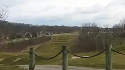 John Aston Warder House |
May 19, 1978 (#78002084) |
Between holes 10 and 11 of the Aston Oaks Golf Course, off Shady Lane east of central North Bend[19] 39°09′12″N 84°43′32″W |
North Bend | Warder's gardens, now a golf course, contribute to the historic designation.[4] |
| 89 | Washington Heights School | 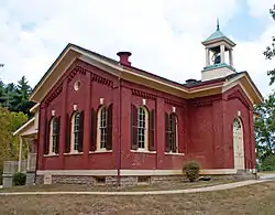 Washington Heights School |
July 30, 1975 (#75001430) |
8100 Given Rd. 39°12′11″N 84°19′26″W |
Indian Hill | |
| 90 | James Whallon House | 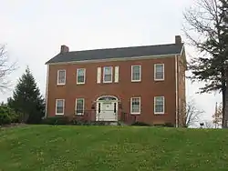 James Whallon House |
May 17, 1973 (#73001473) |
11000 Winton Rd. 39°16′17″N 84°31′20″W |
Greenhills | |
| 91 | Whitewater Shaker Settlement | 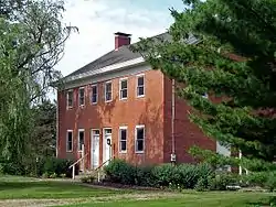 Whitewater Shaker Settlement |
January 21, 1974 (#74001518) |
11813, 11347, and 11081 Oxford Rd., north of New Haven 39°17′40″N 84°44′34″W |
Crosby Township | |
| 92 | Wilder-Swaim House | 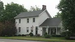 Wilder-Swaim House |
May 20, 1981 (#81000438) |
7650 Cooper Rd. 39°13′41″N 84°21′36″W |
Montgomery | |
| 93 | W. L. Williams House | 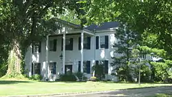 W. L. Williams House |
March 25, 1977 (#77001066) |
280 Anderson Ferry Rd. 39°05′18″N 84°37′06″W |
Delhi Township | |
| 94 | Charles Woodruff House | 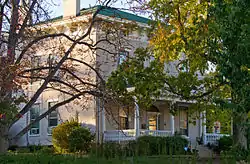 Charles Woodruff House |
August 25, 1986 (#86001651) |
411 Springfield Pike 39°13′32″N 84°28′27″W |
Wyoming | |
| 95 | Wyoming Presbyterian Church | 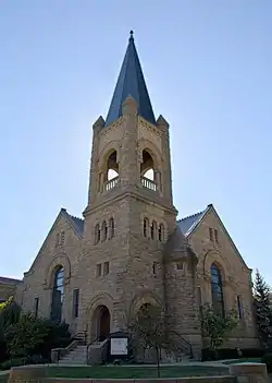 Wyoming Presbyterian Church |
March 3, 1980 (#80003094) |
Wyoming and Burns Aves. 39°13′36″N 84°28′06″W |
Wyoming | |
| 96 | Yost Tavern |  Yost Tavern |
May 6, 1993 (#93000406) |
7872 Cooper Rd. 39°13′36″N 84°21′15″W |
Montgomery |
See also
| Wikimedia Commons has media related to National Register of Historic Places in Hamilton County, Ohio. |
References
- The latitude and longitude information provided in this table was derived originally from the National Register Information System, which has been found to be fairly accurate for about 99% of listings. Some locations in this table may have been corrected to current GPS standards.
- "National Register of Historic Places: Weekly List Actions". National Park Service, United States Department of the Interior. Retrieved on January 29, 2021.
- Numbers represent an alphabetical ordering by significant words. Various colorings, defined here, differentiate National Historic Landmarks and historic districts from other NRHP buildings, structures, sites or objects.
- "National Register Information System". National Register of Historic Places. National Park Service. April 24, 2008.
- The eight-digit number below each date is the number assigned to each location in the National Register Information System database, which can be viewed by clicking the number.
- Location derived from Ford, Henry A., et al. History of Hamilton County Ohio. Cleveland: Williams, 1881, 266. The NRIS lists the site as "Address Restricted"
- Location derived from Starr, S.F. "The Archaeology of Hamilton County Ohio". Journal of the Cincinnati Museum of Natural History 23.1 (1960). The NRIS lists the site as "Address Restricted".
- Location derived from Annual Report of the Trustees of the Peabody Museum of American Archaeology and Ethnology, Vol. 3. Cambridge: Wilson and Son, 1887, 168. The NRIS lists the site as "Address Restricted".
- Location derived from Squier, E.G., and E.H. Davis. Ancient Monuments of the Mississippi Valley. Washington: Smithsonian, 1848, pages 35-36 and plate 13. The NRIS lists the site as "Address Restricted"
- Koleszar, Stephen C. An Archaeological Survey of Southwestern Ohio. Columbus: Ohio Historical Society, 1970, 70.
- Location derived from Otto, Martha P., and Brian G. Redmond. Transitions: Archaic and Early Woodland Research in the Ohio Country. Athens: Ohio UP, 2009, 9-11. The NRIS lists the site as "Address Restricted".
- Location derived from Blount, Jim. "Dunlap Station besieged by Indians Archived 2010-11-24 at the Wayback Machine", Hamilton JournalNews via Lane Public Library, 2001-02-14. Accessed 2009-10-30. The NRIS lists the site as "Address Restricted"
- Location derived from this Archived 2010-06-20 at the Wayback Machine Cincinnati Museum Center webpage, and location of Clear Creek Park derived from this Archived 2009-07-29 at the Wayback Machine Anderson Township parks webpage; the NRIS lists the site as "Address Restricted"
- Location derived from Mills, William C. Archeological Atlas of Ohio. Columbus: Ohio State Archeological and Historical Society, 1914, page 31 and plate 31. The NRIS lists the site as "Address Restricted".
- Location derived from Federal Writers Project. Cincinnati: a Guide to the Queen City and Its Neighbors. Cincinnati: Wiesen-Hart, 1943, 481. The NRIS lists the site as "Address Restricted"
- Location derived from Owen, Lorrie K., ed. Dictionary of Ohio Historic Places. Vol. 1. St. Clair Shores: Somerset, 1999, 646. The NRIS lists the site as "Address Restricted".
- Location derived from Gosman, James Howard. Patterns in Ontogeny of Human Trabecular Bone from Sunwatch Village in the Prehistoric Ohio Valley. Diss. Ohio State University, 2007. Accessed 2010-04-14. The NRIS lists the site as "Address Restricted".
- Farm address derived from About Us Archived 2010-08-25 at the Wayback Machine, Turpin Farms. Accessed 2010-04-12.
- More specific location derived from Hoffman, Carey. "Golf Course Spotlight: Aston Oak". Cincinnati Enquirer, 2011-06-21. Accessed 2011-08-09.

Municipalities and communities of Hamilton County, Ohio, United States | ||
|---|---|---|
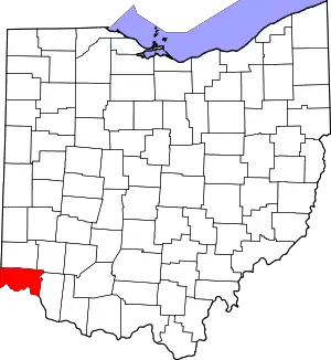
| Cities | Map of Ohio highlighting Hamilton County | |
| Villages | ||
| Townships | ||
| CDPs |
| |
| Other unincorporated communities | ||
| Footnotes | ‡This populated place also has portions in an adjacent county or counties | |
| ||