National Register of Historic Places listings in Sandusky County, Ohio
This is a list of the National Register of Historic Places listings in Sandusky County, Ohio.
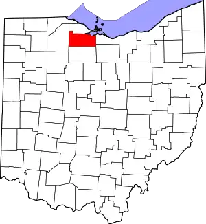
Location of Sandusky County in Ohio
This is intended to be a complete list of the properties and districts on the National Register of Historic Places in Sandusky County, Ohio, United States. The locations of National Register properties and districts for which the latitude and longitude coordinates are included below, may be seen in a Google map.[1]
There are 12 properties and districts listed on the National Register in the county, including 1 National Historic Landmark. Another property was once listed but has been removed.
- This National Park Service list is complete through NPS recent listings posted January 29, 2021.[2]
Current listings
| [3] | Name on the Register[4] | Image | Date listed[5] | Location | City or town | Description |
|---|---|---|---|---|---|---|
| 1 | Joseph and Rachel Bartlett House | 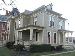 Joseph and Rachel Bartlett House |
March 21, 1990 (#90000388) |
212 S. Park Ave. 41°20′42″N 83°07′03″W |
Fremont | |
| 2 | Ralph P. Buckland House | 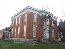 Ralph P. Buckland House |
December 17, 1974 (#74001620) |
300 S. Park Ave. 41°20′38″N 83°07′04″W |
Fremont | |
| 3 | Georg Cronenwett House | 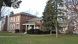 Georg Cronenwett House |
December 1, 1978 (#78002184) |
606 W. Main St. 41°27′11″N 83°22′07″W |
Woodville | |
| 4 | Frederick Fabing House | 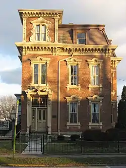 Frederick Fabing House |
May 26, 1983 (#83002054) |
201 S. Park Ave. 41°20′43″N 83°07′01″W |
Fremont | |
| 5 | Rutherford B. Hayes House | .jpg.webp) Rutherford B. Hayes House |
October 15, 1966 (#66000624) |
Hayes and Buckland Aves. 41°20′27″N 83°07′50″W |
Fremont | |
| 6 | Christopher C. Layman Law Office | 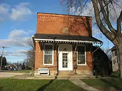 Christopher C. Layman Law Office |
May 15, 1986 (#86001062) |
212 W. 1st St. 41°27′08″N 83°21′52″W |
Woodville | |
| 7 | Maj. Gen. James B. McPherson House |  Maj. Gen. James B. McPherson House |
October 18, 1974 (#74001619) |
300 E. McPherson Highway 41°18′31″N 82°58′17″W |
Clyde | |
| 8 | Mull Covered Bridge | 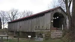 Mull Covered Bridge |
October 15, 1974 (#74001618) |
East of Burgoon between State Routes 12 and 53 41°15′39″N 83°11′04″W |
Ballville Township | |
| 9 | Overmyer-Waggoner-Roush Farm |  Overmyer-Waggoner-Roush Farm |
September 8, 1983 (#83002055) |
654 S. Main St. 41°24′39″N 83°13′18″W |
Lindsey | |
| 10 | St. Paul's Episcopal Church | 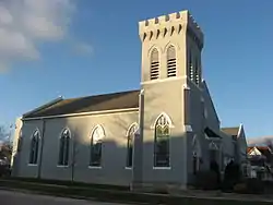 St. Paul's Episcopal Church |
June 9, 1977 (#77001085) |
200 N. Park Ave. 41°20′51″N 83°07′03″W |
Fremont | |
| 11 | Sandusky County Jail and Sheriff's House | 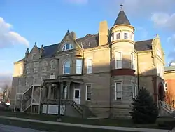 Sandusky County Jail and Sheriff's House |
February 27, 1997 (#97000198) |
622 Croghan St. 41°20′49″N 83°07′06″W |
Fremont | |
| 12 | Soldiers Memorial Parkway and McKinley Memorial Parkway | 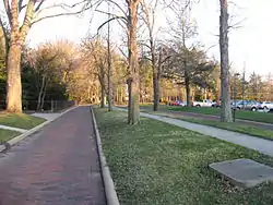 Soldiers Memorial Parkway and McKinley Memorial Parkway |
January 25, 1991 (#90002212) |
Soldiers Memorial Parkway and McKinley Memorial Parkway 41°20′24″N 83°07′59″W |
Fremont |
Former listing
| [3] | Name on the Register | Image | Date listed | Date removed | Location | City or town | Summary |
|---|---|---|---|---|---|---|---|
| 1 | Fremont City Hall | August 30, 1978 (#78002183) | February 20, 1980 | 401 Croghan St. |
Fremont |
See also
| Wikimedia Commons has media related to National Register of Historic Places in Sandusky County, Ohio. |
References
- The latitude and longitude information provided in this table was derived originally from the National Register Information System, which has been found to be fairly accurate for about 99% of listings. Some locations in this table may have been corrected to current GPS standards.
- "National Register of Historic Places: Weekly List Actions". National Park Service, United States Department of the Interior. Retrieved on January 29, 2021.
- Numbers represent an alphabetical ordering by significant words. Various colorings, defined here, differentiate National Historic Landmarks and historic districts from other NRHP buildings, structures, sites or objects.
- "National Register Information System". National Register of Historic Places. National Park Service. April 24, 2008.
- The eight-digit number below each date is the number assigned to each location in the National Register Information System database, which can be viewed by clicking the number.

Municipalities and communities of Sandusky County, Ohio, United States | ||
|---|---|---|
| Cities | Map of Ohio highlighting Sandusky County | |
| Villages | ||
| Townships | ||
| CDPs | ||
| Unincorporated communities | ||
| Footnotes | ‡This populated place also has portions in an adjacent county or counties | |
| ||
This article is issued from Wikipedia. The text is licensed under Creative Commons - Attribution - Sharealike. Additional terms may apply for the media files.