National Register of Historic Places listings in Champaign County, Ohio
This is a list of the National Register of Historic Places listings in Champaign County, Ohio.
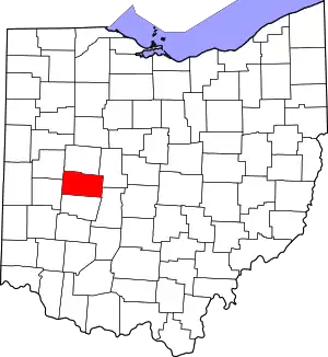
Location of Champaign County in Ohio
This is intended to be a complete list of the properties and districts on the National Register of Historic Places in Champaign County, Ohio, United States. The locations of National Register properties and districts for which the latitude and longitude coordinates are included below, may be seen in an online map.[1]
There are 34 properties and districts listed on the National Register in the county. Another property was once listed but has been removed.
- This National Park Service list is complete through NPS recent listings posted January 29, 2021.[2]
Current listings
| [3] | Name on the Register[4] | Image | Date listed[5] | Location | City or town | Description |
|---|---|---|---|---|---|---|
| 1 | Maj. John C. Baker House |  Maj. John C. Baker House |
August 29, 1985 (#85001875) |
202 W. Main St. 40°04′31″N 83°33′35″W |
Mechanicsburg | |
| 2 | Barr House |  Barr House |
August 29, 1985 (#85001876) |
Locust and Sandusky Sts. 40°04′24″N 83°33′17″W |
Mechanicsburg | |
| 3 | Henry Burnham House |  Henry Burnham House |
August 29, 1985 (#85001877) |
N. Main St. and State Route 559 40°04′30″N 83°33′32″W |
Mechanicsburg | |
| 4 | Church Of Our Savior |  Church Of Our Savior |
August 29, 1985 (#85001878) |
56 S. Main St.[6] 40°04′15″N 83°33′16″W |
Mechanicsburg | 1890s Gothic Revival church; built in the parish's earliest years |
| 5 | Dr. Clark House | 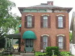 Dr. Clark House |
August 29, 1985 (#85001879) |
21 N. Main St. 40°04′21″N 83°33′24″W |
Mechanicsburg | 1875 Italianate home of a prominent local physician |
| 6 | William Culbertson House | 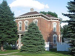 William Culbertson House |
August 29, 1985 (#85001880) |
103 Race St. 40°04′27″N 83°33′21″W |
Mechanicsburg | Italianate home of a local industrialist |
| 7 | Demand-Gest House |  Demand-Gest House |
August 29, 1985 (#85001881) |
37 N. Main St. 40°04′23″N 83°33′26″W |
Mechanicsburg | Colonial Revival home of local businessmen |
| 8 | Hamer's General Store | 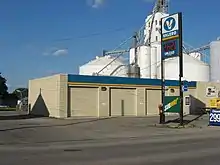 Hamer's General Store |
August 29, 1985 (#85001882) |
88 S. Main St. 40°04′12″N 83°33′13″W |
Mechanicsburg | A traditional-style general store; no longer standing |
| 9 | Norvall Hunter Farm | 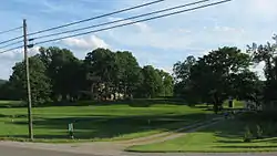 Norvall Hunter Farm |
August 29, 1985 (#85001883) |
129 S. Main St. 40°04′03″N 83°33′12″W |
Mechanicsburg | |
| 10 | Kimball House | 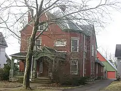 Kimball House |
August 29, 1985 (#85001884) |
115 N. Main St. 40°04′25″N 83°33′29″W |
Mechanicsburg | Town home of a prosperous farmer |
| 11 | Kiser Mansion |  Kiser Mansion |
February 4, 2011 (#10001211) |
149 E. Main St. 40°07′40″N 83°57′27″W |
St. Paris | |
| 12 | Lawler's Tavern | 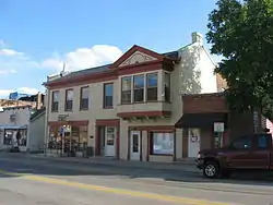 Lawler's Tavern |
August 29, 1985 (#85001885) |
N. Main St. 40°04′20″N 83°33′24″W |
Mechanicsburg | 1830 inn; one of the oldest buildings in the village |
| 13 | Magruder Building | 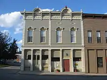 Magruder Building |
August 29, 1985 (#85001886) |
16 S. Main St. 40°04′19″N 83°33′19″W |
Mechanicsburg | |
| 14 | Masonic Temple | 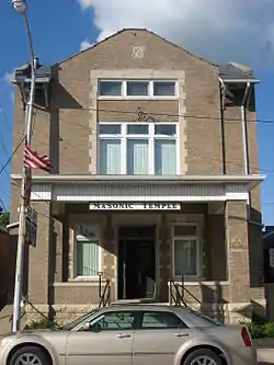 Masonic Temple |
August 29, 1985 (#85001887) |
N. Main St. 40°04′21″N 83°33′21″W |
Mechanicsburg | |
| 15 | Mechanicsburg Baptist Church | 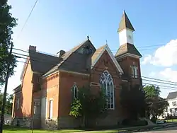 Mechanicsburg Baptist Church |
August 29, 1985 (#85001888) |
Walnut and Sandusky Sts. 40°04′16″N 83°33′27″W |
Mechanicsburg | Large Gothic Revival church built for a Methodist Protestant congregation |
| 16 | Mechanicsburg Commercial Historic District |  Mechanicsburg Commercial Historic District |
August 29, 1985 (#85001895) |
1-11 S. Main St. 40°04′18″N 83°33′21″W |
Mechanicsburg | |
| 17 | Monitor House | 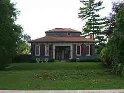 Monitor House |
May 2, 1974 (#74001408) |
375 W. Main St. 40°07′46″N 83°58′02″W |
St. Paris | A rare example of a house with a monitor |
| 18 | Dr. Adam Mosgrove House | 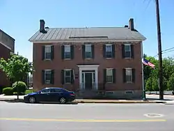 Dr. Adam Mosgrove House |
July 15, 1982 (#82003550) |
127 Miami St. 40°06′29″N 83°45′14″W |
Urbana | Home of one of Urbana's earliest doctors |
| 19 | Mt. Tabor Church Building, Cemetery and Hitching Lot | 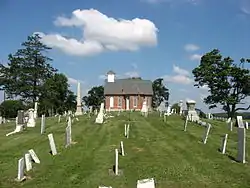 Mt. Tabor Church Building, Cemetery and Hitching Lot |
November 22, 1995 (#95001329) |
State Route 245, 300 meters south of its junction with Mt. Tabor Rd. 40°13′44″N 83°41′38″W |
Salem Township | An abandoned Methodist church and cemetery with graves of Revolutionary War veterans |
| 20 | Dr. Nincehelser House | 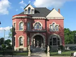 Dr. Nincehelser House |
August 29, 1985 (#85001889) |
28 N. Main St. 40°04′23″N 83°33′24″W |
Mechanicsburg | Home of a wealthy physician |
| 21 | North Ward District School |  North Ward District School |
February 21, 2019 (#100003495) |
626 N. Russell 40°06′55″N 83°45′24″W |
Urbana | |
| 22 | Nutwood Place | 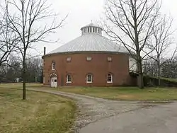 Nutwood Place |
December 12, 1976 (#76002265) |
1428 Nutwood Place 40°07′36″N 83°45′11″W |
Urbana | A farmstead with a brick round barn |
| 23 | Carl Potter Mound | 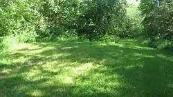 Carl Potter Mound |
August 13, 1974 (#74001407) |
Eastern side of State Route 56, southwest of Mechanicsburg[7] 40°02′21″N 83°36′05″W |
Union Township | A heavily eroded Adena mound |
| 24 | Richards-Sewall House |  Richards-Sewall House |
August 14, 1995 (#95000937) |
222 College St. 40°06′14″N 83°45′20″W |
Urbana | Formerly home to the Urbana University president |
| 25 | St. Michael Catholic Church | 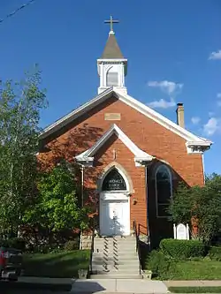 St. Michael Catholic Church |
August 29, 1985 (#85001892) |
40 Walnut St. 40°04′20″N 83°33′30″W |
Mechanicsburg | Small Gothic Revival church in a residential neighborhood |
| 26 | St. Paul AME Church | 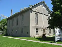 St. Paul AME Church |
September 5, 1997 (#97000954) |
316 E. Market St. 40°06′25″N 83°44′56″W |
Urbana | 1870s church building; home to a church founded in the 1820s |
| 27 | Scioto Street Historic District |  Scioto Street Historic District |
February 9, 1984 (#84002908) |
Scioto St. from Locust to E. Lawn Ave. 40°06′28″N 83°44′45″W |
Urbana | |
| 28 | Second Baptist Church | 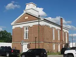 Second Baptist Church |
August 29, 1985 (#85001891) |
Sandusky St. 40°04′21″N 83°33′17″W |
Mechanicsburg | Mechanicsburg's oldest extant church building, a Greek Revival structure |
| 29 | South Ward District School |  South Ward District School |
February 21, 2019 (#100003496) |
725 S. Main St. 40°05′59″N 83°45′11″W |
Urbana | |
| 30 | United Methodist Church | 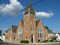 United Methodist Church |
August 29, 1985 (#85001893) |
N. Main and Race Sts. 40°04′24″N 83°33′26″W |
Mechanicsburg | Gothic Revival church with a central dome |
| 31 | Urbana College Historic Buildings | 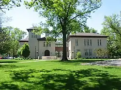 Urbana College Historic Buildings |
October 3, 1980 (#80002952) |
College Way 40°06′08″N 83°45′43″W |
Urbana | The oldest buildings on the Urbana University campus |
| 32 | Urbana Country Club |  Urbana Country Club |
June 8, 2018 (#100002550) |
4761 E. U.S. Route 36 40°06′24″N 83°39′36″W |
Union Township | |
| 33 | Urbana Monument Square Historic District | 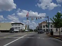 Urbana Monument Square Historic District |
March 1, 1984 (#84002909) |
Roughly bounded by Market, Walnut, Church, and Locust Sts. 40°06′29″N 83°45′09″W |
Urbana | Urbana's commercial district, centered around a roundabout with a war memorial |
| 34 | Village Hobby Shop | 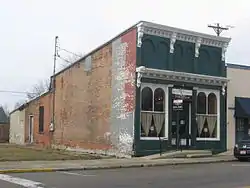 Village Hobby Shop |
August 29, 1985 (#85001894) |
N. Main St. 40°04′20″N 83°33′23″W |
Mechanicsburg | Small Italianate commercial building |
| 35 | John Q.A. Ward House |  John Q.A. Ward House |
July 30, 1974 (#74001409) |
335 College St. 40°06′12″N 83°45′27″W |
Urbana | 1820 home of a local sculptor |
Former listing
| [3] | Name on the Register | Image | Date listed | Date removed | Location | City or town | Summary |
|---|---|---|---|---|---|---|---|
| 1 | Levi Rathburn House |  Levi Rathburn House |
August 29, 1985 (#85001890) | December 24, 1990 | Locust and Sandusky Streets 40°04′23″N 83°33′18″W |
Mechanicsburg |
See also
| Wikimedia Commons has media related to National Register of Historic Places in Champaign County, Ohio. |
References
- The latitude and longitude information provided in this table was derived originally from the National Register Information System, which has been found to be fairly accurate for about 99% of listings. Some locations in this table may have been corrected to current GPS standards.
- "National Register of Historic Places: Weekly List Actions". National Park Service, United States Department of the Interior. Retrieved on January 29, 2021.
- Numbers represent an alphabetical ordering by significant words. Various colorings, defined here, differentiate National Historic Landmarks and historic districts from other NRHP buildings, structures, sites or objects.
- "National Register Information System". National Register of Historic Places. National Park Service. April 24, 2008.
- The eight-digit number below each date is the number assigned to each location in the National Register Information System database, which can be viewed by clicking the number.
- Home page, Church of Our Saviour. Accessed 2009-06-11.
- Drennen, Bert C., III. National Register of Historic Places Inventory/Nomination: Carl Potter Mound. National Park Service, 1974-01-22, 2.

Municipalities and communities of Champaign County, Ohio, United States | ||
|---|---|---|
| City | Map of Ohio highlighting Champaign County | |
| Villages | ||
| Townships | ||
| CDP | ||
| Unincorporated communities | ||
| ||
This article is issued from Wikipedia. The text is licensed under Creative Commons - Attribution - Sharealike. Additional terms may apply for the media files.