National Register of Historic Places listings in Summit County, Ohio
This is a list of the National Register of Historic Places listings in Summit County, Ohio.
This is intended to be a complete list of the properties and districts on the National Register of Historic Places in Summit County, Ohio, United States. Latitude and longitude coordinates are provided for many National Register properties and districts; these locations may be seen together in an online map.[1]
There are 177 properties and districts listed on the National Register in the county, including 3 National Historic Landmarks. The city of Akron is the location of 58 of these properties and districts, including 2 of the National Historic Landmarks; they are listed separately, while the 120 properties and districts and the National Historic Landmarks in the remaining parts of the county are listed here. One district, the Valley Railway Historic District, is split between Akron and other parts of the county, and is thus included on both lists. Another 2 properties were once listed but have been removed.
- This National Park Service list is complete through NPS recent listings posted January 29, 2021.[2]
Current listings
Akron
Outside Akron
| [3] | Name on the Register[4] | Image | Date listed[5] | Location | City or town | Description |
|---|---|---|---|---|---|---|
| 1 | Francis D. Alling House |  Francis D. Alling House |
November 30, 1987 (#87002093) |
323 East Ave. 41°06′06″N 81°25′43″W |
Tallmadge | |
| 2 | Anna-Dean Farm |  Anna-Dean Farm |
July 14, 1977 (#77001086) |
State Route 619 41°00′24″N 81°37′38″W |
Barberton | |
| 3 | O. C. Barber Barn No. 1 | .jpg.webp) O. C. Barber Barn No. 1 |
February 28, 1973 (#73001538) |
115 3rd St. 41°00′26″N 81°35′37″W |
Barberton | |
| 4 | O. C. Barber Colt Barn |  O. C. Barber Colt Barn |
October 9, 1974 (#74001626) |
Austin Dr. 41°00′18″N 81°34′44″W |
Barberton | |
| 5 | O. C. Barber Creamery |  O. C. Barber Creamery |
May 22, 1973 (#73001539) |
365 Portsmouth Ave. 41°00′25″N 81°35′33″W |
Barberton | |
| 6 | O. C. Barber Machine Barn | October 9, 1974 (#74001627) |
Austin Dr. 41°00′22″N 81°34′42″W |
Barberton | ||
| 7 | O. C. Barber Piggery |  O. C. Barber Piggery |
May 22, 1973 (#73001540) |
248 Robinson Ave. 41°00′35″N 81°35′49″W |
Barberton | |
| 8 | Barker Village Site |  Barker Village Site |
April 19, 1978 (#78000379) |
Just north of the old railroad station at Botzum[6] 41°09′56″N 81°34′39″W |
Cuyahoga Falls | Discovered when the Ohio and Erie Canal was constructed through the site[7] |
| 9 | William Barker Residence |  William Barker Residence |
June 11, 1979 (#79002797) |
805 Wye Rd. in Ghent 41°09′27″N 81°38′12″W |
Bath Township | |
| 10 | Bath Township Hall |  Bath Township Hall |
June 11, 1979 (#79002805) |
1241 N. Cleveland-Massilon Rd. 41°11′21″N 81°38′10″W |
Bath Township | |
| 11 | Bath Township School |  Bath Township School |
June 11, 1979 (#79002801) |
4655 Akron-Medina Rd., southeast of Ghent 41°08′13″N 81°40′09″W |
Bath Township | |
| 12 | Francis Becker House |  Francis Becker House |
June 24, 2002 (#02000672) |
3010 Hickory St. 40°55′33″N 81°38′28″W |
Clinton | |
| 13 | Boston Mills Historic District |  Boston Mills Historic District |
November 9, 1992 (#92001490) |
Roughly Riverview, Boston Mills, and Stanford Rds. and Main St. 41°15′52″N 81°33′34″W |
Boston Township | |
| 14 | Botzum Farm | 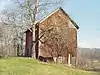 Botzum Farm |
October 21, 1999 (#99001271) |
3486 Riverview Rd. 41°10′26″N 81°34′53″W |
Cuyahoga Falls | |
| 15 | Brecksville-Northfield High Level Bridge |  Brecksville-Northfield High Level Bridge |
January 17, 1986 (#86000078) |
State Route 82 and the Cuyahoga River 41°19′16″N 81°35′11″W |
Sagamore Hills Township | Extends into Brecksville in Cuyahoga County |
| 16 | Brookdale Farm | 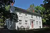 Brookdale Farm |
December 7, 2010 (#10000975) |
1148 N. Cleveland-Massillon Rd., north of Akron 41°10′00″N 81°38′14″W |
Bath Township | |
| 17 | Jim Brown House |  Jim Brown House |
March 2, 1979 (#79000299) |
South of Peninsula at 3491 Akron Peninsula Rd. 41°10′54″N 81°34′42″W |
Cuyahoga Falls | |
| 18 | Jim Brown Tavern |  Jim Brown Tavern |
December 11, 1979 (#79000300) |
Boston Mills Rd. 41°15′48″N 81°33′31″W |
Boston Township | |
| 19 | John Brown Farmhouse |  John Brown Farmhouse |
September 22, 1977 (#77001088) |
1842 Hines Hill Rd. 41°15′48″N 81°26′54″W |
Hudson | |
| 20 | H. Karl Butler Memorial |  H. Karl Butler Memorial |
January 2, 1997 (#96001510) |
Truxell Rd., southeast of its junction with Peninsula Rd., Camp Manatoc 41°13′19″N 81°31′49″W |
Boston Township | |
| 21 | Camp Manatoc Concord Lodge and Adirondacks Historic District |  Camp Manatoc Concord Lodge and Adirondacks Historic District |
January 2, 1997 (#96001513) |
Truxell Rd., southeast of its junction with Peninsula Rd., Camp Manatoc 41°13′07″N 81°31′46″W |
Boston Township | |
| 22 | Camp Manatoc Dining Hall | 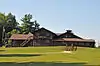 Camp Manatoc Dining Hall |
January 2, 1997 (#96001511) |
Truxell Rd., southeast of its junction with Peninsula Rd., Camp Manatoc 41°13′15″N 81°31′44″W |
Boston Township | |
| 23 | Camp Manatoc Foresters Lodge and Kit Carson-Dan Boone Cabins Historic District | 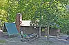 Camp Manatoc Foresters Lodge and Kit Carson-Dan Boone Cabins Historic District |
January 2, 1997 (#96001514) |
Truxell Rd., southeast of its junction with Peninsula Rd., Camp Manatoc 41°13′39″N 81°31′58″W |
Boston Township | |
| 24 | Camp Manatoc Legion Lodge |  Camp Manatoc Legion Lodge |
January 2, 1997 (#96001512) |
Truxell Rd., southeast of its junction with Peninsula Rd., Camp Manatoc 41°13′07″N 81°31′46″W |
Boston Township | |
| 25 | Case-Barlow Farm | August 15, 2019 (#100003498) |
1931 Barlow Rd. 41°12′59″N 81°25′30″W |
Hudson | ||
| 26 | Chuckery Race | 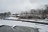 Chuckery Race |
December 15, 1972 (#72001047) |
South of and in Cuyahoga Falls 41°07′06″N 81°29′30″W |
Cuyahoga Falls | |
| 27 | Clinton Ohio and Erie Canal Historic District-Clinton Lock 2 and 3-Clinton Upper (Lock 2) and Clinton Lower (Lock 3) |  Clinton Ohio and Erie Canal Historic District-Clinton Lock 2 and 3-Clinton Upper (Lock 2) and Clinton Lower (Lock 3) |
March 16, 2003 (#03000111) |
Approximately along the canal channel parallel to Water St. 40°55′44″N 81°37′47″W |
Clinton | |
| 28 | Albert Cofta Farmstead | 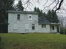 Albert Cofta Farmstead |
November 4, 2004 (#04001214) |
2966 Brush Rd., northeast of Richfield 41°15′13″N 81°36′56″W |
Richfield Township | |
| 29 | Copley Depot |  Copley Depot |
May 31, 2001 (#01000563) |
3772 Copley Rd. 41°05′57″N 81°39′13″W |
Copley Township | |
| 30 | Copley Township Cemetery Receiving Vault |  Copley Township Cemetery Receiving Vault |
July 13, 2017 (#100001333) |
3772 Copley Rd. 41°05′57″N 81°39′07″W |
Copley Township | |
| 31 | John William Creswell Corbusier House |  John William Creswell Corbusier House |
October 5, 1989 (#89001451) |
226 College St. 41°14′57″N 81°26′18″W |
Hudson | |
| 32 | Edward Cranz Farm |  Edward Cranz Farm |
March 12, 1993 (#93000077) |
2780 Oak Hill Dr., south of Peninsula 41°11′50″N 81°35′31″W |
Bath Township | |
| 33 | William and Eugene Cranz Farm |  William and Eugene Cranz Farm |
March 12, 1993 (#93000078) |
2401 Ira Rd., south of Peninsula 41°11′15″N 81°35′31″W |
Bath Township | |
| 34 | Cuyahoga Falls Downtown Historic District | September 6, 2018 (#100002881) |
111-245 Portage Trail, 138 Stowe Ave., 2035 Oldetown Loop, and 2091-2250 Front, 2044-2220 2nd, and 2055-2253 3rd Sts. 41°08′11″N 81°29′03″W |
Cuyahoga Falls | ||
| 35 | Diamond Match Historic District |  Diamond Match Historic District |
February 29, 1996 (#96000218) |
3, 21, and 27 4th St., NW., and 8 2nd St., NW. 41°00′39″N 81°36′31″W |
Barberton | |
| 36 | Michael Duffy Farm |  Michael Duffy Farm |
March 12, 1993 (#93000079) |
4965 Quick Rd., southeast of Peninsula 41°12′15″N 81°30′58″W |
Boston Township | |
| 37 | East Liberty School, District No. 11 | 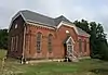 East Liberty School, District No. 11 |
July 3, 2017 (#100001271) |
3492 S. Arlington St. 40°58′33″N 81°29′36″W |
Green | |
| 38 | Everett Historic District |  Everett Historic District |
January 14, 1993 (#93001467) |
4731-4642 Riverview Rd. and 2151-2279 Everett Rd., south of Peninsula, in the Cuyahoga Valley National Park 41°12′16″N 81°34′29″W |
Boston Township | |
| 39 | Everett Knoll Complex |  Everett Knoll Complex |
May 25, 1977 (#77000157) |
Southern side of Everett Rd., west of its junction with Riverview Rd.[8] 41°12′16″N 81°34′33″W |
Boston Township | |
| 40 | Falls Stamping and Welding Building |  Falls Stamping and Welding Building |
February 23, 2016 (#16000045) |
1701 S. Front St. 41°07′41″N 81°29′06″W |
Cuyahoga Falls | |
| 41 | First Congregational Church of Cuyahoga Falls |  First Congregational Church of Cuyahoga Falls |
November 3, 1975 (#75001538) |
130 Broad Boulevard 41°08′01″N 81°29′03″W |
Cuyahoga Falls | |
| 42 | Fort Island Works | 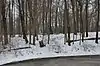 Fort Island Works |
December 2, 1970 (#70000087) |
In Fort Island Park, at 413 Tunko Rd.[9] 41°07′10″N 81°37′02″W |
Fairlawn | |
| 43 | Furnace Run Aqueduct |  Furnace Run Aqueduct |
December 11, 1979 (#79000301) |
Furnace Run 41°12′06″N 81°34′20″W |
Cuyahoga Falls | |
| 44 | Ghent Historic District |  Ghent Historic District |
December 7, 2010 (#10000974) |
Western side of Wye Rd. between Granger and Yellow Creek Rd. in Ghent 41°09′26″N 81°38′13″W |
Bath Township | |
| 45 | Elijah Hale Residence |  Elijah Hale Residence |
June 11, 1979 (#79002795) |
3243 Ira Rd. 41°11′22″N 81°37′15″W |
Bath Township | |
| 46 | Jonathan Hale Homestead |  Jonathan Hale Homestead |
April 23, 1973 (#73000258) |
2686 Oak Hill Rd. 41°11′35″N 81°35′33″W |
Bath Township | |
| 47 | John Harshey Residence |  John Harshey Residence |
June 11, 1979 (#79002804) |
4270 Bath Rd. 41°10′07″N 81°39′07″W |
Bath Township | |
| 48 | Levi J. Hartong House and Farm |  Levi J. Hartong House and Farm |
October 17, 2007 (#07001089) |
6521 Mt. Pleasant Rd. 40°54′29″N 81°28′10″W |
Green | |
| 49 | Edward Heller Residence |  Edward Heller Residence |
June 11, 1979 (#79002798) |
3891 Granger Rd., west of Ghent 41°09′40″N 81°39′02″W |
Bath Township | |
| 50 | J. Hershey Residence |  J. Hershey Residence |
June 11, 1979 (#79002802) |
286 Cleveland-Massilon Rd., south of Ghent 41°08′37″N 81°38′15″W |
Bath Township | |
| 51 | Roswell Hopkins Residence |  Roswell Hopkins Residence |
June 11, 1979 (#79002799) |
299 Hametown Rd., southeast of Ghent 41°08′38″N 81°40′13″W |
Bath Township | |
| 52 | Hudson Historic District |  Hudson Historic District |
November 28, 1973 (#73001542) |
Roughly bounded by College, Streetsboro, S. Main, and Baldwin Sts.; also roughly bounded by Hudson St., Old Orchard Dr., Aurora St., Oviatt St., Streetsboro St., and College St. to Aurora 41°14′37″N 81°26′31″W |
Hudson | Second set of boundaries represents a boundary increase of October 5, 1989 |
| 53 | Humberger House |  Humberger House |
October 11, 2002 (#02001122) |
7616 N. 2nd Ave. 40°55′30″N 81°38′27″W |
Clinton | |
| 54 | Hunt-Wilke Farm |  Hunt-Wilke Farm |
March 12, 1993 (#93000080) |
2049 Bolanz Rd. 41°12′03″N 81°34′19″W |
Cuyahoga Falls | |
| 55 | Grace Goulder Izant House |  Grace Goulder Izant House |
October 4, 1989 (#89001450) |
250 College St. 41°15′02″N 81°26′17″W |
Hudson | |
| 56 | Jaite Mill Historic District |  Jaite Mill Historic District |
May 21, 1979 (#79000288) |
Southeast of Brecksville at Riverview and Vaughan Rds. 41°17′03″N 81°33′47″W |
Sagamore Hills Township | Extends into Brecksville in Cuyahoga County |
| 57 | Dustin Johnson Residence |  Dustin Johnson Residence |
June 11, 1979 (#79002806) |
1946 Cleveland-Massilon Rd. 41°11′18″N 81°38′12″W |
Bath Township | |
| 58 | Jyurovat Farmstead |  Jyurovat Farmstead |
May 25, 1995 (#95000588) |
696 Streetsboro Rd., southeast of Peninsula 41°13′54″N 81°31′05″W |
Boston Heights | |
| 59 | Virginia Kendall State Park Historic District |  Virginia Kendall State Park Historic District |
January 2, 1997 (#96001515) |
701, 801, and 1000 Truxell Rd. and 434 W. Streetsboro, southeast of Peninsula 41°13′04″N 81°31′15″W |
Boston Township | |
| 60 | J. Kent Residence |  J. Kent Residence |
June 11, 1979 (#79002792) |
1727 Medina Line Rd. 41°11′00″N 81°41′07″W |
Bath Township | |
| 61 | James Kirby Mill |  James Kirby Mill |
December 14, 1978 (#78002197) |
West of West Richfield off State Route 303 41°14′26″N 81°40′44″W |
Richfield Township | |
| 62 | David Kittinger Residence | June 11, 1979 (#79002808) |
1904 Cleveland-Massilon Rd. 41°11′14″N 81°38′12″W |
Bath Township | ||
| 63 | Jeremiah Lambert House and Barn |  Jeremiah Lambert House and Barn |
December 7, 2010 (#10000977) |
2138 Cleveland-Massillon Rd. in Ghent 41°11′37″N 81°38′12″W |
Bath Township | |
| 64 | J. Ligget Residence |  J. Ligget Residence |
June 11, 1979 (#79002803) |
481 Cleveland-Massilon Rd., south of Ghent 41°08′55″N 81°38′12″W |
Bath Township | |
| 65 | Limbach Block Historic District |  Limbach Block Historic District |
November 29, 2001 (#01001280) |
7843, 7845, 7847, 7849, 7851, and 7853 Main St. 40°55′38″N 81°37′48″W |
Clinton | |
| 66 | Lock No. 26 | 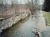 Lock No. 26 |
December 11, 1979 (#79000302) |
3.3 mi (5.3 km) north of Ira Rd. 41°11′08″N 81°34′53″W |
Cuyahoga Falls | |
| 67 | Lock No. 27 |  Lock No. 27 |
December 11, 1979 (#79000303) |
Approximately 400 ft (120 m) east of the intersection of Riverview and Everett Rds. at Everett 41°12′11″N 81°34′15″W |
Boston Township | |
| 68 | Lock No. 28 | 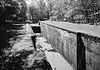 Lock No. 28 |
December 11, 1979 (#79000304) |
Deep Lock Q Quarry Metro Park 41°13′58″N 81°33′09″W |
Peninsula | Originally listed as "Ohio and Erie Canal Deep Lock" in 1974; relisted under the present name in 1979[4] |
| 69 | Lock No. 29 and Aqueduct |  Lock No. 29 and Aqueduct |
December 11, 1979 (#79000305) |
Off State Route 303 41°14′34″N 81°33′02″W |
Peninsula | |
| 70 | Lock No. 30 and Feeder Dam |  Lock No. 30 and Feeder Dam |
December 11, 1979 (#79000306) |
Off State Route 303 41°14′41″N 81°33′14″W |
Peninsula | |
| 71 | Lock No. 31 |  Lock No. 31 |
December 11, 1979 (#79000307) |
200 ft (61 m) east of the Cuyahoga River and approximately 0.5 mi (0.80 km) south of the Ohio Turnpike 41°15′06″N 81°32′46″W |
Peninsula | |
| 72 | Lock No. 32 |  Lock No. 32 |
December 11, 1979 (#79000308) |
800 ft (240 m) north of Boston Mills 41°15′58″N 81°33′32″W |
Boston Township | |
| 73 | Lock No. 33 |  Lock No. 33 |
December 11, 1979 (#79000309) |
1 mi (1.6 km) south of Highland Rd. 41°16′36″N 81°33′40″W |
Boston Township | |
| 74 | Lock No. 34 |  Lock No. 34 |
December 17, 1979 (#79000310) |
Highland Rd. 41°17′21″N 81°33′53″W |
Sagamore Hills Township | |
| 75 | Lock No. 35 |  Lock No. 35 |
December 11, 1979 (#79000311) |
Off State Route 82 41°18′38″N 81°34′56″W |
Sagamore Hills Township | |
| 76 | Longwood Manor | 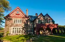 Longwood Manor |
September 3, 2014 (#14000548) |
1634 E. Aurora Rd. 41°18′26″N 81°28′53″W |
Macedonia | |
| 77 | Lutz-Martin Farm |  Lutz-Martin Farm |
July 3, 2003 (#03000608) |
2470 Martin Rd. 41°10′32″N 81°35′33″W |
Bath Township | |
| 78 | Frank H. Mason House | April 20, 1995 (#95000499) |
615 Latham Ln. 40°57′49″N 81°32′44″W |
New Franklin | ||
| 79 | Robert McKisson House |  Robert McKisson House |
December 4, 1974 (#74001632) |
7878 N. Gannett Rd. 41°19′23″N 81°33′51″W |
Sagamore Hills Township | |
| 80 | Harvey Miller Residence |  Harvey Miller Residence |
June 11, 1979 (#79002800) |
188 Hametown Rd., southeast of Ghent 41°08′27″N 81°40′15″W |
Bath Township | |
| 81 | Northfield Town Hall | 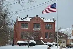 Northfield Town Hall |
August 10, 2000 (#00000962) |
9546 Brandywine Rd. at Northfield Center 41°18′54″N 81°32′23″W |
Northfield Center Township | |
| 82 | Oakwood Cemetery Chapel |  Oakwood Cemetery Chapel |
November 12, 1999 (#99001334) |
2420 Oakwood Dr. 41°08′34″N 81°29′13″W |
Cuyahoga Falls | |
| 83 | Ohio and Erie Canal | 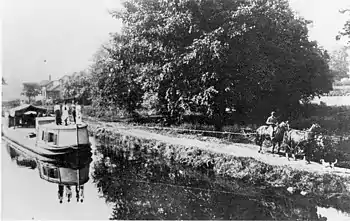 Ohio and Erie Canal |
November 13, 1966 (#66000607) |
State Route 631 (Valley View Rd.) 41°13′31″N 81°33′22″W |
Boston Township, Cuyahoga Falls, Peninsula, and Sagamore Hills Township | Extends into Cuyahoga County |
| 84 | Isaac and Maria Ozmun Farmstead | 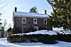 Isaac and Maria Ozmun Farmstead |
December 28, 2000 (#00001556) |
6928 Olde Eight Rd. 41°15′15″N 81°30′28″W |
Boston Heights | |
| 85 | Palmer House |  Palmer House |
August 13, 1974 (#74001628) |
9370 Olde Eight Rd. 41°18′56″N 81°32′22″W |
Northfield Center Township | |
| 86 | Peninsula Village Historic District | 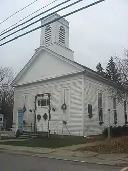 Peninsula Village Historic District |
August 23, 1974 (#74000346) |
Both sides of State Route 303; also Stine and Dell Rds., Emerson St., Boston Run, and Deep Lock Quarry Metro Park 41°14′24″N 81°33′03″W |
Peninsula | Second set of boundaries represents a boundary increase of May 8, 2017 |
| 87 | Nathaniel Point Farm | 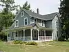 Nathaniel Point Farm |
September 3, 1999 (#99001084) |
4606 and 4631 Akron-Peninsula Rd., south of Peninsula 41°12′20″N 81°33′46″W |
Boston Township | |
| 88 | Orin Porter House | 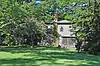 Orin Porter House |
October 5, 1989 (#89001449) |
240 College St. 41°14′59″N 81°26′20″W |
Hudson | |
| 89 | Porter-Aue House | 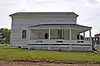 Porter-Aue House |
September 6, 2002 (#02000947) |
2798 North St. 40°55′40″N 81°37′44″W |
Clinton | |
| 90 | Jonathan Price House |  Jonathan Price House |
October 7, 2002 (#02001103) |
7903 Main St. 40°55′36″N 81°37′40″W |
Clinton | |
| 91 | Dr. Rufus Randall Residence |  Dr. Rufus Randall Residence |
June 11, 1979 (#79002796) |
3675 Ira Rd. 41°11′21″N 81°38′06″W |
Bath Township | |
| 92 | Luther B. Ranney Farm | 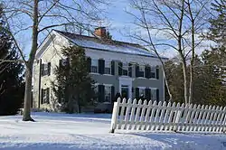 Luther B. Ranney Farm |
December 1, 1988 (#88002749) |
6484 Old State Route 8 41°14′35″N 81°30′04″W |
Boston Heights | |
| 93 | Frank Mason Raymond House |  Frank Mason Raymond House |
April 20, 1995 (#95000500) |
655 Latham Ln. 40°57′59″N 81°32′42″W |
New Franklin | |
| 94 | John Richard Residence |  John Richard Residence |
June 11, 1979 (#79002807) |
1924 Cleveland-Massilon Rd. 41°11′15″N 81°39′38″W |
Bath Township | |
| 95 | Louis Schmitt House and Store |  Louis Schmitt House and Store |
February 14, 2002 (#02000084) |
2967 Hickory St. 40°55′32″N 81°38′21″W |
Clinton | |
| 96 | Samuel Shaw Residence |  Samuel Shaw Residence |
June 11, 1979 (#79002794) |
1588 Hametown Rd. 41°10′51″N 81°39′59″W |
Bath Township | |
| 97 | Sylvester Shaw Residence |  Sylvester Shaw Residence |
June 11, 1979 (#79002793) |
1786 Hametown Rd. 41°11′09″N 81°39′58″W |
Bath Township | |
| 98 | David Smith House |  David Smith House |
October 4, 2002 (#02001104) |
7966 Cleveland-Massillon Rd. 40°55′32″N 81°37′43″W |
Clinton | |
| 99 | William Smith House |  William Smith House |
March 11, 2003 (#02001052) |
7894 Main St. 40°55′36″N 81°37′43″W |
Clinton | |
| 100 | Sorrick-Oster Store |  Sorrick-Oster Store |
October 11, 2002 (#02001123) |
7846 Main St. 40°55′37″N 81°37′47″W |
Clinton | |
| 101 | George Stanford Farm |  George Stanford Farm |
February 17, 1982 (#82001874) |
6093 Stanford Rd., north of Peninsula 41°16′16″N 81°33′25″W |
Boston Township | |
| 102 | Station Road Bridge | .jpg.webp) Station Road Bridge |
March 7, 1979 (#79000312) |
East of Brecksville at the Cuyahoga River 41°19′10″N 81°35′16″W |
Sagamore Hills Township | Extends into Brecksville in Cuyahoga County |
| 103 | Stewart-Hanson Farm |  Stewart-Hanson Farm |
October 15, 1992 (#92001376) |
2832 Call Rd. 41°11′18″N 81°24′19″W |
Stow | |
| 104 | Stumpy Basin |  Stumpy Basin |
December 11, 1979 (#79000313) |
200 ft (61 m) east of the Cuyahoga River and approximately 0.5 mi (0.80 km) south of the Ohio Turnpike, north of Peninsula 41°15′20″N 81°32′45″W |
Boston Township | |
| 105 | Tallmadge Town Square Historic District | 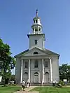 Tallmadge Town Square Historic District |
May 6, 1971 (#71000652) |
Public Sq. 41°06′05″N 81°26′29″W |
Tallmadge | |
| 106 | Thornton-Guise Kitchen And House |  Thornton-Guise Kitchen And House |
May 6, 1976 (#76001534) |
147 S. Main St. 41°08′06″N 81°26′24″W |
Munroe Falls | |
| 107 | Manville Thorp Residence | 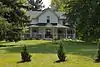 Manville Thorp Residence |
June 11, 1979 (#79002791) |
1907 Medina Lane Rd. 41°11′20″N 81°41′03″W |
Bath Township | |
| 108 | Daniel Tilden House | 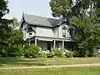 Daniel Tilden House |
June 20, 1985 (#85001340) |
2325 Stine Rd., west of Peninsula 41°14′48″N 81°35′17″W |
Boston Township | |
| 109 | Tuscarawas Avenue – Alexander Square Commercial Historic District |  Tuscarawas Avenue – Alexander Square Commercial Historic District |
May 17, 1990 (#90000755) |
Bounded by Park Ave., Tuscarawas Ave., and 4th and 5th Sts. 41°00′47″N 81°36′39″W |
Barberton | |
| 110 | Twinsburg Congregational Church |  Twinsburg Congregational Church |
May 3, 1974 (#74001634) |
Twinsburg Public Sq. 41°18′43″N 81°26′32″W |
Twinsburg | |
| 111 | Twinsburg Institute |  Twinsburg Institute |
January 1, 1976 (#76001535) |
8996 Darrow Rd. 41°18′38″N 81°26′27″W |
Twinsburg | |
| 112 | Valley Railway Historic District |  Valley Railway Historic District |
May 17, 1985 (#85001123) |
Cuyahoga Valley between Rockside Rd. in the Cuyahoga Valley National Park and Howard St. at Little Cuyahoga Valley 41°14′40″N 81°32′56″W |
Boston Township, Cuyahoga Falls, and Peninsula | Extends into Akron and into Cuyahoga County |
| 113 | Peter Voris, Jr., House |  Peter Voris, Jr., House |
December 7, 2010 (#10000976) |
3622 Ira Rd. in Ghent 41°11′20″N 81°37′59″W |
Bath Township | |
| 114 | Wallace Farm |  Wallace Farm |
June 27, 1985 (#85001387) |
8230 Brandywine Rd. 41°16′40″N 81°32′26″W |
Northfield Center Township | |
| 115 | Ward House |  Ward House |
March 17, 1987 (#87000629) |
1410 Hines Hill Rd. 41°15′38″N 81°27′46″W |
Hudson | |
| 116 | Warwick Interlocking Tower |  Warwick Interlocking Tower |
December 12, 2002 (#02001516) |
2955 S. 1st. St. 40°55′20″N 81°38′34″W |
Clinton | |
| 117 | Allen Welton House |  Allen Welton House |
May 7, 1979 (#79000314) |
Southwest of Peninsula at 2485 Major Rd. 41°14′00″N 81°35′01″W |
Boston Township | |
| 118 | Western Reserve Academy | 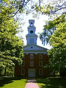 Western Reserve Academy |
June 30, 1975 (#75001539) |
Roughly bounded by Aurora St. and both sides of Oviatt, High, and Hudson 41°14′46″N 81°26′15″W |
Hudson | |
| 119 | Wolcott House |  Wolcott House |
May 5, 1988 (#88000468) |
56 E. Twinsburg Rd., south of Northfield 41°16′51″N 81°30′47″W |
Northfield Center Township | |
| 120 | Zimmerly House |  Zimmerly House |
January 2, 2018 (#100001936) |
4332 Manchester Rd. 40°59′06″N 81°33′36″W |
New Franklin |
Former listings
| [3] | Name on the Register | Image | Date listed | Date removed | Location | City or town | Summary |
|---|---|---|---|---|---|---|---|
| 1 | Everett Road Covered Bridge |  Everett Road Covered Bridge |
May 23, 1974 (#74000344) | October 29, 1985 | Southwest of Peninsula on Everett Rd. over Furnace Creek 41°12′14″N 81°35′00″W |
Boston Township | |
| 2 | Jonathan Herrick House | July 18, 1974 (#74001633) | May 5, 1983 | 8327 Darrow Rd. |
Boston Township |
See also
| Wikimedia Commons has media related to National Register of Historic Places in Summit County, Ohio. |
References
- The latitude and longitude information provided in this table was derived originally from the National Register Information System, which has been found to be fairly accurate for about 99% of listings. Some locations in this table may have been corrected to current GPS standards.
- "National Register of Historic Places: Weekly List Actions". National Park Service, United States Department of the Interior. Retrieved on January 29, 2021.
- Numbers represent an alphabetical ordering by significant words. Various colorings, defined here, differentiate National Historic Landmarks and historic districts from other NRHP buildings, structures, sites or objects.
- "National Register Information System". National Register of Historic Places. National Park Service. April 24, 2008.
- The eight-digit number below each date is the number assigned to each location in the National Register Information System database, which can be viewed by clicking the number.
- Perrin, William Henry, ed. History of Summit County, with an Outline Sketch of Ohio. Chicago: Baskin and Battey, 1881, 213.
- Bush, David R. National Register of Historic Places Inventory/Nomination: Barker Village Site. National Park Service, 1975-11-12, 2.
- Brose, David S. "The Everett Knoll: A Late Hopewellian Site in Northeastern Ohio", Ohio Journal of Science 74.1 (1974): 36-46: 38-39.
- Location derived from this Fairlawn city webpage; the NRIS lists the site as "Address Restricted".
External links

Municipalities and communities of Summit County, Ohio, United States | ||
|---|---|---|
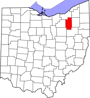
| Cities | Map of Ohio highlighting Summit County | |
| Villages | ||
| Townships | ||
| CDPs | ||
| Unincorporated communities | ||
| Footnotes | ‡This populated place also has portions in an adjacent county or counties | |
| ||