National Register of Historic Places listings in Franklin County, Ohio
This is a list of the National Register of Historic Places listings in Franklin County, Ohio.
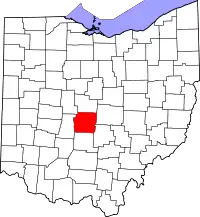
Location of Franklin County in Ohio
This is a list of the properties and districts on the National Register of Historic Places in Franklin County, Ohio, United States. Latitude and longitude coordinates are provided for many National Register properties and districts; these locations may be seen together in an online map.[1]
There are 341 properties and districts listed on the National Register in Franklin County, including 3 National Historic Landmarks. The city of Columbus is the location of 168 of these properties and districts, including all of the National Historic Landmarks; they are listed separately, while the remaining 173 properties and districts are listed here.
- This National Park Service list is complete through NPS recent listings posted January 29, 2021.[2]
Current listings
Columbus
Exclusive of Columbus
| [3] | Name on the Register[4] | Image | Date listed[5] | Location | City or town | Description |
|---|---|---|---|---|---|---|
| 1 | Demas Adams House |  Demas Adams House |
April 17, 1980 (#80003005) |
721 High St. 40°05′19″N 83°01′08″W |
Worthington | |
| 2 | Agler-La Follette House |  Agler-La Follette House |
December 14, 1978 (#78002062) |
2621 Sunbury Rd. 40°01′29″N 82°56′04″W |
Mifflin Township | |
| 3 | Alkire House |  Alkire House |
March 30, 1978 (#78002068) |
259 N. State St. 40°07′58″N 82°56′00″W |
Westerville | |
| 4 | Arendt-Seymour House |  Arendt-Seymour House |
August 15, 1989 (#89001024) |
53 W. Columbus St. 39°50′29″N 82°48′28″W |
Canal Winchester | |
| 5 | Artz House |  Artz House |
April 11, 1979 (#79002901) |
56 N. High St. 40°06′03″N 83°06′48″W |
Dublin | |
| 6 | Bank Block Building | Bank Block Building |
September 15, 1997 (#97000510) |
1255-1293 Grandview Ave. 39°58′58″N 83°02′44″W |
Grandview Heights | |
| 7 | Barnhardt-Bolenbaugh House |  Barnhardt-Bolenbaugh House |
August 15, 1989 (#89001027) |
113 E. Waterloo St. 39°50′28″N 82°48′07″W |
Canal Winchester | |
| 8 | Dr. L.W. Beery House |  Dr. L.W. Beery House |
August 15, 1989 (#89001033) |
68 Washington St. 39°50′32″N 82°48′32″W |
Canal Winchester | |
| 9 | Bergstresser Covered Bridge | 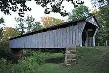 Bergstresser Covered Bridge |
May 3, 1974 (#74001484) |
West of State Route 674 over Walnut Creek 39°49′48″N 82°49′00″W |
Canal Winchester | |
| 10 | E. Boles Cottage |  E. Boles Cottage |
April 11, 1979 (#79002886) |
5350 Hayden Run Rd. 40°03′35″N 83°08′49″W |
Hilliard | |
| 11 | Asher Brand Residence |  Asher Brand Residence |
April 11, 1979 (#79002740) |
5381 Brand Rd. 40°07′06″N 83°07′57″W |
Dublin | |
| 12 | Brelsford-Seese House |  Brelsford-Seese House |
April 11, 1979 (#79002888) |
129 Riverview St. 40°05′49″N 83°06′44″W |
Dublin | |
| 13 | Bruns-Wynkoop House |  Bruns-Wynkoop House |
August 15, 1989 (#89001023) |
129 Washington St. 39°50′25″N 82°48′31″W |
Canal Winchester | |
| 14 | J.G. Butler House |  J.G. Butler House |
April 11, 1979 (#79002759) |
35 S. High St. 40°05′56″N 83°06′50″W |
Dublin | |
| 15 | Aurora Buttles House |  Aurora Buttles House |
April 17, 1980 (#80003007) |
12 E. Strafford Ave. 40°05′28″N 83°01′03″W |
Worthington | |
| 16 | Buttles-Johnson House | 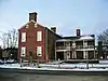 Buttles-Johnson House |
April 3, 1973 (#73001443) |
956 High St. 40°05′37″N 83°01′02″W |
Worthington | |
| 17 | Canal Winchester Methodist Church |  Canal Winchester Methodist Church |
March 15, 1982 (#82003567) |
S. Columbus and High St. 39°50′27″N 82°48′22″W |
Canal Winchester | |
| 18 | Canal Winchester School |  Canal Winchester School |
February 9, 2007 (#07000026) |
100 South Washington St. 39°50′27″N 82°48′34″W |
Canal Winchester | |
| 19 | Tom Cannon Mound |  Tom Cannon Mound |
May 2, 1974 (#74001498) |
On a bluff over the confluence of the Big and Little Darby Creeks[6] 39°53′37″N 83°13′05″W |
Pleasant Township | |
| 20 | Capital University Historic District | 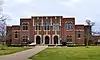 Capital University Historic District |
December 17, 1982 (#82001457) |
E. Main St. at College Ave. 39°57′21″N 82°56′19″W |
Bexley | |
| 21 | J. Carty-R.J. Tussing House |  J. Carty-R.J. Tussing House |
August 15, 1989 (#89001025) |
48 Elm St. 39°50′42″N 82°48′28″W |
Canal Winchester | |
| 22 | Central College Presbyterian Church | 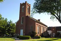 Central College Presbyterian Church |
November 24, 1980 (#80004068) |
6891 Sunbury Rd. 40°05′59″N 82°53′22″W |
Westerville | |
| 23 | O.P. Chaney Grain Elevator |  O.P. Chaney Grain Elevator |
January 28, 1988 (#87002551) |
W. Oak and N. High Sts. 39°50′40″N 82°48′23″W |
Canal Winchester | |
| 24 | Chapman-Hutchinson House |  Chapman-Hutchinson House |
April 11, 1979 (#79002688) |
37 S. Riverview St. 40°05′56″N 83°06′45″W |
Dublin | |
| 25 | Fletcher Coffman House |  Fletcher Coffman House |
April 11, 1979 (#79002751) |
6659 Coffman Rd. 40°06′15″N 83°08′02″W |
Dublin | |
| 26 | Columbus Street Historic District |  Columbus Street Historic District |
May 5, 1988 (#88000559) |
8-129 E. Columbus St. and 57 S. High St. 39°50′26″N 82°48′13″W |
Canal Winchester | |
| 27 | Columbus, Hocking Valley and Toledo Railway Depot |  Columbus, Hocking Valley and Toledo Railway Depot |
January 28, 1988 (#87002550) |
100 N. High St. 39°50′44″N 82°48′21″W |
Canal Winchester | |
| 28 | Walter Datz House |  Walter Datz House |
April 11, 1979 (#79002889) |
5040 Tuttle Rd. 40°04′40″N 83°07′41″W |
Dublin | |
| 29 | David's Reformed Church |  David's Reformed Church |
August 15, 1989 (#89001017) |
80 W. Columbus St. 39°50′30″N 82°48′31″W |
Canal Winchester | |
| 30 | Alexander Davis Cabin |  Alexander Davis Cabin |
April 11, 1979 (#79002892) |
5436 Dublin Rd. (rear house) 40°04′41″N 83°06′46″W |
Dublin | |
| 31 | Alexander Davis House |  Alexander Davis House |
April 11, 1979 (#79002746) |
5436 Dublin Rd. (front house) 40°04′41″N 83°06′48″W |
Dublin | |
| 32 | James Davis Barn |  James Davis Barn |
April 11, 1979 (#79002789) |
5707 Dublin Rd. 40°04′58″N 83°06′55″W |
Dublin | |
| 33 | James Davis Farm |  James Davis Farm |
April 11, 1979 (#79002772) |
5707 Dublin Rd. 40°05′00″N 83°06′55″W |
Dublin | |
| 34 | Samuel Henry Davis House |  Samuel Henry Davis House |
April 11, 1979 (#79002692) |
5083 Rings Rd. 40°05′02″N 83°07′41″W |
Dublin | |
| 35 | Samuel Davis House |  Samuel Davis House |
February 15, 1974 (#74001488) |
4264 Dublin Rd. 40°02′44″N 83°06′13″W |
Norwich Township | |
| 36 | Elias Decker Farmhouse |  Elias Decker Farmhouse |
August 15, 1989 (#89001034) |
6170 Lithopolis Rd. 39°49′36″N 82°50′16″W |
Canal Winchester | |
| 37 | Samuel Deitz Farmhouse |  Samuel Deitz Farmhouse |
August 15, 1989 (#89001021) |
280 Ashbrook Rd. 39°49′59″N 82°48′56″W |
Canal Winchester | |
| 38 | Drexel Theater | 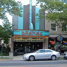 Drexel Theater |
June 8, 2015 (#15000322) |
2254 E. Main St. 39°57′26″N 82°56′19″W |
Bexley | |
| 39 | Dublin Cemetery Vaults |  Dublin Cemetery Vaults |
April 11, 1979 (#79002790) |
State Route 161, 0.25 miles (0.40 km) west of its intersection with Dublin River Rd. 40°05′51″N 83°07′01″W |
Dublin | |
| 40 | Dublin Christian Church |  Dublin Christian Church |
April 11, 1979 (#79002742) |
81 W. Bridge St. (State Route 161) 40°05′56″N 83°06′58″W |
Dublin | |
| 41 | Dublin Christian Church |  Dublin Christian Church |
April 11, 1979 (#79002896) |
53 N. High St. 40°06′00″N 83°06′50″W |
Dublin | |
| 42 | Dublin High Street Historic District |  Dublin High Street Historic District |
April 11, 1979 (#79003645) |
6-126 High St. (both sides of street) 40°05′58″N 83°06′49″W |
Dublin | |
| 43 | Dublin Veterinary Clinic |  Dublin Veterinary Clinic |
April 11, 1979 (#79002884) |
32 W. Bridge St. 40°05′59″N 83°06′53″W |
Dublin | |
| 44 | John Dun Homestead |  John Dun Homestead |
April 11, 1979 (#79002691) |
8055 Dublin-Bellpoint Rd. (at intersection of Ashford Rd.) 40°07′56″N 83°07′28″W |
Dublin | |
| 45 | Robert P. Duncan House |  Robert P. Duncan House |
August 23, 1984 (#09000094) |
333 N. Parkview Ave. 39°58′34″N 82°56′31″W |
Bexley | |
| 46 | George and Christina Ealy House |  George and Christina Ealy House |
July 2, 2008 (#08000626) |
6359 Dublin-Granville Rd. 40°04′57″N 82°49′10″W |
New Albany | |
| 47 | Henry J. Epley House |  Henry J. Epley House |
August 15, 1989 (#89001020) |
55 Franklin St. 39°50′26″N 82°48′29″W |
Canal Winchester | |
| 48 | Richard W. Evans House |  Richard W. Evans House |
April 17, 1980 (#80003020) |
92 E. Granville Rd. 40°05′20″N 83°00′55″W |
Worthington | |
| 49 | John W. Everal Farm Buildings |  John W. Everal Farm Buildings |
September 18, 1975 (#75001404) |
7610 Cleveland Ave. 40°07′35″N 82°56′52″W |
Westerville | |
| 50 | Foor-Alspach House |  Foor-Alspach House |
August 15, 1989 (#89001035) |
92 E. Waterloo St. 39°50′30″N 82°48′10″W |
Canal Winchester | |
| 51 | Frantz House |  Frantz House |
April 11, 1979 (#79002741) |
6152 Frantz Rd. 40°05′31″N 83°07′27″W |
Dublin | |
| 52 | John Galbreath Mound |  John Galbreath Mound |
July 15, 1974 (#74001497) |
Eastern bank of Big Darby Creek, west of Galloway[7] 39°54′43″N 83°13′16″W |
Pleasant Township | |
| 53 | Gantz Homestead | 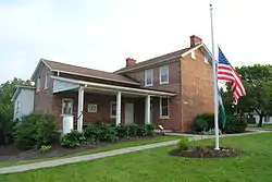 Gantz Homestead |
June 20, 1979 (#79001842) |
2233 Gantz Rd. 39°53′52″N 83°03′46″W |
Grove City | |
| 54 | Gardner House | 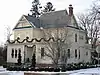 Gardner House |
April 17, 1980 (#80003009) |
80 W. Granville Rd. 40°05′28″N 83°01′13″W |
Worthington | |
| 55 | Christian Gayman House |  Christian Gayman House |
August 15, 1989 (#89001037) |
110 E. Waterloo St. 39°50′30″N 82°48′08″W |
Canal Winchester | |
| 56 | Eleanor A. Gelpi House |  Eleanor A. Gelpi House |
March 19, 2001 (#01000198) |
7125 Riverside Dr. 40°06′45″N 83°06′39″W |
Dublin | |
| 57 | Gilbert House |  Gilbert House |
April 17, 1980 (#80003016) |
72 E. Granville Rd. 40°05′19″N 83°00′56″W |
Worthington | |
| 58 | Gilbert-Wilcox House |  Gilbert-Wilcox House |
April 17, 1980 (#80003021) |
196 E. Granville Rd. 40°05′19″N 83°00′41″W |
Worthington | |
| 59 | A.G. Grant Homestead | 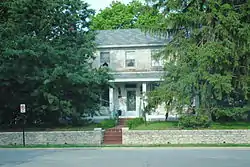 A.G. Grant Homestead |
June 3, 1998 (#98000667) |
4124 Haughn Rd. 39°52′48″N 83°05′07″W |
Grove City | |
| 60 | Green Lawn Abbey |  Green Lawn Abbey |
June 27, 2007 (#07000632) |
700 Greenlawn Ave. 39°56′26″N 83°00′58″W |
Franklin Township | |
| 61 | James Griffith House |  James Griffith House |
August 15, 1989 (#89001019) |
172 Washington St. 39°50′21″N 82°48′34″W |
Canal Winchester | |
| 62 | Groveport Log Houses | 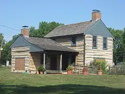 Groveport Log Houses |
May 6, 1976 (#76001428) |
Wirt Rd. 39°50′58″N 82°53′07″W |
Groveport | |
| 63 | Groveport School |  Groveport School |
July 24, 2009 (#09000564) |
715 E. Main St. 39°51′01″N 82°52′51″W |
Groveport | |
| 64 | Groveport Town Hall Historic Group |  Groveport Town Hall Historic Group |
July 31, 1978 (#78002067) |
628, 632 Main and Main and Front Sts. 39°51′05″N 82°52′57″W |
Groveport | |
| 65 | Groveport United Methodist Church |  Groveport United Methodist Church |
April 20, 1995 (#95000494) |
512 Main St. 39°51′08″N 82°53′10″W |
Groveport | |
| 66 | Parley Haffey Farm Complex |  Parley Haffey Farm Complex |
August 15, 1989 (#89001022) |
525 Gender Rd. 39°49′55″N 82°49′52″W |
Canal Winchester | |
| 67 | J.L. Hamilton Residence |  J.L. Hamilton Residence |
April 11, 1979 (#79002887) |
6273 Cosgray Rd. 40°05′54″N 83°11′20″W |
Washington Township | |
| 68 | Benjamin Hanby House |  Benjamin Hanby House |
November 10, 1970 (#70000493) |
160 W. Main St. 40°07′34″N 82°56′15″W |
Westerville | |
| 69 | Gideon Hart House |  Gideon Hart House |
August 14, 1973 (#73001442) |
7328 Hempstead Rd. 40°06′32″N 82°53′52″W |
Westerville | |
| 70 | Lucy Hart House |  Lucy Hart House |
April 17, 1980 (#80003008) |
64 W. Granville Rd. 40°05′29″N 83°01′11″W |
Worthington | |
| 71 | Helpman-Chaney House |  Helpman-Chaney House |
August 15, 1989 (#89001032) |
132 W. Columbus St. 39°50′30″N 82°48′38″W |
Canal Winchester | |
| 72 | Christian S. Herr House |  Christian S. Herr House |
March 5, 1982 (#82003571) |
North of Lockbourne at 1451 Rathmell Rd. 39°51′38″N 82°58′08″W |
Hamilton Township | |
| 73 | Hilliard Methodist Episcopal Church |  Hilliard Methodist Episcopal Church |
August 4, 1988 (#88000634) |
4066 Main St. 40°02′05″N 83°09′30″W |
Hilliard | |
| 74 | Holder-Wright Works |  Holder-Wright Works |
February 15, 1974 (#74001496) |
Off Bright Rd., east of the Scioto River[8] 40°06′47″N 83°06′23″W |
Dublin | |
| 75 | Home for the Aged Deaf |  Home for the Aged Deaf |
November 25, 1980 (#80004522) |
6971 Sunbury Rd. 40°06′05″N 82°53′21″W |
Westerville | |
| 76 | Hotel Central |  Hotel Central |
April 17, 1980 (#80003012) |
New England and High Sts. 40°05′13″N 83°01′06″W |
Worthington | |
| 77 | Franz Huntington House |  Franz Huntington House |
May 29, 1980 (#80002999) |
81 N. Drexel Ave. 39°58′17″N 82°56′16″W |
Bexley | |
| 78 | Indian Run Cemetery Stone Walls |  Indian Run Cemetery Stone Walls |
April 11, 1979 (#79002863) |
North High St. 40°06′07″N 83°06′55″W |
Dublin | |
| 79 | Jackson Fort |  Jackson Fort |
December 16, 1974 (#74001493) |
Surrounding a house at 3845 Westerville Rd.[9] 40°02′55″N 82°56′44″W |
Blendon Township | |
| 80 | H.P. Jeffers Mound |  H.P. Jeffers Mound |
May 2, 1974 (#74001499) |
Above the junction of Olentangy River Rd. and Plesenton Dr., west of downtown Worthington[10] 40°05′33″N 83°02′22″W |
Worthington | |
| 81 | Malcolm Jeffrey House |  Malcolm Jeffrey House |
May 6, 1983 (#83001970) |
358 N. Parkview 39°58′35″N 82°56′25″W |
Bexley | |
| 82 | Karrer Barn |  Karrer Barn |
April 11, 1979 (#79002788) |
6199 Dublin Rd. 40°05′42″N 83°06′49″W |
Dublin | |
| 83 | Henry Karrer House |  Henry Karrer House |
April 11, 1979 (#79002744) |
19 S. Riverview 40°05′58″N 83°06′44″W |
Dublin | |
| 84 | Kilbourn Commercial Building |  Kilbourn Commercial Building |
April 17, 1980 (#80003010) |
679-681 High St. 40°05′16″N 83°01′06″W |
Worthington | |
| 85 | William Kilbourn House |  William Kilbourn House |
April 11, 1979 (#79002894) |
63 S. Riverview St. 40°05′54″N 83°06′44″W |
Dublin | |
| 86 | Frederick G. Kilgour House |  Frederick G. Kilgour House |
July 3, 2012 (#12000392) |
1415 Kirkley Rd. 40°01′11″N 83°03′00″W |
Upper Arlington | |
| 87 | William King House |  William King House |
August 15, 1989 (#89001031) |
80 E. Waterloo St. 39°50′31″N 82°48′11″W |
Canal Winchester | |
| 88 | Abraham Lehman Farmhouse |  Abraham Lehman Farmhouse |
August 15, 1989 (#89001016) |
40 Lehman Dr. 39°50′58″N 82°48′47″W |
Canal Winchester | |
| 89 | C. Leppert Barn |  C. Leppert Barn |
April 11, 1979 (#79002784) |
5280 Pinney Rd. 40°05′28″N 83°07′44″W |
Dublin | |
| 90 | C. Leppert Cabin |  C. Leppert Cabin |
April 11, 1979 (#79002785) |
5280 Pinney Rd. 40°05′27″N 83°07′42″W |
Dublin | |
| 91 | C. Leppert Farm |  C. Leppert Farm |
April 11, 1979 (#79002783) |
5280 Pinney Rd. 40°05′27″N 83°07′42″W |
Dublin | |
| 92 | Alexander W. Livingston House |  Alexander W. Livingston House |
June 17, 1994 (#94000593) |
1792 Graham Rd. 39°56′52″N 82°47′44″W |
Reynoldsburg | |
| 93 | Doctor Longenecker Office Building |  Doctor Longenecker Office Building |
March 9, 1990 (#90000379) |
633-5 High St. 40°05′11″N 83°01′06″W |
Worthington | |
| 94 | David Marshall House |  David Marshall House |
April 11, 1979 (#79002686) |
7455 Cosgray Rd. 40°06′26″N 83°11′30″W |
Washington Township | |
| 95 | Mattoon-Woodrow House |  Mattoon-Woodrow House |
April 17, 1980 (#80003011) |
72 E. North St. 40°05′34″N 83°00′56″W |
Worthington | |
| 96 | McCracken-Sells House |  McCracken-Sells House |
November 29, 1984 (#84000440) |
3983 Dublin Rd. 40°02′08″N 83°06′12″W |
Mifflin Township | |
| 97 | Austin McDowell House |  Austin McDowell House |
April 11, 1979 (#79002906) |
6189 Dublin Rd. 40°05′37″N 83°06′47″W |
Dublin | |
| 98 | Dr. McKitrick House |  Dr. McKitrick House |
April 11, 1979 (#79002687) |
16 N. High St. 40°05′59″N 83°06′50″W |
Dublin | |
| 99 | Dr. McKitrick Office |  Dr. McKitrick Office |
April 11, 1979 (#79002882) |
22 N. High St. 40°06′00″N 83°06′48″W |
Dublin | |
| 100 | Dr. James Merryman House |  Dr. James Merryman House |
May 26, 1988 (#88000638) |
5232 Norwich St. 40°02′00″N 83°09′24″W |
Hilliard | |
| 101 | Methodist Church Parsonage |  Methodist Church Parsonage |
August 15, 1989 (#89001030) |
59 W. Columbus St. 39°50′29″N 82°48′29″W |
Canal Winchester | |
| 102 | J.F. Miller House |  J.F. Miller House |
May 31, 1984 (#84003682) |
1600 Roxbury Rd. 39°59′18″N 83°03′41″W |
Marble Cliff | |
| 103 | Charles Mitchell House |  Charles Mitchell House |
April 11, 1979 (#79002890) |
6992 Dublin-Bellpoint Rd. 40°06′36″N 83°06′52″W |
Washington Township | |
| 104 | Myer House |  Myer House |
April 11, 1979 (#79002689) |
5927 Rings Rd. 40°04′51″N 83°09′03″W |
Dublin | |
| 105 | Nafzger-Miller House |  Nafzger-Miller House |
January 21, 1999 (#98001641) |
110 Mill St. 40°01′13″N 82°52′46″W |
Gahanna | |
| 106 | New England Lodge | 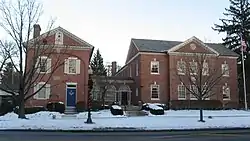 New England Lodge |
March 20, 1973 (#73001444) |
634 N. High St. 40°05′10″N 83°01′04″W |
Worthington | |
| 107 | Niles Car & Manufacturing Company Electric Railway Interurban Combine No. 21 |  Niles Car & Manufacturing Company Electric Railway Interurban Combine No. 21 |
June 19, 1987 (#87000762) |
990 Proprietor's Rd. 40°05′24″N 83°00′07″W |
Worthington | |
| 108 | Lewis Noble House |  Lewis Noble House |
April 17, 1980 (#80003006) |
48 W. South St. 40°05′04″N 83°01′09″W |
Worthington | |
| 109 | North High Street Historic District |  North High Street Historic District |
August 15, 1989 (#89001038) |
Roughly N. High St. and E. and W. Mound St. 39°50′39″N 82°48′19″W |
Canal Winchester | |
| 110 | Odd Fellows Hall |  Odd Fellows Hall |
May 26, 1988 (#88000636) |
4065 Main St. 40°02′05″N 83°09′32″W |
Hilliard | |
| 111 | Old Peace Lutheran Church | 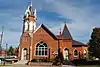 Old Peace Lutheran Church |
April 23, 1987 (#87000640) |
78-82 N. High St. 40°01′11″N 82°52′42″W |
Gahanna | |
| 112 | Charles S. Osborn House |  Charles S. Osborn House |
March 28, 1977 (#77001061) |
5785 Cooper Rd., south of Westerville 40°05′17″N 82°55′55″W |
Blendon Township | |
| 113 | Otterbein Mausoleum | 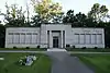 Otterbein Mausoleum |
November 29, 1979 (#79001845) |
W. Walnut St. 40°07′13″N 82°56′10″W |
Westerville | |
| 114 | Jonathan Park House |  Jonathan Park House |
April 17, 1980 (#80003013) |
91 E. Granville Rd. 40°05′18″N 83°00′55″W |
Worthington | |
| 115 | Peoples Bank Company Building |  Peoples Bank Company Building |
August 15, 1989 (#89001026) |
10 N. High St. 39°50′35″N 82°48′22″W |
Canal Winchester | |
| 116 | Pinney Road Log Cabin |  Pinney Road Log Cabin |
April 11, 1979 (#79002786) |
Pinney Rd. 40°05′51″N 83°07′28″W |
Dublin | |
| 117 | Dr. Eli Pinney House |  Dr. Eli Pinney House |
April 11, 1979 (#79002761) |
109 S. Riverview St. 40°05′50″N 83°06′44″W |
Dublin | |
| 118 | Presbyterian Parsonage | 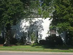 Presbyterian Parsonage |
November 25, 1980 (#80004246) |
6972 Sunbury Rd. 40°06′04″N 82°53′18″W |
Westerville | |
| 119 | Principal's Cottage |  Principal's Cottage |
April 17, 1980 (#80003014) |
38 Short St. 40°05′09″N 83°01′09″W |
Worthington | |
| 120 | John Rager Farmhouse |  John Rager Farmhouse |
October 1, 1990 (#90001498) |
8020 Groveport Rd., west of Canal Winchester 39°50′54″N 82°51′07″W |
Madison Township | |
| 121 | F. Riley House |  F. Riley House |
April 11, 1979 (#79002738) |
182 S. High St. 40°05′45″N 83°06′46″W |
Dublin | |
| 122 | Louis Rings Barn No. 1 |  Louis Rings Barn No. 1 |
April 11, 1979 (#79002769) |
6665 Shiers-Rings Rd. 40°05′37″N 83°10′15″W |
Dublin | |
| 123 | Louis Rings Barn No. 2 |  Louis Rings Barn No. 2 |
April 11, 1979 (#79002767) |
6665 Shiers-Rings Rd. 40°05′37″N 83°10′15″W |
Dublin | |
| 124 | Louis Rings Residence |  Louis Rings Residence |
April 11, 1979 (#79002765) |
6665 Shiers-Rings Rd. 40°05′38″N 83°10′12″W |
Dublin | |
| 125 | Ripley House |  Ripley House |
April 17, 1980 (#80003015) |
623 High St. 40°05′09″N 83°01′06″W |
Worthington | |
| 126 | Rush Creek Village Historic District |  Rush Creek Village Historic District |
August 14, 2003 (#03000760) |
Residential subdivision centered along E. South St., east of Morning St. 40°05′10″N 83°00′33″W |
Worthington | |
| 127 | Mark Russell House |  Mark Russell House |
December 12, 1976 (#76001429) |
5751 N. High St. 40°04′48″N 83°01′09″W |
Riverlea | |
| 128 | Benjamin Sells Barn No. 1 |  Benjamin Sells Barn No. 1 |
April 11, 1979 (#79003133) |
4586 Hayden Run Rd. 40°04′05″N 83°06′58″W |
Washington Township | |
| 129 | Benjamin Sells Barn No. 2 |  Benjamin Sells Barn No. 2 |
April 11, 1979 (#79003134) |
4586 Hayden Run Rd. 40°04′05″N 83°07′00″W |
Washington Township | |
| 130 | Benjamin Sells House |  Benjamin Sells House |
July 30, 1975 (#75001403) |
4586 Hayden Run Rd. 40°04′06″N 83°06′57″W |
Washington Township | |
| 131 | Benjamin Sells Wash House |  Benjamin Sells Wash House |
April 11, 1979 (#79002893) |
4586 Hayden Run Rd. 40°04′05″N 83°06′57″W |
Washington Township | |
| 132 | David Sells Barn |  David Sells Barn |
April 11, 1979 (#79003135) |
4586 Hayden Run Rd. 40°04′04″N 83°07′00″W |
Washington Township | |
| 133 | Eliud Sells House |  Eliud Sells House |
April 11, 1979 (#79002891) |
83 S. Riverview St. 40°05′53″N 83°06′03″W |
Dublin | |
| 134 | William Henry Sells House |  William Henry Sells House |
April 11, 1979 (#79002895) |
6028 Dublin Rd. 40°05′04″N 83°06′51″W |
Dublin | |
| 135 | Sessions Village |  Sessions Village |
February 20, 1975 (#75001401) |
Both sides of Sessions Dr. 39°58′10″N 82°56′40″W |
Bexley | |
| 136 | Sharon Township Town Hall |  Sharon Township Town Hall |
April 17, 1980 (#80003017) |
Granville Rd. and Hartford St. 40°05′19″N 83°00′58″W |
Worthington | |
| 137 | Shepard Street School |  Shepard Street School |
November 29, 1979 (#79001841) |
106 Short St. 40°01′13″N 82°52′37″W |
Gahanna | |
| 138 | Carl H. Shier Barn |  Carl H. Shier Barn |
April 11, 1979 (#79002873) |
7026 Shier-Rings Rd. 40°05′38″N 83°11′00″W |
Washington Township | |
| 139 | Carl H. Shier Chicken House |  Carl H. Shier Chicken House |
April 11, 1979 (#79002868) |
7026 Shier-Rings Rd. 40°05′38″N 83°11′00″W |
Washington Township | |
| 140 | Carl H. Shier House |  Carl H. Shier House |
April 11, 1979 (#79002865) |
7026 Shier-Rings Rd. 40°05′38″N 83°11′00″W |
Washington Township | |
| 141 | Capt. J.S. Skeele House |  Capt. J.S. Skeele House |
April 17, 1980 (#80003018) |
700 Hartford St. 40°05′18″N 83°00′57″W |
Worthington | |
| 142 | John Snow House |  John Snow House |
July 26, 1973 (#73001445) |
41 W. New England Ave. 40°05′12″N 83°01′09″W |
Worthington | |
| 143 | Squire's Glen Farm |  Squire's Glen Farm |
August 13, 1974 (#74001485) |
6770 Sunbury Rd. 40°05′50″N 82°53′10″W |
Westerville | |
| 144 | St. John's Episcopal Church |  St. John's Episcopal Church |
April 17, 1980 (#80003019) |
700 High St. 40°05′19″N 83°01′02″W |
Worthington | |
| 145 | St. John's Lutheran Church |  St. John's Lutheran Church |
April 11, 1979 (#79002877) |
6135 Rings Rd. 40°04′48″N 83°09′24″W |
Dublin | |
| 146 | Joshua Stevenson House |  Joshua Stevenson House |
June 21, 2007 (#07000581) |
5105 Bowen Rd., north of Canal Winchester 39°52′44″N 82°48′16″W |
Madison Township | |
| 147 | Temperance Row Historic District |  Temperance Row Historic District |
October 16, 2008 (#08000995) |
Park, Grove, Walnut, and University Sts. 40°07′24″N 82°56′11″W |
Westerville | |
| 148 | Thompson-Builder House |  Thompson-Builder House |
April 11, 1979 (#79002749) |
5051 Brand Rd. 40°07′00″N 83°07′39″W |
Dublin | |
| 149 | Morgan Thrush Farm Complex |  Morgan Thrush Farm Complex |
August 15, 1989 (#89001036) |
375 Gender Rd. 39°50′24″N 82°49′46″W |
Canal Winchester | |
| 150 | Times Building-Lodge Hall |  Times Building-Lodge Hall |
August 15, 1989 (#89001028) |
19 E. Waterloo St. 39°50′32″N 82°48′18″W |
Canal Winchester | |
| 151 | Towers Hall, Otterbein College |  Towers Hall, Otterbein College |
March 4, 1971 (#71000638) |
Main and Grove Sts. on the Otterbein College campus 40°07′31″N 82°56′11″W |
Westerville | |
| 152 | Upper Arlington Historic District |  Upper Arlington Historic District |
September 30, 1985 (#85002694) |
Roughly bounded by Lane Ave., Andover Rd., 5th Ave., Cambridge Boulevard, and Riverside Dr. 39°59′59″N 83°03′54″W |
Upper Arlington | |
| 153 | Uptown Westerville Historic District |  Uptown Westerville Historic District |
June 17, 2019 (#100004055) |
State St. between Home St. and Dill and Starrock Alleys 40°07′36″N 82°55′54″W |
Westerville | |
| 154 | Rev. Ebenezer Washburn House |  Rev. Ebenezer Washburn House |
November 25, 1980 (#80003004) |
7121 Sunbury Rd. 40°06′15″N 82°53′18″W |
Westerville | |
| 155 | Washington Township School |  Washington Township School |
April 11, 1979 (#79002762) |
4915 Brand Rd. 40°07′02″N 83°07′33″W |
Dublin | |
| 156 | Washington Township Voting Hall |  Washington Township Voting Hall |
April 11, 1979 (#79002880) |
Rings Rd., fourth building east of the railroad tracks 40°04′37″N 83°10′47″W |
Washington Township | |
| 157 | Wesley Chapel |  Wesley Chapel |
February 27, 1979 (#79001843) |
Southeast of Hilliard at 3299 Dublin Rd. 40°01′02″N 83°06′00″W |
Norwich Township | |
| 158 | West Mound Street Historic District |  West Mound Street Historic District |
February 11, 1988 (#88000072) |
10-54 West Mound St., 23 Elm St. 39°50′39″N 82°48′25″W |
Canal Winchester | |
| 159 | Westerville High School-Vine Street School |  Westerville High School-Vine Street School |
May 29, 1975 (#75001405) |
44 N. Vine St. 40°07′38″N 82°55′43″W |
Westerville | |
| 160 | Frieda Whitmer House |  Frieda Whitmer House |
April 11, 1979 (#79002690) |
5530 Houchard Rd. 40°04′42″N 83°11′51″W |
Washington Township | |
| 161 | Jacob Wilcox Farm |  Jacob Wilcox Farm |
April 11, 1979 (#79002899) |
7495 Rings Rd. 40°04′29″N 83°11′42″W |
Washington Township | |
| 162 | James Wilcox House |  James Wilcox House |
April 11, 1979 (#79002898) |
7590 Rings Rd. 40°04′31″N 83°11′52″W |
Washington Township | |
| 163 | Winterringer Building and House |  Winterringer Building and House |
June 9, 1988 (#88000720) |
5344 Center St. 40°02′04″N 83°09′35″W |
Hilliard | |
| 164 | Worthington Historic District |  Worthington Historic District |
April 13, 2010 (#10000190) |
Roughly bounded by North, South, Morning, and Evening Sts. 40°05′20″N 83°01′05″W |
Worthington | |
| 165 | Worthington Historical Society Museum |  Worthington Historical Society Museum |
April 17, 1980 (#80003022) |
50 W. New England Ave. 40°05′13″N 83°01′12″W |
Worthington | |
| 166 | Worthington Manufacturing Company Boardinghouse |  Worthington Manufacturing Company Boardinghouse |
June 19, 1973 (#73001446) |
25 Fox Lane 40°05′05″N 83°01′46″W |
Worthington | |
| 167 | Worthington Public Square |  Worthington Public Square |
April 17, 1980 (#80003024) |
Village Green 40°05′19″N 83°01′05″W |
Worthington | |
| 168 | Worthington United Presbyterian Church |  Worthington United Presbyterian Church |
April 17, 1980 (#80003023) |
High St. and W. Granville Rd. 40°05′22″N 83°01′08″W |
Worthington | |
| 169 | Horace Wright House |  Horace Wright House |
April 17, 1980 (#80003025) |
137 E. Granville Rd. 40°05′17″N 83°00′49″W |
Worthington | |
| 170 | George Karrer Farm |  George Karrer Farm |
April 11, 1979 (#79002905) |
167 S. High St. 40°05′40″N 83°06′48″W |
Dublin | |
| 171 | Potter Wright House |  Potter Wright House |
April 17, 1980 (#80003026) |
174 E. New England Ave. 40°05′12″N 83°00′45″W |
Worthington | |
| 172 | Zellers-Langel House |  Zellers-Langel House |
August 15, 1989 (#89001029) |
163 W. Waterloo St. 39°50′43″N 82°48′38″W |
Canal Winchester | |
| 173 | Zion's Evangelical Lutheran Church |  Zion's Evangelical Lutheran Church |
June 16, 2004 (#04000609) |
4501 Groveport Rd. 39°52′34″N 82°56′52″W |
Obetz |
See also
| Wikimedia Commons has media related to National Register of Historic Places in Franklin County, Ohio. |
References
- The latitude and longitude information provided in this table was derived originally from the National Register Information System, which has been found to be fairly accurate for about 99% of listings. Some locations in this table may have been corrected to current GPS standards.
- "National Register of Historic Places: Weekly List Actions". National Park Service, United States Department of the Interior. Retrieved on January 29, 2021.
- Numbers represent an alphabetical ordering by significant words. Various colorings, defined here, differentiate National Historic Landmarks and historic districts from other NRHP buildings, structures, sites or objects.
- "National Register Information System". National Register of Historic Places. National Park Service. April 24, 2008.
- The eight-digit number below each date is the number assigned to each location in the National Register Information System database, which can be viewed by clicking the number.
- Location derived from this Franklin County document; the NRIS lists the site as "Address Restricted"
- Location derived from Aument, Bruce Warren. Mortuary Variability in the Middle Big Darby Drainage of Central Ohio Between 300 B.C. and 300 A.D. Diss. Ohio State University. Columbus: Ohio State U, 1990, 85 and 117. Accessed 2009-11-10. The NRIS lists the site as "Address Restricted".
- Location derived from Sauer, Erin. "Analysis of Stone Tools from Holder-Wright Mound Complex, Dublin, Ohio". Columbus: Ohio State U, 2006, 6. Accessed 2009-11-10. The NRIS lists the site as "Address Restricted".
- Location derived from main Archived 2011-07-27 at the Wayback Machine and location Archived 2011-07-27 at the Wayback Machine pages for the property owner's website; the NRIS lists the site as "Address Restricted".
- Location derived from this Archived 2008-12-25 at the Wayback Machine Worthington city webpage; the NRIS lists the site as "Address Restricted"

Municipalities and communities of Franklin County, Ohio, United States | ||
|---|---|---|
| Cities | Map of Ohio highlighting Franklin County | |
| Villages | ||
| Townships | ||
| CDPs | ||
| Unincorporated communities | ||
| Footnotes | ‡This populated place also has portions in an adjacent county or counties | |
| ||
This article is issued from Wikipedia. The text is licensed under Creative Commons - Attribution - Sharealike. Additional terms may apply for the media files.