National Register of Historic Places listings in Guernsey County, Ohio
This is a list of the National Register of Historic Places listings in Guernsey County, Ohio.
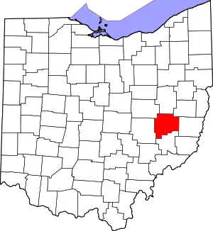
Location of Guernsey County in Ohio
This is intended to be a complete list of the properties and districts on the National Register of Historic Places in Guernsey County, Ohio, United States. The locations of National Register properties and districts for which the latitude and longitude coordinates are included below, may be seen in a Google map.[1]
There are 21 properties and districts listed on the National Register in the county, including 1 National Historic Landmark.
- This National Park Service list is complete through NPS recent listings posted January 29, 2021.[2]
Current listings
| [3] | Name on the Register[4] | Image | Date listed[5] | Location | City or town | Description |
|---|---|---|---|---|---|---|
| 1 | Barnett-Criss House | 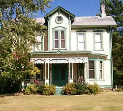 Barnett-Criss House |
December 8, 1978 (#78002070) |
Southwest of Cambridge off U.S. Route 22 39°59′59″N 81°41′33″W |
Westland Township | |
| 2 | Berwick Hotel | 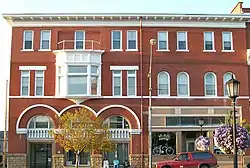 Berwick Hotel |
March 29, 1983 (#83001975) |
600-615 Wheeling Ave. 40°01′30″N 81°35′36″W |
Cambridge | |
| 3 | Bethel Methodist Episcopal Church | 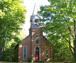 Bethel Methodist Episcopal Church |
November 24, 1978 (#78002072) |
West of Pleasant City on State Route 146 39°54′04″N 81°35′01″W |
Valley Township | |
| 4 | Booth Homestead | 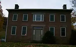 Booth Homestead |
September 6, 1979 (#79001851) |
North of Guernsey at 8433 Township Road 838 40°12′23″N 81°34′37″W |
Wheeling Township | |
| 5 | Broom Building | 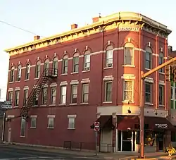 Broom Building |
February 17, 1983 (#83001976) |
701 Wheeling Ave. 40°01′30″N 81°35′31″W |
Cambridge | |
| 6 | Broom-Braden Stone House | 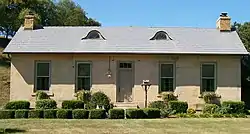 Broom-Braden Stone House |
July 18, 1980 (#80003032) |
North of Cambridge at 66715 Reed Rd. 40°04′12″N 81°33′31″W |
Cambridge Township | |
| 7 | Claysville School | 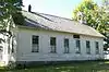 Claysville School |
February 22, 1979 (#79001850) |
North of Claysville on Claysville Rd. 39°56′18″N 81°40′16″W |
Westland Township | |
| 8 | Ebenezer Finley House | 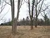 Ebenezer Finley House |
February 28, 1986 (#86000417) |
East of Buffalo on State Route 313 39°55′28″N 81°29′37″W |
Valley Township | Destroyed |
| 9 | Guernsey County Courthouse | 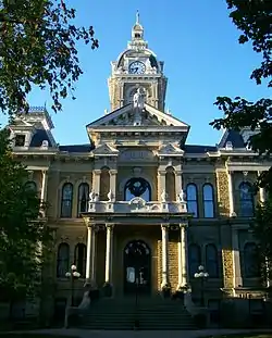 Guernsey County Courthouse |
July 16, 1973 (#73001452) |
Courthouse Sq. 40°01′30″N 81°35′14″W |
Cambridge | |
| 10 | Samuel Harper Stone House | 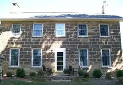 Samuel Harper Stone House |
January 3, 1980 (#80003033) |
North of New Concord on Peters Creek Rd. 40°02′00″N 81°43′12″W |
Adams Township | |
| 11 | Kennedy Stone House |  Kennedy Stone House |
October 3, 1975 (#75001412) |
Southeast of North Salem in Salt Fork State Park 40°07′41″N 81°29′59″W |
Jefferson Township | |
| 12 | McCracken-McFarland House | 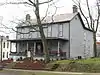 McCracken-McFarland House |
February 16, 1979 (#79001848) |
216 N. 8th St. 40°01′36″N 81°35′24″W |
Cambridge | |
| 13 | McCracken-Scott House | 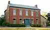 McCracken-Scott House |
December 20, 1978 (#78002071) |
819 Steubenville Ave. 40°01′35″N 81°35′22″W |
Cambridge | |
| 14 | McCreary-Burnworth House | 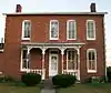 McCreary-Burnworth House |
March 12, 1982 (#82003574) |
220 Highland Ave. 40°01′34″N 81°34′53″W |
Cambridge | |
| 15 | National Road | 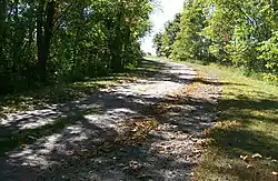 National Road |
August 23, 1985 (#85001842) |
Township Road 650, east of Cambridge 40°01′37″N 81°30′09″W |
Center Township | |
| 16 | Old Washington Historic District | 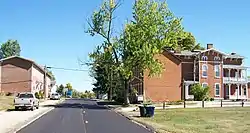 Old Washington Historic District |
May 29, 1975 (#75001413) |
Both sides of Main St. 40°02′18″N 81°26′35″W |
Old Washington | |
| 17 | S Bridge, National Road | 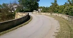 S Bridge, National Road |
October 15, 1966 (#66000610) |
4 mi (6.4 km) east of Old Washington on U.S. Route 40 40°02′43″N 81°22′27″W |
Wills Township | |
| 18 | Peter B. Sarchet House | 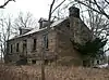 Peter B. Sarchet House |
February 22, 1979 (#79001849) |
North of Cambridge on Oldham Rd. 40°05′02″N 81°35′13″W |
Cambridge Township | |
| 19 | Sarchet-Burgess House | 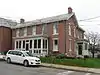 Sarchet-Burgess House |
May 21, 1987 (#87000808) |
145 W. 8th St. 40°01′33″N 81°35′26″W |
Cambridge | |
| 20 | Colonel Joseph Taylor House | 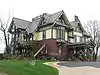 Colonel Joseph Taylor House |
August 29, 2008 (#08000801) |
633 Upland Rd. 40°02′00″N 81°35′33″W |
Cambridge | |
| 21 | Wheeling Avenue Historic District |  Wheeling Avenue Historic District |
May 11, 1987 (#87000919) |
Roughly bounded by Steubenville, 10th, Wheeling, and 4th Aves. 40°01′29″N 81°35′27″W |
Cambridge |
See also
| Wikimedia Commons has media related to National Register of Historic Places in Guernsey County, Ohio. |
References
- The latitude and longitude information provided in this table was derived originally from the National Register Information System, which has been found to be fairly accurate for about 99% of listings. Some locations in this table may have been corrected to current GPS standards.
- "National Register of Historic Places: Weekly List Actions". National Park Service, United States Department of the Interior. Retrieved on January 29, 2021.
- Numbers represent an alphabetical ordering by significant words. Various colorings, defined here, differentiate National Historic Landmarks and historic districts from other NRHP buildings, structures, sites or objects.
- "National Register Information System". National Register of Historic Places. National Park Service. April 24, 2008.
- The eight-digit number below each date is the number assigned to each location in the National Register Information System database, which can be viewed by clicking the number.

Municipalities and communities of Guernsey County, Ohio, United States | ||
|---|---|---|
| City | Map of Ohio highlighting Guernsey County | |
| Villages | ||
| Townships | ||
| CDPs | ||
| Unincorporated communities | ||
| Footnotes | ‡This populated place also has portions in an adjacent county or counties | |
| ||
This article is issued from Wikipedia. The text is licensed under Creative Commons - Attribution - Sharealike. Additional terms may apply for the media files.