National Register of Historic Places listings in Richland County, Ohio
This is intended to be a complete list of the properties and districts on the National Register of Historic Places in Richland County, Ohio, United States. The locations of National Register properties and districts for which the latitude and longitude coordinates are included below, may be seen in an online map.[1]
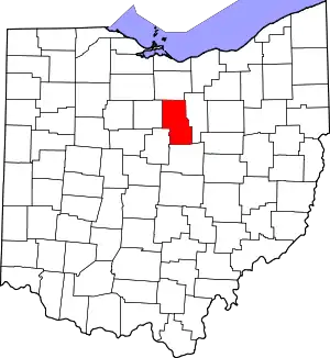
Location of Richland County in Ohio
There are 67 properties and districts listed on the National Register in the county. Another 2 properties were once listed but have been removed.
- This National Park Service list is complete through NPS recent listings posted January 29, 2021.[2]
Current listings
| [3] | Name on the Register[4] | Image | Date listed[5] | Location | City or town | Description |
|---|---|---|---|---|---|---|
| 1 | All Souls Unitarian-Universalist Church |  All Souls Unitarian-Universalist Church |
January 1, 1976 (#76001520) |
125 Church St. 40°37′11″N 82°30′45″W |
Bellville | 1894, Richardsonian Romanesque, still in use |
| 2 | Jacob H. Barr House |  Jacob H. Barr House |
July 8, 1983 (#83002023) |
646 Park Ave., W. 40°45′34″N 82°32′20″W |
Mansfield | |
| 3 | Bellville Bandstand |  Bellville Bandstand |
November 26, 1973 (#73001519) |
North Bellville Municipal Park 40°37′13″N 82°30′29″W |
Bellville | |
| 4 | Bellville Cemetery Chapel |  Bellville Cemetery Chapel |
July 8, 2010 (#10000457) |
Bellville Cemetery, State Route 97 40°37′16″N 82°31′08″W |
Bellville | |
| 5 | Bellville Village Hall |  Bellville Village Hall |
March 17, 1976 (#76001521) |
Park Pl. and Church St. 40°37′11″N 82°30′43″W |
Bellville | |
| 6 | Bissman Block |  Bissman Block |
October 16, 1986 (#86002882) |
193 N. Main St. 40°45′49″N 82°30′56″W |
Mansfield | |
| 7 | B. F. Bissman House |  B. F. Bissman House |
July 8, 1983 (#83002024) |
458 Park Ave., W. 40°45′32″N 82°31′59″W |
Mansfield | |
| 8 | Peter Bissman House |  Peter Bissman House |
July 8, 1983 (#83002025) |
462 Park Ave., W. 40°45′32″N 82°32′00″W |
Mansfield | |
| 9 | Rigby House at 240 Park Avenue West |  Rigby House at 240 Park Avenue West |
July 8, 1983 (#83002026) |
240 Park Ave., W. 40°45′33″N 82°31′28″W |
Mansfield | Designed by Vernon Redding |
| 10 | Building at 252–254 Park Avenue West |  Building at 252–254 Park Avenue West |
February 2, 1984 (#84003802) |
252–254 Park Ave., W. 40°45′33″N 82°31′29″W |
Mansfield | |
| 11 | Building at 309 Park Avenue West |  Building at 309 Park Avenue West |
February 2, 1984 (#84003801) |
309 Park Ave., W. 40°45′32″N 82°31′37″W |
Mansfield | |
| 12 | Building at 415 Park Avenue West |  Building at 415 Park Avenue West |
February 2, 1984 (#84003799) |
415 Park Ave., W. 40°45′32″N 82°31′51″W |
Mansfield | |
| 13 | Martin Bushnell House |  Martin Bushnell House |
April 26, 1974 (#74001609) |
34 Sturges Ave. 40°45′10″N 82°31′24″W |
Mansfield | |
| 14 | Central United Methodist Church |  Central United Methodist Church |
July 8, 1983 (#83002027) |
378 Park Ave., W. 40°45′33″N 82°31′46″W |
Mansfield | |
| 15 | City Mills Building |  City Mills Building |
December 18, 1986 (#86003500) |
160 N. Main St. 40°45′46″N 82°30′54″W |
Mansfield | |
| 16 | The Colonial | 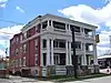 The Colonial |
July 8, 1983 (#83002028) |
283 Park Ave., W. 40°45′31″N 82°31′33″W |
Mansfield | |
| 17 | J. M. Cook House |  J. M. Cook House |
July 8, 1983 (#83002029) |
429 Park Ave., W. 40°45′31″N 82°31′54″W |
Mansfield | |
| 18 | S. M. Douglas House |  S. M. Douglas House |
July 8, 1983 (#83002030) |
437 Park Ave., W. 40°45′31″N 82°31′54″W |
Mansfield | |
| 19 | Dow House | 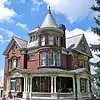 Dow House |
July 8, 1983 (#83002031) |
564 Park Ave., W. 40°45′32″N 82°32′11″W |
Mansfield | |
| 20 | Downtown Mansfield Historic District |  Downtown Mansfield Historic District |
July 25, 2019 (#100004214) |
Roughly bounded by 5th, Diamond, 2nd, and Mulberry Sts. 40°45′30″N 82°30′56″W |
Mansfield | |
| 21 | Silas Ferrell House | 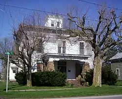 Silas Ferrell House |
December 14, 1987 (#87002146) |
25 E. Main St. 40°58′01″N 82°35′57″W |
Shiloh | |
| 22 | First Congregational Church and Lexington School |  First Congregational Church and Lexington School |
February 23, 1979 (#79001929) |
47 Delaware St. and 51 W. Church St. 40°40′39″N 82°35′09″W |
Lexington | |
| 23 | First English Lutheran Church |  First English Lutheran Church |
July 8, 1983 (#83002032) |
53 Park Ave., W. 40°45′30″N 82°31′04″W |
Mansfield | |
| 24 | Fraser House |  Fraser House |
July 8, 1983 (#83002033) |
681 Park Ave., W. 40°45′32″N 82°32′28″W |
Mansfield | Designed by F. B. Hursh |
| 25 | F. A. Gilbert House |  F. A. Gilbert House |
February 2, 1984 (#84003800) |
343 Park Ave., W. 40°45′31″N 82°31′41″W |
Mansfield | |
| 26 | Gurney-Kochheiser House | 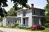 Gurney-Kochheiser House |
April 30, 1976 (#76001522) |
174 Main St. 40°37′09″N 82°30′42″W |
Bellville | |
| 27 | Hancock and Dow Building | 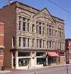 Hancock and Dow Building |
February 26, 1987 (#86002864) |
21 E. 4th St. 40°45′40″N 82°30′54″W |
Mansfield | |
| 28 | Rufus A. Kern House |  Rufus A. Kern House |
July 8, 1983 (#83002034) |
608 Park Ave., W. 40°45′33″N 82°32′15″W |
Mansfield | |
| 29 | Kingwood Center |  Kingwood Center |
November 7, 1976 (#76001523) |
900 Park Ave., W. 40°45′36″N 82°32′52″W |
Mansfield | |
| 30 | John Krause House | 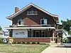 John Krause House |
July 8, 1983 (#83002035) |
428 Park Ave., W. 40°45′33″N 82°31′53″W |
Mansfield | |
| 31 | Samuel Lewis House |  Samuel Lewis House |
June 1, 1982 (#82003636) |
291 N. Stewart Rd., east of Mansfield 40°45′58″N 82°28′35″W |
Madison Township | |
| 32 | Malabar Farm | 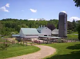 Malabar Farm |
April 11, 1973 (#73001520) |
Southeast of Lucas on Pleasant Valley Rd. 40°38′57″N 82°23′26″W |
Monroe Township | |
| 33 | Mansfield Savings Bank | 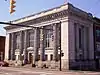 Mansfield Savings Bank |
October 16, 1986 (#86002872) |
4 W. 4th St. 40°45′40″N 82°30′57″W |
Mansfield | |
| 34 | Mansfield Woman's Club |  Mansfield Woman's Club |
July 8, 1983 (#83002037) |
145 Park Ave., W. 40°45′31″N 82°31′16″W |
Mansfield | |
| 35 | Judge Mansfield House |  Judge Mansfield House |
July 8, 1983 (#83002036) |
228 Park Ave., W. 40°45′15″N 82°31′03″W |
Mansfield | |
| 36 | Marvin Memorial Library |  Marvin Memorial Library |
August 13, 1987 (#86003493) |
34 N. Gamble St. 40°52′59″N 82°39′44″W |
Shelby | |
| 37 | May Realty Building | 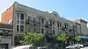 May Realty Building |
October 16, 1986 (#86002865) |
22–32 S. Park St. 40°45′28″N 82°30′53″W |
Mansfield | |
| 38 | Mechanics Building and Loan Company | 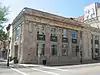 Mechanics Building and Loan Company |
July 8, 1983 (#83002038) |
2 S. Main St. 40°45′30″N 82°30′57″W |
Mansfield | |
| 39 | Most Pure Heart Of Mary Church | 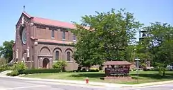 Most Pure Heart Of Mary Church |
November 30, 1978 (#78002179) |
West St. and Raymond Ave. 40°52′58″N 82°40′02″W |
Shelby | |
| 40 | Oak Hill Cottage |  Oak Hill Cottage |
June 11, 1969 (#69000149) |
310 Springmill St. 40°46′04″N 82°31′04″W |
Mansfield | |
| 41 | Ohio State Reformatory |  Ohio State Reformatory |
April 14, 1983 (#83002039) |
Olivesburg Rd. 40°47′07″N 82°30′18″W |
Mansfield | |
| 42 | Ohio Theatre | 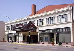 Ohio Theatre |
May 31, 1983 (#83002040) |
136 Park Ave., W. 40°45′32″N 82°31′16″W |
Mansfield | |
| 43 | Old Carriage Barn | 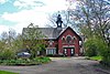 Old Carriage Barn |
July 8, 1983 (#83002041) |
337 Park Ave., W. 40°45′31″N 82°31′41″W |
Mansfield | |
| 44 | Pacific Curios Antiques |  Pacific Curios Antiques |
July 8, 1983 (#83002042) |
365 Park Ave., W. 40°45′31″N 82°31′44″W |
Mansfield | |
| 45 | Park Avenue Baptist Church |  Park Avenue Baptist Church |
July 8, 1983 (#83002043) |
296 Park Ave., W. 40°45′34″N 82°31′34″W |
Mansfield | |
| 46 | Plymouth Greenlawn Cemetery Chapel | Plymouth Greenlawn Cemetery Chapel |
February 22, 1996 (#96000116) |
Greenlawn Cemetery 40°59′13″N 82°40′07″W |
Plymouth | |
| 47 | Plymouth Historic District | 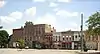 Plymouth Historic District |
December 7, 2018 (#100003245) |
Roughly bounded by Dix, Trux, Mills, and New Railroad Sts. 40°59′43″N 82°40′02″W |
Plymouth | Extends into Huron County |
| 48 | Raemelton Farm Historic District | 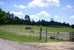 Raemelton Farm Historic District |
January 8, 2003 (#02001682) |
Bounded by Marion Ave. and Millsboro and Trimble Rds. 40°44′36″N 82°32′53″W |
Mansfield | |
| 49 | Richland County Infirmary | 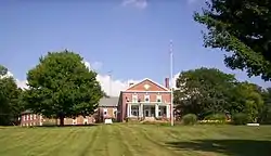 Richland County Infirmary |
September 24, 2001 (#01001042) |
3220 Mansfield-Olivesburg Rd., north of Mansfield 40°50′25″N 82°28′12″W |
Weller Township | Designed by F. F. Schnitzer |
| 50 | Richland Trust Building | 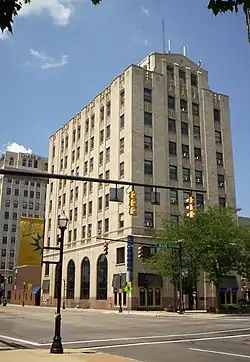 Richland Trust Building |
July 8, 1983 (#83002044) |
3 Park Ave., W. 40°45′31″N 82°30′57″W |
Mansfield | |
| 51 | William Ritter House |  William Ritter House |
December 29, 1978 (#78002178) |
181 S. Main St. 40°45′12″N 82°30′57″W |
Mansfield | |
| 52 | Rummell Mill |  Rummell Mill |
April 7, 1982 (#82003635) |
Northeast of Butler on State Route 349 40°35′59″N 82°24′29″W |
Worthington Township | |
| 53 | Sacred Heart of Jesus Churches | 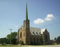 Sacred Heart of Jesus Churches |
January 6, 1986 (#86000035) |
State Route 61 at Bethlehem 40°50′16″N 82°43′21″W |
Sharon Township | |
| 54 | St. Peter's Church | 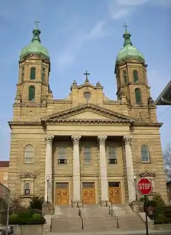 St. Peter's Church |
November 29, 1979 (#79001930) |
54 S. Mulberry St. 40°45′25″N 82°31′07″W |
Mansfield | |
| 55 | Robert Sandiford House | 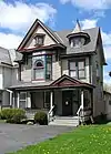 Robert Sandiford House |
July 8, 1983 (#83002045) |
544 Park Ave., W. 40°45′33″N 82°32′07″W |
Mansfield | |
| 56 | George Shambaugh House | 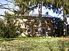 George Shambaugh House |
April 1, 1982 (#82003637) |
Frontz Rd., northwest of Perrysville 40°43′10″N 82°20′48″W |
Monroe Township | |
| 57 | Shelby Center Historic District |  Shelby Center Historic District |
May 13, 1982 (#82003638) |
E. and W. Main Sts. 40°52′51″N 82°39′38″W |
Shelby | |
| 58 | John Sherman Memorial Gateway |  John Sherman Memorial Gateway |
July 8, 1983 (#83002046) |
699 Park Ave., W. 40°45′32″N 82°32′26″W |
Mansfield | |
| 59 | Soldiers and Sailors Memorial Building and Madison Theater |  Soldiers and Sailors Memorial Building and Madison Theater |
May 27, 1980 (#80003214) |
36 Park Ave., W. 40°45′32″N 82°31′01″W |
Mansfield | |
| 60 | Springfield Township School |  Springfield Township School |
April 24, 2003 (#03000325) |
3560 Park Ave., W. 40°45′40″N 82°38′33″W |
Ontario | |
| 61 | Stewart Towers |  Stewart Towers |
July 8, 1983 (#83002048) |
13 Park Ave., W. 40°45′30″N 82°30′59″W |
Mansfield | |
| 62 | Susan Sturges House | 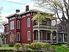 Susan Sturges House |
July 8, 1983 (#83002049) |
317 Park Ave., W. 40°45′31″N 82°31′35″W |
Mansfield | |
| 63 | Tappan House | 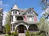 Tappan House |
July 8, 1983 (#83002050) |
308 Park Ave., W. 40°45′33″N 82°31′36″W |
Mansfield | |
| 64 | Tubbs-Sourwine House |  Tubbs-Sourwine House |
February 5, 1999 (#99000094) |
49 Railroad St. 40°59′38″N 82°40′04″W |
Plymouth | |
| 65 | Upson House |  Upson House |
July 8, 1983 (#83002051) |
234 Park Ave., W. 40°45′14″N 82°31′03″W |
Mansfield | |
| 66 | Voegele Building | 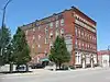 Voegele Building |
January 14, 2000 (#99001687) |
211 N. Main St. 40°45′51″N 82°30′56″W |
Mansfield | |
| 67 | W. S. Ward House |  W. S. Ward House |
July 8, 1983 (#83002052) |
350 Park Ave., W. 40°45′32″N 82°31′43″W |
Mansfield |
Former listings
| [3] | Name on the Register | Image | Date listed | Date removed | Location | City or town | Summary |
|---|---|---|---|---|---|---|---|
| 1 | Renner and Weber Brewery | September 16, 1977 (#77001084) | February 20, 1980 | 79 E. 4th St. |
Mansfield | ||
| 2 | Wilfred J. Spreng House | July 8, 1983 (#83002047) | October 29, 1985 | 414 Park Ave., W. |
Mansfield |
See also
| Wikimedia Commons has media related to National Register of Historic Places in Richland County, Ohio. |
References
- The latitude and longitude information provided in this table was derived originally from the National Register Information System, which has been found to be fairly accurate for about 99% of listings. Some locations in this table may have been corrected to current GPS standards.
- "National Register of Historic Places: Weekly List Actions". National Park Service, United States Department of the Interior. Retrieved on January 29, 2021.
- Numbers represent an alphabetical ordering by significant words. Various colorings, defined here, differentiate National Historic Landmarks and historic districts from other NRHP buildings, structures, sites or objects.
- "National Register Information System". National Register of Historic Places. National Park Service. April 24, 2008.
- The eight-digit number below each date is the number assigned to each location in the National Register Information System database, which can be viewed by clicking the number.

Municipalities and communities of Richland County, Ohio, United States | ||
|---|---|---|
| Cities | Map of Ohio highlighting Richland County | |
| Villages | ||
| Townships | ||
| CDPs |
| |
| Unincorporated communities | ||
| Ghost towns | ||
| Footnotes | ‡This populated place also has portions in an adjacent county or counties | |
| ||
This article is issued from Wikipedia. The text is licensed under Creative Commons - Attribution - Sharealike. Additional terms may apply for the media files.