Qinhuangdao
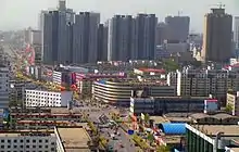
Qinhuangdao (/ˈtʃɪnˈhwɑːŋˈdaʊ/;[2] Chinese: 秦皇岛) is a port city on the coast of China in northern Hebei province. It is administratively a prefecture-level city, about 300 km (190 mi) east of Beijing, on the Bohai Sea, the innermost gulf of the Yellow Sea. Its population during the 2010 national census was 2,987,605, with approximately one million people living in the built-up (or 'metro') area made up of three urban districts.
Qinhuangdao
秦皇岛市 | |
|---|---|
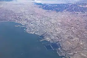 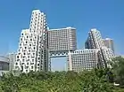 .jpg.webp)    Clockwise from the top: Aerial view of the city, Shanhai Pass, Longtan Falls, Yan Mountains, Old Dragon Head, Habitat Apartments | |
Seal | |
| Nickname(s): Back Garden of Beijing and Tianjin (京津后花园) | |
| |
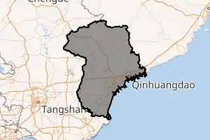
.png.webp) Location of Qinhuangdao City jurisdiction in Hebei | |
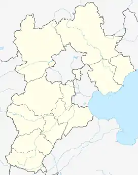 Qinhuangdao Location of the city centre in Hebei 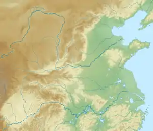 Qinhuangdao Qinhuangdao (North China Plain) 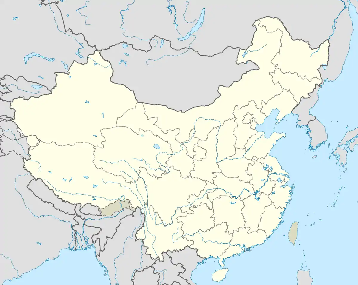 Qinhuangdao Qinhuangdao (China) | |
| Coordinates (People's Square): 39°56′26″N 119°35′42″E | |
| Country | People's Republic of China |
| Province | Hebei |
| Settled | 1737 |
| Established | March 3, 1983 |
| Municipal seat | Haigang District |
| Government | |
| • Party Secretary | Meng Xiangwei |
| • Mayor | Zhang Ruishu |
| Area | |
| • Prefecture-level city | 7,791.57 km2 (3,008.34 sq mi) |
| • Urban | 330.25 km2 (127.51 sq mi) |
| • Districts[1] | 2,131.5 km2 (823.0 sq mi) |
| Population | |
| • Prefecture-level city | 2,897,605 |
| • Density | 370/km2 (960/sq mi) |
| • Urban | 1,252,400 |
| • Urban density | 3,800/km2 (9,800/sq mi) |
| • Districts[1] | 1,710,000 |
| Time zone | UTC+8 (China Standard) |
| Postal code | 066000 |
| Area code(s) | (0)335 |
| ISO 3166 code | CN-HE-03 |
| Licence Plate Prefix | 冀C |
| Website | http://www.qhd.gov.cn/ |
| Qinhuangdao | |||||||||
|---|---|---|---|---|---|---|---|---|---|
 "Qinhuangdao", as written in Simplified Chinese (top) and Traditional Chinese (bottom) | |||||||||
| Simplified Chinese | 秦皇岛 | ||||||||
| Traditional Chinese | 秦皇島 | ||||||||
| Literal meaning | Qin Shi Huang Island | ||||||||
| |||||||||
History
The city's name "Qinhuangdao" literally means "Qin Emperor island", and is allegedly originated from the legend that the Jieshishan Scenic Area in Changli County was the site of First Emperor of Qin's famous ritual during his fourth and final survey tour to the east in 210 BC. The "island" refers to the Nanshan area of the Port of Qinhuangdao at the southern edge of the city's Haigang District, which used to be a small offshore island until the late Qing dynasty, when dumping of dredged silt joined it to the mainland after the Guangxu Emperor approved the port's construction in the late 19th century.
In the 19th century, Qinhuangdao included the separate towns of Qinhuangdao and Tanghe.[n 1] Both were stations along the Peking–Mukden Railway. The design and construction of the new harbour and port of Ching Wang Tao in the Gulf of Pechili was undertaken by the partnership of Sir John Wolfe-Barry and Lt Col Arthur John Barry at the turn of the 20th century.[3]
Qinhuangdao Olympic Sports Center Stadium was used as one of the soccer venues during the 2008 Summer Olympics.
Geography
Qinhuangdao sits on the northwest coast of the Bohai Sea and borders Tangshan to the southwest, Chengde to the northwest, and Liaoning to the northeast. Its administrative area ranges in latitude 39° 24' to 40° 37' N and in longitude from 118° 33' to 119° 51' E, and has a total area of 7,812.4 km2 (3,016.4 sq mi).
Since the elevation of Tianjin to a provincial-level municipality, Qinhuangdao is the chief port of Hebei. The Qin emperor Qin Shi Huang is said to have sought immortality on an island in Haigang District but did not find it.
Qinhuangdao has three main developed areas:
- Beidaihe: A summer seaside resort for senior government officials. Many political decisions affecting China are made here, making it the equivalent to resorts in Maine or Camp David in Maryland, United States.[4]
- Haigang: the harbor city. Qinhuangdao proper. Home of Yan Shan University, the leading university in NE Hebei province.
- Shanhaiguan: a popular tourist destination, featuring the eastern end of the Great Wall.
Qinhuangdao's Olympic Sports Centre Stadium was used as an Olympic Competition Venue (Football Preliminary) during the 2008 Summer Olympics.
Climate
Qinhuangdao has a monsoon-influenced humid continental climate (Köppen Dwa), with four distinct seasons. Winters are cold and dry due to the Siberian high, which often causes winds to blow in from the northwest, minimising the oceanic influence: the monthly daily average temperature in January is −4.8 °C (23.4 °F), colder than Beijing's −3.7 °C (25.3 °F).[5] Summers are hot and humid due to the East Asian Monsoon, often allowing onshore flows; summer is also when the coast moderates the weather the most: the average high temperature in July here is 28.1 °C (83 °F), as compared to 30.9 °C (88 °F) in Beijing.[5] As measured by daily mean temperature, July and August are equally warm, averaging 24.7 °C (76.5 °F). The annual mean is 11.0 °C (51.8 °F), and 70% of the annual precipitation falls from June to August.
| Climate data for Qinhuangdao (1971−2000) | |||||||||||||
|---|---|---|---|---|---|---|---|---|---|---|---|---|---|
| Month | Jan | Feb | Mar | Apr | May | Jun | Jul | Aug | Sep | Oct | Nov | Dec | Year |
| Record high °C (°F) | 11.5 (52.7) |
18.3 (64.9) |
21.8 (71.2) |
31.6 (88.9) |
37.1 (98.8) |
38.4 (101.1) |
39.2 (102.6) |
35.1 (95.2) |
33.6 (92.5) |
29.4 (84.9) |
21.6 (70.9) |
14.0 (57.2) |
39.2 (102.6) |
| Average high °C (°F) | 0.1 (32.2) |
2.6 (36.7) |
8.4 (47.1) |
16.1 (61.0) |
22.1 (71.8) |
25.7 (78.3) |
28.1 (82.6) |
28.5 (83.3) |
25.2 (77.4) |
18.4 (65.1) |
9.7 (49.5) |
2.9 (37.2) |
15.7 (60.2) |
| Daily mean °C (°F) | −4.8 (23.4) |
−2.4 (27.7) |
3.5 (38.3) |
11.2 (52.2) |
17.3 (63.1) |
21.6 (70.9) |
24.7 (76.5) |
24.7 (76.5) |
20.2 (68.4) |
13.1 (55.6) |
4.6 (40.3) |
−1.8 (28.8) |
11.0 (51.8) |
| Average low °C (°F) | −8.8 (16.2) |
−6.3 (20.7) |
−0.5 (31.1) |
6.9 (44.4) |
13.1 (55.6) |
18.0 (64.4) |
21.7 (71.1) |
21.0 (69.8) |
15.6 (60.1) |
8.4 (47.1) |
0.5 (32.9) |
−5.6 (21.9) |
7.0 (44.6) |
| Record low °C (°F) | −20.8 (−5.4) |
−17.0 (1.4) |
−12.5 (9.5) |
−5.0 (23.0) |
3.0 (37.4) |
9.9 (49.8) |
14.3 (57.7) |
13.1 (55.6) |
4.4 (39.9) |
−2.8 (27.0) |
−11.8 (10.8) |
−16.4 (2.5) |
−20.8 (−5.4) |
| Average precipitation mm (inches) | 3.0 (0.12) |
3.0 (0.12) |
9.4 (0.37) |
24.1 (0.95) |
55.2 (2.17) |
102.2 (4.02) |
189.7 (7.47) |
152.3 (6.00) |
51.0 (2.01) |
28.6 (1.13) |
10.7 (0.42) |
5.0 (0.20) |
634.2 (24.98) |
| Average precipitation days (≥ 0.1 mm) | 2.1 | 2.2 | 3.3 | 5.1 | 7.3 | 10.6 | 12.8 | 9.9 | 7.1 | 4.6 | 3.3 | 1.7 | 60.0 |
| Source: Weather China | |||||||||||||
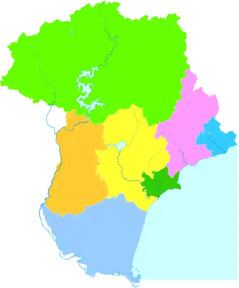
Administrative divisions
| Map | |||||
|---|---|---|---|---|---|
| Name | Hanzi | Hanyu Pinyin | Population (2010) |
Area (km²) | Density (/km²) |
| City proper | |||||
| Haigang District | 海港区 | Hǎigǎng Qū | 765,254 | 246 | 3,110 |
| Suburban | |||||
| Shanhaiguan District | 山海关区 | Shānhǎiguān Qū | 178,879 | 193 | 926 |
| Beidaihe District | 北戴河区 | Běidàihé Qū | 85,647 | 73 | 1,173 |
| Funing District | 抚宁区 | Fǔníng Qū | 517,073 | 1,618 | 319 |
| Rural | |||||
| Changli County | 昌黎县 | Chānglí Xiàn | 559,687 | 1,212 | 461 |
| Lulong County | 卢龙县 | Lúlóng Xiàn | 384,439 | 961 | 400 |
| Qinglong Manchu Autonomous County | 青龙满族自治县 | Qīnglóng Mǎnzú Zìzhìxiàn | 496,726 | 3,510 | 141 |
Development Zone
The Qinhuangdao Economic & Technology Development Zone was approved by the State Council in 1984 to become one of China's first state-level economic and technological development zones. Qinhuangdao is in the heart of the rapidly growing “Bohai-Rim Economic Circle”, in easy reach of Beijing (280 km (170 mi)) and Tianjin (245 km (152 mi)).[6] It covers a sea area of 23.81 km2 (9.19 sq mi) and has a coastline of 6 km (3.7 mi). The planned and controlled area of the development zone has reached 56.72 km2 (21.90 sq mi). By the end of 2006, the number of approved projects reached 4,546, in which 647 projects were foreign-invested, with a total investment of US$4.73 billion.
Qinhuangdao Export Processing Zone is the first export processing zone in Hebei Province. It passed joint appraisal held by Customs General Administration People's Republic of China, State Development Planning Commission and other six departments in 2003. Industries encouraged in the zone include electronics assembly and manufacturing, building/construction materials, computer software, trading and distribution.[7]
Economy
Qinhuangdao Port is a strategically important port and is the largest coal shipping port in the country, much of which is shipped to power plants elsewhere in China. With recent expansion, its capacity has reached 209 million metric tons. The harbor is adding a further six berths to add capacity and is increasingly being invested in by other port operators, such as South Africa's Port of Richards Bay, who have announced plans to invest US$150 million to increase capacity by at least 28 percent.
China is the world's third largest coal exporter, and Qinhuangdao is expected to handle much of the nation's coal exports. Rail links from Shanxi province (China's largest coal producer) to Qinhuangdao Port are being upgraded, which should allow for Qinhuangdao to ultimately increase its throughput to 400 million tonnes of coal per annum from its current level of about 250 million tons by 2015.
Other Chinese and foreign service suppliers are moving to Qinhuangdao to support this. China Ocean Shipping (Group) Co, China's biggest shipping company, expects US$49 billion of spending on ports over the next five years as the industry tackles bottlenecks created by the nation's unprecedented economic boom.[8]
Qinhuangdao is on the Jingshen Expressway which links Beijing with Shenyang, Liaoning.
Tourism
The Qinhuangdao Wildlife Park was opened in 1995 and is China's second largest wildlife park.
Qinhuangdao features a long stretch of beach line, surrounded by mountains. On which marks the beginning of the Great Wall, and its first gate: Shanhai Guan, which translates into Mountain-Sea Gate.
Red Ribbon
Qinhuangdao is home to the Tanghe River Park, which features the Red Ribbon, a knee-high steel sculpture that runs the length of the park, providing seating, environmental interpretation, lighting, and the display of native plants. The project has won an honor award from the American Society of Landscape Architects and was selected by readers of Condé Nast Traveler magazine as one of the seven new wonders of the architecture world.[9]
Education
- Yanshan University
- Northeastern University at Qinhuangdao
- Hebei Institute of International Business and Economics
- Hebei Normal University of Science and Technology
Sister cities
Notes
- simplified Chinese: 汤河; traditional Chinese: 湯河; pinyin: Tānghé; Wade–Giles: Tang-ho; lit. 'soup river'
References
- Ministry of Housing and Urban-Rural Development, ed. (2019). China Urban Construction Statistical Yearbook 2017. Beijing: China Statistics Press. p. 46. Retrieved 11 January 2020.
- "Qinhuangdao pronunciation". Merriam-Webster. Retrieved 25 April 2015.
- Frederick Arthur Crisp Visitation of England and Wales, Volume 14, London (1906)
- "China Expat City Guide". Asia Briefing. 2009. Archived from the original on January 18, 2009. Retrieved 2009-02-08.
- 中国地面国际交换站气候标准值月值数据集(1971-2000年) (in Chinese). China Meteorological Administration. Archived from the original on September 21, 2013. Retrieved 2011-05-28.
- "Qinhuangdao Economic & Technology Development Zone". RightSite.asia. Retrieved 2012-12-24.
- "Qinhuangdao Export Processing Zone". RightSite.asia. Retrieved 2012-12-24.
- "China Briefing Business Guide" (PDF). China Briefing. 2009. Retrieved 2009-02-08.
- "Red Ribbon in Tanghe River Park".
External links
Bohai Economic Rim Region | ||
|---|---|---|
List of major cities and ports in the BER region | ||
| Municipalities |  | |
| Hebei Province | ||
| Liaoning Province | ||
| Shandong Province | ||