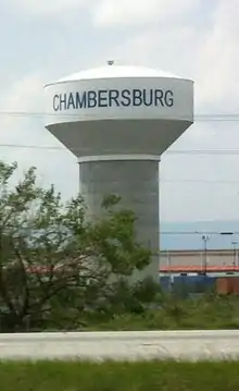
Chambersburg, Pennsylvania
Chambersburg is a borough in and the county seat of Franklin County, in the South Central region of Pennsylvania, United States. It is in the Cumberland Valley, which is part of the Great Appalachian Valley, and 13 miles (21 km) north of Maryland and the Mason-Dixon line and 52 miles (84 km) southwest of Harrisburg, the state capital. According to the United States Census Bureau, Chambersburg's 2010 population was 20,268.[5] When combined with the surrounding Greene, Hamilton, and Guilford Townships, the population of Greater Chambersburg is 52,273 people. The Chambersburg, PA Micropolitan Statistical Area includes surrounding Franklin County, and in 2010 included 149,618 people.[6]
Chambersburg, Pennsylvania | |
|---|---|
Borough | |
| Borough of Chambersburg | |
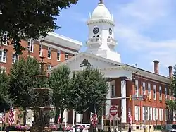 Memorial Square in downtown Chambersburg | |
| Nickname(s): Biggest town in Franklin county | |
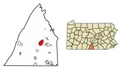 Location of Chambersburg in Franklin County, Pennsylvania. | |
 Chambersburg Location in Pennsylvania and the United States  Chambersburg Chambersburg (the United States) | |
| Coordinates: 39°56′15″N 77°39′40″W | |
| Country | United States |
| State | Pennsylvania |
| County | Franklin County |
| Founded | 1734 |
| Incorporated | March 21, 1803 |
| Government | |
| • Mayor | Walter Bietsch[1] |
| Area | |
| • Borough | 6.92 sq mi (17.94 km2) |
| • Land | 6.92 sq mi (17.94 km2) |
| • Water | 0.00 sq mi (0.00 km2) |
| Elevation | 630 ft (192 m) |
| Population (2010)Urban as of 2000 census | |
| • Borough | 20,268 |
| • Estimate (2019)[4] | 21,143 |
| • Density | 3,053.14/sq mi (1,178.86/km2) |
| • Urban | 54,469 |
| • Metro | 149,618 (Micropolitan area) |
| Time zone | UTC-5 (EST) |
| • Summer (DST) | UTC-4 (EDT) |
| ZIP codes | 17201, 17202 |
| Area code(s) | 717 and 223 |
| FIPS code | 42-12536 |
| Website | Official website |
According to the Pennsylvania Department of Community and Economic Development, Chambersburg Borough is the thirteenth largest municipality in the Commonwealth of Pennsylvania and the largest Borough, as measured by fiscal size (2016). Chambersburg Borough is organized under the Pennsylvania Borough Code and is not a home-rule municipality.
Chambersburg's settlement began in 1730 when water mills were built at the confluence of Conococheague Creek and Falling Spring Creek that now run through the center of the town. Its history includes episodes relating to the French and Indian War, the Whiskey Rebellion, John Brown's raid on Harpers Ferry, and the American Civil War. The borough was the only major northern community burned down by Confederate forces during the war, which led to accusations of war crimes.[7][8]
Chambersburg is located along the Lincoln Highway, U.S. 30, between McConnellsburg and Gettysburg, Pennsylvania, and along U.S. 11, the Molly Pitcher Highway, between Shippensburg, Pennsylvania, and Hagerstown, Maryland. Interstate 81 skirts the borough to its east. The town also lies approximately midpoint on US Route 30 between Pittsburgh and Philadelphia with the local geography reflecting both flatter areas like Philadelphia and mountainous areas like Pittsburgh.
History
European settlement
Native Americans living or hunting in the area during the 18th century included the Iroquois, Lenape, and Shawnee.[9] The Lenape lived mostly to the east, with the Iroquois to the north and the Shawnee to the south. Traders, hunters, and warriors traveled on the north-south route sometimes called the "Virginia path" through the Cumberland Valley, from New York through what became Carlisle and Shippensburg, then through what would become Hagerstown, Maryland, crossing the Potomac River into the Shenandoah Valley.[10]
Benjamin Chambers, a Scots-Irish immigrant, settled "Falling Spring" in 1730, building a grist mill and saw mill by a then-26-foot-high (7.9 m) waterfall where Falling Spring Creek joined Conococheague Creek.[11][12] The creek provided power for the mills, and soon a settlement grew and became known as "Falling Spring."
On March 30, 1734, Chambers received a "Blunston license" for 400 acres (160 ha), from a representative of the Penn family, but European settlement in the area remained of questionable legality until the treaty ending the French and Indian War, because not all Indian tribes with land claims had signed treaties.[11][13] The Penn family encouraged settlement in the area in order to strengthen its case in a border dispute with the Maryland Colony, which had resulted in hostilities known as Cresap's War. This dispute was not settled until 1767, with the border survey which gave rise to the Mason-Dixon line. Chambers traveled to England to testify in support of Penn's claims.[14] To maintain peace with the Indians, European settlers were sometimes removed from nearby areas. In May 1750, Benjamin Chambers helped remove settlers from the nearby Burnt Cabins, named after an incident.[15][16]
The area was initially officially classified as part of Chester County, then Lancaster County (as that was created from Chester County's western area). Then Lancaster County was split, with its western portion renamed as Cumberland County; finally another split (this time of Cumberland County) established Franklin County in 1784 (so Adams County adjoins it on the east).[17]
The Great Wagon Road connecting Philadelphia with the Shenandoah Valley (and an east-west branch through Hagerstown and Cumberland, Maryland to the Ohio Valley known as Nemacolin's Path) passed nearby. In 1744, the road was completed through Harris's Ferry, Carlisle, Shippensburg, and Chambersburg to the Potomac River.[11] In 1748 a local militia was formed for protection against Indians, with Benjamin Chambers named as its colonel.
Chambersburg remained on the frontier during the French and Indian War. Benjamin Chambers built a private stone fort during the war, which was equipped with two 4 pounder cannons. Fighting as well as troop movements occurred nearby.[11][12][18][19] The area's population dropped from about 3,000 in 1755 as the war began, to about 300 during the conflict, and most settlers did not return until after 1764 (when the peace treaty was signed).[20] Because Chambers's fort was otherwise lightly defended, officials attempted to remove the cannons to prevent them from being captured by Indians and used against other forts. However, the attempted removal failed, and one of the cannons still remained in 1840, when it was used to celebrate Independence Day.[21] The Forbes Road and other trails going to Fort Pitt passed nearby as well.[22] The Forbes Road developed into part of the main road connecting Pittsburgh and Philadelphia, and much later into US 30; Chambersburg developed as a transportation hub at the crossroads of Forbes Road and the Great Wagon Road.
Fighting continued in the area after the war, most notably the Enoch Brown school massacre during Pontiac's War and the Black Boys rebellion against British troops at Fort Loudon.[23]
The town of Chambersburg was first laid out in 1764, and lots advertised for sale on July 19 in Benjamin Franklin's Pennsylvania Gazette.
Notice is hereby given to the Public, that there is a town is laid out on Conegogig Creek, on both sides of the Great Falling Spring, where is falls into said creek, by Benjamin Chambers, of Cumberland County. Lots may be had on reasonable terms and Firm Deeds granted for them by said Chambers: the day appointed for drawing of said lots is the 28th day of June inst.. which is a Thursday. The situation of this town is very good for water and stone, both free and marble, and sand all handy to the spot, and a well timbered part of the country adjoining it; within said town is a good Gristmill, Sawmill, and Grindstones going by water. The articles of the Town shall be read on the day appointed for the drawing of the Lots, and the terms of the sale published by me
— Benjamin Chambers[24]
The first settlers were Scots-Irish Presbyterians; German Protestants came soon afterward. Relatively few Quakers and English Protestants (who made up a large proportion of early Pennsylvania settlers generally) settled as far west as Chambersburg. However, blacks lived in Chambersburg almost from the settlement's beginning. Benjamin Chambers owned a black female slave sometime before the French and Indian War and twenty slaves were recorded as taxable property in 1786.[25][26]
The earliest church was established by Scots-Irish Presbyterians in 1734. Chambers gave the congregation land in 1768, for an annual rent of only a single rose. Later, the First Lutheran Church and Zion Reformed Church both organized in 1780 under similar terms, so these three churches came to be known as the "Rose Rent Churches."[27] A Catholic community organized in 1785. St. James African Methodist Episcopal Church dates its founding to members purchasing a log cabin from the expanding Catholic congregation in 1811, and the congregation continued and expanded through 1830.[28][29] The Mt. Moriah First African Baptist Church dates to 1887. The Jewish cemetery dates back to 1840.[11]
1775–1858

In June 1775, soon after the Battle of Lexington, local troops were raised to fight the British in the American Revolution under the command of Benjamin Chambers's eldest son Captain James Chambers, as part of the 1st Pennsylvania Regiment.[30] These troops were among the first non-New Englanders to join the siege of Boston, arriving on August 7, 1775. James Chambers fought for seven years during the revolution, reaching the rank of Colonel of Continental army troops on September 26, 1776.[31] His two brothers, William and Benjamin, Jr., each served for much of the war and reached the rank of Captain.[32] James Chambers commanded local troops at the Battle of Long Island, and at White Plains, Trenton, Princeton, Brandywine, Germantown, and Monmouth. He was part of the rear guard covering the retreat from Brooklyn, and was wounded at the Battle of Brandywine while facing Hessian troops under General Knuphausen at Chadds Ford.[33]
During the Whiskey Rebellion, local citizens raised a liberty pole in support of the rebels, and to protest conscription of soldiers to put down the rebellion. Nevertheless, these citizens were censured in a town meeting and removed the pole the next day.[34] President George Washington, while leading United States troops against the rebels, came through town on the way from Carlisle to Bedford, staying overnight on October 12, 1794. According to tradition, Washington lodged with Dr. Robert Johnson, a surgeon in the Pennsylvania line during the Revolution. This march was one of only two times that a sitting president personally commanded the military in the field. (The other was after President James Madison fled the British occupation of Washington, D.C. during the War of 1812.) After sending the troops toward Pittsburgh from Bedford under General Henry "Light Horse Harry" Lee, Washington returned through Chambersburg sometime between October 21–26.[35] James Chambers was appointed a Brigadier General of Militia during the Whiskey Rebellion.[36]
Chambersburg was incorporated on March 21, 1803,[37] and declared the County Seat when the State Assembly established a formal government. The first courthouse was John Jack's tavern on the Diamond (town square) in 1784, with a permanent courthouse built in 1793, and the first county jail built 1795.[20] The "Old Jail" was built in 1818, survived the fire of 1864 and is the oldest jail building in Pennsylvania. It was originally used as the sheriff's residence and had the longest continuous use of any jail in the state, operating until 1971. Today the Old Jail is a museum and home to the Franklin County – Kittochtinny Historical Society.[38] The county's gallows still stand in the jail's courtyard.[39]
Much of the town's growth was due to its position as a transportation center, first as the starting point on the Forbes Road to Pittsburgh. The U.S. Congress placed Chambersburg on the Philadelphia-Pittsburgh postal road in 1803. The road was rebuilt as the Chambersburg-Bedford Turnpike in 1811. The Cumberland Valley Railroad was built in 1837 and was the area's center of economic activity for nearly 100 years. Until the completion of the Pennsylvania Railroad's main line in 1857, the fastest route from Pittsburgh to Philadelphia was by stagecoach from Pittsburgh to Chambersburg, and then by train to Philadelphia.
Civil War era
Underground railroad / John Brown
By 1859, Chambersburg and its active community of free and enslaved blacks and sympathetic whites was a stop on the Underground Railroad. Several schools taught black children, although such activity was illegal in Virginia and other slave states further south. John Brown stayed in an upstairs room at Mary Ritner's boarding house between June and October, 1859 while preparing for his raid on Harpers Ferry (then in Virginia).[40] Several of his fellow raiders stayed in the house as well, and four of them escaped capture and briefly visited the house after the raid. The house still stands at 225 East King Street. While in Chambersburg, Brown posed as Dr. Isaac Smith, an iron mine developer, and bought, shipped, and stored weapons under the guise of mining equipment.[41]
Brown (using the name John Smith) and John Henry Kagi met with Frederick Douglass and Shields Green at an abandoned quarry outside of town to discuss the raid on August 19.[42] According to Douglass's account, Brown described the planned raid in detail and Douglass advised him against it. Douglass also provided $10 from a supporter, and had helped Green – a future raider – locate Brown.
First two Confederate occupations, selective burnings
During the American Civil War on October 10, 1862, Confederate Maj. Gen. J.E.B. Stuart, with 1,800 cavalrymen, raided Chambersburg, destroying $250,000 of railroad property and taking 500 guns, hundreds of horses, and at least "eight young colored men and boys."[43] They failed, however, to accomplish one of the main targets of the raid: to burn the railroad bridge across the Conococheague Creek at Scotland, five miles (8 km) north of town.[44]
During the early days of the 1863 Gettysburg Campaign, a Virginia cavalry brigade under Brig. Gen. Albert G. Jenkins occupied the town and burned several warehouses and Cumberland Valley Railroad structures and the bridge at Scotland. From June 24–28, 1863, much of the Army of Northern Virginia passed through Chambersburg[45][46] en route to Carlisle and Gettysburg, and Robert E. Lee established his headquarters at a nearby farm.
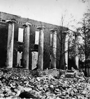
July 30, 1864 devastation
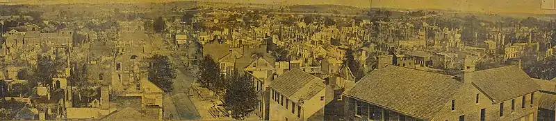
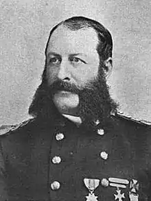
The following year, Chambersburg was invaded for a third time, as cavalry, dispatched from the Shenandoah Valley by Jubal Early, arrived.[7] On July 30, 1864, a large portion of the town was burned down by Brig. Gen. John McCausland for failing to provide a ransom of $500,000 in U.S. currency, or $100,000 in gold, although the local bank had sent its reserves out of town for safekeeping.[47][48][49] Among the few buildings left standing was the Masonic Temple, which had been guarded under orders by a Confederate mason.[50] Norland, the home of Republican politician and editor Alexander McClure, was burned even though it was well north of the main fire. The ransom had been ordered by Early as compensation for residents of the Shenandoah Valley whose homes has been burned by Brig.-Gen. David Hunter, who also burned the Virginia Military Institute.[51]
One black Chambersburg resident was killed when Confederates refused to allow him to leave his burning house. Another man was asked by the Confederates if he had ever educated "niggers"; after replying that he had, the Confederates burned his house as well.[52] Subsequently, "Remember Chambersburg" soon became a Union battle cry.[53]
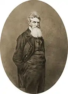 John Brown in 1859
.jpg.webp) Alexander K. McClure
Alexander K. McClure.jpg.webp) J.E.B. Stuart
J.E.B. Stuart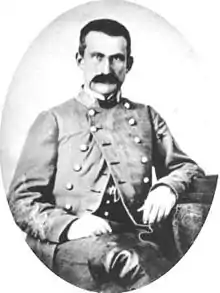 Gen. John McCausland
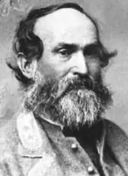 Lieut. Gen. Jubal Early, who ordered Chambersburg burned
Accusations of war crimes
Confederate Lieutenant General Jubal Early was accused of war crimes for ordering Chambersburg burned. The actual burning divided two of his cavalry commanders, because when Maryland-born Gen. Joseph "Allegheny" Johnson saw the behavior of Gen. McCausland's troops in Chambersburg, he refused to participate in a similar burning at Cumberland and Hancock, Maryland not far to the south, so both those towns survived despite likewise not paying ransoms.[54] Union cavalry under Brig. Gen. William W. Averill, although initially misdirected toward Baltimore and thus late to arrive to prevent the atrocities, also pursued the Confederates, who sustained several defeats and lost most of the Shenandoah Valley by November. Furthermore, when the Army of Northern Virginia surrendered on April 9, 1865, Early escaped to Texas by horseback, where he hoped to find a Confederate force still holding out. He proceeded to Mexico, and from there, sailed to Cuba and Canada. Living in Toronto, he wrote his memoir, A Memoir of the Last Year of the War for Independence, in the Confederate States of America, which focused on his Valley Campaign and was published in 1867.
Chambersburg's Reconstruction
A combination of state and private funding rebuilt Chambersburg. However, many new buildings were erected quickly and not initially built to the original standards. It took more than 30 years to fully restore the town's housing stock to pre-Civil War standards. As discussed further below, Chambersburg was the site of one of the 69 schools established by Pennsylvania to educate children orphaned by the war, and which remained when all other such were closed decades later. Known as "The Scotland School for Veterans Children" after the 1890s, it remained open until 2010 and graduated more than 10,000 children during its lifetime.
Memorialization of Civil War
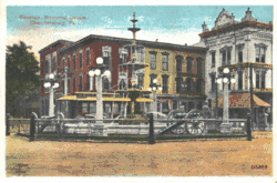
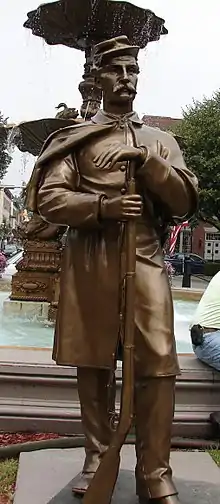
Since people from Chambersburg had relatives on both sides during the war, and the war devastated the town, the town event also became a part of the town's identity. On July 17, 1878, 15,000 people attended dedication of Memorial Fountain in the town's center, which honors the Civil War soldiers, and later Chambersburg's fighters in other wars. A statue of a Union soldier stands next to the fountain, facing south to guard against the return of southern raiders.
To this day, the Civil War burning of Chambersburg remains a part of the town's historic identity and yearly memorial events are held, especially near July 30.
Chambersburg has also recently been the subject of study on how people have historically perceived and responded to war tragedies.
National Register of Historic Places
The following places in Chambersburg are on the National Register of Historic Places:[55]
| Site | Address | Listed |
|---|---|---|
| Brotherton Farm | SW of Chambersburg on Falling Spring Rd. | 1979 |
| John Brown House | 225 E. King St. | 1970 |
| Chambersburg Historic District | US 11 and US 30 (2,320 acres (940 ha), 159 buildings) | 1982 |
| Coldbrook Farm | 955 Spring Ln. | 1996 |
| James Finley House | Building No. 505, Letterkenny Army Depot | 1974 |
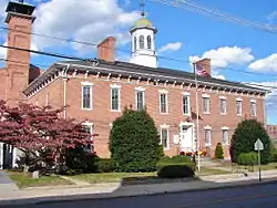
| Franklin County Courthouse | 1 N. Main St., Memorial Square | 1974 |
| Franklin County Jail | NW corner of King and 2nd Sts. | 1970 |
| Gass House | E of Chambersburg off U.S. 30 | 1977 |
| Rocky Spring Presbyterian Church | Rocky Spring Rd., approx. .5 mi (800 m) NW of Funk Rd., | 1994 |
| Masonic Temple | 74 S. 2nd St. | 1976 |
| Memorial Fountain and Statue | Memorial Square | 1978 |
| Townhouse Row | 57–85 North Main Street | 1978 |
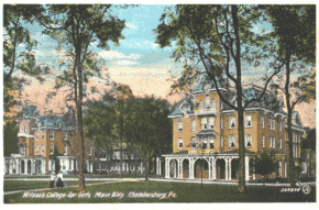
| Wilson College | 1015 Philadelphia Ave. (550 acres (220 ha), 17 buildings) | 1995 |
| Zion Reformed Church | S. Main and W. Liberty Sts. | 1979 |
Historic images
Colorized photographs taken from a series of 22 postcard views mailed in 1921.[56]
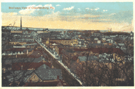 Birds eye view of the borough.
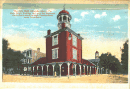 City Hall
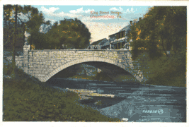 King Street Bridge.
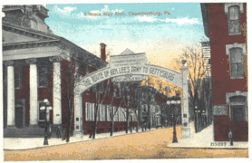 View of the "Lincoln Way Arch" on the Diamond.
Geography
| External video | |
|---|---|
 | |
According to the United States Census Bureau, Chambersburg has a total area of 6.8 square miles (17.6 km2), all land. The elevation is 617 feet (188 m) above sea level.[58] Chambersburg is located in the Cumberland Valley next to the Appalachian Mountains. It also sits right outside of Caledonia State Park, a 1,125-acre (455 ha) park with fishing and hunting areas and hiking trails, including a section of the Appalachian Trail. Also outside of Chambersburg is Michaux State Forest, a 85,000-acre (34,000 ha) forest. Both of these places provide recreation for residents.
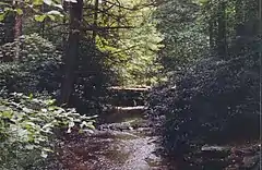
Conococheague Creek, a noted trout stream, runs through the center of town. It is a tributary of the Potomac River. The northernmost reach of the Potomac watershed is a few miles north of town.
Chambersburg has a cold climate, according to the United States Department of Energy.[59][60] The area receives anywhere from 38 to 42 inches (970 to 1,070 mm) of precipitation per year.[61] Chambersburg falls within the warmest part of the Humid Continental Climate with some characteristics in the summer of a Humid Subtropical Climate, but bears much more characteristics of the former. The average January low is 20 °F (−7 °C) and the average high is 37 °F (3 °C). The average July high is 85 °F (29 °C) and the average low is 62 °F (17 °C).[62]
Demographics
| Historical population | |||
|---|---|---|---|
| Census | Pop. | %± | |
| 1810 | 1,304 | — | |
| 1830 | 2,783 | — | |
| 1840 | 3,239 | 16.4% | |
| 1850 | 3,335 | 3.0% | |
| 1860 | 5,255 | 57.6% | |
| 1870 | 6,308 | 20.0% | |
| 1880 | 6,877 | 9.0% | |
| 1890 | 7,863 | 14.3% | |
| 1900 | 8,864 | 12.7% | |
| 1910 | 11,800 | 33.1% | |
| 1920 | 13,171 | 11.6% | |
| 1930 | 13,788 | 4.7% | |
| 1940 | 14,852 | 7.7% | |
| 1950 | 17,212 | 15.9% | |
| 1960 | 17,670 | 2.7% | |
| 1970 | 17,315 | −2.0% | |
| 1980 | 16,174 | −6.6% | |
| 1990 | 16,647 | 2.9% | |
| 2000 | 17,862 | 7.3% | |
| 2010 | 20,268 | 13.5% | |
| 2019 (est.) | 21,143 | [4] | 4.3% |
| Sources:[63][64][65][66] | |||
As of the census[65] of 2000, there were 17,862 people, 7,722 households, and 4,386 families residing in the borough. The population density was 2,601.3 people per square mile (1,003.9/km2). There were 8,305 housing units at an average density of 1,209.5 per square mile (466.8/km2). The racial makeup of the borough was 86.43% White, 7.56% African American, 0.18% Native American, 0.87% Asian, 0.05% Pacific Islander, 3.08% from other races, and 1.83% from two or more races. Hispanic or Latino of any race were 6.38% of the population.
There were 7,722 households, out of which 24.1% had children under the age of 18 living with them, 41.2% were married couples living together, 11.7% had a female householder with no husband present, and 43.2% were non-families. 37.5% of all households were made up of individuals, and 16.8% had someone living alone who was 65 years of age or older. The average household size was 2.16 and the average family size was 2.83.
In the borough the population was spread out, with 20.8% under the age of 18, 9.1% from 18 to 24, 26.8% from 25 to 44, 20.6% from 45 to 64, and 22.7% who were 65 years of age or older. The median age was 40 years. For every 100 females, there were 81.7 males. For every 100 females age 18 and over, there were 77.1 males.
The median income for a household in the borough was $32,336, and the median income for a family was $40,352. Males had a median income of $31,803 versus $21,548 for females. The per capita income for the borough was $19,278. About 9.8% of families and 12.9% of the population were below the poverty line, including 18.3% of those under age 18 and 9.1% of those age 65 or over.
The population stood at 7,863 in 1890; 8,864 in 1900; 11,800 in 1910; 13,171 in 1920; and 14,852 in 1940. It was estimated to be around 18,000 people in January 2008.
Economy
The surrounding area has a large farming population, including many Amish and Mennonite families. Franklin County's largest crop is corn (maize) with 579 farms that cover 29,916 acres (12,107 ha) of land. Franklin also has 344 wheat farms and 299 barley farms which combined cover 14,063 acres (5,691 ha).[67] Manufacturing in Chambersburg includes machinery production, metal fabrication, and food processing according to the 1997 Economic Census of Franklin County.[68] The largest sectors by payroll were manufacturing companies such as T B Wood's Inc., Manitowoc cranes, retail trade, and health care and social assistance. Despite suburban growth, much of the economy of the area is still largely based on agriculture.[37]
Retail stores such as Wal-Mart and Lowe's serve the population with jobs and basic needs. The Chambersburg Mall with one anchor store and about thirty-three vacant stores is located in the unincorporated village of Scotland, about four miles (6 km) north of town on Interstate 81.[69] Chambersburg's retail sector has grown quickly since 2006 with the opening of Target, Petsmart, Michaels, and Kohls near the newly built Exit 17 of Interstate 81. Several restaurants new to the region have also opened, including Sonic, Starbucks, T.G.I. Fridays, Red Robin, Fuddruckers, Ruby Tuesday, Panera Bread, Chipotle, Texas Roadhouse, Olive Garden, and Longhorn Steakhouse.
Chambersburg's 5 largest employers, according to the Borough's Consolidated Annual Financial Report were in 2017: Summit Health Services/Chambersburg Hospital with 3,600 employees, the Chambersburg Area School District with 1,125 employees, Menno Haven retirement community with 705 employees, Franklin County government with 690 employees, and Ventura Foods with 630 employees[70]
The city's location on Interstate 81 within 100 miles (160 km) of both Washington, D.C. and Baltimore, Maryland encourages trucking and distribution businesses.[71] The Letterkenny Army Depot five miles (8 km) north of town is a major employer. Camp David also employs Chambersburg residents. In 2004 Chambersburg had a per capita personal income (PCPI) of $28,208, below the national average of $33,050.[72]
Culture
Chambersburg is part of small town America. Recreation includes hunting, sports events such as baseball games at Henninger Field, and high school football games. The town also hosts a professional football team, the Chambersburg Cardinals, that plays in the Gridiron Developmental Football League. People in the area speak in Pittsburgh English or with a Central Pennsylvania accent, over-pronouncing "O's" and "I's". Caledonia State Park provides an area for outdoor activities, with the park especially busy on July 4.
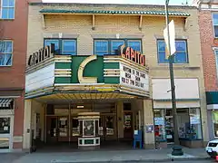
The Capitol Theatre was opened as a movie palace on Main Street in 1927. In 2003, it reopened as the Capitol Theatre Center and is home to the Capitol Theatre Main Stage and Auditorium, Chambersburg Council for the Arts, Caledonia Theatre Company, Chambersburg Ballet Theatre School, and Chambersburg Community Theatre.[73] In 2009, Chambersburg ranked among Newsmax magazine's list of the "Top 25 Most Uniquely American Cities and Towns," a piece written by current CBS News travel editor Peter Greenberg. In determining his ranking, Greenberg cited the Capitol Theatre.[74]
Wilson College is home to the Cumberland Valley School of Music, a local school offering private instruction on various musical instruments. It offers a wide range of lessons, classes, workshops, and summer camps, as well as presenting numerous recitals and concerts in Thomson Hall. CVSM sponsors a children's chorus (the Cumberbunds), a community band, a community orchestra, a concert jazz band, and the New Horizons Band, for adults age 50 or older.
Journalist David Brooks in 2001 used Chambersburg and Franklin County to typify Republican "Red America." According to Brooks, there is little obvious income inequality and people don't define their place in society by their income level. They value the work ethic and are anti-union, anti-welfare, pro-free market, and religious social conservatives.
The joke that Pennsylvanians tell about their state is that it has Philadelphia on one end, Pittsburgh on the other, and Alabama in the middle. Franklin County is in the Alabama part . . . . The local culture owes more to Nashville, Houston, and Daytona than to Washington, Philadelphia, or New York . . . The conservatism I found in Franklin County is not an ideological or a reactionary conservatism. It is a temperamental conservatism. People place tremendous value on being agreeable, civil, and kind . . . They value continuity and revere the past.[75]
Government
The municipal government operates under the Pennsylvania Borough Code, with the Town Council holding both legislative and executive authority. The ten council members are elected from five wards; two from each ward with staggered four-year terms. The Mayor administers the Police Department and can cast tie-breaking votes on the Council. Other departments are administered by the Borough Manager. The current Borough Manager is Jeffrey Stonehill.[76][77]
Walter Bietsch became Mayor on January 2, 2018.[78]
As of January 2020, the town council members are:
Sharon A. Bigler, 4th Ward (D)
Amer Chaudhry, 4th Ward (D)
Allen B. Coffman, 1st Ward (R)
Barbara Beattie, 3rd Ward (D)
Alice C. Elia, 1st Ward (D)(Council President)
Bill Everly, 5th Ward (R)
John Huber, 2nd Ward (R)
Kathy J. Leedy. 3rd Ward (D)
Mike Herbert, 2nd Ward (R) (Council Vice President)
Heath E. Talhelm, 5th Ward (D)
Chambersburg is part of the 13th Congressional District of Pennsylvania and represented by John Joyce (R) in the House of Representatives, and by Pat Toomey (R), and Bob Casey, Jr.(D) in the Senate.[79]
Schooling and Education
Wilson College
Wilson College is a private, Presbyterian-related, liberal arts college founded in 1869 as a women's college and named for its first major donor, Sarah Wilson of Chambersburg. The college has about 800 undergraduate students and is known for its Women With Children, Veterinary Medical Technician, and Equestrian programs. Once an all women's school, it began admitting male students in 2013. In 2009, the school opened the first "green" campus building, housing the science and technology department and featuring a full-length waterfall which begins on the third floor and ends in the building's basement.
Public schools
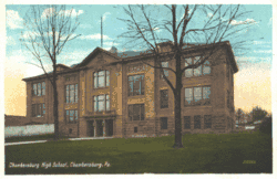
Chambersburg Area Senior High School (CASHS) is a public school with around 2,400 students in grades 9–12, drawn from the borough of Chambersburg and the surrounding townships of Hamilton, Greene, Lurgan, Letterkenny and Guilford. CASHS is accredited by the Middle States Association and has occupied its current facilities since 1955. Principal Dr. Barry Purvis was recognized as the 2006 High School Principal of the Year by the Pennsylvania Association of Elementary and Secondary School Principals.[80]
Until August 2011, J. Frank Faust Junior High School was the only public junior high school for eighth and ninth grade students of the Chambersburg Area School District. It served about 1400 students. J. Frank Faust is now a middle school for Chambersburg area students in the north. CAMS NORTH. It has 6th through 8th grade.
Chambersburg Area Middle School SOUTH was the only middle school, but as of August 2011, it became CAMS SOUTH, 6th through 8th grade. During the 2001–02 school year, CAMS was recognized with the Blue Ribbon School Award of Excellence by the United States Department of Education,[81] the highest award an American school can receive.[82][83]
The Franklin County Career and Technology Center is also located in Chambersburg. FCCTC is a school designated for students and adults to learn vocational trades while still learning core subjects in school. The school offers training in about 20–30 different concentrations. There are currently six different school districts with students attending FCCTC: Chambersburg, Fannett-Metal, Greencastle-Antrim, Shippensburg, Tuscarora, and Waynesboro.[84]
The Chambersburg school district includes seventeen elementary schools. Many school are being upgraded, rebuilt, or closed because of out-of-date buildings and lack of space. As of July 2008, the current School Board President is Stanley Helman. Other members include Anne Boryan, Renee Sharpe, Norman Blowers, Lori Leedy, Fred Rice, Dave Schiamanna, and Joe Tosten. One seat is currently being filled after the resignation of the previous board president, Dr. Thomas Orndorff. [85]
Scotland School for Veterans' Children
The Scotland School for Veterans' Children (SSVC) was a state owned school that offered tuition-free residential education for children of Pennsylvania residents who are veterans or are currently serving in the U.S. armed forces.[86] Scotland School was founded in 1863 after two orphaned children begging for food knocked on the door of Pennsylvania's governor, Andrew Gregg Curtin of Centre County north of Chambersburg. Governor Curtin and his wife realized the orphaned children of Pennsylvania's many soldiers had been forgotten. He established 70 'Soldier's Orphan Schools' across the state. Over time, the number of eligible students declined, and in 1895 all of the schools closed except that located in the unincorporated village of Scotland about four miles (6 km) north of Chambersburg. The name was changed to Scotland School for Veteran's Children, then the Pennsylvania Soldiers Orphans Industrial School, and eligibility criteria changed to provide an education to any child of any veteran, whether that veteran was living or deceased (so the school's founding date is sometimes 1895). It had about 300 students in grades 3–12, annually. More than 10,000 students were educated at the school before it closed in 2009, when Pennsylvania's legislators concurred in the decision of Governor Ed Rendell to remove funding.[87] The 186-acre (75 ha) campus contains about 70 buildings including residential cottages.[88]
Private schools
Private schools include Corpus Christi, a Catholic school with 310 students and over 20 teachers[89] and Cumberland Valley Christian School, a private Christian kindergarten through twelfth grade academy located in Chambersburg. Cumberland Valley Christian School is affiliated with the Open Door Church and has approximately four hundred students. Other private schools include the Montessori Academy of Chambersburg (22 months-12th grade, non-sectarian[90]) and Shalom Christian Academy (K-12, Mennonite affiliation) a pre-K through twelfth grade academy with approximately five hundred students, and several elementary schools with Mennonite, Baptist, Brethren, Christian Science, and other religious orientations.[91]
Library
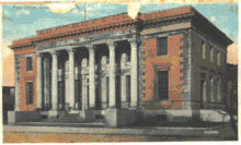
Coyle Free Library[92] has roots going back to 1891,[93] when a library of 166 books was organized by the local Afternoon Club. A member of the club, Blanche Coyle, left a bequest of $30,435 in 1915 to construct a library building. The building was completed in 1924, located at the corner of Second and Queen Streets. Later the library was made part of the Franklin County Library and began to receive funds from the County and State, though the Afternoon Club still donated funds through at least 1979. The building it currently occupies is a former post office.
Home schooling and virtual learning
With the COVID pandemic virtual learning has become the new norm, Chambersburg has taken many precautions to protect and look after the wellbeing of their students, Chambersburg would be one of the first town to put a lockdown on schools and would spend tens of thousands of dollars to supply each student with a laptop.
Media
Newspapers
The Chambersburg Public Opinion is the only daily newspaper published in town, and has weekday circulation about 17,000. It was founded in 1869 and is now owned by Gannett.[94]
Television and radio
Franklin County is in the Harrisburg-Lancaster-York television market. Television reception can be poor because of the surrounding mountains. Harrisburg PBS station WITF-TV rebroadcasts via low-powered translator W34FM-D. All Harrisburg TV stations are available off air and on cable. WHTM is the first network affiliated television station to establish a bureau in Chambersburg. WDVM-TV and WWPB broadcast from nearby Hagerstown, Maryland.
Chambersburg shares a radio market, the 165th largest in the United States, with Waynesboro, Pennsylvania, and Hagerstown, Maryland.[95]
Shopping and Restaurants
With the population of chambersburg on a steady increase it’s no surprise there would be many stores which include’s, Target, Walmart, 2 Giants, 2 CVS/Pharmacy’s, Dick’s sporting goods, Ollies, Petco, Petsmart, Aldi‘s, Walgreens, Gamestop, etc)
Chambersburg also has many restaurants such as the chambersburg diner, McDonald’s, Wendy’s, Burger King, Five guys, Chick-fil-A, Red Robin, chipotle, Texas road house, Dairy Queen, subway, etc)
We also have many smaller stores with in town such as Nerdvana who have there very own D&D brand of figures, with in town there is a large Variety of coffee and Tea shops, There is also many central and South American restaurants located all through town, we also in chambersburg have many art based stores, we also have many thrift shops with in town.
Sister city
Template:Chambersburg doesn’t have a sister city but with Franklin county’s population on the rise there definitely may come a sister city in the near future
Notable people
.jpg.webp)
- Betty Andujar, Texas politician
- D. Dudley Bloom, United States Navy officer and American businessman
- George K. Brady, United States Army officer. Briefly commander of the Department of Alaska.
- Ike Brookens, MLB player in 1975 with the Detroit Tigers.
- Tom Brookens, MLB player from 1979–1990, played third-base for the 1984 World Series Champion Detroit Tigers
- Margaret Corbin, Revolutionary War soldier known as "Captain Molly", although sometimes confused with Philadelphia's "Molly Pitcher"
- Martin Delany, Abolitionist publisher who in 1865 became the first African-American field officer in the U.S. Army, was educated in Chambersburg in the 1830s.
- Gus Dorner Major League Baseball pitcher (1902–1909).
- Ludwig Denig, folk artist and apothecary[97]
- Henry Burchard Fine (1858–1928) was a dean at Princeton University and mathematician.
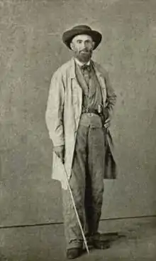
- Patrick Gass (1771–1870), the last surviving member of the Lewis and Clark expedition, was born just outside Chambersburg (Falling Spring).
- Kenton Harper, Virginia newspaper editor and Confederate army general during the Civil War, born and raised in Chambersburg
- John Grier Hibben, later President of Princeton University, served as pastor of Falling Spring Presbyterian Church, 1888–1891.
- Stephen D. Houston, a renowned Mayanist scholar, epigrapher, and anthropologist was born in Chambersburg in 1958.
- John Hughes, archbishop of the Roman Catholic Archdiocese of New York lived in Chambersburg between 1817 and 1819 before going on to Mount St. Mary's University. His family is buried at the Corpus Christi Church Cemetery in Chambersburg.
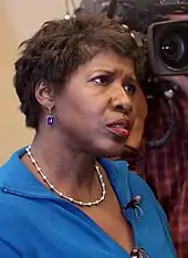
- Gwen Ifill (1955 – 2016) Journalist and author spent a portion of her childhood in Chambersburg while her father was pastor at St. James A.M.E. Church.
- Alexander McClure, editor of the Franklin Repository from 1852–1864
- Abraham Stouffer, settler, miller and founder of Stouffville, Ontario, Canada
- David Fullerton Robison, a U.S. Representative, who in 1859 died of National Hotel disease, was born here
- Frank Thomson, sixth president of the Pennsylvania Railroad
- Zelda Wynn Valdes, fashion designer and credited by some to be the creator of the original Playboy Bunny costume. Born in Chambersburg as Zelda Christian Barbour but grew up in Charlotte, North Carolina.
- Joseph Winters an African-American inventor and abolitionist, moved to Chambersburg in 1830
- Lil Skies, Hip Hop artist, born in Chambersburg on August 4, 1998
- The Shackeltons, Post-Punk band formed in 2004
- Steven Fogarty, professional ice hockey player drafted by the New York Rangers in the third round of the 2011 NHL Entry Draft.
See also
References
- "Mayor's Office - Borough of Chambersburg". borough.chambersburg.pa.us.
- "2019 U.S. Gazetteer Files". United States Census Bureau. Retrieved July 28, 2020.
- "Chambersburg". Geographic Names Information System. United States Geological Survey. Retrieved April 25, 2007.
- "Population and Housing Unit Estimates". United States Census Bureau. May 24, 2020. Retrieved May 27, 2020.
- Table 4: Annual Estimates of the Population for Incorporated Places in Pennsylvania, Listed Alphabetically: April 1, 2000 to July 1, 2008 Archived March 27, 2010, at the Wayback Machine, U.S. Census Bureau, 2009. Retrieved July 1, 2009.
- Table 1: Annual Estimates of the Resident Population for Counties of Pennsylvania: April 1, 2000 to July 1, 2008, U.S. Census Bureau, 2009. Retrieved July 1, 2009.
- "War Comes Home, Chambersburg 1864". The Valley of the Shadow. Archived from the original on July 13, 2007. Retrieved September 21, 2007.
- Morvay, Joanne E. (January 13, 2005). "Chambersburg's rich war history, Pa. town rebuilt after burning in the Civil War". Hartford Courant. Retrieved October 31, 2008.
- Bates 1887, pp. 140–143
- Paul Marr (2002). "SHIPPENSBURG AND THE DEVELOPMENT OF OVERLAND TRANSPORTATION IN THE CUMBERLAND VALLEY, PENNSYLVANIA IN THE 1700s" (PDF). Middle States Geographer. 35: 101–109.
- John R. Schein, Jr. and Ray C. Hearne (July 31, 1980). "National Register of Historic Places Inventory-Nomination: Chambersburg Historic District" (PDF). National Park Service. Archived from the original (PDF) on April 15, 2012.
- Chisholm, Hugh, ed. (1911). . Encyclopædia Britannica. 5 (11th ed.). Cambridge University Press. p. 822.
- Bates 1887, pp. 139–140
- Garrard 1856, p. 12
- Chambers 1856, pp. 122–125
- Biographical Annals of Franklin County, Pennsylvania, Volume 1. Heritage Books. 2007. ISBN 978-0-7884-3738-0.p. 3
- "History". borough.chambersburg.pa.us. Archived from the original on September 28, 2007. Retrieved September 21, 2007.
- Bates 1887, pp. 159–175 Chapter III, Indian War
- "The French and Indian War in Pennsylvania". explorepahistory.com. Retrieved September 21, 2007.
- "Franklin County, Pennsylvania USGENWEB Project". Kittochtinny Historical Society. Archived from the original on August 21, 2008. Retrieved September 21, 2007.
- Garrard 1856, pp. 22–31
- "The Point: Indian Trails to Fort Duquesne". The Carnegie Library of Pittsburg. Archived from the original on October 5, 2007. Retrieved 2007-09-21.
- Bates 1887, pp. 170–175
- Bates 1887, p. 452
- Garrard 1856, p. 13
- M'Cauley 1878, pp. 38
- "Zion Reformed Church". Zion Reformed Church. Archived from the original on August 8, 2007. Retrieved September 21, 2007.
- Jeanne .B. Williams (1996). "The African Methodist Episcopal Church Moves into Central Pennsylvania" (PDF). Lycoming.edu. p. 2.
- McCarthy, Timothy Patrick; Stauffer, John (March 13, 2012). Prophets Of Protest: Reconsidering The History Of American Abolitionism. New Press, The. p. 170. ISBN 9781595588548. Retrieved March 30, 2019 – via Google Books.
- Garrard 1856, pp. 39–42
- Garrard 1856, p. 45
- Bates 1887, pp. 180,625
- Garrard 1856, pp. 48–49
- Baldwin, Leland Dewitt (1968). Whiskey rebels: the story of a frontier uprising. University of Pittsburgh Press. p. 208. ISBN 9780822951513.
- "The Papers of George Washington". University of Virginia. Archived from the original on November 15, 2009. Retrieved July 15, 2009.
- Bates 1887, pp. 180
- "Franklin County". Pennsylvania State Archives. Archived from the original on August 2, 2007. Retrieved August 4, 2009.
- "Historical Sites". chambersburg.biz. Archived from the original on August 22, 2007. Retrieved 2007-09-21.
- "Historic Pictures". Franklin County – Kittochtinny Historical Society. Archived from the original on June 7, 2009. Retrieved June 25, 2009.
- "Collection of letters from Chambersburg, Familytales.org". Archived from the original on June 7, 2007. Retrieved February 26, 2008.
- "John Brown House". nps.gov. Retrieved September 21, 2007.
- "Excerpt from The Life and Times of Frederick Douglass pp. 350–354". Reprint New York: Pathway Press. 1941. Retrieved September 21, 2007.
- "Map of Stuart's Raid". ExplorePaHistory.com. Retrieved October 12, 2012.
- "Stuart's Raid". ExplorePaHistory.com. Retrieved October 12, 2012.
- "The Gettysburg Campaign". civilwarhome.com. Retrieved September 21, 2007.
- "Geology and the Gettysburg Campaign" (PDF). Pennsylvania Department of Conservation and Natural Resources. 1962. Retrieved September 21, 2007.
- "Chambersburg War Damages". www.portal.state.pa.us. March 19, 1866. Archived from the original on February 10, 2015. Retrieved May 5, 2015.
- "Franklin County: "The Burning of Chambersburg,"". valley.vcdh.virginia.edu. August 27, 1870. Archived from the original on July 13, 2007. Retrieved September 21, 2007.
-
Davis, Jefferson (1990) [1881, published by D. Appleton and Company]. Rise and Fall of the Confederate Government (Volume II). New York: Da Capo Press. pp. 532–533. ISBN 0-306-80418-2.
Chambersburg, Pennsylvania.
- "Burning of Chambersburg". explorepahistory.com. Retrieved February 21, 2012.
- Burning of Chambersburg Historical Marker
- Alexander, Ted (September 2001). "A Regular Slave Hunt" (PDF). North & South. p. 88. Archived from the original (PDF) on April 29, 2015. Retrieved April 29, 2015.
- Liva Baker (August 1973). "Burning of Chambersburg". American Heritage Magazine. Archived from the original on September 29, 2007. Retrieved September 21, 2007.
- Douglas Southall Freeman, Lee's Lieutenants (abridged 1-volume version edited by Stephen W. Sears) (Scribner 1998) p. 745
- "National Register of Historic Places". NationalRegisterofHistoricPlaces.com. Retrieved September 21, 2007.
- "Chambersburg historic sites". Franklin County Historical Society. Archived from the original on December 22, 2013. Retrieved December 20, 2013.
- "Chambersburg, Pennsylvania". epodunk.com. Archived from the original on June 30, 2017. Retrieved September 21, 2007.
- "Building America" (PDF). eere.energy.gov. Archived from the original (PDF) on August 10, 2007. Retrieved September 21, 2007.
- "Climate Regions". eere.energy.gov. Retrieved September 21, 2007.
- "Average Annual Precipitation". ocs.orst.edu. Archived from the original on September 11, 2007. Retrieved September 21, 2007.
- "Chambersburg, Pennsylvania". Weather.com. Archived from the original on May 22, 2011. Retrieved September 21, 2007.
- "Number of Inhabitants: Pennsylvania" (PDF). 18th Census of the United States. U.S. Census Bureau. Retrieved November 22, 2013.
- "Pennsylvania: Population and Housing Unit Counts" (PDF). U.S. Census Bureau. Retrieved November 22, 2013.
- "U.S. Census website". United States Census Bureau. Retrieved 2008-01-31.
- "Annual Estimates of the Resident Population". U.S. Census Bureau. Archived from the original on November 20, 2013. Retrieved November 22, 2013.
- "Pennsylvania Crop Map". Purdue University. Retrieved September 21, 2007.
- "1997 Economic Census Summary Statistics for Franklin County, PA". census.gov. Archived from the original on July 22, 2014. Retrieved September 21, 2007.
- "Chambersburg Mall". Chambersburg Mall website. Retrieved September 21, 2007.
- "The Borough of Chambersburg, Pennsylvania : Financial Report for the Year 2017" (PDF). Boroough.chambersburg.pa.us. Retrieved March 30, 2019.
- David Brooks, One Nation, Slightly Divisible; The Atlantic Monthly; December 2001; Volume 288, No. 5; 53–65.
- "Franklin County, PA". Bureau of Economic Analysis. Archived from the original on September 29, 2006. Retrieved September 21, 2007.
- "A Cultural Centerpiece: Chambersburg's Capitol Theatre". Hagarstown Magazine. Archived from the original on July 13, 2011. Retrieved 2008-03-08.
- Greenberg, Peter. "Newsmax Magazine Rates the Top 25 Most Uniquely American Cities And Towns". Retrieved January 16, 2014.
- David Brooks, One Nation, Slightly Divisible, The Atlantic Monthly, December 2001.
- "Appointed Officials". Borough of Chambersburg. Retrieved May 27, 2018.
- "Structure". Borough of Chambersburg. Archived from the original on September 28, 2007. Retrieved September 21, 2007.
- "Mayor's Office". Borough of Chambersburg. Retrieved May 27, 2018.
- "Town Council Directory". Borough of Chambersburg. Retrieved May 27, 2018.
- "Dr. Barry Purvis of CASHS named state High School Principal of the Year". thegazettenews.com. February 15, 2006. Archived from the original on September 29, 2007. Retrieved September 21, 2007.
- Blue Ribbon Schools Program: Schools Recognized 1982–1983 through 1999–2002 (PDF) Archived March 26, 2009, at the Wayback Machine, accessed May 11, 2006
- CIBA cited as one of the best by Education Department Archived August 19, 2007, at the Wayback Machine, Journal Inquirer, November 16, 2006. "The Blue Ribbon award is given only to schools that reach the top 10 percent of their state's testing scores over several years or show significant gains in student achievement. It is considered the highest honor a school can achieve."
- Viers Mill School Wins Blue Ribbon; School Scored High on Statewide Test; The Washington Post. September 29, 2005 "For their accomplishments, all three schools this month earned the status of Blue Ribbon School, the highest honor the U.S. Education Department can bestow upon a school."
- "Archived copy". Archived from the original on June 7, 2010. Retrieved November 2, 2010.CS1 maint: archived copy as title (link) accessed November 2, 2010
- CASD Webpage Archived April 22, 2008, at the Wayback Machine accessed May 29, 2008.
- "Scotland School for Veteran's Children". Scotland School for Veteran's Children website. February 15, 2006. Retrieved September 21, 2007.
- Frame, C. Frank (2009). "Foundation For Scotland School For Veterans' Children". Foundation web site. Foundation For Scotland School For Veterans' Children. Archived from the original on June 19, 2010. Retrieved 2010-11-22.
It is with a sad heart and a deep sense of loss that we must announce that the Scotland School for Veterans' Children, a 114-year-old veterans' benefit, is closing. As you may know Governor Edward G. Rendell did not fund the school in this year's budget and the legislature upheld that position in their budget approval.
- "Corpus Christi school website". Corpus.pa.net.
- "Montessori Academy of Chambersburg". Montessori Academy of Chambersburg. Retrieved March 30, 2019.
- Private Schools in Chambersburg PA accessed March 24, 2007.
- Coyle Free Library Archived October 12, 2006, at the Wayback Machine
- Manuscript from the Coyle Free Library, Our Library Roots and Branches, Jane K. Schleicher, Librarian, November 7, 1979 accessed March 25, 2007. Archived September 29, 2007, at the Wayback Machine
- Public Opinion About Us: Public Opinion: Part of life in the Cumberland Valley Archived September 8, 2012, at Archive.today
- Market Ranks and Schedules 151–200, Arbitron, Fall 2007, Retrieved March 22, 2008.
- "International Exchange". List of Affiliation Partners within Prefectures. Council of Local Authorities for International Relations (CLAIR). Archived from the original on January 13, 2016. Retrieved November 21, 2015.
- Gerard C. Wertkin (August 2, 2004). Encyclopedia of American Folk Art. Routledge. ISBN 978-1-135-95614-1.
Sources
- Alexander, Ted. Southern Revenge!: Civil War History of Chambersburg, Pennsylvania (White Mane Publishing Company, 1989).
- Coddington, Edwin B. "Prelude to Gettysburg: The Confederates Plunder Pennsylvania." Pennsylvania History 30.2 (1963): 123-157. online
- Smith, Everard H. "Chambersburg: Anatomy of a Confederate Reprisal." American Historical Review 96#2 (1991): 432-455 in JSTOR on 1863
- Bates, Samuel P. (1887). History of Franklin County. Chicago: Warner, Beers, & Co.
- Chambers, George (1856). Tribute to the Principles, Virtues, Habits, and Public Usefulness, of the Irish and Scotch Early Settlers of Pennsylvania. Chambersburg.
- Chambersburg Community Development Committee (1945). Chambersburg, Its Record and Its Prospects. Chambersburg: Greater Chambersburg Chamber of Commerce. p. 165.
- "Franklin County Historical Society – Kittochtinny". Retrieved June 25, 2009.
- Garrard, Lewis Hector (1856). Chambersburg in the Colony and the Revolution: A Sketch. Philadelphia: J.B. Lippincott.
chambersburg.
- M'Cauley, I.H. (1878). Historical Sketch of Franklin County, Pennsylvania. Chambersburg.
- Images of America: Chambersburg, Maurice Leonard Marotte III & Janet Kay Pollard (Arcadia, 2005)
External links
| Wikivoyage has a travel guide for Chambersburg. |
| Wikimedia Commons has media related to Chambersburg, Pennsylvania. |
- Official website
- Public Opinion – local newspaper
- Chambersburg Chamber of Commerce
- Franklin County Historical Society-Kittochtinny
- The Burning of Chambersburg
- The Old Jewish Cemetery of Chambersburg
- Council For The Arts
- CASHS Official Link
- CAMS Official Link
- The transcribed 1880 diary of William Zumbro, age 17, of Chambersburg, PA.
Municipalities and communities of Franklin County, Pennsylvania, United States | ||
|---|---|---|
| Boroughs | 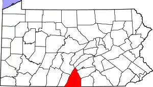 | |
| Townships | ||
| CDPs | ||
| Unincorporated communities |
| |
| Footnotes | ‡This populated place also has portions in an adjacent county or counties | |
| ||

| Authority control |
|---|