National Register of Historic Places listings in eastern Cincinnati
This is a list of the National Register of Historic Places listings in eastern Cincinnati, Ohio.
This is intended to be a complete list of the properties and districts on the National Register of Historic Places in eastern Cincinnati, Ohio, United States. Eastern Cincinnati is defined as being all of the city outside of downtown and east of Vine Street.[a] The locations of National Register properties and districts may be seen in an online map.[1]
There are 273 properties and districts listed on the National Register in Cincinnati, including 12 National Historic Landmarks. Eastern Cincinnati includes 124 of these properties and districts, including 4 National Historic Landmarks; the city's remaining properties and districts are listed elsewhere. Another property in eastern Cincinnati was once listed but has been removed.
- This National Park Service list is complete through NPS recent listings posted January 29, 2021.[2]
Current listings
| [3] | Name on the Register[4] | Image | Date listed[5] | Location | Description |
|---|---|---|---|---|---|
| 1 | The Alameda Flats | 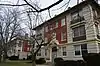 The Alameda Flats |
June 4, 2014 (#14000293) |
3580-3586 Reading Rd. 39°08′50″N 84°29′20″W |
|
| 2 | The Alexandra | 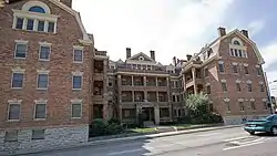 The Alexandra |
October 17, 1997 (#97001223) |
921 E. William H. Taft Rd. 39°07′37″N 84°29′21″W |
|
| 3 | Alms and Doepke Dry Goods Company | 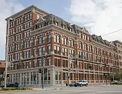 Alms and Doepke Dry Goods Company |
March 3, 1980 (#80003035) |
222 E. Central Parkway 39°06′29″N 84°30′37″W |
|
| 4 | The Ambassador | 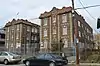 The Ambassador |
June 30, 2014 (#14000356) |
722-724 Gholson Ave. 39°08′57″N 84°29′21″W |
|
| 5 | John S. Baker House | 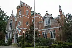 John S. Baker House |
June 6, 1979 (#79001852) |
1887 Madison Rd. 39°07′45″N 84°28′04″W |
|
| 6 | Baldwin Piano Company Building | _(2015-01-30_10.45.07_by_Ohio_Redevelopment_Projects_-_ODSA).jpg.webp) Baldwin Piano Company Building |
February 23, 2016 (#16000043) |
655 Eden Park Dr. 39°07′00″N 84°29′53″W |
|
| 7 | Bates Building | 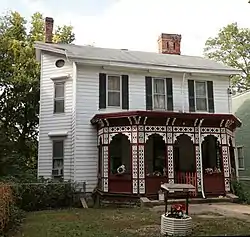 Bates Building |
August 24, 1979 (#79002700) |
3819 Eastern Ave. 39°06′40″N 84°26′08″W |
|
| 8 | Bauer Apartments | 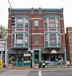 Bauer Apartments |
December 2, 1982 (#82001465) |
2015-2017 Madison Rd. 39°07′55″N 84°27′44″W |
|
| 9 | August Bepler House | 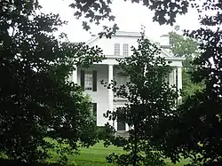 August Bepler House |
April 13, 1977 (#77001062) |
805 Tusculum Ave. 39°06′59″N 84°25′31″W |
|
| 10 | Bernheim House | 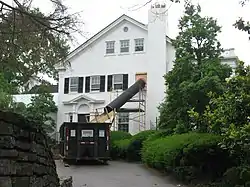 Bernheim House |
March 29, 1983 (#83001977) |
195 Greenhills Rd. 39°07′55″N 84°26′35″W |
|
| 11 | Bon Air Flats | 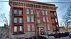 Bon Air Flats |
September 1, 2015 (#15000562) |
615 Maple Ave. 39°08′31″N 84°29′37″W |
|
| 12 | Ayres L. Bramble House | 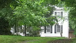 Ayres L. Bramble House |
April 1, 1982 (#82003576) |
4416 Homer Ave. 39°09′06″N 84°23′18″W |
|
| 13 | A. E. Burckhardt House | 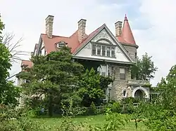 A. E. Burckhardt House |
March 3, 1980 (#80003038) |
400 Forest Ave. 39°08′47″N 84°29′58″W |
|
| 14 | Samuel Burdsal House | 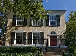 Samuel Burdsal House |
June 10, 1982 (#82003577) |
1342 Broadway St. 39°06′40″N 84°30′30″W |
|
| 15 | C. H. Burroughs House | 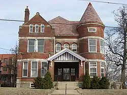 C. H. Burroughs House |
March 3, 1980 (#80003039) |
1010 Chapel St. 39°07′52″N 84°29′15″W |
|
| 16 | Cincinnati Observatory Building | 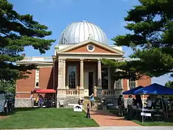 Cincinnati Observatory Building |
March 3, 1980 (#80003043) |
Observatory Pl. 39°08′21″N 84°25′21″W |
|
| 17 | Cincinnati Tennis Club |  Cincinnati Tennis Club |
March 29, 1983 (#83001979) |
Dexter and Wold Aves. 39°08′03″N 84°28′10″W |
|
| 18 | Cincinnati Zoo Historic Structures | 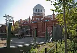 Cincinnati Zoo Historic Structures |
February 27, 1987 (#87000905) |
3400 Vine St. 39°08′39″N 84°30′31″W |
|
| 19 | Clauder's Pharmacy | 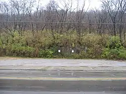 Clauder's Pharmacy |
August 24, 1979 (#79002696) |
4026 Eastern Ave. 39°06′31″N 84°25′56″W |
|
| 20 | Coca-Cola Bottling Corporation | 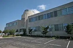 Coca-Cola Bottling Corporation |
July 2, 1987 (#87000985) |
1507 Dana Ave. 39°08′46″N 84°28′42″W |
|
| 21 | Columbia Baptist Cemetery | 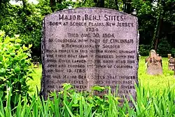 Columbia Baptist Cemetery |
August 24, 1979 (#79002709) |
Northern side of Wilmer Rd. 39°06′22″N 84°25′45″W |
|
| 22 | Jacob D. Cox House | 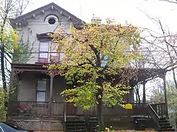 Jacob D. Cox House |
April 14, 1975 (#75001416) |
241-243 Gilman Ave. 39°07′19″N 84°30′19″W |
|
| 23 | The Crescent | 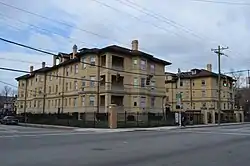 The Crescent |
June 20, 2014 (#14000336) |
3719 Reading Road 39°09′04″N 84°29′14″W |
|
| 24 | Cummins School | 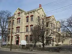 Cummins School |
January 9, 1986 (#86000014) |
824 William H. Taft Rd. 39°07′40″N 84°29′27″W |
|
| 25 | Stephen Decker Rowhouse |  Stephen Decker Rowhouse |
August 24, 1979 (#79002693) |
531-541 Tusculum Ave. 39°06′56″N 84°26′00″W |
|
| 26 | A. M. Detmer House | 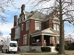 A. M. Detmer House |
March 3, 1980 (#80003046) |
1520 Chapel St. 39°07′51″N 84°28′48″W |
|
| 27 | East Walnut Hills Firehouse | 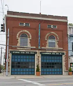 East Walnut Hills Firehouse |
February 17, 1983 (#83001980) |
Madison Rd. and Hackberry St. 39°07′48″N 84°28′28″W |
|
| 28 | Eastern Hills Young Men's Christian Association (YMCA) | .jpg.webp) Eastern Hills Young Men's Christian Association (YMCA) |
December 13, 2016 (#16000847) |
1228 E. McMillan St. 39°07′32″N 84°29′00″W |
|
| 29 | Eastwood Historic District | 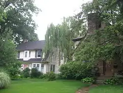 Eastwood Historic District |
February 25, 2005 (#05000093) |
Roughly along Eastwood, Collinwood, Overbrook, Madison and Duck Creek Rds. 39°09′48″N 84°24′39″W |
|
| 30 | Eckert Building | 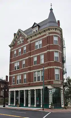 Eckert Building |
September 29, 1983 (#83001981) |
2600 Woodburn Ave. 39°07′38″N 84°28′42″W |
|
| 31 | Eden Park Stand Pipe | 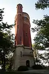 Eden Park Stand Pipe |
March 3, 1980 (#80003048) |
Eden Park Dr. 39°07′02″N 84°29′25″W |
|
| 32 | Eden Park Station No. 7 | 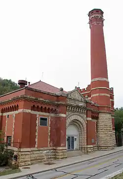 Eden Park Station No. 7 |
March 3, 1980 (#80003049) |
1430 Martin Dr. 39°06′47″N 84°29′28″W |
|
| 33 | Edgecliff |  Edgecliff |
March 3, 1980 (#80003050) |
2220 Victory Parkway 39°07′18″N 84°29′02″W |
|
| 34 | Edgecliff Area Historic Group |  Edgecliff Area Historic Group |
November 11, 1977 (#77001063) |
2220 Victory Parkway 39°07′16″N 84°29′02″W |
|
| 35 | Elsinore Arch |  Elsinore Arch |
March 3, 1980 (#80003052) |
1700 Gilbert Ave. 39°06′47″N 84°29′59″W |
|
| 36 | Walter Field House | 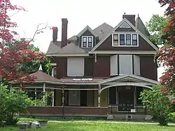 Walter Field House |
March 3, 1980 (#80003053) |
3725 Reading Rd. 39°09′05″N 84°29′11″W |
Shingle Style residence built for businessman; now apartments |
| 37 | First Congregational-Unitarian Church | 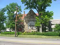 First Congregational-Unitarian Church |
May 28, 1976 (#76001434) |
2901 Reading Rd. 39°07′55″N 84°29′53″W |
|
| 38 | First Universalist Church | 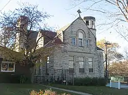 First Universalist Church |
March 3, 1980 (#80003055) |
2600 Essex Pl. 39°07′40″N 84°29′55″W |
|
| 39 | Ford Motor Company Cincinnati Plant | 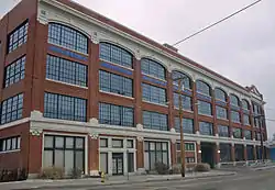 Ford Motor Company Cincinnati Plant |
May 25, 1989 (#89000460) |
660 Lincoln Ave. 39°07′58″N 84°29′36″W |
|
| 40 | Madam Fredin's Eden Park School and Neighboring Row House | 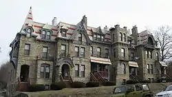 Madam Fredin's Eden Park School and Neighboring Row House |
November 29, 1979 (#79001858) |
938-946 Morris St. and 922-932 Morris St. 39°07′07″N 84°29′40″W |
|
| 41 | Fulton-Presbyterian Cemetery |  Fulton-Presbyterian Cemetery |
August 24, 1979 (#79002706) |
Carrel St. 39°06′24″N 84°25′59″W |
|
| 42 | General Hospital Nurses' Home |  General Hospital Nurses' Home |
June 10, 2005 (#05000581) |
311 Albert Sabin Way 39°08′20″N 84°30′09″W |
|
| 43 | Stephen A. Gerrard Mansion |  Stephen A. Gerrard Mansion |
November 5, 1987 (#87001940) |
748 Betula Ave. 39°09′39″N 84°29′09″W |
|
| 44 | Gilbert Row |  Gilbert Row |
May 13, 1982 (#82003579) |
2152-2166 Gilbert Ave. 39°07′12″N 84°29′39″W |
|
| 45 | Gilbert-Sinton Historic District | 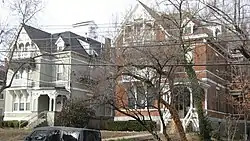 Gilbert-Sinton Historic District |
October 6, 1983 (#83004306) |
Roughly bounded by Morris, Gilbert and Sinton Aves. 39°07′09″N 84°29′37″W |
|
| 46 | Glencoe-Auburn Hotel and Glencoe-Auburn Place Row Houses | 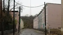 Glencoe-Auburn Hotel and Glencoe-Auburn Place Row Houses |
December 10, 2003 (#03001286) |
Glencoe Place, Leroy Court, View Court 39°07′22″N 84°30′37″W |
|
| 47 | Grace Church | 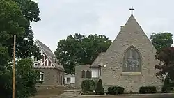 Grace Church |
September 16, 1982 (#82003581) |
3626 Reading Rd. 39°08′53″N 84°29′14″W |
Now known as St. Michael and All Angels Episcopal Church |
| 48 | Gruen Watch Company-Time Hill | 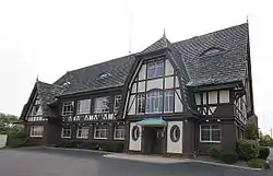 Gruen Watch Company-Time Hill |
February 29, 1996 (#96000219) |
401 E. McMillan St. 39°07′33″N 84°30′06″W |
|
| 49 | Haddon Hall | 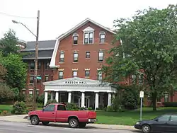 Haddon Hall |
July 22, 1982 (#82003582) |
3418 Reading Rd. 39°08′30″N 84°29′32″W |
|
| 50 | George Hoadley Jr. House | 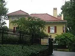 George Hoadley Jr. House |
March 9, 1990 (#90000380) |
2337 Grandin Rd. 39°07′41″N 84°27′10″W |
|
| 51 | Holy Cross Monastery and Chapel | 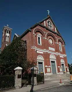 Holy Cross Monastery and Chapel |
September 13, 1978 (#78002078) |
1055 St. Paul Pl. 39°06′27″N 84°29′57″W |
|
| 52 | Hoodin Building |  Hoodin Building |
August 24, 1979 (#79002708) |
3719-3725 Eastern Ave. 39°06′41″N 84°26′09″W |
|
| 53 | Houston House | 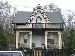 Houston House |
August 24, 1979 (#79002704) |
3708 Mead Ave. 39°06′46″N 84°26′18″W |
|
| 54 | Hyde Park Methodist Episcopal Church | 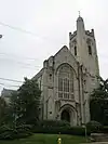 Hyde Park Methodist Episcopal Church |
January 7, 2009 (#08001294) |
1345 Grace Ave. 39°08′12″N 84°25′56″W |
|
| 55 | Ida Street Viaduct | 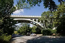 Ida Street Viaduct |
November 28, 1980 (#80003060) |
Ida St. between Monastery and Paradrome Sts. 39°06′32″N 84°29′57″W |
|
| 56 | Immaculate Conception Church, School, and Rectory | 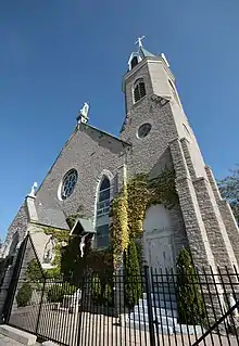 Immaculate Conception Church, School, and Rectory |
December 29, 1978 (#78002079) |
Pavilion and Guido Sts. 39°06′26″N 84°29′46″W |
|
| 57 | Kellogg House | 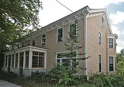 Kellogg House |
August 24, 1979 (#79002702) |
3807 Eastern Ave. 39°06′41″N 84°26′09″W |
|
| 58 | Kestler Building | 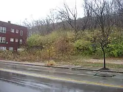 Kestler Building |
August 24, 1979 (#79002695) |
4024 Eastern Ave. 39°06′31″N 84°25′56″W |
|
| 59 | The Kinsey |  The Kinsey |
December 18, 2013 (#13000937) |
2415 Maplewood Ave. 39°07′31″N 84°30′18″W |
|
| 60 | Theodore Krumberg Building | 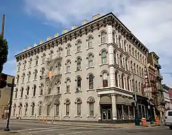 Theodore Krumberg Building |
December 17, 1982 (#82001467) |
1201 Main St. 39°06′32″N 84°30′42″W |
|
| 61 | La Tosca Flats | 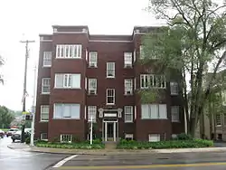 La Tosca Flats |
February 5, 1999 (#99000096) |
2700 Observatory Ave. 39°08′17″N 84°26′33″W |
|
| 62 | Landt Building | 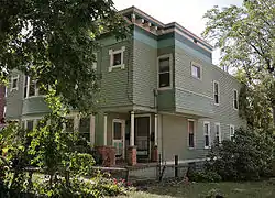 Landt Building |
August 24, 1979 (#79002703) |
3815-3817 Eastern Ave. 39°06′41″N 84°26′08″W |
|
| 63 | Langdon House | 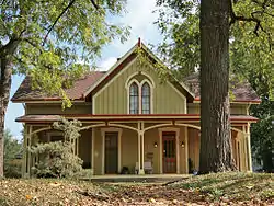 Langdon House |
April 16, 1969 (#69000143) |
3626 Eastern Ave. 39°06′49″N 84°26′14″W |
|
| 64 | Harry Milton Levy House | 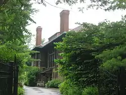 Harry Milton Levy House |
January 30, 1998 (#98000040) |
2383 Observatory Ave. 39°08′17″N 84°27′17″W |
|
| 65 | Lillybanks | 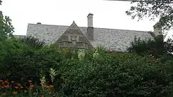 Lillybanks |
July 7, 1983 (#83001982) |
2386 Grandin Rd. 39°07′40″N 84°26′59″W |
|
| 66 | LuNeack House | 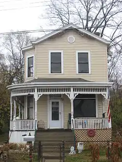 LuNeack House |
August 24, 1979 (#79002705) |
3718 Mead Ave. 39°06′45″N 84°26′18″W |
|
| 67 | Frederick Lunkenheimer House | 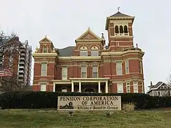 Frederick Lunkenheimer House |
August 8, 1985 (#85001690) |
2133 Luray 39°07′07″N 84°29′18″W |
|
| 68 | Madison and Woodburn Historic District | 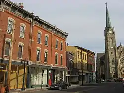 Madison and Woodburn Historic District |
June 30, 1983 (#83001983) |
Woodburn Ave. and Madison Rd. 39°07′45″N 84°28′36″W |
|
| 69 | Madison-Stewart Historic District | 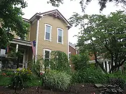 Madison-Stewart Historic District |
May 29, 1975 (#75001419) |
Junction of Madison and Stewart Sts. 39°09′36″N 84°23′53″W |
|
| 70 | Manse Hotel and Manse Hotel Annex | .jpg.webp) Manse Hotel and Manse Hotel Annex |
August 8, 2019 (#100004232) |
916-926 and 1004 Chapel St. 39°07′53″N 84°29′12″W |
|
| 71 | Mardot Antique Shop |  Mardot Antique Shop |
August 24, 1979 (#79002698) |
3964 Eastern Ave. 39°06′32″N 84°25′57″W |
|
| 72 | Martin House |  Martin House |
March 21, 1979 (#79001859) |
6500 Beechmont Ave. 39°05′13″N 84°22′42″W |
|
| 73 | David and Mary May House |  David and Mary May House |
August 22, 1996 (#96000931) |
3723 Washington Ave. 39°09′07″N 84°29′40″W |
|
| 74 | S.C. Mayer House |  S.C. Mayer House |
March 3, 1980 (#80003063) |
1614 Main St. 39°06′47″N 84°30′44″W |
|
| 75 | McKinley School |  McKinley School |
August 24, 1979 (#79002697) |
3905 Eastern Ave. 39°06′35″N 84°26′03″W |
|
| 76 | Mecklenburg's Garden |  Mecklenburg's Garden |
November 7, 1976 (#76001436) |
302 E. University Ave. 39°07′57″N 84°30′10″W |
|
| 77 | Mill & Dunn Historic District | August 29, 2019 (#100004315) |
100-139 Williams St., 119 Lock St., 200-328 Dunn St., 100-200 Mill St., and 209-327 Wyoming Ave. 39°13′26″N 84°27′10″W |
||
| 78 | Mills' Row |  Mills' Row |
April 29, 1977 (#77001065) |
2201-2209 Park Ave. 39°07′13″N 84°29′14″W |
|
| 79 | Richard H. Mitchell House | 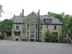 Richard H. Mitchell House |
March 3, 1980 (#80003065) |
3 Burton Woods Lane 39°09′24″N 84°29′14″W |
|
| 80 | Bernard H. Moormann House | 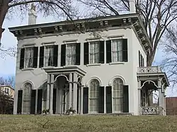 Bernard H. Moormann House |
March 20, 1973 (#73001462) |
1514 E. McMillan St. 39°07′31″N 84°28′38″W |
|
| 81 | Mount Adams Public School | 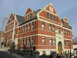 Mount Adams Public School |
November 24, 1980 (#80003066) |
1125 St. Gregory St. 39°06′31″N 84°29′53″W |
|
| 82 | Mount Auburn Historic District | 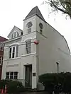 Mount Auburn Historic District |
March 28, 1973 (#73001464) |
Both sides of Auburn Ave. from Ringgold St. to Howard Taft Rd. 39°07′12″N 84°30′30″W |
|
| 83 | Norwell Residence | 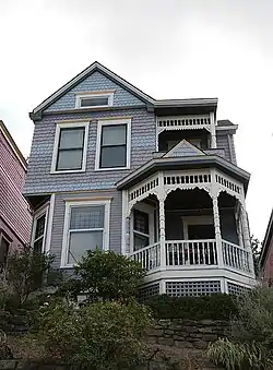 Norwell Residence |
August 24, 1979 (#79002707) |
506 Tusculum Ave. 39°06′53″N 84°26′00″W |
|
| 84 | Observatory Historic District | 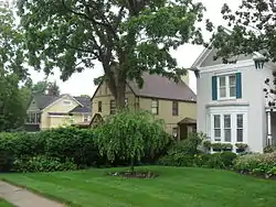 Observatory Historic District |
September 20, 1978 (#78002080) |
Observatory Pl. and Ave. 39°08′18″N 84°25′22″W |
|
| 85 | Old St. Mary's Church, School and Rectory | 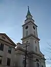 Old St. Mary's Church, School and Rectory |
March 13, 1976 (#76001439) |
123 E. 13th St. 39°06′34″N 84°30′43″W |
|
| 86 | Over-the-Rhine Historic District | 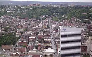 Over-the-Rhine Historic District |
May 17, 1983 (#83001985) |
Roughly bounded by Dorsey, Sycamore, Liberty, Reading, Central Parkway, McMicken Ave., and Vine Sts.; also 308-322, 500-550 Reading Rd., 222 W. 12th St., and 1208, 1416-1430, 1544, 1600, 1628, and 1900 Central Parkway 39°06′52″N 84°30′54″W |
Extends into western Cincinnati. Second set of addresses represents a boundary increase of June 13, 2014. |
| 87 | Park Flats |  Park Flats |
September 8, 1983 (#83001986) |
2378-2384 Park Ave. 39°07′32″N 84°29′10″W |
|
| 88 | Peeble's Corner Historic District | 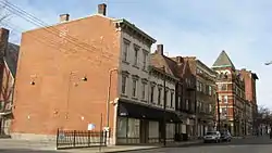 Peeble's Corner Historic District |
November 14, 1985 (#85002835) |
Roughly E. McMillan St. and Gilbert Ave. 39°07′33″N 84°29′24″W |
|
| 89 | George Hunt Pendleton House | 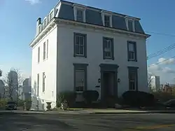 George Hunt Pendleton House |
October 15, 1966 (#66000611) |
559 E. Liberty St. 39°06′43″N 84°30′16″W |
|
| 90 | Peters-Kupferschmid House |  Peters-Kupferschmid House |
October 18, 1984 (#84000134) |
2167 Grandin Rd. 39°07′50″N 84°27′31″W |
|
| 91 | Pfleger Family Houses | 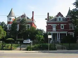 Pfleger Family Houses |
March 11, 1980 (#80003072) |
216 and 218 Erkenbrecker Ave. 39°08′32″N 84°30′20″W |
|
| 92 | Pilgrim Presbyterian Church | 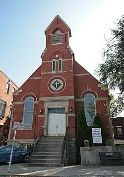 Pilgrim Presbyterian Church |
July 18, 1980 (#80003074) |
1222 Ida St. 39°06′36″N 84°29′56″W |
|
| 93 | Ben Pitman House |  Ben Pitman House |
July 7, 1969 (#69000144) |
1852 Columbia Parkway 39°07′15″N 84°28′53″W |
|
| 94 | Poinciana Flats |  Poinciana Flats |
June 5, 2014 (#14000294) |
3522 Reading Rd. 39°08′43″N 84°29′24″W |
|
| 95 | Police Station No. 6 | 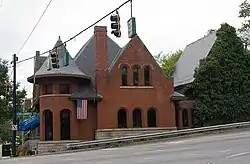 Police Station No. 6 |
May 18, 1981 (#81000436) |
Delta Ave. and Columbia Parkway 39°07′02″N 84°26′23″W |
|
| 96 | Henry Powell House | 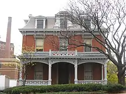 Henry Powell House |
March 3, 1980 (#80003076) |
2209 Auburn Ave. 39°07′20″N 84°30′31″W |
|
| 97 | Procter and Collier-Beau Brummell Building | 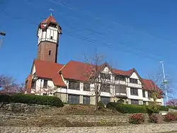 Procter and Collier-Beau Brummell Building |
October 18, 1984 (#84002714) |
440 E. McMillan St. 39°07′37″N 84°30′00″W |
|
| 98 | Prospect Hill Historic District | 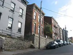 Prospect Hill Historic District |
September 4, 1980 (#80003078) |
Roughly bounded by Liberty Hill, Highland, Pueblo, Channing, and Sycamore Sts. 39°06′48″N 84°30′23″W |
|
| 99 | Ransley Apartment Building | 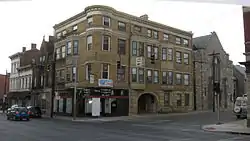 Ransley Apartment Building |
March 3, 1980 (#80003079) |
2390 Kemper Lane 39°07′32″N 84°29′16″W |
|
| 100 | Bernard Ratterman House |  Bernard Ratterman House |
September 30, 1982 (#82003584) |
1349 Broadway 39°06′43″N 84°30′32″W |
|
| 101 | L.B. Robb Drugstore |  L.B. Robb Drugstore |
August 24, 1979 (#79002694) |
4030 Eastern Ave. 39°06′30″N 84°25′55″W |
|
| 102 | Rookwood Pottery |  Rookwood Pottery |
December 5, 1972 (#72001023) |
Celestial and Rookwood Pl. 39°06′25″N 84°30′02″W |
|
| 103 | St. Aloysius Orphanage |  St. Aloysius Orphanage |
September 27, 2012 (#12000835) |
4721 Reading Rd. 39°10′17″N 84°28′09″W |
|
| 104 | St. Francis De Sales Church Historic District | 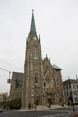 St. Francis De Sales Church Historic District |
March 1, 1974 (#74001512) |
Woodburn Ave. and Madison Rd. 39°07′48″N 84°28′36″W |
|
| 105 | St. Paul Church Historic District |  St. Paul Church Historic District |
January 18, 1974 (#74001513) |
Spring, 12th, and Pendleton Sts. 39°06′34″N 84°30′25″W |
|
| 106 | St. Rosa Church | 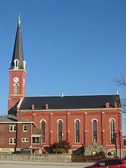 St. Rosa Church |
April 1, 1982 (#82003587) |
2501 Eastern Ave. 39°07′25″N 84°27′42″W |
|
| 107 | The Somerset Apartments |  The Somerset Apartments |
June 30, 2014 (#14000355) |
802-814 Blair Ave. 39°08′29″N 84°29′33″W |
|
| 108 | Spencer Town Hall | 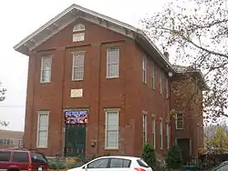 Spencer Town Hall |
August 24, 1979 (#79002701) |
3833 Eastern Ave. 39°06′39″N 84°26′06″W |
|
| 109 | Stites House | 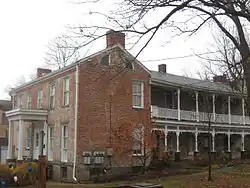 Stites House |
August 24, 1979 (#79002699) |
315 Stites Ave. 39°06′41″N 84°26′05″W |
|
| 110 | Capt. Stone House | 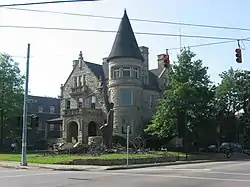 Capt. Stone House |
March 3, 1980 (#80003041) |
405 Oak St. 39°07′51″N 84°30′05″W |
|
| 111 | Harriet Beecher Stowe House | 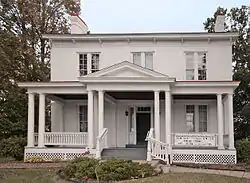 Harriet Beecher Stowe House |
November 10, 1970 (#70000497) |
2950 Gilbert Ave. 39°07′59″N 84°29′16″W |
|
| 112 | Sycamore-13th Street Grouping | 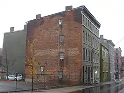 Sycamore-13th Street Grouping |
June 1, 1982 (#82003588) |
12th, 13th, and Sycamore Sts. 39°06′35″N 84°30′35″W |
|
| 113 | William Howard Taft National Historic Site | 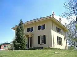 William Howard Taft National Historic Site |
October 15, 1966 (#66000612) |
2038 Auburn Ave. 39°07′11″N 84°30′31″W |
|
| 114 | Twentieth Century Theatre | 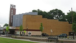 Twentieth Century Theatre |
August 26, 1993 (#93000879) |
3023-3025 Madison Rd. 39°09′03″N 84°25′59″W |
|
| 115 | Verona Apartments | 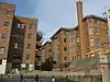 Verona Apartments |
July 2, 2008 (#08000625) |
2356 Park Ave. 39°07′28″N 84°29′11″W |
|
| 116 | Charlton Wallace House | 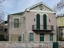 Charlton Wallace House |
January 30, 1976 (#76001441) |
2563 Hackberry St. 39°07′37″N 84°28′36″W |
|
| 117 | Walnut Hills United Presbyterian Church | 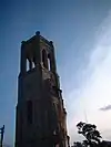 Walnut Hills United Presbyterian Church |
March 3, 1980 (#80003089) |
2601 Gilbert Ave. 39°07′40″N 84°29′23″W |
|
| 118 | John Henry Weston House | 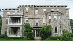 John Henry Weston House |
March 20, 2002 (#02000218) |
1321 Michigan Ave. 39°08′10″N 84°26′33″W |
|
| 119 | Wilson-Gibson House | 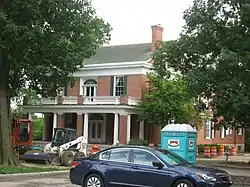 Wilson-Gibson House |
March 17, 1976 (#76001444) |
425 Oak St. 39°07′49″N 84°30′01″W |
|
| 120 | Windsor Public School |  Windsor Public School |
March 10, 2015 (#15000095) |
937 Windsor St. 39°07′20″N 84°29′24″W |
|
| 121 | Isaac M. Wise Temple-Center | %252C_North_Avondale%252C_Cincinnati%252C_OH_-_48639395192.jpg.webp) Isaac M. Wise Temple-Center |
March 15, 2019 (#100003527) |
3771 Reading Rd. 39°09′08″N 84°29′07″W |
|
| 122 | Withrow High School |  Withrow High School |
January 19, 1983 (#83001987) |
2488 Madison Rd. 39°08′29″N 84°27′07″W |
|
| 123 | Mary A. Wolfe House |  Mary A. Wolfe House |
March 3, 1980 (#80003092) |
965 Burton Ave. 39°08′59″N 84°29′01″W |
|
| 124 | Gorham A. Worth House |  Gorham A. Worth House |
April 11, 1973 (#73001472) |
2316 Auburncrest Ave. 39°07′25″N 84°30′23″W |
Former listing
| [3] | Name on the Register | Image | Date listed | Date removed | Location | Summary |
|---|---|---|---|---|---|---|
| 1 | Cincinnati Zoo District | 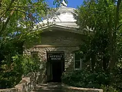 Cincinnati Zoo District |
January 27, 1975 (#75001415) | Unknown | Cincinnati Zoological Gardens 39°08′36″N 84°30′28″W |
Listing of four buildings. Two were demolished, two were transferred to the Cincinnati Zoo Historic Structures listing in 1987. |
See also
| Wikimedia Commons has media related to National Register of Historic Places in Hamilton County, Ohio. |
- List of National Historic Landmarks in Ohio
- National Register of Historic Places listings in Cincinnati, Ohio
Notes
^ a: Stated more precisely, this list includes the portions of the city located east of a line running along Interstate 471 from the Ohio River to Interstate 71, north to Central Parkway, west to Vine Street, and north to the city's northern edge.
References
- The latitude and longitude information provided in this table was derived originally from the National Register Information System, which has been found to be fairly accurate for about 99% of listings. Some locations in this table may have been corrected to current GPS standards.
- "National Register of Historic Places: Weekly List Actions". National Park Service, United States Department of the Interior. Retrieved on January 29, 2021.
- Numbers represent an alphabetical ordering by significant words. Various colorings, defined here, differentiate National Historic Landmarks and historic districts from other NRHP buildings, structures, sites or objects.
- "National Register Information System". National Register of Historic Places. National Park Service. April 24, 2008.
- The eight-digit number below each date is the number assigned to each location in the National Register Information System database, which can be viewed by clicking the number.
