National Register of Historic Places listings in downtown Cincinnati
This is intended to be a complete list of the properties and districts on the National Register of Historic Places in downtown Cincinnati, Ohio, United States. Downtown Cincinnati is defined as being all of the city south of Central Parkway, west of Interstates 71 and 471, and east of Interstate 75. The locations of National Register properties and districts may be seen in an online map.[1]
There are 270 properties and districts listed on the National Register in Cincinnati, including 12 National Historic Landmarks. Downtown Cincinnati includes 59 of these properties and districts, including 5 National Historic Landmarks; the city's remaining properties and districts are listed elsewhere.
- This National Park Service list is complete through NPS recent listings posted January 29, 2021.[2]
Current listings
| [3] | Name on the Register[4] | Image | Date listed[5] | Location | Description |
|---|---|---|---|---|---|
| 1 | Alkemeyer Commercial Buildings | 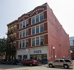 Alkemeyer Commercial Buildings |
December 9, 1980 (#80003034) |
19–23 W. Court St. 39°06′21″N 84°30′52″W |
|
| 2 | Brittany Apartment Building | 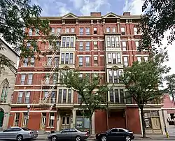 Brittany Apartment Building |
March 3, 1980 (#80003037) |
100–104 W. 9th St. 39°06′19″N 84°30′57″W |
|
| 3 | Brunswick-Balke-Collender Building | .jpg.webp) Brunswick-Balke-Collender Building |
January 24, 2017 (#100000568) |
130–132 E. 6th St. 39°06′11″N 84°30′38″W |
|
| 4 | Building at 620–622 Vine Street | .jpg.webp) Building at 620–622 Vine Street |
February 14, 2018 (#100002121) |
620–622 Vine St. 39°06′12″N 84°30′49″W |
Also known as the House of Adam Building |
| 5 | Carew Tower |  Carew Tower |
August 5, 1982 (#82003578) |
W. 5th St. and Fountain Sq. 39°06′04″N 84°30′42″W |
|
| 6 | John Church Company Building | 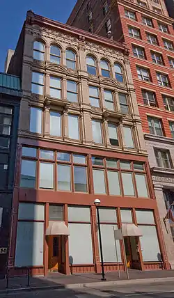 John Church Company Building |
June 17, 1994 (#94000592) |
14–16 E. 4th St. 39°06′01″N 84°30′43″W |
|
| 7 | Cincinnati and Suburban Telephone Company Building | 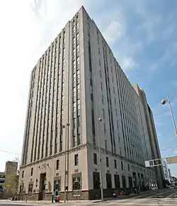 Cincinnati and Suburban Telephone Company Building |
April 20, 1995 (#95000495) |
209 W. 7th St. 39°06′10″N 84°31′02″W |
|
| 8 | Cincinnati City Hall | 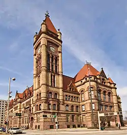 Cincinnati City Hall |
December 11, 1972 (#72001017) |
801 Plum St. 39°06′15″N 84°31′10″W |
|
| 9 | Cincinnati East Manufacturing and Warehouse District | 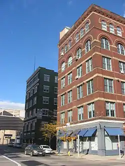 Cincinnati East Manufacturing and Warehouse District |
March 12, 1999 (#99000318) |
Between E. Court and E. 8th, Broadway and Main Sts. 39°06′19″N 84°30′32″W |
|
| 10 | Cincinnati Enquirer Building | 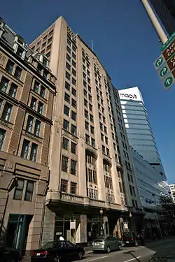 Cincinnati Enquirer Building |
November 13, 1985 (#85002787) |
617 Vine St. 39°06′11″N 84°30′49″W |
|
| 11 | Cincinnati Gymnasium and Athletic Club | 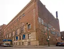 Cincinnati Gymnasium and Athletic Club |
February 17, 1983 (#83001978) |
111 Shillito Pl. 39°06′09″N 84°30′55″W |
|
| 12 | Court Street Firehouse | 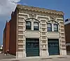 Court Street Firehouse |
July 18, 1974 (#74001510) |
311 W. Court St. 39°06′19″N 84°31′10″W |
|
| 13 | Courtland Flats | 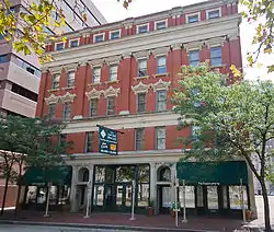 Courtland Flats |
December 20, 1984 (#84001046) |
117–121 E. Court St. 39°06′23″N 84°30′42″W |
|
| 14 | Covenant First Presbyterian Church | 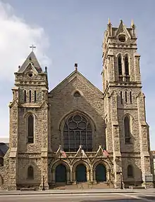 Covenant First Presbyterian Church |
January 29, 1973 (#73001455) |
8th and Elm Sts. 39°06′14″N 84°31′02″W |
|
| 15 | Covington and Cincinnati Suspension Bridge | 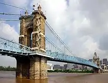 Covington and Cincinnati Suspension Bridge |
May 15, 1975 (#75000786) |
Spans the Ohio River between Cincinnati and Covington 39°05′32″N 84°30′34″W |
Extends into Kenton County, Kentucky |
| 16 | Cuvier Press Club | 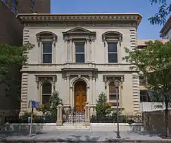 Cuvier Press Club |
October 26, 1972 (#72001019) |
22 Garfield Pl. 39°06′17″N 84°30′52″W |
|
| 17 | Tyler Davidson Fountain | 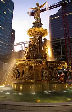 Tyler Davidson Fountain |
October 11, 1979 (#79001854) |
5th St. 39°06′05″N 84°30′44″W |
|
| 18 | H. W. Derby Building | 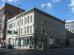 H. W. Derby Building |
March 3, 1980 (#80003045) |
300 W. 4th St. 39°05′57″N 84°31′03″W |
|
| 19 | Doctors' Building | 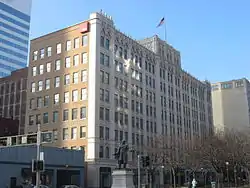 Doctors' Building |
December 4, 1986 (#86003317) |
19 Garfield Pl. 39°06′15″N 84°30′53″W |
|
| 20 | Duttenhofer Building | .jpg.webp) Duttenhofer Building |
December 26, 2017 (#100001933) |
299 E. 6th St. 39°06′11″N 84°30′31″W |
|
| 21 | East Fourth Street Historic District | 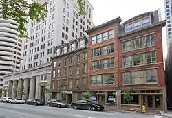 East Fourth Street Historic District |
February 22, 1988 (#88000078) |
123, 127, and 135-137 E. 4th St. 39°06′N 84°31′W |
|
| 22 | Fenwick Club Annex | 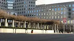 Fenwick Club Annex |
March 7, 1973 (#73001458) |
426 E. 5th St. 39°06′09″N 84°30′21″W |
|
| 23 | First National Bank Building | .jpg.webp) First National Bank Building |
January 24, 2017 (#100000570) |
105 E. 4th St. 39°06′01″N 84°30′39″W |
|
| 24 | Abraham J. Friedlander House | 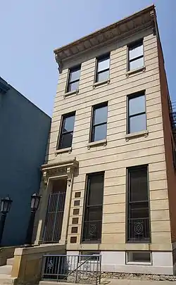 Abraham J. Friedlander House |
May 7, 1979 (#79001855) |
8 W. 9th St. 39°06′19″N 84°30′51″W |
|
| 25 | Goodall Building | 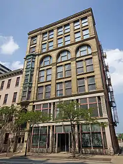 Goodall Building |
February 9, 1984 (#84003710) |
324 W. 9th St. 39°06′17″N 84°31′12″W |
|
| 26 | Gwynne Building | 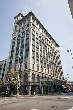 Gwynne Building |
August 3, 1979 (#79001856) |
6th and Main Sts 39°06′11″N 84°30′36″W |
|
| 27 | Hooper Building | 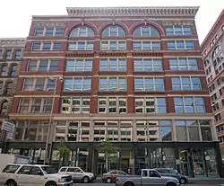 Hooper Building |
March 3, 1980 (#80003058) |
139–151 W. 4th St. 39°05′57″N 84°30′56″W |
|
| 28 | Hotel Metropole |  Hotel Metropole |
June 18, 2009 (#09000443) |
609 Walnut St. 39°06′11″N 84°30′43″W |
Transformed into the 21c Museum Hotel |
| 29 | Ingalls Building | 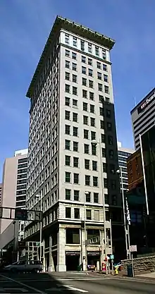 Ingalls Building |
March 7, 1975 (#75001418) |
6 E. 4th St. 39°06′00″N 84°30′45″W |
|
| 30 | Krippendorf-Dittman Company | 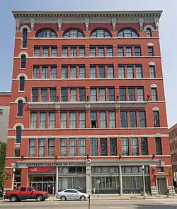 Krippendorf-Dittman Company |
March 3, 1980 (#80003061) |
628 Sycamore St. 39°06′14″N 84°30′30″W |
|
| 31 | Lombardy Apartment Building | 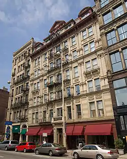 Lombardy Apartment Building |
March 3, 1980 (#80003062) |
318–326 W. 4th St. 39°05′57″N 84°31′05″W |
|
| 32 | Lytle Park Historic District | 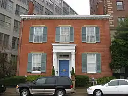 Lytle Park Historic District |
March 26, 1976 (#76001435) |
Roughly bounded by 3rd, 5th, Sycamore, Commercial Sq., and Butler Sts. 39°06′04″N 84°30′19″W |
|
| 33 | Main and Third Street Cluster | 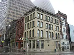 Main and Third Street Cluster |
July 15, 1983 (#83001984) |
300–302, 304–306 Main St., and 208–210 E. 3rd St.; also 308–318 Main St. 39°05′58″N 84°30′31″W |
308–318 Main represents a boundary increase of November 14, 2012, the Main-Third Street Buildings |
| 34 | MAJESTIC | 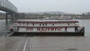 MAJESTIC |
January 3, 1980 (#89002456) |
Ohio River below Central Bridge 39°05′49″N 84°30′17″W |
Originally listed on the NRHP as "SHOWBOAT MAJESTIC"; declared a National Historic Landmark under this name on December 20, 1989 |
| 35 | Newport and Cincinnati Bridge | Newport and Cincinnati Bridge |
April 17, 2001 (#01000364) |
Spans the Ohio River 39°05′41″N 84°29′40″W |
Also known as the Newport Southbank Bridge; extends into Campbell County, Kentucky |
| 36 | Ninth Street Historic District | 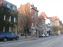 Ninth Street Historic District |
November 25, 1980 (#80003067) |
9th St. between Vine and Plum Sts. 39°06′17″N 84°30′59″W |
|
| 37 | Palace Hotel | 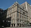 Palace Hotel |
March 3, 1980 (#80003071) |
6th and Vine Sts. 39°06′09″N 84°30′49″W |
|
| 38 | Palace Theatre | 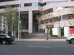 Palace Theatre |
March 24, 1980 (#80004067) |
12 E. 6th St. 39°06′09″N 84°30′46″W |
|
| 39 | Phoenix Building/Cincinnati Club | 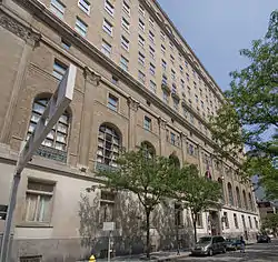 Phoenix Building/Cincinnati Club |
January 11, 1985 (#85000068) |
30 Garfield Pl. and 812 Race St. 39°06′17″N 84°30′55″W |
|
| 40 | Phoenix Club | 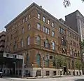 Phoenix Club |
March 3, 1980 (#80003073) |
9th and Race Sts. 39°06′18″N 84°30′55″W |
|
| 41 | Plum Street Temple | 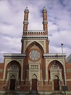 Plum Street Temple |
December 27, 1972 (#72001021) |
8th and Plum Sts. 39°06′13″N 84°31′05″W |
Now known as Isaac M. Wise Temple |
| 42 | Police Station No. 2 | 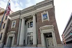 Police Station No. 2 |
May 18, 1981 (#81000655) |
314 Broadway 39°06′01″N 84°30′20″W |
|
| 43 | Power Building | 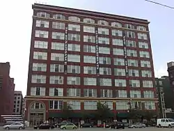 Power Building |
March 5, 1999 (#99000276) |
224 E. 8th St. 39°06′19″N 84°30′32″W |
|
| 44 | Provident Savings Bank and Trust Co. | .jpg.webp) Provident Savings Bank and Trust Co. |
September 6, 2018 (#100002878) |
630–632 Vine St. 39°06′13″N 84°30′49″W |
|
| 45 | Race Street Historic District | 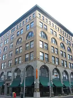 Race Street Historic District |
August 4, 1995 (#95000878) |
Roughly along Race, W. 6th and W. 7th Sts. and Shillito Pl. 39°06′11″N 84°30′54″W |
|
| 46 | Reakirt Building | .jpg.webp) Reakirt Building |
January 24, 2017 (#100000569) |
126–128 E. 6th St. 39°06′11″N 84°30′39″W |
|
| 47 | Nathaniel Ropes Building | 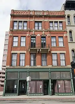 Nathaniel Ropes Building |
September 30, 1982 (#82003585) |
917 Main St. 39°06′22″N 84°30′40″W |
|
| 48 | St. Francis Xavier Church | 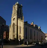 St. Francis Xavier Church |
July 18, 1980 (#80003087) |
607 Sycamore St. 39°06′12″N 84°30′33″W |
|
| 49 | St. Peter-In-Chains Cathedral | 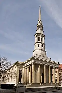 St. Peter-In-Chains Cathedral |
January 18, 1973 (#73001469) |
325 W. 8th St. 39°06′13″N 84°31′11″W |
|
| 50 | Saxony Apartment Building | 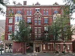 Saxony Apartment Building |
March 3, 1980 (#80003083) |
105–111 W. 9th St. 39°06′19″N 84°30′56″W |
|
| 51 | Taft Museum |  Taft Museum |
January 29, 1973 (#73001470) |
316 Pike St. 39°06′09″N 84°30′12″W |
Also known as Baum-Taft House |
| 52 | Terrace Plaza Hotel | .jpg.webp) Terrace Plaza Hotel |
August 24, 2017 (#100001493) |
15 W. 6th St. 39°06′09″N 84°30′52″W |
|
| 53 | Times-Star Building | 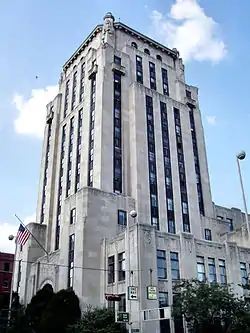 Times-Star Building |
November 25, 1983 (#83004309) |
800 Broadway 39°06′21″N 84°30′24″W |
|
| 54 | Traction Company Building | .tiff.jpg.webp) Traction Company Building |
July 3, 2017 (#100001270) |
432 Walnut St. 39°06′04″N 84°30′41″W |
|
| 55 | Underwriters Salvage Corps | 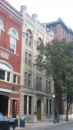 Underwriters Salvage Corps |
July 15, 1982 (#82003589) |
110–112 E. 8th St. 39°06′18″N 84°30′42″W |
|
| 56 | Union Trust Building | 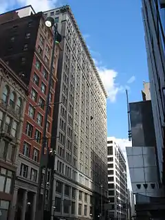 Union Trust Building |
August 29, 2008 (#08000802) |
36 E. 4th St. 39°06′00″N 84°30′42″W |
|
| 57 | United States Post Office and Court House | 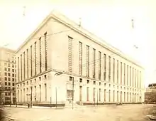 United States Post Office and Court House |
April 28, 2015 (#15000184) |
100 E. 5th St. 39°06′06″N 84°30′37″W |
Now known as the Potter Stewart United States Courthouse. |
| 58 | West Fourth Street Historic District | 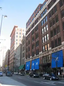 West Fourth Street Historic District |
August 13, 1976 (#79001861) |
Bounded by Central Ave, W. 5th, Plum, and McFarland Sts.; also W. 5th and Perry Sts. between Central Ave. and Plum St., 4th St. between Central Ave. and Race St.; also 1–35 and 2–18 W. 4th St.; also 309 Vine St. 39°05′58″N 84°31′06″W |
Second, third, and fourth sets of boundaries represent boundary increases |
| 59 | Young Women's Christian Association of Cincinnati | 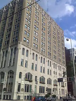 Young Women's Christian Association of Cincinnati |
September 16, 1982 (#82003591) |
9th and Walnut Sts. 39°06′19″N 84°30′43″W |
Former listings
| [3] | Name on the Register | Image | Date listed | Date removed | Location | Summary |
|---|---|---|---|---|---|---|
| 1 | Albee Theatre | July 24, 1972 (#72001016) | 1999 | 12 E. 5th St. |
||
| 2 | Allen Temple | July 7, 1975 (#75001414) | 1999 | 538 Broadway |
||
| 3 | Wesley Chapel Methodist Church | Unavailable (#70000922) | 1972 | 320 E. 5th St. |
See also
| Wikimedia Commons has media related to National Register of Historic Places in Hamilton County, Ohio. |
- List of National Historic Landmarks in Ohio
- National Register of Historic Places listings in Cincinnati, Ohio
References
- The latitude and longitude information provided in this table was derived originally from the National Register Information System, which has been found to be fairly accurate for about 99% of listings. Some locations in this table may have been corrected to current GPS standards.
- "National Register of Historic Places: Weekly List Actions". National Park Service, United States Department of the Interior. Retrieved on January 29, 2021.
- Numbers represent an alphabetical ordering by significant words. Various colorings, defined here, differentiate National Historic Landmarks and historic districts from other NRHP buildings, structures, sites or objects.
- "National Register Information System". National Register of Historic Places. National Park Service. April 24, 2008.
- The eight-digit number below each date is the number assigned to each location in the National Register Information System database, which can be viewed by clicking the number.

This article is issued from Wikipedia. The text is licensed under Creative Commons - Attribution - Sharealike. Additional terms may apply for the media files.