National Register of Historic Places listings in Kenton County, Kentucky
This is intended to be a complete list of the properties and districts on the National Register of Historic Places in Kenton County, Kentucky, United States. The locations of National Register properties and districts for which the latitude and longitude coordinates are included below, may be seen in a map.[1]
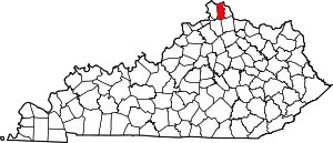
Location of Kenton County in Kentucky
There are 66 properties and districts listed on the National Register in the county; 2 of these are National Historic Landmarks. Another property was once listed but has been removed.
- This National Park Service list is complete through NPS recent listings posted February 5, 2021.[2]
Current listings
| [3] | Name on the Register | Image | Date listed[4] | Location | City or town | Description |
|---|---|---|---|---|---|---|
| 1 | Austinberg Historic District | 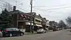 Austinberg Historic District |
February 18, 1987 (#86003483) |
Roughly bounded by the Chesapeake & Ohio railroad line, the Licking River floodwall, rear lot lines on the northern side of Wallace Ave., and Madison Ave 39°04′11″N 84°30′03″W |
Covington | |
| 2 | Battery Bates and Battery Coombs | September 10, 2018 (#100002920) |
Sleepy Hollow Rd., Devou Park 39°04′40″N 84°32′38″W |
Covington | ||
| 3 | Bavarian Brewing Company | 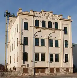 Bavarian Brewing Company |
March 21, 1996 (#96000281) |
522 W. 12th St. 39°04′38″N 84°31′05″W |
Covington | |
| 4 | Daniel Carter Beard Boyhood Home | 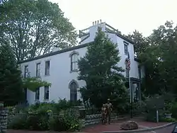 Daniel Carter Beard Boyhood Home |
October 15, 1966 (#66000360) |
322 E. 3rd St. 39°05′21″N 84°30′20″W |
Covington | |
| 5 | Beechwood Historic District | 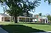 Beechwood Historic District |
December 11, 1989 (#89001168) |
Roughly bounded by Beechwood Rd., Dixie Highway, and Woodlawn Ave. 39°02′49″N 84°33′15″W |
Fort Mitchell | |
| 6 | Cathedral Basilica of the Assumption | 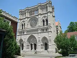 Cathedral Basilica of the Assumption |
July 20, 1973 (#73000812) |
1130 Madison Ave. 39°04′42″N 84°30′29″W |
Covington | |
| 7 | Central Ludlow Historic District | 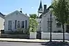 Central Ludlow Historic District |
November 28, 1984 (#84000526) |
Roughly bounded by Glenwood, Church, Adela, and Carneal Sts. 39°05′34″N 84°33′00″W |
Ludlow | |
| 8 | Covington and Cincinnati Suspension Bridge |  Covington and Cincinnati Suspension Bridge |
May 15, 1975 (#75000786) |
Spans the Ohio River between Covington and Cincinnati, Ohio 39°05′32″N 84°30′34″W |
Covington | Extends into Cincinnati, Ohio |
| 9 | Covington Downtown Commercial Historic District | 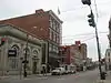 Covington Downtown Commercial Historic District |
June 9, 1983 (#83002804) |
Roughly bounded by the Chesapeake & Ohio railroad line, Robbins, Greenup, 4th, 9th, Washington, 7th Sts., Madison Ave., Scott Blvd., Pine, and E. 8th Sts. 39°05′01″N 84°30′38″W |
Covington | Lists of streets beginning with "also" represent separate boundary increases |
| 10 | Dixie Highway Historic District | 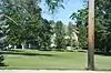 Dixie Highway Historic District |
February 19, 1988 (#88000146) |
2696, 2698, 2700, 2708, and 2712 Dixie Hwy. 39°01′56″N 84°34′18″W |
Lakeside Park | |
| 11 | Frank Duveneck House and Studio | September 29, 2015 (#15000652) |
1226 Greenup St. 39°04′38″N 84°30′19″W |
Covington | ||
| 12 | Eleventh District School | 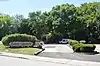 Eleventh District School |
June 16, 1983 (#83002805) |
Parkway and Altamont St. 39°05′25″N 84°32′09″W |
Covington | |
| 13 | Elmwood Hall |  Elmwood Hall |
August 7, 1972 (#72000541) |
244–246 Forest Ave. 39°05′42″N 84°32′56″W |
Ludlow | |
| 14 | Emery Row | 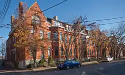 Emery Row |
November 14, 1985 (#85002820) |
810–828 Scott Boulevard 38°59′30″N 84°30′42″W |
Covington | |
| 15 | Emery-Price Historic District | 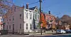 Emery-Price Historic District |
February 18, 1987 (#86003484) |
Roughly bounded by 8th, Greenup, and 11th Sts., and the alley behind the western side of Scott Blvd. 39°04′53″N 84°30′24″W |
Covington | |
| 16 | Erlanger Proper Subdivision Historic District |  Erlanger Proper Subdivision Historic District |
September 6, 2002 (#02000918) |
Roughly bounded by Hulbert, Division, Crescent, Dixie, and Graves. 39°01′12″N 84°36′02″W |
Erlanger | |
| 17 | Fifth District School | 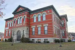 Fifth District School |
November 25, 2005 (#05001320) |
1735 Holman Ave. 39°04′06″N 84°30′44″W |
Covington | |
| 18 | Fort Mitchell Heights Historic District |  Fort Mitchell Heights Historic District |
September 8, 1989 (#89001169) |
Roughly bounded by Park Rd., Barrington Rd., Dixie Highway, and Fortside Dr. 39°03′29″N 84°32′44″W |
Fort Mitchell | |
| 19 | Fourth District Elementary School | Fourth District Elementary School |
February 3, 2010 (#09001309) |
1508–1510 Scott St. 39°04′26″N 84°30′21″W |
Covington | |
| 20 | GAR Monument in Covington | 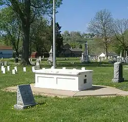 GAR Monument in Covington |
July 17, 1997 (#97000684) |
1413 Holman St. 39°04′23″N 84°30′53″W |
Covington | |
| 21 | Hearne House | 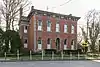 Hearne House |
June 24, 1974 (#74000888) |
500 Garrard St. 39°05′11″N 84°30′21″W |
Covington | |
| 22 | Helentown Historic District | 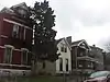 Helentown Historic District |
February 18, 1987 (#86003481) |
Roughly bounded by 11th and Wheeler Sts., the Chesapeake & Ohio railroad line, and Madison Boulevard 39°04′34″N 84°30′16″W |
Covington | |
| 23 | Hellman Lumber and Manufacturing Company | 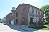 Hellman Lumber and Manufacturing Company |
March 17, 2015 (#15000084) |
321 W. 12th St. 39°04′35″N 84°30′52″W |
Covington | |
| 24 | Highland Cemetery Historic District | 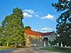 Highland Cemetery Historic District |
October 12, 1989 (#89001585) |
2167 Dixie Highway 39°02′31″N 84°32′48″W |
Fort Mitchell | |
| 25 | Holy Cross Church and School Complex-Latonia | 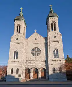 Holy Cross Church and School Complex-Latonia |
April 17, 1986 (#86000800) |
3600 block of Church St. 39°02′52″N 84°30′08″W |
Covington | |
| 26 | House at 855–857 Oak Street | 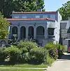 House at 855–857 Oak Street |
November 28, 1984 (#84000320) |
855–857 Oak Street 39°05′09″N 84°33′25″W |
Ludlow | |
| 27 | House at 859 Oak Street | 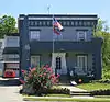 House at 859 Oak Street |
November 28, 1984 (#84000329) |
859 Oak St. 39°05′07″N 84°33′28″W |
Ludlow | |
| 28 | JOHN W. HUBBARD (sternwheeler) | 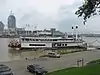 JOHN W. HUBBARD (sternwheeler) |
May 20, 1982 (#82002729) |
Greenup St. 39°05′29″N 84°30′30″W |
Covington | |
| 29 | Kenney's Crossing | 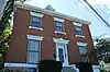 Kenney's Crossing |
March 22, 1990 (#90000481) |
1001 Highway Ave. 39°05′24″N 84°31′45″W |
Covington | |
| 30 | Kenton County Library | 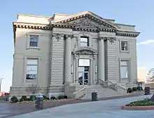 Kenton County Library |
October 31, 1972 (#72000540) |
1028 Scott St. 39°04′48″N 84°30′26″W |
Covington | |
| 31 | Kruempelman Farmhouse | 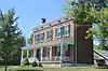 Kruempelman Farmhouse |
September 8, 1989 (#89001171) |
24 Ridge Rd. 39°03′23″N 84°32′55″W |
Fort Mitchell | |
| 32 | LaSalette Academy | 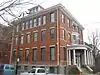 LaSalette Academy |
November 14, 2011 (#11000791) |
702 Greenup St. 39°05′02″N 84°30′24″W |
Covington | |
| 33 | Lee-Holman Historic District | 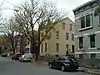 Lee-Holman Historic District |
July 25, 1996 (#96000798) |
Bounded by W. Robbins, Holman, W. 12th, and Lee Sts. 39°04′40″N 84°30′52″W |
Covington | |
| 34 | Lewisburg Historic District | 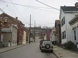 Lewisburg Historic District |
November 5, 1993 (#93001165) |
Roughly bounded by Interstate 75 and the Covington city limits 39°04′37″N 84°31′23″W |
Covington | |
| 35 | Licking Riverside Historic District | 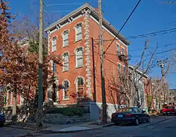 Licking Riverside Historic District |
July 30, 1975 (#75000787) |
Roughly bounded by 4th, Scott, 8th Sts., and the Licking River 39°05′05″N 84°30′22″W |
Covington | |
| 36 | Lincoln-Grant School | 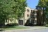 Lincoln-Grant School |
July 29, 2013 (#13000562) |
824 Greenup St. 39°04′56″N 84°30′22″W |
Covington | |
| 37 | Linden Grove Cemetery | 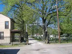 Linden Grove Cemetery |
January 4, 2001 (#00001600) |
1421 Holman Ave. 39°04′25″N 84°30′53″W |
Covington | |
| 38 | Ludlow Lagoon Clubhouse |  Ludlow Lagoon Clubhouse |
November 28, 1984 (#84000348) |
312 Lake St. 39°05′04″N 84°33′15″W |
Ludlow | |
| 39 | The Ludlow Theater | 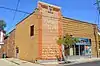 The Ludlow Theater |
March 27, 2013 (#13000111) |
322–326 Elm St. 39°05′37″N 84°32′58″W |
Ludlow | |
| 40 | Maxwell House | 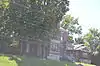 Maxwell House |
November 28, 1984 (#84000350) |
27 River Rd. 39°05′45″N 84°32′30″W |
Ludlow | |
| 41 | Prettyman Merry House | January 8, 1987 (#87000203) |
Shelby St. 39°04′50″N 84°33′49″W |
Bromley | ||
| 42 | Metcalfe-Stephens House | November 12, 1998 (#98001290) |
5241 Madison Pike 38°56′42″N 84°32′36″W |
Independence | ||
| 43 | Moser Family Houses | 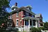 Moser Family Houses |
August 2, 2000 (#00000858) |
1224 and 1226 Highway Ave. 39°05′23″N 84°31′58″W |
Covington | |
| 44 | Mother of God Roman Catholic Church | 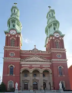 Mother of God Roman Catholic Church |
July 24, 1973 (#73000813) |
119 W. 6th St. 39°05′02″N 84°30′45″W |
Covington | |
| 45 | Mutter Gottes Historic District | 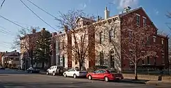 Mutter Gottes Historic District |
May 29, 1980 (#80004499) |
Roughly bounded by Madison Ave., 4th, Harvey, and Johnson Sts.; also roughly bounded by Madison Ave. and 4th, Harvey, and Johnson Sts. 39°05′06″N 84°30′49″W |
Covington | Second list of streets represents a boundary increase |
| 46 | Northern Bank of Kentucky | 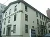 Northern Bank of Kentucky |
December 23, 1998 (#98001487) |
241–45 Scott Blvd. 39°05′18″N 84°30′36″W |
Covington | |
| 47 | Odd Fellows Hall | 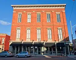 Odd Fellows Hall |
August 11, 1980 (#80001646) |
5th and Madison Sts. 39°05′09″N 84°30′38″W |
Covington | |
| 48 | Old Fort Mitchell Historic District | 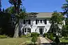 Old Fort Mitchell Historic District |
September 8, 1989 (#89001170) |
Roughly bounded by Saint Johns Rd., Dixie Highway, E. Maple Ave., and Edgewood Rd. 39°03′20″N 84°33′06″W |
Fort Mitchell | |
| 49 | Park Hills Historic District | 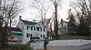 Park Hills Historic District |
March 13, 2008 (#07001252) |
Roughly bounded by Dixie Highway, Montague, Breckenridge, Sleepy Hollow Rds., Old State, Arlington Rds., and St. James Ave. 39°04′17″N 84°31′56″W |
Park Hills | |
| 50 | Robert Patton House | 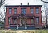 Robert Patton House |
March 1, 1984 (#84001789) |
1533 Garrard St. 39°03′51″N 84°30′10″W |
Covington | |
| 51 | Peaselburg Neighborhood Historic District | March 13, 2017 (#16000501) |
W. 16th, Holman, W. 19th & Russell Sts. 39°04′10″N 84°30′39″W |
Covington | ||
| 52 | Pleasant Run Stone House I | 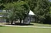 Pleasant Run Stone House I |
January 8, 1987 (#87000153) |
Bromley Rd. off Kentucky Route 8 39°04′31″N 84°33′29″W |
Bromley | |
| 53 | Pleasant Run Stone House II |  Pleasant Run Stone House II |
January 8, 1987 (#87000154) |
Bromley Rd. off Kentucky Route 8 39°04′19″N 84°33′36″W |
Bromley | |
| 54 | Ritte's Corner Historic District, Latonia |  Ritte's Corner Historic District, Latonia |
May 21, 1987 (#87000776) |
Roughly bounded by DeCoursey, Southern, Inez, and Winston Aves.; also approximately 3424–3601 Decoursey Ave., 9 E. Southern Ave., and CSX railroad property 39°02′50″N 84°30′12″W |
Covington | Second group of streets represents a boundary increase |
| 55 | Ritte's East Historic District | July 31, 2014 (#14000459) |
CSX RR., Twin Oaks Golf Course, Winston, Decoursey & 40th Sts. 39°02′32″N 84°29′56″W |
Covington | ||
| 56 | Riverside Drive Historic District |  Riverside Drive Historic District |
November 23, 1971 (#71000350) |
Bounded by Riverside Dr., 4th St., the Licking River, and the alley between Greenup and Garrard Sts.; also along sections of Greenup St., Court Ave., 3rd, and 4th Sts. 39°05′23″N 84°30′23″W |
Covington | Second list of streets represents a boundary increase |
| 57 | St. Augustine Church Complex | 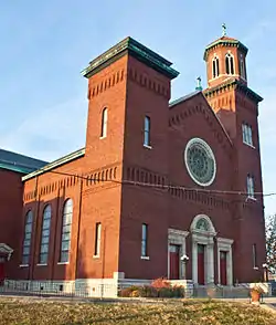 St. Augustine Church Complex |
November 25, 2005 (#05001321) |
1839 Euclid Ave. 39°03′58″N 84°30′47″W |
Covington | |
| 58 | Seminary Square Historic District | 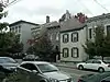 Seminary Square Historic District |
May 27, 1980 (#80001647) |
Roughly bounded by railroad tracks and Holman, 9th, and 12th Sts. 39°04′45″N 84°30′45″W |
Covington | |
| 59 | Amos Shinkle Summer Residence | 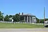 Amos Shinkle Summer Residence |
April 28, 1983 (#83002806) |
U.S. Route 25 39°01′49″N 84°34′32″W |
Fort Mitchell | |
| 60 | Trinity Episcopal Church | 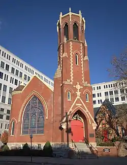 Trinity Episcopal Church |
March 1, 1982 (#82002730) |
326 Madison Ave. 39°05′15″N 84°30′39″W |
Covington | |
| 61 | Veteran's Monument in Covington | 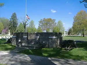 Veteran's Monument in Covington |
July 17, 1997 (#97000685) |
1413 Holman St. 39°04′22″N 84°30′54″W |
Covington | |
| 62 | Wadsworth Electric Manufacturing Company | Wadsworth Electric Manufacturing Company |
January 28, 1994 (#93001585) |
20 W. 11th St. 39°04′45″N 84°30′36″W |
Covington | |
| 63 | Wallace Woods Area Residential Historic District | Wallace Woods Area Residential Historic District |
August 11, 1983 (#83002807) |
Roughly bounded by 24th St. and Glenway, Wallace, and Madison Aves. 39°03′54″N 84°30′02″W |
Covington | |
| 64 | West Fifteenth Street Historic District | 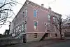 West Fifteenth Street Historic District |
February 18, 1987 (#86003485) |
1445–1451 and 1501–1513 Madison Ave., 1421–1423 Neave St., and 10–32 W. Fifteenth St. 39°04′27″N 84°30′30″W |
Covington | |
| 65 | West Side-Main Strasse Historic District | 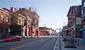 West Side-Main Strasse Historic District |
November 10, 1983 (#83003650) |
Roughly bounded by the Chesapeake & Ohio railroad line and 6th, Philadelphia, Dalton, Pike, and Robbins Sts. 39°04′52″N 84°31′00″W |
Covington | |
| 66 | William A. Yeager and Edward Mohr Farmstead | November 25, 1994 (#94001380) |
5002 Madison Pike 38°57′34″N 84°32′22″W |
Independence |
Former listing
| [3] | Name on the Register | Image | Date listed | Date removed | Location | City or town | Summary |
|---|---|---|---|---|---|---|---|
| 1 | Champion Ice Manufacturing and Cold Storage Company | 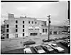 Champion Ice Manufacturing and Cold Storage Company |
March 7, 1979 (#79001016) | February 3, 1988 | 40 E. 2nd St. |
Covington |
See also
| Wikimedia Commons has media related to National Register of Historic Places in Kenton County, Kentucky. |
References
- The latitude and longitude information provided in this table was derived originally from the National Register Information System, which has been found to be fairly accurate for about 99% of listings. Some locations in this table may have been corrected to current GPS standards.
- "National Register of Historic Places: Weekly List Actions". National Park Service, United States Department of the Interior. Retrieved on February 5, 2021.
- Numbers represent an alphabetical ordering by significant words. Various colorings, defined here, differentiate National Historic Landmarks and historic districts from other NRHP buildings, structures, sites or objects.
- The eight-digit number below each date is the number assigned to each location in the National Register Information System database, which can be viewed by clicking the number.
| Topics | |
|---|---|
| Lists by state |
|
| Lists by insular areas | |
| Lists by associated state | |
| Other areas | |
| Related | |
| |
Municipalities and communities of Kenton County, Kentucky, United States | ||
|---|---|---|
| Cities | Location of Kenton County, Kentucky | |
| Unincorporated communities | ||
| Footnotes | ‡This populated place also has portions in an adjacent county or counties. | |
| ||
This article is issued from Wikipedia. The text is licensed under Creative Commons - Attribution - Sharealike. Additional terms may apply for the media files.