National Register of Historic Places listings in Meigs County, Tennessee
This is a list of the National Register of Historic Places listings in Meigs County, Tennessee.
Location of Meigs County in Tennessee
This is intended to be a complete list of the properties and districts on the National Register of Historic Places in Meigs County, Tennessee, United States. Latitude and longitude coordinates are provided for many National Register properties and districts; these locations may be seen together in a map.[1]
There are 37 properties listed on the National Register in the county. Another 4 properties were once listed but have been removed.
| Anderson – Bedford – Benton – Bledsoe – Blount – Bradley – Campbell – Cannon – Carroll – Carter – Cheatham – Chester – Claiborne – Clay – Cocke – Coffee – Crockett – Cumberland – Davidson – Decatur – DeKalb – Dickson – Dyer – Fayette – Fentress – Franklin – Gibson – Giles – Grainger – Greene – Grundy – Hamblen – Hamilton – Hancock – Hardeman – Hardin – Hawkins – Haywood – Henderson – Henry – Hickman – Houston – Humphreys – Jackson – Jefferson – Johnson – Knox – Lake – Lauderdale – Lawrence – Lewis – Lincoln – Loudon – Macon – Madison – Marion – Marshall – Maury – McMinn – McNairy – Meigs – Monroe – Montgomery – Moore – Morgan – Obion – Overton – Perry – Pickett – Polk – Putnam – Rhea – Roane – Robertson – Rutherford – Scott – Sequatchie – Sevier – Shelby – Smith – Stewart – Sullivan – Sumner – Tipton – Trousdale – Unicoi – Union – Van Buren – Warren – Washington – Wayne – Weakley – White – Williamson – Wilson |
- This National Park Service list is complete through NPS recent listings posted January 29, 2021.[2]
Current listings
| [3] | Name on the Register[4] | Image | Date listed[5] | Location | City or town | Description |
|---|---|---|---|---|---|---|
| 1 | Big Sewee Creek Bridge | July 6, 1982 (#82003995) |
State Route 58 and Center Point Rd. 35°35′37″N 84°42′46″W |
Decatur | ||
| 2 | John M. Black Cabin | July 6, 1982 (#82004016) |
Big Sewee Creek Rd. 35°38′52″N 84°37′57″W |
Ten Mile | ||
| 3 | Blythe Ferry | 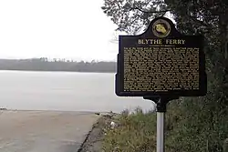 Blythe Ferry |
January 5, 1983 (#83003055) |
North of Birchwood on State Route 60 at the Tennessee River 35°24′51″N 85°00′41″W |
Birchwood | Extends into Rhea County |
| 4 | Buchanan House | 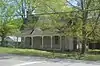 Buchanan House |
July 6, 1982 (#82003996) |
Vernon St. 35°30′49″N 84°47′29″W |
Decatur | |
| 5 | James Cowan House | July 6, 1982 (#82003994) |
Old Bunker Hill Rd. 35°22′35″N 84°56′01″W |
Big Spring | ||
| 6 | Decatur Methodist Church |  Decatur Methodist Church |
July 6, 1982 (#82003997) |
Vernon St. 35°30′47″N 84°47′30″W |
Decatur | |
| 7 | S.S. Eaves House | July 6, 1982 (#82003998) |
Eaves Ferry Rd. 35°32′45″N 84°48′02″W |
Decatur | ||
| 8 | Ewing House | July 6, 1982 (#82004018) |
River Rd. 35°40′03″N 84°43′38″W |
Ten Mile | ||
| 9 | Feezell Barn | July 6, 1982 (#82004019) |
State Route 58 35°38′34″N 84°41′19″W |
Ten Mile | ||
| 10 | James R. Gettys House | July 6, 1982 (#82004020) |
N. No Pone Valley Rd. 35°35′29″N 84°40′41″W |
Ten Mile | ||
| 11 | James R. Gettys Mill | July 6, 1982 (#82004021) |
N. No Pone Valley Rd. 35°35′31″N 84°40′42″W |
Ten Mile | ||
| 12 | Jim Godsey House | July 6, 1982 (#82003999) |
State Route 30 35°31′30″N 84°51′06″W |
Decatur | ||
| 13 | James Turk Griffith House | July 6, 1982 (#82004022) |
State Route 58 35°38′54″N 84°41′18″W |
Ten Mile | ||
| 14 | Jacob L. Grubb Store | 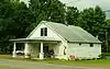 Jacob L. Grubb Store |
July 6, 1982 (#82004000) |
State Route 58 35°23′38″N 84°54′02″W |
Decatur | Nomination form |
| 15 | Hastings-Locke Ferry | 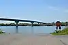 Hastings-Locke Ferry |
January 5, 1983 (#83003056) |
West of Decatur on State Route 30 at the Tennessee River 35°32′16″N 84°52′41″W |
Decatur | Extends into Rhea County |
| 16 | Dr. D.W. Holloway House | July 6, 1982 (#82004023) |
River Rd. 35°42′16″N 84°41′36″W |
Ten Mile | ||
| 17 | Scott Hooper Garage | July 6, 1982 (#82004010) |
State Route 1 35°21′21″N 84°54′56″W |
Georgetown | ||
| 18 | Hutsell Truss Bridge | July 6, 1982 (#82004024) |
Old Ten Mile Rd. 35°36′49″N 84°41′16″W |
Ten Mile | ||
| 19 | Sam Hutsell House | July 6, 1982 (#82004025) |
Old Ten Mile Rd. 35°36′46″N 84°41′15″W |
Ten Mile | ||
| 20 | R.H. Johnson Stable | _Ten_Mile_TN.jpg.webp) R.H. Johnson Stable |
July 6, 1982 (#82004026) |
State Route 58 35°40′49″N 84°40′09″W |
Ten Mile | |
| 21 | Kings Mill Bridge | July 6, 1982 (#82004001) |
Big Sewee Rd. 35°34′40″N 84°45′34″W |
Decatur | ||
| 22 | MacPherson House | July 6, 1982 (#82004027) |
Off Hurricane Valley Rd. 35°40′28″N 84°38′33″W |
Ten Mile | ||
| 23 | McKenzie Windmill | July 6, 1982 (#82004011) |
State Route 58 35°21′23″N 84°54′55″W |
Georgetown | ||
| 24 | Meigs County Bank | 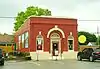 Meigs County Bank |
July 6, 1982 (#82004003) |
Court Sq. 35°30′56″N 84°47′23″W |
Decatur | Nomination form |
| 25 | Meigs County Courthouse | 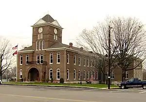 Meigs County Courthouse |
August 3, 1978 (#78002613) |
Court Sq. 35°30′53″N 84°47′24″W |
Decatur | |
| 26 | Mount Zion Church | July 6, 1982 (#82004006) |
Mt. Zion Hollow 35°37′28″N 84°38′48″W |
Decatur | ||
| 27 | Oak Grove Methodist Church | July 6, 1982 (#82004028) |
Pinhook Ferroy Rd. 35°37′56″N 84°46′12″W |
Ten Mile | ||
| 28 | Alexander Patterson House | July 6, 1982 (#82004029) |
Wood Lane 35°39′11″N 84°40′51″W |
Ten Mile | ||
| 29 | Rice-Marler House | July 6, 1982 (#82004007) |
Goodfield Valley Rd. 35°28′42″N 84°50′07″W |
Decatur | ||
| 30 | Bradford Rymer Barn | 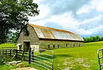 Bradford Rymer Barn |
July 6, 1982 (#82004012) |
State Route 1 35°17′47″N 84°57′11″W |
Georgetown | Nomination form |
| 31 | Elisha Sharp House | July 6, 1982 (#82004030) |
Old Ten Mile Rd. 35°38′34″N 84°40′23″W |
Ten Mile | ||
| 32 | G. W. Shiflett Barn | July 6, 1982 (#82004013) |
State Route 1 35°18′37″N 84°54′53″W |
Georgetown | ||
| 33 | Robert H. Smith Law Office |  Robert H. Smith Law Office |
July 6, 1982 (#82004008) |
State Route 58 35°30′58″N 84°47′20″W |
Decatur | Nomination form |
| 34 | John Stewart House | July 6, 1982 (#82004009) |
State Route 58 35°32′58″N 84°46′20″W |
Decatur | ||
| 35 | Surprise Truss Bridge | July 6, 1982 (#82004031) |
Sewee Creek Rd. 35°38′51″N 84°37′58″W |
Ten Mile | ||
| 36 | Watts Bar Hydroelectric Project | 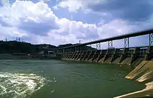 Watts Bar Hydroelectric Project |
August 14, 2017 (#100001474) |
6868 State Route 68 35°37′20″N 84°46′48″W |
Spring City | Extends into Rhea County |
| 37 | Andy Wood Log House and Willie Wood Blacksmith Shop | July 6, 1982 (#82004015) |
State Route 1 35°21′11″N 84°55′42″W |
Georgetown |
Former listings
| [3] | Name on the Register | Image | Date listed | Date removed | Location | City or town | Summary |
|---|---|---|---|---|---|---|---|
| 1 | Culvahouse House | July 6, 1982 (#82004017) | July 17, 2013 | River Rd. 35°40′36″N 84°43′03″W |
Ten Mile | ||
| 2 | Locke House | July 6, 1982 (#82004002) | August 15, 1989 | Concord Rd. |
Decatur | ||
| 3 | Meigs County High School Gymnasium | July 6, 1982 (#82004005) | March 21, 2007 | Brown Street |
Decatur | Demolished in 2006 | |
| 4 | H. C. Shiflett Barn | July 6, 1982 (#82004014) | March 20, 2017 | State Route 1 35°20′40″N 84°55′10″W |
Georgetown |
See also
| Wikimedia Commons has media related to National Register of Historic Places in Meigs County, Tennessee. |
References
- The latitude and longitude information provided in this table was derived originally from the National Register Information System, which has been found to be fairly accurate for about 99% of listings. Some locations in this table may have been corrected to current GPS standards.
- "National Register of Historic Places: Weekly List Actions". National Park Service, United States Department of the Interior. Retrieved on January 29, 2021.
- Numbers represent an alphabetical ordering by significant words. Various colorings, defined here, differentiate National Historic Landmarks and historic districts from other NRHP buildings, structures, sites or objects.
- "National Register Information System". National Register of Historic Places. National Park Service. April 24, 2008.
- The eight-digit number below each date is the number assigned to each location in the National Register Information System database, which can be viewed by clicking the number.
| Topics | |
|---|---|
| Lists by state |
|
| Lists by insular areas | |
| Lists by associated state | |
| Other areas | |
| Related | |
| |
Municipalities and communities of Meigs County, Tennessee, United States | ||
|---|---|---|
| Town | ||
| Unincorporated communities | ||
| Ghost towns | ||
| Footnotes | ‡This populated place also has portions in an adjacent county or counties | |
| ||
This article is issued from Wikipedia. The text is licensed under Creative Commons - Attribution - Sharealike. Additional terms may apply for the media files.