National Register of Historic Places listings in Sullivan County, Tennessee
This is a list of the National Register of Historic Places listings in Sullivan County, Tennessee.
Location of Sullivan County in Tennessee
This is intended to be a complete list of the properties and districts on the National Register of Historic Places in Sullivan County, Tennessee, United States. Latitude and longitude coordinates are provided for many National Register properties and districts; these locations may be seen together in a map.[1]
There are 46 properties and districts listed on the National Register in the county, including 1 National Historic Landmark. Another 6 properties were once listed but have been removed.
| Anderson – Bedford – Benton – Bledsoe – Blount – Bradley – Campbell – Cannon – Carroll – Carter – Cheatham – Chester – Claiborne – Clay – Cocke – Coffee – Crockett – Cumberland – Davidson – Decatur – DeKalb – Dickson – Dyer – Fayette – Fentress – Franklin – Gibson – Giles – Grainger – Greene – Grundy – Hamblen – Hamilton – Hancock – Hardeman – Hardin – Hawkins – Haywood – Henderson – Henry – Hickman – Houston – Humphreys – Jackson – Jefferson – Johnson – Knox – Lake – Lauderdale – Lawrence – Lewis – Lincoln – Loudon – Macon – Madison – Marion – Marshall – Maury – McMinn – McNairy – Meigs – Monroe – Montgomery – Moore – Morgan – Obion – Overton – Perry – Pickett – Polk – Putnam – Rhea – Roane – Robertson – Rutherford – Scott – Sequatchie – Sevier – Shelby – Smith – Stewart – Sullivan – Sumner – Tipton – Trousdale – Unicoi – Union – Van Buren – Warren – Washington – Wayne – Weakley – White – Williamson – Wilson |
- This National Park Service list is complete through NPS recent listings posted January 29, 2021.[2]
Current listings
| [3] | Name on the Register[4] | Image | Date listed[5] | Location | City or town | Description |
|---|---|---|---|---|---|---|
| 1 | Finlay Alison House | April 11, 1973 (#73001851) |
West of Piney Flats off U.S. Route 11E 36°25′22″N 82°21′34″W |
Piney Flats | ||
| 2 | Arcadia | 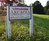 Arcadia |
April 11, 1973 (#73001834) |
East of Bloomingdale off U.S. Route 11W 36°35′01″N 82°26′43″W |
Arcadia | |
| 3 | Blountville Historic District | 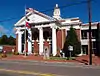 Blountville Historic District |
February 23, 1973 (#73001835) |
Center of Blountville along both sides of State Route 126; also roughly bounded by the Blountville Cemetery, Great Stage and Massengill Rds., and the Blountville Bypass 36°31′58″N 82°19′37″W |
Blountville | Second set of addresses represents a boundary increase of March 26, 2014 |
| 4 | Boatyard Historic District | 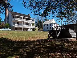 Boatyard Historic District |
December 12, 1973 (#73001785) |
Southwest of Kingsport on the Holston River and the South Fork of the Holston River 36°33′02″N 82°36′17″W |
Kingsport | |
| 5 | Boone Hydroelectric Project | 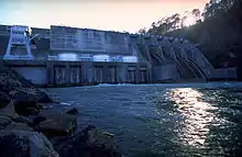 Boone Hydroelectric Project |
October 26, 2017 (#100001476) |
301 Boone Dam Rd. 36°26′25″N 82°26′12″W |
Kingsport | Extends into Washington County |
| 6 | Bristol Commercial Historic District | .jpg.webp) Bristol Commercial Historic District |
May 22, 2003 (#03000441) |
Roughly along State, Piedmont, Moore, Shelby, Bank, Progress, 5th, 6th, 7th, and 8th Sts. 36°35′38″N 82°11′03″W |
Bristol | Extends into Bristol, Virginia |
| 7 | Bristol Municipal Stadium | 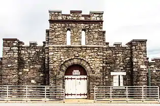 Bristol Municipal Stadium |
June 25, 1987 (#87001039) |
1112 Edgemont Ave. 36°34′57″N 82°11′00″W |
Bristol | |
| 8 | Bristol Virginia-Tennessee Slogan Sign | 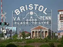 Bristol Virginia-Tennessee Slogan Sign |
September 8, 1988 (#88001568) |
E. State St. 36°35′40″N 82°10′45″W |
Bristol | Extends into Bristol, Virginia |
| 9 | Church Circle District |  Church Circle District |
April 11, 1973 (#73001841) |
Along Sullivan in the center of Kingsport 36°32′59″N 82°33′29″W |
Kingsport | |
| 10 | Clinchfield Railroad Station | 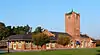 Clinchfield Railroad Station |
April 24, 1973 (#73001842) |
101 E. Main St. 36°32′40″N 82°33′45″W |
Kingsport | |
| 11 | DeVault-Masengill House | March 28, 1985 (#85000669) |
Andrew Johnson Highway, U.S. Route 11E 36°24′20″N 82°20′40″W |
Piney Flats | An alternate spelling of Massengill is also used. | |
| 12 | East Hill Cemetery | _-_Confederate_Unknown.jpg.webp) East Hill Cemetery |
March 28, 2011 (#11000142) |
E. State St. at Georgia Ave. 36°35′39″N 82°10′16″W |
Bristol | American Civil War-era cemetery with sections for Confederate soldiers and veterans as well as a small section for African American burials.[6] Extends into Bristol, Virginia |
| 13 | Erwin Farm | April 11, 1973 (#73001836) |
West of Blountville off State Route 75 36°31′24″N 82°22′30″W |
Blountville | ||
| 14 | Fairmont Neighborhood Historic District | 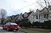 Fairmont Neighborhood Historic District |
July 30, 2010 (#10000510) |
Roughly bounded by Taylor St., Pennsylvania Ave., Maple St., and Florida Ave. 36°35′20″N 82°10′13″W |
Bristol | |
| 15 | First National Bank of Bristol | 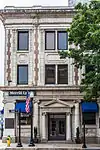 First National Bank of Bristol |
July 25, 1985 (#85001606) |
500 State St. 36°35′41″N 82°10′57″W |
Bristol | |
| 16 | Fort Patrick Henry Hydroelectric Project | 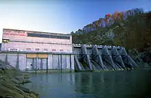 Fort Patrick Henry Hydroelectric Project |
October 26, 2017 (#100001477) |
Rt. 1 Box 2385 36°29′52″N 82°30′30″W |
Kingsport | |
| 17 | Gammon House | 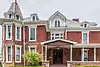 Gammon House |
March 10, 2009 (#09000119) |
324 6th St. 36°35′28″N 82°11′02″W |
Bristol | |
| 18 | Grass Dale | 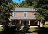 Grass Dale |
October 25, 1984 (#84000140) |
774 Bloomingdale Pike 36°33′30″N 82°33′22″W |
Kingsport | |
| 19 | Alexander Doak Hall Farm | 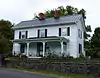 Alexander Doak Hall Farm |
July 28, 1995 (#95000931) |
440 Proffitt Ln. 36°26′51″N 82°28′39″W |
Kingsport | |
| 20 | Holston Avenue Neighborhood Historic District |  Holston Avenue Neighborhood Historic District |
November 14, 2012 (#12000945) |
Roughly Holston, 7th, 8th, and Watauga Aves., and Haynes, Orchard, Clyde Reser, Reynolds, and Weise Sts. 36°35′08″N 82°11′18″W |
Bristol | |
| 21 | J. Fred Johnson House | 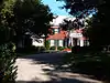 J. Fred Johnson House |
April 11, 1973 (#73001843) |
1322 Watauga Ave. 36°32′38″N 82°32′22″W |
Kingsport | |
| 22 | Edward Washington King House | 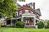 Edward Washington King House |
November 18, 1999 (#99001371) |
308 7th St. 36°35′32″N 82°11′10″W |
Bristol | |
| 23 | Kingsport Hosiery Mills | November 16, 2020 (#100005791) |
435 Press St. 36°33′05″N 82°33′46″W |
Kingsport | ||
| 24 | Long Island of the Holston | 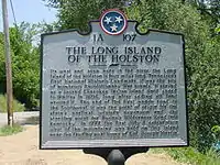 Long Island of the Holston |
October 15, 1966 (#66000733) |
South Fork of the Holston River 36°31′49″N 82°33′39″W |
Kingsport | |
| 25 | Moses Looney Fort House | 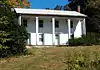 Moses Looney Fort House |
January 18, 1978 (#78002638) |
5436 Old Island Rd. 36°33′19″N 82°25′28″W |
Kingsport | |
| 26 | Martin-Dobyns House | 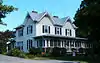 Martin-Dobyns House |
March 26, 2014 (#14000088) |
1434 Watauga St. 36°32′27″N 82°32′04″W |
Kingsport | |
| 27 | Mount Ida | 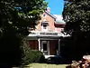 Mount Ida |
April 2, 1973 (#73001844) |
1010-1012 Sevier Terrace Dr. 36°33′29″N 82°34′12″W |
Kingsport | |
| 28 | Netherland Inn and Complex | .jpg.webp) Netherland Inn and Complex |
December 23, 1969 (#69000182) |
2144 Netherland Inn Rd. 36°33′05″N 82°35′48″W |
Kingsport | |
| 29 | Old Deery Inn | 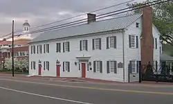 Old Deery Inn |
May 7, 1973 (#73001838) |
Main St. 36°31′59″N 82°19′34″W |
Blountville | |
| 30 | Old Kingsport Presbyterian Church | 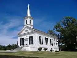 Old Kingsport Presbyterian Church |
October 2, 1973 (#73001845) |
Stone Dr. (U.S. Route 11W) and Afton 36°33′22″N 82°35′32″W |
Kingsport | |
| 31 | Paramount Theatre and Office Building | 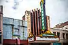 Paramount Theatre and Office Building |
April 4, 1985 (#85000701) |
516 State St. 36°35′41″N 82°10′59″W |
Bristol | |
| 32 | Parlett House | 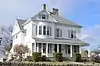 Parlett House |
August 18, 1983 (#83003070) |
728 Georgia Ave. 36°35′19″N 82°10′04″W |
Bristol | |
| 33 | Pemberton Mansion and Oak | March 14, 1973 (#73001840) |
9 miles (14 km) northeast of Bristol on State Route 34 36°33′45″N 82°04′24″W |
Bristol | ||
| 34 | Pierce Chapel AME Church Cemetery | 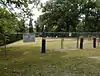 Pierce Chapel AME Church Cemetery |
July 14, 2000 (#00000809) |
Seaver Rd. at Horse Creek Rd. 36°30′04″N 82°34′40″W |
Kingsport | |
| 35 | Piney Flats Historic District | November 15, 2011 (#11000808) |
Main, McKamey, and Methodist Church Sts. and parts of Tank Hill, Piney Flats, Austin Springs, and Mountain View Rds. 36°25′07″N 82°18′22″W |
Piney Flats | ||
| 36 | Preston Farm | 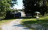 Preston Farm |
September 3, 1971 (#71000837) |
4812 Orebank Rd. 36°32′38″N 82°29′10″W |
Kingsport | |
| 37 | Rock Ledge | 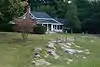 Rock Ledge |
May 24, 1978 (#78002639) |
117 Stuffle Place 36°34′35″N 82°30′52″W |
Kingsport | |
| 38 | Rocky Mount | February 26, 1970 (#70000617) |
Southwest of Piney Flats off U.S. Route 11E 36°24′21″N 82°20′12″W |
Piney Flats | ||
| 39 | Roller-Pettyjohn Mill | 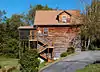 Roller-Pettyjohn Mill |
December 7, 1977 (#77001293) |
West of Blountville on Fall Creek Rd. 36°31′48″N 82°26′52″W |
Blountville | |
| 40 | South Holston Hydroelectric Project | 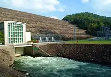 South Holston Hydroelectric Project |
August 14, 2017 (#100001478) |
918 South View Rd. 36°31′24″N 82°05′20″W |
Bristol | |
| 41 | Steel-Seneker Houses | August 22, 1977 (#77001294) |
4 miles (6.4 km) west of Bristol on State Route 126 36°33′56″N 82°15′44″W |
Bristol | ||
| 42 | Stone-Penn House | 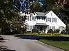 Stone-Penn House |
November 15, 1984 (#84000669) |
1306 Watauga St. 36°32′39″N 82°32′25″W |
Kingsport | |
| 43 | US Post Office-Shelby Street Station | 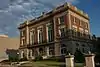 US Post Office-Shelby Street Station |
November 7, 1985 (#85002772) |
620 Shelby St. 36°35′37″N 82°11′04″W |
Bristol | |
| 44 | George Washington School | 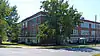 George Washington School |
March 21, 2007 (#07000184) |
205 E. Sevier Ave. 36°32′54″N 82°33′13″W |
Kingsport | |
| 45 | Wills-Dickey Stone House | 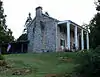 Wills-Dickey Stone House |
March 30, 1973 (#73001849) |
Northwest of Kingsport off U.S. Route 23 on W. Carter's Valley Rd. 36°35′22″N 82°34′18″W |
Kingsport | |
| 46 | Yancey's Tavern | 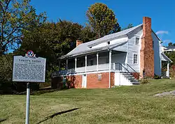 Yancey's Tavern |
April 11, 1973 (#73001850) |
East of Kingsport on State Route 126 36°32′55″N 82°27′28″W |
Kingsport |
Former listings
| [3] | Name on the Register | Image | Date listed | Date removed | Location | City or town | Summary |
|---|---|---|---|---|---|---|---|
| 1 | Jesse Alison House | April 2, 1973 (#73001839) | July 17, 2012 | Southwest of Bluff City off U.S. Route 11E 36°26′08″N 82°21′17″W |
Bluff City | Demolished | |
| 2 | Grand Guitar | 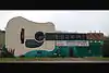 Grand Guitar |
March 11, 2014 (#14000057) | March 27, 2020 | 3245 W. State St. 36°35′36″N 82°14′50″W |
Bristol | Deemed structurally unsound and demolished in August 2019[7] |
| 3 | Pearson Brick House | April 11, 1973 (#73001846) | March 20, 2017 | East of Kingsport on Shipley Ferry Rd. 36°28′55″N 82°28′21″W |
Kingsport | ||
| 4 | Roseland | April 2, 1973 (#73001847) | August 27, 2013 | South of Kingsport on Shipp St. 36°31′24″N 82°33′43″W |
Kingsport | ||
| 5 | Spring Place | April 11, 1973 (#73001848) | July 17, 2013 | Northwest of Kingsport on W. Carter's Valley Rd., off U.S. Route 23 36°35′26″N 82°36′13″W |
Kingsport | ||
| 6 | Squire John Fain Barn | 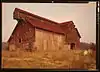 Squire John Fain Barn |
April 11, 1973 (#73001837) | December 30, 1985 | Lone Oak Estates, TN 126 |
Blountville |
See also
| Wikimedia Commons has media related to National Register of Historic Places in Sullivan County, Tennessee. |
References
- The latitude and longitude information provided in this table was derived originally from the National Register Information System, which has been found to be fairly accurate for about 99% of listings. Some locations in this table may have been corrected to current GPS standards.
- "National Register of Historic Places: Weekly List Actions". National Park Service, United States Department of the Interior. Retrieved on January 29, 2021.
- Numbers represent an alphabetical ordering by significant words. Various colorings, defined here, differentiate National Historic Landmarks and historic districts from other NRHP buildings, structures, sites or objects.
- "National Register Information System". National Register of Historic Places. National Park Service. April 24, 2008.
- The eight-digit number below each date is the number assigned to each location in the National Register Information System database, which can be viewed by clicking the number.
- "East Hill Cemetery Brochure" (PDF). Bristol, Tennessee: Bristol Historical Association. Retrieved April 14, 2011.
- Sorrell, Robert. "Landmark Grand Guitar building demolished". Bristol Herald Courier, 2019-08-17. Accessed 2020-02-16.
| Topics | |
|---|---|
| Lists by state |
|
| Lists by insular areas | |
| Lists by associated state | |
| Other areas | |
| Related | |
| |
Municipalities and communities of Sullivan County, Tennessee, United States | ||
|---|---|---|
| Cities | Sullivan County map | |
| CDPs | ||
| Unincorporated communities | ||
| Footnotes | ‡This populated place also has portions in an adjacent county or counties | |
| ||
This article is issued from Wikipedia. The text is licensed under Creative Commons - Attribution - Sharealike. Additional terms may apply for the media files.